{
	"@context": "https://project-open-data.cio.gov/v1.1/schema/catalog.jsonld",
	"@type": "dcat:Catalog",
	"conformsTo": "https://project-open-data.cio.gov/v1.1/schema",
	"describedBy": "https://project-open-data.cio.gov/v1.1/schema/catalog.json",
	"dataset": [
		{
			"@type": "dcat:Dataset",
			"identifier": "https://www.arcgis.com/home/item.html?id=95b2cce919be4240b5e938421ec8e07c&sublayer=164",
			"landingPage": "https://data.clevelandohio.gov/datasets/ClevelandGIS::15-minute-city-index",
			"title": "15 Minute City Index",
			"description": "<p><strong>Description</strong></p><p><strong>Version 10</strong></p><p>The 15 Minute City Index is the output of a weighted sum analysis of all the walksheds from <a target='_blank' href='https://data.clevelandohio.gov/maps/17e8378f03114d139e68e6a045fcf748/about' rel='nofollow ugc noopener noreferrer'>15 Minute City Points of Interest</a><a target='_blank' href='https://clevelandgis.maps.arcgis.com/home/item.html?id=eecf8b3612d342e49b023b9984aa435a' rel='nofollow ugc noopener noreferrer'> </a>gathered by City Planning. The final index value reflects how many points of interest are within walking distance and has no operational implications for City services.</p><p>The animation below demonstrates how the different walking distance areas are combined by weight to create a total index score. Higher scores indicate better access to services, amenities, and stores. Walkability is also shaped by factors such as design, safety, and street environment.</p><p style='color:#dc143c;'><strong>This work is preliminary and in development.</strong></p><div style='text-align:center;'><img style='max-width:100%;' src='https://planning.clevelandohio.gov/gisdata/Walksheds_v2_Loop_15secpause.gif' alt='Animation of walkshed' /></div><p>&nbsp;</p><p><strong>Data Glossary</strong></p><p>See the <strong>Attributes </strong>section below for details about each column in this dataset.&nbsp;</p><p>The following <strong>Amenity Weighting</strong> chart should be used in conjunction with the attribute <code>gridcode</code>.</p><p><strong>Amenity Weighting</strong></p><figure><table style='border-collapse:collapse;' border='1'><tr style='background-color:#bde0ff;'><th style='padding:5px;'>Amenity Type</th><th style='padding:5px;'>Weight</th></tr><tbody><tr><td style='padding:5px;'>Grocery Store</td><td style='padding:5px;'>5</td></tr><tr><td style='padding:5px;'>High Frequency RTA</td><td style='padding:5px;'>5</td></tr><tr><td style='padding:5px;'>Schools</td><td style='padding:5px;'>5</td></tr><tr><td style='padding:5px;'>Healthcare / Hospital</td><td style='padding:5px;'>3</td></tr><tr><td style='padding:5px;'>Public Library</td><td style='padding:5px;'>3</td></tr><tr><td style='padding:5px;'>Pharmacy</td><td style='padding:5px;'>3</td></tr><tr><td style='padding:5px;'>Park Access</td><td style='padding:5px;'>3</td></tr><tr><td style='padding:5px;'>Daycares</td><td style='padding:5px;'>3</td></tr><tr><td style='padding:5px;'>Cafes</td><td style='padding:5px;'>1</td></tr><tr><td style='padding:5px;'>Laundries</td><td style='padding:5px;'>1</td></tr><tr><td style='padding:5px;'>Bank</td><td style='padding:5px;'>1</td></tr><tr><td style='padding:5px;'>Fitness Centers</td><td style='padding:5px;'>1</td></tr><tr><td style='padding:5px;'>Hair Care</td><td style='padding:5px;'>1</td></tr></tbody></table></figure><p>&nbsp;</p><p><strong>Update Frequency</strong></p><p>Annually</p><p><strong>Contacts</strong></p><p>Cleveland City Planning Commission, Strategic Initiatives</p><p><a href='mailto:cityplanning@clevelandohio.gov' rel='nofollow ugc'>cityplanning@clevelandohio.gov</a></p>",
			"keyword": [
				"15MC",
				"transit",
				"walking",
				"Cleveland",
				"city planning"
			],
			"issued": "2022-02-16T20:07:49.000Z",
			"modified": "2025-07-02T20:34:27.288Z",
			"publisher": {
				"name": "Cleveland | GIS"
			},
			"contactPoint": {
				"@type": "vcard:Contact",
				"fn": "MMoss_ClevelandGIS",
				"hasEmail": "mailto:xander_mavrides@clevelandwater.com"
			},
			"accessLevel": "public",
			"spatial": "-81.8792,41.3907,-81.5320,41.5993",
			"license": "https://opendatacommons.org/licenses/odbl/summary",
			"distribution": [
				{
					"@type": "dcat:Distribution",
					"title": "ArcGIS Hub Dataset",
					"format": "Web Page",
					"mediaType": "text/html",
					"accessURL": "https://data.clevelandohio.gov/datasets/ClevelandGIS::15-minute-city-index"
				},
				{
					"@type": "dcat:Distribution",
					"title": "ArcGIS GeoService",
					"format": "ArcGIS GeoServices REST API",
					"mediaType": "application/json",
					"accessURL": "https://services3.arcgis.com/dty2kHktVXHrqO8i/arcgis/rest/services/15_Minute_City_Index/FeatureServer/164"
				},
				{
					"@type": "dcat:Distribution",
					"title": "CSV",
					"format": "CSV",
					"mediaType": "text/csv",
					"accessURL": "https://data.clevelandohio.gov/api/download/v1/items/95b2cce919be4240b5e938421ec8e07c/csv?layers=164"
				},
				{
					"@type": "dcat:Distribution",
					"title": "Shapefile",
					"format": "ZIP",
					"mediaType": "application/zip",
					"accessURL": "https://data.clevelandohio.gov/api/download/v1/items/95b2cce919be4240b5e938421ec8e07c/shapefile?layers=164"
				},
				{
					"@type": "dcat:Distribution",
					"title": "GeoJSON",
					"format": "GeoJSON",
					"mediaType": "application/vnd.geo+json",
					"accessURL": "https://data.clevelandohio.gov/api/download/v1/items/95b2cce919be4240b5e938421ec8e07c/geojson?layers=164"
				},
				{
					"@type": "dcat:Distribution",
					"title": "KML",
					"format": "KML",
					"mediaType": "application/vnd.google-earth.kml+xml",
					"accessURL": "https://data.clevelandohio.gov/api/download/v1/items/95b2cce919be4240b5e938421ec8e07c/kml?layers=164"
				},
				{
					"@type": "dcat:Distribution",
					"title": "File Geodatabase",
					"format": "ZIP",
					"mediaType": "application/zip",
					"accessURL": "https://data.clevelandohio.gov/api/download/v1/items/95b2cce919be4240b5e938421ec8e07c/filegdb?layers=164"
				},
				{
					"@type": "dcat:Distribution",
					"title": "Feature Collection",
					"format": "TXT",
					"mediaType": "text/plain",
					"accessURL": "https://data.clevelandohio.gov/api/download/v1/items/95b2cce919be4240b5e938421ec8e07c/featureCollection?layers=164"
				},
				{
					"@type": "dcat:Distribution",
					"title": "Excel",
					"format": "XLSX",
					"mediaType": "application/vnd.ms-excel",
					"accessURL": "https://data.clevelandohio.gov/api/download/v1/items/95b2cce919be4240b5e938421ec8e07c/excel?layers=164"
				},
				{
					"@type": "dcat:Distribution",
					"title": "GeoPackage",
					"format": "GPKG",
					"mediaType": "application/geopackage+sqlite3",
					"accessURL": "https://data.clevelandohio.gov/api/download/v1/items/95b2cce919be4240b5e938421ec8e07c/geoPackage?layers=164"
				},
				{
					"@type": "dcat:Distribution",
					"title": "SQLite Geodatabase",
					"format": "GDB",
					"mediaType": "application/geopackage+sqlite3",
					"accessURL": "https://data.clevelandohio.gov/api/download/v1/items/95b2cce919be4240b5e938421ec8e07c/sqlite?layers=164"
				}
			],
			"theme": [
				"geospatial"
			]
		},
		{
			"@type": "dcat:Dataset",
			"identifier": "https://www.arcgis.com/home/item.html?id=d34f4aecebe14e3fa3cc9dd3cc190a77",
			"landingPage": "https://data.clevelandohio.gov/maps/ClevelandGIS::citywide-property-survey-2022",
			"title": "Citywide Property Survey 2022",
			"description": "<p style='color:rgb(41, 41, 41); font-family:Inter, &quot;Avenir Next&quot;; max-width:100%;'><span style='color:#b22222;'><font style='max-width:100%;'><span style='max-width:100%;'><strong>TO VIEW AND DOWNLOAD THE ACTUAL DATA, CLICK ON ONE OF THE LAYERS BELOW</strong></span></font></span></p><p><strong>Description</strong><br />In 2022, the Western Reserve Land Conservancy (WRLC) partnered with the City of Cleveland to survey every property in the city, collecting data and photos on structure condition, signs of vacancy, sidewalk condition, and more. This dataset is a refined version of the original survey results, curated by the City of Cleveland’s Office of Urban Analytics and Building &amp; Housing. Fields were cleaned and standardized for accuracy and readability. The data is available as parcel polygons and parcel centroids. For more details, visit WRLC’s page explaining the survey process and results.</p><p><strong>Related Items</strong><br /><a target='_blank' href='https://experience.arcgis.com/experience/edc55e70b1d44fcd8878e7d341967c63' rel='nofollow ugc noopener noreferrer'>Citywide Property Survey 2022 Interactive Viewer</a></p><p><strong>Data Glossary</strong><br />See the <strong>Attributes</strong> section in each layer below for details about each column in these datasets.&nbsp;<br /><br />All survey fields are prefixed with <code>survey_</code> and include field aliases that explain the field's purpose. All other fields are part of the survey system and County property data. For more information about the Regrid fields, see their <a target='_blank' href='https://support.regrid.com/parcel-data/schema' rel='nofollow ugc noopener noreferrer'>parcel schema</a>.</p><p><strong>Update Frequency</strong><br />Static</p><p><strong>Contacts</strong><br />City of Cleveland, Building &amp; Housing<br />City of Cleveland, Urban Analytics &amp; Innovation</p>",
			"keyword": [
				"property survey",
				"Western Reserve",
				"inventory",
				"condition",
				"housing"
			],
			"issued": "2023-05-24T19:44:45.000Z",
			"modified": "2026-05-07T14:40:30.000Z",
			"publisher": {
				"name": "Cleveland | GIS"
			},
			"contactPoint": {
				"@type": "vcard:Contact",
				"fn": "opendataCLE",
				"hasEmail": "mailto:xander_mavrides@clevelandwater.com"
			},
			"accessLevel": "public",
			"spatial": "-81.8791,41.3907,-81.5321,41.5993",
			"license": "<p>Public Domain</p>",
			"distribution": [
				{
					"@type": "dcat:Distribution",
					"title": "ArcGIS Hub Dataset",
					"format": "Web Page",
					"mediaType": "text/html",
					"accessURL": "https://data.clevelandohio.gov/maps/ClevelandGIS::citywide-property-survey-2022"
				},
				{
					"@type": "dcat:Distribution",
					"title": "ArcGIS GeoService",
					"format": "ArcGIS GeoServices REST API",
					"mediaType": "application/json",
					"accessURL": "https://services3.arcgis.com/dty2kHktVXHrqO8i/arcgis/rest/services/Citywide_Property_Survey_2022/FeatureServer"
				}
			],
			"theme": [
				"geospatial"
			]
		},
		{
			"@type": "dcat:Dataset",
			"identifier": "https://www.arcgis.com/home/item.html?id=d34f4aecebe14e3fa3cc9dd3cc190a77&sublayer=0",
			"landingPage": "https://data.clevelandohio.gov/datasets/ClevelandGIS::cleveland-citywide-property-survey-2022-centroids",
			"title": "Cleveland Citywide Property Survey 2022 Centroids",
			"description": "<p style='color:rgb(41, 41, 41); font-family:Inter, &quot;Avenir Next&quot;; max-width:100%;'><span style='color:#b22222;'><font style='max-width:100%;'><span style='max-width:100%;'><strong>TO VIEW AND DOWNLOAD THE ACTUAL DATA, CLICK ON ONE OF THE LAYERS BELOW</strong></span></font></span></p><p><strong>Description</strong><br />In 2022, the Western Reserve Land Conservancy (WRLC) partnered with the City of Cleveland to survey every property in the city, collecting data and photos on structure condition, signs of vacancy, sidewalk condition, and more. This dataset is a refined version of the original survey results, curated by the City of Cleveland’s Office of Urban Analytics and Building &amp; Housing. Fields were cleaned and standardized for accuracy and readability. The data is available as parcel polygons and parcel centroids. For more details, visit WRLC’s page explaining the survey process and results.</p><p><strong>Related Items</strong><br /><a target='_blank' href='https://experience.arcgis.com/experience/edc55e70b1d44fcd8878e7d341967c63' rel='nofollow ugc noopener noreferrer'>Citywide Property Survey 2022 Interactive Viewer</a></p><p><strong>Data Glossary</strong><br />See the <strong>Attributes</strong> section in each layer below for details about each column in these datasets.&nbsp;<br /><br />All survey fields are prefixed with <code>survey_</code> and include field aliases that explain the field's purpose. All other fields are part of the survey system and County property data. For more information about the Regrid fields, see their <a target='_blank' href='https://support.regrid.com/parcel-data/schema' rel='nofollow ugc noopener noreferrer'>parcel schema</a>.</p><p><strong>Update Frequency</strong><br />Static</p><p><strong>Contacts</strong><br />City of Cleveland, Building &amp; Housing<br />City of Cleveland, Urban Analytics &amp; Innovation</p>",
			"keyword": [
				"property survey",
				"Western Reserve",
				"inventory",
				"condition",
				"housing"
			],
			"issued": "2023-05-24T19:44:45.000Z",
			"modified": "2025-08-18T20:09:44.594Z",
			"publisher": {
				"name": "Cleveland | GIS"
			},
			"contactPoint": {
				"@type": "vcard:Contact",
				"fn": "opendataCLE",
				"hasEmail": "mailto:xander_mavrides@clevelandwater.com"
			},
			"accessLevel": "public",
			"spatial": "-81.8756,41.3913,-81.5329,41.5975",
			"license": "<p>Public Domain</p>",
			"distribution": [
				{
					"@type": "dcat:Distribution",
					"title": "ArcGIS Hub Dataset",
					"format": "Web Page",
					"mediaType": "text/html",
					"accessURL": "https://data.clevelandohio.gov/datasets/ClevelandGIS::cleveland-citywide-property-survey-2022-centroids"
				},
				{
					"@type": "dcat:Distribution",
					"title": "ArcGIS GeoService",
					"format": "ArcGIS GeoServices REST API",
					"mediaType": "application/json",
					"accessURL": "https://services3.arcgis.com/dty2kHktVXHrqO8i/arcgis/rest/services/Citywide_Property_Survey_2022/FeatureServer/0"
				},
				{
					"@type": "dcat:Distribution",
					"title": "CSV",
					"format": "CSV",
					"mediaType": "text/csv",
					"accessURL": "https://data.clevelandohio.gov/api/download/v1/items/d34f4aecebe14e3fa3cc9dd3cc190a77/csv?layers=0"
				},
				{
					"@type": "dcat:Distribution",
					"title": "Shapefile",
					"format": "ZIP",
					"mediaType": "application/zip",
					"accessURL": "https://data.clevelandohio.gov/api/download/v1/items/d34f4aecebe14e3fa3cc9dd3cc190a77/shapefile?layers=0"
				},
				{
					"@type": "dcat:Distribution",
					"title": "GeoJSON",
					"format": "GeoJSON",
					"mediaType": "application/vnd.geo+json",
					"accessURL": "https://data.clevelandohio.gov/api/download/v1/items/d34f4aecebe14e3fa3cc9dd3cc190a77/geojson?layers=0"
				},
				{
					"@type": "dcat:Distribution",
					"title": "KML",
					"format": "KML",
					"mediaType": "application/vnd.google-earth.kml+xml",
					"accessURL": "https://data.clevelandohio.gov/api/download/v1/items/d34f4aecebe14e3fa3cc9dd3cc190a77/kml?layers=0"
				},
				{
					"@type": "dcat:Distribution",
					"title": "File Geodatabase",
					"format": "ZIP",
					"mediaType": "application/zip",
					"accessURL": "https://data.clevelandohio.gov/api/download/v1/items/d34f4aecebe14e3fa3cc9dd3cc190a77/filegdb?layers=0"
				},
				{
					"@type": "dcat:Distribution",
					"title": "Feature Collection",
					"format": "TXT",
					"mediaType": "text/plain",
					"accessURL": "https://data.clevelandohio.gov/api/download/v1/items/d34f4aecebe14e3fa3cc9dd3cc190a77/featureCollection?layers=0"
				},
				{
					"@type": "dcat:Distribution",
					"title": "Excel",
					"format": "XLSX",
					"mediaType": "application/vnd.ms-excel",
					"accessURL": "https://data.clevelandohio.gov/api/download/v1/items/d34f4aecebe14e3fa3cc9dd3cc190a77/excel?layers=0"
				},
				{
					"@type": "dcat:Distribution",
					"title": "GeoPackage",
					"format": "GPKG",
					"mediaType": "application/geopackage+sqlite3",
					"accessURL": "https://data.clevelandohio.gov/api/download/v1/items/d34f4aecebe14e3fa3cc9dd3cc190a77/geoPackage?layers=0"
				},
				{
					"@type": "dcat:Distribution",
					"title": "SQLite Geodatabase",
					"format": "GDB",
					"mediaType": "application/geopackage+sqlite3",
					"accessURL": "https://data.clevelandohio.gov/api/download/v1/items/d34f4aecebe14e3fa3cc9dd3cc190a77/sqlite?layers=0"
				}
			],
			"theme": [
				"geospatial"
			]
		},
		{
			"@type": "dcat:Dataset",
			"identifier": "https://www.arcgis.com/home/item.html?id=d34f4aecebe14e3fa3cc9dd3cc190a77&sublayer=1",
			"landingPage": "https://data.clevelandohio.gov/datasets/ClevelandGIS::cleveland-citywide-property-survey-2022-parcels",
			"title": "Cleveland Citywide Property Survey 2022 Parcels",
			"description": "<p style='color:rgb(41, 41, 41); font-family:Inter, &quot;Avenir Next&quot;; max-width:100%;'><span style='color:#b22222;'><font style='max-width:100%;'><span style='max-width:100%;'><strong>TO VIEW AND DOWNLOAD THE ACTUAL DATA, CLICK ON ONE OF THE LAYERS BELOW</strong></span></font></span></p><p><strong>Description</strong><br />In 2022, the Western Reserve Land Conservancy (WRLC) partnered with the City of Cleveland to survey every property in the city, collecting data and photos on structure condition, signs of vacancy, sidewalk condition, and more. This dataset is a refined version of the original survey results, curated by the City of Cleveland’s Office of Urban Analytics and Building &amp; Housing. Fields were cleaned and standardized for accuracy and readability. The data is available as parcel polygons and parcel centroids. For more details, visit WRLC’s page explaining the survey process and results.</p><p><strong>Related Items</strong><br /><a target='_blank' href='https://experience.arcgis.com/experience/edc55e70b1d44fcd8878e7d341967c63' rel='nofollow ugc noopener noreferrer'>Citywide Property Survey 2022 Interactive Viewer</a></p><p><strong>Data Glossary</strong><br />See the <strong>Attributes</strong> section in each layer below for details about each column in these datasets.&nbsp;<br /><br />All survey fields are prefixed with <code>survey_</code> and include field aliases that explain the field's purpose. All other fields are part of the survey system and County property data. For more information about the Regrid fields, see their <a target='_blank' href='https://support.regrid.com/parcel-data/schema' rel='nofollow ugc noopener noreferrer'>parcel schema</a>.</p><p><strong>Update Frequency</strong><br />Static</p><p><strong>Contacts</strong><br />City of Cleveland, Building &amp; Housing<br />City of Cleveland, Urban Analytics &amp; Innovation</p>",
			"keyword": [
				"property survey",
				"Western Reserve",
				"inventory",
				"condition",
				"housing"
			],
			"issued": "2023-05-24T19:44:45.000Z",
			"modified": "2025-09-17T20:56:05.713Z",
			"publisher": {
				"name": "Cleveland | GIS"
			},
			"contactPoint": {
				"@type": "vcard:Contact",
				"fn": "opendataCLE",
				"hasEmail": "mailto:xander_mavrides@clevelandwater.com"
			},
			"accessLevel": "public",
			"spatial": "-81.8791,41.3907,-81.5321,41.5993",
			"license": "<p>Public Domain</p>",
			"distribution": [
				{
					"@type": "dcat:Distribution",
					"title": "ArcGIS Hub Dataset",
					"format": "Web Page",
					"mediaType": "text/html",
					"accessURL": "https://data.clevelandohio.gov/datasets/ClevelandGIS::cleveland-citywide-property-survey-2022-parcels"
				},
				{
					"@type": "dcat:Distribution",
					"title": "ArcGIS GeoService",
					"format": "ArcGIS GeoServices REST API",
					"mediaType": "application/json",
					"accessURL": "https://services3.arcgis.com/dty2kHktVXHrqO8i/arcgis/rest/services/Citywide_Property_Survey_2022/FeatureServer/1"
				},
				{
					"@type": "dcat:Distribution",
					"title": "CSV",
					"format": "CSV",
					"mediaType": "text/csv",
					"accessURL": "https://data.clevelandohio.gov/api/download/v1/items/d34f4aecebe14e3fa3cc9dd3cc190a77/csv?layers=1"
				},
				{
					"@type": "dcat:Distribution",
					"title": "Shapefile",
					"format": "ZIP",
					"mediaType": "application/zip",
					"accessURL": "https://data.clevelandohio.gov/api/download/v1/items/d34f4aecebe14e3fa3cc9dd3cc190a77/shapefile?layers=1"
				},
				{
					"@type": "dcat:Distribution",
					"title": "GeoJSON",
					"format": "GeoJSON",
					"mediaType": "application/vnd.geo+json",
					"accessURL": "https://data.clevelandohio.gov/api/download/v1/items/d34f4aecebe14e3fa3cc9dd3cc190a77/geojson?layers=1"
				},
				{
					"@type": "dcat:Distribution",
					"title": "KML",
					"format": "KML",
					"mediaType": "application/vnd.google-earth.kml+xml",
					"accessURL": "https://data.clevelandohio.gov/api/download/v1/items/d34f4aecebe14e3fa3cc9dd3cc190a77/kml?layers=1"
				},
				{
					"@type": "dcat:Distribution",
					"title": "File Geodatabase",
					"format": "ZIP",
					"mediaType": "application/zip",
					"accessURL": "https://data.clevelandohio.gov/api/download/v1/items/d34f4aecebe14e3fa3cc9dd3cc190a77/filegdb?layers=1"
				},
				{
					"@type": "dcat:Distribution",
					"title": "Feature Collection",
					"format": "TXT",
					"mediaType": "text/plain",
					"accessURL": "https://data.clevelandohio.gov/api/download/v1/items/d34f4aecebe14e3fa3cc9dd3cc190a77/featureCollection?layers=1"
				},
				{
					"@type": "dcat:Distribution",
					"title": "Excel",
					"format": "XLSX",
					"mediaType": "application/vnd.ms-excel",
					"accessURL": "https://data.clevelandohio.gov/api/download/v1/items/d34f4aecebe14e3fa3cc9dd3cc190a77/excel?layers=1"
				},
				{
					"@type": "dcat:Distribution",
					"title": "GeoPackage",
					"format": "GPKG",
					"mediaType": "application/geopackage+sqlite3",
					"accessURL": "https://data.clevelandohio.gov/api/download/v1/items/d34f4aecebe14e3fa3cc9dd3cc190a77/geoPackage?layers=1"
				},
				{
					"@type": "dcat:Distribution",
					"title": "SQLite Geodatabase",
					"format": "GDB",
					"mediaType": "application/geopackage+sqlite3",
					"accessURL": "https://data.clevelandohio.gov/api/download/v1/items/d34f4aecebe14e3fa3cc9dd3cc190a77/sqlite?layers=1"
				}
			],
			"theme": [
				"geospatial"
			]
		},
		{
			"@type": "dcat:Dataset",
			"identifier": "https://www.arcgis.com/home/item.html?id=25cacb86e54d4105b833a57a862d0815",
			"landingPage": "https://data.clevelandohio.gov/apps/ClevelandGIS::traffic-count-viewer",
			"title": "Traffic Count Viewer",
			"description": "<div>This application provides an interactive experience to look up traffic count reports across the City of Cleveland. Traffic count reports are conducted using unmanned vehicle counter devices that detect the volume and speed of vehicular traffic.</div><div>&nbsp;</div><div><p><strong>Instructions</strong></p><ul><li>Each point represents a single traffic count observation that was conducted since 2019.</li><li>Zoom into a point, click on it to generate a pop-up that presents summary statistics and a PDF link for each report.</li><li>Use Filter or Search to narrow down to your area or time of interest.</li></ul></div><div>&nbsp;</div><div><strong>Data Glossary</strong></div><div>See:&nbsp;<a target='_blank' href='https://clevelandgis.maps.arcgis.com/home/item.html?id=41dac8cbf74a4e31bda30a105b53bcc6' rel='nofollow ugc noopener noreferrer'>Cleveland Traffic Count Reports - Overview (arcgis.com)</a></div><div>&nbsp;</div><div><strong>Update Frequency</strong></div><div>Typically weekly</div><div>&nbsp;</div><div><strong>This application uses the following dataset(s):</strong></div><div><a target='_blank' href='https://data.clevelandohio.gov/search?collection=Dataset&amp;q=city%20planning%20layers&amp;sort=Title%7Ctitle%7Casc' rel='nofollow ugc noopener noreferrer'>Cleveland Traffic Count Reports</a><br />&nbsp;</div><div>&nbsp;</div><div><strong>Contacts</strong></div><div>City Planning Commission</div>",
			"keyword": [
				"mobility",
				"transportation",
				"City Planning"
			],
			"issued": "2023-06-13T21:03:42.000Z",
			"modified": "2026-05-06T20:06:33.000Z",
			"publisher": {
				"name": "Cleveland | GIS"
			},
			"contactPoint": {
				"@type": "vcard:Contact",
				"fn": "MMoss_ClevelandGIS",
				"hasEmail": "mailto:xander_mavrides@clevelandwater.com"
			},
			"accessLevel": "public",
			"spatial": "",
			"license": "https://opendatacommons.org/licenses/odbl/summary",
			"distribution": [
				{
					"@type": "dcat:Distribution",
					"title": "ArcGIS Hub Dataset",
					"format": "Web Page",
					"mediaType": "text/html",
					"accessURL": "https://data.clevelandohio.gov/apps/ClevelandGIS::traffic-count-viewer"
				},
				{
					"@type": "dcat:Distribution",
					"title": "ArcGIS GeoService",
					"format": "ArcGIS GeoServices REST API",
					"mediaType": "application/json",
					"accessURL": "https://experience.arcgis.com/experience/25cacb86e54d4105b833a57a862d0815"
				}
			],
			"theme": ""
		},
		{
			"@type": "dcat:Dataset",
			"identifier": "https://www.arcgis.com/home/item.html?id=44bd466d14ce4d90bc0671c524bf16c2&sublayer=0",
			"landingPage": "https://data.clevelandohio.gov/datasets/ClevelandGIS::property-insights-dataset",
			"title": "Property Insights Dataset",
			"description": "<div><p>Many organizations in and around Cleveland region rely on up-to-date and comprehensive property data to perform their work effectively. Property Insights is a cross-source property dataset produced by Urban Analytics &amp; Innovation. It serves as an aggregator of property information across a variety of systems.&nbsp;This dataset is automatically updated every week by pulling records from the County, City, and various sources. The dataset includes information from City systems (Accela, Cityworks, etc.) and external sources (MyPlace, County Fiscal Office, Census). Through the integration of these sources, the dataset offers a comprehensive analysis of regulatory status, permitting, code enforcement activity, city services, and ownership research.</p><div>This dataset enriches the&nbsp;<a target='_blank' href='https://fiscalhub.gis.cuyahogacounty.gov/maps/7f830d017ef94d029824530761115be9/about' rel='nofollow ugc noopener noreferrer'>Cuyahoga County EPV Taxparcels</a>&nbsp;dataset, which is maintained by the County Auditor's office. All of the data that is featured in that dataset is contained in this one. The City of Cleveland incorporates additional information that is specifically relevant to City operations.</div><div>&nbsp;</div><div><strong>Update Frequency</strong></div><div>Every Sunday around 5:00 PM EST</div><div>&nbsp;</div><div><strong>Related Items</strong></div><div><a target='_blank' href='https://experience.arcgis.com/experience/30779ea3c7c5435499f1b230f323bafc' rel='nofollow ugc noopener noreferrer'>Property Insights App</a></div><div>&nbsp;</div><div><strong>Contact</strong></div><div><a href='mailto:opendata@clevelandohio.gov' rel='nofollow ugc'>City of Cleveland Department of Urban Analytics and Innovation</a></div><div>&nbsp;</div><div><strong>Data Glossary</strong></div><div><a target='_blank' href='https://data.clevelandohio.gov/datasets/44bd466d14ce4d90bc0671c524bf16c2/about' rel='nofollow ugc noopener noreferrer'>Click here</a> and scroll down to the “Attributes” section.</div></div>",
			"keyword": [
				"parcel",
				"real estate",
				"values",
				"ownership"
			],
			"issued": "2024-10-17T14:05:46.000Z",
			"modified": "2026-05-17T21:27:05.145Z",
			"publisher": {
				"name": "Cleveland | GIS"
			},
			"contactPoint": {
				"@type": "vcard:Contact",
				"fn": "opendataCLE",
				"hasEmail": "mailto:xander_mavrides@clevelandwater.com"
			},
			"accessLevel": "public",
			"spatial": "-81.6112,41.4998,-81.6064,41.5047",
			"license": "https://opendatacommons.org/licenses/odbl/summary",
			"distribution": [
				{
					"@type": "dcat:Distribution",
					"title": "ArcGIS Hub Dataset",
					"format": "Web Page",
					"mediaType": "text/html",
					"accessURL": "https://data.clevelandohio.gov/datasets/ClevelandGIS::property-insights-dataset"
				},
				{
					"@type": "dcat:Distribution",
					"title": "ArcGIS GeoService",
					"format": "ArcGIS GeoServices REST API",
					"mediaType": "application/json",
					"accessURL": "https://services3.arcgis.com/dty2kHktVXHrqO8i/arcgis/rest/services/Parcel_Analytics_(PUBLIC_DRAFT_)/FeatureServer/0"
				},
				{
					"@type": "dcat:Distribution",
					"title": "CSV",
					"format": "CSV",
					"mediaType": "text/csv",
					"accessURL": "https://data.clevelandohio.gov/api/download/v1/items/44bd466d14ce4d90bc0671c524bf16c2/csv?layers=0"
				},
				{
					"@type": "dcat:Distribution",
					"title": "Shapefile",
					"format": "ZIP",
					"mediaType": "application/zip",
					"accessURL": "https://data.clevelandohio.gov/api/download/v1/items/44bd466d14ce4d90bc0671c524bf16c2/shapefile?layers=0"
				},
				{
					"@type": "dcat:Distribution",
					"title": "GeoJSON",
					"format": "GeoJSON",
					"mediaType": "application/vnd.geo+json",
					"accessURL": "https://data.clevelandohio.gov/api/download/v1/items/44bd466d14ce4d90bc0671c524bf16c2/geojson?layers=0"
				},
				{
					"@type": "dcat:Distribution",
					"title": "KML",
					"format": "KML",
					"mediaType": "application/vnd.google-earth.kml+xml",
					"accessURL": "https://data.clevelandohio.gov/api/download/v1/items/44bd466d14ce4d90bc0671c524bf16c2/kml?layers=0"
				}
			],
			"theme": [
				"geospatial"
			]
		},
		{
			"@type": "dcat:Dataset",
			"identifier": "https://www.arcgis.com/home/item.html?id=e15e8989c83e4cbd841fb171a6c62f68&sublayer=0",
			"landingPage": "https://data.clevelandohio.gov/datasets/ClevelandGIS::crime-incidents",
			"title": "Crime Incidents",
			"description": "<p style='background-color:rgb(255, 255, 255); border:0px solid currentcolor; box-sizing:border-box; color:rgb(74, 74, 74); font-family:&quot;Avenir Next&quot;, Avenir, &quot;Helvetica Neue&quot;, sans-serif; font-size:16px; font-style:normal; font-variant-caps:normal; font-variant-ligatures:normal; font-weight:400; letter-spacing:normal; margin:0px 0px 1.5rem; text-align:start; text-decoration-color:initial; text-decoration-style:initial; text-indent:0px; text-transform:none; word-spacing:0px;'><span style='color:rgb(220,20,60); font-family:inherit;'><span style='border:0px solid currentcolor; box-sizing:border-box; line-height:1.5;'><strong>⚠️Due to the City's transition to a new Record Management System (RMS) , the </strong></span><i><span style='border:0px solid currentcolor; box-sizing:border-box; line-height:1.5;'><strong>Crime Incidents</strong></span></i><span style='border:0px solid currentcolor; box-sizing:border-box; line-height:1.5;'><strong> data listed here was initialized to include records from 11/11/25 to present. </strong></span></span><a target='_blank' href='https://data.clevelandohio.gov/datasets/ClevelandGIS::crime-incidents/about' rel='nofollow ugc noopener noreferrer'><span style='font-family:inherit;'><span style='border:0px solid currentcolor; box-sizing:border-box; line-height:1.5;'><strong>Click here to view data from before 11/11/25</strong></span></span></a><span style='color:rgb(220,20,60); font-family:inherit;'><span style='border:0px solid currentcolor; box-sizing:border-box; line-height:1.5;'><strong>. Public Safety is working to migrate records pre 11/11/25 to the new Record Management System. This dataset will update accordingly as records are migrated.</strong></span></span></p><p style='background-color:rgb(255, 255, 255); border:0px solid currentcolor; box-sizing:border-box; color:rgb(74, 74, 74); font-family:&quot;Avenir Next&quot;, Avenir, &quot;Helvetica Neue&quot;, sans-serif; font-size:16px; font-style:normal; font-variant-caps:normal; font-variant-ligatures:normal; font-weight:400; letter-spacing:normal; margin:0px 0px 1.5rem; text-align:start; text-decoration-color:initial; text-decoration-style:initial; text-indent:0px; text-transform:none; word-spacing:0px;'><span style='color:rgb(220,20,60); font-family:inherit;'><span style='border:0px solid currentcolor; box-sizing:border-box; line-height:1.5;'><strong>The following data products will be decommissioned once the migration is complete:</strong></span></span>&nbsp;<br /><a target='_blank' href='https://data.clevelandohio.gov/apps/f1fa870ebbcc47beabdc4de4357d3c8b/about' rel='nofollow ugc noopener noreferrer'>Cleveland Division of Police Crime Dashboard [2016 to Nov 2025]</a><br /><a target='_blank' href='https://data.clevelandohio.gov/apps/09c88aeae1774752acfe30b11c3215ec/explore' rel='nofollow ugc noopener noreferrer'>Crime Incidents Map [2016 to Nov 2025]</a><br /><a target='_blank' href='https://data.clevelandohio.gov/datasets/ClevelandGIS::crime-incidents/about' rel='nofollow ugc noopener noreferrer'>Crime Incidents Dataset [2016 to Nov 2025]</a><br />&nbsp;</p><p style='background-color:rgb(255, 255, 255); border:0px solid currentcolor; box-sizing:border-box; color:rgb(74, 74, 74); font-family:&quot;Avenir Next&quot;, Avenir, &quot;Helvetica Neue&quot;, sans-serif; font-size:16px; font-style:normal; font-variant-caps:normal; font-variant-ligatures:normal; font-weight:400; letter-spacing:normal; margin:0px 0px 1.5rem; text-align:start; text-decoration-color:initial; text-decoration-style:initial; text-indent:0px; text-transform:none; word-spacing:0px;'>Crime incidents starting with those reported November 2025.&nbsp;The data provided is the latest available information and is updated regularly as statistics change. For access to comprehensive reports, kindly submit a public record request <a style='border:0px solid currentcolor; box-sizing:border-box; color:rgb(0, 97, 155); font-family:inherit; line-height:1.5; text-decoration:none;' target='_blank' href='https://clevelandoh.govqa.us/WEBAPP/_rs/(S(x32gnbgnqriwvnjpusw0glmw))/supporthome.aspx' rel='nofollow ugc noopener noreferrer'>here</a>.</p><p style='background-color:rgb(255, 255, 255); border:0px solid currentcolor; box-sizing:border-box; color:rgb(74, 74, 74); font-family:&quot;Avenir Next&quot;, Avenir, &quot;Helvetica Neue&quot;, sans-serif; font-size:16px; font-style:normal; font-variant-caps:normal; font-variant-ligatures:normal; font-weight:400; letter-spacing:normal; margin:0px 0px 1.5rem; text-align:start; text-decoration-color:initial; text-decoration-style:initial; text-indent:0px; text-transform:none; word-spacing:0px;'><span style='background-color:rgb(255,255,255); color:#2f4f4f; font-size:16px;'><span style='display:inline !important; float:none; font-style:normal; font-variant-caps:normal; font-variant-ligatures:normal; font-weight:400; letter-spacing:normal; text-align:start; text-decoration-color:initial; text-decoration-style:initial; text-indent:0px; text-transform:none; word-spacing:0px;'>Current incident data is reported according to the FBI’s National Incident-Based Reporting System (NIBRS). This includes the highest offense for each incident but not lesser included offenses. This is a change from our previous Records Management System (RMS), which reported lesser included offenses. For a more detailed explanation, visit the FBI’s page on NIBRS reporting at: </span></span><a style='border-width:0px; color:rgb(70, 120, 134); font:inherit; margin:0px; padding:0px;' target='_blank' href='https://gcc02.safelinks.protection.outlook.com/?url=https%3A%2F%2Fwww.fbi.gov%2Fhow-we-can-help-you%2Fmore-fbi-services-and-information%2Fucr%2Fnibrs&amp;data=05%7C02%7CSMartinez2%40clevelandohio.gov%7C6bb2f43f13a64e55a3a508de7afa6d73%7C76e2f9638a1d45bf8e0687a368508b40%7C0%7C0%7C639083413150975112%7CUnknown%7CTWFpbGZsb3d8eyJFbXB0eU1hcGkiOnRydWUsIlYiOiIwLjAuMDAwMCIsIlAiOiJXaW4zMiIsIkFOIjoiTWFpbCIsIldUIjoyfQ%3D%3D%7C0%7C%7C%7C&amp;sdata=STOxaMLK7C4wv94BLeerhMz%2B6VMVcVKWBvX6Ay3TUro%3D&amp;reserved=0' rel='nofollow ugc noopener noreferrer'>FBI NIBRS</a><br /><br /><strong>Disclaimer:&nbsp;</strong><i>The City strives to provide the highest-quality information on this platform. The content on this website is provided as a public service, on an ‘as is’ basis. The City makes no warranty, representation, or guarantee of any type as to the content, accuracy, timeliness, completeness, or fitness for any particular purpose or use of any public data provided on this portal; nor shall any such warranty be implied, including, without limitation, the implied warranties of merchantability and fitness for a particular purpose. The City assumes no liability by making data available to the public or other departments.</i><br /><br /><strong>This dataset is featured in the following app(s):</strong><br /><a style='border:0px solid currentcolor; box-sizing:border-box; color:rgb(0, 97, 155); font-family:inherit; line-height:1.5; text-decoration:none;' target='_blank' href='https://data.clevelandohio.gov/apps/5783851bbb1a462c98632168cfeea3fd/about' rel='nofollow ugc noopener noreferrer'>Cleveland Division of Police Crime Dashboard</a><br /><a style='border:0px solid currentcolor; box-sizing:border-box; color:rgb(0, 97, 155); font-family:inherit; line-height:1.5; text-decoration:none;' target='_blank' href='https://data.clevelandohio.gov/apps/7942d5c8ad6c4eeba9fa74722a334de0/explore' rel='nofollow ugc noopener noreferrer'>Crime Incidents Map</a><br /><br /><strong>Data Glossary</strong><br />See the <strong>Attributes </strong>section below for details about each column in this dataset.<br /><br /><strong>Update Frequency</strong><br />Daily around 8 AM EST<br /><br /><strong>Contacts</strong><br /><a style='border:0px solid currentcolor; box-sizing:border-box; color:rgb(0, 97, 155); font-family:inherit; line-height:1.5; text-decoration:none;' target='_blank' href='https://www.clevelandohio.gov/city-hall/departments/public-safety/divisions/police' rel='nofollow ugc noopener noreferrer'>City of Cleveland, Division of Police&nbsp;</a></p>",
			"keyword": [
				"crime",
				"police",
				"911",
				"911 calls"
			],
			"issued": "2026-02-26T19:54:23.000Z",
			"modified": "2026-05-18T10:51:36.734Z",
			"publisher": {
				"name": "Cleveland | GIS"
			},
			"contactPoint": {
				"@type": "vcard:Contact",
				"fn": "opendataCLE",
				"hasEmail": "mailto:xander_mavrides@clevelandwater.com"
			},
			"accessLevel": "public",
			"spatial": "-81.8636,-0.5877,97.5002,89.0000",
			"license": "https://opendatacommons.org/licenses/odbl/summary",
			"distribution": [
				{
					"@type": "dcat:Distribution",
					"title": "ArcGIS Hub Dataset",
					"format": "Web Page",
					"mediaType": "text/html",
					"accessURL": "https://data.clevelandohio.gov/datasets/ClevelandGIS::crime-incidents"
				},
				{
					"@type": "dcat:Distribution",
					"title": "ArcGIS GeoService",
					"format": "ArcGIS GeoServices REST API",
					"mediaType": "application/json",
					"accessURL": "https://services3.arcgis.com/dty2kHktVXHrqO8i/arcgis/rest/services/Crime_Incidents_P1RMS/FeatureServer/0"
				},
				{
					"@type": "dcat:Distribution",
					"title": "CSV",
					"format": "CSV",
					"mediaType": "text/csv",
					"accessURL": "https://data.clevelandohio.gov/api/download/v1/items/e15e8989c83e4cbd841fb171a6c62f68/csv?layers=0"
				},
				{
					"@type": "dcat:Distribution",
					"title": "Shapefile",
					"format": "ZIP",
					"mediaType": "application/zip",
					"accessURL": "https://data.clevelandohio.gov/api/download/v1/items/e15e8989c83e4cbd841fb171a6c62f68/shapefile?layers=0"
				},
				{
					"@type": "dcat:Distribution",
					"title": "GeoJSON",
					"format": "GeoJSON",
					"mediaType": "application/vnd.geo+json",
					"accessURL": "https://data.clevelandohio.gov/api/download/v1/items/e15e8989c83e4cbd841fb171a6c62f68/geojson?layers=0"
				},
				{
					"@type": "dcat:Distribution",
					"title": "KML",
					"format": "KML",
					"mediaType": "application/vnd.google-earth.kml+xml",
					"accessURL": "https://data.clevelandohio.gov/api/download/v1/items/e15e8989c83e4cbd841fb171a6c62f68/kml?layers=0"
				},
				{
					"@type": "dcat:Distribution",
					"title": "File Geodatabase",
					"format": "ZIP",
					"mediaType": "application/zip",
					"accessURL": "https://data.clevelandohio.gov/api/download/v1/items/e15e8989c83e4cbd841fb171a6c62f68/filegdb?layers=0"
				},
				{
					"@type": "dcat:Distribution",
					"title": "Feature Collection",
					"format": "TXT",
					"mediaType": "text/plain",
					"accessURL": "https://data.clevelandohio.gov/api/download/v1/items/e15e8989c83e4cbd841fb171a6c62f68/featureCollection?layers=0"
				},
				{
					"@type": "dcat:Distribution",
					"title": "Excel",
					"format": "XLSX",
					"mediaType": "application/vnd.ms-excel",
					"accessURL": "https://data.clevelandohio.gov/api/download/v1/items/e15e8989c83e4cbd841fb171a6c62f68/excel?layers=0"
				},
				{
					"@type": "dcat:Distribution",
					"title": "GeoPackage",
					"format": "GPKG",
					"mediaType": "application/geopackage+sqlite3",
					"accessURL": "https://data.clevelandohio.gov/api/download/v1/items/e15e8989c83e4cbd841fb171a6c62f68/geoPackage?layers=0"
				},
				{
					"@type": "dcat:Distribution",
					"title": "SQLite Geodatabase",
					"format": "GDB",
					"mediaType": "application/geopackage+sqlite3",
					"accessURL": "https://data.clevelandohio.gov/api/download/v1/items/e15e8989c83e4cbd841fb171a6c62f68/sqlite?layers=0"
				}
			],
			"theme": [
				"geospatial"
			]
		},
		{
			"@type": "dcat:Dataset",
			"identifier": "https://www.arcgis.com/home/item.html?id=aec7cde2885f4b56ad23a5166e4380c6&sublayer=0",
			"landingPage": "https://data.clevelandohio.gov/datasets/ClevelandGIS::civil-tickets",
			"title": "Civil Tickets",
			"description": "<p style='background-color:rgb(255, 255, 255); border:0px solid currentcolor; box-sizing:border-box; color:rgb(74, 74, 74); font-family:&quot;Avenir Next&quot;, Avenir, &quot;Helvetica Neue&quot;, sans-serif; font-size:16px; font-style:normal; font-variant-caps:normal; font-variant-ligatures:normal; font-weight:400; letter-spacing:normal; margin:0px 0px 1rem; text-align:start; text-decoration-color:initial; text-decoration-style:initial; text-indent:0px; text-transform:none; word-spacing:0px;'><strong>Description</strong><br />This dataset contains Civil Tickets issued by the City of Cleveland's Department of Building &amp; Housing. The data is sourced form the City's Accela permitting and code enforcement system and refects civil enforcement acitvity tied to property maintenance and housing-related citations. Records span from 2025 to present.&nbsp;Consult the Accela Citizen Access portal for authoritative information about a given record.</p><p style='background-color:rgb(255, 255, 255); border:0px solid currentcolor; box-sizing:border-box; color:rgb(74, 74, 74); font-family:&quot;Avenir Next&quot;, Avenir, &quot;Helvetica Neue&quot;, sans-serif; font-size:16px; font-style:normal; font-variant-caps:normal; font-variant-ligatures:normal; font-weight:400; letter-spacing:normal; margin:0px 0px 1rem; text-align:start; text-decoration-color:initial; text-decoration-style:initial; text-indent:0px; text-transform:none; word-spacing:0px;'>Civil Tickets were established under the City of Cleveland's Residents First legislative reforms adopted in 2024. The Residents First initiative modernized housing and code enforcement tools to prioritize tenant protections, proactive compliance, and improved accountability for property owners.&nbsp;</p><p style='background-color:rgb(255, 255, 255); border:0px solid currentcolor; box-sizing:border-box; color:rgb(74, 74, 74); font-family:&quot;Avenir Next&quot;, Avenir, &quot;Helvetica Neue&quot;, sans-serif; font-size:16px; font-style:normal; font-variant-caps:normal; font-variant-ligatures:normal; font-weight:400; letter-spacing:normal; margin:0px 0px 1rem; text-align:start; text-decoration-color:initial; text-decoration-style:initial; text-indent:0px; text-transform:none; word-spacing:0px;'>Under this framework:</p><ul><li><p style='background-color:rgb(255, 255, 255); border:0px solid currentcolor; box-sizing:border-box; color:rgb(74, 74, 74); font-family:&quot;Avenir Next&quot;, Avenir, &quot;Helvetica Neue&quot;, sans-serif; font-size:16px; font-style:normal; font-variant-caps:normal; font-variant-ligatures:normal; font-weight:400; letter-spacing:normal; margin:0px 0px 1rem; text-align:start; text-decoration-color:initial; text-decoration-style:initial; text-indent:0px; text-transform:none; word-spacing:0px;'>Civil Tickets are administrative enforcement actions issued for housing and property maintenance citations.&nbsp;</p></li><li><p style='background-color:rgb(255, 255, 255); border:0px solid currentcolor; box-sizing:border-box; color:rgb(74, 74, 74); font-family:&quot;Avenir Next&quot;, Avenir, &quot;Helvetica Neue&quot;, sans-serif; font-size:16px; font-style:normal; font-variant-caps:normal; font-variant-ligatures:normal; font-weight:400; letter-spacing:normal; margin:0px 0px 1rem; text-align:start; text-decoration-color:initial; text-decoration-style:initial; text-indent:0px; text-transform:none; word-spacing:0px;'>They may be issued follwing inspection findings.&nbsp;</p></li><li><p style='background-color:rgb(255, 255, 255); border:0px solid currentcolor; box-sizing:border-box; color:rgb(74, 74, 74); font-family:&quot;Avenir Next&quot;, Avenir, &quot;Helvetica Neue&quot;, sans-serif; font-size:16px; font-style:normal; font-variant-caps:normal; font-variant-ligatures:normal; font-weight:400; letter-spacing:normal; margin:0px 0px 1rem; text-align:start; text-decoration-color:initial; text-decoration-style:initial; text-indent:0px; text-transform:none; word-spacing:0px;'>Citations can include failure to maintain safe housing conditions, failure to obtain or maintain required registrations, certificates and other Building &amp; Housing code violations.&nbsp;</p></li><li><p style='background-color:rgb(255, 255, 255); border:0px solid currentcolor; box-sizing:border-box; color:rgb(74, 74, 74); font-family:&quot;Avenir Next&quot;, Avenir, &quot;Helvetica Neue&quot;, sans-serif; font-size:16px; font-style:normal; font-variant-caps:normal; font-variant-ligatures:normal; font-weight:400; letter-spacing:normal; margin:0px 0px 1rem; text-align:start; text-decoration-color:initial; text-decoration-style:initial; text-indent:0px; text-transform:none; word-spacing:0px;'>Civil tickets may carry monetary penalities.&nbsp;</p></li><li><p style='background-color:rgb(255, 255, 255); border:0px solid currentcolor; box-sizing:border-box; color:rgb(74, 74, 74); font-family:&quot;Avenir Next&quot;, Avenir, &quot;Helvetica Neue&quot;, sans-serif; font-size:16px; font-style:normal; font-variant-caps:normal; font-variant-ligatures:normal; font-weight:400; letter-spacing:normal; margin:0px 0px 1rem; text-align:start; text-decoration-color:initial; text-decoration-style:initial; text-indent:0px; text-transform:none; word-spacing:0px;'>Unpaid fines and fees may be subject to additional collection mechanisms as authorized by City ordinance.&nbsp;</p></li></ul><p style='background-color:rgb(255, 255, 255); border:0px solid currentcolor; box-sizing:border-box; color:rgb(74, 74, 74); font-family:&quot;Avenir Next&quot;, Avenir, &quot;Helvetica Neue&quot;, sans-serif; font-size:16px; font-style:normal; font-variant-caps:normal; font-variant-ligatures:normal; font-weight:400; letter-spacing:normal; margin:0px 0px 1rem; text-align:start; text-decoration-color:initial; text-decoration-style:initial; text-indent:0px; text-transform:none; word-spacing:0px;'>The goal of civil ticket enforcement under Residents First is to promote safe housing conditions, encourage timely compliance, and provide a structured administrative process separate from criminal prosecution.&nbsp;</p><p style='background-color:rgb(255, 255, 255); border:0px solid currentcolor; box-sizing:border-box; color:rgb(74, 74, 74); font-family:&quot;Avenir Next&quot;, Avenir, &quot;Helvetica Neue&quot;, sans-serif; font-size:16px; font-style:normal; font-variant-caps:normal; font-variant-ligatures:normal; font-weight:400; letter-spacing:normal; margin:0px 0px 1rem; text-align:start; text-decoration-color:initial; text-decoration-style:initial; text-indent:0px; text-transform:none; word-spacing:0px;'><strong>Data Glossary</strong><br />See the <strong>Attributes</strong> section below for details about each column in this dataset.</p><p style='background-color:rgb(255, 255, 255); border:0px solid currentcolor; box-sizing:border-box; color:rgb(74, 74, 74); font-family:&quot;Avenir Next&quot;, Avenir, &quot;Helvetica Neue&quot;, sans-serif; font-size:16px; font-style:normal; font-variant-caps:normal; font-variant-ligatures:normal; font-weight:400; letter-spacing:normal; margin:0px 0px 1rem; text-align:start; text-decoration-color:initial; text-decoration-style:initial; text-indent:0px; text-transform:none; word-spacing:0px;'><span style='background-color:rgb(255,255,255); color:rgb(74,74,74); font-family:inherit; font-size:16px;'><span style='border:0px solid currentcolor; box-sizing:border-box; display:inline !important; float:none; font-style:normal; font-variant-caps:normal; font-variant-ligatures:normal; font-weight:400; letter-spacing:normal; line-height:1.5; text-align:start; text-decoration-color:initial; text-decoration-style:initial; text-indent:0px; text-transform:none; word-spacing:0px;'>Original fields (without the </span></span><strong>DW</strong><span style='background-color:rgb(255,255,255); color:rgb(74,74,74); font-family:inherit; font-size:16px;'><span style='border:0px solid currentcolor; box-sizing:border-box; display:inline !important; float:none; font-style:normal; font-variant-caps:normal; font-variant-ligatures:normal; font-weight:400; letter-spacing:normal; line-height:1.5; text-align:start; text-decoration-color:initial; text-decoration-style:initial; text-indent:0px; text-transform:none; word-spacing:0px;'> prefix) show the unmodified [ward/parcel/etc] as recorded in the source system at the time of collection. </span></span><strong>DW</strong><span style='background-color:rgb(255,255,255); color:rgb(74,74,74); font-family:inherit; font-size:16px;'><span style='border:0px solid currentcolor; box-sizing:border-box; display:inline !important; float:none; font-style:normal; font-variant-caps:normal; font-variant-ligatures:normal; font-weight:400; letter-spacing:normal; line-height:1.5; text-align:start; text-decoration-color:initial; text-decoration-style:initial; text-indent:0px; text-transform:none; word-spacing:0px;'>-prefixed fields are enhanced versions, standardized, validated, or enriched by the data warehouse for easier analysis.</span></span></p><p style='background-color:rgb(255, 255, 255); border:0px solid currentcolor; box-sizing:border-box; color:rgb(74, 74, 74); font-family:&quot;Avenir Next&quot;, Avenir, &quot;Helvetica Neue&quot;, sans-serif; font-size:16px; font-style:normal; font-variant-caps:normal; font-variant-ligatures:normal; font-weight:400; letter-spacing:normal; margin:0px 0px 1rem; text-align:start; text-decoration-color:initial; text-decoration-style:initial; text-indent:0px; text-transform:none; word-spacing:0px;'><strong>Update Frequency</strong><br />Weekly</p><p style='background-color:rgb(255, 255, 255); border:0px solid currentcolor; box-sizing:border-box; color:rgb(74, 74, 74); font-family:&quot;Avenir Next&quot;, Avenir, &quot;Helvetica Neue&quot;, sans-serif; font-size:16px; font-style:normal; font-variant-caps:normal; font-variant-ligatures:normal; font-weight:400; letter-spacing:normal; margin:0px 0px 1rem; text-align:start; text-decoration-color:initial; text-decoration-style:initial; text-indent:0px; text-transform:none; word-spacing:0px;'><strong>Contacts</strong><br />Department of Building and Housing</p>",
			"keyword": [
				"accela",
				"Building & Housing",
				"B&H",
				"Civil Ticket",
				"Code Enforcement"
			],
			"issued": "2026-02-27T16:25:18.000Z",
			"modified": "2026-05-10T10:29:53.001Z",
			"publisher": {
				"name": "Cleveland | GIS"
			},
			"contactPoint": {
				"@type": "vcard:Contact",
				"fn": "opendataCLE",
				"hasEmail": "mailto:xander_mavrides@clevelandwater.com"
			},
			"accessLevel": "public",
			"spatial": "",
			"license": "https://opendatacommons.org/licenses/odbl/summary",
			"distribution": [
				{
					"@type": "dcat:Distribution",
					"title": "ArcGIS Hub Dataset",
					"format": "Web Page",
					"mediaType": "text/html",
					"accessURL": "https://data.clevelandohio.gov/datasets/ClevelandGIS::civil-tickets"
				},
				{
					"@type": "dcat:Distribution",
					"title": "ArcGIS GeoService",
					"format": "ArcGIS GeoServices REST API",
					"mediaType": "application/json",
					"accessURL": "https://services3.arcgis.com/dty2kHktVXHrqO8i/arcgis/rest/services/Civil_Tickets/FeatureServer/0"
				},
				{
					"@type": "dcat:Distribution",
					"title": "CSV",
					"format": "CSV",
					"mediaType": "text/csv",
					"accessURL": "https://data.clevelandohio.gov/api/download/v1/items/aec7cde2885f4b56ad23a5166e4380c6/csv?layers=0"
				},
				{
					"@type": "dcat:Distribution",
					"title": "Shapefile",
					"format": "ZIP",
					"mediaType": "application/zip",
					"accessURL": "https://data.clevelandohio.gov/api/download/v1/items/aec7cde2885f4b56ad23a5166e4380c6/shapefile?layers=0"
				},
				{
					"@type": "dcat:Distribution",
					"title": "GeoJSON",
					"format": "GeoJSON",
					"mediaType": "application/vnd.geo+json",
					"accessURL": "https://data.clevelandohio.gov/api/download/v1/items/aec7cde2885f4b56ad23a5166e4380c6/geojson?layers=0"
				},
				{
					"@type": "dcat:Distribution",
					"title": "KML",
					"format": "KML",
					"mediaType": "application/vnd.google-earth.kml+xml",
					"accessURL": "https://data.clevelandohio.gov/api/download/v1/items/aec7cde2885f4b56ad23a5166e4380c6/kml?layers=0"
				}
			],
			"theme": ""
		},
		{
			"@type": "dcat:Dataset",
			"identifier": "https://www.arcgis.com/home/item.html?id=218599b82aa749528b03942ca799f20a",
			"landingPage": "https://data.clevelandohio.gov/maps/ClevelandGIS::birth-and-mortality-data",
			"title": "Birth and Mortality Data",
			"description": "<p style='background-color:rgb(255, 255, 255); border:0px solid currentcolor; box-sizing:border-box; color:rgb(74, 74, 74); font-family:&quot;Avenir Next&quot;, Avenir, &quot;Helvetica Neue&quot;, sans-serif; font-size:16px; font-style:normal; font-variant-caps:normal; font-variant-ligatures:normal; font-weight:400; letter-spacing:normal; margin-bottom:1.5rem; margin-right:0px; margin-top:0px; text-align:start; text-decoration-color:initial; text-decoration-style:initial; text-indent:0px; text-transform:none; word-spacing:0px;'><strong>Description</strong></p><p><span>This dataset includes five tables summarizing mortality and birth outcomes for Cleveland, Ohio. Mortality data provide annual age‑adjusted rates by age, race, and sex (2018–present). Birth data include annual counts and key birth characteristics for Cleveland residents (2012–present). Age‑adjustment is used to support comparisons across populations with different age structures.</span></p><ol><li><span><strong>Five‑Year Leading Causes of Death:</strong> Lists the top ten causes of death that account for the largest share of all deaths over a five‑year period. Ohio and U.S. rankings are included for context.</span></li><li><span><strong>Annual Leading Causes of Death:</strong> Lists the leading causes of death each year based on the proportion of total deaths. Ohio and U.S. rankings are included for context.</span></li><li><span><strong>Mortality Rates by Cause:</strong> Provides annual age‑adjusted mortality rates for each leading cause of death (i.e., cause-specific mortality rates). Ohio and U.S. rates are included for comparison.</span></li><li><span><strong>Mortality Rates:</strong> Includes overall mortality rates (not cause-specific) for Cleveland, Ohio, and U.S.</span></li><li><span><strong>Annual Birth Data:</strong> Includes annual counts of births, the percentage of births that are preterm (overall and by race and ethnicity), and maternal age at childbirth.</span></li><li><strong>Age-Specific Mortality Rates: </strong>Provides mortality rates for specific age groups, allowing comparison of death rates across different stages of life. <span>Ohio and U.S. rates are included for comparison.</span></li><li><strong>Age-Adjusted Mortality Rate by Race and Ethnicity: </strong>Shows annual age‑adjusted mortality rates for Cleveland residents by race and ethnicity, allowing comparison across groups and over time. <span>Ohio and U.S. rates are included for comparison.</span></li><li><strong>Age-Adjusted Mortality Rate by Sex: </strong>Presents annual age‑adjusted mortality rates for males and females, highlighting differences in mortality patterns by sex.&nbsp;<span> Ohio and U.S. rates are included for comparison.</span></li></ol><p>&nbsp;</p><p style='background-color:rgb(255, 255, 255); border:0px solid currentcolor; box-sizing:border-box; color:rgb(74, 74, 74); font-family:&quot;Avenir Next&quot;, Avenir, &quot;Helvetica Neue&quot;, sans-serif; font-size:16px; font-style:normal; font-variant-caps:normal; font-variant-ligatures:normal; font-weight:400; letter-spacing:normal; margin-bottom:1.5rem; margin-right:0px; margin-top:0px; text-align:start; text-decoration-color:initial; text-decoration-style:initial; text-indent:0px; text-transform:none; word-spacing:0px;'><strong>Related Items</strong></p><p style='background-color:rgb(255, 255, 255); border:0px solid currentcolor; box-sizing:border-box; color:rgb(74, 74, 74); font-family:&quot;Avenir Next&quot;, Avenir, &quot;Helvetica Neue&quot;, sans-serif; font-size:16px; font-style:normal; font-variant-caps:normal; font-variant-ligatures:normal; font-weight:400; letter-spacing:normal; margin-bottom:1.5rem; margin-right:0px; margin-top:0px; text-align:start; text-decoration-color:initial; text-decoration-style:initial; text-indent:0px; text-transform:none; word-spacing:0px;'>This dataset is featured in the following app(s): <a target='_blank' href='https://experience.arcgis.com/experience/95b57e3a7d2f4cc587b3acda316d033c' rel='nofollow ugc noopener noreferrer'>Birth and Mortality Dashboard</a></p><p style='background-color:rgb(255, 255, 255); border:0px solid currentcolor; box-sizing:border-box; color:rgb(74, 74, 74); font-family:&quot;Avenir Next&quot;, Avenir, &quot;Helvetica Neue&quot;, sans-serif; font-size:16px; font-style:normal; font-variant-caps:normal; font-variant-ligatures:normal; font-weight:400; letter-spacing:normal; margin-bottom:1.5rem; margin-right:0px; margin-top:0px; text-align:start; text-decoration-color:initial; text-decoration-style:initial; text-indent:0px; text-transform:none; word-spacing:0px;'>This dataset is related to the following dataset(s): <a target='_blank' href='https://services3.arcgis.com/dty2kHktVXHrqO8i/arcgis/rest/services/Infant_Mortality_Rates/FeatureServer' rel='nofollow ugc noopener noreferrer'>Infant Mortality Data</a></p><p style='background-color:rgb(255, 255, 255); border:0px solid currentcolor; box-sizing:border-box; color:rgb(74, 74, 74); font-family:&quot;Avenir Next&quot;, Avenir, &quot;Helvetica Neue&quot;, sans-serif; font-size:16px; font-style:normal; font-variant-caps:normal; font-variant-ligatures:normal; font-weight:400; letter-spacing:normal; margin-bottom:1.5rem; margin-right:0px; margin-top:0px; text-align:start; text-decoration-color:initial; text-decoration-style:initial; text-indent:0px; text-transform:none; word-spacing:0px;'><strong>Data Glossary</strong></p><p style='background-color:rgb(255, 255, 255); border:0px solid currentcolor; box-sizing:border-box; color:rgb(74, 74, 74); font-family:&quot;Avenir Next&quot;, Avenir, &quot;Helvetica Neue&quot;, sans-serif; font-size:16px; font-style:normal; font-variant-caps:normal; font-variant-ligatures:normal; font-weight:400; letter-spacing:normal; margin-bottom:1.5rem; margin-right:0px; margin-top:0px; text-align:start; text-decoration-color:initial; text-decoration-style:initial; text-indent:0px; text-transform:none; word-spacing:0px;'>See Attributes for field definitions.</p><p style='background-color:rgb(255, 255, 255); border:0px solid currentcolor; box-sizing:border-box; color:rgb(74, 74, 74); font-family:&quot;Avenir Next&quot;, Avenir, &quot;Helvetica Neue&quot;, sans-serif; font-size:16px; font-style:normal; font-variant-caps:normal; font-variant-ligatures:normal; font-weight:400; letter-spacing:normal; margin-bottom:1.5rem; margin-right:0px; margin-top:0px; text-align:start; text-decoration-color:initial; text-decoration-style:initial; text-indent:0px; text-transform:none; word-spacing:0px;'><strong>Update Frequency</strong></p><p style='background-color:rgb(255, 255, 255); border:0px solid currentcolor; box-sizing:border-box; color:rgb(74, 74, 74); font-family:&quot;Avenir Next&quot;, Avenir, &quot;Helvetica Neue&quot;, sans-serif; font-size:16px; font-style:normal; font-variant-caps:normal; font-variant-ligatures:normal; font-weight:400; letter-spacing:normal; margin-bottom:1.5rem; margin-right:0px; margin-top:0px; text-align:start; text-decoration-color:initial; text-decoration-style:initial; text-indent:0px; text-transform:none; word-spacing:0px;'>Data will be updated annually in January.</p><p style='background-color:rgb(255, 255, 255); border:0px solid currentcolor; box-sizing:border-box; color:rgb(74, 74, 74); font-family:&quot;Avenir Next&quot;, Avenir, &quot;Helvetica Neue&quot;, sans-serif; font-size:16px; font-style:normal; font-variant-caps:normal; font-variant-ligatures:normal; font-weight:400; letter-spacing:normal; margin-bottom:1.5rem; margin-right:0px; margin-top:0px; text-align:start; text-decoration-color:initial; text-decoration-style:initial; text-indent:0px; text-transform:none; word-spacing:0px;'><strong>Contact</strong></p><ul><li><p style='background-color:rgb(255, 255, 255); border:0px solid currentcolor; box-sizing:border-box; color:rgb(74, 74, 74); font-family:&quot;Avenir Next&quot;, Avenir, &quot;Helvetica Neue&quot;, sans-serif; font-size:16px; font-style:normal; font-variant-caps:normal; font-variant-ligatures:normal; font-weight:400; letter-spacing:normal; margin-bottom:1.5rem; margin-right:0px; margin-top:0px; text-align:start; text-decoration-color:initial; text-decoration-style:initial; text-indent:0px; text-transform:none; word-spacing:0px;'>Cleveland Department of Public Health, Office of Epidemiology and Population Health</p></li><li><p style='background-color:rgb(255, 255, 255); border:0px solid currentcolor; box-sizing:border-box; color:rgb(74, 74, 74); font-family:&quot;Avenir Next&quot;, Avenir, &quot;Helvetica Neue&quot;, sans-serif; font-size:16px; font-style:normal; font-variant-caps:normal; font-variant-ligatures:normal; font-weight:400; letter-spacing:normal; margin-bottom:1.5rem; margin-right:0px; margin-top:0px; text-align:start; text-decoration-color:initial; text-decoration-style:initial; text-indent:0px; text-transform:none; word-spacing:0px;'><strong>Are you looking for data not available in this publication? </strong>Access data not included in this publication by submitting a data request to Office of Epidemiology and Population Health: <a target='_blank' href='https://forms.office.com/g/RTvFzUgk8A' rel='nofollow ugc noopener noreferrer'>Form</a></p></li></ul><p><strong>Source</strong></p><ul><li>Cleveland birth and mortality data are provided by the Ohio Department of Health Bureau of Vital Statistics.&nbsp;</li><li>State and national data come from publicly available CDC WONDER datasets.</li></ul><p>&nbsp;</p><p><strong>Methods</strong></p><p><span>Birth and death records were aggregated to summarize patterns in mortality and natality among Cleveland residents. Data were grouped by<strong> </strong>year, underlying cause of death, demographic characteristics (such as age, sex, and race/ethnicity), and other selected factors relevant to public‑health reporting.</span></p><p><span>Leading causes of death were identified using the standard methodology developed by the National Center for Health Statistics (NCHS), which ranks causes based on the underlying cause of death. Age‑adjusted mortality rates were calculated to allow comparisons across populations with different age distributions.</span></p><p><span>All analyses reflect counts and rates for Cleveland residents. Data suppression rules were applied when necessary to protect confidentiality.</span></p>",
			"keyword": [
				"Birth",
				"Death",
				"Mortality",
				"Leading Causes of Death",
				"Public Health",
				"Epidemiology"
			],
			"issued": "2025-12-12T19:00:37.000Z",
			"modified": "2026-05-06T14:39:46.000Z",
			"publisher": {
				"name": "Cleveland | GIS"
			},
			"contactPoint": {
				"@type": "vcard:Contact",
				"fn": "opendataCLE",
				"hasEmail": "mailto:xander_mavrides@clevelandwater.com"
			},
			"accessLevel": "public",
			"spatial": "0.0000,0.0000,0.0000,0.0000",
			"license": "https://opendatacommons.org/licenses/odbl/summary",
			"distribution": [
				{
					"@type": "dcat:Distribution",
					"title": "ArcGIS Hub Dataset",
					"format": "Web Page",
					"mediaType": "text/html",
					"accessURL": "https://data.clevelandohio.gov/maps/ClevelandGIS::birth-and-mortality-data"
				},
				{
					"@type": "dcat:Distribution",
					"title": "ArcGIS GeoService",
					"format": "ArcGIS GeoServices REST API",
					"mediaType": "application/json",
					"accessURL": "https://services3.arcgis.com/dty2kHktVXHrqO8i/arcgis/rest/services/Mortality_Rates/FeatureServer"
				}
			],
			"theme": [
				"geospatial"
			]
		},
		{
			"@type": "dcat:Dataset",
			"identifier": "https://www.arcgis.com/home/item.html?id=218599b82aa749528b03942ca799f20a&sublayer=0",
			"landingPage": "https://data.clevelandohio.gov/datasets/ClevelandGIS::mortality-rates",
			"title": "Mortality Rates",
			"description": "<p style='background-color:rgb(255, 255, 255); border:0px solid currentcolor; box-sizing:border-box; color:rgb(74, 74, 74); font-family:&quot;Avenir Next&quot;, Avenir, &quot;Helvetica Neue&quot;, sans-serif; font-size:16px; font-style:normal; font-variant-caps:normal; font-variant-ligatures:normal; font-weight:400; letter-spacing:normal; margin-bottom:1.5rem; margin-right:0px; margin-top:0px; text-align:start; text-decoration-color:initial; text-decoration-style:initial; text-indent:0px; text-transform:none; word-spacing:0px;'><strong>Description</strong></p><p><span>This dataset includes five tables summarizing mortality and birth outcomes for Cleveland, Ohio. Mortality data provide annual age‑adjusted rates by age, race, and sex (2018–present). Birth data include annual counts and key birth characteristics for Cleveland residents (2012–present). Age‑adjustment is used to support comparisons across populations with different age structures.</span></p><ol><li><span><strong>Five‑Year Leading Causes of Death:</strong> Lists the top ten causes of death that account for the largest share of all deaths over a five‑year period. Ohio and U.S. rankings are included for context.</span></li><li><span><strong>Annual Leading Causes of Death:</strong> Lists the leading causes of death each year based on the proportion of total deaths. Ohio and U.S. rankings are included for context.</span></li><li><span><strong>Mortality Rates by Cause:</strong> Provides annual age‑adjusted mortality rates for each leading cause of death (i.e., cause-specific mortality rates). Ohio and U.S. rates are included for comparison.</span></li><li><span><strong>Mortality Rates:</strong> Includes overall mortality rates (not cause-specific) for Cleveland, Ohio, and U.S.</span></li><li><span><strong>Annual Birth Data:</strong> Includes annual counts of births, the percentage of births that are preterm (overall and by race and ethnicity), and maternal age at childbirth.</span></li><li><strong>Age-Specific Mortality Rates: </strong>Provides mortality rates for specific age groups, allowing comparison of death rates across different stages of life. <span>Ohio and U.S. rates are included for comparison.</span></li><li><strong>Age-Adjusted Mortality Rate by Race and Ethnicity: </strong>Shows annual age‑adjusted mortality rates for Cleveland residents by race and ethnicity, allowing comparison across groups and over time. <span>Ohio and U.S. rates are included for comparison.</span></li><li><strong>Age-Adjusted Mortality Rate by Sex: </strong>Presents annual age‑adjusted mortality rates for males and females, highlighting differences in mortality patterns by sex.&nbsp;<span> Ohio and U.S. rates are included for comparison.</span></li></ol><p>&nbsp;</p><p style='background-color:rgb(255, 255, 255); border:0px solid currentcolor; box-sizing:border-box; color:rgb(74, 74, 74); font-family:&quot;Avenir Next&quot;, Avenir, &quot;Helvetica Neue&quot;, sans-serif; font-size:16px; font-style:normal; font-variant-caps:normal; font-variant-ligatures:normal; font-weight:400; letter-spacing:normal; margin-bottom:1.5rem; margin-right:0px; margin-top:0px; text-align:start; text-decoration-color:initial; text-decoration-style:initial; text-indent:0px; text-transform:none; word-spacing:0px;'><strong>Related Items</strong></p><p style='background-color:rgb(255, 255, 255); border:0px solid currentcolor; box-sizing:border-box; color:rgb(74, 74, 74); font-family:&quot;Avenir Next&quot;, Avenir, &quot;Helvetica Neue&quot;, sans-serif; font-size:16px; font-style:normal; font-variant-caps:normal; font-variant-ligatures:normal; font-weight:400; letter-spacing:normal; margin-bottom:1.5rem; margin-right:0px; margin-top:0px; text-align:start; text-decoration-color:initial; text-decoration-style:initial; text-indent:0px; text-transform:none; word-spacing:0px;'>This dataset is featured in the following app(s): <a target='_blank' href='https://experience.arcgis.com/experience/95b57e3a7d2f4cc587b3acda316d033c' rel='nofollow ugc noopener noreferrer'>Birth and Mortality Dashboard</a></p><p style='background-color:rgb(255, 255, 255); border:0px solid currentcolor; box-sizing:border-box; color:rgb(74, 74, 74); font-family:&quot;Avenir Next&quot;, Avenir, &quot;Helvetica Neue&quot;, sans-serif; font-size:16px; font-style:normal; font-variant-caps:normal; font-variant-ligatures:normal; font-weight:400; letter-spacing:normal; margin-bottom:1.5rem; margin-right:0px; margin-top:0px; text-align:start; text-decoration-color:initial; text-decoration-style:initial; text-indent:0px; text-transform:none; word-spacing:0px;'>This dataset is related to the following dataset(s): <a target='_blank' href='https://services3.arcgis.com/dty2kHktVXHrqO8i/arcgis/rest/services/Infant_Mortality_Rates/FeatureServer' rel='nofollow ugc noopener noreferrer'>Infant Mortality Data</a></p><p style='background-color:rgb(255, 255, 255); border:0px solid currentcolor; box-sizing:border-box; color:rgb(74, 74, 74); font-family:&quot;Avenir Next&quot;, Avenir, &quot;Helvetica Neue&quot;, sans-serif; font-size:16px; font-style:normal; font-variant-caps:normal; font-variant-ligatures:normal; font-weight:400; letter-spacing:normal; margin-bottom:1.5rem; margin-right:0px; margin-top:0px; text-align:start; text-decoration-color:initial; text-decoration-style:initial; text-indent:0px; text-transform:none; word-spacing:0px;'><strong>Data Glossary</strong></p><p style='background-color:rgb(255, 255, 255); border:0px solid currentcolor; box-sizing:border-box; color:rgb(74, 74, 74); font-family:&quot;Avenir Next&quot;, Avenir, &quot;Helvetica Neue&quot;, sans-serif; font-size:16px; font-style:normal; font-variant-caps:normal; font-variant-ligatures:normal; font-weight:400; letter-spacing:normal; margin-bottom:1.5rem; margin-right:0px; margin-top:0px; text-align:start; text-decoration-color:initial; text-decoration-style:initial; text-indent:0px; text-transform:none; word-spacing:0px;'>See Attributes for field definitions.</p><p style='background-color:rgb(255, 255, 255); border:0px solid currentcolor; box-sizing:border-box; color:rgb(74, 74, 74); font-family:&quot;Avenir Next&quot;, Avenir, &quot;Helvetica Neue&quot;, sans-serif; font-size:16px; font-style:normal; font-variant-caps:normal; font-variant-ligatures:normal; font-weight:400; letter-spacing:normal; margin-bottom:1.5rem; margin-right:0px; margin-top:0px; text-align:start; text-decoration-color:initial; text-decoration-style:initial; text-indent:0px; text-transform:none; word-spacing:0px;'><strong>Update Frequency</strong></p><p style='background-color:rgb(255, 255, 255); border:0px solid currentcolor; box-sizing:border-box; color:rgb(74, 74, 74); font-family:&quot;Avenir Next&quot;, Avenir, &quot;Helvetica Neue&quot;, sans-serif; font-size:16px; font-style:normal; font-variant-caps:normal; font-variant-ligatures:normal; font-weight:400; letter-spacing:normal; margin-bottom:1.5rem; margin-right:0px; margin-top:0px; text-align:start; text-decoration-color:initial; text-decoration-style:initial; text-indent:0px; text-transform:none; word-spacing:0px;'>Data will be updated annually in January.</p><p style='background-color:rgb(255, 255, 255); border:0px solid currentcolor; box-sizing:border-box; color:rgb(74, 74, 74); font-family:&quot;Avenir Next&quot;, Avenir, &quot;Helvetica Neue&quot;, sans-serif; font-size:16px; font-style:normal; font-variant-caps:normal; font-variant-ligatures:normal; font-weight:400; letter-spacing:normal; margin-bottom:1.5rem; margin-right:0px; margin-top:0px; text-align:start; text-decoration-color:initial; text-decoration-style:initial; text-indent:0px; text-transform:none; word-spacing:0px;'><strong>Contact</strong></p><ul><li><p style='background-color:rgb(255, 255, 255); border:0px solid currentcolor; box-sizing:border-box; color:rgb(74, 74, 74); font-family:&quot;Avenir Next&quot;, Avenir, &quot;Helvetica Neue&quot;, sans-serif; font-size:16px; font-style:normal; font-variant-caps:normal; font-variant-ligatures:normal; font-weight:400; letter-spacing:normal; margin-bottom:1.5rem; margin-right:0px; margin-top:0px; text-align:start; text-decoration-color:initial; text-decoration-style:initial; text-indent:0px; text-transform:none; word-spacing:0px;'>Cleveland Department of Public Health, Office of Epidemiology and Population Health</p></li><li><p style='background-color:rgb(255, 255, 255); border:0px solid currentcolor; box-sizing:border-box; color:rgb(74, 74, 74); font-family:&quot;Avenir Next&quot;, Avenir, &quot;Helvetica Neue&quot;, sans-serif; font-size:16px; font-style:normal; font-variant-caps:normal; font-variant-ligatures:normal; font-weight:400; letter-spacing:normal; margin-bottom:1.5rem; margin-right:0px; margin-top:0px; text-align:start; text-decoration-color:initial; text-decoration-style:initial; text-indent:0px; text-transform:none; word-spacing:0px;'><strong>Are you looking for data not available in this publication? </strong>Access data not included in this publication by submitting a data request to Office of Epidemiology and Population Health: <a target='_blank' href='https://forms.office.com/g/RTvFzUgk8A' rel='nofollow ugc noopener noreferrer'>Form</a></p></li></ul><p><strong>Source</strong></p><ul><li>Cleveland birth and mortality data are provided by the Ohio Department of Health Bureau of Vital Statistics.&nbsp;</li><li>State and national data come from publicly available CDC WONDER datasets.</li></ul><p>&nbsp;</p><p><strong>Methods</strong></p><p><span>Birth and death records were aggregated to summarize patterns in mortality and natality among Cleveland residents. Data were grouped by<strong> </strong>year, underlying cause of death, demographic characteristics (such as age, sex, and race/ethnicity), and other selected factors relevant to public‑health reporting.</span></p><p><span>Leading causes of death were identified using the standard methodology developed by the National Center for Health Statistics (NCHS), which ranks causes based on the underlying cause of death. Age‑adjusted mortality rates were calculated to allow comparisons across populations with different age distributions.</span></p><p><span>All analyses reflect counts and rates for Cleveland residents. Data suppression rules were applied when necessary to protect confidentiality.</span></p>",
			"keyword": [
				"Birth",
				"Death",
				"Mortality",
				"Leading Causes of Death",
				"Public Health",
				"Epidemiology"
			],
			"issued": "2025-12-12T19:00:37.000Z",
			"modified": "2026-02-17T14:06:43.554Z",
			"publisher": {
				"name": "Cleveland | GIS"
			},
			"contactPoint": {
				"@type": "vcard:Contact",
				"fn": "opendataCLE",
				"hasEmail": "mailto:xander_mavrides@clevelandwater.com"
			},
			"accessLevel": "public",
			"spatial": "0.0000,0.0000,0.0000,0.0000",
			"license": "https://opendatacommons.org/licenses/odbl/summary",
			"distribution": [
				{
					"@type": "dcat:Distribution",
					"title": "ArcGIS Hub Dataset",
					"format": "Web Page",
					"mediaType": "text/html",
					"accessURL": "https://data.clevelandohio.gov/datasets/ClevelandGIS::mortality-rates"
				},
				{
					"@type": "dcat:Distribution",
					"title": "ArcGIS GeoService",
					"format": "ArcGIS GeoServices REST API",
					"mediaType": "application/json",
					"accessURL": "https://services3.arcgis.com/dty2kHktVXHrqO8i/arcgis/rest/services/Mortality_Rates/FeatureServer/0"
				},
				{
					"@type": "dcat:Distribution",
					"title": "CSV",
					"format": "CSV",
					"mediaType": "text/csv",
					"accessURL": "https://data.clevelandohio.gov/api/download/v1/items/218599b82aa749528b03942ca799f20a/csv?layers=0"
				},
				{
					"@type": "dcat:Distribution",
					"title": "Shapefile",
					"format": "ZIP",
					"mediaType": "application/zip",
					"accessURL": "https://data.clevelandohio.gov/api/download/v1/items/218599b82aa749528b03942ca799f20a/shapefile?layers=0"
				},
				{
					"@type": "dcat:Distribution",
					"title": "GeoJSON",
					"format": "GeoJSON",
					"mediaType": "application/vnd.geo+json",
					"accessURL": "https://data.clevelandohio.gov/api/download/v1/items/218599b82aa749528b03942ca799f20a/geojson?layers=0"
				},
				{
					"@type": "dcat:Distribution",
					"title": "KML",
					"format": "KML",
					"mediaType": "application/vnd.google-earth.kml+xml",
					"accessURL": "https://data.clevelandohio.gov/api/download/v1/items/218599b82aa749528b03942ca799f20a/kml?layers=0"
				},
				{
					"@type": "dcat:Distribution",
					"title": "File Geodatabase",
					"format": "ZIP",
					"mediaType": "application/zip",
					"accessURL": "https://data.clevelandohio.gov/api/download/v1/items/218599b82aa749528b03942ca799f20a/filegdb?layers=0"
				},
				{
					"@type": "dcat:Distribution",
					"title": "Feature Collection",
					"format": "TXT",
					"mediaType": "text/plain",
					"accessURL": "https://data.clevelandohio.gov/api/download/v1/items/218599b82aa749528b03942ca799f20a/featureCollection?layers=0"
				},
				{
					"@type": "dcat:Distribution",
					"title": "Excel",
					"format": "XLSX",
					"mediaType": "application/vnd.ms-excel",
					"accessURL": "https://data.clevelandohio.gov/api/download/v1/items/218599b82aa749528b03942ca799f20a/excel?layers=0"
				},
				{
					"@type": "dcat:Distribution",
					"title": "GeoPackage",
					"format": "GPKG",
					"mediaType": "application/geopackage+sqlite3",
					"accessURL": "https://data.clevelandohio.gov/api/download/v1/items/218599b82aa749528b03942ca799f20a/geoPackage?layers=0"
				},
				{
					"@type": "dcat:Distribution",
					"title": "SQLite Geodatabase",
					"format": "GDB",
					"mediaType": "application/geopackage+sqlite3",
					"accessURL": "https://data.clevelandohio.gov/api/download/v1/items/218599b82aa749528b03942ca799f20a/sqlite?layers=0"
				}
			],
			"theme": [
				"geospatial"
			]
		},
		{
			"@type": "dcat:Dataset",
			"identifier": "https://www.arcgis.com/home/item.html?id=218599b82aa749528b03942ca799f20a&sublayer=1",
			"landingPage": "https://data.clevelandohio.gov/datasets/ClevelandGIS::annual-leading-causes-of-death",
			"title": "Annual Leading Causes of Death",
			"description": "<p style='background-color:rgb(255, 255, 255); border:0px solid currentcolor; box-sizing:border-box; color:rgb(74, 74, 74); font-family:&quot;Avenir Next&quot;, Avenir, &quot;Helvetica Neue&quot;, sans-serif; font-size:16px; font-style:normal; font-variant-caps:normal; font-variant-ligatures:normal; font-weight:400; letter-spacing:normal; margin-bottom:1.5rem; margin-right:0px; margin-top:0px; text-align:start; text-decoration-color:initial; text-decoration-style:initial; text-indent:0px; text-transform:none; word-spacing:0px;'><strong>Description</strong></p><p><span>This dataset includes five tables summarizing mortality and birth outcomes for Cleveland, Ohio. Mortality data provide annual age‑adjusted rates by age, race, and sex (2018–present). Birth data include annual counts and key birth characteristics for Cleveland residents (2012–present). Age‑adjustment is used to support comparisons across populations with different age structures.</span></p><ol><li><span><strong>Five‑Year Leading Causes of Death:</strong> Lists the top ten causes of death that account for the largest share of all deaths over a five‑year period. Ohio and U.S. rankings are included for context.</span></li><li><span><strong>Annual Leading Causes of Death:</strong> Lists the leading causes of death each year based on the proportion of total deaths. Ohio and U.S. rankings are included for context.</span></li><li><span><strong>Mortality Rates by Cause:</strong> Provides annual age‑adjusted mortality rates for each leading cause of death (i.e., cause-specific mortality rates). Ohio and U.S. rates are included for comparison.</span></li><li><span><strong>Mortality Rates:</strong> Includes overall mortality rates (not cause-specific) for Cleveland, Ohio, and U.S.</span></li><li><span><strong>Annual Birth Data:</strong> Includes annual counts of births, the percentage of births that are preterm (overall and by race and ethnicity), and maternal age at childbirth.</span></li><li><strong>Age-Specific Mortality Rates: </strong>Provides mortality rates for specific age groups, allowing comparison of death rates across different stages of life. <span>Ohio and U.S. rates are included for comparison.</span></li><li><strong>Age-Adjusted Mortality Rate by Race and Ethnicity: </strong>Shows annual age‑adjusted mortality rates for Cleveland residents by race and ethnicity, allowing comparison across groups and over time. <span>Ohio and U.S. rates are included for comparison.</span></li><li><strong>Age-Adjusted Mortality Rate by Sex: </strong>Presents annual age‑adjusted mortality rates for males and females, highlighting differences in mortality patterns by sex.&nbsp;<span> Ohio and U.S. rates are included for comparison.</span></li></ol><p>&nbsp;</p><p style='background-color:rgb(255, 255, 255); border:0px solid currentcolor; box-sizing:border-box; color:rgb(74, 74, 74); font-family:&quot;Avenir Next&quot;, Avenir, &quot;Helvetica Neue&quot;, sans-serif; font-size:16px; font-style:normal; font-variant-caps:normal; font-variant-ligatures:normal; font-weight:400; letter-spacing:normal; margin-bottom:1.5rem; margin-right:0px; margin-top:0px; text-align:start; text-decoration-color:initial; text-decoration-style:initial; text-indent:0px; text-transform:none; word-spacing:0px;'><strong>Related Items</strong></p><p style='background-color:rgb(255, 255, 255); border:0px solid currentcolor; box-sizing:border-box; color:rgb(74, 74, 74); font-family:&quot;Avenir Next&quot;, Avenir, &quot;Helvetica Neue&quot;, sans-serif; font-size:16px; font-style:normal; font-variant-caps:normal; font-variant-ligatures:normal; font-weight:400; letter-spacing:normal; margin-bottom:1.5rem; margin-right:0px; margin-top:0px; text-align:start; text-decoration-color:initial; text-decoration-style:initial; text-indent:0px; text-transform:none; word-spacing:0px;'>This dataset is featured in the following app(s): <a target='_blank' href='https://experience.arcgis.com/experience/95b57e3a7d2f4cc587b3acda316d033c' rel='nofollow ugc noopener noreferrer'>Birth and Mortality Dashboard</a></p><p style='background-color:rgb(255, 255, 255); border:0px solid currentcolor; box-sizing:border-box; color:rgb(74, 74, 74); font-family:&quot;Avenir Next&quot;, Avenir, &quot;Helvetica Neue&quot;, sans-serif; font-size:16px; font-style:normal; font-variant-caps:normal; font-variant-ligatures:normal; font-weight:400; letter-spacing:normal; margin-bottom:1.5rem; margin-right:0px; margin-top:0px; text-align:start; text-decoration-color:initial; text-decoration-style:initial; text-indent:0px; text-transform:none; word-spacing:0px;'>This dataset is related to the following dataset(s): <a target='_blank' href='https://services3.arcgis.com/dty2kHktVXHrqO8i/arcgis/rest/services/Infant_Mortality_Rates/FeatureServer' rel='nofollow ugc noopener noreferrer'>Infant Mortality Data</a></p><p style='background-color:rgb(255, 255, 255); border:0px solid currentcolor; box-sizing:border-box; color:rgb(74, 74, 74); font-family:&quot;Avenir Next&quot;, Avenir, &quot;Helvetica Neue&quot;, sans-serif; font-size:16px; font-style:normal; font-variant-caps:normal; font-variant-ligatures:normal; font-weight:400; letter-spacing:normal; margin-bottom:1.5rem; margin-right:0px; margin-top:0px; text-align:start; text-decoration-color:initial; text-decoration-style:initial; text-indent:0px; text-transform:none; word-spacing:0px;'><strong>Data Glossary</strong></p><p style='background-color:rgb(255, 255, 255); border:0px solid currentcolor; box-sizing:border-box; color:rgb(74, 74, 74); font-family:&quot;Avenir Next&quot;, Avenir, &quot;Helvetica Neue&quot;, sans-serif; font-size:16px; font-style:normal; font-variant-caps:normal; font-variant-ligatures:normal; font-weight:400; letter-spacing:normal; margin-bottom:1.5rem; margin-right:0px; margin-top:0px; text-align:start; text-decoration-color:initial; text-decoration-style:initial; text-indent:0px; text-transform:none; word-spacing:0px;'>See Attributes for field definitions.</p><p style='background-color:rgb(255, 255, 255); border:0px solid currentcolor; box-sizing:border-box; color:rgb(74, 74, 74); font-family:&quot;Avenir Next&quot;, Avenir, &quot;Helvetica Neue&quot;, sans-serif; font-size:16px; font-style:normal; font-variant-caps:normal; font-variant-ligatures:normal; font-weight:400; letter-spacing:normal; margin-bottom:1.5rem; margin-right:0px; margin-top:0px; text-align:start; text-decoration-color:initial; text-decoration-style:initial; text-indent:0px; text-transform:none; word-spacing:0px;'><strong>Update Frequency</strong></p><p style='background-color:rgb(255, 255, 255); border:0px solid currentcolor; box-sizing:border-box; color:rgb(74, 74, 74); font-family:&quot;Avenir Next&quot;, Avenir, &quot;Helvetica Neue&quot;, sans-serif; font-size:16px; font-style:normal; font-variant-caps:normal; font-variant-ligatures:normal; font-weight:400; letter-spacing:normal; margin-bottom:1.5rem; margin-right:0px; margin-top:0px; text-align:start; text-decoration-color:initial; text-decoration-style:initial; text-indent:0px; text-transform:none; word-spacing:0px;'>Data will be updated annually in January.</p><p style='background-color:rgb(255, 255, 255); border:0px solid currentcolor; box-sizing:border-box; color:rgb(74, 74, 74); font-family:&quot;Avenir Next&quot;, Avenir, &quot;Helvetica Neue&quot;, sans-serif; font-size:16px; font-style:normal; font-variant-caps:normal; font-variant-ligatures:normal; font-weight:400; letter-spacing:normal; margin-bottom:1.5rem; margin-right:0px; margin-top:0px; text-align:start; text-decoration-color:initial; text-decoration-style:initial; text-indent:0px; text-transform:none; word-spacing:0px;'><strong>Contact</strong></p><ul><li><p style='background-color:rgb(255, 255, 255); border:0px solid currentcolor; box-sizing:border-box; color:rgb(74, 74, 74); font-family:&quot;Avenir Next&quot;, Avenir, &quot;Helvetica Neue&quot;, sans-serif; font-size:16px; font-style:normal; font-variant-caps:normal; font-variant-ligatures:normal; font-weight:400; letter-spacing:normal; margin-bottom:1.5rem; margin-right:0px; margin-top:0px; text-align:start; text-decoration-color:initial; text-decoration-style:initial; text-indent:0px; text-transform:none; word-spacing:0px;'>Cleveland Department of Public Health, Office of Epidemiology and Population Health</p></li><li><p style='background-color:rgb(255, 255, 255); border:0px solid currentcolor; box-sizing:border-box; color:rgb(74, 74, 74); font-family:&quot;Avenir Next&quot;, Avenir, &quot;Helvetica Neue&quot;, sans-serif; font-size:16px; font-style:normal; font-variant-caps:normal; font-variant-ligatures:normal; font-weight:400; letter-spacing:normal; margin-bottom:1.5rem; margin-right:0px; margin-top:0px; text-align:start; text-decoration-color:initial; text-decoration-style:initial; text-indent:0px; text-transform:none; word-spacing:0px;'><strong>Are you looking for data not available in this publication? </strong>Access data not included in this publication by submitting a data request to Office of Epidemiology and Population Health: <a target='_blank' href='https://forms.office.com/g/RTvFzUgk8A' rel='nofollow ugc noopener noreferrer'>Form</a></p></li></ul><p><strong>Source</strong></p><ul><li>Cleveland birth and mortality data are provided by the Ohio Department of Health Bureau of Vital Statistics.&nbsp;</li><li>State and national data come from publicly available CDC WONDER datasets.</li></ul><p>&nbsp;</p><p><strong>Methods</strong></p><p><span>Birth and death records were aggregated to summarize patterns in mortality and natality among Cleveland residents. Data were grouped by<strong> </strong>year, underlying cause of death, demographic characteristics (such as age, sex, and race/ethnicity), and other selected factors relevant to public‑health reporting.</span></p><p><span>Leading causes of death were identified using the standard methodology developed by the National Center for Health Statistics (NCHS), which ranks causes based on the underlying cause of death. Age‑adjusted mortality rates were calculated to allow comparisons across populations with different age distributions.</span></p><p><span>All analyses reflect counts and rates for Cleveland residents. Data suppression rules were applied when necessary to protect confidentiality.</span></p>",
			"keyword": [
				"Birth",
				"Death",
				"Mortality",
				"Leading Causes of Death",
				"Public Health",
				"Epidemiology"
			],
			"issued": "2025-12-12T19:00:37.000Z",
			"modified": "2026-02-17T14:06:43.554Z",
			"publisher": {
				"name": "Cleveland | GIS"
			},
			"contactPoint": {
				"@type": "vcard:Contact",
				"fn": "opendataCLE",
				"hasEmail": "mailto:xander_mavrides@clevelandwater.com"
			},
			"accessLevel": "public",
			"spatial": "0.0000,0.0000,0.0000,0.0000",
			"license": "https://opendatacommons.org/licenses/odbl/summary",
			"distribution": [
				{
					"@type": "dcat:Distribution",
					"title": "ArcGIS Hub Dataset",
					"format": "Web Page",
					"mediaType": "text/html",
					"accessURL": "https://data.clevelandohio.gov/datasets/ClevelandGIS::annual-leading-causes-of-death"
				},
				{
					"@type": "dcat:Distribution",
					"title": "ArcGIS GeoService",
					"format": "ArcGIS GeoServices REST API",
					"mediaType": "application/json",
					"accessURL": "https://services3.arcgis.com/dty2kHktVXHrqO8i/arcgis/rest/services/Mortality_Rates/FeatureServer/1"
				},
				{
					"@type": "dcat:Distribution",
					"title": "CSV",
					"format": "CSV",
					"mediaType": "text/csv",
					"accessURL": "https://data.clevelandohio.gov/api/download/v1/items/218599b82aa749528b03942ca799f20a/csv?layers=1"
				},
				{
					"@type": "dcat:Distribution",
					"title": "Shapefile",
					"format": "ZIP",
					"mediaType": "application/zip",
					"accessURL": "https://data.clevelandohio.gov/api/download/v1/items/218599b82aa749528b03942ca799f20a/shapefile?layers=1"
				},
				{
					"@type": "dcat:Distribution",
					"title": "GeoJSON",
					"format": "GeoJSON",
					"mediaType": "application/vnd.geo+json",
					"accessURL": "https://data.clevelandohio.gov/api/download/v1/items/218599b82aa749528b03942ca799f20a/geojson?layers=1"
				},
				{
					"@type": "dcat:Distribution",
					"title": "KML",
					"format": "KML",
					"mediaType": "application/vnd.google-earth.kml+xml",
					"accessURL": "https://data.clevelandohio.gov/api/download/v1/items/218599b82aa749528b03942ca799f20a/kml?layers=1"
				},
				{
					"@type": "dcat:Distribution",
					"title": "File Geodatabase",
					"format": "ZIP",
					"mediaType": "application/zip",
					"accessURL": "https://data.clevelandohio.gov/api/download/v1/items/218599b82aa749528b03942ca799f20a/filegdb?layers=1"
				},
				{
					"@type": "dcat:Distribution",
					"title": "Feature Collection",
					"format": "TXT",
					"mediaType": "text/plain",
					"accessURL": "https://data.clevelandohio.gov/api/download/v1/items/218599b82aa749528b03942ca799f20a/featureCollection?layers=1"
				},
				{
					"@type": "dcat:Distribution",
					"title": "Excel",
					"format": "XLSX",
					"mediaType": "application/vnd.ms-excel",
					"accessURL": "https://data.clevelandohio.gov/api/download/v1/items/218599b82aa749528b03942ca799f20a/excel?layers=1"
				},
				{
					"@type": "dcat:Distribution",
					"title": "GeoPackage",
					"format": "GPKG",
					"mediaType": "application/geopackage+sqlite3",
					"accessURL": "https://data.clevelandohio.gov/api/download/v1/items/218599b82aa749528b03942ca799f20a/geoPackage?layers=1"
				},
				{
					"@type": "dcat:Distribution",
					"title": "SQLite Geodatabase",
					"format": "GDB",
					"mediaType": "application/geopackage+sqlite3",
					"accessURL": "https://data.clevelandohio.gov/api/download/v1/items/218599b82aa749528b03942ca799f20a/sqlite?layers=1"
				}
			],
			"theme": [
				"geospatial"
			]
		},
		{
			"@type": "dcat:Dataset",
			"identifier": "https://www.arcgis.com/home/item.html?id=218599b82aa749528b03942ca799f20a&sublayer=2",
			"landingPage": "https://data.clevelandohio.gov/datasets/ClevelandGIS::five-year-leading-causes-of-death",
			"title": "Five-Year Leading Causes of Death",
			"description": "<p style='background-color:rgb(255, 255, 255); border:0px solid currentcolor; box-sizing:border-box; color:rgb(74, 74, 74); font-family:&quot;Avenir Next&quot;, Avenir, &quot;Helvetica Neue&quot;, sans-serif; font-size:16px; font-style:normal; font-variant-caps:normal; font-variant-ligatures:normal; font-weight:400; letter-spacing:normal; margin-bottom:1.5rem; margin-right:0px; margin-top:0px; text-align:start; text-decoration-color:initial; text-decoration-style:initial; text-indent:0px; text-transform:none; word-spacing:0px;'><strong>Description</strong></p><p><span>This dataset includes five tables summarizing mortality and birth outcomes for Cleveland, Ohio. Mortality data provide annual age‑adjusted rates by age, race, and sex (2018–present). Birth data include annual counts and key birth characteristics for Cleveland residents (2012–present). Age‑adjustment is used to support comparisons across populations with different age structures.</span></p><ol><li><span><strong>Five‑Year Leading Causes of Death:</strong> Lists the top ten causes of death that account for the largest share of all deaths over a five‑year period. Ohio and U.S. rankings are included for context.</span></li><li><span><strong>Annual Leading Causes of Death:</strong> Lists the leading causes of death each year based on the proportion of total deaths. Ohio and U.S. rankings are included for context.</span></li><li><span><strong>Mortality Rates by Cause:</strong> Provides annual age‑adjusted mortality rates for each leading cause of death (i.e., cause-specific mortality rates). Ohio and U.S. rates are included for comparison.</span></li><li><span><strong>Mortality Rates:</strong> Includes overall mortality rates (not cause-specific) for Cleveland, Ohio, and U.S.</span></li><li><span><strong>Annual Birth Data:</strong> Includes annual counts of births, the percentage of births that are preterm (overall and by race and ethnicity), and maternal age at childbirth.</span></li><li><strong>Age-Specific Mortality Rates: </strong>Provides mortality rates for specific age groups, allowing comparison of death rates across different stages of life. <span>Ohio and U.S. rates are included for comparison.</span></li><li><strong>Age-Adjusted Mortality Rate by Race and Ethnicity: </strong>Shows annual age‑adjusted mortality rates for Cleveland residents by race and ethnicity, allowing comparison across groups and over time. <span>Ohio and U.S. rates are included for comparison.</span></li><li><strong>Age-Adjusted Mortality Rate by Sex: </strong>Presents annual age‑adjusted mortality rates for males and females, highlighting differences in mortality patterns by sex.&nbsp;<span> Ohio and U.S. rates are included for comparison.</span></li></ol><p>&nbsp;</p><p style='background-color:rgb(255, 255, 255); border:0px solid currentcolor; box-sizing:border-box; color:rgb(74, 74, 74); font-family:&quot;Avenir Next&quot;, Avenir, &quot;Helvetica Neue&quot;, sans-serif; font-size:16px; font-style:normal; font-variant-caps:normal; font-variant-ligatures:normal; font-weight:400; letter-spacing:normal; margin-bottom:1.5rem; margin-right:0px; margin-top:0px; text-align:start; text-decoration-color:initial; text-decoration-style:initial; text-indent:0px; text-transform:none; word-spacing:0px;'><strong>Related Items</strong></p><p style='background-color:rgb(255, 255, 255); border:0px solid currentcolor; box-sizing:border-box; color:rgb(74, 74, 74); font-family:&quot;Avenir Next&quot;, Avenir, &quot;Helvetica Neue&quot;, sans-serif; font-size:16px; font-style:normal; font-variant-caps:normal; font-variant-ligatures:normal; font-weight:400; letter-spacing:normal; margin-bottom:1.5rem; margin-right:0px; margin-top:0px; text-align:start; text-decoration-color:initial; text-decoration-style:initial; text-indent:0px; text-transform:none; word-spacing:0px;'>This dataset is featured in the following app(s): <a target='_blank' href='https://experience.arcgis.com/experience/95b57e3a7d2f4cc587b3acda316d033c' rel='nofollow ugc noopener noreferrer'>Birth and Mortality Dashboard</a></p><p style='background-color:rgb(255, 255, 255); border:0px solid currentcolor; box-sizing:border-box; color:rgb(74, 74, 74); font-family:&quot;Avenir Next&quot;, Avenir, &quot;Helvetica Neue&quot;, sans-serif; font-size:16px; font-style:normal; font-variant-caps:normal; font-variant-ligatures:normal; font-weight:400; letter-spacing:normal; margin-bottom:1.5rem; margin-right:0px; margin-top:0px; text-align:start; text-decoration-color:initial; text-decoration-style:initial; text-indent:0px; text-transform:none; word-spacing:0px;'>This dataset is related to the following dataset(s): <a target='_blank' href='https://services3.arcgis.com/dty2kHktVXHrqO8i/arcgis/rest/services/Infant_Mortality_Rates/FeatureServer' rel='nofollow ugc noopener noreferrer'>Infant Mortality Data</a></p><p style='background-color:rgb(255, 255, 255); border:0px solid currentcolor; box-sizing:border-box; color:rgb(74, 74, 74); font-family:&quot;Avenir Next&quot;, Avenir, &quot;Helvetica Neue&quot;, sans-serif; font-size:16px; font-style:normal; font-variant-caps:normal; font-variant-ligatures:normal; font-weight:400; letter-spacing:normal; margin-bottom:1.5rem; margin-right:0px; margin-top:0px; text-align:start; text-decoration-color:initial; text-decoration-style:initial; text-indent:0px; text-transform:none; word-spacing:0px;'><strong>Data Glossary</strong></p><p style='background-color:rgb(255, 255, 255); border:0px solid currentcolor; box-sizing:border-box; color:rgb(74, 74, 74); font-family:&quot;Avenir Next&quot;, Avenir, &quot;Helvetica Neue&quot;, sans-serif; font-size:16px; font-style:normal; font-variant-caps:normal; font-variant-ligatures:normal; font-weight:400; letter-spacing:normal; margin-bottom:1.5rem; margin-right:0px; margin-top:0px; text-align:start; text-decoration-color:initial; text-decoration-style:initial; text-indent:0px; text-transform:none; word-spacing:0px;'>See Attributes for field definitions.</p><p style='background-color:rgb(255, 255, 255); border:0px solid currentcolor; box-sizing:border-box; color:rgb(74, 74, 74); font-family:&quot;Avenir Next&quot;, Avenir, &quot;Helvetica Neue&quot;, sans-serif; font-size:16px; font-style:normal; font-variant-caps:normal; font-variant-ligatures:normal; font-weight:400; letter-spacing:normal; margin-bottom:1.5rem; margin-right:0px; margin-top:0px; text-align:start; text-decoration-color:initial; text-decoration-style:initial; text-indent:0px; text-transform:none; word-spacing:0px;'><strong>Update Frequency</strong></p><p style='background-color:rgb(255, 255, 255); border:0px solid currentcolor; box-sizing:border-box; color:rgb(74, 74, 74); font-family:&quot;Avenir Next&quot;, Avenir, &quot;Helvetica Neue&quot;, sans-serif; font-size:16px; font-style:normal; font-variant-caps:normal; font-variant-ligatures:normal; font-weight:400; letter-spacing:normal; margin-bottom:1.5rem; margin-right:0px; margin-top:0px; text-align:start; text-decoration-color:initial; text-decoration-style:initial; text-indent:0px; text-transform:none; word-spacing:0px;'>Data will be updated annually in January.</p><p style='background-color:rgb(255, 255, 255); border:0px solid currentcolor; box-sizing:border-box; color:rgb(74, 74, 74); font-family:&quot;Avenir Next&quot;, Avenir, &quot;Helvetica Neue&quot;, sans-serif; font-size:16px; font-style:normal; font-variant-caps:normal; font-variant-ligatures:normal; font-weight:400; letter-spacing:normal; margin-bottom:1.5rem; margin-right:0px; margin-top:0px; text-align:start; text-decoration-color:initial; text-decoration-style:initial; text-indent:0px; text-transform:none; word-spacing:0px;'><strong>Contact</strong></p><ul><li><p style='background-color:rgb(255, 255, 255); border:0px solid currentcolor; box-sizing:border-box; color:rgb(74, 74, 74); font-family:&quot;Avenir Next&quot;, Avenir, &quot;Helvetica Neue&quot;, sans-serif; font-size:16px; font-style:normal; font-variant-caps:normal; font-variant-ligatures:normal; font-weight:400; letter-spacing:normal; margin-bottom:1.5rem; margin-right:0px; margin-top:0px; text-align:start; text-decoration-color:initial; text-decoration-style:initial; text-indent:0px; text-transform:none; word-spacing:0px;'>Cleveland Department of Public Health, Office of Epidemiology and Population Health</p></li><li><p style='background-color:rgb(255, 255, 255); border:0px solid currentcolor; box-sizing:border-box; color:rgb(74, 74, 74); font-family:&quot;Avenir Next&quot;, Avenir, &quot;Helvetica Neue&quot;, sans-serif; font-size:16px; font-style:normal; font-variant-caps:normal; font-variant-ligatures:normal; font-weight:400; letter-spacing:normal; margin-bottom:1.5rem; margin-right:0px; margin-top:0px; text-align:start; text-decoration-color:initial; text-decoration-style:initial; text-indent:0px; text-transform:none; word-spacing:0px;'><strong>Are you looking for data not available in this publication? </strong>Access data not included in this publication by submitting a data request to Office of Epidemiology and Population Health: <a target='_blank' href='https://forms.office.com/g/RTvFzUgk8A' rel='nofollow ugc noopener noreferrer'>Form</a></p></li></ul><p><strong>Source</strong></p><ul><li>Cleveland birth and mortality data are provided by the Ohio Department of Health Bureau of Vital Statistics.&nbsp;</li><li>State and national data come from publicly available CDC WONDER datasets.</li></ul><p>&nbsp;</p><p><strong>Methods</strong></p><p><span>Birth and death records were aggregated to summarize patterns in mortality and natality among Cleveland residents. Data were grouped by<strong> </strong>year, underlying cause of death, demographic characteristics (such as age, sex, and race/ethnicity), and other selected factors relevant to public‑health reporting.</span></p><p><span>Leading causes of death were identified using the standard methodology developed by the National Center for Health Statistics (NCHS), which ranks causes based on the underlying cause of death. Age‑adjusted mortality rates were calculated to allow comparisons across populations with different age distributions.</span></p><p><span>All analyses reflect counts and rates for Cleveland residents. Data suppression rules were applied when necessary to protect confidentiality.</span></p>",
			"keyword": [
				"Birth",
				"Death",
				"Mortality",
				"Leading Causes of Death",
				"Public Health",
				"Epidemiology"
			],
			"issued": "2025-12-12T19:00:37.000Z",
			"modified": "2026-02-17T14:06:43.554Z",
			"publisher": {
				"name": "Cleveland | GIS"
			},
			"contactPoint": {
				"@type": "vcard:Contact",
				"fn": "opendataCLE",
				"hasEmail": "mailto:xander_mavrides@clevelandwater.com"
			},
			"accessLevel": "public",
			"spatial": "0.0000,0.0000,0.0000,0.0000",
			"license": "https://opendatacommons.org/licenses/odbl/summary",
			"distribution": [
				{
					"@type": "dcat:Distribution",
					"title": "ArcGIS Hub Dataset",
					"format": "Web Page",
					"mediaType": "text/html",
					"accessURL": "https://data.clevelandohio.gov/datasets/ClevelandGIS::five-year-leading-causes-of-death"
				},
				{
					"@type": "dcat:Distribution",
					"title": "ArcGIS GeoService",
					"format": "ArcGIS GeoServices REST API",
					"mediaType": "application/json",
					"accessURL": "https://services3.arcgis.com/dty2kHktVXHrqO8i/arcgis/rest/services/Mortality_Rates/FeatureServer/2"
				},
				{
					"@type": "dcat:Distribution",
					"title": "CSV",
					"format": "CSV",
					"mediaType": "text/csv",
					"accessURL": "https://data.clevelandohio.gov/api/download/v1/items/218599b82aa749528b03942ca799f20a/csv?layers=2"
				},
				{
					"@type": "dcat:Distribution",
					"title": "Shapefile",
					"format": "ZIP",
					"mediaType": "application/zip",
					"accessURL": "https://data.clevelandohio.gov/api/download/v1/items/218599b82aa749528b03942ca799f20a/shapefile?layers=2"
				},
				{
					"@type": "dcat:Distribution",
					"title": "GeoJSON",
					"format": "GeoJSON",
					"mediaType": "application/vnd.geo+json",
					"accessURL": "https://data.clevelandohio.gov/api/download/v1/items/218599b82aa749528b03942ca799f20a/geojson?layers=2"
				},
				{
					"@type": "dcat:Distribution",
					"title": "KML",
					"format": "KML",
					"mediaType": "application/vnd.google-earth.kml+xml",
					"accessURL": "https://data.clevelandohio.gov/api/download/v1/items/218599b82aa749528b03942ca799f20a/kml?layers=2"
				},
				{
					"@type": "dcat:Distribution",
					"title": "File Geodatabase",
					"format": "ZIP",
					"mediaType": "application/zip",
					"accessURL": "https://data.clevelandohio.gov/api/download/v1/items/218599b82aa749528b03942ca799f20a/filegdb?layers=2"
				},
				{
					"@type": "dcat:Distribution",
					"title": "Feature Collection",
					"format": "TXT",
					"mediaType": "text/plain",
					"accessURL": "https://data.clevelandohio.gov/api/download/v1/items/218599b82aa749528b03942ca799f20a/featureCollection?layers=2"
				},
				{
					"@type": "dcat:Distribution",
					"title": "Excel",
					"format": "XLSX",
					"mediaType": "application/vnd.ms-excel",
					"accessURL": "https://data.clevelandohio.gov/api/download/v1/items/218599b82aa749528b03942ca799f20a/excel?layers=2"
				},
				{
					"@type": "dcat:Distribution",
					"title": "GeoPackage",
					"format": "GPKG",
					"mediaType": "application/geopackage+sqlite3",
					"accessURL": "https://data.clevelandohio.gov/api/download/v1/items/218599b82aa749528b03942ca799f20a/geoPackage?layers=2"
				},
				{
					"@type": "dcat:Distribution",
					"title": "SQLite Geodatabase",
					"format": "GDB",
					"mediaType": "application/geopackage+sqlite3",
					"accessURL": "https://data.clevelandohio.gov/api/download/v1/items/218599b82aa749528b03942ca799f20a/sqlite?layers=2"
				}
			],
			"theme": [
				"geospatial"
			]
		},
		{
			"@type": "dcat:Dataset",
			"identifier": "https://www.arcgis.com/home/item.html?id=218599b82aa749528b03942ca799f20a&sublayer=3",
			"landingPage": "https://data.clevelandohio.gov/datasets/ClevelandGIS::mortality-rates-by-cause",
			"title": "Mortality Rates by Cause",
			"description": "<p style='background-color:rgb(255, 255, 255); border:0px solid currentcolor; box-sizing:border-box; color:rgb(74, 74, 74); font-family:&quot;Avenir Next&quot;, Avenir, &quot;Helvetica Neue&quot;, sans-serif; font-size:16px; font-style:normal; font-variant-caps:normal; font-variant-ligatures:normal; font-weight:400; letter-spacing:normal; margin-bottom:1.5rem; margin-right:0px; margin-top:0px; text-align:start; text-decoration-color:initial; text-decoration-style:initial; text-indent:0px; text-transform:none; word-spacing:0px;'><strong>Description</strong></p><p><span>This dataset includes five tables summarizing mortality and birth outcomes for Cleveland, Ohio. Mortality data provide annual age‑adjusted rates by age, race, and sex (2018–present). Birth data include annual counts and key birth characteristics for Cleveland residents (2012–present). Age‑adjustment is used to support comparisons across populations with different age structures.</span></p><ol><li><span><strong>Five‑Year Leading Causes of Death:</strong> Lists the top ten causes of death that account for the largest share of all deaths over a five‑year period. Ohio and U.S. rankings are included for context.</span></li><li><span><strong>Annual Leading Causes of Death:</strong> Lists the leading causes of death each year based on the proportion of total deaths. Ohio and U.S. rankings are included for context.</span></li><li><span><strong>Mortality Rates by Cause:</strong> Provides annual age‑adjusted mortality rates for each leading cause of death (i.e., cause-specific mortality rates). Ohio and U.S. rates are included for comparison.</span></li><li><span><strong>Mortality Rates:</strong> Includes overall mortality rates (not cause-specific) for Cleveland, Ohio, and U.S.</span></li><li><span><strong>Annual Birth Data:</strong> Includes annual counts of births, the percentage of births that are preterm (overall and by race and ethnicity), and maternal age at childbirth.</span></li><li><strong>Age-Specific Mortality Rates: </strong>Provides mortality rates for specific age groups, allowing comparison of death rates across different stages of life. <span>Ohio and U.S. rates are included for comparison.</span></li><li><strong>Age-Adjusted Mortality Rate by Race and Ethnicity: </strong>Shows annual age‑adjusted mortality rates for Cleveland residents by race and ethnicity, allowing comparison across groups and over time. <span>Ohio and U.S. rates are included for comparison.</span></li><li><strong>Age-Adjusted Mortality Rate by Sex: </strong>Presents annual age‑adjusted mortality rates for males and females, highlighting differences in mortality patterns by sex.&nbsp;<span> Ohio and U.S. rates are included for comparison.</span></li></ol><p>&nbsp;</p><p style='background-color:rgb(255, 255, 255); border:0px solid currentcolor; box-sizing:border-box; color:rgb(74, 74, 74); font-family:&quot;Avenir Next&quot;, Avenir, &quot;Helvetica Neue&quot;, sans-serif; font-size:16px; font-style:normal; font-variant-caps:normal; font-variant-ligatures:normal; font-weight:400; letter-spacing:normal; margin-bottom:1.5rem; margin-right:0px; margin-top:0px; text-align:start; text-decoration-color:initial; text-decoration-style:initial; text-indent:0px; text-transform:none; word-spacing:0px;'><strong>Related Items</strong></p><p style='background-color:rgb(255, 255, 255); border:0px solid currentcolor; box-sizing:border-box; color:rgb(74, 74, 74); font-family:&quot;Avenir Next&quot;, Avenir, &quot;Helvetica Neue&quot;, sans-serif; font-size:16px; font-style:normal; font-variant-caps:normal; font-variant-ligatures:normal; font-weight:400; letter-spacing:normal; margin-bottom:1.5rem; margin-right:0px; margin-top:0px; text-align:start; text-decoration-color:initial; text-decoration-style:initial; text-indent:0px; text-transform:none; word-spacing:0px;'>This dataset is featured in the following app(s): <a target='_blank' href='https://experience.arcgis.com/experience/95b57e3a7d2f4cc587b3acda316d033c' rel='nofollow ugc noopener noreferrer'>Birth and Mortality Dashboard</a></p><p style='background-color:rgb(255, 255, 255); border:0px solid currentcolor; box-sizing:border-box; color:rgb(74, 74, 74); font-family:&quot;Avenir Next&quot;, Avenir, &quot;Helvetica Neue&quot;, sans-serif; font-size:16px; font-style:normal; font-variant-caps:normal; font-variant-ligatures:normal; font-weight:400; letter-spacing:normal; margin-bottom:1.5rem; margin-right:0px; margin-top:0px; text-align:start; text-decoration-color:initial; text-decoration-style:initial; text-indent:0px; text-transform:none; word-spacing:0px;'>This dataset is related to the following dataset(s): <a target='_blank' href='https://services3.arcgis.com/dty2kHktVXHrqO8i/arcgis/rest/services/Infant_Mortality_Rates/FeatureServer' rel='nofollow ugc noopener noreferrer'>Infant Mortality Data</a></p><p style='background-color:rgb(255, 255, 255); border:0px solid currentcolor; box-sizing:border-box; color:rgb(74, 74, 74); font-family:&quot;Avenir Next&quot;, Avenir, &quot;Helvetica Neue&quot;, sans-serif; font-size:16px; font-style:normal; font-variant-caps:normal; font-variant-ligatures:normal; font-weight:400; letter-spacing:normal; margin-bottom:1.5rem; margin-right:0px; margin-top:0px; text-align:start; text-decoration-color:initial; text-decoration-style:initial; text-indent:0px; text-transform:none; word-spacing:0px;'><strong>Data Glossary</strong></p><p style='background-color:rgb(255, 255, 255); border:0px solid currentcolor; box-sizing:border-box; color:rgb(74, 74, 74); font-family:&quot;Avenir Next&quot;, Avenir, &quot;Helvetica Neue&quot;, sans-serif; font-size:16px; font-style:normal; font-variant-caps:normal; font-variant-ligatures:normal; font-weight:400; letter-spacing:normal; margin-bottom:1.5rem; margin-right:0px; margin-top:0px; text-align:start; text-decoration-color:initial; text-decoration-style:initial; text-indent:0px; text-transform:none; word-spacing:0px;'>See Attributes for field definitions.</p><p style='background-color:rgb(255, 255, 255); border:0px solid currentcolor; box-sizing:border-box; color:rgb(74, 74, 74); font-family:&quot;Avenir Next&quot;, Avenir, &quot;Helvetica Neue&quot;, sans-serif; font-size:16px; font-style:normal; font-variant-caps:normal; font-variant-ligatures:normal; font-weight:400; letter-spacing:normal; margin-bottom:1.5rem; margin-right:0px; margin-top:0px; text-align:start; text-decoration-color:initial; text-decoration-style:initial; text-indent:0px; text-transform:none; word-spacing:0px;'><strong>Update Frequency</strong></p><p style='background-color:rgb(255, 255, 255); border:0px solid currentcolor; box-sizing:border-box; color:rgb(74, 74, 74); font-family:&quot;Avenir Next&quot;, Avenir, &quot;Helvetica Neue&quot;, sans-serif; font-size:16px; font-style:normal; font-variant-caps:normal; font-variant-ligatures:normal; font-weight:400; letter-spacing:normal; margin-bottom:1.5rem; margin-right:0px; margin-top:0px; text-align:start; text-decoration-color:initial; text-decoration-style:initial; text-indent:0px; text-transform:none; word-spacing:0px;'>Data will be updated annually in January.</p><p style='background-color:rgb(255, 255, 255); border:0px solid currentcolor; box-sizing:border-box; color:rgb(74, 74, 74); font-family:&quot;Avenir Next&quot;, Avenir, &quot;Helvetica Neue&quot;, sans-serif; font-size:16px; font-style:normal; font-variant-caps:normal; font-variant-ligatures:normal; font-weight:400; letter-spacing:normal; margin-bottom:1.5rem; margin-right:0px; margin-top:0px; text-align:start; text-decoration-color:initial; text-decoration-style:initial; text-indent:0px; text-transform:none; word-spacing:0px;'><strong>Contact</strong></p><ul><li><p style='background-color:rgb(255, 255, 255); border:0px solid currentcolor; box-sizing:border-box; color:rgb(74, 74, 74); font-family:&quot;Avenir Next&quot;, Avenir, &quot;Helvetica Neue&quot;, sans-serif; font-size:16px; font-style:normal; font-variant-caps:normal; font-variant-ligatures:normal; font-weight:400; letter-spacing:normal; margin-bottom:1.5rem; margin-right:0px; margin-top:0px; text-align:start; text-decoration-color:initial; text-decoration-style:initial; text-indent:0px; text-transform:none; word-spacing:0px;'>Cleveland Department of Public Health, Office of Epidemiology and Population Health</p></li><li><p style='background-color:rgb(255, 255, 255); border:0px solid currentcolor; box-sizing:border-box; color:rgb(74, 74, 74); font-family:&quot;Avenir Next&quot;, Avenir, &quot;Helvetica Neue&quot;, sans-serif; font-size:16px; font-style:normal; font-variant-caps:normal; font-variant-ligatures:normal; font-weight:400; letter-spacing:normal; margin-bottom:1.5rem; margin-right:0px; margin-top:0px; text-align:start; text-decoration-color:initial; text-decoration-style:initial; text-indent:0px; text-transform:none; word-spacing:0px;'><strong>Are you looking for data not available in this publication? </strong>Access data not included in this publication by submitting a data request to Office of Epidemiology and Population Health: <a target='_blank' href='https://forms.office.com/g/RTvFzUgk8A' rel='nofollow ugc noopener noreferrer'>Form</a></p></li></ul><p><strong>Source</strong></p><ul><li>Cleveland birth and mortality data are provided by the Ohio Department of Health Bureau of Vital Statistics.&nbsp;</li><li>State and national data come from publicly available CDC WONDER datasets.</li></ul><p>&nbsp;</p><p><strong>Methods</strong></p><p><span>Birth and death records were aggregated to summarize patterns in mortality and natality among Cleveland residents. Data were grouped by<strong> </strong>year, underlying cause of death, demographic characteristics (such as age, sex, and race/ethnicity), and other selected factors relevant to public‑health reporting.</span></p><p><span>Leading causes of death were identified using the standard methodology developed by the National Center for Health Statistics (NCHS), which ranks causes based on the underlying cause of death. Age‑adjusted mortality rates were calculated to allow comparisons across populations with different age distributions.</span></p><p><span>All analyses reflect counts and rates for Cleveland residents. Data suppression rules were applied when necessary to protect confidentiality.</span></p>",
			"keyword": [
				"Birth",
				"Death",
				"Mortality",
				"Leading Causes of Death",
				"Public Health",
				"Epidemiology"
			],
			"issued": "2025-12-12T19:00:37.000Z",
			"modified": "2026-02-17T14:06:43.554Z",
			"publisher": {
				"name": "Cleveland | GIS"
			},
			"contactPoint": {
				"@type": "vcard:Contact",
				"fn": "opendataCLE",
				"hasEmail": "mailto:xander_mavrides@clevelandwater.com"
			},
			"accessLevel": "public",
			"spatial": "0.0000,0.0000,0.0000,0.0000",
			"license": "https://opendatacommons.org/licenses/odbl/summary",
			"distribution": [
				{
					"@type": "dcat:Distribution",
					"title": "ArcGIS Hub Dataset",
					"format": "Web Page",
					"mediaType": "text/html",
					"accessURL": "https://data.clevelandohio.gov/datasets/ClevelandGIS::mortality-rates-by-cause"
				},
				{
					"@type": "dcat:Distribution",
					"title": "ArcGIS GeoService",
					"format": "ArcGIS GeoServices REST API",
					"mediaType": "application/json",
					"accessURL": "https://services3.arcgis.com/dty2kHktVXHrqO8i/arcgis/rest/services/Mortality_Rates/FeatureServer/3"
				},
				{
					"@type": "dcat:Distribution",
					"title": "CSV",
					"format": "CSV",
					"mediaType": "text/csv",
					"accessURL": "https://data.clevelandohio.gov/api/download/v1/items/218599b82aa749528b03942ca799f20a/csv?layers=3"
				},
				{
					"@type": "dcat:Distribution",
					"title": "Shapefile",
					"format": "ZIP",
					"mediaType": "application/zip",
					"accessURL": "https://data.clevelandohio.gov/api/download/v1/items/218599b82aa749528b03942ca799f20a/shapefile?layers=3"
				},
				{
					"@type": "dcat:Distribution",
					"title": "GeoJSON",
					"format": "GeoJSON",
					"mediaType": "application/vnd.geo+json",
					"accessURL": "https://data.clevelandohio.gov/api/download/v1/items/218599b82aa749528b03942ca799f20a/geojson?layers=3"
				},
				{
					"@type": "dcat:Distribution",
					"title": "KML",
					"format": "KML",
					"mediaType": "application/vnd.google-earth.kml+xml",
					"accessURL": "https://data.clevelandohio.gov/api/download/v1/items/218599b82aa749528b03942ca799f20a/kml?layers=3"
				},
				{
					"@type": "dcat:Distribution",
					"title": "File Geodatabase",
					"format": "ZIP",
					"mediaType": "application/zip",
					"accessURL": "https://data.clevelandohio.gov/api/download/v1/items/218599b82aa749528b03942ca799f20a/filegdb?layers=3"
				},
				{
					"@type": "dcat:Distribution",
					"title": "Feature Collection",
					"format": "TXT",
					"mediaType": "text/plain",
					"accessURL": "https://data.clevelandohio.gov/api/download/v1/items/218599b82aa749528b03942ca799f20a/featureCollection?layers=3"
				},
				{
					"@type": "dcat:Distribution",
					"title": "Excel",
					"format": "XLSX",
					"mediaType": "application/vnd.ms-excel",
					"accessURL": "https://data.clevelandohio.gov/api/download/v1/items/218599b82aa749528b03942ca799f20a/excel?layers=3"
				},
				{
					"@type": "dcat:Distribution",
					"title": "GeoPackage",
					"format": "GPKG",
					"mediaType": "application/geopackage+sqlite3",
					"accessURL": "https://data.clevelandohio.gov/api/download/v1/items/218599b82aa749528b03942ca799f20a/geoPackage?layers=3"
				},
				{
					"@type": "dcat:Distribution",
					"title": "SQLite Geodatabase",
					"format": "GDB",
					"mediaType": "application/geopackage+sqlite3",
					"accessURL": "https://data.clevelandohio.gov/api/download/v1/items/218599b82aa749528b03942ca799f20a/sqlite?layers=3"
				}
			],
			"theme": [
				"geospatial"
			]
		},
		{
			"@type": "dcat:Dataset",
			"identifier": "https://www.arcgis.com/home/item.html?id=218599b82aa749528b03942ca799f20a&sublayer=4",
			"landingPage": "https://data.clevelandohio.gov/datasets/ClevelandGIS::annual-birth-data",
			"title": "Annual Birth Data",
			"description": "<p style='background-color:rgb(255, 255, 255); border:0px solid currentcolor; box-sizing:border-box; color:rgb(74, 74, 74); font-family:&quot;Avenir Next&quot;, Avenir, &quot;Helvetica Neue&quot;, sans-serif; font-size:16px; font-style:normal; font-variant-caps:normal; font-variant-ligatures:normal; font-weight:400; letter-spacing:normal; margin-bottom:1.5rem; margin-right:0px; margin-top:0px; text-align:start; text-decoration-color:initial; text-decoration-style:initial; text-indent:0px; text-transform:none; word-spacing:0px;'><strong>Description</strong></p><p><span>This dataset includes five tables summarizing mortality and birth outcomes for Cleveland, Ohio. Mortality data provide annual age‑adjusted rates by age, race, and sex (2018–present). Birth data include annual counts and key birth characteristics for Cleveland residents (2012–present). Age‑adjustment is used to support comparisons across populations with different age structures.</span></p><ol><li><span><strong>Five‑Year Leading Causes of Death:</strong> Lists the top ten causes of death that account for the largest share of all deaths over a five‑year period. Ohio and U.S. rankings are included for context.</span></li><li><span><strong>Annual Leading Causes of Death:</strong> Lists the leading causes of death each year based on the proportion of total deaths. Ohio and U.S. rankings are included for context.</span></li><li><span><strong>Mortality Rates by Cause:</strong> Provides annual age‑adjusted mortality rates for each leading cause of death (i.e., cause-specific mortality rates). Ohio and U.S. rates are included for comparison.</span></li><li><span><strong>Mortality Rates:</strong> Includes overall mortality rates (not cause-specific) for Cleveland, Ohio, and U.S.</span></li><li><span><strong>Annual Birth Data:</strong> Includes annual counts of births, the percentage of births that are preterm (overall and by race and ethnicity), and maternal age at childbirth.</span></li><li><strong>Age-Specific Mortality Rates: </strong>Provides mortality rates for specific age groups, allowing comparison of death rates across different stages of life. <span>Ohio and U.S. rates are included for comparison.</span></li><li><strong>Age-Adjusted Mortality Rate by Race and Ethnicity: </strong>Shows annual age‑adjusted mortality rates for Cleveland residents by race and ethnicity, allowing comparison across groups and over time. <span>Ohio and U.S. rates are included for comparison.</span></li><li><strong>Age-Adjusted Mortality Rate by Sex: </strong>Presents annual age‑adjusted mortality rates for males and females, highlighting differences in mortality patterns by sex.&nbsp;<span> Ohio and U.S. rates are included for comparison.</span></li></ol><p>&nbsp;</p><p style='background-color:rgb(255, 255, 255); border:0px solid currentcolor; box-sizing:border-box; color:rgb(74, 74, 74); font-family:&quot;Avenir Next&quot;, Avenir, &quot;Helvetica Neue&quot;, sans-serif; font-size:16px; font-style:normal; font-variant-caps:normal; font-variant-ligatures:normal; font-weight:400; letter-spacing:normal; margin-bottom:1.5rem; margin-right:0px; margin-top:0px; text-align:start; text-decoration-color:initial; text-decoration-style:initial; text-indent:0px; text-transform:none; word-spacing:0px;'><strong>Related Items</strong></p><p style='background-color:rgb(255, 255, 255); border:0px solid currentcolor; box-sizing:border-box; color:rgb(74, 74, 74); font-family:&quot;Avenir Next&quot;, Avenir, &quot;Helvetica Neue&quot;, sans-serif; font-size:16px; font-style:normal; font-variant-caps:normal; font-variant-ligatures:normal; font-weight:400; letter-spacing:normal; margin-bottom:1.5rem; margin-right:0px; margin-top:0px; text-align:start; text-decoration-color:initial; text-decoration-style:initial; text-indent:0px; text-transform:none; word-spacing:0px;'>This dataset is featured in the following app(s): <a target='_blank' href='https://experience.arcgis.com/experience/95b57e3a7d2f4cc587b3acda316d033c' rel='nofollow ugc noopener noreferrer'>Birth and Mortality Dashboard</a></p><p style='background-color:rgb(255, 255, 255); border:0px solid currentcolor; box-sizing:border-box; color:rgb(74, 74, 74); font-family:&quot;Avenir Next&quot;, Avenir, &quot;Helvetica Neue&quot;, sans-serif; font-size:16px; font-style:normal; font-variant-caps:normal; font-variant-ligatures:normal; font-weight:400; letter-spacing:normal; margin-bottom:1.5rem; margin-right:0px; margin-top:0px; text-align:start; text-decoration-color:initial; text-decoration-style:initial; text-indent:0px; text-transform:none; word-spacing:0px;'>This dataset is related to the following dataset(s): <a target='_blank' href='https://services3.arcgis.com/dty2kHktVXHrqO8i/arcgis/rest/services/Infant_Mortality_Rates/FeatureServer' rel='nofollow ugc noopener noreferrer'>Infant Mortality Data</a></p><p style='background-color:rgb(255, 255, 255); border:0px solid currentcolor; box-sizing:border-box; color:rgb(74, 74, 74); font-family:&quot;Avenir Next&quot;, Avenir, &quot;Helvetica Neue&quot;, sans-serif; font-size:16px; font-style:normal; font-variant-caps:normal; font-variant-ligatures:normal; font-weight:400; letter-spacing:normal; margin-bottom:1.5rem; margin-right:0px; margin-top:0px; text-align:start; text-decoration-color:initial; text-decoration-style:initial; text-indent:0px; text-transform:none; word-spacing:0px;'><strong>Data Glossary</strong></p><p style='background-color:rgb(255, 255, 255); border:0px solid currentcolor; box-sizing:border-box; color:rgb(74, 74, 74); font-family:&quot;Avenir Next&quot;, Avenir, &quot;Helvetica Neue&quot;, sans-serif; font-size:16px; font-style:normal; font-variant-caps:normal; font-variant-ligatures:normal; font-weight:400; letter-spacing:normal; margin-bottom:1.5rem; margin-right:0px; margin-top:0px; text-align:start; text-decoration-color:initial; text-decoration-style:initial; text-indent:0px; text-transform:none; word-spacing:0px;'>See Attributes for field definitions.</p><p style='background-color:rgb(255, 255, 255); border:0px solid currentcolor; box-sizing:border-box; color:rgb(74, 74, 74); font-family:&quot;Avenir Next&quot;, Avenir, &quot;Helvetica Neue&quot;, sans-serif; font-size:16px; font-style:normal; font-variant-caps:normal; font-variant-ligatures:normal; font-weight:400; letter-spacing:normal; margin-bottom:1.5rem; margin-right:0px; margin-top:0px; text-align:start; text-decoration-color:initial; text-decoration-style:initial; text-indent:0px; text-transform:none; word-spacing:0px;'><strong>Update Frequency</strong></p><p style='background-color:rgb(255, 255, 255); border:0px solid currentcolor; box-sizing:border-box; color:rgb(74, 74, 74); font-family:&quot;Avenir Next&quot;, Avenir, &quot;Helvetica Neue&quot;, sans-serif; font-size:16px; font-style:normal; font-variant-caps:normal; font-variant-ligatures:normal; font-weight:400; letter-spacing:normal; margin-bottom:1.5rem; margin-right:0px; margin-top:0px; text-align:start; text-decoration-color:initial; text-decoration-style:initial; text-indent:0px; text-transform:none; word-spacing:0px;'>Data will be updated annually in January.</p><p style='background-color:rgb(255, 255, 255); border:0px solid currentcolor; box-sizing:border-box; color:rgb(74, 74, 74); font-family:&quot;Avenir Next&quot;, Avenir, &quot;Helvetica Neue&quot;, sans-serif; font-size:16px; font-style:normal; font-variant-caps:normal; font-variant-ligatures:normal; font-weight:400; letter-spacing:normal; margin-bottom:1.5rem; margin-right:0px; margin-top:0px; text-align:start; text-decoration-color:initial; text-decoration-style:initial; text-indent:0px; text-transform:none; word-spacing:0px;'><strong>Contact</strong></p><ul><li><p style='background-color:rgb(255, 255, 255); border:0px solid currentcolor; box-sizing:border-box; color:rgb(74, 74, 74); font-family:&quot;Avenir Next&quot;, Avenir, &quot;Helvetica Neue&quot;, sans-serif; font-size:16px; font-style:normal; font-variant-caps:normal; font-variant-ligatures:normal; font-weight:400; letter-spacing:normal; margin-bottom:1.5rem; margin-right:0px; margin-top:0px; text-align:start; text-decoration-color:initial; text-decoration-style:initial; text-indent:0px; text-transform:none; word-spacing:0px;'>Cleveland Department of Public Health, Office of Epidemiology and Population Health</p></li><li><p style='background-color:rgb(255, 255, 255); border:0px solid currentcolor; box-sizing:border-box; color:rgb(74, 74, 74); font-family:&quot;Avenir Next&quot;, Avenir, &quot;Helvetica Neue&quot;, sans-serif; font-size:16px; font-style:normal; font-variant-caps:normal; font-variant-ligatures:normal; font-weight:400; letter-spacing:normal; margin-bottom:1.5rem; margin-right:0px; margin-top:0px; text-align:start; text-decoration-color:initial; text-decoration-style:initial; text-indent:0px; text-transform:none; word-spacing:0px;'><strong>Are you looking for data not available in this publication? </strong>Access data not included in this publication by submitting a data request to Office of Epidemiology and Population Health: <a target='_blank' href='https://forms.office.com/g/RTvFzUgk8A' rel='nofollow ugc noopener noreferrer'>Form</a></p></li></ul><p><strong>Source</strong></p><ul><li>Cleveland birth and mortality data are provided by the Ohio Department of Health Bureau of Vital Statistics.&nbsp;</li><li>State and national data come from publicly available CDC WONDER datasets.</li></ul><p>&nbsp;</p><p><strong>Methods</strong></p><p><span>Birth and death records were aggregated to summarize patterns in mortality and natality among Cleveland residents. Data were grouped by<strong> </strong>year, underlying cause of death, demographic characteristics (such as age, sex, and race/ethnicity), and other selected factors relevant to public‑health reporting.</span></p><p><span>Leading causes of death were identified using the standard methodology developed by the National Center for Health Statistics (NCHS), which ranks causes based on the underlying cause of death. Age‑adjusted mortality rates were calculated to allow comparisons across populations with different age distributions.</span></p><p><span>All analyses reflect counts and rates for Cleveland residents. Data suppression rules were applied when necessary to protect confidentiality.</span></p>",
			"keyword": [
				"Birth",
				"Death",
				"Mortality",
				"Leading Causes of Death",
				"Public Health",
				"Epidemiology"
			],
			"issued": "2025-12-12T19:00:37.000Z",
			"modified": "2026-02-17T14:06:43.554Z",
			"publisher": {
				"name": "Cleveland | GIS"
			},
			"contactPoint": {
				"@type": "vcard:Contact",
				"fn": "opendataCLE",
				"hasEmail": "mailto:xander_mavrides@clevelandwater.com"
			},
			"accessLevel": "public",
			"spatial": "0.0000,0.0000,0.0000,0.0000",
			"license": "https://opendatacommons.org/licenses/odbl/summary",
			"distribution": [
				{
					"@type": "dcat:Distribution",
					"title": "ArcGIS Hub Dataset",
					"format": "Web Page",
					"mediaType": "text/html",
					"accessURL": "https://data.clevelandohio.gov/datasets/ClevelandGIS::annual-birth-data"
				},
				{
					"@type": "dcat:Distribution",
					"title": "ArcGIS GeoService",
					"format": "ArcGIS GeoServices REST API",
					"mediaType": "application/json",
					"accessURL": "https://services3.arcgis.com/dty2kHktVXHrqO8i/arcgis/rest/services/Mortality_Rates/FeatureServer/4"
				},
				{
					"@type": "dcat:Distribution",
					"title": "CSV",
					"format": "CSV",
					"mediaType": "text/csv",
					"accessURL": "https://data.clevelandohio.gov/api/download/v1/items/218599b82aa749528b03942ca799f20a/csv?layers=4"
				},
				{
					"@type": "dcat:Distribution",
					"title": "Shapefile",
					"format": "ZIP",
					"mediaType": "application/zip",
					"accessURL": "https://data.clevelandohio.gov/api/download/v1/items/218599b82aa749528b03942ca799f20a/shapefile?layers=4"
				},
				{
					"@type": "dcat:Distribution",
					"title": "GeoJSON",
					"format": "GeoJSON",
					"mediaType": "application/vnd.geo+json",
					"accessURL": "https://data.clevelandohio.gov/api/download/v1/items/218599b82aa749528b03942ca799f20a/geojson?layers=4"
				},
				{
					"@type": "dcat:Distribution",
					"title": "KML",
					"format": "KML",
					"mediaType": "application/vnd.google-earth.kml+xml",
					"accessURL": "https://data.clevelandohio.gov/api/download/v1/items/218599b82aa749528b03942ca799f20a/kml?layers=4"
				},
				{
					"@type": "dcat:Distribution",
					"title": "File Geodatabase",
					"format": "ZIP",
					"mediaType": "application/zip",
					"accessURL": "https://data.clevelandohio.gov/api/download/v1/items/218599b82aa749528b03942ca799f20a/filegdb?layers=4"
				},
				{
					"@type": "dcat:Distribution",
					"title": "Feature Collection",
					"format": "TXT",
					"mediaType": "text/plain",
					"accessURL": "https://data.clevelandohio.gov/api/download/v1/items/218599b82aa749528b03942ca799f20a/featureCollection?layers=4"
				},
				{
					"@type": "dcat:Distribution",
					"title": "Excel",
					"format": "XLSX",
					"mediaType": "application/vnd.ms-excel",
					"accessURL": "https://data.clevelandohio.gov/api/download/v1/items/218599b82aa749528b03942ca799f20a/excel?layers=4"
				},
				{
					"@type": "dcat:Distribution",
					"title": "GeoPackage",
					"format": "GPKG",
					"mediaType": "application/geopackage+sqlite3",
					"accessURL": "https://data.clevelandohio.gov/api/download/v1/items/218599b82aa749528b03942ca799f20a/geoPackage?layers=4"
				},
				{
					"@type": "dcat:Distribution",
					"title": "SQLite Geodatabase",
					"format": "GDB",
					"mediaType": "application/geopackage+sqlite3",
					"accessURL": "https://data.clevelandohio.gov/api/download/v1/items/218599b82aa749528b03942ca799f20a/sqlite?layers=4"
				}
			],
			"theme": [
				"geospatial"
			]
		},
		{
			"@type": "dcat:Dataset",
			"identifier": "https://www.arcgis.com/home/item.html?id=218599b82aa749528b03942ca799f20a&sublayer=5",
			"landingPage": "https://data.clevelandohio.gov/datasets/ClevelandGIS::age-adjusted-mortality-rate-race-and-ethnicity",
			"title": "Age Adjusted Mortality Rate Race and Ethnicity",
			"description": "<p style='background-color:rgb(255, 255, 255); border:0px solid currentcolor; box-sizing:border-box; color:rgb(74, 74, 74); font-family:&quot;Avenir Next&quot;, Avenir, &quot;Helvetica Neue&quot;, sans-serif; font-size:16px; font-style:normal; font-variant-caps:normal; font-variant-ligatures:normal; font-weight:400; letter-spacing:normal; margin-bottom:1.5rem; margin-right:0px; margin-top:0px; text-align:start; text-decoration-color:initial; text-decoration-style:initial; text-indent:0px; text-transform:none; word-spacing:0px;'><strong>Description</strong></p><p><span>This dataset includes five tables summarizing mortality and birth outcomes for Cleveland, Ohio. Mortality data provide annual age‑adjusted rates by age, race, and sex (2018–present). Birth data include annual counts and key birth characteristics for Cleveland residents (2012–present). Age‑adjustment is used to support comparisons across populations with different age structures.</span></p><ol><li><span><strong>Five‑Year Leading Causes of Death:</strong> Lists the top ten causes of death that account for the largest share of all deaths over a five‑year period. Ohio and U.S. rankings are included for context.</span></li><li><span><strong>Annual Leading Causes of Death:</strong> Lists the leading causes of death each year based on the proportion of total deaths. Ohio and U.S. rankings are included for context.</span></li><li><span><strong>Mortality Rates by Cause:</strong> Provides annual age‑adjusted mortality rates for each leading cause of death (i.e., cause-specific mortality rates). Ohio and U.S. rates are included for comparison.</span></li><li><span><strong>Mortality Rates:</strong> Includes overall mortality rates (not cause-specific) for Cleveland, Ohio, and U.S.</span></li><li><span><strong>Annual Birth Data:</strong> Includes annual counts of births, the percentage of births that are preterm (overall and by race and ethnicity), and maternal age at childbirth.</span></li><li><strong>Age-Specific Mortality Rates: </strong>Provides mortality rates for specific age groups, allowing comparison of death rates across different stages of life. <span>Ohio and U.S. rates are included for comparison.</span></li><li><strong>Age-Adjusted Mortality Rate by Race and Ethnicity: </strong>Shows annual age‑adjusted mortality rates for Cleveland residents by race and ethnicity, allowing comparison across groups and over time. <span>Ohio and U.S. rates are included for comparison.</span></li><li><strong>Age-Adjusted Mortality Rate by Sex: </strong>Presents annual age‑adjusted mortality rates for males and females, highlighting differences in mortality patterns by sex.&nbsp;<span> Ohio and U.S. rates are included for comparison.</span></li></ol><p>&nbsp;</p><p style='background-color:rgb(255, 255, 255); border:0px solid currentcolor; box-sizing:border-box; color:rgb(74, 74, 74); font-family:&quot;Avenir Next&quot;, Avenir, &quot;Helvetica Neue&quot;, sans-serif; font-size:16px; font-style:normal; font-variant-caps:normal; font-variant-ligatures:normal; font-weight:400; letter-spacing:normal; margin-bottom:1.5rem; margin-right:0px; margin-top:0px; text-align:start; text-decoration-color:initial; text-decoration-style:initial; text-indent:0px; text-transform:none; word-spacing:0px;'><strong>Related Items</strong></p><p style='background-color:rgb(255, 255, 255); border:0px solid currentcolor; box-sizing:border-box; color:rgb(74, 74, 74); font-family:&quot;Avenir Next&quot;, Avenir, &quot;Helvetica Neue&quot;, sans-serif; font-size:16px; font-style:normal; font-variant-caps:normal; font-variant-ligatures:normal; font-weight:400; letter-spacing:normal; margin-bottom:1.5rem; margin-right:0px; margin-top:0px; text-align:start; text-decoration-color:initial; text-decoration-style:initial; text-indent:0px; text-transform:none; word-spacing:0px;'>This dataset is featured in the following app(s): <a target='_blank' href='https://experience.arcgis.com/experience/95b57e3a7d2f4cc587b3acda316d033c' rel='nofollow ugc noopener noreferrer'>Birth and Mortality Dashboard</a></p><p style='background-color:rgb(255, 255, 255); border:0px solid currentcolor; box-sizing:border-box; color:rgb(74, 74, 74); font-family:&quot;Avenir Next&quot;, Avenir, &quot;Helvetica Neue&quot;, sans-serif; font-size:16px; font-style:normal; font-variant-caps:normal; font-variant-ligatures:normal; font-weight:400; letter-spacing:normal; margin-bottom:1.5rem; margin-right:0px; margin-top:0px; text-align:start; text-decoration-color:initial; text-decoration-style:initial; text-indent:0px; text-transform:none; word-spacing:0px;'>This dataset is related to the following dataset(s): <a target='_blank' href='https://services3.arcgis.com/dty2kHktVXHrqO8i/arcgis/rest/services/Infant_Mortality_Rates/FeatureServer' rel='nofollow ugc noopener noreferrer'>Infant Mortality Data</a></p><p style='background-color:rgb(255, 255, 255); border:0px solid currentcolor; box-sizing:border-box; color:rgb(74, 74, 74); font-family:&quot;Avenir Next&quot;, Avenir, &quot;Helvetica Neue&quot;, sans-serif; font-size:16px; font-style:normal; font-variant-caps:normal; font-variant-ligatures:normal; font-weight:400; letter-spacing:normal; margin-bottom:1.5rem; margin-right:0px; margin-top:0px; text-align:start; text-decoration-color:initial; text-decoration-style:initial; text-indent:0px; text-transform:none; word-spacing:0px;'><strong>Data Glossary</strong></p><p style='background-color:rgb(255, 255, 255); border:0px solid currentcolor; box-sizing:border-box; color:rgb(74, 74, 74); font-family:&quot;Avenir Next&quot;, Avenir, &quot;Helvetica Neue&quot;, sans-serif; font-size:16px; font-style:normal; font-variant-caps:normal; font-variant-ligatures:normal; font-weight:400; letter-spacing:normal; margin-bottom:1.5rem; margin-right:0px; margin-top:0px; text-align:start; text-decoration-color:initial; text-decoration-style:initial; text-indent:0px; text-transform:none; word-spacing:0px;'>See Attributes for field definitions.</p><p style='background-color:rgb(255, 255, 255); border:0px solid currentcolor; box-sizing:border-box; color:rgb(74, 74, 74); font-family:&quot;Avenir Next&quot;, Avenir, &quot;Helvetica Neue&quot;, sans-serif; font-size:16px; font-style:normal; font-variant-caps:normal; font-variant-ligatures:normal; font-weight:400; letter-spacing:normal; margin-bottom:1.5rem; margin-right:0px; margin-top:0px; text-align:start; text-decoration-color:initial; text-decoration-style:initial; text-indent:0px; text-transform:none; word-spacing:0px;'><strong>Update Frequency</strong></p><p style='background-color:rgb(255, 255, 255); border:0px solid currentcolor; box-sizing:border-box; color:rgb(74, 74, 74); font-family:&quot;Avenir Next&quot;, Avenir, &quot;Helvetica Neue&quot;, sans-serif; font-size:16px; font-style:normal; font-variant-caps:normal; font-variant-ligatures:normal; font-weight:400; letter-spacing:normal; margin-bottom:1.5rem; margin-right:0px; margin-top:0px; text-align:start; text-decoration-color:initial; text-decoration-style:initial; text-indent:0px; text-transform:none; word-spacing:0px;'>Data will be updated annually in January.</p><p style='background-color:rgb(255, 255, 255); border:0px solid currentcolor; box-sizing:border-box; color:rgb(74, 74, 74); font-family:&quot;Avenir Next&quot;, Avenir, &quot;Helvetica Neue&quot;, sans-serif; font-size:16px; font-style:normal; font-variant-caps:normal; font-variant-ligatures:normal; font-weight:400; letter-spacing:normal; margin-bottom:1.5rem; margin-right:0px; margin-top:0px; text-align:start; text-decoration-color:initial; text-decoration-style:initial; text-indent:0px; text-transform:none; word-spacing:0px;'><strong>Contact</strong></p><ul><li><p style='background-color:rgb(255, 255, 255); border:0px solid currentcolor; box-sizing:border-box; color:rgb(74, 74, 74); font-family:&quot;Avenir Next&quot;, Avenir, &quot;Helvetica Neue&quot;, sans-serif; font-size:16px; font-style:normal; font-variant-caps:normal; font-variant-ligatures:normal; font-weight:400; letter-spacing:normal; margin-bottom:1.5rem; margin-right:0px; margin-top:0px; text-align:start; text-decoration-color:initial; text-decoration-style:initial; text-indent:0px; text-transform:none; word-spacing:0px;'>Cleveland Department of Public Health, Office of Epidemiology and Population Health</p></li><li><p style='background-color:rgb(255, 255, 255); border:0px solid currentcolor; box-sizing:border-box; color:rgb(74, 74, 74); font-family:&quot;Avenir Next&quot;, Avenir, &quot;Helvetica Neue&quot;, sans-serif; font-size:16px; font-style:normal; font-variant-caps:normal; font-variant-ligatures:normal; font-weight:400; letter-spacing:normal; margin-bottom:1.5rem; margin-right:0px; margin-top:0px; text-align:start; text-decoration-color:initial; text-decoration-style:initial; text-indent:0px; text-transform:none; word-spacing:0px;'><strong>Are you looking for data not available in this publication? </strong>Access data not included in this publication by submitting a data request to Office of Epidemiology and Population Health: <a target='_blank' href='https://forms.office.com/g/RTvFzUgk8A' rel='nofollow ugc noopener noreferrer'>Form</a></p></li></ul><p><strong>Source</strong></p><ul><li>Cleveland birth and mortality data are provided by the Ohio Department of Health Bureau of Vital Statistics.&nbsp;</li><li>State and national data come from publicly available CDC WONDER datasets.</li></ul><p>&nbsp;</p><p><strong>Methods</strong></p><p><span>Birth and death records were aggregated to summarize patterns in mortality and natality among Cleveland residents. Data were grouped by<strong> </strong>year, underlying cause of death, demographic characteristics (such as age, sex, and race/ethnicity), and other selected factors relevant to public‑health reporting.</span></p><p><span>Leading causes of death were identified using the standard methodology developed by the National Center for Health Statistics (NCHS), which ranks causes based on the underlying cause of death. Age‑adjusted mortality rates were calculated to allow comparisons across populations with different age distributions.</span></p><p><span>All analyses reflect counts and rates for Cleveland residents. Data suppression rules were applied when necessary to protect confidentiality.</span></p>",
			"keyword": [
				"Birth",
				"Death",
				"Mortality",
				"Leading Causes of Death",
				"Public Health",
				"Epidemiology"
			],
			"issued": "2025-12-12T19:00:37.000Z",
			"modified": "2026-02-17T14:06:43.554Z",
			"publisher": {
				"name": "Cleveland | GIS"
			},
			"contactPoint": {
				"@type": "vcard:Contact",
				"fn": "opendataCLE",
				"hasEmail": "mailto:xander_mavrides@clevelandwater.com"
			},
			"accessLevel": "public",
			"spatial": "0.0000,0.0000,0.0000,0.0000",
			"license": "https://opendatacommons.org/licenses/odbl/summary",
			"distribution": [
				{
					"@type": "dcat:Distribution",
					"title": "ArcGIS Hub Dataset",
					"format": "Web Page",
					"mediaType": "text/html",
					"accessURL": "https://data.clevelandohio.gov/datasets/ClevelandGIS::age-adjusted-mortality-rate-race-and-ethnicity"
				},
				{
					"@type": "dcat:Distribution",
					"title": "ArcGIS GeoService",
					"format": "ArcGIS GeoServices REST API",
					"mediaType": "application/json",
					"accessURL": "https://services3.arcgis.com/dty2kHktVXHrqO8i/arcgis/rest/services/Mortality_Rates/FeatureServer/5"
				},
				{
					"@type": "dcat:Distribution",
					"title": "CSV",
					"format": "CSV",
					"mediaType": "text/csv",
					"accessURL": "https://data.clevelandohio.gov/api/download/v1/items/218599b82aa749528b03942ca799f20a/csv?layers=5"
				},
				{
					"@type": "dcat:Distribution",
					"title": "Shapefile",
					"format": "ZIP",
					"mediaType": "application/zip",
					"accessURL": "https://data.clevelandohio.gov/api/download/v1/items/218599b82aa749528b03942ca799f20a/shapefile?layers=5"
				},
				{
					"@type": "dcat:Distribution",
					"title": "GeoJSON",
					"format": "GeoJSON",
					"mediaType": "application/vnd.geo+json",
					"accessURL": "https://data.clevelandohio.gov/api/download/v1/items/218599b82aa749528b03942ca799f20a/geojson?layers=5"
				},
				{
					"@type": "dcat:Distribution",
					"title": "KML",
					"format": "KML",
					"mediaType": "application/vnd.google-earth.kml+xml",
					"accessURL": "https://data.clevelandohio.gov/api/download/v1/items/218599b82aa749528b03942ca799f20a/kml?layers=5"
				},
				{
					"@type": "dcat:Distribution",
					"title": "File Geodatabase",
					"format": "ZIP",
					"mediaType": "application/zip",
					"accessURL": "https://data.clevelandohio.gov/api/download/v1/items/218599b82aa749528b03942ca799f20a/filegdb?layers=5"
				},
				{
					"@type": "dcat:Distribution",
					"title": "Feature Collection",
					"format": "TXT",
					"mediaType": "text/plain",
					"accessURL": "https://data.clevelandohio.gov/api/download/v1/items/218599b82aa749528b03942ca799f20a/featureCollection?layers=5"
				},
				{
					"@type": "dcat:Distribution",
					"title": "Excel",
					"format": "XLSX",
					"mediaType": "application/vnd.ms-excel",
					"accessURL": "https://data.clevelandohio.gov/api/download/v1/items/218599b82aa749528b03942ca799f20a/excel?layers=5"
				},
				{
					"@type": "dcat:Distribution",
					"title": "GeoPackage",
					"format": "GPKG",
					"mediaType": "application/geopackage+sqlite3",
					"accessURL": "https://data.clevelandohio.gov/api/download/v1/items/218599b82aa749528b03942ca799f20a/geoPackage?layers=5"
				},
				{
					"@type": "dcat:Distribution",
					"title": "SQLite Geodatabase",
					"format": "GDB",
					"mediaType": "application/geopackage+sqlite3",
					"accessURL": "https://data.clevelandohio.gov/api/download/v1/items/218599b82aa749528b03942ca799f20a/sqlite?layers=5"
				}
			],
			"theme": [
				"geospatial"
			]
		},
		{
			"@type": "dcat:Dataset",
			"identifier": "https://www.arcgis.com/home/item.html?id=218599b82aa749528b03942ca799f20a&sublayer=6",
			"landingPage": "https://data.clevelandohio.gov/datasets/ClevelandGIS::age-adjusted-mortality-rate-sex",
			"title": "Age Adjusted Mortality Rate Sex",
			"description": "<p style='background-color:rgb(255, 255, 255); border:0px solid currentcolor; box-sizing:border-box; color:rgb(74, 74, 74); font-family:&quot;Avenir Next&quot;, Avenir, &quot;Helvetica Neue&quot;, sans-serif; font-size:16px; font-style:normal; font-variant-caps:normal; font-variant-ligatures:normal; font-weight:400; letter-spacing:normal; margin-bottom:1.5rem; margin-right:0px; margin-top:0px; text-align:start; text-decoration-color:initial; text-decoration-style:initial; text-indent:0px; text-transform:none; word-spacing:0px;'><strong>Description</strong></p><p><span>This dataset includes five tables summarizing mortality and birth outcomes for Cleveland, Ohio. Mortality data provide annual age‑adjusted rates by age, race, and sex (2018–present). Birth data include annual counts and key birth characteristics for Cleveland residents (2012–present). Age‑adjustment is used to support comparisons across populations with different age structures.</span></p><ol><li><span><strong>Five‑Year Leading Causes of Death:</strong> Lists the top ten causes of death that account for the largest share of all deaths over a five‑year period. Ohio and U.S. rankings are included for context.</span></li><li><span><strong>Annual Leading Causes of Death:</strong> Lists the leading causes of death each year based on the proportion of total deaths. Ohio and U.S. rankings are included for context.</span></li><li><span><strong>Mortality Rates by Cause:</strong> Provides annual age‑adjusted mortality rates for each leading cause of death (i.e., cause-specific mortality rates). Ohio and U.S. rates are included for comparison.</span></li><li><span><strong>Mortality Rates:</strong> Includes overall mortality rates (not cause-specific) for Cleveland, Ohio, and U.S.</span></li><li><span><strong>Annual Birth Data:</strong> Includes annual counts of births, the percentage of births that are preterm (overall and by race and ethnicity), and maternal age at childbirth.</span></li><li><strong>Age-Specific Mortality Rates: </strong>Provides mortality rates for specific age groups, allowing comparison of death rates across different stages of life. <span>Ohio and U.S. rates are included for comparison.</span></li><li><strong>Age-Adjusted Mortality Rate by Race and Ethnicity: </strong>Shows annual age‑adjusted mortality rates for Cleveland residents by race and ethnicity, allowing comparison across groups and over time. <span>Ohio and U.S. rates are included for comparison.</span></li><li><strong>Age-Adjusted Mortality Rate by Sex: </strong>Presents annual age‑adjusted mortality rates for males and females, highlighting differences in mortality patterns by sex.&nbsp;<span> Ohio and U.S. rates are included for comparison.</span></li></ol><p>&nbsp;</p><p style='background-color:rgb(255, 255, 255); border:0px solid currentcolor; box-sizing:border-box; color:rgb(74, 74, 74); font-family:&quot;Avenir Next&quot;, Avenir, &quot;Helvetica Neue&quot;, sans-serif; font-size:16px; font-style:normal; font-variant-caps:normal; font-variant-ligatures:normal; font-weight:400; letter-spacing:normal; margin-bottom:1.5rem; margin-right:0px; margin-top:0px; text-align:start; text-decoration-color:initial; text-decoration-style:initial; text-indent:0px; text-transform:none; word-spacing:0px;'><strong>Related Items</strong></p><p style='background-color:rgb(255, 255, 255); border:0px solid currentcolor; box-sizing:border-box; color:rgb(74, 74, 74); font-family:&quot;Avenir Next&quot;, Avenir, &quot;Helvetica Neue&quot;, sans-serif; font-size:16px; font-style:normal; font-variant-caps:normal; font-variant-ligatures:normal; font-weight:400; letter-spacing:normal; margin-bottom:1.5rem; margin-right:0px; margin-top:0px; text-align:start; text-decoration-color:initial; text-decoration-style:initial; text-indent:0px; text-transform:none; word-spacing:0px;'>This dataset is featured in the following app(s): <a target='_blank' href='https://experience.arcgis.com/experience/95b57e3a7d2f4cc587b3acda316d033c' rel='nofollow ugc noopener noreferrer'>Birth and Mortality Dashboard</a></p><p style='background-color:rgb(255, 255, 255); border:0px solid currentcolor; box-sizing:border-box; color:rgb(74, 74, 74); font-family:&quot;Avenir Next&quot;, Avenir, &quot;Helvetica Neue&quot;, sans-serif; font-size:16px; font-style:normal; font-variant-caps:normal; font-variant-ligatures:normal; font-weight:400; letter-spacing:normal; margin-bottom:1.5rem; margin-right:0px; margin-top:0px; text-align:start; text-decoration-color:initial; text-decoration-style:initial; text-indent:0px; text-transform:none; word-spacing:0px;'>This dataset is related to the following dataset(s): <a target='_blank' href='https://services3.arcgis.com/dty2kHktVXHrqO8i/arcgis/rest/services/Infant_Mortality_Rates/FeatureServer' rel='nofollow ugc noopener noreferrer'>Infant Mortality Data</a></p><p style='background-color:rgb(255, 255, 255); border:0px solid currentcolor; box-sizing:border-box; color:rgb(74, 74, 74); font-family:&quot;Avenir Next&quot;, Avenir, &quot;Helvetica Neue&quot;, sans-serif; font-size:16px; font-style:normal; font-variant-caps:normal; font-variant-ligatures:normal; font-weight:400; letter-spacing:normal; margin-bottom:1.5rem; margin-right:0px; margin-top:0px; text-align:start; text-decoration-color:initial; text-decoration-style:initial; text-indent:0px; text-transform:none; word-spacing:0px;'><strong>Data Glossary</strong></p><p style='background-color:rgb(255, 255, 255); border:0px solid currentcolor; box-sizing:border-box; color:rgb(74, 74, 74); font-family:&quot;Avenir Next&quot;, Avenir, &quot;Helvetica Neue&quot;, sans-serif; font-size:16px; font-style:normal; font-variant-caps:normal; font-variant-ligatures:normal; font-weight:400; letter-spacing:normal; margin-bottom:1.5rem; margin-right:0px; margin-top:0px; text-align:start; text-decoration-color:initial; text-decoration-style:initial; text-indent:0px; text-transform:none; word-spacing:0px;'>See Attributes for field definitions.</p><p style='background-color:rgb(255, 255, 255); border:0px solid currentcolor; box-sizing:border-box; color:rgb(74, 74, 74); font-family:&quot;Avenir Next&quot;, Avenir, &quot;Helvetica Neue&quot;, sans-serif; font-size:16px; font-style:normal; font-variant-caps:normal; font-variant-ligatures:normal; font-weight:400; letter-spacing:normal; margin-bottom:1.5rem; margin-right:0px; margin-top:0px; text-align:start; text-decoration-color:initial; text-decoration-style:initial; text-indent:0px; text-transform:none; word-spacing:0px;'><strong>Update Frequency</strong></p><p style='background-color:rgb(255, 255, 255); border:0px solid currentcolor; box-sizing:border-box; color:rgb(74, 74, 74); font-family:&quot;Avenir Next&quot;, Avenir, &quot;Helvetica Neue&quot;, sans-serif; font-size:16px; font-style:normal; font-variant-caps:normal; font-variant-ligatures:normal; font-weight:400; letter-spacing:normal; margin-bottom:1.5rem; margin-right:0px; margin-top:0px; text-align:start; text-decoration-color:initial; text-decoration-style:initial; text-indent:0px; text-transform:none; word-spacing:0px;'>Data will be updated annually in January.</p><p style='background-color:rgb(255, 255, 255); border:0px solid currentcolor; box-sizing:border-box; color:rgb(74, 74, 74); font-family:&quot;Avenir Next&quot;, Avenir, &quot;Helvetica Neue&quot;, sans-serif; font-size:16px; font-style:normal; font-variant-caps:normal; font-variant-ligatures:normal; font-weight:400; letter-spacing:normal; margin-bottom:1.5rem; margin-right:0px; margin-top:0px; text-align:start; text-decoration-color:initial; text-decoration-style:initial; text-indent:0px; text-transform:none; word-spacing:0px;'><strong>Contact</strong></p><ul><li><p style='background-color:rgb(255, 255, 255); border:0px solid currentcolor; box-sizing:border-box; color:rgb(74, 74, 74); font-family:&quot;Avenir Next&quot;, Avenir, &quot;Helvetica Neue&quot;, sans-serif; font-size:16px; font-style:normal; font-variant-caps:normal; font-variant-ligatures:normal; font-weight:400; letter-spacing:normal; margin-bottom:1.5rem; margin-right:0px; margin-top:0px; text-align:start; text-decoration-color:initial; text-decoration-style:initial; text-indent:0px; text-transform:none; word-spacing:0px;'>Cleveland Department of Public Health, Office of Epidemiology and Population Health</p></li><li><p style='background-color:rgb(255, 255, 255); border:0px solid currentcolor; box-sizing:border-box; color:rgb(74, 74, 74); font-family:&quot;Avenir Next&quot;, Avenir, &quot;Helvetica Neue&quot;, sans-serif; font-size:16px; font-style:normal; font-variant-caps:normal; font-variant-ligatures:normal; font-weight:400; letter-spacing:normal; margin-bottom:1.5rem; margin-right:0px; margin-top:0px; text-align:start; text-decoration-color:initial; text-decoration-style:initial; text-indent:0px; text-transform:none; word-spacing:0px;'><strong>Are you looking for data not available in this publication? </strong>Access data not included in this publication by submitting a data request to Office of Epidemiology and Population Health: <a target='_blank' href='https://forms.office.com/g/RTvFzUgk8A' rel='nofollow ugc noopener noreferrer'>Form</a></p></li></ul><p><strong>Source</strong></p><ul><li>Cleveland birth and mortality data are provided by the Ohio Department of Health Bureau of Vital Statistics.&nbsp;</li><li>State and national data come from publicly available CDC WONDER datasets.</li></ul><p>&nbsp;</p><p><strong>Methods</strong></p><p><span>Birth and death records were aggregated to summarize patterns in mortality and natality among Cleveland residents. Data were grouped by<strong> </strong>year, underlying cause of death, demographic characteristics (such as age, sex, and race/ethnicity), and other selected factors relevant to public‑health reporting.</span></p><p><span>Leading causes of death were identified using the standard methodology developed by the National Center for Health Statistics (NCHS), which ranks causes based on the underlying cause of death. Age‑adjusted mortality rates were calculated to allow comparisons across populations with different age distributions.</span></p><p><span>All analyses reflect counts and rates for Cleveland residents. Data suppression rules were applied when necessary to protect confidentiality.</span></p>",
			"keyword": [
				"Birth",
				"Death",
				"Mortality",
				"Leading Causes of Death",
				"Public Health",
				"Epidemiology"
			],
			"issued": "2025-12-12T19:00:37.000Z",
			"modified": "2026-02-17T14:06:43.554Z",
			"publisher": {
				"name": "Cleveland | GIS"
			},
			"contactPoint": {
				"@type": "vcard:Contact",
				"fn": "opendataCLE",
				"hasEmail": "mailto:xander_mavrides@clevelandwater.com"
			},
			"accessLevel": "public",
			"spatial": "0.0000,0.0000,0.0000,0.0000",
			"license": "https://opendatacommons.org/licenses/odbl/summary",
			"distribution": [
				{
					"@type": "dcat:Distribution",
					"title": "ArcGIS Hub Dataset",
					"format": "Web Page",
					"mediaType": "text/html",
					"accessURL": "https://data.clevelandohio.gov/datasets/ClevelandGIS::age-adjusted-mortality-rate-sex"
				},
				{
					"@type": "dcat:Distribution",
					"title": "ArcGIS GeoService",
					"format": "ArcGIS GeoServices REST API",
					"mediaType": "application/json",
					"accessURL": "https://services3.arcgis.com/dty2kHktVXHrqO8i/arcgis/rest/services/Mortality_Rates/FeatureServer/6"
				},
				{
					"@type": "dcat:Distribution",
					"title": "CSV",
					"format": "CSV",
					"mediaType": "text/csv",
					"accessURL": "https://data.clevelandohio.gov/api/download/v1/items/218599b82aa749528b03942ca799f20a/csv?layers=6"
				},
				{
					"@type": "dcat:Distribution",
					"title": "Shapefile",
					"format": "ZIP",
					"mediaType": "application/zip",
					"accessURL": "https://data.clevelandohio.gov/api/download/v1/items/218599b82aa749528b03942ca799f20a/shapefile?layers=6"
				},
				{
					"@type": "dcat:Distribution",
					"title": "GeoJSON",
					"format": "GeoJSON",
					"mediaType": "application/vnd.geo+json",
					"accessURL": "https://data.clevelandohio.gov/api/download/v1/items/218599b82aa749528b03942ca799f20a/geojson?layers=6"
				},
				{
					"@type": "dcat:Distribution",
					"title": "KML",
					"format": "KML",
					"mediaType": "application/vnd.google-earth.kml+xml",
					"accessURL": "https://data.clevelandohio.gov/api/download/v1/items/218599b82aa749528b03942ca799f20a/kml?layers=6"
				},
				{
					"@type": "dcat:Distribution",
					"title": "File Geodatabase",
					"format": "ZIP",
					"mediaType": "application/zip",
					"accessURL": "https://data.clevelandohio.gov/api/download/v1/items/218599b82aa749528b03942ca799f20a/filegdb?layers=6"
				},
				{
					"@type": "dcat:Distribution",
					"title": "Feature Collection",
					"format": "TXT",
					"mediaType": "text/plain",
					"accessURL": "https://data.clevelandohio.gov/api/download/v1/items/218599b82aa749528b03942ca799f20a/featureCollection?layers=6"
				},
				{
					"@type": "dcat:Distribution",
					"title": "Excel",
					"format": "XLSX",
					"mediaType": "application/vnd.ms-excel",
					"accessURL": "https://data.clevelandohio.gov/api/download/v1/items/218599b82aa749528b03942ca799f20a/excel?layers=6"
				},
				{
					"@type": "dcat:Distribution",
					"title": "GeoPackage",
					"format": "GPKG",
					"mediaType": "application/geopackage+sqlite3",
					"accessURL": "https://data.clevelandohio.gov/api/download/v1/items/218599b82aa749528b03942ca799f20a/geoPackage?layers=6"
				},
				{
					"@type": "dcat:Distribution",
					"title": "SQLite Geodatabase",
					"format": "GDB",
					"mediaType": "application/geopackage+sqlite3",
					"accessURL": "https://data.clevelandohio.gov/api/download/v1/items/218599b82aa749528b03942ca799f20a/sqlite?layers=6"
				}
			],
			"theme": [
				"geospatial"
			]
		},
		{
			"@type": "dcat:Dataset",
			"identifier": "https://www.arcgis.com/home/item.html?id=218599b82aa749528b03942ca799f20a&sublayer=7",
			"landingPage": "https://data.clevelandohio.gov/datasets/ClevelandGIS::age-specific-mortality-rates",
			"title": "Age Specific Mortality Rates",
			"description": "<p style='background-color:rgb(255, 255, 255); border:0px solid currentcolor; box-sizing:border-box; color:rgb(74, 74, 74); font-family:&quot;Avenir Next&quot;, Avenir, &quot;Helvetica Neue&quot;, sans-serif; font-size:16px; font-style:normal; font-variant-caps:normal; font-variant-ligatures:normal; font-weight:400; letter-spacing:normal; margin-bottom:1.5rem; margin-right:0px; margin-top:0px; text-align:start; text-decoration-color:initial; text-decoration-style:initial; text-indent:0px; text-transform:none; word-spacing:0px;'><strong>Description</strong></p><p><span>This dataset includes five tables summarizing mortality and birth outcomes for Cleveland, Ohio. Mortality data provide annual age‑adjusted rates by age, race, and sex (2018–present). Birth data include annual counts and key birth characteristics for Cleveland residents (2012–present). Age‑adjustment is used to support comparisons across populations with different age structures.</span></p><ol><li><span><strong>Five‑Year Leading Causes of Death:</strong> Lists the top ten causes of death that account for the largest share of all deaths over a five‑year period. Ohio and U.S. rankings are included for context.</span></li><li><span><strong>Annual Leading Causes of Death:</strong> Lists the leading causes of death each year based on the proportion of total deaths. Ohio and U.S. rankings are included for context.</span></li><li><span><strong>Mortality Rates by Cause:</strong> Provides annual age‑adjusted mortality rates for each leading cause of death (i.e., cause-specific mortality rates). Ohio and U.S. rates are included for comparison.</span></li><li><span><strong>Mortality Rates:</strong> Includes overall mortality rates (not cause-specific) for Cleveland, Ohio, and U.S.</span></li><li><span><strong>Annual Birth Data:</strong> Includes annual counts of births, the percentage of births that are preterm (overall and by race and ethnicity), and maternal age at childbirth.</span></li><li><strong>Age-Specific Mortality Rates: </strong>Provides mortality rates for specific age groups, allowing comparison of death rates across different stages of life. <span>Ohio and U.S. rates are included for comparison.</span></li><li><strong>Age-Adjusted Mortality Rate by Race and Ethnicity: </strong>Shows annual age‑adjusted mortality rates for Cleveland residents by race and ethnicity, allowing comparison across groups and over time. <span>Ohio and U.S. rates are included for comparison.</span></li><li><strong>Age-Adjusted Mortality Rate by Sex: </strong>Presents annual age‑adjusted mortality rates for males and females, highlighting differences in mortality patterns by sex.&nbsp;<span> Ohio and U.S. rates are included for comparison.</span></li></ol><p>&nbsp;</p><p style='background-color:rgb(255, 255, 255); border:0px solid currentcolor; box-sizing:border-box; color:rgb(74, 74, 74); font-family:&quot;Avenir Next&quot;, Avenir, &quot;Helvetica Neue&quot;, sans-serif; font-size:16px; font-style:normal; font-variant-caps:normal; font-variant-ligatures:normal; font-weight:400; letter-spacing:normal; margin-bottom:1.5rem; margin-right:0px; margin-top:0px; text-align:start; text-decoration-color:initial; text-decoration-style:initial; text-indent:0px; text-transform:none; word-spacing:0px;'><strong>Related Items</strong></p><p style='background-color:rgb(255, 255, 255); border:0px solid currentcolor; box-sizing:border-box; color:rgb(74, 74, 74); font-family:&quot;Avenir Next&quot;, Avenir, &quot;Helvetica Neue&quot;, sans-serif; font-size:16px; font-style:normal; font-variant-caps:normal; font-variant-ligatures:normal; font-weight:400; letter-spacing:normal; margin-bottom:1.5rem; margin-right:0px; margin-top:0px; text-align:start; text-decoration-color:initial; text-decoration-style:initial; text-indent:0px; text-transform:none; word-spacing:0px;'>This dataset is featured in the following app(s): <a target='_blank' href='https://experience.arcgis.com/experience/95b57e3a7d2f4cc587b3acda316d033c' rel='nofollow ugc noopener noreferrer'>Birth and Mortality Dashboard</a></p><p style='background-color:rgb(255, 255, 255); border:0px solid currentcolor; box-sizing:border-box; color:rgb(74, 74, 74); font-family:&quot;Avenir Next&quot;, Avenir, &quot;Helvetica Neue&quot;, sans-serif; font-size:16px; font-style:normal; font-variant-caps:normal; font-variant-ligatures:normal; font-weight:400; letter-spacing:normal; margin-bottom:1.5rem; margin-right:0px; margin-top:0px; text-align:start; text-decoration-color:initial; text-decoration-style:initial; text-indent:0px; text-transform:none; word-spacing:0px;'>This dataset is related to the following dataset(s): <a target='_blank' href='https://services3.arcgis.com/dty2kHktVXHrqO8i/arcgis/rest/services/Infant_Mortality_Rates/FeatureServer' rel='nofollow ugc noopener noreferrer'>Infant Mortality Data</a></p><p style='background-color:rgb(255, 255, 255); border:0px solid currentcolor; box-sizing:border-box; color:rgb(74, 74, 74); font-family:&quot;Avenir Next&quot;, Avenir, &quot;Helvetica Neue&quot;, sans-serif; font-size:16px; font-style:normal; font-variant-caps:normal; font-variant-ligatures:normal; font-weight:400; letter-spacing:normal; margin-bottom:1.5rem; margin-right:0px; margin-top:0px; text-align:start; text-decoration-color:initial; text-decoration-style:initial; text-indent:0px; text-transform:none; word-spacing:0px;'><strong>Data Glossary</strong></p><p style='background-color:rgb(255, 255, 255); border:0px solid currentcolor; box-sizing:border-box; color:rgb(74, 74, 74); font-family:&quot;Avenir Next&quot;, Avenir, &quot;Helvetica Neue&quot;, sans-serif; font-size:16px; font-style:normal; font-variant-caps:normal; font-variant-ligatures:normal; font-weight:400; letter-spacing:normal; margin-bottom:1.5rem; margin-right:0px; margin-top:0px; text-align:start; text-decoration-color:initial; text-decoration-style:initial; text-indent:0px; text-transform:none; word-spacing:0px;'>See Attributes for field definitions.</p><p style='background-color:rgb(255, 255, 255); border:0px solid currentcolor; box-sizing:border-box; color:rgb(74, 74, 74); font-family:&quot;Avenir Next&quot;, Avenir, &quot;Helvetica Neue&quot;, sans-serif; font-size:16px; font-style:normal; font-variant-caps:normal; font-variant-ligatures:normal; font-weight:400; letter-spacing:normal; margin-bottom:1.5rem; margin-right:0px; margin-top:0px; text-align:start; text-decoration-color:initial; text-decoration-style:initial; text-indent:0px; text-transform:none; word-spacing:0px;'><strong>Update Frequency</strong></p><p style='background-color:rgb(255, 255, 255); border:0px solid currentcolor; box-sizing:border-box; color:rgb(74, 74, 74); font-family:&quot;Avenir Next&quot;, Avenir, &quot;Helvetica Neue&quot;, sans-serif; font-size:16px; font-style:normal; font-variant-caps:normal; font-variant-ligatures:normal; font-weight:400; letter-spacing:normal; margin-bottom:1.5rem; margin-right:0px; margin-top:0px; text-align:start; text-decoration-color:initial; text-decoration-style:initial; text-indent:0px; text-transform:none; word-spacing:0px;'>Data will be updated annually in January.</p><p style='background-color:rgb(255, 255, 255); border:0px solid currentcolor; box-sizing:border-box; color:rgb(74, 74, 74); font-family:&quot;Avenir Next&quot;, Avenir, &quot;Helvetica Neue&quot;, sans-serif; font-size:16px; font-style:normal; font-variant-caps:normal; font-variant-ligatures:normal; font-weight:400; letter-spacing:normal; margin-bottom:1.5rem; margin-right:0px; margin-top:0px; text-align:start; text-decoration-color:initial; text-decoration-style:initial; text-indent:0px; text-transform:none; word-spacing:0px;'><strong>Contact</strong></p><ul><li><p style='background-color:rgb(255, 255, 255); border:0px solid currentcolor; box-sizing:border-box; color:rgb(74, 74, 74); font-family:&quot;Avenir Next&quot;, Avenir, &quot;Helvetica Neue&quot;, sans-serif; font-size:16px; font-style:normal; font-variant-caps:normal; font-variant-ligatures:normal; font-weight:400; letter-spacing:normal; margin-bottom:1.5rem; margin-right:0px; margin-top:0px; text-align:start; text-decoration-color:initial; text-decoration-style:initial; text-indent:0px; text-transform:none; word-spacing:0px;'>Cleveland Department of Public Health, Office of Epidemiology and Population Health</p></li><li><p style='background-color:rgb(255, 255, 255); border:0px solid currentcolor; box-sizing:border-box; color:rgb(74, 74, 74); font-family:&quot;Avenir Next&quot;, Avenir, &quot;Helvetica Neue&quot;, sans-serif; font-size:16px; font-style:normal; font-variant-caps:normal; font-variant-ligatures:normal; font-weight:400; letter-spacing:normal; margin-bottom:1.5rem; margin-right:0px; margin-top:0px; text-align:start; text-decoration-color:initial; text-decoration-style:initial; text-indent:0px; text-transform:none; word-spacing:0px;'><strong>Are you looking for data not available in this publication? </strong>Access data not included in this publication by submitting a data request to Office of Epidemiology and Population Health: <a target='_blank' href='https://forms.office.com/g/RTvFzUgk8A' rel='nofollow ugc noopener noreferrer'>Form</a></p></li></ul><p><strong>Source</strong></p><ul><li>Cleveland birth and mortality data are provided by the Ohio Department of Health Bureau of Vital Statistics.&nbsp;</li><li>State and national data come from publicly available CDC WONDER datasets.</li></ul><p>&nbsp;</p><p><strong>Methods</strong></p><p><span>Birth and death records were aggregated to summarize patterns in mortality and natality among Cleveland residents. Data were grouped by<strong> </strong>year, underlying cause of death, demographic characteristics (such as age, sex, and race/ethnicity), and other selected factors relevant to public‑health reporting.</span></p><p><span>Leading causes of death were identified using the standard methodology developed by the National Center for Health Statistics (NCHS), which ranks causes based on the underlying cause of death. Age‑adjusted mortality rates were calculated to allow comparisons across populations with different age distributions.</span></p><p><span>All analyses reflect counts and rates for Cleveland residents. Data suppression rules were applied when necessary to protect confidentiality.</span></p>",
			"keyword": [
				"Birth",
				"Death",
				"Mortality",
				"Leading Causes of Death",
				"Public Health",
				"Epidemiology"
			],
			"issued": "2025-12-12T19:00:37.000Z",
			"modified": "2026-02-17T14:06:43.554Z",
			"publisher": {
				"name": "Cleveland | GIS"
			},
			"contactPoint": {
				"@type": "vcard:Contact",
				"fn": "opendataCLE",
				"hasEmail": "mailto:xander_mavrides@clevelandwater.com"
			},
			"accessLevel": "public",
			"spatial": "0.0000,0.0000,0.0000,0.0000",
			"license": "https://opendatacommons.org/licenses/odbl/summary",
			"distribution": [
				{
					"@type": "dcat:Distribution",
					"title": "ArcGIS Hub Dataset",
					"format": "Web Page",
					"mediaType": "text/html",
					"accessURL": "https://data.clevelandohio.gov/datasets/ClevelandGIS::age-specific-mortality-rates"
				},
				{
					"@type": "dcat:Distribution",
					"title": "ArcGIS GeoService",
					"format": "ArcGIS GeoServices REST API",
					"mediaType": "application/json",
					"accessURL": "https://services3.arcgis.com/dty2kHktVXHrqO8i/arcgis/rest/services/Mortality_Rates/FeatureServer/7"
				},
				{
					"@type": "dcat:Distribution",
					"title": "CSV",
					"format": "CSV",
					"mediaType": "text/csv",
					"accessURL": "https://data.clevelandohio.gov/api/download/v1/items/218599b82aa749528b03942ca799f20a/csv?layers=7"
				},
				{
					"@type": "dcat:Distribution",
					"title": "Shapefile",
					"format": "ZIP",
					"mediaType": "application/zip",
					"accessURL": "https://data.clevelandohio.gov/api/download/v1/items/218599b82aa749528b03942ca799f20a/shapefile?layers=7"
				},
				{
					"@type": "dcat:Distribution",
					"title": "GeoJSON",
					"format": "GeoJSON",
					"mediaType": "application/vnd.geo+json",
					"accessURL": "https://data.clevelandohio.gov/api/download/v1/items/218599b82aa749528b03942ca799f20a/geojson?layers=7"
				},
				{
					"@type": "dcat:Distribution",
					"title": "KML",
					"format": "KML",
					"mediaType": "application/vnd.google-earth.kml+xml",
					"accessURL": "https://data.clevelandohio.gov/api/download/v1/items/218599b82aa749528b03942ca799f20a/kml?layers=7"
				},
				{
					"@type": "dcat:Distribution",
					"title": "File Geodatabase",
					"format": "ZIP",
					"mediaType": "application/zip",
					"accessURL": "https://data.clevelandohio.gov/api/download/v1/items/218599b82aa749528b03942ca799f20a/filegdb?layers=7"
				},
				{
					"@type": "dcat:Distribution",
					"title": "Feature Collection",
					"format": "TXT",
					"mediaType": "text/plain",
					"accessURL": "https://data.clevelandohio.gov/api/download/v1/items/218599b82aa749528b03942ca799f20a/featureCollection?layers=7"
				},
				{
					"@type": "dcat:Distribution",
					"title": "Excel",
					"format": "XLSX",
					"mediaType": "application/vnd.ms-excel",
					"accessURL": "https://data.clevelandohio.gov/api/download/v1/items/218599b82aa749528b03942ca799f20a/excel?layers=7"
				},
				{
					"@type": "dcat:Distribution",
					"title": "GeoPackage",
					"format": "GPKG",
					"mediaType": "application/geopackage+sqlite3",
					"accessURL": "https://data.clevelandohio.gov/api/download/v1/items/218599b82aa749528b03942ca799f20a/geoPackage?layers=7"
				},
				{
					"@type": "dcat:Distribution",
					"title": "SQLite Geodatabase",
					"format": "GDB",
					"mediaType": "application/geopackage+sqlite3",
					"accessURL": "https://data.clevelandohio.gov/api/download/v1/items/218599b82aa749528b03942ca799f20a/sqlite?layers=7"
				}
			],
			"theme": [
				"geospatial"
			]
		},
		{
			"@type": "dcat:Dataset",
			"identifier": "https://www.arcgis.com/home/item.html?id=67589e11fbd8439092d6c2448e5c86d2&sublayer=0",
			"landingPage": "https://data.clevelandohio.gov/datasets/ClevelandGIS::high-crash-segments-2021-2025",
			"title": "High Crash Segments 2021-2025",
			"description": "<p><span style='background-color:rgb(255,255,255); color:#000000; font-family:&quot;Avenir Next&quot;, Avenir, &quot;Helvetica Neue&quot;, sans-serif; font-size:16px;'><span style='display:inline !important; float:none; font-style:normal; font-variant-caps:normal; font-variant-ligatures:normal; font-weight:400; letter-spacing:normal; text-align:start; text-decoration-color:initial; text-decoration-style:initial; text-indent:0px; text-transform:none; word-spacing:0px;'>This layer shows the high crash segments in Cleveland using crash data from 2021 to 2025. Crashes resulting in serious injuries or death are used to determine if a segment qualifies as a high-crash segment. In order to qualify, there must be 10 or more serious injury or fatal crashes in any 5-year period. Generally, one-mile segments with 10 or more serious or fatal crashes represent particularly dangerous road segments on the city's network.</span></span><br /><br /><span style='color:#000000;'>Crash data is obtained from ODOT:</span>&nbsp;<a style='color:rgb(0, 97, 155); font-family:inherit; text-decoration-line:none;' target='_blank' href='https://www.transportation.ohio.gov/traveling/safety/data/crash-analysis-tools' rel='nofollow ugc noopener noreferrer'><span style='color:#0000ff;'><u>Crash Analysis Tools | ODOT</u></span></a><br /><br /><span style='color:#000000;'><strong>Documentation and Definitions</strong></span><br /><span style='color:#000000;'>See data table. Also, ODOT provides a data glossary:</span>&nbsp;<a style='color:rgb(0, 97, 155); font-family:inherit; text-decoration-line:none;' target='_blank' href='https://www.dot.state.oh.us/Divisions/Planning/LocalPrograms/LTAP/Documents/Crash_Data_Dictionary.pdf?ID=1229/1000' rel='nofollow ugc noopener noreferrer'><span style='color:#0000ff;'><u>Crash Data Dictionary | ODOT</u></span></a><br /><br /><span style='color:#000000;'><strong>Update Frequency</strong></span><br /><span style='background-color:rgb(255,255,255); color:#000000; font-family:&quot;Avenir Next&quot;, Avenir, &quot;Helvetica Neue&quot;, sans-serif; font-size:16px;'><span style='display:inline !important; float:none; font-style:normal; font-variant-caps:normal; font-variant-ligatures:normal; font-weight:400; letter-spacing:normal; text-align:start; text-decoration-color:initial; text-decoration-style:initial; text-indent:0px; text-transform:none; word-spacing:0px;'>Not updated. See preceeding High Crash Segment layers for more data (</span></span><a target='_blank' href='https://clevelandgis.maps.arcgis.com/home/item.html?id=78e30760869740e3ba8415164d3b2bf7' rel='nofollow ugc noopener noreferrer'><span style='background-color:rgb(255,255,255); color:hsl(240,100%,50%); font-family:&quot;Avenir Next&quot;, Avenir, &quot;Helvetica Neue&quot;, sans-serif; font-size:16px;'><span style='display:inline !important; float:none; font-style:normal; font-variant-caps:normal; font-variant-ligatures:normal; font-weight:400; letter-spacing:normal; text-align:start; text-decoration-color:initial; text-decoration-style:initial; text-indent:0px; text-transform:none; word-spacing:0px;'><u>2020-2024</u></span></span></a><span style='background-color:rgb(255,255,255); color:#000000; font-family:&quot;Avenir Next&quot;, Avenir, &quot;Helvetica Neue&quot;, sans-serif; font-size:16px;'><span style='display:inline !important; float:none; font-style:normal; font-variant-caps:normal; font-variant-ligatures:normal; font-weight:400; letter-spacing:normal; text-align:start; text-decoration-color:initial; text-decoration-style:initial; text-indent:0px; text-transform:none; word-spacing:0px;'>, </span></span><a target='_blank' href='https://clevelandgis.maps.arcgis.com/home/item.html?id=356e7e925ee04c13b49cfa739a98f7bc' rel='nofollow ugc noopener noreferrer'><span style='background-color:rgb(255,255,255); color:#0000ff; font-family:&quot;Avenir Next&quot;, Avenir, &quot;Helvetica Neue&quot;, sans-serif; font-size:16px;'><span style='display:inline !important; float:none; font-style:normal; font-variant-caps:normal; font-variant-ligatures:normal; font-weight:400; letter-spacing:normal; text-align:start; text-decoration-color:initial; text-decoration-style:initial; text-indent:0px; text-transform:none; word-spacing:0px;'><u>2019-2023</u></span></span></a><span style='background-color:rgb(255,255,255); color:#000000; font-family:&quot;Avenir Next&quot;, Avenir, &quot;Helvetica Neue&quot;, sans-serif; font-size:16px;'><span style='display:inline !important; float:none; font-style:normal; font-variant-caps:normal; font-variant-ligatures:normal; font-weight:400; letter-spacing:normal; text-align:start; text-decoration-color:initial; text-decoration-style:initial; text-indent:0px; text-transform:none; word-spacing:0px;'>, </span></span><a target='_blank' href='https://clevelandgis.maps.arcgis.com/home/item.html?id=55e9470576314acd8b45f330dd04b10d' rel='nofollow ugc noopener noreferrer'><span style='background-color:rgb(255,255,255); color:#0000ff; font-family:&quot;Avenir Next&quot;, Avenir, &quot;Helvetica Neue&quot;, sans-serif; font-size:16px;'><span style='display:inline !important; float:none; font-style:normal; font-variant-caps:normal; font-variant-ligatures:normal; font-weight:400; letter-spacing:normal; text-align:start; text-decoration-color:initial; text-decoration-style:initial; text-indent:0px; text-transform:none; word-spacing:0px;'><u>2018-2022</u></span></span></a><span style='background-color:rgb(255,255,255); color:#000000; font-family:&quot;Avenir Next&quot;, Avenir, &quot;Helvetica Neue&quot;, sans-serif; font-size:16px;'><span style='display:inline !important; float:none; font-style:normal; font-variant-caps:normal; font-variant-ligatures:normal; font-weight:400; letter-spacing:normal; text-align:start; text-decoration-color:initial; text-decoration-style:initial; text-indent:0px; text-transform:none; word-spacing:0px;'>, etc.).</span></span><br /><br /><span style='color:#000000;'><strong>Contact</strong></span><br /><span style='background-color:rgb(255,255,255); color:#000000; font-family:inherit; font-size:16px;'><span style='border:0px solid currentcolor; box-sizing:border-box; display:inline !important; float:none; font-style:normal; font-variant-caps:normal; font-variant-ligatures:normal; font-weight:400; letter-spacing:normal; line-height:1.5; text-align:start; text-decoration-color:initial; text-decoration-style:initial; text-indent:0px; text-transform:none; word-spacing:0px;'>Cameron Roberts, Vision Zero Coordinator</span></span><br /><a style='background-color:rgb(255, 255, 255); border:0px solid currentcolor; box-sizing:border-box; color:rgb(0, 97, 155); font-family:inherit; font-size:16px; font-style:normal; font-variant-caps:normal; font-variant-ligatures:normal; font-weight:400; letter-spacing:normal; line-height:1.5; text-align:start; text-decoration:none; text-indent:0px; text-transform:none; word-spacing:0px;' href='mailto:croberts5@clevelandohio.gov' target='_blank' rel='nofollow ugc noopener noreferrer'><span style='color:#0000ff;'><u>croberts5@clevelandohio.gov</u></span></a></p>",
			"keyword": [
				"Vision Zero",
				"High Crash Segments",
				"crashes",
				"new release"
			],
			"issued": "2026-03-20T19:45:47.000Z",
			"modified": "2025-07-31T14:58:09.000Z",
			"publisher": {
				"name": "Cleveland | GIS"
			},
			"contactPoint": {
				"@type": "vcard:Contact",
				"fn": "croberts5_ago",
				"hasEmail": "mailto:xander_mavrides@clevelandwater.com"
			},
			"accessLevel": "public",
			"spatial": "-81.7860,41.4350,-81.5437,41.5767",
			"license": "https://opendatacommons.org/licenses/odbl/summary",
			"distribution": [
				{
					"@type": "dcat:Distribution",
					"title": "ArcGIS Hub Dataset",
					"format": "Web Page",
					"mediaType": "text/html",
					"accessURL": "https://data.clevelandohio.gov/datasets/ClevelandGIS::high-crash-segments-2021-2025"
				},
				{
					"@type": "dcat:Distribution",
					"title": "ArcGIS GeoService",
					"format": "ArcGIS GeoServices REST API",
					"mediaType": "application/json",
					"accessURL": "https://services3.arcgis.com/dty2kHktVXHrqO8i/arcgis/rest/services/High_Crash_Segments_2021_2025/FeatureServer/0"
				},
				{
					"@type": "dcat:Distribution",
					"title": "CSV",
					"format": "CSV",
					"mediaType": "text/csv",
					"accessURL": "https://data.clevelandohio.gov/api/download/v1/items/67589e11fbd8439092d6c2448e5c86d2/csv?layers=0"
				},
				{
					"@type": "dcat:Distribution",
					"title": "Shapefile",
					"format": "ZIP",
					"mediaType": "application/zip",
					"accessURL": "https://data.clevelandohio.gov/api/download/v1/items/67589e11fbd8439092d6c2448e5c86d2/shapefile?layers=0"
				},
				{
					"@type": "dcat:Distribution",
					"title": "GeoJSON",
					"format": "GeoJSON",
					"mediaType": "application/vnd.geo+json",
					"accessURL": "https://data.clevelandohio.gov/api/download/v1/items/67589e11fbd8439092d6c2448e5c86d2/geojson?layers=0"
				},
				{
					"@type": "dcat:Distribution",
					"title": "KML",
					"format": "KML",
					"mediaType": "application/vnd.google-earth.kml+xml",
					"accessURL": "https://data.clevelandohio.gov/api/download/v1/items/67589e11fbd8439092d6c2448e5c86d2/kml?layers=0"
				}
			],
			"theme": [
				"geospatial"
			]
		},
		{
			"@type": "dcat:Dataset",
			"identifier": "https://www.arcgis.com/home/item.html?id=55e9470576314acd8b45f330dd04b10d&sublayer=27",
			"landingPage": "https://data.clevelandohio.gov/datasets/ClevelandGIS::high-crash-segments-2018-2022",
			"title": "High Crash Segments 2018-2022",
			"description": "<p><span style='background-color:rgb(255,255,255); color:#000000; font-family:&quot;Avenir Next&quot;, Avenir, &quot;Helvetica Neue&quot;, sans-serif; font-size:16px;'><span style='display:inline !important; float:none; font-style:normal; font-variant-caps:normal; font-variant-ligatures:normal; font-weight:400; letter-spacing:normal; text-align:start; text-decoration-color:initial; text-decoration-style:initial; text-indent:0px; text-transform:none; word-spacing:0px;'>This layer shows the high crash segments in Cleveland using crash data from 2018 to 2022. Crashes resulting in serious injuries or death are used to determine if a segment qualifies as a high-crash segment. In order to qualify, there must be 10 or more serious injury or fatal crashes in any 5-year period. Generally, one-mile segments with 10 or more serious or fatal crashes represent particularly dangerous road segments on the city's network.</span></span><br /><br /><span style='color:#000000;'>Crash data is obtained from ODOT:&nbsp;</span><a style='color:rgb(0, 97, 155); font-family:inherit; text-decoration-line:none;' target='_blank' href='https://www.transportation.ohio.gov/traveling/safety/data/crash-analysis-tools' rel='nofollow ugc noopener noreferrer'><span style='color:#0000ff;'><u>Crash Analysis Tools | ODOT</u></span></a><br /><br /><span style='color:#000000;'><strong>Documentation and Definitions</strong></span><br /><span style='color:#000000;'>See data table. Also, ODOT provides a data glossary:&nbsp;</span><a style='color:rgb(0, 97, 155); font-family:inherit; text-decoration-line:none;' target='_blank' href='https://www.dot.state.oh.us/Divisions/Planning/LocalPrograms/LTAP/Documents/Crash_Data_Dictionary.pdf?ID=1229/1000' rel='nofollow ugc noopener noreferrer'><span style='color:#0000ff;'><u>Crash Data Dictionary | ODOT</u></span></a><br /><br /><span style='color:#000000;'><strong>Update Frequency</strong></span><br /><span style='color:#000000;'>Not updated. See subsequent layers for more recent data (</span><a target='_blank' href='https://clevelandgis.maps.arcgis.com/home/item.html?id=356e7e925ee04c13b49cfa739a98f7bc' rel='nofollow ugc noopener noreferrer'><span style='color:#0000ff;'><u>2019-2023</u></span></a><span style='color:#000000;'>, </span><a target='_blank' href='https://clevelandgis.maps.arcgis.com/home/item.html?id=78e30760869740e3ba8415164d3b2bf7' rel='nofollow ugc noopener noreferrer'><span style='color:#0000ff;'><u>2020-2024</u></span></a><span style='color:#000000;'>, </span><a target='_blank' href='https://clevelandgis.maps.arcgis.com/home/item.html?id=67589e11fbd8439092d6c2448e5c86d2' rel='nofollow ugc noopener noreferrer'><span style='color:#0000ff;'><u>2021- 2025</u></span></a><span style='color:#000000;'>, etc.).</span><br /><br /><span style='color:#000000;'><strong>Contact</strong></span><br /><span style='background-color:rgb(255,255,255); color:#000000; font-family:inherit; font-size:16px;'><span style='border:0px solid currentcolor; box-sizing:border-box; display:inline !important; float:none; font-style:normal; font-variant-caps:normal; font-variant-ligatures:normal; font-weight:400; letter-spacing:normal; line-height:1.5; text-align:start; text-decoration-color:initial; text-decoration-style:initial; text-indent:0px; text-transform:none; word-spacing:0px;'>Cameron Roberts, Vision Zero Coordinator</span></span><br /><a style='background-color:rgb(255, 255, 255); border:0px solid currentcolor; box-sizing:border-box; color:rgb(0, 97, 155); font-family:inherit; font-size:16px; font-style:normal; font-variant-caps:normal; font-variant-ligatures:normal; font-weight:400; letter-spacing:normal; line-height:1.5; text-align:start; text-decoration:none; text-indent:0px; text-transform:none; word-spacing:0px;' href='mailto:croberts5@clevelandohio.gov' target='_blank' rel='nofollow ugc noopener noreferrer'><span style='color:#0000ff;'><u>croberts5@clevelandohio.gov</u></span></a></p>",
			"keyword": [
				"Vision Zero",
				"High Crash Segments",
				"crashes",
				"crash",
				"new release"
			],
			"issued": "2023-10-27T14:56:22.000Z",
			"modified": "2025-11-21T20:43:04.564Z",
			"publisher": {
				"name": "Cleveland | GIS"
			},
			"contactPoint": {
				"@type": "vcard:Contact",
				"fn": "croberts5_ago",
				"hasEmail": "mailto:xander_mavrides@clevelandwater.com"
			},
			"accessLevel": "public",
			"spatial": "-81.7876,41.4350,-81.5559,41.5702",
			"license": "https://opendatacommons.org/licenses/odbl/summary",
			"distribution": [
				{
					"@type": "dcat:Distribution",
					"title": "ArcGIS Hub Dataset",
					"format": "Web Page",
					"mediaType": "text/html",
					"accessURL": "https://data.clevelandohio.gov/datasets/ClevelandGIS::high-crash-segments-2018-2022"
				},
				{
					"@type": "dcat:Distribution",
					"title": "ArcGIS GeoService",
					"format": "ArcGIS GeoServices REST API",
					"mediaType": "application/json",
					"accessURL": "https://services3.arcgis.com/dty2kHktVXHrqO8i/arcgis/rest/services/High_Crash_Segments_2018_2022/FeatureServer/27"
				},
				{
					"@type": "dcat:Distribution",
					"title": "CSV",
					"format": "CSV",
					"mediaType": "text/csv",
					"accessURL": "https://data.clevelandohio.gov/api/download/v1/items/55e9470576314acd8b45f330dd04b10d/csv?layers=27"
				},
				{
					"@type": "dcat:Distribution",
					"title": "Shapefile",
					"format": "ZIP",
					"mediaType": "application/zip",
					"accessURL": "https://data.clevelandohio.gov/api/download/v1/items/55e9470576314acd8b45f330dd04b10d/shapefile?layers=27"
				},
				{
					"@type": "dcat:Distribution",
					"title": "GeoJSON",
					"format": "GeoJSON",
					"mediaType": "application/vnd.geo+json",
					"accessURL": "https://data.clevelandohio.gov/api/download/v1/items/55e9470576314acd8b45f330dd04b10d/geojson?layers=27"
				},
				{
					"@type": "dcat:Distribution",
					"title": "KML",
					"format": "KML",
					"mediaType": "application/vnd.google-earth.kml+xml",
					"accessURL": "https://data.clevelandohio.gov/api/download/v1/items/55e9470576314acd8b45f330dd04b10d/kml?layers=27"
				}
			],
			"theme": [
				"geospatial"
			]
		},
		{
			"@type": "dcat:Dataset",
			"identifier": "https://www.arcgis.com/home/item.html?id=356e7e925ee04c13b49cfa739a98f7bc&sublayer=34",
			"landingPage": "https://data.clevelandohio.gov/datasets/ClevelandGIS::high-crash-segments-2019-2023",
			"title": "High Crash Segments 2019-2023",
			"description": "<p><span style='color:#000000; font-family:&quot;Avenir Next W01&quot;, &quot;Avenir Next W00&quot;, &quot;Avenir Next&quot;, Avenir, &quot;Helvetica Neue&quot;, sans-serif; font-size:16px;'>This layer shows the high crash segments in Cleveland using crash data from 2019 to 2023. Crashes resulting in serious injuries or death are used to determine if a segment qualifies as a high-crash segment. In order to qualify, there must be 10 or more serious injury or fatal crashes in any 5-year period. Generally, one-mile segments with 10 or more serious or fatal crashes represent particularly dangerous road segments on the city's network.</span><br /><br /><span style='color:#000000;'>Crash data is obtained from ODOT:</span>&nbsp;<a style='color:rgb(0, 97, 155); font-family:inherit; text-decoration-line:none;' target='_blank' href='https://www.transportation.ohio.gov/traveling/safety/data/crash-analysis-tools' rel='nofollow ugc noopener noreferrer'><span style='color:#0000ff;'><u>Crash Analysis Tools | ODOT</u></span></a><br /><br /><span style='color:#000000;'><strong>Documentation and Definitions</strong></span><br /><span style='color:#000000;'>See data table. Also, ODOT provides a data glossary:</span>&nbsp;<a style='color:rgb(0, 97, 155); font-family:inherit; text-decoration-line:none;' target='_blank' href='https://www.dot.state.oh.us/Divisions/Planning/LocalPrograms/LTAP/Documents/Crash_Data_Dictionary.pdf?ID=1229/1000' rel='nofollow ugc noopener noreferrer'><span style='color:#0000ff;'><u>Crash Data Dictionary | ODOT</u></span></a><br /><br /><span style='color:#000000;'><strong>Update Frequency</strong></span><br /><span style='color:#000000;'>Not updated. See subsequent layers for more recent data (</span><a target='_blank' href='https://clevelandgis.maps.arcgis.com/home/item.html?id=78e30760869740e3ba8415164d3b2bf7' rel='nofollow ugc noopener noreferrer'><span style='color:#0000ff;'><u>2020-2024</u></span></a><span style='color:#000000;'>, </span><a target='_blank' href='https://clevelandgis.maps.arcgis.com/home/item.html?id=67589e11fbd8439092d6c2448e5c86d2' rel='nofollow ugc noopener noreferrer'><span style='color:#0000ff;'><u>2021-2025</u></span></a><span style='color:#000000;'>, etc.).</span><br /><br /><span style='color:#000000;'><strong>Contact</strong></span><br /><span style='background-color:rgb(255,255,255); color:#000000; font-family:inherit; font-size:16px;'><span style='border:0px solid currentcolor; box-sizing:border-box; display:inline !important; float:none; font-style:normal; font-variant-caps:normal; font-variant-ligatures:normal; font-weight:400; letter-spacing:normal; line-height:1.5; text-align:start; text-decoration-color:initial; text-decoration-style:initial; text-indent:0px; text-transform:none; word-spacing:0px;'>Cameron Roberts, Vision Zero Coordinator</span></span><br /><a style='background-color:rgb(255, 255, 255); border:0px solid currentcolor; box-sizing:border-box; color:rgb(0, 97, 155); font-family:inherit; font-size:16px; font-style:normal; font-variant-caps:normal; font-variant-ligatures:normal; font-weight:400; letter-spacing:normal; line-height:1.5; text-align:start; text-decoration:none; text-indent:0px; text-transform:none; word-spacing:0px;' href='mailto:croberts5@clevelandohio.gov' target='_blank' rel='nofollow ugc noopener noreferrer'><span style='color:#0000ff;'><u>croberts5@clevelandohio.gov</u></span></a></p>",
			"keyword": [
				"Vision Zero",
				"City Planning",
				"High Crash Segments",
				"crash",
				"crashes",
				"new release"
			],
			"issued": "2024-07-29T19:26:29.000Z",
			"modified": "2025-11-21T20:13:56.614Z",
			"publisher": {
				"name": "Cleveland | GIS"
			},
			"contactPoint": {
				"@type": "vcard:Contact",
				"fn": "croberts5_ago",
				"hasEmail": "mailto:xander_mavrides@clevelandwater.com"
			},
			"accessLevel": "public",
			"spatial": "-81.7876,41.4381,-81.5540,41.5703",
			"license": "https://opendatacommons.org/licenses/odbl/summary",
			"distribution": [
				{
					"@type": "dcat:Distribution",
					"title": "ArcGIS Hub Dataset",
					"format": "Web Page",
					"mediaType": "text/html",
					"accessURL": "https://data.clevelandohio.gov/datasets/ClevelandGIS::high-crash-segments-2019-2023"
				},
				{
					"@type": "dcat:Distribution",
					"title": "ArcGIS GeoService",
					"format": "ArcGIS GeoServices REST API",
					"mediaType": "application/json",
					"accessURL": "https://services3.arcgis.com/dty2kHktVXHrqO8i/arcgis/rest/services/High_Crash_Segments_2019_2023/FeatureServer/34"
				},
				{
					"@type": "dcat:Distribution",
					"title": "CSV",
					"format": "CSV",
					"mediaType": "text/csv",
					"accessURL": "https://data.clevelandohio.gov/api/download/v1/items/356e7e925ee04c13b49cfa739a98f7bc/csv?layers=34"
				},
				{
					"@type": "dcat:Distribution",
					"title": "Shapefile",
					"format": "ZIP",
					"mediaType": "application/zip",
					"accessURL": "https://data.clevelandohio.gov/api/download/v1/items/356e7e925ee04c13b49cfa739a98f7bc/shapefile?layers=34"
				},
				{
					"@type": "dcat:Distribution",
					"title": "GeoJSON",
					"format": "GeoJSON",
					"mediaType": "application/vnd.geo+json",
					"accessURL": "https://data.clevelandohio.gov/api/download/v1/items/356e7e925ee04c13b49cfa739a98f7bc/geojson?layers=34"
				},
				{
					"@type": "dcat:Distribution",
					"title": "KML",
					"format": "KML",
					"mediaType": "application/vnd.google-earth.kml+xml",
					"accessURL": "https://data.clevelandohio.gov/api/download/v1/items/356e7e925ee04c13b49cfa739a98f7bc/kml?layers=34"
				},
				{
					"@type": "dcat:Distribution",
					"title": "File Geodatabase",
					"format": "ZIP",
					"mediaType": "application/zip",
					"accessURL": "https://data.clevelandohio.gov/api/download/v1/items/356e7e925ee04c13b49cfa739a98f7bc/filegdb?layers=34"
				},
				{
					"@type": "dcat:Distribution",
					"title": "Feature Collection",
					"format": "TXT",
					"mediaType": "text/plain",
					"accessURL": "https://data.clevelandohio.gov/api/download/v1/items/356e7e925ee04c13b49cfa739a98f7bc/featureCollection?layers=34"
				},
				{
					"@type": "dcat:Distribution",
					"title": "Excel",
					"format": "XLSX",
					"mediaType": "application/vnd.ms-excel",
					"accessURL": "https://data.clevelandohio.gov/api/download/v1/items/356e7e925ee04c13b49cfa739a98f7bc/excel?layers=34"
				},
				{
					"@type": "dcat:Distribution",
					"title": "GeoPackage",
					"format": "GPKG",
					"mediaType": "application/geopackage+sqlite3",
					"accessURL": "https://data.clevelandohio.gov/api/download/v1/items/356e7e925ee04c13b49cfa739a98f7bc/geoPackage?layers=34"
				},
				{
					"@type": "dcat:Distribution",
					"title": "SQLite Geodatabase",
					"format": "GDB",
					"mediaType": "application/geopackage+sqlite3",
					"accessURL": "https://data.clevelandohio.gov/api/download/v1/items/356e7e925ee04c13b49cfa739a98f7bc/sqlite?layers=34"
				}
			],
			"theme": [
				"geospatial"
			]
		},
		{
			"@type": "dcat:Dataset",
			"identifier": "https://www.arcgis.com/home/item.html?id=689831dc5ad8429983ac072abeb12863&sublayer=13",
			"landingPage": "https://data.clevelandohio.gov/datasets/ClevelandGIS::high-crash-segments-2017-2021",
			"title": "High Crash Segments 2017-2021",
			"description": "<p><span style='background-color:rgb(255,255,255); color:#000000; font-family:&quot;Avenir Next&quot;, Avenir, &quot;Helvetica Neue&quot;, sans-serif; font-size:16px;'><span style='display:inline !important; float:none; font-style:normal; font-variant-caps:normal; font-variant-ligatures:normal; font-weight:400; letter-spacing:normal; text-align:start; text-decoration-color:initial; text-decoration-style:initial; text-indent:0px; text-transform:none; word-spacing:0px;'>This layer shows the high crash segments in Cleveland using crash data from 2017 to 2021. Crashes resulting in serious injuries or death are used to determine if a segment qualifies as a high-crash segment. In order to qualify, there must be 10 or more serious injury or fatal crashes in any 5-year period. Generally, one-mile segments with 10 or more serious or fatal crashes represent particularly dangerous road segments on the city's network.</span></span><br /><br /><span style='color:#000000;'>Crash data is obtained from ODOT:</span>&nbsp;<a style='color:rgb(0, 97, 155); font-family:inherit; text-decoration-line:none;' target='_blank' href='https://www.transportation.ohio.gov/traveling/safety/data/crash-analysis-tools' rel='nofollow ugc noopener noreferrer'><span style='color:#0000ff;'><u>Crash Analysis Tools | ODOT</u></span></a><br /><br /><span style='color:#000000;'><strong>Documentation and Definitions</strong></span><br /><span style='color:#000000;'>See data table. Also, ODOT provides a data glossary:&nbsp;</span><a style='color:rgb(0, 97, 155); font-family:inherit; text-decoration-line:none;' target='_blank' href='https://www.dot.state.oh.us/Divisions/Planning/LocalPrograms/LTAP/Documents/Crash_Data_Dictionary.pdf?ID=1229/1000' rel='nofollow ugc noopener noreferrer'><span style='color:#0000ff;'><u>Crash Data Dictionary | ODOT</u></span></a><br /><br /><span style='color:#000000;'><strong>Update Frequency</strong></span><br /><span style='color:#000000;'>Not updated. See subsequent layers for more recent data (</span><a target='_blank' href='https://clevelandgis.maps.arcgis.com/home/item.html?id=55e9470576314acd8b45f330dd04b10d' rel='nofollow ugc noopener noreferrer'><span style='color:#0000ff;'><u>2018-2022</u></span></a><span style='color:#000000;'>, </span><a target='_blank' href='https://clevelandgis.maps.arcgis.com/home/item.html?id=356e7e925ee04c13b49cfa739a98f7bc' rel='nofollow ugc noopener noreferrer'><span style='color:#0000ff;'><u>2019-2023</u></span></a><span style='color:#000000;'>, </span><a target='_blank' href='https://clevelandgis.maps.arcgis.com/home/item.html?id=78e30760869740e3ba8415164d3b2bf7' rel='nofollow ugc noopener noreferrer'><span style='color:#0000ff;'><u>2020-2024</u></span></a><span style='color:#000000;'>, etc.).</span><br /><br /><span style='color:#000000;'><strong>Contact</strong></span><br /><span style='background-color:rgb(255,255,255); color:#000000; font-family:inherit; font-size:16px;'><span style='border:0px solid currentcolor; box-sizing:border-box; display:inline !important; float:none; font-style:normal; font-variant-caps:normal; font-variant-ligatures:normal; font-weight:400; letter-spacing:normal; line-height:1.5; text-align:start; text-decoration-color:initial; text-decoration-style:initial; text-indent:0px; text-transform:none; word-spacing:0px;'>Cameron Roberts, Vision Zero Coordinator</span></span><br /><a style='background-color:rgb(255, 255, 255); border:0px solid currentcolor; box-sizing:border-box; color:rgb(0, 97, 155); font-family:inherit; font-size:16px; font-style:normal; font-variant-caps:normal; font-variant-ligatures:normal; font-weight:400; letter-spacing:normal; line-height:1.5; text-align:start; text-decoration:none; text-indent:0px; text-transform:none; word-spacing:0px;' href='mailto:croberts5@clevelandohio.gov' target='_blank' rel='nofollow ugc noopener noreferrer'><span style='color:#0000ff;'><u>croberts5@clevelandohio.gov</u></span></a></p>",
			"keyword": [
				"HCS",
				"Vision Zero",
				"Cleveland",
				"High Crash Segments",
				"crash",
				"crashes",
				"new release"
			],
			"issued": "2022-06-06T16:43:40.000Z",
			"modified": "2025-11-21T21:03:07.274Z",
			"publisher": {
				"name": "Cleveland | GIS"
			},
			"contactPoint": {
				"@type": "vcard:Contact",
				"fn": "croberts5_ago",
				"hasEmail": "mailto:xander_mavrides@clevelandwater.com"
			},
			"accessLevel": "public",
			"spatial": "-81.7876,41.4349,-81.5559,41.5667",
			"license": "https://opendatacommons.org/licenses/odbl/summary",
			"distribution": [
				{
					"@type": "dcat:Distribution",
					"title": "ArcGIS Hub Dataset",
					"format": "Web Page",
					"mediaType": "text/html",
					"accessURL": "https://data.clevelandohio.gov/datasets/ClevelandGIS::high-crash-segments-2017-2021"
				},
				{
					"@type": "dcat:Distribution",
					"title": "ArcGIS GeoService",
					"format": "ArcGIS GeoServices REST API",
					"mediaType": "application/json",
					"accessURL": "https://services3.arcgis.com/dty2kHktVXHrqO8i/arcgis/rest/services/FSI_segments_2017_2021/FeatureServer/13"
				},
				{
					"@type": "dcat:Distribution",
					"title": "CSV",
					"format": "CSV",
					"mediaType": "text/csv",
					"accessURL": "https://data.clevelandohio.gov/api/download/v1/items/689831dc5ad8429983ac072abeb12863/csv?layers=13"
				},
				{
					"@type": "dcat:Distribution",
					"title": "Shapefile",
					"format": "ZIP",
					"mediaType": "application/zip",
					"accessURL": "https://data.clevelandohio.gov/api/download/v1/items/689831dc5ad8429983ac072abeb12863/shapefile?layers=13"
				},
				{
					"@type": "dcat:Distribution",
					"title": "GeoJSON",
					"format": "GeoJSON",
					"mediaType": "application/vnd.geo+json",
					"accessURL": "https://data.clevelandohio.gov/api/download/v1/items/689831dc5ad8429983ac072abeb12863/geojson?layers=13"
				},
				{
					"@type": "dcat:Distribution",
					"title": "KML",
					"format": "KML",
					"mediaType": "application/vnd.google-earth.kml+xml",
					"accessURL": "https://data.clevelandohio.gov/api/download/v1/items/689831dc5ad8429983ac072abeb12863/kml?layers=13"
				}
			],
			"theme": [
				"geospatial"
			]
		},
		{
			"@type": "dcat:Dataset",
			"identifier": "https://www.arcgis.com/home/item.html?id=78e30760869740e3ba8415164d3b2bf7&sublayer=0",
			"landingPage": "https://data.clevelandohio.gov/datasets/ClevelandGIS::high-crash-segments-2020-2024",
			"title": "High Crash Segments 2020-2024",
			"description": "<p><span style='background-color:rgb(255,255,255); color:#000000; font-family:&quot;Avenir Next&quot;, Avenir, &quot;Helvetica Neue&quot;, sans-serif; font-size:16px;'><span style='display:inline !important; float:none; font-style:normal; font-variant-caps:normal; font-variant-ligatures:normal; font-weight:400; letter-spacing:normal; text-align:start; text-decoration-color:initial; text-decoration-style:initial; text-indent:0px; text-transform:none; word-spacing:0px;'>This layer shows the high crash segments in Cleveland using crash data from 2020 to 2024. Crashes resulting in serious injuries or death are used to determine if a segment qualifies as a high-crash segment. In order to qualify, there must be 10 or more serious injury or fatal crashes in any 5-year period. Generally, one-mile segments with 10 or more serious or fatal crashes represent particularly dangerous road segments on the city's network.</span></span><br /><br /><span style='color:#000000;'>Crash data is obtained from ODOT:</span>&nbsp;<a style='color:rgb(0, 97, 155); font-family:inherit; text-decoration-line:none;' target='_blank' href='https://www.transportation.ohio.gov/traveling/safety/data/crash-analysis-tools' rel='nofollow ugc noopener noreferrer'><span style='color:#0000ff;'><u>Crash Analysis Tools | ODOT</u></span></a><br /><br /><span style='color:#000000;'><strong>Documentation and Definitions</strong></span><br /><span style='color:#000000;'>See data table. Also, ODOT provides a data glossary:</span>&nbsp;<a style='color:rgb(0, 97, 155); font-family:inherit; text-decoration-line:none;' target='_blank' href='https://www.dot.state.oh.us/Divisions/Planning/LocalPrograms/LTAP/Documents/Crash_Data_Dictionary.pdf?ID=1229/1000' rel='nofollow ugc noopener noreferrer'><span style='color:#0000ff;'><u>Crash Data Dictionary | ODOT</u></span></a><br /><br /><span style='color:#000000;'><strong>Update Frequency</strong></span><br /><span style='color:#000000;'>Not updated. See subsequent high crash segment layer for more recent data (</span><a target='_blank' href='https://clevelandgis.maps.arcgis.com/home/item.html?id=67589e11fbd8439092d6c2448e5c86d2' rel='nofollow ugc noopener noreferrer'><span style='color:#0000ff;'><u>2021-2025</u></span></a><span style='color:#000000;'>).</span><br /><br /><span style='color:#000000;'><strong>Contact</strong></span><br /><span style='background-color:rgb(255,255,255); color:#000000; font-family:inherit; font-size:16px;'><span style='border:0px solid currentcolor; box-sizing:border-box; display:inline !important; float:none; font-style:normal; font-variant-caps:normal; font-variant-ligatures:normal; font-weight:400; letter-spacing:normal; line-height:1.5; text-align:start; text-decoration-color:initial; text-decoration-style:initial; text-indent:0px; text-transform:none; word-spacing:0px;'>Cameron Roberts, Vision Zero Coordinator</span></span><br /><a style='background-color:rgb(255, 255, 255); border:0px solid currentcolor; box-sizing:border-box; color:rgb(0, 97, 155); font-family:inherit; font-size:16px; font-style:normal; font-variant-caps:normal; font-variant-ligatures:normal; font-weight:400; letter-spacing:normal; line-height:1.5; text-align:start; text-decoration:none; text-indent:0px; text-transform:none; word-spacing:0px;' href='mailto:croberts5@clevelandohio.gov' target='_blank' rel='nofollow ugc noopener noreferrer'><span style='color:#0000ff;'><u>croberts5@clevelandohio.gov</u></span></a></p>",
			"keyword": [
				"High Crash Segments",
				"Vision Zero",
				"crashes",
				"new release"
			],
			"issued": "2025-07-03T13:13:37.000Z",
			"modified": "2026-05-04T17:34:04.616Z",
			"publisher": {
				"name": "Cleveland | GIS"
			},
			"contactPoint": {
				"@type": "vcard:Contact",
				"fn": "croberts5_ago",
				"hasEmail": "mailto:xander_mavrides@clevelandwater.com"
			},
			"accessLevel": "public",
			"spatial": "-81.7860,41.4398,-81.5437,41.5767",
			"license": "https://opendatacommons.org/licenses/odbl/summary",
			"distribution": [
				{
					"@type": "dcat:Distribution",
					"title": "ArcGIS Hub Dataset",
					"format": "Web Page",
					"mediaType": "text/html",
					"accessURL": "https://data.clevelandohio.gov/datasets/ClevelandGIS::high-crash-segments-2020-2024"
				},
				{
					"@type": "dcat:Distribution",
					"title": "ArcGIS GeoService",
					"format": "ArcGIS GeoServices REST API",
					"mediaType": "application/json",
					"accessURL": "https://services3.arcgis.com/dty2kHktVXHrqO8i/arcgis/rest/services/High%20Crash%20Segments%202020_2024/FeatureServer/0"
				},
				{
					"@type": "dcat:Distribution",
					"title": "CSV",
					"format": "CSV",
					"mediaType": "text/csv",
					"accessURL": "https://data.clevelandohio.gov/api/download/v1/items/78e30760869740e3ba8415164d3b2bf7/csv?layers=0"
				},
				{
					"@type": "dcat:Distribution",
					"title": "Shapefile",
					"format": "ZIP",
					"mediaType": "application/zip",
					"accessURL": "https://data.clevelandohio.gov/api/download/v1/items/78e30760869740e3ba8415164d3b2bf7/shapefile?layers=0"
				},
				{
					"@type": "dcat:Distribution",
					"title": "GeoJSON",
					"format": "GeoJSON",
					"mediaType": "application/vnd.geo+json",
					"accessURL": "https://data.clevelandohio.gov/api/download/v1/items/78e30760869740e3ba8415164d3b2bf7/geojson?layers=0"
				},
				{
					"@type": "dcat:Distribution",
					"title": "KML",
					"format": "KML",
					"mediaType": "application/vnd.google-earth.kml+xml",
					"accessURL": "https://data.clevelandohio.gov/api/download/v1/items/78e30760869740e3ba8415164d3b2bf7/kml?layers=0"
				}
			],
			"theme": [
				"geospatial"
			]
		},
		{
			"@type": "dcat:Dataset",
			"identifier": "https://www.arcgis.com/home/item.html?id=92e169a99d7b42ae97f6c28a7f7e9a19&sublayer=0",
			"landingPage": "https://data.clevelandohio.gov/datasets/ClevelandGIS::active-contractor-registrations",
			"title": "Active Contractor Registrations",
			"description": "<p><strong>Description</strong><br />All active contractor registrations in the Building &amp; Housing's permitting system.</p><p><strong>Data Glossary</strong><br />See the <strong>Attributes</strong> section below for details about each column in this dataset.</p><p>For more information on the RRP program and certification number, click <a target='_blank' href='https://www.epa.gov/lead/lead-renovation-repair-and-painting-program' rel='nofollow ugc noopener noreferrer'>here</a>.</p><p><strong>Update Frequency</strong><br />Weekly on Sundays at 7 AM EST (6 AM during daylight savings)</p><p><strong>Contacts</strong><br /><a target='_blank' href='https://www.clevelandohio.gov/city-hall/departments/building-housing' rel='nofollow ugc noopener noreferrer'>Department of Building &amp; Housing</a></p>",
			"keyword": [
				"accela"
			],
			"issued": "2024-01-23T16:01:08.000Z",
			"modified": "2026-05-17T10:35:49.473Z",
			"publisher": {
				"name": "Cleveland | GIS"
			},
			"contactPoint": {
				"@type": "vcard:Contact",
				"fn": "opendataCLE",
				"hasEmail": "mailto:xander_mavrides@clevelandwater.com"
			},
			"accessLevel": "public",
			"spatial": "",
			"license": "https://opendatacommons.org/licenses/odbl/summary",
			"distribution": [
				{
					"@type": "dcat:Distribution",
					"title": "ArcGIS Hub Dataset",
					"format": "Web Page",
					"mediaType": "text/html",
					"accessURL": "https://data.clevelandohio.gov/datasets/ClevelandGIS::active-contractor-registrations"
				},
				{
					"@type": "dcat:Distribution",
					"title": "ArcGIS GeoService",
					"format": "ArcGIS GeoServices REST API",
					"mediaType": "application/json",
					"accessURL": "https://services3.arcgis.com/dty2kHktVXHrqO8i/arcgis/rest/services/Active_Contractor_Registrations/FeatureServer/0"
				},
				{
					"@type": "dcat:Distribution",
					"title": "CSV",
					"format": "CSV",
					"mediaType": "text/csv",
					"accessURL": "https://data.clevelandohio.gov/api/download/v1/items/92e169a99d7b42ae97f6c28a7f7e9a19/csv?layers=0"
				},
				{
					"@type": "dcat:Distribution",
					"title": "Shapefile",
					"format": "ZIP",
					"mediaType": "application/zip",
					"accessURL": "https://data.clevelandohio.gov/api/download/v1/items/92e169a99d7b42ae97f6c28a7f7e9a19/shapefile?layers=0"
				},
				{
					"@type": "dcat:Distribution",
					"title": "GeoJSON",
					"format": "GeoJSON",
					"mediaType": "application/vnd.geo+json",
					"accessURL": "https://data.clevelandohio.gov/api/download/v1/items/92e169a99d7b42ae97f6c28a7f7e9a19/geojson?layers=0"
				},
				{
					"@type": "dcat:Distribution",
					"title": "KML",
					"format": "KML",
					"mediaType": "application/vnd.google-earth.kml+xml",
					"accessURL": "https://data.clevelandohio.gov/api/download/v1/items/92e169a99d7b42ae97f6c28a7f7e9a19/kml?layers=0"
				},
				{
					"@type": "dcat:Distribution",
					"title": "File Geodatabase",
					"format": "ZIP",
					"mediaType": "application/zip",
					"accessURL": "https://data.clevelandohio.gov/api/download/v1/items/92e169a99d7b42ae97f6c28a7f7e9a19/filegdb?layers=0"
				},
				{
					"@type": "dcat:Distribution",
					"title": "Feature Collection",
					"format": "TXT",
					"mediaType": "text/plain",
					"accessURL": "https://data.clevelandohio.gov/api/download/v1/items/92e169a99d7b42ae97f6c28a7f7e9a19/featureCollection?layers=0"
				},
				{
					"@type": "dcat:Distribution",
					"title": "Excel",
					"format": "XLSX",
					"mediaType": "application/vnd.ms-excel",
					"accessURL": "https://data.clevelandohio.gov/api/download/v1/items/92e169a99d7b42ae97f6c28a7f7e9a19/excel?layers=0"
				},
				{
					"@type": "dcat:Distribution",
					"title": "GeoPackage",
					"format": "GPKG",
					"mediaType": "application/geopackage+sqlite3",
					"accessURL": "https://data.clevelandohio.gov/api/download/v1/items/92e169a99d7b42ae97f6c28a7f7e9a19/geoPackage?layers=0"
				},
				{
					"@type": "dcat:Distribution",
					"title": "SQLite Geodatabase",
					"format": "GDB",
					"mediaType": "application/geopackage+sqlite3",
					"accessURL": "https://data.clevelandohio.gov/api/download/v1/items/92e169a99d7b42ae97f6c28a7f7e9a19/sqlite?layers=0"
				}
			],
			"theme": ""
		},
		{
			"@type": "dcat:Dataset",
			"identifier": "https://www.arcgis.com/home/item.html?id=30779ea3c7c5435499f1b230f323bafc",
			"landingPage": "https://data.clevelandohio.gov/apps/ClevelandGIS::property-insights",
			"title": "Property Insights",
			"description": "<div>Many organizations in and around Cleveland region rely on up-to-date, comprehensive info about real estate. Property Insights is an all-purpose, interactive web app that allows users to monitor, research and explore property-related data. The tool features near real-time info from major City systems (Accela, Cityworks, etc.) and external sources (County Fiscal Office, Census). Plus, it offers custom-built analysis about each property’s regulatory status, permitting and code activity, spatial references, ownership characteristics, and more.</div><div>&nbsp;</div><div><a target='_blank' href='https://data.clevelandohio.gov/datasets/44bd466d14ce4d90bc0671c524bf16c2/about' rel='nofollow ugc noopener noreferrer'>A centralized property dataset</a> offers new insights to City staff that weren’t readily available before. It’s an authoritative internal property resource that puts departments on the same page when they work with land. Urban AI will also provide backend access to the data, so departments with analyst capacity can build tailored tools for their teams.</div><div>&nbsp;</div><div>The Property Insights application is accessible on both desktop and mobile.</div><div>&nbsp;</div><div><strong>Related Items</strong></div><div><a target='_blank' href='https://data.clevelandohio.gov/datasets/44bd466d14ce4d90bc0671c524bf16c2/about' rel='nofollow ugc noopener noreferrer'>Property Insights Public Dataset</a></div><div>&nbsp;</div><div><strong>Update Frequency</strong></div><div>Every Sunday around 5:00 PM EST</div><div>&nbsp;</div><div><strong>Contacts</strong></div><div><a href='mailto:opendata@clevelandohio.gov' rel='nofollow ugc'>Office of Urban Analytics &amp; Innovation</a></div>",
			"keyword": [
				"parcel",
				"real estate",
				"values",
				"ownership",
				"new release"
			],
			"issued": "2025-12-04T19:33:04.000Z",
			"modified": "2026-05-04T20:03:47.000Z",
			"publisher": {
				"name": "Cleveland | GIS"
			},
			"contactPoint": {
				"@type": "vcard:Contact",
				"fn": "opendataCLE",
				"hasEmail": "mailto:xander_mavrides@clevelandwater.com"
			},
			"accessLevel": "public",
			"spatial": "",
			"license": "https://opendatacommons.org/licenses/odbl/summary",
			"distribution": [
				{
					"@type": "dcat:Distribution",
					"title": "ArcGIS Hub Dataset",
					"format": "Web Page",
					"mediaType": "text/html",
					"accessURL": "https://data.clevelandohio.gov/apps/ClevelandGIS::property-insights"
				},
				{
					"@type": "dcat:Distribution",
					"title": "ArcGIS GeoService",
					"format": "ArcGIS GeoServices REST API",
					"mediaType": "application/json",
					"accessURL": "https://experience.arcgis.com/experience/30779ea3c7c5435499f1b230f323bafc"
				}
			],
			"theme": ""
		},
		{
			"@type": "dcat:Dataset",
			"identifier": "https://www.arcgis.com/home/item.html?id=2759182438094627a4ef77b8adde9818",
			"landingPage": "https://data.clevelandohio.gov/pages/ClevelandGIS::census",
			"title": "Census",
			"description": "{{description}}",
			"keyword": [
				""
			],
			"issued": "2024-01-29T19:22:12.000Z",
			"modified": "2026-05-04T18:10:35.000Z",
			"publisher": {
				"name": "Cleveland | GIS"
			},
			"contactPoint": {
				"@type": "vcard:Contact",
				"fn": "opendataCLE",
				"hasEmail": "mailto:xander_mavrides@clevelandwater.com"
			},
			"accessLevel": "public",
			"spatial": "-81.8287,41.3667,-81.5527,41.6427",
			"license": "https://opendatacommons.org/licenses/odbl/summary",
			"distribution": [
				{
					"@type": "dcat:Distribution",
					"title": "ArcGIS Hub Dataset",
					"format": "Web Page",
					"mediaType": "text/html",
					"accessURL": "https://data.clevelandohio.gov/pages/ClevelandGIS::census"
				}
			],
			"theme": [
				"geospatial"
			]
		},
		{
			"@type": "dcat:Dataset",
			"identifier": "https://www.arcgis.com/home/item.html?id=792495301e504d04b6f39ec604107534&sublayer=0",
			"landingPage": "https://data.clevelandohio.gov/datasets/ClevelandGIS::city-of-cleveland-wards-2026",
			"title": "City of Cleveland Wards (2026)",
			"description": "<p><strong>Description</strong><br />
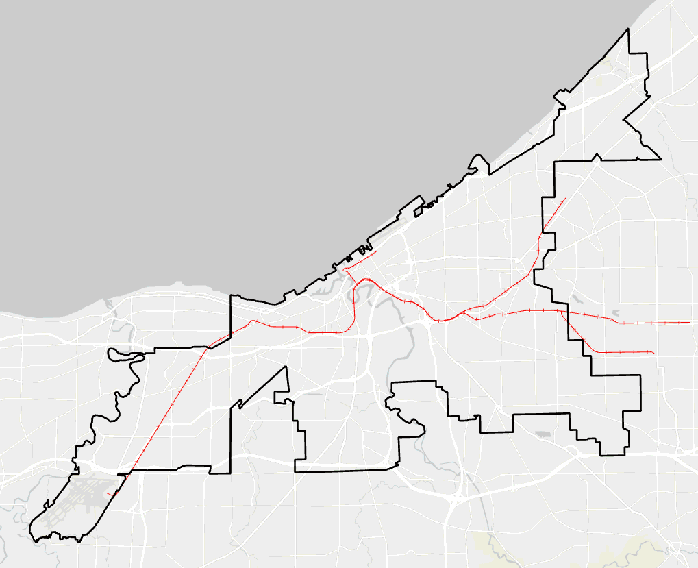
This dataset contains the official City of Cleveland ward boundaries for 2026 and beyond. These boundaries were drawn and approved in 2025 following the passage of <a target='_blank' href='https://cityofcleveland.legistar.com/LegislationDetail.aspx?ID=7083264&amp;GUID=E52606C2-3FB8-45A9-9E8C-40D544DB4196&amp;G=2EB18EF1-2C21-4D1D-85C9-B38100AB8FFD' rel='nofollow ugc noopener noreferrer'>Ordinance No. 1-2025</a> by Cleveland City Council on January 6, 2025. The new wards will be used in the Fall 2025 elections, with terms beginning in January 2026. For more information, refer to the <a target='_blank' href='https://www.clevelandcitycouncil.org/cleveland-city-council-redistricting' rel='nofollow ugc noopener noreferrer'>Ward Redistricting Info</a> page on the Cleveland City Council website and <a target='_blank' href='https://codelibrary.amlegal.com/codes/cleveland/latest/cleveland_oh/0-0-0-215' rel='nofollow ugc noopener noreferrer'>Section&nbsp;§ 25-1 Reapportionment of Wards</a> of the City Charter regarding Reapportionment of Wards. The source data was provided by City Council on January 7, 2025.</p><p><strong>Data Glossary</strong><br />See the <strong>Attributes</strong> section below for details about each column in this dataset.</p><p><strong>Update Frequency</strong><br />Static (does not change)</p><p><strong>Contacts</strong><br />Cleveland City Council</p>",
			"keyword": [
				"Wards",
				"Council",
				"City Council",
				"Reference"
			],
			"issued": "2025-01-08T17:03:44.000Z",
			"modified": "2026-02-24T15:22:02.077Z",
			"publisher": {
				"name": "Cleveland | GIS"
			},
			"contactPoint": {
				"@type": "vcard:Contact",
				"fn": "opendataCLE",
				"hasEmail": "mailto:xander_mavrides@clevelandwater.com"
			},
			"accessLevel": "public",
			"spatial": "-81.8791,41.3907,-81.5334,41.6006",
			"license": "https://opendatacommons.org/licenses/odbl/summary",
			"distribution": [
				{
					"@type": "dcat:Distribution",
					"title": "ArcGIS Hub Dataset",
					"format": "Web Page",
					"mediaType": "text/html",
					"accessURL": "https://data.clevelandohio.gov/datasets/ClevelandGIS::city-of-cleveland-wards-2026"
				},
				{
					"@type": "dcat:Distribution",
					"title": "ArcGIS GeoService",
					"format": "ArcGIS GeoServices REST API",
					"mediaType": "application/json",
					"accessURL": "https://services3.arcgis.com/dty2kHktVXHrqO8i/arcgis/rest/services/Cleveland_Wards_1_2_25_Topocleaned_pop20/FeatureServer/0"
				},
				{
					"@type": "dcat:Distribution",
					"title": "CSV",
					"format": "CSV",
					"mediaType": "text/csv",
					"accessURL": "https://data.clevelandohio.gov/api/download/v1/items/792495301e504d04b6f39ec604107534/csv?layers=0"
				},
				{
					"@type": "dcat:Distribution",
					"title": "Shapefile",
					"format": "ZIP",
					"mediaType": "application/zip",
					"accessURL": "https://data.clevelandohio.gov/api/download/v1/items/792495301e504d04b6f39ec604107534/shapefile?layers=0"
				},
				{
					"@type": "dcat:Distribution",
					"title": "GeoJSON",
					"format": "GeoJSON",
					"mediaType": "application/vnd.geo+json",
					"accessURL": "https://data.clevelandohio.gov/api/download/v1/items/792495301e504d04b6f39ec604107534/geojson?layers=0"
				},
				{
					"@type": "dcat:Distribution",
					"title": "KML",
					"format": "KML",
					"mediaType": "application/vnd.google-earth.kml+xml",
					"accessURL": "https://data.clevelandohio.gov/api/download/v1/items/792495301e504d04b6f39ec604107534/kml?layers=0"
				},
				{
					"@type": "dcat:Distribution",
					"title": "File Geodatabase",
					"format": "ZIP",
					"mediaType": "application/zip",
					"accessURL": "https://data.clevelandohio.gov/api/download/v1/items/792495301e504d04b6f39ec604107534/filegdb?layers=0"
				},
				{
					"@type": "dcat:Distribution",
					"title": "Feature Collection",
					"format": "TXT",
					"mediaType": "text/plain",
					"accessURL": "https://data.clevelandohio.gov/api/download/v1/items/792495301e504d04b6f39ec604107534/featureCollection?layers=0"
				},
				{
					"@type": "dcat:Distribution",
					"title": "Excel",
					"format": "XLSX",
					"mediaType": "application/vnd.ms-excel",
					"accessURL": "https://data.clevelandohio.gov/api/download/v1/items/792495301e504d04b6f39ec604107534/excel?layers=0"
				},
				{
					"@type": "dcat:Distribution",
					"title": "GeoPackage",
					"format": "GPKG",
					"mediaType": "application/geopackage+sqlite3",
					"accessURL": "https://data.clevelandohio.gov/api/download/v1/items/792495301e504d04b6f39ec604107534/geoPackage?layers=0"
				},
				{
					"@type": "dcat:Distribution",
					"title": "SQLite Geodatabase",
					"format": "GDB",
					"mediaType": "application/geopackage+sqlite3",
					"accessURL": "https://data.clevelandohio.gov/api/download/v1/items/792495301e504d04b6f39ec604107534/sqlite?layers=0"
				}
			],
			"theme": [
				"geospatial"
			]
		},
		{
			"@type": "dcat:Dataset",
			"identifier": "https://www.arcgis.com/home/item.html?id=852ce2e02acf43bf879f51cb1c084ee3&sublayer=120",
			"landingPage": "https://data.clevelandohio.gov/datasets/ClevelandGIS::neighborhood-development-index-ndi",
			"title": "Neighborhood Development Index (NDI)",
			"description": "<p><strong>Description</strong><br />This layer represents the Neighborhood Development Index (NDI), developed through a study by the Department of Community Development and the Poverty Center at Case Western Reserve University. The NDI identifies areas of Cleveland that fall in the middle of the socioeconomic and housing spectrum—neither the strongest nor the most distressed neighborhoods. These “middle neighborhoods” are often on the edge between growth and decline.</p><p>The research team analyzed over 100 indicators, condensed through factor analysis into 65 variables across six distinct factors. These include household income, housing value, race, education, age, poverty rate, health insurance coverage, foreign-born rates, loan activity, and more. The final classification includes three categories:</p><ul><li><strong>Market-Rate:</strong> Active development, rising rents and transfer values, market-driven growth</li><li><strong>Middle Neighborhood:</strong> Stable areas with gradual improvement or decline in property and socioeconomic conditions</li><li><strong>Opportunity:</strong> Lower property values and income levels, requiring greater redevelopment incentives</li></ul><p>These categories are also used to determine eligibility and levels for the City’s residential tax abatement program.</p><p><strong>Data Glossary</strong><br />See the <strong>Attributes</strong> section below for details about each column in this dataset.</p><p><strong>Update Frequency</strong><br />Every 2 years</p><p><strong>Contacts</strong><br />City of Cleveland, Department of Community Development</p>",
			"keyword": [
				"tax abatement",
				"NDI",
				"Market Classifications",
				"Commdev"
			],
			"issued": "2022-05-06T15:02:53.000Z",
			"modified": "2025-08-26T19:58:04.400Z",
			"publisher": {
				"name": "Cleveland | GIS"
			},
			"contactPoint": {
				"@type": "vcard:Contact",
				"fn": "dmatthews_ClevelandGIS",
				"hasEmail": "mailto:xander_mavrides@clevelandwater.com"
			},
			"accessLevel": "public",
			"spatial": "-81.8791,41.3908,-81.5321,41.5994",
			"license": "https://opendatacommons.org/licenses/odbl/summary",
			"distribution": [
				{
					"@type": "dcat:Distribution",
					"title": "ArcGIS Hub Dataset",
					"format": "Web Page",
					"mediaType": "text/html",
					"accessURL": "https://data.clevelandohio.gov/datasets/ClevelandGIS::neighborhood-development-index-ndi"
				},
				{
					"@type": "dcat:Distribution",
					"title": "ArcGIS GeoService",
					"format": "ArcGIS GeoServices REST API",
					"mediaType": "application/json",
					"accessURL": "https://services3.arcgis.com/dty2kHktVXHrqO8i/arcgis/rest/services/UPDATEDndiMarketClassification05062022/FeatureServer/120"
				},
				{
					"@type": "dcat:Distribution",
					"title": "CSV",
					"format": "CSV",
					"mediaType": "text/csv",
					"accessURL": "https://data.clevelandohio.gov/api/download/v1/items/852ce2e02acf43bf879f51cb1c084ee3/csv?layers=120"
				},
				{
					"@type": "dcat:Distribution",
					"title": "Shapefile",
					"format": "ZIP",
					"mediaType": "application/zip",
					"accessURL": "https://data.clevelandohio.gov/api/download/v1/items/852ce2e02acf43bf879f51cb1c084ee3/shapefile?layers=120"
				},
				{
					"@type": "dcat:Distribution",
					"title": "GeoJSON",
					"format": "GeoJSON",
					"mediaType": "application/vnd.geo+json",
					"accessURL": "https://data.clevelandohio.gov/api/download/v1/items/852ce2e02acf43bf879f51cb1c084ee3/geojson?layers=120"
				},
				{
					"@type": "dcat:Distribution",
					"title": "KML",
					"format": "KML",
					"mediaType": "application/vnd.google-earth.kml+xml",
					"accessURL": "https://data.clevelandohio.gov/api/download/v1/items/852ce2e02acf43bf879f51cb1c084ee3/kml?layers=120"
				}
			],
			"theme": [
				"geospatial"
			]
		},
		{
			"@type": "dcat:Dataset",
			"identifier": "https://www.arcgis.com/home/item.html?id=6f591e3ea2654c10a6d33713ce877495&sublayer=0",
			"landingPage": "https://data.clevelandohio.gov/datasets/ClevelandGIS::right-of-ways-cuyahoga",
			"title": "Right of Ways - Cuyahoga",
			"description": "Boundary lines for public Right of Ways within Cuyahoga county. A right of way is any traversable public space. This is a published service coming from the Cleveland GIS office. <b>This is not a legal description of any property, easement or boundaries. </b>Please consult with Cuyahoga County for official Real Property records.<div><br /></div><div><b>Update Frequency</b></div><div>As needed</div><div><br /></div><div><b>Contacts</b></div><div><a href='mailto:xander@clevelandGIS.com' target='_blank' rel='nofollow ugc noopener noreferrer'>Cleveland GIS</a> </div>",
			"keyword": [
				"Reference",
				"Boundary",
				"Authoritative",
				"ROW",
				"R/W",
				"R-O-W"
			],
			"issued": "2021-09-09T19:33:11.000Z",
			"modified": "2026-05-03T14:39:33.000Z",
			"publisher": {
				"name": "Cleveland | GIS"
			},
			"contactPoint": {
				"@type": "vcard:Contact",
				"fn": "jot_hall",
				"hasEmail": "mailto:xander_mavrides@clevelandwater.com"
			},
			"accessLevel": "public",
			"spatial": "-81.9717,41.2756,-81.3713,41.6300",
			"license": "https://opendatacommons.org/licenses/odbl/summary",
			"distribution": [
				{
					"@type": "dcat:Distribution",
					"title": "ArcGIS Hub Dataset",
					"format": "Web Page",
					"mediaType": "text/html",
					"accessURL": "https://data.clevelandohio.gov/datasets/ClevelandGIS::right-of-ways-cuyahoga"
				},
				{
					"@type": "dcat:Distribution",
					"title": "ArcGIS GeoService",
					"format": "ArcGIS GeoServices REST API",
					"mediaType": "application/json",
					"accessURL": "https://www.clevelandgis.org/arcgis/rest/services/ReferenceLayers/RightOfWay/MapServer/0"
				},
				{
					"@type": "dcat:Distribution",
					"title": "CSV",
					"format": "CSV",
					"mediaType": "text/csv",
					"accessURL": "https://data.clevelandohio.gov/api/download/v1/items/6f591e3ea2654c10a6d33713ce877495/csv?layers=0"
				},
				{
					"@type": "dcat:Distribution",
					"title": "Shapefile",
					"format": "ZIP",
					"mediaType": "application/zip",
					"accessURL": "https://data.clevelandohio.gov/api/download/v1/items/6f591e3ea2654c10a6d33713ce877495/shapefile?layers=0"
				},
				{
					"@type": "dcat:Distribution",
					"title": "GeoJSON",
					"format": "GeoJSON",
					"mediaType": "application/vnd.geo+json",
					"accessURL": "https://data.clevelandohio.gov/api/download/v1/items/6f591e3ea2654c10a6d33713ce877495/geojson?layers=0"
				},
				{
					"@type": "dcat:Distribution",
					"title": "KML",
					"format": "KML",
					"mediaType": "application/vnd.google-earth.kml+xml",
					"accessURL": "https://data.clevelandohio.gov/api/download/v1/items/6f591e3ea2654c10a6d33713ce877495/kml?layers=0"
				}
			],
			"theme": [
				"geospatial"
			]
		},
		{
			"@type": "dcat:Dataset",
			"identifier": "https://www.arcgis.com/home/item.html?id=d7a260273e804dd3b86bf10446142eee&sublayer=0",
			"landingPage": "https://data.clevelandohio.gov/datasets/ClevelandGIS::reported-near-miss-incidents",
			"title": "Reported Near-Miss Incidents",
			"description": "<p style='background-color:rgb(255, 255, 255); border:0px solid currentcolor; box-sizing:border-box; color:rgb(74, 74, 74); font-family:&quot;Avenir Next&quot;, Avenir, &quot;Helvetica Neue&quot;, sans-serif; font-size:16px; font-style:normal; font-variant-caps:normal; font-variant-ligatures:normal; font-weight:400; letter-spacing:normal; margin:0px 0px 1.5rem; text-align:start; text-decoration-color:initial; text-decoration-style:initial; text-indent:0px; text-transform:none; word-spacing:0px;'><span style='background-color:rgb(255,255,255); color:rgb(20,20,20); font-family:inherit; font-size:16px;'><span style='border:0px solid currentcolor; box-sizing:border-box; display:inline !important; float:none; font-style:normal; font-variant-caps:normal; font-variant-ligatures:normal; font-weight:400; letter-spacing:normal; line-height:1.5; text-align:start; text-decoration-color:initial; text-decoration-style:initial; text-indent:0px; text-transform:none; word-spacing:0px;'>A point layer of all near-miss incidents reported through the City of Cleveland's Near-Miss Incidents Reporting Form after August 2025.</span></span><br /><br />Near-miss incidents are defined as situations where someone walking, rolling, biking, or driving had to stop, swerve, or take sudden action to avoid a crash. Because these incidents are rarely reported, gathering this information is essential to understanding potential hazards before they result in harm.<br /><br /><a style='border:0px solid currentcolor; box-sizing:border-box; color:rgb(0, 97, 155); font-family:inherit; line-height:1.5; text-decoration:none;' target='_blank' href='https://arcg.is/05X5WG' rel='nofollow ugc noopener noreferrer'>Report a Near-Miss Incident.&nbsp;</a></p><p style='background-color:rgb(255, 255, 255); border:0px solid currentcolor; box-sizing:border-box; color:rgb(74, 74, 74); font-family:&quot;Avenir Next&quot;, Avenir, &quot;Helvetica Neue&quot;, sans-serif; font-size:16px; font-style:normal; font-variant-caps:normal; font-variant-ligatures:normal; font-weight:400; letter-spacing:normal; margin:0px 0px 1.5rem; text-align:start; text-decoration-color:initial; text-decoration-style:initial; text-indent:0px; text-transform:none; word-spacing:0px;'><strong>Update Frequency</strong><br /><span style='background-color:rgb(255,255,255); color:rgb(74,74,74); font-family:inherit; font-size:16px;'><span style='border:0px solid currentcolor; box-sizing:border-box; display:inline !important; float:none; font-style:normal; font-variant-caps:normal; font-variant-ligatures:normal; font-weight:400; letter-spacing:normal; line-height:1.5; text-align:start; text-decoration-color:initial; text-decoration-style:initial; text-indent:0px; text-transform:none; word-spacing:0px;'>Updated in real-time as survey submissions are received.</span></span><br /><br /><strong>Contact</strong><br /><span style='background-color:rgb(255,255,255); color:rgb(74,74,74); font-family:inherit; font-size:16px;'><span style='border:0px solid currentcolor; box-sizing:border-box; display:inline !important; float:none; font-style:normal; font-variant-caps:normal; font-variant-ligatures:normal; font-weight:400; letter-spacing:normal; line-height:1.5; text-align:start; text-decoration-color:initial; text-decoration-style:initial; text-indent:0px; text-transform:none; word-spacing:0px;'>Cameron Roberts, Vision Zero Coordinator</span></span><br /><a style='background-color:rgb(255, 255, 255); border:0px solid currentcolor; box-sizing:border-box; color:rgb(0, 97, 155); font-family:inherit; font-size:16px; font-style:normal; font-variant-caps:normal; font-variant-ligatures:normal; font-weight:400; letter-spacing:normal; line-height:1.5; text-align:start; text-decoration:none; text-indent:0px; text-transform:none; word-spacing:0px;' href='mailto:croberts5@clevelandohio.gov' target='_blank' rel='nofollow ugc noopener noreferrer'>croberts5@clevelandohio.gov</a></p>",
			"keyword": [
				"Survey123",
				"Near Miss",
				"Incident",
				"Close Call",
				"Vision Zero"
			],
			"issued": "2025-06-27T18:56:39.000Z",
			"modified": "2026-05-14T21:12:17.756Z",
			"publisher": {
				"name": "Cleveland | GIS"
			},
			"contactPoint": {
				"@type": "vcard:Contact",
				"fn": "croberts5_ago",
				"hasEmail": "mailto:xander_mavrides@clevelandwater.com"
			},
			"accessLevel": "public",
			"spatial": "-180.0000,-90.0000,180.0000,90.0000",
			"license": "https://opendatacommons.org/licenses/odbl/summary",
			"distribution": [
				{
					"@type": "dcat:Distribution",
					"title": "ArcGIS Hub Dataset",
					"format": "Web Page",
					"mediaType": "text/html",
					"accessURL": "https://data.clevelandohio.gov/datasets/ClevelandGIS::reported-near-miss-incidents"
				},
				{
					"@type": "dcat:Distribution",
					"title": "ArcGIS GeoService",
					"format": "ArcGIS GeoServices REST API",
					"mediaType": "application/json",
					"accessURL": "https://services3.arcgis.com/dty2kHktVXHrqO8i/arcgis/rest/services/survey123_b55cb67c52324b888a3bae43abc47925_results/FeatureServer/0"
				},
				{
					"@type": "dcat:Distribution",
					"title": "CSV",
					"format": "CSV",
					"mediaType": "text/csv",
					"accessURL": "https://data.clevelandohio.gov/api/download/v1/items/d7a260273e804dd3b86bf10446142eee/csv?layers=0"
				},
				{
					"@type": "dcat:Distribution",
					"title": "Shapefile",
					"format": "ZIP",
					"mediaType": "application/zip",
					"accessURL": "https://data.clevelandohio.gov/api/download/v1/items/d7a260273e804dd3b86bf10446142eee/shapefile?layers=0"
				},
				{
					"@type": "dcat:Distribution",
					"title": "GeoJSON",
					"format": "GeoJSON",
					"mediaType": "application/vnd.geo+json",
					"accessURL": "https://data.clevelandohio.gov/api/download/v1/items/d7a260273e804dd3b86bf10446142eee/geojson?layers=0"
				},
				{
					"@type": "dcat:Distribution",
					"title": "KML",
					"format": "KML",
					"mediaType": "application/vnd.google-earth.kml+xml",
					"accessURL": "https://data.clevelandohio.gov/api/download/v1/items/d7a260273e804dd3b86bf10446142eee/kml?layers=0"
				},
				{
					"@type": "dcat:Distribution",
					"title": "File Geodatabase",
					"format": "ZIP",
					"mediaType": "application/zip",
					"accessURL": "https://data.clevelandohio.gov/api/download/v1/items/d7a260273e804dd3b86bf10446142eee/filegdb?layers=0"
				},
				{
					"@type": "dcat:Distribution",
					"title": "Feature Collection",
					"format": "TXT",
					"mediaType": "text/plain",
					"accessURL": "https://data.clevelandohio.gov/api/download/v1/items/d7a260273e804dd3b86bf10446142eee/featureCollection?layers=0"
				},
				{
					"@type": "dcat:Distribution",
					"title": "Excel",
					"format": "XLSX",
					"mediaType": "application/vnd.ms-excel",
					"accessURL": "https://data.clevelandohio.gov/api/download/v1/items/d7a260273e804dd3b86bf10446142eee/excel?layers=0"
				},
				{
					"@type": "dcat:Distribution",
					"title": "GeoPackage",
					"format": "GPKG",
					"mediaType": "application/geopackage+sqlite3",
					"accessURL": "https://data.clevelandohio.gov/api/download/v1/items/d7a260273e804dd3b86bf10446142eee/geoPackage?layers=0"
				},
				{
					"@type": "dcat:Distribution",
					"title": "SQLite Geodatabase",
					"format": "GDB",
					"mediaType": "application/geopackage+sqlite3",
					"accessURL": "https://data.clevelandohio.gov/api/download/v1/items/d7a260273e804dd3b86bf10446142eee/sqlite?layers=0"
				}
			],
			"theme": [
				"geospatial"
			]
		},
		{
			"@type": "dcat:Dataset",
			"identifier": "https://www.arcgis.com/home/item.html?id=550e243224e44edc85207a1b4dfff9db",
			"landingPage": "https://data.clevelandohio.gov/apps/ClevelandGIS::vision-zero-cleveland-crash-dashboard",
			"title": "Vision Zero Cleveland Crash Dashboard",
			"description": "<div><span style='font-family:Avenir Next W01, Avenir Next W00, Avenir Next, Avenir, Helvetica Neue, sans-serif; font-size:16px;'>This dashboard includes an overview of fatal and suspected serious injury crash data analysis conducted by Vision Zero Cleveland. It includes fatal and serious crash data between the years 2016-2025 and Cleveland's 2020-2024 High Crash Segment network.</span></div><div><br />&nbsp;</div><div><span style='font-family:Avenir Next W01, Avenir Next W00, Avenir Next, Avenir, Helvetica Neue, sans-serif; font-size:16px;'>Crash data is obtained from the Ohio Department of Transportation’s (ODOT) crash database, which is populated by reports submitted by law enforcement agencies throughout Cleveland.</span></div><div><br />&nbsp;</div><div><span style='font-family:&quot;Avenir Next W01&quot;, &quot;Avenir Next W00&quot;, &quot;Avenir Next&quot;, Avenir, &quot;Helvetica Neue&quot;, sans-serif; font-size:16px;'>The 2020-2024 High Crash Segment layer represents one-mile segments where 10 or more serious injury or fatal crashes have occurred within the 5-year period. Generally, this dataset represents particularly dangerous road segments on the city's network.</span></div><div><br />&nbsp;</div><div><span style='font-family:&quot;Avenir Next W01&quot;, &quot;Avenir Next W00&quot;, &quot;Avenir Next&quot;, Avenir, &quot;Helvetica Neue&quot;, sans-serif; font-size:16px;'><strong>Update Frequency</strong></span></div><p><span style='font-family:&quot;Avenir Next W01&quot;, &quot;Avenir Next W00&quot;, &quot;Avenir Next&quot;, Avenir, &quot;Helvetica Neue&quot;, sans-serif; font-size:16px;'>This is an ongoing data export from ODOT that is further disaggregated by Vision Zero Cleveland and will be updated annually once fully documented crashes for the calendar year are available (typically spring of the following calendar year). Check the \"Data Updated\" info to the right and consult this description for details.</span></p><div><br />&nbsp;</div><div><div style='font-family:&quot;Avenir Next W01&quot;, &quot;Avenir Next W00&quot;, &quot;Avenir Next&quot;, Avenir, &quot;Helvetica Neue&quot;, sans-serif; font-size:16px;'><div style='font-family:inherit;'><div style='font-family:inherit;'><strong>Contact</strong></div></div></div><div style='font-family:&quot;Avenir Next W01&quot;, &quot;Avenir Next W00&quot;, &quot;Avenir Next&quot;, Avenir, &quot;Helvetica Neue&quot;, sans-serif; font-size:16px;'>Cameron Roberts, Vision Zero Coordinator</div><div style='font-family:&quot;Avenir Next W01&quot;, &quot;Avenir Next W00&quot;, &quot;Avenir Next&quot;, Avenir, &quot;Helvetica Neue&quot;, sans-serif; font-size:16px;'><a href='mailto:croberts5@clevelandohio.gov' target='_blank' rel='nofollow ugc noopener noreferrer'>croberts5@clevelandohio.gov</a></div></div>",
			"keyword": [
				"Vision Zero",
				"Crashes",
				"GCAT"
			],
			"issued": "2025-06-24T15:02:24.000Z",
			"modified": "2026-05-01T20:04:04.000Z",
			"publisher": {
				"name": "Cleveland | GIS"
			},
			"contactPoint": {
				"@type": "vcard:Contact",
				"fn": "croberts5_ago",
				"hasEmail": "mailto:xander_mavrides@clevelandwater.com"
			},
			"accessLevel": "public",
			"spatial": "",
			"license": "https://opendatacommons.org/licenses/odbl/summary",
			"distribution": [
				{
					"@type": "dcat:Distribution",
					"title": "ArcGIS Hub Dataset",
					"format": "Web Page",
					"mediaType": "text/html",
					"accessURL": "https://data.clevelandohio.gov/apps/ClevelandGIS::vision-zero-cleveland-crash-dashboard"
				}
			],
			"theme": ""
		},
		{
			"@type": "dcat:Dataset",
			"identifier": "https://www.arcgis.com/home/item.html?id=17a75fd5ac72444dad36b23cf6bfb774&sublayer=0",
			"landingPage": "https://data.clevelandohio.gov/datasets/ClevelandGIS::cleveland-and-cuyahoga-county-shared-mobility-hubs",
			"title": "Cleveland and Cuyahoga County Shared Mobility Hubs",
			"description": "<p><strong>Description</strong><br />This view shows shared mobility hub locations across Cleveland and Cuyahoga County. Shared mobility hubs provide organized parking for rentable shared bikes and scooters. Each hub includes bike racks, ground markings, and signage with program information and rules. You can view location-specific photos and explore different hub typologies. Learn more at: <a target='_blank' href='https://www.clevelandohio.gov/shared-mobility' rel='nofollow ugc noopener noreferrer'>www.clevelandohio.gov/shared-mobility</a>.<br /><br /><a target='_blank' href='https://drive.google.com/file/d/1tEVkm39mSN6Cv8z0iHMi1Z2WjODpwB2V/view?usp=sharing' rel='nofollow ugc noopener noreferrer'>View each location's specifics with photos</a>.<br /><br /><a target='_blank' href='https://drive.google.com/file/d/1ZoFN2o2Ki0qbWi6dvAetq2B0P_OWM7Dc/view?usp=drive_link' rel='nofollow ugc noopener noreferrer'>View the different hub typologies</a>.</p><p><strong>Data Glossary</strong><br />See the <strong>Attributes</strong> section below for details about each column in this dataset.<br /><br />You can find each hub by reference number in this <a target='_blank' href='https://drive.google.com/drive/u/2/folders/1kWB48BTFso3d7HGXUQy6eOPxZTxKt-aB' rel='nofollow ugc noopener noreferrer'>location sheet document</a>.</p><p><strong>Update Frequency</strong><br />In Spring 2025, Cleveland and Cuyahoga County will install the first collection of 75+ shared mobility hubs across the county. This map will be updated as additional hubs are added.</p><p><strong>Contacts</strong><br />Sarah Davis, Active Transportation Senior Planner<br />sdavis2@clevelandohio.gov</p>",
			"keyword": [
				"Active Transportation",
				"Bicycle",
				"bike",
				"scooters",
				"shared mobility"
			],
			"issued": "2025-03-12T19:50:14.000Z",
			"modified": "2025-09-05T16:59:00.568Z",
			"publisher": {
				"name": "Cleveland | GIS"
			},
			"contactPoint": {
				"@type": "vcard:Contact",
				"fn": "sdavis2_ago",
				"hasEmail": "mailto:xander_mavrides@clevelandwater.com"
			},
			"accessLevel": "public",
			"spatial": "-81.8163,41.4337,-81.5185,41.5386",
			"license": "https://opendatacommons.org/licenses/odbl/summary",
			"distribution": [
				{
					"@type": "dcat:Distribution",
					"title": "ArcGIS Hub Dataset",
					"format": "Web Page",
					"mediaType": "text/html",
					"accessURL": "https://data.clevelandohio.gov/datasets/ClevelandGIS::cleveland-and-cuyahoga-county-shared-mobility-hubs"
				},
				{
					"@type": "dcat:Distribution",
					"title": "ArcGIS GeoService",
					"format": "ArcGIS GeoServices REST API",
					"mediaType": "application/json",
					"accessURL": "https://services3.arcgis.com/dty2kHktVXHrqO8i/arcgis/rest/services/Cleveland_and_Cuyahoga_County_Shared_Mobility_Hubs/FeatureServer/0"
				},
				{
					"@type": "dcat:Distribution",
					"title": "CSV",
					"format": "CSV",
					"mediaType": "text/csv",
					"accessURL": "https://data.clevelandohio.gov/api/download/v1/items/17a75fd5ac72444dad36b23cf6bfb774/csv?layers=0"
				},
				{
					"@type": "dcat:Distribution",
					"title": "Shapefile",
					"format": "ZIP",
					"mediaType": "application/zip",
					"accessURL": "https://data.clevelandohio.gov/api/download/v1/items/17a75fd5ac72444dad36b23cf6bfb774/shapefile?layers=0"
				},
				{
					"@type": "dcat:Distribution",
					"title": "GeoJSON",
					"format": "GeoJSON",
					"mediaType": "application/vnd.geo+json",
					"accessURL": "https://data.clevelandohio.gov/api/download/v1/items/17a75fd5ac72444dad36b23cf6bfb774/geojson?layers=0"
				},
				{
					"@type": "dcat:Distribution",
					"title": "KML",
					"format": "KML",
					"mediaType": "application/vnd.google-earth.kml+xml",
					"accessURL": "https://data.clevelandohio.gov/api/download/v1/items/17a75fd5ac72444dad36b23cf6bfb774/kml?layers=0"
				},
				{
					"@type": "dcat:Distribution",
					"title": "File Geodatabase",
					"format": "ZIP",
					"mediaType": "application/zip",
					"accessURL": "https://data.clevelandohio.gov/api/download/v1/items/17a75fd5ac72444dad36b23cf6bfb774/filegdb?layers=0"
				},
				{
					"@type": "dcat:Distribution",
					"title": "Feature Collection",
					"format": "TXT",
					"mediaType": "text/plain",
					"accessURL": "https://data.clevelandohio.gov/api/download/v1/items/17a75fd5ac72444dad36b23cf6bfb774/featureCollection?layers=0"
				},
				{
					"@type": "dcat:Distribution",
					"title": "Excel",
					"format": "XLSX",
					"mediaType": "application/vnd.ms-excel",
					"accessURL": "https://data.clevelandohio.gov/api/download/v1/items/17a75fd5ac72444dad36b23cf6bfb774/excel?layers=0"
				},
				{
					"@type": "dcat:Distribution",
					"title": "GeoPackage",
					"format": "GPKG",
					"mediaType": "application/geopackage+sqlite3",
					"accessURL": "https://data.clevelandohio.gov/api/download/v1/items/17a75fd5ac72444dad36b23cf6bfb774/geoPackage?layers=0"
				},
				{
					"@type": "dcat:Distribution",
					"title": "SQLite Geodatabase",
					"format": "GDB",
					"mediaType": "application/geopackage+sqlite3",
					"accessURL": "https://data.clevelandohio.gov/api/download/v1/items/17a75fd5ac72444dad36b23cf6bfb774/sqlite?layers=0"
				}
			],
			"theme": [
				"geospatial"
			]
		},
		{
			"@type": "dcat:Dataset",
			"identifier": "https://www.arcgis.com/home/item.html?id=27d5fd9063984f2cb415541826edda24",
			"landingPage": "https://data.clevelandohio.gov/apps/ClevelandGIS::lead-safe-certificate-explorer",
			"title": "Lead Safe Certificate Explorer",
			"description": "<div>The goal of the Lead Safe Certificate program is to prevent lead poisoning by ensuring that all rental homes built prior to 1978 are compliant with the city's Lead Safe Ordinance and maintained free of lead hazards.</div><div><br /></div><div>This tool allows you to do the following:</div><div><ul><li>View all certificates associated with a location</li><li>Search for specific certificates by ID or address</li><li>Filter certificates by characteristics like active/inactive</li><li>See visualizations of the overall certificate dataset</li></ul></div><div><br /></div><div>For more information about the City's Lead Safe Certification program, please visit <a href='https://www.clevelandohio.gov/city-hall/departments/building-housing/divisions/records-administration/lead-safe-certification' target='_blank' rel='nofollow ugc noopener noreferrer'>this Building &amp; Housing page</a>.</div><div><br /></div><div><b>Related</b></div><div><a href='https://clevelandgis.maps.arcgis.com/home/item.html?id=8efc4d35878f42cea588b441fc5e9930&amp;view=table&amp;sortOrder=desc&amp;sortField=defaultFSOrder#overview' target='_blank' rel='nofollow ugc noopener noreferrer'>Lead Safe Certificates Dataset</a></div><div><br /></div><div><b>Contact</b></div><div>City of Cleveland, Building and Housing Lead Compliance Program</div><div><br /></div><div><b>Update Frequency</b></div><div>Daily around 7 AM EST (6 AM during daylight savings)</div>",
			"keyword": [
				"accela"
			],
			"issued": "2024-12-30T16:09:09.000Z",
			"modified": "2026-05-01T14:41:40.000Z",
			"publisher": {
				"name": "Cleveland | GIS"
			},
			"contactPoint": {
				"@type": "vcard:Contact",
				"fn": "opendataCLE",
				"hasEmail": "mailto:xander_mavrides@clevelandwater.com"
			},
			"accessLevel": "public",
			"spatial": "",
			"license": "https://opendatacommons.org/licenses/odbl/summary",
			"distribution": [
				{
					"@type": "dcat:Distribution",
					"title": "ArcGIS Hub Dataset",
					"format": "Web Page",
					"mediaType": "text/html",
					"accessURL": "https://data.clevelandohio.gov/apps/ClevelandGIS::lead-safe-certificate-explorer"
				},
				{
					"@type": "dcat:Distribution",
					"title": "ArcGIS GeoService",
					"format": "ArcGIS GeoServices REST API",
					"mediaType": "application/json",
					"accessURL": "https://experience.arcgis.com/experience/27d5fd9063984f2cb415541826edda24"
				}
			],
			"theme": ""
		},
		{
			"@type": "dcat:Dataset",
			"identifier": "https://www.arcgis.com/home/item.html?id=953a32e123c3485d96a3b588b4bc56e9",
			"landingPage": "https://data.clevelandohio.gov/apps/ClevelandGIS::cleveland-cemetery-viewer",
			"title": "Cleveland Cemetery Viewer",
			"description": "Look up burial information across all Cleveland City-owned cemeteries using the City of Cleveland Cemetery Viewer web application.<div><br /></div><div><b>Instructions</b><br /><div><ul><li>Search for individuals buried across all City-owned and operated cemeteries, including historic records going back to 1800s</li><li>Find detailed maps of cemeteries to navigate to each section and lot/tier.</li><li>Learn more about each facility in the Explore Our Cemeteries tab</li><li>Perform more advanced queries on the burials database</li><li>For historic records (buried before 1980), jump to a scanned image of the City register book</li></ul><div>See instructions and help documentation in the application to learn more.</div><div><br /></div><div><b>This app uses the following dataset(s):</b></div><div><a href='https://data.clevelandohio.gov/maps/d1fc3cb80d5a4628b406318f7ed3d741/about' target='_blank' rel='nofollow ugc noopener noreferrer'>City Cemetery Records</a><br /></div><div><br /></div><div><b>Release Date</b></div><div>May 2024</div><div><br /></div><div><b>Contact</b></div></div><div><a href='https://www.clevelandohio.gov/city-hall/departments/public-works/divisions/park-maintenance-properties/cemeteries' target='_blank' rel='nofollow ugc noopener noreferrer'>City of Cleveland, Dept. of Public Works, Division of Park Maintenance &amp; Property Cemetery Operations</a><b><br /></b></div><div>For questions or issues, call the main line at Highland Park office at 216-348-7210.</div></div>",
			"keyword": [
				"Cemeteries",
				"Gravesites",
				"Burials",
				"Owners",
				"Public Works",
				"Parks",
				"Asset Management",
				"Field",
				"ArcGIS Solutions"
			],
			"issued": "2023-06-08T18:06:50.000Z",
			"modified": "2026-05-01T14:41:39.000Z",
			"publisher": {
				"name": "Cleveland | GIS"
			},
			"contactPoint": {
				"@type": "vcard:Contact",
				"fn": "opendataCLE",
				"hasEmail": "mailto:xander_mavrides@clevelandwater.com"
			},
			"accessLevel": "public",
			"spatial": "-81.8287,41.3667,-81.5527,41.6427",
			"license": "Copyright 2023 Esri<br /><br />Licensed under the Apache License, Version 2.0 (the &quot;License&quot;); you may not use this file except in compliance with the License. You may obtain a copy of the License at<br /><br /><a href='https://www.apache.org/licenses/LICENSE-2.0' target='_blank' rel='nofollow ugc noopener noreferrer'>https://www.apache.org/licenses/LICENSE-2.0</a><br /><br />Unless required by applicable law or agreed to in writing, software distributed under the License is distributed on an &quot;AS IS&quot; BASIS, WITHOUT WARRANTIES OR CONDITIONS OF ANY KIND, either express or implied. See the License for the specific language governing permissions and limitations under the License.",
			"distribution": [
				{
					"@type": "dcat:Distribution",
					"title": "ArcGIS Hub Dataset",
					"format": "Web Page",
					"mediaType": "text/html",
					"accessURL": "https://data.clevelandohio.gov/apps/ClevelandGIS::cleveland-cemetery-viewer"
				},
				{
					"@type": "dcat:Distribution",
					"title": "ArcGIS GeoService",
					"format": "ArcGIS GeoServices REST API",
					"mediaType": "application/json",
					"accessURL": "https://experience.arcgis.com/experience/953a32e123c3485d96a3b588b4bc56e9"
				}
			],
			"theme": [
				"geospatial"
			]
		},
		{
			"@type": "dcat:Dataset",
			"identifier": "https://www.arcgis.com/home/item.html?id=e3946f944a7f43e782417dc161890d21&sublayer=0",
			"landingPage": "https://data.clevelandohio.gov/datasets/ClevelandGIS::certificates-of-disclosure",
			"title": "Certificates of Disclosure",
			"description": "<p><strong>Description</strong><br />Certificates of Disclosure (COD) issued by the City of Cleveland Department of Building and Housing since 2015. A COD is required when transferring properties with structures in the City and typically includes historical issues concerning the property and/or the seller.</p><p><strong>Data Glossary</strong><br />See the <strong>Attributes</strong> section below for details about each column in this dataset.</p><p>Original fields (without the <strong>DW </strong>prefix) show the unmodified [ward/parcel/etc] as recorded in the source system at the time of collection. <strong>DW</strong>-prefixed fields are enhanced versions, standardized, validated, or enriched by the data warehouse for easier analysis.</p><p><strong>Update Frequency</strong><br />Weekly on Sundays at 7 AM EST (6 AM during daylight savings)</p><p><strong>Contacts</strong><br />Department of Building and Housing, 216-664-2930</p>",
			"keyword": [
				"accela",
				"property",
				"B&H",
				"COD",
				"transfers"
			],
			"issued": "2024-01-23T15:52:24.000Z",
			"modified": "2026-05-10T10:24:09.700Z",
			"publisher": {
				"name": "Cleveland | GIS"
			},
			"contactPoint": {
				"@type": "vcard:Contact",
				"fn": "opendataCLE",
				"hasEmail": "mailto:xander_mavrides@clevelandwater.com"
			},
			"accessLevel": "public",
			"spatial": "",
			"license": "https://opendatacommons.org/licenses/odbl/summary",
			"distribution": [
				{
					"@type": "dcat:Distribution",
					"title": "ArcGIS Hub Dataset",
					"format": "Web Page",
					"mediaType": "text/html",
					"accessURL": "https://data.clevelandohio.gov/datasets/ClevelandGIS::certificates-of-disclosure"
				},
				{
					"@type": "dcat:Distribution",
					"title": "ArcGIS GeoService",
					"format": "ArcGIS GeoServices REST API",
					"mediaType": "application/json",
					"accessURL": "https://services3.arcgis.com/dty2kHktVXHrqO8i/arcgis/rest/services/Certificates_of_Disclosure/FeatureServer/0"
				},
				{
					"@type": "dcat:Distribution",
					"title": "CSV",
					"format": "CSV",
					"mediaType": "text/csv",
					"accessURL": "https://data.clevelandohio.gov/api/download/v1/items/e3946f944a7f43e782417dc161890d21/csv?layers=0"
				},
				{
					"@type": "dcat:Distribution",
					"title": "Shapefile",
					"format": "ZIP",
					"mediaType": "application/zip",
					"accessURL": "https://data.clevelandohio.gov/api/download/v1/items/e3946f944a7f43e782417dc161890d21/shapefile?layers=0"
				},
				{
					"@type": "dcat:Distribution",
					"title": "GeoJSON",
					"format": "GeoJSON",
					"mediaType": "application/vnd.geo+json",
					"accessURL": "https://data.clevelandohio.gov/api/download/v1/items/e3946f944a7f43e782417dc161890d21/geojson?layers=0"
				},
				{
					"@type": "dcat:Distribution",
					"title": "KML",
					"format": "KML",
					"mediaType": "application/vnd.google-earth.kml+xml",
					"accessURL": "https://data.clevelandohio.gov/api/download/v1/items/e3946f944a7f43e782417dc161890d21/kml?layers=0"
				},
				{
					"@type": "dcat:Distribution",
					"title": "File Geodatabase",
					"format": "ZIP",
					"mediaType": "application/zip",
					"accessURL": "https://data.clevelandohio.gov/api/download/v1/items/e3946f944a7f43e782417dc161890d21/filegdb?layers=0"
				},
				{
					"@type": "dcat:Distribution",
					"title": "Feature Collection",
					"format": "TXT",
					"mediaType": "text/plain",
					"accessURL": "https://data.clevelandohio.gov/api/download/v1/items/e3946f944a7f43e782417dc161890d21/featureCollection?layers=0"
				},
				{
					"@type": "dcat:Distribution",
					"title": "Excel",
					"format": "XLSX",
					"mediaType": "application/vnd.ms-excel",
					"accessURL": "https://data.clevelandohio.gov/api/download/v1/items/e3946f944a7f43e782417dc161890d21/excel?layers=0"
				},
				{
					"@type": "dcat:Distribution",
					"title": "GeoPackage",
					"format": "GPKG",
					"mediaType": "application/geopackage+sqlite3",
					"accessURL": "https://data.clevelandohio.gov/api/download/v1/items/e3946f944a7f43e782417dc161890d21/geoPackage?layers=0"
				},
				{
					"@type": "dcat:Distribution",
					"title": "SQLite Geodatabase",
					"format": "GDB",
					"mediaType": "application/geopackage+sqlite3",
					"accessURL": "https://data.clevelandohio.gov/api/download/v1/items/e3946f944a7f43e782417dc161890d21/sqlite?layers=0"
				}
			],
			"theme": ""
		},
		{
			"@type": "dcat:Dataset",
			"identifier": "https://www.arcgis.com/home/item.html?id=21d27b6876944aa1b6ac5d060d699fb8",
			"landingPage": "https://data.clevelandohio.gov/apps/ClevelandGIS::cleveland-water-department-boil-alert-advisory",
			"title": "Cleveland Water Department Boil Alert Advisory",
			"description": "<div>A boil advisory is a public notice advising customers to boil tap water or use bottled water for any consumption purpose. Cleveland Water is required by the Ohio EPA to issue a boil advisory under certain circumstances. Use this application to see if there is a current boil advisory within the Cleveland Water service area.</div><div><br /></div><div>If there is a boil alert, you will be able to view the boundary area and search to see if your address falls within the boundary.</div><div><br /></div><div>If there is no active boil alert, there will be a splash screening displaying this message.</div><div><br /></div><div><b>Update Frequency</b></div><div>When a boil alert is active</div><div><br /></div><div><b>This application uses the following dataset(s):</b></div><div><a href='https://data.clevelandohio.gov/datasets/50c244e387804e53b678ec51ce3d4400_0/explore?location=41.412223%2C-81.655000%2C8.55' target='_blank' rel='nofollow ugc noopener noreferrer'>Water Boil Alert Areas</a><br /></div><div><br /></div><div><b>Contact</b></div><div>Department of Public Utilities, <a href='mailto:xander@clevelandGIS.com' target='_blank' rel='nofollow ugc noopener noreferrer'>Cleveland GIS</a></div>",
			"keyword": [
				"advisory",
				"cwd",
				"boil alert"
			],
			"issued": "2016-12-04T14:17:43.000Z",
			"modified": "2026-04-28T16:25:04.000Z",
			"publisher": {
				"name": "Cleveland | GIS"
			},
			"contactPoint": {
				"@type": "vcard:Contact",
				"fn": "jot_hall",
				"hasEmail": "mailto:xander_mavrides@clevelandwater.com"
			},
			"accessLevel": "public",
			"spatial": "",
			"license": "https://opendatacommons.org/licenses/odbl/summary",
			"distribution": [
				{
					"@type": "dcat:Distribution",
					"title": "ArcGIS Hub Dataset",
					"format": "Web Page",
					"mediaType": "text/html",
					"accessURL": "https://data.clevelandohio.gov/apps/ClevelandGIS::cleveland-water-department-boil-alert-advisory"
				},
				{
					"@type": "dcat:Distribution",
					"title": "ArcGIS GeoService",
					"format": "ArcGIS GeoServices REST API",
					"mediaType": "application/json",
					"accessURL": "https://clevelandgis.maps.arcgis.com/apps/webappviewer/index.html?id=21d27b6876944aa1b6ac5d060d699fb8"
				}
			],
			"theme": ""
		},
		{
			"@type": "dcat:Dataset",
			"identifier": "https://www.arcgis.com/home/item.html?id=29c5cca661e444d6aaaa26325fa633d4&sublayer=0",
			"landingPage": "https://data.clevelandohio.gov/datasets/ClevelandGIS::traffic-calming-and-safety-installations-1",
			"title": "Traffic Calming and Safety Installations",
			"description": "<span style='font-family:&quot;Avenir Next W01&quot;, &quot;Avenir Next W00&quot;, &quot;Avenir Next&quot;, Avenir, &quot;Helvetica Neue&quot;, sans-serif; font-size:16px;'>Inventory of street features that are installed on streets for traffic calming and safety enhancements.</span><div><font face='Avenir Next W01, Avenir Next W00, Avenir Next, Avenir, Helvetica Neue, sans-serif'><span style='font-size:16px;'><br /></span></font><div><div style='font-family:&quot;Avenir Next W01&quot;, &quot;Avenir Next W00&quot;, &quot;Avenir Next&quot;, Avenir, &quot;Helvetica Neue&quot;, sans-serif; font-size:16px;'><b>Data Glossary</b></div><div style='font-family:&quot;Avenir Next W01&quot;, &quot;Avenir Next W00&quot;, &quot;Avenir Next&quot;, Avenir, &quot;Helvetica Neue&quot;, sans-serif; font-size:16px;'><a href='https://clevelandgis.maps.arcgis.com/home/item.html?id=29c5cca661e444d6aaaa26325fa633d4#data' target='_blank' rel='nofollow ugc noopener noreferrer'>Click here to view table and field information.</a><br /></div><div style='font-family:&quot;Avenir Next W01&quot;, &quot;Avenir Next W00&quot;, &quot;Avenir Next&quot;, Avenir, &quot;Helvetica Neue&quot;, sans-serif; font-size:16px;'><b><br /></b></div><div style='font-family:&quot;Avenir Next W01&quot;, &quot;Avenir Next W00&quot;, &quot;Avenir Next&quot;, Avenir, &quot;Helvetica Neue&quot;, sans-serif; font-size:16px;'><b>Description</b></div><div style='font-family:&quot;Avenir Next W01&quot;, &quot;Avenir Next W00&quot;, &quot;Avenir Next&quot;, Avenir, &quot;Helvetica Neue&quot;, sans-serif; font-size:16px;'>Installations are categorized by status, where e<i>xisting </i>installations are present on the street. <i>In progress</i> installations are funded and have a date set for construction.</div><div style='font-family:&quot;Avenir Next W01&quot;, &quot;Avenir Next W00&quot;, &quot;Avenir Next&quot;, Avenir, &quot;Helvetica Neue&quot;, sans-serif; font-size:16px;'><br /></div><div style='font-family:&quot;Avenir Next W01&quot;, &quot;Avenir Next W00&quot;, &quot;Avenir Next&quot;, Avenir, &quot;Helvetica Neue&quot;, sans-serif; font-size:16px;'>The dataset includes several types of traffic calming or safety installation, including:</div><div><ul><li><i>Speed table: </i><font face='Avenir Next W01, Avenir Next W00, Avenir Next, Avenir, Helvetica Neue, sans-serif'><span style='font-size:16px;'>vertical bumps in the road that cause drivers to slow down to drive over them. Speed tables are relatively flat on the top and are not as abrupt as speed bumps, which are narrower and rounded.<i> </i></span></font></li><li><i>Roundabout</i>: an intersection where traffic moves in one direction around a central island to reach a converging street</li><li><i>Mini-roundabout</i>: a roundabout with a mountable central island</li><li><i>Pedestrian refuge island</i>: a physically separated median segment in the roadway connecting a crosswalk to either side of the street; intended to help protect pedestrians who are crossing a multilane road</li><li><i>Curb extension</i>: an extension of the sidewalk or curb line out into a parking lane, shortening the pedestrian crossing distance and increasing visibility</li></ul><div><b><br /></b></div><b>Update Frequency</b><br /></div><div style='font-family:inherit; font-size:16px;'><div style='font-family:inherit;'>Annually, typically at the end of Fall</div><div style='font-family:inherit;'><br /></div><div style='font-family:inherit;'><b>This dataset is featured in the following stories/apps:</b></div><div style='font-family:inherit;'><ul><li><a href='https://storymaps.arcgis.com/stories/9e3123e95f124125a62d2daad566db28' target='_blank' rel='nofollow ugc noopener noreferrer'>Safe Streets for Clevelanders</a><br /></li></ul></div></div><div style='font-family:inherit; font-size:16px;'><b><br /></b></div><div style='font-family:inherit; font-size:16px;'><b>Contact</b></div><div style='font-family:inherit; font-size:16px;'>Calley Mersmann, Senior Strategist, Transit and Mobility, cmersmann@clevelandohio.gov</div></div></div>",
			"keyword": [
				"snow",
				"streets",
				"Public View",
				"Speed Tables",
				"Traffic Calming",
				"Transportation",
				"Vision Zero"
			],
			"issued": "2024-08-01T12:50:04.000Z",
			"modified": "2026-05-15T13:37:56.493Z",
			"publisher": {
				"name": "Cleveland | GIS"
			},
			"contactPoint": {
				"@type": "vcard:Contact",
				"fn": "CMersmann_ClevelandGIS",
				"hasEmail": "mailto:xander_mavrides@clevelandwater.com"
			},
			"accessLevel": "public",
			"spatial": "-150.9983,-77.4751,93.0534,-71.8770",
			"license": "https://opendatacommons.org/licenses/odbl/summary",
			"distribution": [
				{
					"@type": "dcat:Distribution",
					"title": "ArcGIS Hub Dataset",
					"format": "Web Page",
					"mediaType": "text/html",
					"accessURL": "https://data.clevelandohio.gov/datasets/ClevelandGIS::traffic-calming-and-safety-installations-1"
				},
				{
					"@type": "dcat:Distribution",
					"title": "ArcGIS GeoService",
					"format": "ArcGIS GeoServices REST API",
					"mediaType": "application/json",
					"accessURL": "https://services3.arcgis.com/dty2kHktVXHrqO8i/arcgis/rest/services/Traffic_Calming_and_Safety_Installations/FeatureServer/0"
				},
				{
					"@type": "dcat:Distribution",
					"title": "CSV",
					"format": "CSV",
					"mediaType": "text/csv",
					"accessURL": "https://data.clevelandohio.gov/api/download/v1/items/29c5cca661e444d6aaaa26325fa633d4/csv?layers=0"
				},
				{
					"@type": "dcat:Distribution",
					"title": "Shapefile",
					"format": "ZIP",
					"mediaType": "application/zip",
					"accessURL": "https://data.clevelandohio.gov/api/download/v1/items/29c5cca661e444d6aaaa26325fa633d4/shapefile?layers=0"
				},
				{
					"@type": "dcat:Distribution",
					"title": "GeoJSON",
					"format": "GeoJSON",
					"mediaType": "application/vnd.geo+json",
					"accessURL": "https://data.clevelandohio.gov/api/download/v1/items/29c5cca661e444d6aaaa26325fa633d4/geojson?layers=0"
				},
				{
					"@type": "dcat:Distribution",
					"title": "KML",
					"format": "KML",
					"mediaType": "application/vnd.google-earth.kml+xml",
					"accessURL": "https://data.clevelandohio.gov/api/download/v1/items/29c5cca661e444d6aaaa26325fa633d4/kml?layers=0"
				},
				{
					"@type": "dcat:Distribution",
					"title": "File Geodatabase",
					"format": "ZIP",
					"mediaType": "application/zip",
					"accessURL": "https://data.clevelandohio.gov/api/download/v1/items/29c5cca661e444d6aaaa26325fa633d4/filegdb?layers=0"
				},
				{
					"@type": "dcat:Distribution",
					"title": "Feature Collection",
					"format": "TXT",
					"mediaType": "text/plain",
					"accessURL": "https://data.clevelandohio.gov/api/download/v1/items/29c5cca661e444d6aaaa26325fa633d4/featureCollection?layers=0"
				},
				{
					"@type": "dcat:Distribution",
					"title": "Excel",
					"format": "XLSX",
					"mediaType": "application/vnd.ms-excel",
					"accessURL": "https://data.clevelandohio.gov/api/download/v1/items/29c5cca661e444d6aaaa26325fa633d4/excel?layers=0"
				},
				{
					"@type": "dcat:Distribution",
					"title": "GeoPackage",
					"format": "GPKG",
					"mediaType": "application/geopackage+sqlite3",
					"accessURL": "https://data.clevelandohio.gov/api/download/v1/items/29c5cca661e444d6aaaa26325fa633d4/geoPackage?layers=0"
				},
				{
					"@type": "dcat:Distribution",
					"title": "SQLite Geodatabase",
					"format": "GDB",
					"mediaType": "application/geopackage+sqlite3",
					"accessURL": "https://data.clevelandohio.gov/api/download/v1/items/29c5cca661e444d6aaaa26325fa633d4/sqlite?layers=0"
				}
			],
			"theme": [
				"geospatial"
			]
		},
		{
			"@type": "dcat:Dataset",
			"identifier": "https://www.arcgis.com/home/item.html?id=ed8f378b7691485e8790ec241a3f87a1&sublayer=0",
			"landingPage": "https://data.clevelandohio.gov/datasets/ClevelandGIS::certificates-of-occupancy",
			"title": "Certificates of Occupancy",
			"description": "<p><strong>Description</strong><br />This data service provides all Certificates of Occupancy (COOs) issued by the Department of Building and Housing. A COO establishes the allowable use of a structure, typically for business use or housing. The records found here are from 2015 to present.</p><p><strong>Data Glossary</strong><br />See the <strong>Attributes</strong> section below for details about each column in this dataset.</p><p><strong>Update Frequency</strong><br />Weekly on Sundays at 7 AM EST (6 AM during daylight savings)</p><p><strong>Contacts</strong><br />Department of Building and Housing<br />216-664-2282</p>",
			"keyword": [
				"accela",
				"COO",
				"occupancy",
				"B&H"
			],
			"issued": "2024-01-23T15:52:10.000Z",
			"modified": "2026-05-10T10:23:02.289Z",
			"publisher": {
				"name": "Cleveland | GIS"
			},
			"contactPoint": {
				"@type": "vcard:Contact",
				"fn": "opendataCLE",
				"hasEmail": "mailto:xander_mavrides@clevelandwater.com"
			},
			"accessLevel": "public",
			"spatial": "",
			"license": "https://opendatacommons.org/licenses/odbl/summary",
			"distribution": [
				{
					"@type": "dcat:Distribution",
					"title": "ArcGIS Hub Dataset",
					"format": "Web Page",
					"mediaType": "text/html",
					"accessURL": "https://data.clevelandohio.gov/datasets/ClevelandGIS::certificates-of-occupancy"
				},
				{
					"@type": "dcat:Distribution",
					"title": "ArcGIS GeoService",
					"format": "ArcGIS GeoServices REST API",
					"mediaType": "application/json",
					"accessURL": "https://services3.arcgis.com/dty2kHktVXHrqO8i/arcgis/rest/services/Certificates_of_Occupancy/FeatureServer/0"
				},
				{
					"@type": "dcat:Distribution",
					"title": "CSV",
					"format": "CSV",
					"mediaType": "text/csv",
					"accessURL": "https://data.clevelandohio.gov/api/download/v1/items/ed8f378b7691485e8790ec241a3f87a1/csv?layers=0"
				},
				{
					"@type": "dcat:Distribution",
					"title": "Shapefile",
					"format": "ZIP",
					"mediaType": "application/zip",
					"accessURL": "https://data.clevelandohio.gov/api/download/v1/items/ed8f378b7691485e8790ec241a3f87a1/shapefile?layers=0"
				},
				{
					"@type": "dcat:Distribution",
					"title": "GeoJSON",
					"format": "GeoJSON",
					"mediaType": "application/vnd.geo+json",
					"accessURL": "https://data.clevelandohio.gov/api/download/v1/items/ed8f378b7691485e8790ec241a3f87a1/geojson?layers=0"
				},
				{
					"@type": "dcat:Distribution",
					"title": "KML",
					"format": "KML",
					"mediaType": "application/vnd.google-earth.kml+xml",
					"accessURL": "https://data.clevelandohio.gov/api/download/v1/items/ed8f378b7691485e8790ec241a3f87a1/kml?layers=0"
				},
				{
					"@type": "dcat:Distribution",
					"title": "File Geodatabase",
					"format": "ZIP",
					"mediaType": "application/zip",
					"accessURL": "https://data.clevelandohio.gov/api/download/v1/items/ed8f378b7691485e8790ec241a3f87a1/filegdb?layers=0"
				},
				{
					"@type": "dcat:Distribution",
					"title": "Feature Collection",
					"format": "TXT",
					"mediaType": "text/plain",
					"accessURL": "https://data.clevelandohio.gov/api/download/v1/items/ed8f378b7691485e8790ec241a3f87a1/featureCollection?layers=0"
				},
				{
					"@type": "dcat:Distribution",
					"title": "Excel",
					"format": "XLSX",
					"mediaType": "application/vnd.ms-excel",
					"accessURL": "https://data.clevelandohio.gov/api/download/v1/items/ed8f378b7691485e8790ec241a3f87a1/excel?layers=0"
				},
				{
					"@type": "dcat:Distribution",
					"title": "GeoPackage",
					"format": "GPKG",
					"mediaType": "application/geopackage+sqlite3",
					"accessURL": "https://data.clevelandohio.gov/api/download/v1/items/ed8f378b7691485e8790ec241a3f87a1/geoPackage?layers=0"
				},
				{
					"@type": "dcat:Distribution",
					"title": "SQLite Geodatabase",
					"format": "GDB",
					"mediaType": "application/geopackage+sqlite3",
					"accessURL": "https://data.clevelandohio.gov/api/download/v1/items/ed8f378b7691485e8790ec241a3f87a1/sqlite?layers=0"
				}
			],
			"theme": ""
		},
		{
			"@type": "dcat:Dataset",
			"identifier": "https://www.arcgis.com/home/item.html?id=fa8ba3c00cf842fd8dd49e8d9e80e268&sublayer=0",
			"landingPage": "https://data.clevelandohio.gov/datasets/ClevelandGIS::city-of-cleveland-boundary",
			"title": "City of Cleveland Boundary",
			"description": "<p><strong>Description</strong></p><p>This layer shows the boundary for the City of Cleveland, Ohio as defined by&nbsp;<a target='_blank' href='https://codelibrary.amlegal.com/codes/cleveland/latest/cleveland_oh/0-0-0-1353' rel='nofollow ugc noopener noreferrer'>City Codified Ordinances § 103.001 Boundaries of City of Cleveland</a>. It is only a simple shape and contains no topical data.</p><p><strong>Data Glossary</strong></p><p>See the <strong>Attributes </strong>section below for details about each column in this dataset.&nbsp;</p><p>No topical data is included in this dataset.</p><p><strong>Update Frequency</strong></p><p>When the city boundary changes.</p><p><strong>Contact</strong></p><p>Cleveland | GIS</p>",
			"keyword": [
				"City Boundary",
				"Cleveland",
				"reference",
				"boundary",
				"border"
			],
			"issued": "2021-11-01T13:23:50.000Z",
			"modified": "2025-06-23T19:08:01.520Z",
			"publisher": {
				"name": "Cleveland | GIS"
			},
			"contactPoint": {
				"@type": "vcard:Contact",
				"fn": "clevelandGISAGO",
				"hasEmail": "mailto:xander_mavrides@clevelandwater.com"
			},
			"accessLevel": "public",
			"spatial": "-81.8791,41.3908,-81.5321,41.5994",
			"license": "https://opendatacommons.org/licenses/odbl/summary",
			"distribution": [
				{
					"@type": "dcat:Distribution",
					"title": "ArcGIS Hub Dataset",
					"format": "Web Page",
					"mediaType": "text/html",
					"accessURL": "https://data.clevelandohio.gov/datasets/ClevelandGIS::city-of-cleveland-boundary"
				},
				{
					"@type": "dcat:Distribution",
					"title": "ArcGIS GeoService",
					"format": "ArcGIS GeoServices REST API",
					"mediaType": "application/json",
					"accessURL": "https://services3.arcgis.com/dty2kHktVXHrqO8i/arcgis/rest/services/City_Boundary/FeatureServer/0"
				},
				{
					"@type": "dcat:Distribution",
					"title": "CSV",
					"format": "CSV",
					"mediaType": "text/csv",
					"accessURL": "https://data.clevelandohio.gov/api/download/v1/items/fa8ba3c00cf842fd8dd49e8d9e80e268/csv?layers=0"
				},
				{
					"@type": "dcat:Distribution",
					"title": "Shapefile",
					"format": "ZIP",
					"mediaType": "application/zip",
					"accessURL": "https://data.clevelandohio.gov/api/download/v1/items/fa8ba3c00cf842fd8dd49e8d9e80e268/shapefile?layers=0"
				},
				{
					"@type": "dcat:Distribution",
					"title": "GeoJSON",
					"format": "GeoJSON",
					"mediaType": "application/vnd.geo+json",
					"accessURL": "https://data.clevelandohio.gov/api/download/v1/items/fa8ba3c00cf842fd8dd49e8d9e80e268/geojson?layers=0"
				},
				{
					"@type": "dcat:Distribution",
					"title": "KML",
					"format": "KML",
					"mediaType": "application/vnd.google-earth.kml+xml",
					"accessURL": "https://data.clevelandohio.gov/api/download/v1/items/fa8ba3c00cf842fd8dd49e8d9e80e268/kml?layers=0"
				},
				{
					"@type": "dcat:Distribution",
					"title": "File Geodatabase",
					"format": "ZIP",
					"mediaType": "application/zip",
					"accessURL": "https://data.clevelandohio.gov/api/download/v1/items/fa8ba3c00cf842fd8dd49e8d9e80e268/filegdb?layers=0"
				},
				{
					"@type": "dcat:Distribution",
					"title": "Feature Collection",
					"format": "TXT",
					"mediaType": "text/plain",
					"accessURL": "https://data.clevelandohio.gov/api/download/v1/items/fa8ba3c00cf842fd8dd49e8d9e80e268/featureCollection?layers=0"
				},
				{
					"@type": "dcat:Distribution",
					"title": "Excel",
					"format": "XLSX",
					"mediaType": "application/vnd.ms-excel",
					"accessURL": "https://data.clevelandohio.gov/api/download/v1/items/fa8ba3c00cf842fd8dd49e8d9e80e268/excel?layers=0"
				},
				{
					"@type": "dcat:Distribution",
					"title": "GeoPackage",
					"format": "GPKG",
					"mediaType": "application/geopackage+sqlite3",
					"accessURL": "https://data.clevelandohio.gov/api/download/v1/items/fa8ba3c00cf842fd8dd49e8d9e80e268/geoPackage?layers=0"
				},
				{
					"@type": "dcat:Distribution",
					"title": "SQLite Geodatabase",
					"format": "GDB",
					"mediaType": "application/geopackage+sqlite3",
					"accessURL": "https://data.clevelandohio.gov/api/download/v1/items/fa8ba3c00cf842fd8dd49e8d9e80e268/sqlite?layers=0"
				}
			],
			"theme": [
				"geospatial"
			]
		},
		{
			"@type": "dcat:Dataset",
			"identifier": "https://www.arcgis.com/home/item.html?id=92e113dc57014b6f9ff88483e9dd11d7",
			"landingPage": "https://data.clevelandohio.gov/maps/ClevelandGIS::infant-mortality",
			"title": "Infant Mortality",
			"description": "<p style='background-color:rgb(255, 255, 255); border:0px solid currentcolor; box-sizing:border-box; color:rgb(74, 74, 74); font-family:&quot;Avenir Next&quot;, Avenir, &quot;Helvetica Neue&quot;, sans-serif; font-size:16px; font-style:normal; font-variant-caps:normal; font-variant-ligatures:normal; font-weight:400; letter-spacing:normal; margin-bottom:1.5rem; margin-right:0px; margin-top:0px; text-align:start; text-decoration-color:initial; text-decoration-style:initial; text-indent:0px; text-transform:none; word-spacing:0px;'><strong>Description</strong></p><p><span>This dataset provides information on infant mortality in Cleveland, Ohio, including annual <strong>infant mortality rates (IMR)</strong> from 2012 to the present. The dataset includes IMR stratified by year, race, ethnicity, and neighborhood of residence at the time of birth. Infant deaths and live births are identified through birth and death certificates filed with the Ohio Department of Health, Bureau of Vital Statistics.</span></p><p><span>Infant mortality rates are calculated as the number of infant deaths before one year of age divided by the number of live births, multiplied by 1,000. This represents the number of infant deaths per 1,000 live births.</span></p><p><span>Tables in this dataset include:</span></p><ol><li><p style='background-color:rgb(255, 255, 255); border:0px solid currentcolor; box-sizing:border-box; color:rgb(74, 74, 74); font-family:&quot;Avenir Next&quot;, Avenir, &quot;Helvetica Neue&quot;, sans-serif; font-size:16px; font-style:normal; font-variant-caps:normal; font-variant-ligatures:normal; font-weight:400; letter-spacing:normal; margin-bottom:1.5rem; margin-right:0px; margin-top:0px; text-align:start; text-decoration-color:initial; text-decoration-style:initial; text-indent:0px; text-transform:none; word-spacing:0px;'><strong>Infant Mortality Rates:</strong> Includes infant mortality rates per year and by race and ethnicity.&nbsp;</p></li><li><p style='background-color:rgb(255, 255, 255); border:0px solid currentcolor; box-sizing:border-box; color:rgb(74, 74, 74); font-family:&quot;Avenir Next&quot;, Avenir, &quot;Helvetica Neue&quot;, sans-serif; font-size:16px; font-style:normal; font-variant-caps:normal; font-variant-ligatures:normal; font-weight:400; letter-spacing:normal; margin-bottom:1.5rem; margin-right:0px; margin-top:0px; text-align:start; text-decoration-color:initial; text-decoration-style:initial; text-indent:0px; text-transform:none; word-spacing:0px;'><strong>5-Year IMR by Neighborhood: </strong><span>This table includes five‑year average infant mortality rates by Cleveland neighborhood or statistical planning area, beginning with the 2017–2021 period. These multi‑year averages help smooth year‑to‑year variation and highlight longer‑term patterns.</span></p></li></ol><p style='background-color:rgb(255, 255, 255); border:0px solid currentcolor; box-sizing:border-box; color:rgb(74, 74, 74); font-family:&quot;Avenir Next&quot;, Avenir, &quot;Helvetica Neue&quot;, sans-serif; font-size:16px; font-style:normal; font-variant-caps:normal; font-variant-ligatures:normal; font-weight:400; letter-spacing:normal; margin-bottom:1.5rem; margin-right:0px; margin-top:0px; text-align:start; text-decoration-color:initial; text-decoration-style:initial; text-indent:0px; text-transform:none; word-spacing:0px;'><strong>Related Items</strong></p><p style='background-color:rgb(255, 255, 255); border:0px solid currentcolor; box-sizing:border-box; color:rgb(74, 74, 74); font-family:&quot;Avenir Next&quot;, Avenir, &quot;Helvetica Neue&quot;, sans-serif; font-size:16px; font-style:normal; font-variant-caps:normal; font-variant-ligatures:normal; font-weight:400; letter-spacing:normal; margin-bottom:1.5rem; margin-right:0px; margin-top:0px; text-align:start; text-decoration-color:initial; text-decoration-style:initial; text-indent:0px; text-transform:none; word-spacing:0px;'>This dataset is featured in the following app(s): <a target='_blank' href='https://experience.arcgis.com/experience/95b57e3a7d2f4cc587b3acda316d033c' rel='nofollow ugc noopener noreferrer'>Birth and Mortality Dashboard</a></p><p style='background-color:rgb(255, 255, 255); border:0px solid currentcolor; box-sizing:border-box; color:rgb(74, 74, 74); font-family:&quot;Avenir Next&quot;, Avenir, &quot;Helvetica Neue&quot;, sans-serif; font-size:16px; font-style:normal; font-variant-caps:normal; font-variant-ligatures:normal; font-weight:400; letter-spacing:normal; margin-bottom:1.5rem; margin-right:0px; margin-top:0px; text-align:start; text-decoration-color:initial; text-decoration-style:initial; text-indent:0px; text-transform:none; word-spacing:0px;'>This dataset is related to the following dataset(s): <a target='_blank' href='https://services3.arcgis.com/dty2kHktVXHrqO8i/arcgis/rest/services/Mortality_Rates/FeatureServer' rel='nofollow ugc noopener noreferrer'>Birth and Mortality Data</a></p><p style='background-color:rgb(255, 255, 255); border:0px solid currentcolor; box-sizing:border-box; color:rgb(74, 74, 74); font-family:&quot;Avenir Next&quot;, Avenir, &quot;Helvetica Neue&quot;, sans-serif; font-size:16px; font-style:normal; font-variant-caps:normal; font-variant-ligatures:normal; font-weight:400; letter-spacing:normal; margin-bottom:1.5rem; margin-right:0px; margin-top:0px; text-align:start; text-decoration-color:initial; text-decoration-style:initial; text-indent:0px; text-transform:none; word-spacing:0px;'><span style='background-color:rgb(255,255,255); color:rgb(74,74,74); font-family:&quot;Avenir Next&quot;, Avenir, &quot;Helvetica Neue&quot;, sans-serif; font-size:16px;'><span style='display:inline !important; float:none; font-style:normal; font-variant-caps:normal; font-variant-ligatures:normal; font-weight:400; letter-spacing:normal; text-align:start; text-decoration-color:initial; text-decoration-style:initial; text-indent:0px; text-transform:none; word-spacing:0px;'>Find additional information on factors contributing to infant mortality here:</span></span> <a target='_blank' href='https://www.clevelandhealth.org/assets/documents/health/health_statistics/Infant_Mortality_And_Birth_Outcomes_2021.pdf' rel='nofollow ugc noopener noreferrer'>Infant Mortality and Birth Outcomes, 2021</a></p><p style='background-color:rgb(255, 255, 255); border:0px solid currentcolor; box-sizing:border-box; color:rgb(74, 74, 74); font-family:&quot;Avenir Next&quot;, Avenir, &quot;Helvetica Neue&quot;, sans-serif; font-size:16px; font-style:normal; font-variant-caps:normal; font-variant-ligatures:normal; font-weight:400; letter-spacing:normal; margin-bottom:1.5rem; margin-right:0px; margin-top:0px; text-align:start; text-decoration-color:initial; text-decoration-style:initial; text-indent:0px; text-transform:none; word-spacing:0px;'><strong>Data Glossary</strong></p><p style='background-color:rgb(255, 255, 255); border:0px solid currentcolor; box-sizing:border-box; color:rgb(74, 74, 74); font-family:&quot;Avenir Next&quot;, Avenir, &quot;Helvetica Neue&quot;, sans-serif; font-size:16px; font-style:normal; font-variant-caps:normal; font-variant-ligatures:normal; font-weight:400; letter-spacing:normal; margin-bottom:1.5rem; margin-right:0px; margin-top:0px; text-align:start; text-decoration-color:initial; text-decoration-style:initial; text-indent:0px; text-transform:none; word-spacing:0px;'>See Attributes for field definitions.</p><p style='background-color:rgb(255, 255, 255); border:0px solid currentcolor; box-sizing:border-box; color:rgb(74, 74, 74); font-family:&quot;Avenir Next&quot;, Avenir, &quot;Helvetica Neue&quot;, sans-serif; font-size:16px; font-style:normal; font-variant-caps:normal; font-variant-ligatures:normal; font-weight:400; letter-spacing:normal; margin-bottom:1.5rem; margin-right:0px; margin-top:0px; text-align:start; text-decoration-color:initial; text-decoration-style:initial; text-indent:0px; text-transform:none; word-spacing:0px;'><strong>Update Frequency</strong></p><p style='background-color:rgb(255, 255, 255); border:0px solid currentcolor; box-sizing:border-box; color:rgb(74, 74, 74); font-family:&quot;Avenir Next&quot;, Avenir, &quot;Helvetica Neue&quot;, sans-serif; font-size:16px; font-style:normal; font-variant-caps:normal; font-variant-ligatures:normal; font-weight:400; letter-spacing:normal; margin-bottom:1.5rem; margin-right:0px; margin-top:0px; text-align:start; text-decoration-color:initial; text-decoration-style:initial; text-indent:0px; text-transform:none; word-spacing:0px;'>Data will be updated annually in January.</p><p style='background-color:rgb(255, 255, 255); border:0px solid currentcolor; box-sizing:border-box; color:rgb(74, 74, 74); font-family:&quot;Avenir Next&quot;, Avenir, &quot;Helvetica Neue&quot;, sans-serif; font-size:16px; font-style:normal; font-variant-caps:normal; font-variant-ligatures:normal; font-weight:400; letter-spacing:normal; margin-bottom:1.5rem; margin-right:0px; margin-top:0px; text-align:start; text-decoration-color:initial; text-decoration-style:initial; text-indent:0px; text-transform:none; word-spacing:0px;'><strong>Contact</strong></p><ul><li><p style='background-color:rgb(255, 255, 255); border:0px solid currentcolor; box-sizing:border-box; color:rgb(74, 74, 74); font-family:&quot;Avenir Next&quot;, Avenir, &quot;Helvetica Neue&quot;, sans-serif; font-size:16px; font-style:normal; font-variant-caps:normal; font-variant-ligatures:normal; font-weight:400; letter-spacing:normal; margin-bottom:1.5rem; margin-right:0px; margin-top:0px; text-align:start; text-decoration-color:initial; text-decoration-style:initial; text-indent:0px; text-transform:none; word-spacing:0px;'>Cleveland Department of Public Health, Office of Epidemiology and Population Health</p></li><li><p style='background-color:rgb(255, 255, 255); border:0px solid currentcolor; box-sizing:border-box; color:rgb(74, 74, 74); font-family:&quot;Avenir Next&quot;, Avenir, &quot;Helvetica Neue&quot;, sans-serif; font-size:16px; font-style:normal; font-variant-caps:normal; font-variant-ligatures:normal; font-weight:400; letter-spacing:normal; margin-bottom:1.5rem; margin-right:0px; margin-top:0px; text-align:start; text-decoration-color:initial; text-decoration-style:initial; text-indent:0px; text-transform:none; word-spacing:0px;'><strong>Are you looking for data not available in this publication?</strong> Access data not included in this publication by submitting a data request to Office of Epidemiology and Population Health: <a target='_blank' href='https://forms.office.com/g/RTvFzUgk8A' rel='nofollow ugc noopener noreferrer'>Form</a></p></li></ul><p style='background-color:rgb(255, 255, 255); border:0px solid currentcolor; box-sizing:border-box; color:rgb(74, 74, 74); font-family:&quot;Avenir Next&quot;, Avenir, &quot;Helvetica Neue&quot;, sans-serif; font-size:16px; font-style:normal; font-variant-caps:normal; font-variant-ligatures:normal; font-weight:400; letter-spacing:normal; margin-bottom:1.5rem; margin-right:0px; margin-top:0px; text-align:start; text-decoration-color:initial; text-decoration-style:initial; text-indent:0px; text-transform:none; word-spacing:0px;'><strong>Source</strong></p><ul><li><p style='background-color:rgb(255, 255, 255); border:0px solid currentcolor; box-sizing:border-box; color:rgb(74, 74, 74); font-family:&quot;Avenir Next&quot;, Avenir, &quot;Helvetica Neue&quot;, sans-serif; font-size:16px; font-style:normal; font-variant-caps:normal; font-variant-ligatures:normal; font-weight:400; letter-spacing:normal; margin:0px 0px 1.5rem; text-align:start; text-decoration-color:initial; text-decoration-style:initial; text-indent:0px; text-transform:none; word-spacing:0px;'>Cleveland birth and mortality data are provided by the Ohio Department of Health Bureau of Vital Statistics.</p></li><li><p style='background-color:rgb(255, 255, 255); border:0px solid currentcolor; box-sizing:border-box; color:rgb(74, 74, 74); font-family:&quot;Avenir Next&quot;, Avenir, &quot;Helvetica Neue&quot;, sans-serif; font-size:16px; font-style:normal; font-variant-caps:normal; font-variant-ligatures:normal; font-weight:400; letter-spacing:normal; margin:0px 0px 1.5rem; text-align:start; text-decoration-color:initial; text-decoration-style:initial; text-indent:0px; text-transform:none; word-spacing:0px;'>State and national data come from publicly available CDC WONDER datasets.</p></li></ul><p style='background-color:rgb(255, 255, 255); border:0px solid currentcolor; box-sizing:border-box; color:rgb(74, 74, 74); font-family:&quot;Avenir Next&quot;, Avenir, &quot;Helvetica Neue&quot;, sans-serif; font-size:16px; font-style:normal; font-variant-caps:normal; font-variant-ligatures:normal; font-weight:400; letter-spacing:normal; margin:0px 0px 1.5rem; text-align:start; text-decoration-color:initial; text-decoration-style:initial; text-indent:0px; text-transform:none; word-spacing:0px;'><strong>Methods</strong></p><p style='background-color:rgb(255, 255, 255); border:0px solid currentcolor; box-sizing:border-box; color:rgb(74, 74, 74); font-family:&quot;Avenir Next&quot;, Avenir, &quot;Helvetica Neue&quot;, sans-serif; font-size:16px; font-style:normal; font-variant-caps:normal; font-variant-ligatures:normal; font-weight:400; letter-spacing:normal; margin:0px 0px 1.5rem; text-align:start; text-decoration-color:initial; text-decoration-style:initial; text-indent:0px; text-transform:none; word-spacing:0px;'><span style='font-family:inherit;'><span style='border:0px solid currentcolor; box-sizing:border-box; line-height:1.5;'>Birth and death records were aggregated to summarize patterns in mortality and natality among Cleveland residents. Data were grouped by<strong> </strong>year, underlying cause of death, demographic characteristics (such as age, sex, and race/ethnicity), and other selected factors relevant to public‑health reporting.</span></span></p><p style='background-color:rgb(255, 255, 255); border:0px solid currentcolor; box-sizing:border-box; color:rgb(74, 74, 74); font-family:&quot;Avenir Next&quot;, Avenir, &quot;Helvetica Neue&quot;, sans-serif; font-size:16px; font-style:normal; font-variant-caps:normal; font-variant-ligatures:normal; font-weight:400; letter-spacing:normal; margin:0px 0px 1.5rem; text-align:start; text-decoration-color:initial; text-decoration-style:initial; text-indent:0px; text-transform:none; word-spacing:0px;'><span style='font-family:inherit;'><span style='border:0px solid currentcolor; box-sizing:border-box; line-height:1.5;'>Leading causes of death were identified using the standard methodology developed by the National Center for Health Statistics (NCHS), which ranks causes based on the underlying cause of death. Age‑adjusted mortality rates were calculated to allow comparisons across populations with different age distributions.</span></span></p><p style='background-color:rgb(255, 255, 255); border:0px solid currentcolor; box-sizing:border-box; color:rgb(74, 74, 74); font-family:&quot;Avenir Next&quot;, Avenir, &quot;Helvetica Neue&quot;, sans-serif; font-size:16px; font-style:normal; font-variant-caps:normal; font-variant-ligatures:normal; font-weight:400; letter-spacing:normal; margin:0px 0px 1.5rem; text-align:start; text-decoration-color:initial; text-decoration-style:initial; text-indent:0px; text-transform:none; word-spacing:0px;'><span style='font-family:inherit;'><span style='border:0px solid currentcolor; box-sizing:border-box; line-height:1.5;'>All analyses reflect counts and rates for Cleveland residents. Data suppression rules were applied when necessary to protect confidentiality.</span></span></p>",
			"keyword": [
				"Infant Mortality",
				"Maternal and Child Health",
				"Birth Outcomes",
				"Infant Health",
				"Public Health",
				"Epidemiology"
			],
			"issued": "2025-12-12T18:58:41.000Z",
			"modified": "2026-04-24T14:39:50.000Z",
			"publisher": {
				"name": "Cleveland | GIS"
			},
			"contactPoint": {
				"@type": "vcard:Contact",
				"fn": "opendataCLE",
				"hasEmail": "mailto:xander_mavrides@clevelandwater.com"
			},
			"accessLevel": "public",
			"spatial": "",
			"license": "https://opendatacommons.org/licenses/odbl/summary",
			"distribution": [
				{
					"@type": "dcat:Distribution",
					"title": "ArcGIS Hub Dataset",
					"format": "Web Page",
					"mediaType": "text/html",
					"accessURL": "https://data.clevelandohio.gov/maps/ClevelandGIS::infant-mortality"
				},
				{
					"@type": "dcat:Distribution",
					"title": "ArcGIS GeoService",
					"format": "ArcGIS GeoServices REST API",
					"mediaType": "application/json",
					"accessURL": "https://services3.arcgis.com/dty2kHktVXHrqO8i/arcgis/rest/services/Infant_Mortality_Rates/FeatureServer"
				}
			],
			"theme": ""
		},
		{
			"@type": "dcat:Dataset",
			"identifier": "https://www.arcgis.com/home/item.html?id=92e113dc57014b6f9ff88483e9dd11d7&sublayer=0",
			"landingPage": "https://data.clevelandohio.gov/datasets/ClevelandGIS::infant-mortality-rates",
			"title": "Infant Mortality Rates",
			"description": "<p style='background-color:rgb(255, 255, 255); border:0px solid currentcolor; box-sizing:border-box; color:rgb(74, 74, 74); font-family:&quot;Avenir Next&quot;, Avenir, &quot;Helvetica Neue&quot;, sans-serif; font-size:16px; font-style:normal; font-variant-caps:normal; font-variant-ligatures:normal; font-weight:400; letter-spacing:normal; margin-bottom:1.5rem; margin-right:0px; margin-top:0px; text-align:start; text-decoration-color:initial; text-decoration-style:initial; text-indent:0px; text-transform:none; word-spacing:0px;'><strong>Description</strong></p><p><span>This dataset provides information on infant mortality in Cleveland, Ohio, including annual <strong>infant mortality rates (IMR)</strong> from 2012 to the present. The dataset includes IMR stratified by year, race, ethnicity, and neighborhood of residence at the time of birth. Infant deaths and live births are identified through birth and death certificates filed with the Ohio Department of Health, Bureau of Vital Statistics.</span></p><p><span>Infant mortality rates are calculated as the number of infant deaths before one year of age divided by the number of live births, multiplied by 1,000. This represents the number of infant deaths per 1,000 live births.</span></p><p><span>Tables in this dataset include:</span></p><ol><li><p style='background-color:rgb(255, 255, 255); border:0px solid currentcolor; box-sizing:border-box; color:rgb(74, 74, 74); font-family:&quot;Avenir Next&quot;, Avenir, &quot;Helvetica Neue&quot;, sans-serif; font-size:16px; font-style:normal; font-variant-caps:normal; font-variant-ligatures:normal; font-weight:400; letter-spacing:normal; margin-bottom:1.5rem; margin-right:0px; margin-top:0px; text-align:start; text-decoration-color:initial; text-decoration-style:initial; text-indent:0px; text-transform:none; word-spacing:0px;'><strong>Infant Mortality Rates:</strong> Includes infant mortality rates per year and by race and ethnicity.&nbsp;</p></li><li><p style='background-color:rgb(255, 255, 255); border:0px solid currentcolor; box-sizing:border-box; color:rgb(74, 74, 74); font-family:&quot;Avenir Next&quot;, Avenir, &quot;Helvetica Neue&quot;, sans-serif; font-size:16px; font-style:normal; font-variant-caps:normal; font-variant-ligatures:normal; font-weight:400; letter-spacing:normal; margin-bottom:1.5rem; margin-right:0px; margin-top:0px; text-align:start; text-decoration-color:initial; text-decoration-style:initial; text-indent:0px; text-transform:none; word-spacing:0px;'><strong>5-Year IMR by Neighborhood: </strong><span>This table includes five‑year average infant mortality rates by Cleveland neighborhood or statistical planning area, beginning with the 2017–2021 period. These multi‑year averages help smooth year‑to‑year variation and highlight longer‑term patterns.</span></p></li></ol><p style='background-color:rgb(255, 255, 255); border:0px solid currentcolor; box-sizing:border-box; color:rgb(74, 74, 74); font-family:&quot;Avenir Next&quot;, Avenir, &quot;Helvetica Neue&quot;, sans-serif; font-size:16px; font-style:normal; font-variant-caps:normal; font-variant-ligatures:normal; font-weight:400; letter-spacing:normal; margin-bottom:1.5rem; margin-right:0px; margin-top:0px; text-align:start; text-decoration-color:initial; text-decoration-style:initial; text-indent:0px; text-transform:none; word-spacing:0px;'><strong>Related Items</strong></p><p style='background-color:rgb(255, 255, 255); border:0px solid currentcolor; box-sizing:border-box; color:rgb(74, 74, 74); font-family:&quot;Avenir Next&quot;, Avenir, &quot;Helvetica Neue&quot;, sans-serif; font-size:16px; font-style:normal; font-variant-caps:normal; font-variant-ligatures:normal; font-weight:400; letter-spacing:normal; margin-bottom:1.5rem; margin-right:0px; margin-top:0px; text-align:start; text-decoration-color:initial; text-decoration-style:initial; text-indent:0px; text-transform:none; word-spacing:0px;'>This dataset is featured in the following app(s): <a target='_blank' href='https://experience.arcgis.com/experience/95b57e3a7d2f4cc587b3acda316d033c' rel='nofollow ugc noopener noreferrer'>Birth and Mortality Dashboard</a></p><p style='background-color:rgb(255, 255, 255); border:0px solid currentcolor; box-sizing:border-box; color:rgb(74, 74, 74); font-family:&quot;Avenir Next&quot;, Avenir, &quot;Helvetica Neue&quot;, sans-serif; font-size:16px; font-style:normal; font-variant-caps:normal; font-variant-ligatures:normal; font-weight:400; letter-spacing:normal; margin-bottom:1.5rem; margin-right:0px; margin-top:0px; text-align:start; text-decoration-color:initial; text-decoration-style:initial; text-indent:0px; text-transform:none; word-spacing:0px;'>This dataset is related to the following dataset(s): <a target='_blank' href='https://services3.arcgis.com/dty2kHktVXHrqO8i/arcgis/rest/services/Mortality_Rates/FeatureServer' rel='nofollow ugc noopener noreferrer'>Birth and Mortality Data</a></p><p style='background-color:rgb(255, 255, 255); border:0px solid currentcolor; box-sizing:border-box; color:rgb(74, 74, 74); font-family:&quot;Avenir Next&quot;, Avenir, &quot;Helvetica Neue&quot;, sans-serif; font-size:16px; font-style:normal; font-variant-caps:normal; font-variant-ligatures:normal; font-weight:400; letter-spacing:normal; margin-bottom:1.5rem; margin-right:0px; margin-top:0px; text-align:start; text-decoration-color:initial; text-decoration-style:initial; text-indent:0px; text-transform:none; word-spacing:0px;'><span style='background-color:rgb(255,255,255); color:rgb(74,74,74); font-family:&quot;Avenir Next&quot;, Avenir, &quot;Helvetica Neue&quot;, sans-serif; font-size:16px;'><span style='display:inline !important; float:none; font-style:normal; font-variant-caps:normal; font-variant-ligatures:normal; font-weight:400; letter-spacing:normal; text-align:start; text-decoration-color:initial; text-decoration-style:initial; text-indent:0px; text-transform:none; word-spacing:0px;'>Find additional information on factors contributing to infant mortality here:</span></span> <a target='_blank' href='https://www.clevelandhealth.org/assets/documents/health/health_statistics/Infant_Mortality_And_Birth_Outcomes_2021.pdf' rel='nofollow ugc noopener noreferrer'>Infant Mortality and Birth Outcomes, 2021</a></p><p style='background-color:rgb(255, 255, 255); border:0px solid currentcolor; box-sizing:border-box; color:rgb(74, 74, 74); font-family:&quot;Avenir Next&quot;, Avenir, &quot;Helvetica Neue&quot;, sans-serif; font-size:16px; font-style:normal; font-variant-caps:normal; font-variant-ligatures:normal; font-weight:400; letter-spacing:normal; margin-bottom:1.5rem; margin-right:0px; margin-top:0px; text-align:start; text-decoration-color:initial; text-decoration-style:initial; text-indent:0px; text-transform:none; word-spacing:0px;'><strong>Data Glossary</strong></p><p style='background-color:rgb(255, 255, 255); border:0px solid currentcolor; box-sizing:border-box; color:rgb(74, 74, 74); font-family:&quot;Avenir Next&quot;, Avenir, &quot;Helvetica Neue&quot;, sans-serif; font-size:16px; font-style:normal; font-variant-caps:normal; font-variant-ligatures:normal; font-weight:400; letter-spacing:normal; margin-bottom:1.5rem; margin-right:0px; margin-top:0px; text-align:start; text-decoration-color:initial; text-decoration-style:initial; text-indent:0px; text-transform:none; word-spacing:0px;'>See Attributes for field definitions.</p><p style='background-color:rgb(255, 255, 255); border:0px solid currentcolor; box-sizing:border-box; color:rgb(74, 74, 74); font-family:&quot;Avenir Next&quot;, Avenir, &quot;Helvetica Neue&quot;, sans-serif; font-size:16px; font-style:normal; font-variant-caps:normal; font-variant-ligatures:normal; font-weight:400; letter-spacing:normal; margin-bottom:1.5rem; margin-right:0px; margin-top:0px; text-align:start; text-decoration-color:initial; text-decoration-style:initial; text-indent:0px; text-transform:none; word-spacing:0px;'><strong>Update Frequency</strong></p><p style='background-color:rgb(255, 255, 255); border:0px solid currentcolor; box-sizing:border-box; color:rgb(74, 74, 74); font-family:&quot;Avenir Next&quot;, Avenir, &quot;Helvetica Neue&quot;, sans-serif; font-size:16px; font-style:normal; font-variant-caps:normal; font-variant-ligatures:normal; font-weight:400; letter-spacing:normal; margin-bottom:1.5rem; margin-right:0px; margin-top:0px; text-align:start; text-decoration-color:initial; text-decoration-style:initial; text-indent:0px; text-transform:none; word-spacing:0px;'>Data will be updated annually in January.</p><p style='background-color:rgb(255, 255, 255); border:0px solid currentcolor; box-sizing:border-box; color:rgb(74, 74, 74); font-family:&quot;Avenir Next&quot;, Avenir, &quot;Helvetica Neue&quot;, sans-serif; font-size:16px; font-style:normal; font-variant-caps:normal; font-variant-ligatures:normal; font-weight:400; letter-spacing:normal; margin-bottom:1.5rem; margin-right:0px; margin-top:0px; text-align:start; text-decoration-color:initial; text-decoration-style:initial; text-indent:0px; text-transform:none; word-spacing:0px;'><strong>Contact</strong></p><ul><li><p style='background-color:rgb(255, 255, 255); border:0px solid currentcolor; box-sizing:border-box; color:rgb(74, 74, 74); font-family:&quot;Avenir Next&quot;, Avenir, &quot;Helvetica Neue&quot;, sans-serif; font-size:16px; font-style:normal; font-variant-caps:normal; font-variant-ligatures:normal; font-weight:400; letter-spacing:normal; margin-bottom:1.5rem; margin-right:0px; margin-top:0px; text-align:start; text-decoration-color:initial; text-decoration-style:initial; text-indent:0px; text-transform:none; word-spacing:0px;'>Cleveland Department of Public Health, Office of Epidemiology and Population Health</p></li><li><p style='background-color:rgb(255, 255, 255); border:0px solid currentcolor; box-sizing:border-box; color:rgb(74, 74, 74); font-family:&quot;Avenir Next&quot;, Avenir, &quot;Helvetica Neue&quot;, sans-serif; font-size:16px; font-style:normal; font-variant-caps:normal; font-variant-ligatures:normal; font-weight:400; letter-spacing:normal; margin-bottom:1.5rem; margin-right:0px; margin-top:0px; text-align:start; text-decoration-color:initial; text-decoration-style:initial; text-indent:0px; text-transform:none; word-spacing:0px;'><strong>Are you looking for data not available in this publication?</strong> Access data not included in this publication by submitting a data request to Office of Epidemiology and Population Health: <a target='_blank' href='https://forms.office.com/g/RTvFzUgk8A' rel='nofollow ugc noopener noreferrer'>Form</a></p></li></ul><p style='background-color:rgb(255, 255, 255); border:0px solid currentcolor; box-sizing:border-box; color:rgb(74, 74, 74); font-family:&quot;Avenir Next&quot;, Avenir, &quot;Helvetica Neue&quot;, sans-serif; font-size:16px; font-style:normal; font-variant-caps:normal; font-variant-ligatures:normal; font-weight:400; letter-spacing:normal; margin-bottom:1.5rem; margin-right:0px; margin-top:0px; text-align:start; text-decoration-color:initial; text-decoration-style:initial; text-indent:0px; text-transform:none; word-spacing:0px;'><strong>Source</strong></p><ul><li><p style='background-color:rgb(255, 255, 255); border:0px solid currentcolor; box-sizing:border-box; color:rgb(74, 74, 74); font-family:&quot;Avenir Next&quot;, Avenir, &quot;Helvetica Neue&quot;, sans-serif; font-size:16px; font-style:normal; font-variant-caps:normal; font-variant-ligatures:normal; font-weight:400; letter-spacing:normal; margin:0px 0px 1.5rem; text-align:start; text-decoration-color:initial; text-decoration-style:initial; text-indent:0px; text-transform:none; word-spacing:0px;'>Cleveland birth and mortality data are provided by the Ohio Department of Health Bureau of Vital Statistics.</p></li><li><p style='background-color:rgb(255, 255, 255); border:0px solid currentcolor; box-sizing:border-box; color:rgb(74, 74, 74); font-family:&quot;Avenir Next&quot;, Avenir, &quot;Helvetica Neue&quot;, sans-serif; font-size:16px; font-style:normal; font-variant-caps:normal; font-variant-ligatures:normal; font-weight:400; letter-spacing:normal; margin:0px 0px 1.5rem; text-align:start; text-decoration-color:initial; text-decoration-style:initial; text-indent:0px; text-transform:none; word-spacing:0px;'>State and national data come from publicly available CDC WONDER datasets.</p></li></ul><p style='background-color:rgb(255, 255, 255); border:0px solid currentcolor; box-sizing:border-box; color:rgb(74, 74, 74); font-family:&quot;Avenir Next&quot;, Avenir, &quot;Helvetica Neue&quot;, sans-serif; font-size:16px; font-style:normal; font-variant-caps:normal; font-variant-ligatures:normal; font-weight:400; letter-spacing:normal; margin:0px 0px 1.5rem; text-align:start; text-decoration-color:initial; text-decoration-style:initial; text-indent:0px; text-transform:none; word-spacing:0px;'><strong>Methods</strong></p><p style='background-color:rgb(255, 255, 255); border:0px solid currentcolor; box-sizing:border-box; color:rgb(74, 74, 74); font-family:&quot;Avenir Next&quot;, Avenir, &quot;Helvetica Neue&quot;, sans-serif; font-size:16px; font-style:normal; font-variant-caps:normal; font-variant-ligatures:normal; font-weight:400; letter-spacing:normal; margin:0px 0px 1.5rem; text-align:start; text-decoration-color:initial; text-decoration-style:initial; text-indent:0px; text-transform:none; word-spacing:0px;'><span style='font-family:inherit;'><span style='border:0px solid currentcolor; box-sizing:border-box; line-height:1.5;'>Birth and death records were aggregated to summarize patterns in mortality and natality among Cleveland residents. Data were grouped by<strong> </strong>year, underlying cause of death, demographic characteristics (such as age, sex, and race/ethnicity), and other selected factors relevant to public‑health reporting.</span></span></p><p style='background-color:rgb(255, 255, 255); border:0px solid currentcolor; box-sizing:border-box; color:rgb(74, 74, 74); font-family:&quot;Avenir Next&quot;, Avenir, &quot;Helvetica Neue&quot;, sans-serif; font-size:16px; font-style:normal; font-variant-caps:normal; font-variant-ligatures:normal; font-weight:400; letter-spacing:normal; margin:0px 0px 1.5rem; text-align:start; text-decoration-color:initial; text-decoration-style:initial; text-indent:0px; text-transform:none; word-spacing:0px;'><span style='font-family:inherit;'><span style='border:0px solid currentcolor; box-sizing:border-box; line-height:1.5;'>Leading causes of death were identified using the standard methodology developed by the National Center for Health Statistics (NCHS), which ranks causes based on the underlying cause of death. Age‑adjusted mortality rates were calculated to allow comparisons across populations with different age distributions.</span></span></p><p style='background-color:rgb(255, 255, 255); border:0px solid currentcolor; box-sizing:border-box; color:rgb(74, 74, 74); font-family:&quot;Avenir Next&quot;, Avenir, &quot;Helvetica Neue&quot;, sans-serif; font-size:16px; font-style:normal; font-variant-caps:normal; font-variant-ligatures:normal; font-weight:400; letter-spacing:normal; margin:0px 0px 1.5rem; text-align:start; text-decoration-color:initial; text-decoration-style:initial; text-indent:0px; text-transform:none; word-spacing:0px;'><span style='font-family:inherit;'><span style='border:0px solid currentcolor; box-sizing:border-box; line-height:1.5;'>All analyses reflect counts and rates for Cleveland residents. Data suppression rules were applied when necessary to protect confidentiality.</span></span></p>",
			"keyword": [
				"Infant Mortality",
				"Maternal and Child Health",
				"Birth Outcomes",
				"Infant Health",
				"Public Health",
				"Epidemiology"
			],
			"issued": "2025-12-12T18:58:41.000Z",
			"modified": "2026-02-17T14:06:58.494Z",
			"publisher": {
				"name": "Cleveland | GIS"
			},
			"contactPoint": {
				"@type": "vcard:Contact",
				"fn": "opendataCLE",
				"hasEmail": "mailto:xander_mavrides@clevelandwater.com"
			},
			"accessLevel": "public",
			"spatial": "",
			"license": "https://opendatacommons.org/licenses/odbl/summary",
			"distribution": [
				{
					"@type": "dcat:Distribution",
					"title": "ArcGIS Hub Dataset",
					"format": "Web Page",
					"mediaType": "text/html",
					"accessURL": "https://data.clevelandohio.gov/datasets/ClevelandGIS::infant-mortality-rates"
				},
				{
					"@type": "dcat:Distribution",
					"title": "ArcGIS GeoService",
					"format": "ArcGIS GeoServices REST API",
					"mediaType": "application/json",
					"accessURL": "https://services3.arcgis.com/dty2kHktVXHrqO8i/arcgis/rest/services/Infant_Mortality_Rates/FeatureServer/0"
				},
				{
					"@type": "dcat:Distribution",
					"title": "CSV",
					"format": "CSV",
					"mediaType": "text/csv",
					"accessURL": "https://data.clevelandohio.gov/api/download/v1/items/92e113dc57014b6f9ff88483e9dd11d7/csv?layers=0"
				},
				{
					"@type": "dcat:Distribution",
					"title": "Shapefile",
					"format": "ZIP",
					"mediaType": "application/zip",
					"accessURL": "https://data.clevelandohio.gov/api/download/v1/items/92e113dc57014b6f9ff88483e9dd11d7/shapefile?layers=0"
				},
				{
					"@type": "dcat:Distribution",
					"title": "GeoJSON",
					"format": "GeoJSON",
					"mediaType": "application/vnd.geo+json",
					"accessURL": "https://data.clevelandohio.gov/api/download/v1/items/92e113dc57014b6f9ff88483e9dd11d7/geojson?layers=0"
				},
				{
					"@type": "dcat:Distribution",
					"title": "KML",
					"format": "KML",
					"mediaType": "application/vnd.google-earth.kml+xml",
					"accessURL": "https://data.clevelandohio.gov/api/download/v1/items/92e113dc57014b6f9ff88483e9dd11d7/kml?layers=0"
				},
				{
					"@type": "dcat:Distribution",
					"title": "File Geodatabase",
					"format": "ZIP",
					"mediaType": "application/zip",
					"accessURL": "https://data.clevelandohio.gov/api/download/v1/items/92e113dc57014b6f9ff88483e9dd11d7/filegdb?layers=0"
				},
				{
					"@type": "dcat:Distribution",
					"title": "Feature Collection",
					"format": "TXT",
					"mediaType": "text/plain",
					"accessURL": "https://data.clevelandohio.gov/api/download/v1/items/92e113dc57014b6f9ff88483e9dd11d7/featureCollection?layers=0"
				},
				{
					"@type": "dcat:Distribution",
					"title": "Excel",
					"format": "XLSX",
					"mediaType": "application/vnd.ms-excel",
					"accessURL": "https://data.clevelandohio.gov/api/download/v1/items/92e113dc57014b6f9ff88483e9dd11d7/excel?layers=0"
				},
				{
					"@type": "dcat:Distribution",
					"title": "GeoPackage",
					"format": "GPKG",
					"mediaType": "application/geopackage+sqlite3",
					"accessURL": "https://data.clevelandohio.gov/api/download/v1/items/92e113dc57014b6f9ff88483e9dd11d7/geoPackage?layers=0"
				},
				{
					"@type": "dcat:Distribution",
					"title": "SQLite Geodatabase",
					"format": "GDB",
					"mediaType": "application/geopackage+sqlite3",
					"accessURL": "https://data.clevelandohio.gov/api/download/v1/items/92e113dc57014b6f9ff88483e9dd11d7/sqlite?layers=0"
				}
			],
			"theme": ""
		},
		{
			"@type": "dcat:Dataset",
			"identifier": "https://www.arcgis.com/home/item.html?id=92e113dc57014b6f9ff88483e9dd11d7&sublayer=1",
			"landingPage": "https://data.clevelandohio.gov/datasets/ClevelandGIS::5-year-imr-by-neighborhood",
			"title": "5 Year IMR by Neighborhood",
			"description": "<p style='background-color:rgb(255, 255, 255); border:0px solid currentcolor; box-sizing:border-box; color:rgb(74, 74, 74); font-family:&quot;Avenir Next&quot;, Avenir, &quot;Helvetica Neue&quot;, sans-serif; font-size:16px; font-style:normal; font-variant-caps:normal; font-variant-ligatures:normal; font-weight:400; letter-spacing:normal; margin-bottom:1.5rem; margin-right:0px; margin-top:0px; text-align:start; text-decoration-color:initial; text-decoration-style:initial; text-indent:0px; text-transform:none; word-spacing:0px;'><strong>Description</strong></p><p><span>This dataset provides information on infant mortality in Cleveland, Ohio, including annual <strong>infant mortality rates (IMR)</strong> from 2012 to the present. The dataset includes IMR stratified by year, race, ethnicity, and neighborhood of residence at the time of birth. Infant deaths and live births are identified through birth and death certificates filed with the Ohio Department of Health, Bureau of Vital Statistics.</span></p><p><span>Infant mortality rates are calculated as the number of infant deaths before one year of age divided by the number of live births, multiplied by 1,000. This represents the number of infant deaths per 1,000 live births.</span></p><p><span>Tables in this dataset include:</span></p><ol><li><p style='background-color:rgb(255, 255, 255); border:0px solid currentcolor; box-sizing:border-box; color:rgb(74, 74, 74); font-family:&quot;Avenir Next&quot;, Avenir, &quot;Helvetica Neue&quot;, sans-serif; font-size:16px; font-style:normal; font-variant-caps:normal; font-variant-ligatures:normal; font-weight:400; letter-spacing:normal; margin-bottom:1.5rem; margin-right:0px; margin-top:0px; text-align:start; text-decoration-color:initial; text-decoration-style:initial; text-indent:0px; text-transform:none; word-spacing:0px;'><strong>Infant Mortality Rates:</strong> Includes infant mortality rates per year and by race and ethnicity.&nbsp;</p></li><li><p style='background-color:rgb(255, 255, 255); border:0px solid currentcolor; box-sizing:border-box; color:rgb(74, 74, 74); font-family:&quot;Avenir Next&quot;, Avenir, &quot;Helvetica Neue&quot;, sans-serif; font-size:16px; font-style:normal; font-variant-caps:normal; font-variant-ligatures:normal; font-weight:400; letter-spacing:normal; margin-bottom:1.5rem; margin-right:0px; margin-top:0px; text-align:start; text-decoration-color:initial; text-decoration-style:initial; text-indent:0px; text-transform:none; word-spacing:0px;'><strong>5-Year IMR by Neighborhood: </strong><span>This table includes five‑year average infant mortality rates by Cleveland neighborhood or statistical planning area, beginning with the 2017–2021 period. These multi‑year averages help smooth year‑to‑year variation and highlight longer‑term patterns.</span></p></li></ol><p style='background-color:rgb(255, 255, 255); border:0px solid currentcolor; box-sizing:border-box; color:rgb(74, 74, 74); font-family:&quot;Avenir Next&quot;, Avenir, &quot;Helvetica Neue&quot;, sans-serif; font-size:16px; font-style:normal; font-variant-caps:normal; font-variant-ligatures:normal; font-weight:400; letter-spacing:normal; margin-bottom:1.5rem; margin-right:0px; margin-top:0px; text-align:start; text-decoration-color:initial; text-decoration-style:initial; text-indent:0px; text-transform:none; word-spacing:0px;'><strong>Related Items</strong></p><p style='background-color:rgb(255, 255, 255); border:0px solid currentcolor; box-sizing:border-box; color:rgb(74, 74, 74); font-family:&quot;Avenir Next&quot;, Avenir, &quot;Helvetica Neue&quot;, sans-serif; font-size:16px; font-style:normal; font-variant-caps:normal; font-variant-ligatures:normal; font-weight:400; letter-spacing:normal; margin-bottom:1.5rem; margin-right:0px; margin-top:0px; text-align:start; text-decoration-color:initial; text-decoration-style:initial; text-indent:0px; text-transform:none; word-spacing:0px;'>This dataset is featured in the following app(s): <a target='_blank' href='https://experience.arcgis.com/experience/95b57e3a7d2f4cc587b3acda316d033c' rel='nofollow ugc noopener noreferrer'>Birth and Mortality Dashboard</a></p><p style='background-color:rgb(255, 255, 255); border:0px solid currentcolor; box-sizing:border-box; color:rgb(74, 74, 74); font-family:&quot;Avenir Next&quot;, Avenir, &quot;Helvetica Neue&quot;, sans-serif; font-size:16px; font-style:normal; font-variant-caps:normal; font-variant-ligatures:normal; font-weight:400; letter-spacing:normal; margin-bottom:1.5rem; margin-right:0px; margin-top:0px; text-align:start; text-decoration-color:initial; text-decoration-style:initial; text-indent:0px; text-transform:none; word-spacing:0px;'>This dataset is related to the following dataset(s): <a target='_blank' href='https://services3.arcgis.com/dty2kHktVXHrqO8i/arcgis/rest/services/Mortality_Rates/FeatureServer' rel='nofollow ugc noopener noreferrer'>Birth and Mortality Data</a></p><p style='background-color:rgb(255, 255, 255); border:0px solid currentcolor; box-sizing:border-box; color:rgb(74, 74, 74); font-family:&quot;Avenir Next&quot;, Avenir, &quot;Helvetica Neue&quot;, sans-serif; font-size:16px; font-style:normal; font-variant-caps:normal; font-variant-ligatures:normal; font-weight:400; letter-spacing:normal; margin-bottom:1.5rem; margin-right:0px; margin-top:0px; text-align:start; text-decoration-color:initial; text-decoration-style:initial; text-indent:0px; text-transform:none; word-spacing:0px;'><span style='background-color:rgb(255,255,255); color:rgb(74,74,74); font-family:&quot;Avenir Next&quot;, Avenir, &quot;Helvetica Neue&quot;, sans-serif; font-size:16px;'><span style='display:inline !important; float:none; font-style:normal; font-variant-caps:normal; font-variant-ligatures:normal; font-weight:400; letter-spacing:normal; text-align:start; text-decoration-color:initial; text-decoration-style:initial; text-indent:0px; text-transform:none; word-spacing:0px;'>Find additional information on factors contributing to infant mortality here:</span></span> <a target='_blank' href='https://www.clevelandhealth.org/assets/documents/health/health_statistics/Infant_Mortality_And_Birth_Outcomes_2021.pdf' rel='nofollow ugc noopener noreferrer'>Infant Mortality and Birth Outcomes, 2021</a></p><p style='background-color:rgb(255, 255, 255); border:0px solid currentcolor; box-sizing:border-box; color:rgb(74, 74, 74); font-family:&quot;Avenir Next&quot;, Avenir, &quot;Helvetica Neue&quot;, sans-serif; font-size:16px; font-style:normal; font-variant-caps:normal; font-variant-ligatures:normal; font-weight:400; letter-spacing:normal; margin-bottom:1.5rem; margin-right:0px; margin-top:0px; text-align:start; text-decoration-color:initial; text-decoration-style:initial; text-indent:0px; text-transform:none; word-spacing:0px;'><strong>Data Glossary</strong></p><p style='background-color:rgb(255, 255, 255); border:0px solid currentcolor; box-sizing:border-box; color:rgb(74, 74, 74); font-family:&quot;Avenir Next&quot;, Avenir, &quot;Helvetica Neue&quot;, sans-serif; font-size:16px; font-style:normal; font-variant-caps:normal; font-variant-ligatures:normal; font-weight:400; letter-spacing:normal; margin-bottom:1.5rem; margin-right:0px; margin-top:0px; text-align:start; text-decoration-color:initial; text-decoration-style:initial; text-indent:0px; text-transform:none; word-spacing:0px;'>See Attributes for field definitions.</p><p style='background-color:rgb(255, 255, 255); border:0px solid currentcolor; box-sizing:border-box; color:rgb(74, 74, 74); font-family:&quot;Avenir Next&quot;, Avenir, &quot;Helvetica Neue&quot;, sans-serif; font-size:16px; font-style:normal; font-variant-caps:normal; font-variant-ligatures:normal; font-weight:400; letter-spacing:normal; margin-bottom:1.5rem; margin-right:0px; margin-top:0px; text-align:start; text-decoration-color:initial; text-decoration-style:initial; text-indent:0px; text-transform:none; word-spacing:0px;'><strong>Update Frequency</strong></p><p style='background-color:rgb(255, 255, 255); border:0px solid currentcolor; box-sizing:border-box; color:rgb(74, 74, 74); font-family:&quot;Avenir Next&quot;, Avenir, &quot;Helvetica Neue&quot;, sans-serif; font-size:16px; font-style:normal; font-variant-caps:normal; font-variant-ligatures:normal; font-weight:400; letter-spacing:normal; margin-bottom:1.5rem; margin-right:0px; margin-top:0px; text-align:start; text-decoration-color:initial; text-decoration-style:initial; text-indent:0px; text-transform:none; word-spacing:0px;'>Data will be updated annually in January.</p><p style='background-color:rgb(255, 255, 255); border:0px solid currentcolor; box-sizing:border-box; color:rgb(74, 74, 74); font-family:&quot;Avenir Next&quot;, Avenir, &quot;Helvetica Neue&quot;, sans-serif; font-size:16px; font-style:normal; font-variant-caps:normal; font-variant-ligatures:normal; font-weight:400; letter-spacing:normal; margin-bottom:1.5rem; margin-right:0px; margin-top:0px; text-align:start; text-decoration-color:initial; text-decoration-style:initial; text-indent:0px; text-transform:none; word-spacing:0px;'><strong>Contact</strong></p><ul><li><p style='background-color:rgb(255, 255, 255); border:0px solid currentcolor; box-sizing:border-box; color:rgb(74, 74, 74); font-family:&quot;Avenir Next&quot;, Avenir, &quot;Helvetica Neue&quot;, sans-serif; font-size:16px; font-style:normal; font-variant-caps:normal; font-variant-ligatures:normal; font-weight:400; letter-spacing:normal; margin-bottom:1.5rem; margin-right:0px; margin-top:0px; text-align:start; text-decoration-color:initial; text-decoration-style:initial; text-indent:0px; text-transform:none; word-spacing:0px;'>Cleveland Department of Public Health, Office of Epidemiology and Population Health</p></li><li><p style='background-color:rgb(255, 255, 255); border:0px solid currentcolor; box-sizing:border-box; color:rgb(74, 74, 74); font-family:&quot;Avenir Next&quot;, Avenir, &quot;Helvetica Neue&quot;, sans-serif; font-size:16px; font-style:normal; font-variant-caps:normal; font-variant-ligatures:normal; font-weight:400; letter-spacing:normal; margin-bottom:1.5rem; margin-right:0px; margin-top:0px; text-align:start; text-decoration-color:initial; text-decoration-style:initial; text-indent:0px; text-transform:none; word-spacing:0px;'><strong>Are you looking for data not available in this publication?</strong> Access data not included in this publication by submitting a data request to Office of Epidemiology and Population Health: <a target='_blank' href='https://forms.office.com/g/RTvFzUgk8A' rel='nofollow ugc noopener noreferrer'>Form</a></p></li></ul><p style='background-color:rgb(255, 255, 255); border:0px solid currentcolor; box-sizing:border-box; color:rgb(74, 74, 74); font-family:&quot;Avenir Next&quot;, Avenir, &quot;Helvetica Neue&quot;, sans-serif; font-size:16px; font-style:normal; font-variant-caps:normal; font-variant-ligatures:normal; font-weight:400; letter-spacing:normal; margin-bottom:1.5rem; margin-right:0px; margin-top:0px; text-align:start; text-decoration-color:initial; text-decoration-style:initial; text-indent:0px; text-transform:none; word-spacing:0px;'><strong>Source</strong></p><ul><li><p style='background-color:rgb(255, 255, 255); border:0px solid currentcolor; box-sizing:border-box; color:rgb(74, 74, 74); font-family:&quot;Avenir Next&quot;, Avenir, &quot;Helvetica Neue&quot;, sans-serif; font-size:16px; font-style:normal; font-variant-caps:normal; font-variant-ligatures:normal; font-weight:400; letter-spacing:normal; margin:0px 0px 1.5rem; text-align:start; text-decoration-color:initial; text-decoration-style:initial; text-indent:0px; text-transform:none; word-spacing:0px;'>Cleveland birth and mortality data are provided by the Ohio Department of Health Bureau of Vital Statistics.</p></li><li><p style='background-color:rgb(255, 255, 255); border:0px solid currentcolor; box-sizing:border-box; color:rgb(74, 74, 74); font-family:&quot;Avenir Next&quot;, Avenir, &quot;Helvetica Neue&quot;, sans-serif; font-size:16px; font-style:normal; font-variant-caps:normal; font-variant-ligatures:normal; font-weight:400; letter-spacing:normal; margin:0px 0px 1.5rem; text-align:start; text-decoration-color:initial; text-decoration-style:initial; text-indent:0px; text-transform:none; word-spacing:0px;'>State and national data come from publicly available CDC WONDER datasets.</p></li></ul><p style='background-color:rgb(255, 255, 255); border:0px solid currentcolor; box-sizing:border-box; color:rgb(74, 74, 74); font-family:&quot;Avenir Next&quot;, Avenir, &quot;Helvetica Neue&quot;, sans-serif; font-size:16px; font-style:normal; font-variant-caps:normal; font-variant-ligatures:normal; font-weight:400; letter-spacing:normal; margin:0px 0px 1.5rem; text-align:start; text-decoration-color:initial; text-decoration-style:initial; text-indent:0px; text-transform:none; word-spacing:0px;'><strong>Methods</strong></p><p style='background-color:rgb(255, 255, 255); border:0px solid currentcolor; box-sizing:border-box; color:rgb(74, 74, 74); font-family:&quot;Avenir Next&quot;, Avenir, &quot;Helvetica Neue&quot;, sans-serif; font-size:16px; font-style:normal; font-variant-caps:normal; font-variant-ligatures:normal; font-weight:400; letter-spacing:normal; margin:0px 0px 1.5rem; text-align:start; text-decoration-color:initial; text-decoration-style:initial; text-indent:0px; text-transform:none; word-spacing:0px;'><span style='font-family:inherit;'><span style='border:0px solid currentcolor; box-sizing:border-box; line-height:1.5;'>Birth and death records were aggregated to summarize patterns in mortality and natality among Cleveland residents. Data were grouped by<strong> </strong>year, underlying cause of death, demographic characteristics (such as age, sex, and race/ethnicity), and other selected factors relevant to public‑health reporting.</span></span></p><p style='background-color:rgb(255, 255, 255); border:0px solid currentcolor; box-sizing:border-box; color:rgb(74, 74, 74); font-family:&quot;Avenir Next&quot;, Avenir, &quot;Helvetica Neue&quot;, sans-serif; font-size:16px; font-style:normal; font-variant-caps:normal; font-variant-ligatures:normal; font-weight:400; letter-spacing:normal; margin:0px 0px 1.5rem; text-align:start; text-decoration-color:initial; text-decoration-style:initial; text-indent:0px; text-transform:none; word-spacing:0px;'><span style='font-family:inherit;'><span style='border:0px solid currentcolor; box-sizing:border-box; line-height:1.5;'>Leading causes of death were identified using the standard methodology developed by the National Center for Health Statistics (NCHS), which ranks causes based on the underlying cause of death. Age‑adjusted mortality rates were calculated to allow comparisons across populations with different age distributions.</span></span></p><p style='background-color:rgb(255, 255, 255); border:0px solid currentcolor; box-sizing:border-box; color:rgb(74, 74, 74); font-family:&quot;Avenir Next&quot;, Avenir, &quot;Helvetica Neue&quot;, sans-serif; font-size:16px; font-style:normal; font-variant-caps:normal; font-variant-ligatures:normal; font-weight:400; letter-spacing:normal; margin:0px 0px 1.5rem; text-align:start; text-decoration-color:initial; text-decoration-style:initial; text-indent:0px; text-transform:none; word-spacing:0px;'><span style='font-family:inherit;'><span style='border:0px solid currentcolor; box-sizing:border-box; line-height:1.5;'>All analyses reflect counts and rates for Cleveland residents. Data suppression rules were applied when necessary to protect confidentiality.</span></span></p>",
			"keyword": [
				"Infant Mortality",
				"Maternal and Child Health",
				"Birth Outcomes",
				"Infant Health",
				"Public Health",
				"Epidemiology"
			],
			"issued": "2025-12-12T18:58:41.000Z",
			"modified": "2026-02-17T14:06:58.494Z",
			"publisher": {
				"name": "Cleveland | GIS"
			},
			"contactPoint": {
				"@type": "vcard:Contact",
				"fn": "opendataCLE",
				"hasEmail": "mailto:xander_mavrides@clevelandwater.com"
			},
			"accessLevel": "public",
			"spatial": "",
			"license": "https://opendatacommons.org/licenses/odbl/summary",
			"distribution": [
				{
					"@type": "dcat:Distribution",
					"title": "ArcGIS Hub Dataset",
					"format": "Web Page",
					"mediaType": "text/html",
					"accessURL": "https://data.clevelandohio.gov/datasets/ClevelandGIS::5-year-imr-by-neighborhood"
				},
				{
					"@type": "dcat:Distribution",
					"title": "ArcGIS GeoService",
					"format": "ArcGIS GeoServices REST API",
					"mediaType": "application/json",
					"accessURL": "https://services3.arcgis.com/dty2kHktVXHrqO8i/arcgis/rest/services/Infant_Mortality_Rates/FeatureServer/1"
				},
				{
					"@type": "dcat:Distribution",
					"title": "CSV",
					"format": "CSV",
					"mediaType": "text/csv",
					"accessURL": "https://data.clevelandohio.gov/api/download/v1/items/92e113dc57014b6f9ff88483e9dd11d7/csv?layers=1"
				},
				{
					"@type": "dcat:Distribution",
					"title": "Shapefile",
					"format": "ZIP",
					"mediaType": "application/zip",
					"accessURL": "https://data.clevelandohio.gov/api/download/v1/items/92e113dc57014b6f9ff88483e9dd11d7/shapefile?layers=1"
				},
				{
					"@type": "dcat:Distribution",
					"title": "GeoJSON",
					"format": "GeoJSON",
					"mediaType": "application/vnd.geo+json",
					"accessURL": "https://data.clevelandohio.gov/api/download/v1/items/92e113dc57014b6f9ff88483e9dd11d7/geojson?layers=1"
				},
				{
					"@type": "dcat:Distribution",
					"title": "KML",
					"format": "KML",
					"mediaType": "application/vnd.google-earth.kml+xml",
					"accessURL": "https://data.clevelandohio.gov/api/download/v1/items/92e113dc57014b6f9ff88483e9dd11d7/kml?layers=1"
				},
				{
					"@type": "dcat:Distribution",
					"title": "File Geodatabase",
					"format": "ZIP",
					"mediaType": "application/zip",
					"accessURL": "https://data.clevelandohio.gov/api/download/v1/items/92e113dc57014b6f9ff88483e9dd11d7/filegdb?layers=1"
				},
				{
					"@type": "dcat:Distribution",
					"title": "Feature Collection",
					"format": "TXT",
					"mediaType": "text/plain",
					"accessURL": "https://data.clevelandohio.gov/api/download/v1/items/92e113dc57014b6f9ff88483e9dd11d7/featureCollection?layers=1"
				},
				{
					"@type": "dcat:Distribution",
					"title": "Excel",
					"format": "XLSX",
					"mediaType": "application/vnd.ms-excel",
					"accessURL": "https://data.clevelandohio.gov/api/download/v1/items/92e113dc57014b6f9ff88483e9dd11d7/excel?layers=1"
				},
				{
					"@type": "dcat:Distribution",
					"title": "GeoPackage",
					"format": "GPKG",
					"mediaType": "application/geopackage+sqlite3",
					"accessURL": "https://data.clevelandohio.gov/api/download/v1/items/92e113dc57014b6f9ff88483e9dd11d7/geoPackage?layers=1"
				},
				{
					"@type": "dcat:Distribution",
					"title": "SQLite Geodatabase",
					"format": "GDB",
					"mediaType": "application/geopackage+sqlite3",
					"accessURL": "https://data.clevelandohio.gov/api/download/v1/items/92e113dc57014b6f9ff88483e9dd11d7/sqlite?layers=1"
				}
			],
			"theme": ""
		},
		{
			"@type": "dcat:Dataset",
			"identifier": "https://www.arcgis.com/home/item.html?id=0b4e789a00d4449c9e21aac3a9c7cf13",
			"landingPage": "https://data.clevelandohio.gov/apps/ClevelandGIS::speed-table-locations",
			"title": "Speed Table Locations",
			"description": "<p>Simple map of Cleveland's existing and planned speed table locations. This map can be found on the City of Cleveland's Public Works<a target='_blank' href='https://www.clevelandohio.gov/city-hall/departments/public-works/divisions/traffic-engineering/traffic-calming' rel='nofollow ugc noopener noreferrer'> Division of Traffic Engineering web page for Neighborhood Traffic Calming</a>.</p><div>&nbsp;</div><div><div><strong>Contacts</strong></div><div><a target='_blank' href='https://www.clevelandohio.gov/city-hall/departments/public-works/divisions/traffic-engineering' rel='nofollow ugc noopener noreferrer'>Public Works, Division of Traffic Engineering</a><br />&nbsp;</div></div><div>&nbsp;</div><div><strong>This application is connected to the following dataset(s):</strong></div><div><br />&nbsp;</div>",
			"keyword": [
				"Transportation",
				"Planning",
				"Speeding",
				"Traffic Calming",
				"Web App",
				"Vision Zero"
			],
			"issued": "2022-06-02T14:46:38.000Z",
			"modified": "2026-04-23T16:06:37.000Z",
			"publisher": {
				"name": "Cleveland | GIS"
			},
			"contactPoint": {
				"@type": "vcard:Contact",
				"fn": "CMersmann_ClevelandGIS",
				"hasEmail": "mailto:xander_mavrides@clevelandwater.com"
			},
			"accessLevel": "public",
			"spatial": "-81.8287,41.3667,-81.5527,41.6427",
			"license": "https://opendatacommons.org/licenses/odbl/summary",
			"distribution": [
				{
					"@type": "dcat:Distribution",
					"title": "ArcGIS Hub Dataset",
					"format": "Web Page",
					"mediaType": "text/html",
					"accessURL": "https://data.clevelandohio.gov/apps/ClevelandGIS::speed-table-locations"
				},
				{
					"@type": "dcat:Distribution",
					"title": "ArcGIS GeoService",
					"format": "ArcGIS GeoServices REST API",
					"mediaType": "application/json",
					"accessURL": "https://clevelandgis.maps.arcgis.com/apps/instant/basic/index.html?appid=0b4e789a00d4449c9e21aac3a9c7cf13"
				}
			],
			"theme": [
				"geospatial"
			]
		},
		{
			"@type": "dcat:Dataset",
			"identifier": "https://www.arcgis.com/home/item.html?id=dce9807106d34d38a3ff8d8168d8da6d",
			"landingPage": "https://data.clevelandohio.gov/maps/ClevelandGIS::office-of-professional-standards-ops-cases-allegations",
			"title": "Office of Professional Standards (OPS) Cases & Allegations",
			"description": "<p>These two datasets provides an overview of Office of Professional Standards (OPS) cases and Civilian Police Review Board (CPRB) hearings. It allows users to monitor the real-time status of all active OPS cases, look up the progress of individual cases, and explore historical CPRB rulings dating back to 2020.</p><p>The Office of Professional Standards (OPS) is responsible for receiving and investigating complaints filed by members of the public against Cleveland Division of Police employees. We complete our investigations in a fair and impartial manner. Then, in a public hearing, we present our findings to the Civilian Police Review Board (CPRB), a committee made up of unbiased citizens independent of the police, for disposition.</p><p>The mission of OPS and CPRB is to increase accountability and improve public confidence in the police by receiving and fairly, thoroughly, objectively, and timely investigating and resolving misconduct complaints against Cleveland Division of Police employees.</p><p>To learn more about the Office of Professional Standards or to file a complaint, visit the City's <a target='_blank' href='https://www.clevelandohio.gov/city-hall/ops' rel='nofollow ugc noopener noreferrer'>Office of Professional Standards webpage</a>. The <i>Publications </i>section will provide the full OPS manual that can help understand this dataset and the OPS Dashboard.</p><p><strong>Update Frequency</strong><br />Daily, at 9 AM Eastern</p><p><strong>You can interact and search these two datasets at the following apps:</strong></p><ul><li><p><a target='_blank' href='https://data.clevelandohio.gov/apps/8bf805ddbcc942c6afe02d3a6a2dcc18/about' rel='nofollow ugc noopener noreferrer'>Office of Professional Standards Cases Dashboard</a></p><p>&nbsp;</p></li></ul><p><strong>Data Glossary</strong><br />Cases Table — Explanation of the <i>Category </i>field</p><figure><figure><figure><figure><figure><figure><figure><figure><figure><figure><figure><figure><figure><figure><figure><figure><figure><figure><figure><table style='background-color:rgb(255, 255, 255); color:rgb(36, 36, 36); font-family:&quot;Segoe UI&quot;, &quot;Segoe UI Web (West European)&quot;, -apple-system, BlinkMacSystemFont, Roboto, &quot;Helvetica Neue&quot;, sans-serif; font-feature-settings:inherit; font-kerning:inherit; font-size-adjust:inherit; font-size:15px; font-stretch:inherit; font-style:normal; font-variant-alternates:inherit; font-variant-caps:normal; font-variant-east-asian:inherit; font-variant-ligatures:normal; font-variant-numeric:inherit; font-variant-position:inherit; font-weight:400; letter-spacing:normal; line-height:inherit; text-align:start; text-decoration-color:initial; text-decoration-style:initial; text-transform:none; word-spacing:0px;'><tbody><tr><td style='border:1px solid rgb(12, 100, 192);'><div style='border-width:0px; color:rgb(0, 36, 81) !important; font-family:Aptos, Aptos_EmbeddedFont, Aptos_MSFontService, Calibri, Helvetica, sans-serif, serif, EmojiFont; font-feature-settings:inherit; font-kerning:inherit; font-size-adjust:inherit; font-size:12pt; font-stretch:inherit; font-style:inherit; font-variant:inherit; font-weight:inherit; line-height:inherit; margin:0px; padding:0px;'><strong>Category Value</strong></div></td><td style='border:1px solid rgb(12, 100, 192);'><div style='border-width:0px; color:rgb(0, 36, 81) !important; font-family:Aptos, Aptos_EmbeddedFont, Aptos_MSFontService, Calibri, Helvetica, sans-serif, serif, EmojiFont; font-feature-settings:inherit; font-kerning:inherit; font-size-adjust:inherit; font-size:12pt; font-stretch:inherit; font-style:inherit; font-variant:inherit; font-weight:inherit; line-height:inherit; margin:0px; padding:0px;'><strong>Meaning</strong></div></td></tr><tr><td style='background-color:rgb(206, 224, 242) !important; border:1px solid rgb(12, 100, 192); color:rgb(0, 0, 0) !important;'><div style='border-width:0px; color:rgb(0, 36, 81) !important; font-family:Aptos, Aptos_EmbeddedFont, Aptos_MSFontService, Calibri, Helvetica, sans-serif, serif, EmojiFont; font-feature-settings:inherit; font-kerning:inherit; font-size-adjust:inherit; font-size:12pt; font-stretch:inherit; font-style:inherit; font-variant:inherit; font-weight:inherit; line-height:inherit; margin:0px; padding:0px;'>Complaint Received</div></td><td style='background-color:rgb(206, 224, 242) !important; border:1px solid rgb(12, 100, 192); color:rgb(0, 0, 0) !important;'><div style='border-width:0px; color:rgb(0, 36, 81) !important; font-family:Aptos, Aptos_EmbeddedFont, Aptos_MSFontService, Calibri, Helvetica, sans-serif, serif, EmojiFont; font-feature-settings:inherit; font-kerning:inherit; font-size-adjust:inherit; font-size:12pt; font-stretch:inherit; font-style:inherit; font-variant:inherit; font-weight:inherit; line-height:inherit; margin:0px; padding:0px;'>Complaint submitted and awaiting investigator assignment</div></td></tr><tr><td style='border:1px solid rgb(12, 100, 192);'><div style='border-width:0px; color:rgb(0, 36, 81) !important; font-family:Aptos, Aptos_EmbeddedFont, Aptos_MSFontService, Calibri, Helvetica, sans-serif, serif, EmojiFont; font-feature-settings:inherit; font-kerning:inherit; font-size-adjust:inherit; font-size:12pt; font-stretch:inherit; font-style:inherit; font-variant:inherit; font-weight:inherit; line-height:inherit; margin:0px; padding:0px;'>Under Investigation</div></td><td style='border:1px solid rgb(12, 100, 192);'><div style='border-width:0px; color:rgb(0, 36, 81) !important; font-family:Aptos, Aptos_EmbeddedFont, Aptos_MSFontService, Calibri, Helvetica, sans-serif, serif, EmojiFont; font-feature-settings:inherit; font-kerning:inherit; font-size-adjust:inherit; font-size:12pt; font-stretch:inherit; font-style:inherit; font-variant:inherit; font-weight:inherit; line-height:inherit; margin:0px; padding:0px;'>Investigator is actively reviewing all allegations</div></td></tr><tr><td style='background-color:rgb(206, 224, 242) !important; border:1px solid rgb(12, 100, 192); color:rgb(0, 0, 0) !important;'><div style='border-width:0px; color:rgb(0, 36, 81) !important; font-family:Aptos, Aptos_EmbeddedFont, Aptos_MSFontService, Calibri, Helvetica, sans-serif, serif, EmojiFont; font-feature-settings:inherit; font-kerning:inherit; font-size-adjust:inherit; font-size:12pt; font-stretch:inherit; font-style:inherit; font-variant:inherit; font-weight:inherit; line-height:inherit; margin:0px; padding:0px;'>Submitted for Review</div></td><td style='background-color:rgb(206, 224, 242) !important; border:1px solid rgb(12, 100, 192); color:rgb(0, 0, 0) !important;'><div style='border-width:0px; color:rgb(0, 36, 81) !important; font-family:Aptos, Aptos_EmbeddedFont, Aptos_MSFontService, Calibri, Helvetica, sans-serif, serif, EmojiFont; font-feature-settings:inherit; font-kerning:inherit; font-size-adjust:inherit; font-size:12pt; font-stretch:inherit; font-style:inherit; font-variant:inherit; font-weight:inherit; line-height:inherit; margin:0px; padding:0px;'>Investigation complete and pending OPS administrative review</div></td></tr><tr><td style='border:1px solid rgb(12, 100, 192);'><div style='border-width:0px; color:rgb(0, 36, 81) !important; font-family:Aptos, Aptos_EmbeddedFont, Aptos_MSFontService, Calibri, Helvetica, sans-serif, serif, EmojiFont; font-feature-settings:inherit; font-kerning:inherit; font-size-adjust:inherit; font-size:12pt; font-stretch:inherit; font-style:inherit; font-variant:inherit; font-weight:inherit; line-height:inherit; margin:0px; padding:0px;'>Referred to Internal Affairs</div></td><td style='border:1px solid rgb(12, 100, 192);'><div style='border-width:0px; color:rgb(0, 36, 81) !important; font-family:Aptos, Aptos_EmbeddedFont, Aptos_MSFontService, Calibri, Helvetica, sans-serif, serif, EmojiFont; font-feature-settings:inherit; font-kerning:inherit; font-size-adjust:inherit; font-size:12pt; font-stretch:inherit; font-style:inherit; font-variant:inherit; font-weight:inherit; line-height:inherit; margin:0px; padding:0px;'>Includes potential criminal conduct and has been escalated for IA review</div></td></tr><tr><td style='background-color:rgb(206, 224, 242) !important; border:1px solid rgb(12, 100, 192); color:rgb(0, 0, 0) !important;'><div style='border-width:0px; color:rgb(0, 36, 81) !important; font-family:Aptos, Aptos_EmbeddedFont, Aptos_MSFontService, Calibri, Helvetica, sans-serif, serif, EmojiFont; font-feature-settings:inherit; font-kerning:inherit; font-size-adjust:inherit; font-size:12pt; font-stretch:inherit; font-style:inherit; font-variant:inherit; font-weight:inherit; line-height:inherit; margin:0px; padding:0px;'>Administrative Closure</div></td><td style='background-color:rgb(206, 224, 242) !important; border:1px solid rgb(12, 100, 192); color:rgb(0, 0, 0) !important;'><div style='border-width:0px; color:rgb(0, 36, 81) !important; font-family:Aptos, Aptos_EmbeddedFont, Aptos_MSFontService, Calibri, Helvetica, sans-serif, serif, EmojiFont; font-feature-settings:inherit; font-kerning:inherit; font-size-adjust:inherit; font-size:12pt; font-stretch:inherit; font-style:inherit; font-variant:inherit; font-weight:inherit; line-height:inherit; margin:0px; padding:0px;'>Falls outside OPS jurisdiction and will not move forward</div></td></tr><tr><td style='border:1px solid rgb(12, 100, 192);'><div style='border-width:0px; color:rgb(0, 36, 81) !important; font-family:Aptos, Aptos_EmbeddedFont, Aptos_MSFontService, Calibri, Helvetica, sans-serif, serif, EmojiFont; font-feature-settings:inherit; font-kerning:inherit; font-size-adjust:inherit; font-size:12pt; font-stretch:inherit; font-style:inherit; font-variant:inherit; font-weight:inherit; line-height:inherit; margin:0px; padding:0px;'>Pending CPRB Hearing</div></td><td style='border:1px solid rgb(12, 100, 192);'><div style='border-width:0px; color:rgb(0, 36, 81) !important; font-family:Aptos, Aptos_EmbeddedFont, Aptos_MSFontService, Calibri, Helvetica, sans-serif, serif, EmojiFont; font-feature-settings:inherit; font-kerning:inherit; font-size-adjust:inherit; font-size:12pt; font-stretch:inherit; font-style:inherit; font-variant:inherit; font-weight:inherit; line-height:inherit; margin:0px; padding:0px;'>Investigation complete and awaiting CPRB review</div></td></tr><tr><td style='background-color:rgb(206, 224, 242) !important; border:1px solid rgb(12, 100, 192); color:rgb(0, 0, 0) !important;'><div style='border-width:0px; color:rgb(0, 36, 81) !important; font-family:Aptos, Aptos_EmbeddedFont, Aptos_MSFontService, Calibri, Helvetica, sans-serif, serif, EmojiFont; font-feature-settings:inherit; font-kerning:inherit; font-size-adjust:inherit; font-size:12pt; font-stretch:inherit; font-style:inherit; font-variant:inherit; font-weight:inherit; line-height:inherit; margin:0px; padding:0px;'>Pending CDP Chief / Pre-Disciplinary Hearing</div></td><td style='background-color:rgb(206, 224, 242) !important; border:1px solid rgb(12, 100, 192); color:rgb(0, 0, 0) !important;'><div style='border-width:0px; color:rgb(0, 36, 81) !important; font-family:Aptos, Aptos_EmbeddedFont, Aptos_MSFontService, Calibri, Helvetica, sans-serif, serif, EmojiFont; font-feature-settings:inherit; font-kerning:inherit; font-size-adjust:inherit; font-size:12pt; font-stretch:inherit; font-style:inherit; font-variant:inherit; font-weight:inherit; line-height:inherit; margin:0px; padding:0px;'>One or more allegations sustained; disciplinary review pending</div></td></tr><tr><td style='border:1px solid rgb(12, 100, 192);'><div style='border-width:0px; color:rgb(0, 36, 81) !important; font-family:Aptos, Aptos_EmbeddedFont, Aptos_MSFontService, Calibri, Helvetica, sans-serif, serif, EmojiFont; font-feature-settings:inherit; font-kerning:inherit; font-size-adjust:inherit; font-size:12pt; font-stretch:inherit; font-style:inherit; font-variant:inherit; font-weight:inherit; line-height:inherit; margin:0px; padding:0px;'>Closed</div></td><td style='border:1px solid rgb(12, 100, 192);'><div style='border-width:0px; color:rgb(0, 36, 81) !important; font-family:Aptos, Aptos_EmbeddedFont, Aptos_MSFontService, Calibri, Helvetica, sans-serif, serif, EmojiFont; font-feature-settings:inherit; font-kerning:inherit; font-size-adjust:inherit; font-size:12pt; font-stretch:inherit; font-style:inherit; font-variant:inherit; font-weight:inherit; line-height:inherit; margin:0px; padding:0px;'>Fully investigated, ruled upon, and finalized</div></td></tr></tbody></table></figure></figure></figure></figure></figure></figure></figure></figure></figure></figure></figure></figure></figure></figure></figure></figure></figure></figure></figure><p><strong>Contact</strong><br /><a target='_blank' href='https://www.clevelandohio.gov/city-hall/ops' rel='nofollow ugc noopener noreferrer'>City of Cleveland Office of Professional Standards</a><br />CLEPoliceComplaints@clevelandohio.gov</p>",
			"keyword": [
				"ops",
				"officer",
				"police",
				"complaint"
			],
			"issued": "2025-10-23T18:06:55.000Z",
			"modified": "2026-04-23T14:38:53.000Z",
			"publisher": {
				"name": "Cleveland | GIS"
			},
			"contactPoint": {
				"@type": "vcard:Contact",
				"fn": "opendataCLE",
				"hasEmail": "mailto:xander_mavrides@clevelandwater.com"
			},
			"accessLevel": "public",
			"spatial": "",
			"license": "https://opendatacommons.org/licenses/odbl/summary",
			"distribution": [
				{
					"@type": "dcat:Distribution",
					"title": "ArcGIS Hub Dataset",
					"format": "Web Page",
					"mediaType": "text/html",
					"accessURL": "https://data.clevelandohio.gov/maps/ClevelandGIS::office-of-professional-standards-ops-cases-allegations"
				},
				{
					"@type": "dcat:Distribution",
					"title": "ArcGIS GeoService",
					"format": "ArcGIS GeoServices REST API",
					"mediaType": "application/json",
					"accessURL": "https://services3.arcgis.com/dty2kHktVXHrqO8i/arcgis/rest/services/ops_allegations/FeatureServer"
				}
			],
			"theme": ""
		},
		{
			"@type": "dcat:Dataset",
			"identifier": "https://www.arcgis.com/home/item.html?id=dce9807106d34d38a3ff8d8168d8da6d&sublayer=0",
			"landingPage": "https://data.clevelandohio.gov/datasets/ClevelandGIS::allegations",
			"title": "Allegations",
			"description": "<p>These two datasets provides an overview of Office of Professional Standards (OPS) cases and Civilian Police Review Board (CPRB) hearings. It allows users to monitor the real-time status of all active OPS cases, look up the progress of individual cases, and explore historical CPRB rulings dating back to 2020.</p><p>The Office of Professional Standards (OPS) is responsible for receiving and investigating complaints filed by members of the public against Cleveland Division of Police employees. We complete our investigations in a fair and impartial manner. Then, in a public hearing, we present our findings to the Civilian Police Review Board (CPRB), a committee made up of unbiased citizens independent of the police, for disposition.</p><p>The mission of OPS and CPRB is to increase accountability and improve public confidence in the police by receiving and fairly, thoroughly, objectively, and timely investigating and resolving misconduct complaints against Cleveland Division of Police employees.</p><p>To learn more about the Office of Professional Standards or to file a complaint, visit the City's <a target='_blank' href='https://www.clevelandohio.gov/city-hall/ops' rel='nofollow ugc noopener noreferrer'>Office of Professional Standards webpage</a>. The <i>Publications </i>section will provide the full OPS manual that can help understand this dataset and the OPS Dashboard.</p><p><strong>Update Frequency</strong><br />Daily, at 9 AM Eastern</p><p><strong>You can interact and search these two datasets at the following apps:</strong></p><ul><li><p><a target='_blank' href='https://data.clevelandohio.gov/apps/8bf805ddbcc942c6afe02d3a6a2dcc18/about' rel='nofollow ugc noopener noreferrer'>Office of Professional Standards Cases Dashboard</a></p><p>&nbsp;</p></li></ul><p><strong>Data Glossary</strong><br />Cases Table — Explanation of the <i>Category </i>field</p><figure><figure><figure><figure><figure><figure><figure><figure><figure><figure><figure><figure><figure><figure><figure><figure><figure><figure><figure><table style='background-color:rgb(255, 255, 255); color:rgb(36, 36, 36); font-family:&quot;Segoe UI&quot;, &quot;Segoe UI Web (West European)&quot;, -apple-system, BlinkMacSystemFont, Roboto, &quot;Helvetica Neue&quot;, sans-serif; font-feature-settings:inherit; font-kerning:inherit; font-size-adjust:inherit; font-size:15px; font-stretch:inherit; font-style:normal; font-variant-alternates:inherit; font-variant-caps:normal; font-variant-east-asian:inherit; font-variant-ligatures:normal; font-variant-numeric:inherit; font-variant-position:inherit; font-weight:400; letter-spacing:normal; line-height:inherit; text-align:start; text-decoration-color:initial; text-decoration-style:initial; text-transform:none; word-spacing:0px;'><tbody><tr><td style='border:1px solid rgb(12, 100, 192);'><div style='border-width:0px; color:rgb(0, 36, 81) !important; font-family:Aptos, Aptos_EmbeddedFont, Aptos_MSFontService, Calibri, Helvetica, sans-serif, serif, EmojiFont; font-feature-settings:inherit; font-kerning:inherit; font-size-adjust:inherit; font-size:12pt; font-stretch:inherit; font-style:inherit; font-variant:inherit; font-weight:inherit; line-height:inherit; margin:0px; padding:0px;'><strong>Category Value</strong></div></td><td style='border:1px solid rgb(12, 100, 192);'><div style='border-width:0px; color:rgb(0, 36, 81) !important; font-family:Aptos, Aptos_EmbeddedFont, Aptos_MSFontService, Calibri, Helvetica, sans-serif, serif, EmojiFont; font-feature-settings:inherit; font-kerning:inherit; font-size-adjust:inherit; font-size:12pt; font-stretch:inherit; font-style:inherit; font-variant:inherit; font-weight:inherit; line-height:inherit; margin:0px; padding:0px;'><strong>Meaning</strong></div></td></tr><tr><td style='background-color:rgb(206, 224, 242) !important; border:1px solid rgb(12, 100, 192); color:rgb(0, 0, 0) !important;'><div style='border-width:0px; color:rgb(0, 36, 81) !important; font-family:Aptos, Aptos_EmbeddedFont, Aptos_MSFontService, Calibri, Helvetica, sans-serif, serif, EmojiFont; font-feature-settings:inherit; font-kerning:inherit; font-size-adjust:inherit; font-size:12pt; font-stretch:inherit; font-style:inherit; font-variant:inherit; font-weight:inherit; line-height:inherit; margin:0px; padding:0px;'>Complaint Received</div></td><td style='background-color:rgb(206, 224, 242) !important; border:1px solid rgb(12, 100, 192); color:rgb(0, 0, 0) !important;'><div style='border-width:0px; color:rgb(0, 36, 81) !important; font-family:Aptos, Aptos_EmbeddedFont, Aptos_MSFontService, Calibri, Helvetica, sans-serif, serif, EmojiFont; font-feature-settings:inherit; font-kerning:inherit; font-size-adjust:inherit; font-size:12pt; font-stretch:inherit; font-style:inherit; font-variant:inherit; font-weight:inherit; line-height:inherit; margin:0px; padding:0px;'>Complaint submitted and awaiting investigator assignment</div></td></tr><tr><td style='border:1px solid rgb(12, 100, 192);'><div style='border-width:0px; color:rgb(0, 36, 81) !important; font-family:Aptos, Aptos_EmbeddedFont, Aptos_MSFontService, Calibri, Helvetica, sans-serif, serif, EmojiFont; font-feature-settings:inherit; font-kerning:inherit; font-size-adjust:inherit; font-size:12pt; font-stretch:inherit; font-style:inherit; font-variant:inherit; font-weight:inherit; line-height:inherit; margin:0px; padding:0px;'>Under Investigation</div></td><td style='border:1px solid rgb(12, 100, 192);'><div style='border-width:0px; color:rgb(0, 36, 81) !important; font-family:Aptos, Aptos_EmbeddedFont, Aptos_MSFontService, Calibri, Helvetica, sans-serif, serif, EmojiFont; font-feature-settings:inherit; font-kerning:inherit; font-size-adjust:inherit; font-size:12pt; font-stretch:inherit; font-style:inherit; font-variant:inherit; font-weight:inherit; line-height:inherit; margin:0px; padding:0px;'>Investigator is actively reviewing all allegations</div></td></tr><tr><td style='background-color:rgb(206, 224, 242) !important; border:1px solid rgb(12, 100, 192); color:rgb(0, 0, 0) !important;'><div style='border-width:0px; color:rgb(0, 36, 81) !important; font-family:Aptos, Aptos_EmbeddedFont, Aptos_MSFontService, Calibri, Helvetica, sans-serif, serif, EmojiFont; font-feature-settings:inherit; font-kerning:inherit; font-size-adjust:inherit; font-size:12pt; font-stretch:inherit; font-style:inherit; font-variant:inherit; font-weight:inherit; line-height:inherit; margin:0px; padding:0px;'>Submitted for Review</div></td><td style='background-color:rgb(206, 224, 242) !important; border:1px solid rgb(12, 100, 192); color:rgb(0, 0, 0) !important;'><div style='border-width:0px; color:rgb(0, 36, 81) !important; font-family:Aptos, Aptos_EmbeddedFont, Aptos_MSFontService, Calibri, Helvetica, sans-serif, serif, EmojiFont; font-feature-settings:inherit; font-kerning:inherit; font-size-adjust:inherit; font-size:12pt; font-stretch:inherit; font-style:inherit; font-variant:inherit; font-weight:inherit; line-height:inherit; margin:0px; padding:0px;'>Investigation complete and pending OPS administrative review</div></td></tr><tr><td style='border:1px solid rgb(12, 100, 192);'><div style='border-width:0px; color:rgb(0, 36, 81) !important; font-family:Aptos, Aptos_EmbeddedFont, Aptos_MSFontService, Calibri, Helvetica, sans-serif, serif, EmojiFont; font-feature-settings:inherit; font-kerning:inherit; font-size-adjust:inherit; font-size:12pt; font-stretch:inherit; font-style:inherit; font-variant:inherit; font-weight:inherit; line-height:inherit; margin:0px; padding:0px;'>Referred to Internal Affairs</div></td><td style='border:1px solid rgb(12, 100, 192);'><div style='border-width:0px; color:rgb(0, 36, 81) !important; font-family:Aptos, Aptos_EmbeddedFont, Aptos_MSFontService, Calibri, Helvetica, sans-serif, serif, EmojiFont; font-feature-settings:inherit; font-kerning:inherit; font-size-adjust:inherit; font-size:12pt; font-stretch:inherit; font-style:inherit; font-variant:inherit; font-weight:inherit; line-height:inherit; margin:0px; padding:0px;'>Includes potential criminal conduct and has been escalated for IA review</div></td></tr><tr><td style='background-color:rgb(206, 224, 242) !important; border:1px solid rgb(12, 100, 192); color:rgb(0, 0, 0) !important;'><div style='border-width:0px; color:rgb(0, 36, 81) !important; font-family:Aptos, Aptos_EmbeddedFont, Aptos_MSFontService, Calibri, Helvetica, sans-serif, serif, EmojiFont; font-feature-settings:inherit; font-kerning:inherit; font-size-adjust:inherit; font-size:12pt; font-stretch:inherit; font-style:inherit; font-variant:inherit; font-weight:inherit; line-height:inherit; margin:0px; padding:0px;'>Administrative Closure</div></td><td style='background-color:rgb(206, 224, 242) !important; border:1px solid rgb(12, 100, 192); color:rgb(0, 0, 0) !important;'><div style='border-width:0px; color:rgb(0, 36, 81) !important; font-family:Aptos, Aptos_EmbeddedFont, Aptos_MSFontService, Calibri, Helvetica, sans-serif, serif, EmojiFont; font-feature-settings:inherit; font-kerning:inherit; font-size-adjust:inherit; font-size:12pt; font-stretch:inherit; font-style:inherit; font-variant:inherit; font-weight:inherit; line-height:inherit; margin:0px; padding:0px;'>Falls outside OPS jurisdiction and will not move forward</div></td></tr><tr><td style='border:1px solid rgb(12, 100, 192);'><div style='border-width:0px; color:rgb(0, 36, 81) !important; font-family:Aptos, Aptos_EmbeddedFont, Aptos_MSFontService, Calibri, Helvetica, sans-serif, serif, EmojiFont; font-feature-settings:inherit; font-kerning:inherit; font-size-adjust:inherit; font-size:12pt; font-stretch:inherit; font-style:inherit; font-variant:inherit; font-weight:inherit; line-height:inherit; margin:0px; padding:0px;'>Pending CPRB Hearing</div></td><td style='border:1px solid rgb(12, 100, 192);'><div style='border-width:0px; color:rgb(0, 36, 81) !important; font-family:Aptos, Aptos_EmbeddedFont, Aptos_MSFontService, Calibri, Helvetica, sans-serif, serif, EmojiFont; font-feature-settings:inherit; font-kerning:inherit; font-size-adjust:inherit; font-size:12pt; font-stretch:inherit; font-style:inherit; font-variant:inherit; font-weight:inherit; line-height:inherit; margin:0px; padding:0px;'>Investigation complete and awaiting CPRB review</div></td></tr><tr><td style='background-color:rgb(206, 224, 242) !important; border:1px solid rgb(12, 100, 192); color:rgb(0, 0, 0) !important;'><div style='border-width:0px; color:rgb(0, 36, 81) !important; font-family:Aptos, Aptos_EmbeddedFont, Aptos_MSFontService, Calibri, Helvetica, sans-serif, serif, EmojiFont; font-feature-settings:inherit; font-kerning:inherit; font-size-adjust:inherit; font-size:12pt; font-stretch:inherit; font-style:inherit; font-variant:inherit; font-weight:inherit; line-height:inherit; margin:0px; padding:0px;'>Pending CDP Chief / Pre-Disciplinary Hearing</div></td><td style='background-color:rgb(206, 224, 242) !important; border:1px solid rgb(12, 100, 192); color:rgb(0, 0, 0) !important;'><div style='border-width:0px; color:rgb(0, 36, 81) !important; font-family:Aptos, Aptos_EmbeddedFont, Aptos_MSFontService, Calibri, Helvetica, sans-serif, serif, EmojiFont; font-feature-settings:inherit; font-kerning:inherit; font-size-adjust:inherit; font-size:12pt; font-stretch:inherit; font-style:inherit; font-variant:inherit; font-weight:inherit; line-height:inherit; margin:0px; padding:0px;'>One or more allegations sustained; disciplinary review pending</div></td></tr><tr><td style='border:1px solid rgb(12, 100, 192);'><div style='border-width:0px; color:rgb(0, 36, 81) !important; font-family:Aptos, Aptos_EmbeddedFont, Aptos_MSFontService, Calibri, Helvetica, sans-serif, serif, EmojiFont; font-feature-settings:inherit; font-kerning:inherit; font-size-adjust:inherit; font-size:12pt; font-stretch:inherit; font-style:inherit; font-variant:inherit; font-weight:inherit; line-height:inherit; margin:0px; padding:0px;'>Closed</div></td><td style='border:1px solid rgb(12, 100, 192);'><div style='border-width:0px; color:rgb(0, 36, 81) !important; font-family:Aptos, Aptos_EmbeddedFont, Aptos_MSFontService, Calibri, Helvetica, sans-serif, serif, EmojiFont; font-feature-settings:inherit; font-kerning:inherit; font-size-adjust:inherit; font-size:12pt; font-stretch:inherit; font-style:inherit; font-variant:inherit; font-weight:inherit; line-height:inherit; margin:0px; padding:0px;'>Fully investigated, ruled upon, and finalized</div></td></tr></tbody></table></figure></figure></figure></figure></figure></figure></figure></figure></figure></figure></figure></figure></figure></figure></figure></figure></figure></figure></figure><p><strong>Contact</strong><br /><a target='_blank' href='https://www.clevelandohio.gov/city-hall/ops' rel='nofollow ugc noopener noreferrer'>City of Cleveland Office of Professional Standards</a><br />CLEPoliceComplaints@clevelandohio.gov</p>",
			"keyword": [
				"ops",
				"officer",
				"police",
				"complaint"
			],
			"issued": "2025-10-23T18:06:55.000Z",
			"modified": "2026-05-18T14:00:57.992Z",
			"publisher": {
				"name": "Cleveland | GIS"
			},
			"contactPoint": {
				"@type": "vcard:Contact",
				"fn": "opendataCLE",
				"hasEmail": "mailto:xander_mavrides@clevelandwater.com"
			},
			"accessLevel": "public",
			"spatial": "",
			"license": "https://opendatacommons.org/licenses/odbl/summary",
			"distribution": [
				{
					"@type": "dcat:Distribution",
					"title": "ArcGIS Hub Dataset",
					"format": "Web Page",
					"mediaType": "text/html",
					"accessURL": "https://data.clevelandohio.gov/datasets/ClevelandGIS::allegations"
				},
				{
					"@type": "dcat:Distribution",
					"title": "ArcGIS GeoService",
					"format": "ArcGIS GeoServices REST API",
					"mediaType": "application/json",
					"accessURL": "https://services3.arcgis.com/dty2kHktVXHrqO8i/arcgis/rest/services/ops_allegations/FeatureServer/0"
				},
				{
					"@type": "dcat:Distribution",
					"title": "CSV",
					"format": "CSV",
					"mediaType": "text/csv",
					"accessURL": "https://data.clevelandohio.gov/api/download/v1/items/dce9807106d34d38a3ff8d8168d8da6d/csv?layers=0"
				},
				{
					"@type": "dcat:Distribution",
					"title": "Shapefile",
					"format": "ZIP",
					"mediaType": "application/zip",
					"accessURL": "https://data.clevelandohio.gov/api/download/v1/items/dce9807106d34d38a3ff8d8168d8da6d/shapefile?layers=0"
				},
				{
					"@type": "dcat:Distribution",
					"title": "GeoJSON",
					"format": "GeoJSON",
					"mediaType": "application/vnd.geo+json",
					"accessURL": "https://data.clevelandohio.gov/api/download/v1/items/dce9807106d34d38a3ff8d8168d8da6d/geojson?layers=0"
				},
				{
					"@type": "dcat:Distribution",
					"title": "KML",
					"format": "KML",
					"mediaType": "application/vnd.google-earth.kml+xml",
					"accessURL": "https://data.clevelandohio.gov/api/download/v1/items/dce9807106d34d38a3ff8d8168d8da6d/kml?layers=0"
				}
			],
			"theme": ""
		},
		{
			"@type": "dcat:Dataset",
			"identifier": "https://www.arcgis.com/home/item.html?id=dce9807106d34d38a3ff8d8168d8da6d&sublayer=1",
			"landingPage": "https://data.clevelandohio.gov/datasets/ClevelandGIS::cases",
			"title": "Cases",
			"description": "<p>These two datasets provides an overview of Office of Professional Standards (OPS) cases and Civilian Police Review Board (CPRB) hearings. It allows users to monitor the real-time status of all active OPS cases, look up the progress of individual cases, and explore historical CPRB rulings dating back to 2020.</p><p>The Office of Professional Standards (OPS) is responsible for receiving and investigating complaints filed by members of the public against Cleveland Division of Police employees. We complete our investigations in a fair and impartial manner. Then, in a public hearing, we present our findings to the Civilian Police Review Board (CPRB), a committee made up of unbiased citizens independent of the police, for disposition.</p><p>The mission of OPS and CPRB is to increase accountability and improve public confidence in the police by receiving and fairly, thoroughly, objectively, and timely investigating and resolving misconduct complaints against Cleveland Division of Police employees.</p><p>To learn more about the Office of Professional Standards or to file a complaint, visit the City's <a target='_blank' href='https://www.clevelandohio.gov/city-hall/ops' rel='nofollow ugc noopener noreferrer'>Office of Professional Standards webpage</a>. The <i>Publications </i>section will provide the full OPS manual that can help understand this dataset and the OPS Dashboard.</p><p><strong>Update Frequency</strong><br />Daily, at 9 AM Eastern</p><p><strong>You can interact and search these two datasets at the following apps:</strong></p><ul><li><p><a target='_blank' href='https://data.clevelandohio.gov/apps/8bf805ddbcc942c6afe02d3a6a2dcc18/about' rel='nofollow ugc noopener noreferrer'>Office of Professional Standards Cases Dashboard</a></p><p>&nbsp;</p></li></ul><p><strong>Data Glossary</strong><br />Cases Table — Explanation of the <i>Category </i>field</p><figure><figure><figure><figure><figure><figure><figure><figure><figure><figure><figure><figure><figure><figure><figure><figure><figure><figure><figure><table style='background-color:rgb(255, 255, 255); color:rgb(36, 36, 36); font-family:&quot;Segoe UI&quot;, &quot;Segoe UI Web (West European)&quot;, -apple-system, BlinkMacSystemFont, Roboto, &quot;Helvetica Neue&quot;, sans-serif; font-feature-settings:inherit; font-kerning:inherit; font-size-adjust:inherit; font-size:15px; font-stretch:inherit; font-style:normal; font-variant-alternates:inherit; font-variant-caps:normal; font-variant-east-asian:inherit; font-variant-ligatures:normal; font-variant-numeric:inherit; font-variant-position:inherit; font-weight:400; letter-spacing:normal; line-height:inherit; text-align:start; text-decoration-color:initial; text-decoration-style:initial; text-transform:none; word-spacing:0px;'><tbody><tr><td style='border:1px solid rgb(12, 100, 192);'><div style='border-width:0px; color:rgb(0, 36, 81) !important; font-family:Aptos, Aptos_EmbeddedFont, Aptos_MSFontService, Calibri, Helvetica, sans-serif, serif, EmojiFont; font-feature-settings:inherit; font-kerning:inherit; font-size-adjust:inherit; font-size:12pt; font-stretch:inherit; font-style:inherit; font-variant:inherit; font-weight:inherit; line-height:inherit; margin:0px; padding:0px;'><strong>Category Value</strong></div></td><td style='border:1px solid rgb(12, 100, 192);'><div style='border-width:0px; color:rgb(0, 36, 81) !important; font-family:Aptos, Aptos_EmbeddedFont, Aptos_MSFontService, Calibri, Helvetica, sans-serif, serif, EmojiFont; font-feature-settings:inherit; font-kerning:inherit; font-size-adjust:inherit; font-size:12pt; font-stretch:inherit; font-style:inherit; font-variant:inherit; font-weight:inherit; line-height:inherit; margin:0px; padding:0px;'><strong>Meaning</strong></div></td></tr><tr><td style='background-color:rgb(206, 224, 242) !important; border:1px solid rgb(12, 100, 192); color:rgb(0, 0, 0) !important;'><div style='border-width:0px; color:rgb(0, 36, 81) !important; font-family:Aptos, Aptos_EmbeddedFont, Aptos_MSFontService, Calibri, Helvetica, sans-serif, serif, EmojiFont; font-feature-settings:inherit; font-kerning:inherit; font-size-adjust:inherit; font-size:12pt; font-stretch:inherit; font-style:inherit; font-variant:inherit; font-weight:inherit; line-height:inherit; margin:0px; padding:0px;'>Complaint Received</div></td><td style='background-color:rgb(206, 224, 242) !important; border:1px solid rgb(12, 100, 192); color:rgb(0, 0, 0) !important;'><div style='border-width:0px; color:rgb(0, 36, 81) !important; font-family:Aptos, Aptos_EmbeddedFont, Aptos_MSFontService, Calibri, Helvetica, sans-serif, serif, EmojiFont; font-feature-settings:inherit; font-kerning:inherit; font-size-adjust:inherit; font-size:12pt; font-stretch:inherit; font-style:inherit; font-variant:inherit; font-weight:inherit; line-height:inherit; margin:0px; padding:0px;'>Complaint submitted and awaiting investigator assignment</div></td></tr><tr><td style='border:1px solid rgb(12, 100, 192);'><div style='border-width:0px; color:rgb(0, 36, 81) !important; font-family:Aptos, Aptos_EmbeddedFont, Aptos_MSFontService, Calibri, Helvetica, sans-serif, serif, EmojiFont; font-feature-settings:inherit; font-kerning:inherit; font-size-adjust:inherit; font-size:12pt; font-stretch:inherit; font-style:inherit; font-variant:inherit; font-weight:inherit; line-height:inherit; margin:0px; padding:0px;'>Under Investigation</div></td><td style='border:1px solid rgb(12, 100, 192);'><div style='border-width:0px; color:rgb(0, 36, 81) !important; font-family:Aptos, Aptos_EmbeddedFont, Aptos_MSFontService, Calibri, Helvetica, sans-serif, serif, EmojiFont; font-feature-settings:inherit; font-kerning:inherit; font-size-adjust:inherit; font-size:12pt; font-stretch:inherit; font-style:inherit; font-variant:inherit; font-weight:inherit; line-height:inherit; margin:0px; padding:0px;'>Investigator is actively reviewing all allegations</div></td></tr><tr><td style='background-color:rgb(206, 224, 242) !important; border:1px solid rgb(12, 100, 192); color:rgb(0, 0, 0) !important;'><div style='border-width:0px; color:rgb(0, 36, 81) !important; font-family:Aptos, Aptos_EmbeddedFont, Aptos_MSFontService, Calibri, Helvetica, sans-serif, serif, EmojiFont; font-feature-settings:inherit; font-kerning:inherit; font-size-adjust:inherit; font-size:12pt; font-stretch:inherit; font-style:inherit; font-variant:inherit; font-weight:inherit; line-height:inherit; margin:0px; padding:0px;'>Submitted for Review</div></td><td style='background-color:rgb(206, 224, 242) !important; border:1px solid rgb(12, 100, 192); color:rgb(0, 0, 0) !important;'><div style='border-width:0px; color:rgb(0, 36, 81) !important; font-family:Aptos, Aptos_EmbeddedFont, Aptos_MSFontService, Calibri, Helvetica, sans-serif, serif, EmojiFont; font-feature-settings:inherit; font-kerning:inherit; font-size-adjust:inherit; font-size:12pt; font-stretch:inherit; font-style:inherit; font-variant:inherit; font-weight:inherit; line-height:inherit; margin:0px; padding:0px;'>Investigation complete and pending OPS administrative review</div></td></tr><tr><td style='border:1px solid rgb(12, 100, 192);'><div style='border-width:0px; color:rgb(0, 36, 81) !important; font-family:Aptos, Aptos_EmbeddedFont, Aptos_MSFontService, Calibri, Helvetica, sans-serif, serif, EmojiFont; font-feature-settings:inherit; font-kerning:inherit; font-size-adjust:inherit; font-size:12pt; font-stretch:inherit; font-style:inherit; font-variant:inherit; font-weight:inherit; line-height:inherit; margin:0px; padding:0px;'>Referred to Internal Affairs</div></td><td style='border:1px solid rgb(12, 100, 192);'><div style='border-width:0px; color:rgb(0, 36, 81) !important; font-family:Aptos, Aptos_EmbeddedFont, Aptos_MSFontService, Calibri, Helvetica, sans-serif, serif, EmojiFont; font-feature-settings:inherit; font-kerning:inherit; font-size-adjust:inherit; font-size:12pt; font-stretch:inherit; font-style:inherit; font-variant:inherit; font-weight:inherit; line-height:inherit; margin:0px; padding:0px;'>Includes potential criminal conduct and has been escalated for IA review</div></td></tr><tr><td style='background-color:rgb(206, 224, 242) !important; border:1px solid rgb(12, 100, 192); color:rgb(0, 0, 0) !important;'><div style='border-width:0px; color:rgb(0, 36, 81) !important; font-family:Aptos, Aptos_EmbeddedFont, Aptos_MSFontService, Calibri, Helvetica, sans-serif, serif, EmojiFont; font-feature-settings:inherit; font-kerning:inherit; font-size-adjust:inherit; font-size:12pt; font-stretch:inherit; font-style:inherit; font-variant:inherit; font-weight:inherit; line-height:inherit; margin:0px; padding:0px;'>Administrative Closure</div></td><td style='background-color:rgb(206, 224, 242) !important; border:1px solid rgb(12, 100, 192); color:rgb(0, 0, 0) !important;'><div style='border-width:0px; color:rgb(0, 36, 81) !important; font-family:Aptos, Aptos_EmbeddedFont, Aptos_MSFontService, Calibri, Helvetica, sans-serif, serif, EmojiFont; font-feature-settings:inherit; font-kerning:inherit; font-size-adjust:inherit; font-size:12pt; font-stretch:inherit; font-style:inherit; font-variant:inherit; font-weight:inherit; line-height:inherit; margin:0px; padding:0px;'>Falls outside OPS jurisdiction and will not move forward</div></td></tr><tr><td style='border:1px solid rgb(12, 100, 192);'><div style='border-width:0px; color:rgb(0, 36, 81) !important; font-family:Aptos, Aptos_EmbeddedFont, Aptos_MSFontService, Calibri, Helvetica, sans-serif, serif, EmojiFont; font-feature-settings:inherit; font-kerning:inherit; font-size-adjust:inherit; font-size:12pt; font-stretch:inherit; font-style:inherit; font-variant:inherit; font-weight:inherit; line-height:inherit; margin:0px; padding:0px;'>Pending CPRB Hearing</div></td><td style='border:1px solid rgb(12, 100, 192);'><div style='border-width:0px; color:rgb(0, 36, 81) !important; font-family:Aptos, Aptos_EmbeddedFont, Aptos_MSFontService, Calibri, Helvetica, sans-serif, serif, EmojiFont; font-feature-settings:inherit; font-kerning:inherit; font-size-adjust:inherit; font-size:12pt; font-stretch:inherit; font-style:inherit; font-variant:inherit; font-weight:inherit; line-height:inherit; margin:0px; padding:0px;'>Investigation complete and awaiting CPRB review</div></td></tr><tr><td style='background-color:rgb(206, 224, 242) !important; border:1px solid rgb(12, 100, 192); color:rgb(0, 0, 0) !important;'><div style='border-width:0px; color:rgb(0, 36, 81) !important; font-family:Aptos, Aptos_EmbeddedFont, Aptos_MSFontService, Calibri, Helvetica, sans-serif, serif, EmojiFont; font-feature-settings:inherit; font-kerning:inherit; font-size-adjust:inherit; font-size:12pt; font-stretch:inherit; font-style:inherit; font-variant:inherit; font-weight:inherit; line-height:inherit; margin:0px; padding:0px;'>Pending CDP Chief / Pre-Disciplinary Hearing</div></td><td style='background-color:rgb(206, 224, 242) !important; border:1px solid rgb(12, 100, 192); color:rgb(0, 0, 0) !important;'><div style='border-width:0px; color:rgb(0, 36, 81) !important; font-family:Aptos, Aptos_EmbeddedFont, Aptos_MSFontService, Calibri, Helvetica, sans-serif, serif, EmojiFont; font-feature-settings:inherit; font-kerning:inherit; font-size-adjust:inherit; font-size:12pt; font-stretch:inherit; font-style:inherit; font-variant:inherit; font-weight:inherit; line-height:inherit; margin:0px; padding:0px;'>One or more allegations sustained; disciplinary review pending</div></td></tr><tr><td style='border:1px solid rgb(12, 100, 192);'><div style='border-width:0px; color:rgb(0, 36, 81) !important; font-family:Aptos, Aptos_EmbeddedFont, Aptos_MSFontService, Calibri, Helvetica, sans-serif, serif, EmojiFont; font-feature-settings:inherit; font-kerning:inherit; font-size-adjust:inherit; font-size:12pt; font-stretch:inherit; font-style:inherit; font-variant:inherit; font-weight:inherit; line-height:inherit; margin:0px; padding:0px;'>Closed</div></td><td style='border:1px solid rgb(12, 100, 192);'><div style='border-width:0px; color:rgb(0, 36, 81) !important; font-family:Aptos, Aptos_EmbeddedFont, Aptos_MSFontService, Calibri, Helvetica, sans-serif, serif, EmojiFont; font-feature-settings:inherit; font-kerning:inherit; font-size-adjust:inherit; font-size:12pt; font-stretch:inherit; font-style:inherit; font-variant:inherit; font-weight:inherit; line-height:inherit; margin:0px; padding:0px;'>Fully investigated, ruled upon, and finalized</div></td></tr></tbody></table></figure></figure></figure></figure></figure></figure></figure></figure></figure></figure></figure></figure></figure></figure></figure></figure></figure></figure></figure><p><strong>Contact</strong><br /><a target='_blank' href='https://www.clevelandohio.gov/city-hall/ops' rel='nofollow ugc noopener noreferrer'>City of Cleveland Office of Professional Standards</a><br />CLEPoliceComplaints@clevelandohio.gov</p>",
			"keyword": [
				"ops",
				"officer",
				"police",
				"complaint"
			],
			"issued": "2025-10-23T18:06:55.000Z",
			"modified": "2026-05-18T14:01:27.003Z",
			"publisher": {
				"name": "Cleveland | GIS"
			},
			"contactPoint": {
				"@type": "vcard:Contact",
				"fn": "opendataCLE",
				"hasEmail": "mailto:xander_mavrides@clevelandwater.com"
			},
			"accessLevel": "public",
			"spatial": "",
			"license": "https://opendatacommons.org/licenses/odbl/summary",
			"distribution": [
				{
					"@type": "dcat:Distribution",
					"title": "ArcGIS Hub Dataset",
					"format": "Web Page",
					"mediaType": "text/html",
					"accessURL": "https://data.clevelandohio.gov/datasets/ClevelandGIS::cases"
				},
				{
					"@type": "dcat:Distribution",
					"title": "ArcGIS GeoService",
					"format": "ArcGIS GeoServices REST API",
					"mediaType": "application/json",
					"accessURL": "https://services3.arcgis.com/dty2kHktVXHrqO8i/arcgis/rest/services/ops_allegations/FeatureServer/1"
				},
				{
					"@type": "dcat:Distribution",
					"title": "CSV",
					"format": "CSV",
					"mediaType": "text/csv",
					"accessURL": "https://data.clevelandohio.gov/api/download/v1/items/dce9807106d34d38a3ff8d8168d8da6d/csv?layers=1"
				},
				{
					"@type": "dcat:Distribution",
					"title": "Shapefile",
					"format": "ZIP",
					"mediaType": "application/zip",
					"accessURL": "https://data.clevelandohio.gov/api/download/v1/items/dce9807106d34d38a3ff8d8168d8da6d/shapefile?layers=1"
				},
				{
					"@type": "dcat:Distribution",
					"title": "GeoJSON",
					"format": "GeoJSON",
					"mediaType": "application/vnd.geo+json",
					"accessURL": "https://data.clevelandohio.gov/api/download/v1/items/dce9807106d34d38a3ff8d8168d8da6d/geojson?layers=1"
				},
				{
					"@type": "dcat:Distribution",
					"title": "KML",
					"format": "KML",
					"mediaType": "application/vnd.google-earth.kml+xml",
					"accessURL": "https://data.clevelandohio.gov/api/download/v1/items/dce9807106d34d38a3ff8d8168d8da6d/kml?layers=1"
				}
			],
			"theme": ""
		},
		{
			"@type": "dcat:Dataset",
			"identifier": "https://www.arcgis.com/home/item.html?id=798bdc69f28a411ea5072258fc8a3477",
			"landingPage": "https://data.clevelandohio.gov/maps/ClevelandGIS::cleveland-citywide-transportation-network-assessment",
			"title": "Cleveland Citywide Transportation Network Assessment",
			"description": "<p><strong>Description</strong><br />This dataset includes a multimodal assessment of the Cleveland Transportation Network, conducted as part of the Cleveland Moves initiative. It evaluates need and comfort levels to improve safety and mobility on Cleveland streets.</p><p>The <i>Pedestrian Crossing Level of Stress</i> layer was created by Toole Design and uses attributes such as number of lanes, speed limit, and presence of pedestrian islands to assess crossing stress. Data sources include Ohio and City of Cleveland street and intersection data (2024).</p><p>The <i>Bicycle Level of Traffic Stress</i> layer, also developed by Toole Design, evaluates stress for cyclists based on lane count, speed limit, bikeway type, and other factors. This data was also generated in 2024.</p><p>The <i>ODOT Active Transportation Need</i> layer was developed by the Ohio Department of Transportation. It incorporates factors such as vehicle access and poverty rates to determine transportation need.</p><p><strong>Update Frequency</strong><br />This dataset will be updated with additional analysis from the Cleveland Moves planning process by early 2025. After that, updates will occur annually to reflect changes aimed at improving safety and mobility.</p><p><strong>Related Applications</strong><br />A summary of this dataset is available in the Cleveland Moves Network Assessment Dashboard.<br /><br />The ODOT Active Transportation Need dataset was developed by the Ohio Department of Transportation. More information is available on their website: <a target='_blank' href='https://gis.dot.state.oh.us/tims_classic/Glossary' rel='nofollow ugc noopener noreferrer'>ODOT Glossary</a></p><p><strong>Contacts</strong><br />Sarah Davis, Active Transportation Senior Planner<br />sdavis2@clevelandohio.gov</p>",
			"keyword": [
				"transportation"
			],
			"issued": "2024-10-08T16:59:11.000Z",
			"modified": "2026-04-23T14:38:51.000Z",
			"publisher": {
				"name": "Cleveland | GIS"
			},
			"contactPoint": {
				"@type": "vcard:Contact",
				"fn": "sdavis2_ago",
				"hasEmail": "mailto:xander_mavrides@clevelandwater.com"
			},
			"accessLevel": "public",
			"spatial": "-81.8838,41.3905,-81.5284,41.6045",
			"license": "https://opendatacommons.org/licenses/odbl/summary",
			"distribution": [
				{
					"@type": "dcat:Distribution",
					"title": "ArcGIS Hub Dataset",
					"format": "Web Page",
					"mediaType": "text/html",
					"accessURL": "https://data.clevelandohio.gov/maps/ClevelandGIS::cleveland-citywide-transportation-network-assessment"
				},
				{
					"@type": "dcat:Distribution",
					"title": "ArcGIS GeoService",
					"format": "ArcGIS GeoServices REST API",
					"mediaType": "application/json",
					"accessURL": "https://services3.arcgis.com/dty2kHktVXHrqO8i/arcgis/rest/services/Cleveland_Citywide_Transportation_Network_Assessment_View/FeatureServer"
				}
			],
			"theme": [
				"geospatial"
			]
		},
		{
			"@type": "dcat:Dataset",
			"identifier": "https://www.arcgis.com/home/item.html?id=798bdc69f28a411ea5072258fc8a3477&sublayer=0",
			"landingPage": "https://data.clevelandohio.gov/datasets/ClevelandGIS::pedestrian-crossing-level-of-stress",
			"title": "Pedestrian Crossing Level of Stress",
			"description": "<p><strong>Description</strong><br />This dataset includes a multimodal assessment of the Cleveland Transportation Network, conducted as part of the Cleveland Moves initiative. It evaluates need and comfort levels to improve safety and mobility on Cleveland streets.</p><p>The <i>Pedestrian Crossing Level of Stress</i> layer was created by Toole Design and uses attributes such as number of lanes, speed limit, and presence of pedestrian islands to assess crossing stress. Data sources include Ohio and City of Cleveland street and intersection data (2024).</p><p>The <i>Bicycle Level of Traffic Stress</i> layer, also developed by Toole Design, evaluates stress for cyclists based on lane count, speed limit, bikeway type, and other factors. This data was also generated in 2024.</p><p>The <i>ODOT Active Transportation Need</i> layer was developed by the Ohio Department of Transportation. It incorporates factors such as vehicle access and poverty rates to determine transportation need.</p><p><strong>Update Frequency</strong><br />This dataset will be updated with additional analysis from the Cleveland Moves planning process by early 2025. After that, updates will occur annually to reflect changes aimed at improving safety and mobility.</p><p><strong>Related Applications</strong><br />A summary of this dataset is available in the Cleveland Moves Network Assessment Dashboard.<br /><br />The ODOT Active Transportation Need dataset was developed by the Ohio Department of Transportation. More information is available on their website: <a target='_blank' href='https://gis.dot.state.oh.us/tims_classic/Glossary' rel='nofollow ugc noopener noreferrer'>ODOT Glossary</a></p><p><strong>Contacts</strong><br />Sarah Davis, Active Transportation Senior Planner<br />sdavis2@clevelandohio.gov</p>",
			"keyword": [
				"transportation"
			],
			"issued": "2024-10-08T16:59:11.000Z",
			"modified": "2024-10-17T18:48:57.878Z",
			"publisher": {
				"name": "Cleveland | GIS"
			},
			"contactPoint": {
				"@type": "vcard:Contact",
				"fn": "sdavis2_ago",
				"hasEmail": "mailto:xander_mavrides@clevelandwater.com"
			},
			"accessLevel": "public",
			"spatial": "-81.8758,41.3933,-81.5341,41.5988",
			"license": "https://opendatacommons.org/licenses/odbl/summary",
			"distribution": [
				{
					"@type": "dcat:Distribution",
					"title": "ArcGIS Hub Dataset",
					"format": "Web Page",
					"mediaType": "text/html",
					"accessURL": "https://data.clevelandohio.gov/datasets/ClevelandGIS::pedestrian-crossing-level-of-stress"
				},
				{
					"@type": "dcat:Distribution",
					"title": "ArcGIS GeoService",
					"format": "ArcGIS GeoServices REST API",
					"mediaType": "application/json",
					"accessURL": "https://services3.arcgis.com/dty2kHktVXHrqO8i/arcgis/rest/services/Cleveland_Citywide_Transportation_Network_Assessment_View/FeatureServer/0"
				},
				{
					"@type": "dcat:Distribution",
					"title": "CSV",
					"format": "CSV",
					"mediaType": "text/csv",
					"accessURL": "https://data.clevelandohio.gov/api/download/v1/items/798bdc69f28a411ea5072258fc8a3477/csv?layers=0"
				},
				{
					"@type": "dcat:Distribution",
					"title": "Shapefile",
					"format": "ZIP",
					"mediaType": "application/zip",
					"accessURL": "https://data.clevelandohio.gov/api/download/v1/items/798bdc69f28a411ea5072258fc8a3477/shapefile?layers=0"
				},
				{
					"@type": "dcat:Distribution",
					"title": "GeoJSON",
					"format": "GeoJSON",
					"mediaType": "application/vnd.geo+json",
					"accessURL": "https://data.clevelandohio.gov/api/download/v1/items/798bdc69f28a411ea5072258fc8a3477/geojson?layers=0"
				},
				{
					"@type": "dcat:Distribution",
					"title": "KML",
					"format": "KML",
					"mediaType": "application/vnd.google-earth.kml+xml",
					"accessURL": "https://data.clevelandohio.gov/api/download/v1/items/798bdc69f28a411ea5072258fc8a3477/kml?layers=0"
				},
				{
					"@type": "dcat:Distribution",
					"title": "File Geodatabase",
					"format": "ZIP",
					"mediaType": "application/zip",
					"accessURL": "https://data.clevelandohio.gov/api/download/v1/items/798bdc69f28a411ea5072258fc8a3477/filegdb?layers=0"
				},
				{
					"@type": "dcat:Distribution",
					"title": "Feature Collection",
					"format": "TXT",
					"mediaType": "text/plain",
					"accessURL": "https://data.clevelandohio.gov/api/download/v1/items/798bdc69f28a411ea5072258fc8a3477/featureCollection?layers=0"
				},
				{
					"@type": "dcat:Distribution",
					"title": "Excel",
					"format": "XLSX",
					"mediaType": "application/vnd.ms-excel",
					"accessURL": "https://data.clevelandohio.gov/api/download/v1/items/798bdc69f28a411ea5072258fc8a3477/excel?layers=0"
				},
				{
					"@type": "dcat:Distribution",
					"title": "GeoPackage",
					"format": "GPKG",
					"mediaType": "application/geopackage+sqlite3",
					"accessURL": "https://data.clevelandohio.gov/api/download/v1/items/798bdc69f28a411ea5072258fc8a3477/geoPackage?layers=0"
				},
				{
					"@type": "dcat:Distribution",
					"title": "SQLite Geodatabase",
					"format": "GDB",
					"mediaType": "application/geopackage+sqlite3",
					"accessURL": "https://data.clevelandohio.gov/api/download/v1/items/798bdc69f28a411ea5072258fc8a3477/sqlite?layers=0"
				}
			],
			"theme": [
				"geospatial"
			]
		},
		{
			"@type": "dcat:Dataset",
			"identifier": "https://www.arcgis.com/home/item.html?id=798bdc69f28a411ea5072258fc8a3477&sublayer=1",
			"landingPage": "https://data.clevelandohio.gov/datasets/ClevelandGIS::bicycle-level-of-traffic-stress-forward",
			"title": "Bicycle Level of Traffic Stress - Forward",
			"description": "<p><strong>Description</strong><br />This dataset includes a multimodal assessment of the Cleveland Transportation Network, conducted as part of the Cleveland Moves initiative. It evaluates need and comfort levels to improve safety and mobility on Cleveland streets.</p><p>The <i>Pedestrian Crossing Level of Stress</i> layer was created by Toole Design and uses attributes such as number of lanes, speed limit, and presence of pedestrian islands to assess crossing stress. Data sources include Ohio and City of Cleveland street and intersection data (2024).</p><p>The <i>Bicycle Level of Traffic Stress</i> layer, also developed by Toole Design, evaluates stress for cyclists based on lane count, speed limit, bikeway type, and other factors. This data was also generated in 2024.</p><p>The <i>ODOT Active Transportation Need</i> layer was developed by the Ohio Department of Transportation. It incorporates factors such as vehicle access and poverty rates to determine transportation need.</p><p><strong>Update Frequency</strong><br />This dataset will be updated with additional analysis from the Cleveland Moves planning process by early 2025. After that, updates will occur annually to reflect changes aimed at improving safety and mobility.</p><p><strong>Related Applications</strong><br />A summary of this dataset is available in the Cleveland Moves Network Assessment Dashboard.<br /><br />The ODOT Active Transportation Need dataset was developed by the Ohio Department of Transportation. More information is available on their website: <a target='_blank' href='https://gis.dot.state.oh.us/tims_classic/Glossary' rel='nofollow ugc noopener noreferrer'>ODOT Glossary</a></p><p><strong>Contacts</strong><br />Sarah Davis, Active Transportation Senior Planner<br />sdavis2@clevelandohio.gov</p>",
			"keyword": [
				"transportation"
			],
			"issued": "2024-10-08T16:59:11.000Z",
			"modified": "2024-10-15T12:54:48.041Z",
			"publisher": {
				"name": "Cleveland | GIS"
			},
			"contactPoint": {
				"@type": "vcard:Contact",
				"fn": "sdavis2_ago",
				"hasEmail": "mailto:xander_mavrides@clevelandwater.com"
			},
			"accessLevel": "public",
			"spatial": "-81.8826,41.3926,-81.5312,41.5988",
			"license": "https://opendatacommons.org/licenses/odbl/summary",
			"distribution": [
				{
					"@type": "dcat:Distribution",
					"title": "ArcGIS Hub Dataset",
					"format": "Web Page",
					"mediaType": "text/html",
					"accessURL": "https://data.clevelandohio.gov/datasets/ClevelandGIS::bicycle-level-of-traffic-stress-forward"
				},
				{
					"@type": "dcat:Distribution",
					"title": "ArcGIS GeoService",
					"format": "ArcGIS GeoServices REST API",
					"mediaType": "application/json",
					"accessURL": "https://services3.arcgis.com/dty2kHktVXHrqO8i/arcgis/rest/services/Cleveland_Citywide_Transportation_Network_Assessment_View/FeatureServer/1"
				},
				{
					"@type": "dcat:Distribution",
					"title": "CSV",
					"format": "CSV",
					"mediaType": "text/csv",
					"accessURL": "https://data.clevelandohio.gov/api/download/v1/items/798bdc69f28a411ea5072258fc8a3477/csv?layers=1"
				},
				{
					"@type": "dcat:Distribution",
					"title": "Shapefile",
					"format": "ZIP",
					"mediaType": "application/zip",
					"accessURL": "https://data.clevelandohio.gov/api/download/v1/items/798bdc69f28a411ea5072258fc8a3477/shapefile?layers=1"
				},
				{
					"@type": "dcat:Distribution",
					"title": "GeoJSON",
					"format": "GeoJSON",
					"mediaType": "application/vnd.geo+json",
					"accessURL": "https://data.clevelandohio.gov/api/download/v1/items/798bdc69f28a411ea5072258fc8a3477/geojson?layers=1"
				},
				{
					"@type": "dcat:Distribution",
					"title": "KML",
					"format": "KML",
					"mediaType": "application/vnd.google-earth.kml+xml",
					"accessURL": "https://data.clevelandohio.gov/api/download/v1/items/798bdc69f28a411ea5072258fc8a3477/kml?layers=1"
				},
				{
					"@type": "dcat:Distribution",
					"title": "File Geodatabase",
					"format": "ZIP",
					"mediaType": "application/zip",
					"accessURL": "https://data.clevelandohio.gov/api/download/v1/items/798bdc69f28a411ea5072258fc8a3477/filegdb?layers=1"
				},
				{
					"@type": "dcat:Distribution",
					"title": "Feature Collection",
					"format": "TXT",
					"mediaType": "text/plain",
					"accessURL": "https://data.clevelandohio.gov/api/download/v1/items/798bdc69f28a411ea5072258fc8a3477/featureCollection?layers=1"
				},
				{
					"@type": "dcat:Distribution",
					"title": "Excel",
					"format": "XLSX",
					"mediaType": "application/vnd.ms-excel",
					"accessURL": "https://data.clevelandohio.gov/api/download/v1/items/798bdc69f28a411ea5072258fc8a3477/excel?layers=1"
				},
				{
					"@type": "dcat:Distribution",
					"title": "GeoPackage",
					"format": "GPKG",
					"mediaType": "application/geopackage+sqlite3",
					"accessURL": "https://data.clevelandohio.gov/api/download/v1/items/798bdc69f28a411ea5072258fc8a3477/geoPackage?layers=1"
				},
				{
					"@type": "dcat:Distribution",
					"title": "SQLite Geodatabase",
					"format": "GDB",
					"mediaType": "application/geopackage+sqlite3",
					"accessURL": "https://data.clevelandohio.gov/api/download/v1/items/798bdc69f28a411ea5072258fc8a3477/sqlite?layers=1"
				}
			],
			"theme": [
				"geospatial"
			]
		},
		{
			"@type": "dcat:Dataset",
			"identifier": "https://www.arcgis.com/home/item.html?id=798bdc69f28a411ea5072258fc8a3477&sublayer=2",
			"landingPage": "https://data.clevelandohio.gov/datasets/ClevelandGIS::odot-active-transportation-need",
			"title": "ODOT Active Transportation Need",
			"description": "<p><strong>Description</strong><br />This dataset includes a multimodal assessment of the Cleveland Transportation Network, conducted as part of the Cleveland Moves initiative. It evaluates need and comfort levels to improve safety and mobility on Cleveland streets.</p><p>The <i>Pedestrian Crossing Level of Stress</i> layer was created by Toole Design and uses attributes such as number of lanes, speed limit, and presence of pedestrian islands to assess crossing stress. Data sources include Ohio and City of Cleveland street and intersection data (2024).</p><p>The <i>Bicycle Level of Traffic Stress</i> layer, also developed by Toole Design, evaluates stress for cyclists based on lane count, speed limit, bikeway type, and other factors. This data was also generated in 2024.</p><p>The <i>ODOT Active Transportation Need</i> layer was developed by the Ohio Department of Transportation. It incorporates factors such as vehicle access and poverty rates to determine transportation need.</p><p><strong>Update Frequency</strong><br />This dataset will be updated with additional analysis from the Cleveland Moves planning process by early 2025. After that, updates will occur annually to reflect changes aimed at improving safety and mobility.</p><p><strong>Related Applications</strong><br />A summary of this dataset is available in the Cleveland Moves Network Assessment Dashboard.<br /><br />The ODOT Active Transportation Need dataset was developed by the Ohio Department of Transportation. More information is available on their website: <a target='_blank' href='https://gis.dot.state.oh.us/tims_classic/Glossary' rel='nofollow ugc noopener noreferrer'>ODOT Glossary</a></p><p><strong>Contacts</strong><br />Sarah Davis, Active Transportation Senior Planner<br />sdavis2@clevelandohio.gov</p>",
			"keyword": [
				"transportation"
			],
			"issued": "2024-10-08T16:59:11.000Z",
			"modified": "2024-10-15T12:54:48.041Z",
			"publisher": {
				"name": "Cleveland | GIS"
			},
			"contactPoint": {
				"@type": "vcard:Contact",
				"fn": "sdavis2_ago",
				"hasEmail": "mailto:xander_mavrides@clevelandwater.com"
			},
			"accessLevel": "public",
			"spatial": "-81.8838,41.3905,-81.5284,41.6045",
			"license": "https://opendatacommons.org/licenses/odbl/summary",
			"distribution": [
				{
					"@type": "dcat:Distribution",
					"title": "ArcGIS Hub Dataset",
					"format": "Web Page",
					"mediaType": "text/html",
					"accessURL": "https://data.clevelandohio.gov/datasets/ClevelandGIS::odot-active-transportation-need"
				},
				{
					"@type": "dcat:Distribution",
					"title": "ArcGIS GeoService",
					"format": "ArcGIS GeoServices REST API",
					"mediaType": "application/json",
					"accessURL": "https://services3.arcgis.com/dty2kHktVXHrqO8i/arcgis/rest/services/Cleveland_Citywide_Transportation_Network_Assessment_View/FeatureServer/2"
				},
				{
					"@type": "dcat:Distribution",
					"title": "CSV",
					"format": "CSV",
					"mediaType": "text/csv",
					"accessURL": "https://data.clevelandohio.gov/api/download/v1/items/798bdc69f28a411ea5072258fc8a3477/csv?layers=2"
				},
				{
					"@type": "dcat:Distribution",
					"title": "Shapefile",
					"format": "ZIP",
					"mediaType": "application/zip",
					"accessURL": "https://data.clevelandohio.gov/api/download/v1/items/798bdc69f28a411ea5072258fc8a3477/shapefile?layers=2"
				},
				{
					"@type": "dcat:Distribution",
					"title": "GeoJSON",
					"format": "GeoJSON",
					"mediaType": "application/vnd.geo+json",
					"accessURL": "https://data.clevelandohio.gov/api/download/v1/items/798bdc69f28a411ea5072258fc8a3477/geojson?layers=2"
				},
				{
					"@type": "dcat:Distribution",
					"title": "KML",
					"format": "KML",
					"mediaType": "application/vnd.google-earth.kml+xml",
					"accessURL": "https://data.clevelandohio.gov/api/download/v1/items/798bdc69f28a411ea5072258fc8a3477/kml?layers=2"
				},
				{
					"@type": "dcat:Distribution",
					"title": "File Geodatabase",
					"format": "ZIP",
					"mediaType": "application/zip",
					"accessURL": "https://data.clevelandohio.gov/api/download/v1/items/798bdc69f28a411ea5072258fc8a3477/filegdb?layers=2"
				},
				{
					"@type": "dcat:Distribution",
					"title": "Feature Collection",
					"format": "TXT",
					"mediaType": "text/plain",
					"accessURL": "https://data.clevelandohio.gov/api/download/v1/items/798bdc69f28a411ea5072258fc8a3477/featureCollection?layers=2"
				},
				{
					"@type": "dcat:Distribution",
					"title": "Excel",
					"format": "XLSX",
					"mediaType": "application/vnd.ms-excel",
					"accessURL": "https://data.clevelandohio.gov/api/download/v1/items/798bdc69f28a411ea5072258fc8a3477/excel?layers=2"
				},
				{
					"@type": "dcat:Distribution",
					"title": "GeoPackage",
					"format": "GPKG",
					"mediaType": "application/geopackage+sqlite3",
					"accessURL": "https://data.clevelandohio.gov/api/download/v1/items/798bdc69f28a411ea5072258fc8a3477/geoPackage?layers=2"
				},
				{
					"@type": "dcat:Distribution",
					"title": "SQLite Geodatabase",
					"format": "GDB",
					"mediaType": "application/geopackage+sqlite3",
					"accessURL": "https://data.clevelandohio.gov/api/download/v1/items/798bdc69f28a411ea5072258fc8a3477/sqlite?layers=2"
				}
			],
			"theme": [
				"geospatial"
			]
		},
		{
			"@type": "dcat:Dataset",
			"identifier": "https://www.arcgis.com/home/item.html?id=44239d50c4f448dc9789ff4f7739e524&sublayer=62",
			"landingPage": "https://data.clevelandohio.gov/datasets/ClevelandGIS::cleveland-traffic-crashes",
			"title": "Cleveland Traffic Crashes",
			"description": "<p><strong>Description</strong><br />A dataset of all Cleveland crash locations exported from ODOT’s TIMS/GIS Crash Analysis Tool (GCAT). All crash types are included without filtering. Updated annually after fully documented crashes from the previous calendar year become available.</p><p><strong>Data Glossary</strong><br />See the <strong>Attributes</strong> section below or consult the ODOT data glossary <a target='_blank' href='https://gis.dot.state.oh.us/tims_classic/Glossary' rel='nofollow ugc noopener noreferrer'>ODOT TIMS</a> for more information.</p><p>For specific crash types or years, use the CRASH_TYPE_CD, YEAR, and other fields.&nbsp;</p><p><strong>Update Frequency</strong><br />Annually, first quarter.</p><p><strong>Contacts</strong><br />City Planning Commission, Strategic Initiatives</p>",
			"keyword": [
				"GCAT",
				"crashes",
				"CPC"
			],
			"issued": "2024-02-21T14:15:48.000Z",
			"modified": "2026-03-24T17:17:30.552Z",
			"publisher": {
				"name": "Cleveland | GIS"
			},
			"contactPoint": {
				"@type": "vcard:Contact",
				"fn": "croberts5_ago",
				"hasEmail": "mailto:xander_mavrides@clevelandwater.com"
			},
			"accessLevel": "public",
			"spatial": "-89.4761,39.4506,73.6625,16.0347",
			"license": "https://opendatacommons.org/licenses/odbl/summary",
			"distribution": [
				{
					"@type": "dcat:Distribution",
					"title": "ArcGIS Hub Dataset",
					"format": "Web Page",
					"mediaType": "text/html",
					"accessURL": "https://data.clevelandohio.gov/datasets/ClevelandGIS::cleveland-traffic-crashes"
				},
				{
					"@type": "dcat:Distribution",
					"title": "ArcGIS GeoService",
					"format": "ArcGIS GeoServices REST API",
					"mediaType": "application/json",
					"accessURL": "https://services3.arcgis.com/dty2kHktVXHrqO8i/arcgis/rest/services/Cleveland_Traffic_Crashes_view/FeatureServer/62"
				},
				{
					"@type": "dcat:Distribution",
					"title": "CSV",
					"format": "CSV",
					"mediaType": "text/csv",
					"accessURL": "https://data.clevelandohio.gov/api/download/v1/items/44239d50c4f448dc9789ff4f7739e524/csv?layers=62"
				},
				{
					"@type": "dcat:Distribution",
					"title": "Shapefile",
					"format": "ZIP",
					"mediaType": "application/zip",
					"accessURL": "https://data.clevelandohio.gov/api/download/v1/items/44239d50c4f448dc9789ff4f7739e524/shapefile?layers=62"
				},
				{
					"@type": "dcat:Distribution",
					"title": "GeoJSON",
					"format": "GeoJSON",
					"mediaType": "application/vnd.geo+json",
					"accessURL": "https://data.clevelandohio.gov/api/download/v1/items/44239d50c4f448dc9789ff4f7739e524/geojson?layers=62"
				},
				{
					"@type": "dcat:Distribution",
					"title": "KML",
					"format": "KML",
					"mediaType": "application/vnd.google-earth.kml+xml",
					"accessURL": "https://data.clevelandohio.gov/api/download/v1/items/44239d50c4f448dc9789ff4f7739e524/kml?layers=62"
				}
			],
			"theme": [
				"geospatial"
			]
		},
		{
			"@type": "dcat:Dataset",
			"identifier": "https://www.arcgis.com/home/item.html?id=b2a2da54401a41e78dd71563f01f5273&sublayer=0",
			"landingPage": "https://data.clevelandohio.gov/datasets/ClevelandGIS::cleveland-neighborhoods",
			"title": "Cleveland Neighborhoods",
			"description": "<p><strong>Description</strong></p><p>Reference boundaries of Cleveland neighborhoods, also referred to in some contexts as “Statistical Planning Areas” or SPAs.</p><p>The City of Cleveland's neighborhoods were last updated in 2012 and include the following 34 neighborhoods:</p><figure style='width:100%;'><table style='border-collapse:collapse;' border='1'><tbody><tr><td style='padding:5px;'>Bellaire-Puritas</td><td style='padding:5px;'>Euclid-Green</td><td style='padding:5px;'>Ohio City</td></tr><tr><td style='padding:5px;'>Broadway-Slavic Village</td><td style='padding:5px;'>Fairfax</td><td style='padding:5px;'>Old Brooklyn</td></tr><tr><td style='padding:5px;'>Brooklyn Centre</td><td style='padding:5px;'>Glenville</td><td style='padding:5px;'>St. Clair-Superior</td></tr><tr><td style='padding:5px;'>Buckeye-Shaker Square</td><td style='padding:5px;'>Goodrich-Kirtland Pk</td><td style='padding:5px;'>Stockyards</td></tr><tr><td style='padding:5px;'>Buckeye-Woodhill</td><td style='padding:5px;'>Hopkins</td><td style='padding:5px;'>Tremont</td></tr><tr><td style='padding:5px;'>Central</td><td style='padding:5px;'>Hough</td><td style='padding:5px;'>Union-Miles</td></tr><tr><td style='padding:5px;'>Clark-Fulton</td><td style='padding:5px;'>Jefferson</td><td style='padding:5px;'>University</td></tr><tr><td style='padding:5px;'>Collinwood-Nottingham</td><td style='padding:5px;'>Kamm's</td><td style='padding:5px;'>West Boulevard</td></tr><tr><td style='padding:5px;'>Cudell</td><td style='padding:5px;'>Kinsman</td><td>&nbsp;</td></tr><tr><td style='padding:5px;'>Cuyahoga Valley</td><td style='padding:5px;'>Lee-Harvard</td><td>&nbsp;</td></tr><tr><td style='padding:5px;'>Detroit Shoreway</td><td style='padding:5px;'>Lee-Seville</td><td>&nbsp;</td></tr><tr><td style='padding:5px;'>Downtown</td><td style='padding:5px;'>Mount Pleasant</td><td>&nbsp;</td></tr><tr><td style='padding:5px;'>Edgewater</td><td style='padding:5px;'>North Shore Collinwood</td><td>&nbsp;</td></tr></tbody></table></figure><p>&nbsp;</p><p><strong>Data Glossary</strong></p><p>See the <strong>Attributes </strong>section below for details about each column in this dataset.</p><p>This dataset contains no topical data.</p><p><strong>Update Frequency</strong></p><p>Updated when Cleveland neighborhood boundaries change.</p><p><strong>Contact</strong></p><p><a href='mailto:xander@clevelandGIS.com' target='_blank' rel='nofollow ugc noopener noreferrer'>Cleveland GIS</a></p>",
			"keyword": [
				"SPA",
				"Neighborhoods",
				"City of Cleveland",
				"Boundary",
				"Authoritative"
			],
			"issued": "2022-09-07T16:47:12.000Z",
			"modified": "2026-04-21T14:42:03.000Z",
			"publisher": {
				"name": "Cleveland | GIS"
			},
			"contactPoint": {
				"@type": "vcard:Contact",
				"fn": "jot_hall",
				"hasEmail": "mailto:xander_mavrides@clevelandwater.com"
			},
			"accessLevel": "public",
			"spatial": "-81.8794,41.3907,-81.5322,41.5993",
			"license": "https://opendatacommons.org/licenses/odbl/summary",
			"distribution": [
				{
					"@type": "dcat:Distribution",
					"title": "ArcGIS Hub Dataset",
					"format": "Web Page",
					"mediaType": "text/html",
					"accessURL": "https://data.clevelandohio.gov/datasets/ClevelandGIS::cleveland-neighborhoods"
				},
				{
					"@type": "dcat:Distribution",
					"title": "ArcGIS GeoService",
					"format": "ArcGIS GeoServices REST API",
					"mediaType": "application/json",
					"accessURL": "https://www.clevelandgis.org/arcgis/rest/services/ReferenceLayers/SPA/FeatureServer/0"
				},
				{
					"@type": "dcat:Distribution",
					"title": "CSV",
					"format": "CSV",
					"mediaType": "text/csv",
					"accessURL": "https://data.clevelandohio.gov/api/download/v1/items/b2a2da54401a41e78dd71563f01f5273/csv?layers=0"
				},
				{
					"@type": "dcat:Distribution",
					"title": "Shapefile",
					"format": "ZIP",
					"mediaType": "application/zip",
					"accessURL": "https://data.clevelandohio.gov/api/download/v1/items/b2a2da54401a41e78dd71563f01f5273/shapefile?layers=0"
				},
				{
					"@type": "dcat:Distribution",
					"title": "GeoJSON",
					"format": "GeoJSON",
					"mediaType": "application/vnd.geo+json",
					"accessURL": "https://data.clevelandohio.gov/api/download/v1/items/b2a2da54401a41e78dd71563f01f5273/geojson?layers=0"
				},
				{
					"@type": "dcat:Distribution",
					"title": "KML",
					"format": "KML",
					"mediaType": "application/vnd.google-earth.kml+xml",
					"accessURL": "https://data.clevelandohio.gov/api/download/v1/items/b2a2da54401a41e78dd71563f01f5273/kml?layers=0"
				}
			],
			"theme": [
				"geospatial"
			]
		},
		{
			"@type": "dcat:Dataset",
			"identifier": "https://www.arcgis.com/home/item.html?id=9241da46a234466e9364796f4ad24b18&sublayer=0",
			"landingPage": "https://data.clevelandohio.gov/datasets/ClevelandGIS::mayoral-appointments-to-boards-and-commissions",
			"title": "Mayoral Appointments to Boards and Commissions",
			"description": "<p><strong>Description</strong><br />This table is a running list of the City of Cleveland's Mayoral Appointments to various boards and commissions. The Office of the Mayor appoints individuals to a variety of municipal and regional bodies, including the City Planning Commission, Community Relations Board, Cleveland-Cuyahoga County Port Authority Board, and the Regional Transit Authority.</p><p><strong>Data Glossary</strong><br />See the <strong>Attributes</strong> section below for details about each column in this dataset.</p><p><strong>Update Frequency</strong><br />As changes occur</p><p><strong>Contacts</strong><br />City of Cleveland, Office of the Mayor</p>",
			"keyword": [
				"mayor"
			],
			"issued": "2024-06-04T12:31:44.000Z",
			"modified": "2026-03-03T18:55:51.329Z",
			"publisher": {
				"name": "Cleveland | GIS"
			},
			"contactPoint": {
				"@type": "vcard:Contact",
				"fn": "opendataCLE",
				"hasEmail": "mailto:xander_mavrides@clevelandwater.com"
			},
			"accessLevel": "public",
			"spatial": "",
			"license": "https://opendatacommons.org/licenses/odbl/summary",
			"distribution": [
				{
					"@type": "dcat:Distribution",
					"title": "ArcGIS Hub Dataset",
					"format": "Web Page",
					"mediaType": "text/html",
					"accessURL": "https://data.clevelandohio.gov/datasets/ClevelandGIS::mayoral-appointments-to-boards-and-commissions"
				},
				{
					"@type": "dcat:Distribution",
					"title": "ArcGIS GeoService",
					"format": "ArcGIS GeoServices REST API",
					"mediaType": "application/json",
					"accessURL": "https://services3.arcgis.com/dty2kHktVXHrqO8i/arcgis/rest/services/Mayors_Appointments_to_Boards_and_Commissions_view/FeatureServer/0"
				},
				{
					"@type": "dcat:Distribution",
					"title": "CSV",
					"format": "CSV",
					"mediaType": "text/csv",
					"accessURL": "https://data.clevelandohio.gov/api/download/v1/items/9241da46a234466e9364796f4ad24b18/csv?layers=0"
				},
				{
					"@type": "dcat:Distribution",
					"title": "Shapefile",
					"format": "ZIP",
					"mediaType": "application/zip",
					"accessURL": "https://data.clevelandohio.gov/api/download/v1/items/9241da46a234466e9364796f4ad24b18/shapefile?layers=0"
				},
				{
					"@type": "dcat:Distribution",
					"title": "GeoJSON",
					"format": "GeoJSON",
					"mediaType": "application/vnd.geo+json",
					"accessURL": "https://data.clevelandohio.gov/api/download/v1/items/9241da46a234466e9364796f4ad24b18/geojson?layers=0"
				},
				{
					"@type": "dcat:Distribution",
					"title": "KML",
					"format": "KML",
					"mediaType": "application/vnd.google-earth.kml+xml",
					"accessURL": "https://data.clevelandohio.gov/api/download/v1/items/9241da46a234466e9364796f4ad24b18/kml?layers=0"
				},
				{
					"@type": "dcat:Distribution",
					"title": "File Geodatabase",
					"format": "ZIP",
					"mediaType": "application/zip",
					"accessURL": "https://data.clevelandohio.gov/api/download/v1/items/9241da46a234466e9364796f4ad24b18/filegdb?layers=0"
				},
				{
					"@type": "dcat:Distribution",
					"title": "Feature Collection",
					"format": "TXT",
					"mediaType": "text/plain",
					"accessURL": "https://data.clevelandohio.gov/api/download/v1/items/9241da46a234466e9364796f4ad24b18/featureCollection?layers=0"
				},
				{
					"@type": "dcat:Distribution",
					"title": "Excel",
					"format": "XLSX",
					"mediaType": "application/vnd.ms-excel",
					"accessURL": "https://data.clevelandohio.gov/api/download/v1/items/9241da46a234466e9364796f4ad24b18/excel?layers=0"
				},
				{
					"@type": "dcat:Distribution",
					"title": "GeoPackage",
					"format": "GPKG",
					"mediaType": "application/geopackage+sqlite3",
					"accessURL": "https://data.clevelandohio.gov/api/download/v1/items/9241da46a234466e9364796f4ad24b18/geoPackage?layers=0"
				},
				{
					"@type": "dcat:Distribution",
					"title": "SQLite Geodatabase",
					"format": "GDB",
					"mediaType": "application/geopackage+sqlite3",
					"accessURL": "https://data.clevelandohio.gov/api/download/v1/items/9241da46a234466e9364796f4ad24b18/sqlite?layers=0"
				}
			],
			"theme": ""
		},
		{
			"@type": "dcat:Dataset",
			"identifier": "https://www.arcgis.com/home/item.html?id=bd47abc2adc242f789313af4191610ae&sublayer=0",
			"landingPage": "https://data.clevelandohio.gov/datasets/ClevelandGIS::active-condemnations",
			"title": "Active Condemnations",
			"description": "<p><strong>Description</strong><br />This dataset provides a detailed record of active building condemnations in the city. Condemnation occurs when a property is deemed unsafe or uninhabitable under building codes, often due to structural issues or health hazards. A condemned building doesn’t automatically mean demolition—property owners may initiate repairs or challenge the decision in court.&nbsp;</p><p>This set combines data from the city's Accela system with historical condemnation records previously maintained by Building &amp; Housing (B&amp;H) before the adoption of current Accela violation workflows.<br /><br /><strong>Data Glossary</strong><br />See the <strong>Attributes</strong> section below for details about each column in this dataset.</p><p>Original fields (without the <strong>DW</strong> prefix) show the unmodified [ward/parcel/etc] as recorded in the source system at the time of collection. <strong>DW</strong>-prefixed fields are enhanced versions, standardized, validated, or enriched by the data warehouse for easier analysis.<br /><br /><strong>Update Frequency</strong><br />Weekly on Sundays at 7 AM EST (6 AM during daylight savings)<br /><br /><strong>Contacts</strong><br /><a target='_blank' href='https://www.clevelandohio.gov/city-hall/departments/building-housing' rel='nofollow ugc noopener noreferrer'>Department of Building and Housing</a> – 216-664-2282</p>",
			"keyword": [
				"accela",
				"B&H",
				"Condemnations"
			],
			"issued": "2024-11-17T10:19:23.000Z",
			"modified": "2026-05-10T10:29:48.392Z",
			"publisher": {
				"name": "Cleveland | GIS"
			},
			"contactPoint": {
				"@type": "vcard:Contact",
				"fn": "opendataCLE",
				"hasEmail": "mailto:xander_mavrides@clevelandwater.com"
			},
			"accessLevel": "public",
			"spatial": "",
			"license": "https://opendatacommons.org/licenses/odbl/summary",
			"distribution": [
				{
					"@type": "dcat:Distribution",
					"title": "ArcGIS Hub Dataset",
					"format": "Web Page",
					"mediaType": "text/html",
					"accessURL": "https://data.clevelandohio.gov/datasets/ClevelandGIS::active-condemnations"
				},
				{
					"@type": "dcat:Distribution",
					"title": "ArcGIS GeoService",
					"format": "ArcGIS GeoServices REST API",
					"mediaType": "application/json",
					"accessURL": "https://services3.arcgis.com/dty2kHktVXHrqO8i/arcgis/rest/services/Current_Condemnations/FeatureServer/0"
				},
				{
					"@type": "dcat:Distribution",
					"title": "CSV",
					"format": "CSV",
					"mediaType": "text/csv",
					"accessURL": "https://data.clevelandohio.gov/api/download/v1/items/bd47abc2adc242f789313af4191610ae/csv?layers=0"
				},
				{
					"@type": "dcat:Distribution",
					"title": "Shapefile",
					"format": "ZIP",
					"mediaType": "application/zip",
					"accessURL": "https://data.clevelandohio.gov/api/download/v1/items/bd47abc2adc242f789313af4191610ae/shapefile?layers=0"
				},
				{
					"@type": "dcat:Distribution",
					"title": "GeoJSON",
					"format": "GeoJSON",
					"mediaType": "application/vnd.geo+json",
					"accessURL": "https://data.clevelandohio.gov/api/download/v1/items/bd47abc2adc242f789313af4191610ae/geojson?layers=0"
				},
				{
					"@type": "dcat:Distribution",
					"title": "KML",
					"format": "KML",
					"mediaType": "application/vnd.google-earth.kml+xml",
					"accessURL": "https://data.clevelandohio.gov/api/download/v1/items/bd47abc2adc242f789313af4191610ae/kml?layers=0"
				},
				{
					"@type": "dcat:Distribution",
					"title": "File Geodatabase",
					"format": "ZIP",
					"mediaType": "application/zip",
					"accessURL": "https://data.clevelandohio.gov/api/download/v1/items/bd47abc2adc242f789313af4191610ae/filegdb?layers=0"
				},
				{
					"@type": "dcat:Distribution",
					"title": "Feature Collection",
					"format": "TXT",
					"mediaType": "text/plain",
					"accessURL": "https://data.clevelandohio.gov/api/download/v1/items/bd47abc2adc242f789313af4191610ae/featureCollection?layers=0"
				},
				{
					"@type": "dcat:Distribution",
					"title": "Excel",
					"format": "XLSX",
					"mediaType": "application/vnd.ms-excel",
					"accessURL": "https://data.clevelandohio.gov/api/download/v1/items/bd47abc2adc242f789313af4191610ae/excel?layers=0"
				},
				{
					"@type": "dcat:Distribution",
					"title": "GeoPackage",
					"format": "GPKG",
					"mediaType": "application/geopackage+sqlite3",
					"accessURL": "https://data.clevelandohio.gov/api/download/v1/items/bd47abc2adc242f789313af4191610ae/geoPackage?layers=0"
				},
				{
					"@type": "dcat:Distribution",
					"title": "SQLite Geodatabase",
					"format": "GDB",
					"mediaType": "application/geopackage+sqlite3",
					"accessURL": "https://data.clevelandohio.gov/api/download/v1/items/bd47abc2adc242f789313af4191610ae/sqlite?layers=0"
				}
			],
			"theme": ""
		},
		{
			"@type": "dcat:Dataset",
			"identifier": "https://www.arcgis.com/home/item.html?id=9069337e485d4fe18330614e845e8673",
			"landingPage": "https://data.clevelandohio.gov/apps/ClevelandGIS::city-census-viewer",
			"title": "City Census Viewer",
			"description": "The City Census Viewer uses data from the American Community Survey (ACS) on the census tract, neighborhood, and city ward level. Data in this application is filtered for Cuyahoga county, and users can filter further by cities within the county. All data in this viewer is exportable.<div><br /></div><div><b>Instructions</b></div><div><ul><li>Click on a census tract to view more information about the data.</li><li>Click the &quot;Export Data&quot; button to view and export the table that supports the active map.</li><li>Click the &quot;Menu&quot; button to view additional data categories.</li></ul></div><div><br /></div><div><b>Release Date</b></div><div>August 2023</div><div><br /></div><div><b>Update Frequency</b></div><div>This dataset is updated every year, when the newest vintage of the American Community Survey is released.</div><div><br /></div><div><b>Contacts</b></div><div>Report errors or issues to <a href='mailto:smartinez2@clevelandohio.gov' target='_blank' rel='nofollow ugc noopener noreferrer'>Samuel Martinez</a>, Spatial Data Analyst at City of Cleveland Urban AI</div>",
			"keyword": [
				"census",
				"acs",
				"american community survey"
			],
			"issued": "2023-08-22T19:57:25.000Z",
			"modified": "2026-04-20T13:52:57.000Z",
			"publisher": {
				"name": "Cleveland | GIS"
			},
			"contactPoint": {
				"@type": "vcard:Contact",
				"fn": "opendataCLE",
				"hasEmail": "mailto:xander_mavrides@clevelandwater.com"
			},
			"accessLevel": "public",
			"spatial": "",
			"license": "This work is licensed under a Creative Commons Attribution 4.0 License<div><br /></div>",
			"distribution": [
				{
					"@type": "dcat:Distribution",
					"title": "ArcGIS Hub Dataset",
					"format": "Web Page",
					"mediaType": "text/html",
					"accessURL": "https://data.clevelandohio.gov/apps/ClevelandGIS::city-census-viewer"
				},
				{
					"@type": "dcat:Distribution",
					"title": "ArcGIS GeoService",
					"format": "ArcGIS GeoServices REST API",
					"mediaType": "application/json",
					"accessURL": "https://experience.arcgis.com/experience/9069337e485d4fe18330614e845e8673"
				}
			],
			"theme": ""
		},
		{
			"@type": "dcat:Dataset",
			"identifier": "https://www.arcgis.com/home/item.html?id=bd02b9cefeb64a71a4a0bdc08d31062f&sublayer=0",
			"landingPage": "https://data.clevelandohio.gov/datasets/ClevelandGIS::cleveland-moves-bikeway-vision-network",
			"title": "Cleveland Moves Bikeway Vision Network",
			"description": "<p><strong>Description</strong><br />This dataset shows the vision network of bikeways in Cleveland as established in Cleveland Moves, the city's five-year transportation plan.&nbsp;</p><p>You can learn more about&nbsp;<a target='_blank' href='https://www.clevelandohio.gov/cleveland-moves' rel='nofollow ugc noopener noreferrer'>Cleveland Moves, our five-year citywide transportation plan</a>, on our project webpage. You can also learn more about&nbsp;<a target='_blank' href='https://www.clevelandohio.gov/residents/programs-services/transportation-mobility' rel='nofollow ugc noopener noreferrer'>transportation and mobility in Cleveland</a>&nbsp;on the City website.</p><p><strong>Data Glossary</strong><br />See the <strong>Attributes</strong> section below for details about each column in this dataset.<br /><br />You can learn more about&nbsp;<a target='_blank' href='https://www.clevelandohio.gov/types-bikeways' rel='nofollow ugc noopener noreferrer'>different types of bikeways</a>&nbsp;and see photo examples&nbsp;on our City webpage.</p><p><strong>Update Frequency</strong><br />Static (originally published April 2025; next update expected with the 2030 transportation plan)</p><p><strong>Contacts</strong><br />Sarah Davis, Active Transportation Senior Planner<br />sdavis2@clevelandohio.gov</p>",
			"keyword": [
				"Active Transportation",
				"Bicycle",
				"bike",
				"Bikeways",
				"Safety",
				"Scooter"
			],
			"issued": "2025-03-12T22:04:07.000Z",
			"modified": "2026-02-12T21:46:17.837Z",
			"publisher": {
				"name": "Cleveland | GIS"
			},
			"contactPoint": {
				"@type": "vcard:Contact",
				"fn": "sdavis2_ago",
				"hasEmail": "mailto:xander_mavrides@clevelandwater.com"
			},
			"accessLevel": "public",
			"spatial": "-81.8382,41.4200,-81.5355,41.5952",
			"license": "https://opendatacommons.org/licenses/odbl/summary",
			"distribution": [
				{
					"@type": "dcat:Distribution",
					"title": "ArcGIS Hub Dataset",
					"format": "Web Page",
					"mediaType": "text/html",
					"accessURL": "https://data.clevelandohio.gov/datasets/ClevelandGIS::cleveland-moves-bikeway-vision-network"
				},
				{
					"@type": "dcat:Distribution",
					"title": "ArcGIS GeoService",
					"format": "ArcGIS GeoServices REST API",
					"mediaType": "application/json",
					"accessURL": "https://services3.arcgis.com/dty2kHktVXHrqO8i/arcgis/rest/services/Cleveland_Moves_Bikeway_Vision_Network_View/FeatureServer/0"
				},
				{
					"@type": "dcat:Distribution",
					"title": "CSV",
					"format": "CSV",
					"mediaType": "text/csv",
					"accessURL": "https://data.clevelandohio.gov/api/download/v1/items/bd02b9cefeb64a71a4a0bdc08d31062f/csv?layers=0"
				},
				{
					"@type": "dcat:Distribution",
					"title": "Shapefile",
					"format": "ZIP",
					"mediaType": "application/zip",
					"accessURL": "https://data.clevelandohio.gov/api/download/v1/items/bd02b9cefeb64a71a4a0bdc08d31062f/shapefile?layers=0"
				},
				{
					"@type": "dcat:Distribution",
					"title": "GeoJSON",
					"format": "GeoJSON",
					"mediaType": "application/vnd.geo+json",
					"accessURL": "https://data.clevelandohio.gov/api/download/v1/items/bd02b9cefeb64a71a4a0bdc08d31062f/geojson?layers=0"
				},
				{
					"@type": "dcat:Distribution",
					"title": "KML",
					"format": "KML",
					"mediaType": "application/vnd.google-earth.kml+xml",
					"accessURL": "https://data.clevelandohio.gov/api/download/v1/items/bd02b9cefeb64a71a4a0bdc08d31062f/kml?layers=0"
				},
				{
					"@type": "dcat:Distribution",
					"title": "File Geodatabase",
					"format": "ZIP",
					"mediaType": "application/zip",
					"accessURL": "https://data.clevelandohio.gov/api/download/v1/items/bd02b9cefeb64a71a4a0bdc08d31062f/filegdb?layers=0"
				},
				{
					"@type": "dcat:Distribution",
					"title": "Feature Collection",
					"format": "TXT",
					"mediaType": "text/plain",
					"accessURL": "https://data.clevelandohio.gov/api/download/v1/items/bd02b9cefeb64a71a4a0bdc08d31062f/featureCollection?layers=0"
				},
				{
					"@type": "dcat:Distribution",
					"title": "Excel",
					"format": "XLSX",
					"mediaType": "application/vnd.ms-excel",
					"accessURL": "https://data.clevelandohio.gov/api/download/v1/items/bd02b9cefeb64a71a4a0bdc08d31062f/excel?layers=0"
				},
				{
					"@type": "dcat:Distribution",
					"title": "GeoPackage",
					"format": "GPKG",
					"mediaType": "application/geopackage+sqlite3",
					"accessURL": "https://data.clevelandohio.gov/api/download/v1/items/bd02b9cefeb64a71a4a0bdc08d31062f/geoPackage?layers=0"
				},
				{
					"@type": "dcat:Distribution",
					"title": "SQLite Geodatabase",
					"format": "GDB",
					"mediaType": "application/geopackage+sqlite3",
					"accessURL": "https://data.clevelandohio.gov/api/download/v1/items/bd02b9cefeb64a71a4a0bdc08d31062f/sqlite?layers=0"
				}
			],
			"theme": [
				"geospatial"
			]
		},
		{
			"@type": "dcat:Dataset",
			"identifier": "https://www.arcgis.com/home/item.html?id=ab7de150b0d2495f81e59f2945173073&sublayer=15",
			"landingPage": "https://data.clevelandohio.gov/datasets/ClevelandGIS::division-of-streets-sectors",
			"title": "Division of Streets Sectors",
			"description": "<p><strong>Description</strong><br />Geographic sectors used by the City of Cleveland Division of Streets and other departments to organize street maintenance and related operations. Sectors are also used across Public Works for tasks such as vacant property maintenance.</p><p><strong>Data Glossary</strong><br />See the <strong>Attributes</strong> section below for details about each column in this dataset.</p><p><strong>Update Frequency</strong><br />Static</p><p><strong>Contacts</strong><br />Department of Public Works, Division of Streets<br />Cleveland GIS</p>",
			"keyword": [
				"streets",
				"311",
				"boundary"
			],
			"issued": "2022-09-30T10:47:53.000Z",
			"modified": "2025-08-22T18:39:22.963Z",
			"publisher": {
				"name": "Cleveland | GIS"
			},
			"contactPoint": {
				"@type": "vcard:Contact",
				"fn": "clevelandGISAGO",
				"hasEmail": "mailto:xander_mavrides@clevelandwater.com"
			},
			"accessLevel": "public",
			"spatial": "-81.8792,41.3907,-81.5325,41.5993",
			"license": "https://opendatacommons.org/licenses/odbl/summary",
			"distribution": [
				{
					"@type": "dcat:Distribution",
					"title": "ArcGIS Hub Dataset",
					"format": "Web Page",
					"mediaType": "text/html",
					"accessURL": "https://data.clevelandohio.gov/datasets/ClevelandGIS::division-of-streets-sectors"
				},
				{
					"@type": "dcat:Distribution",
					"title": "ArcGIS GeoService",
					"format": "ArcGIS GeoServices REST API",
					"mediaType": "application/json",
					"accessURL": "https://services3.arcgis.com/dty2kHktVXHrqO8i/arcgis/rest/services/DOS_Sectors/FeatureServer/15"
				},
				{
					"@type": "dcat:Distribution",
					"title": "CSV",
					"format": "CSV",
					"mediaType": "text/csv",
					"accessURL": "https://data.clevelandohio.gov/api/download/v1/items/ab7de150b0d2495f81e59f2945173073/csv?layers=15"
				},
				{
					"@type": "dcat:Distribution",
					"title": "Shapefile",
					"format": "ZIP",
					"mediaType": "application/zip",
					"accessURL": "https://data.clevelandohio.gov/api/download/v1/items/ab7de150b0d2495f81e59f2945173073/shapefile?layers=15"
				},
				{
					"@type": "dcat:Distribution",
					"title": "GeoJSON",
					"format": "GeoJSON",
					"mediaType": "application/vnd.geo+json",
					"accessURL": "https://data.clevelandohio.gov/api/download/v1/items/ab7de150b0d2495f81e59f2945173073/geojson?layers=15"
				},
				{
					"@type": "dcat:Distribution",
					"title": "KML",
					"format": "KML",
					"mediaType": "application/vnd.google-earth.kml+xml",
					"accessURL": "https://data.clevelandohio.gov/api/download/v1/items/ab7de150b0d2495f81e59f2945173073/kml?layers=15"
				},
				{
					"@type": "dcat:Distribution",
					"title": "File Geodatabase",
					"format": "ZIP",
					"mediaType": "application/zip",
					"accessURL": "https://data.clevelandohio.gov/api/download/v1/items/ab7de150b0d2495f81e59f2945173073/filegdb?layers=15"
				},
				{
					"@type": "dcat:Distribution",
					"title": "Feature Collection",
					"format": "TXT",
					"mediaType": "text/plain",
					"accessURL": "https://data.clevelandohio.gov/api/download/v1/items/ab7de150b0d2495f81e59f2945173073/featureCollection?layers=15"
				},
				{
					"@type": "dcat:Distribution",
					"title": "Excel",
					"format": "XLSX",
					"mediaType": "application/vnd.ms-excel",
					"accessURL": "https://data.clevelandohio.gov/api/download/v1/items/ab7de150b0d2495f81e59f2945173073/excel?layers=15"
				},
				{
					"@type": "dcat:Distribution",
					"title": "GeoPackage",
					"format": "GPKG",
					"mediaType": "application/geopackage+sqlite3",
					"accessURL": "https://data.clevelandohio.gov/api/download/v1/items/ab7de150b0d2495f81e59f2945173073/geoPackage?layers=15"
				},
				{
					"@type": "dcat:Distribution",
					"title": "SQLite Geodatabase",
					"format": "GDB",
					"mediaType": "application/geopackage+sqlite3",
					"accessURL": "https://data.clevelandohio.gov/api/download/v1/items/ab7de150b0d2495f81e59f2945173073/sqlite?layers=15"
				}
			],
			"theme": [
				"geospatial"
			]
		},
		{
			"@type": "dcat:Dataset",
			"identifier": "https://www.arcgis.com/home/item.html?id=25f6cdc173774df594b4db4f8aa98926",
			"landingPage": "https://data.clevelandohio.gov/maps/ClevelandGIS::census-2020-analysis",
			"title": "Census 2020 Analysis",
			"description": "<p><span style='color:#dc143c;'><font><span><strong>TO VIEW AND DOWNLOAD THE ACTUAL DATA, CLICK ON ONE OF THE LAYERS BELOW</strong></span></font></span></p><p><strong>Description</strong><br />This dataset was created in late 2021 using the Census Bureau's redistricting PL 94-171 dataset. The block-level data is the official release of Census results, provided in a text format that requires processing via R or other statistical software. City Planning ran analysis of the Census results by aggregating data by city neighborhoods and comparing it to 2010 results to help the City and others understand how Cleveland's demographics changed from 2010 to 2020.</p><p><strong>This dataset is featured in the following app(s):</strong><br /><a>Census 2020 in Cleveland Story Map</a><br /><a>Transit Oriented Development in Cleveland</a></p><p><strong>Data Glossary</strong><br />See the <strong>Attributes</strong> section in each layer below for information concerning fields.</p><p><strong>Update Frequency</strong><br />Static</p><p><strong>Contacts</strong><br /><a>Cleveland City Planning Commission</a>, Zoning &amp; Technology<br />Dro Sohrabian, <a href='mailto:dsohrabian@clevelandohio.gov' rel='nofollow ugc'>dsohrabian@clevelandohio.gov</a></p>",
			"keyword": [
				"cpc",
				"census",
				"2020"
			],
			"issued": "2021-09-28T20:50:36.000Z",
			"modified": "2026-04-18T14:40:10.000Z",
			"publisher": {
				"name": "Cleveland | GIS"
			},
			"contactPoint": {
				"@type": "vcard:Contact",
				"fn": "alazaridis_ago",
				"hasEmail": "mailto:xander_mavrides@clevelandwater.com"
			},
			"accessLevel": "public",
			"spatial": "-81.9719,41.2755,-81.3712,41.6340",
			"license": "https://opendatacommons.org/licenses/odbl/summary",
			"distribution": [
				{
					"@type": "dcat:Distribution",
					"title": "ArcGIS Hub Dataset",
					"format": "Web Page",
					"mediaType": "text/html",
					"accessURL": "https://data.clevelandohio.gov/maps/ClevelandGIS::census-2020-analysis"
				},
				{
					"@type": "dcat:Distribution",
					"title": "ArcGIS GeoService",
					"format": "ArcGIS GeoServices REST API",
					"mediaType": "application/json",
					"accessURL": "https://services3.arcgis.com/dty2kHktVXHrqO8i/arcgis/rest/services/Census_2020_Cleveland/FeatureServer"
				}
			],
			"theme": [
				"geospatial"
			]
		},
		{
			"@type": "dcat:Dataset",
			"identifier": "https://www.arcgis.com/home/item.html?id=25f6cdc173774df594b4db4f8aa98926&sublayer=0",
			"landingPage": "https://data.clevelandohio.gov/datasets/ClevelandGIS::neighborhood-population-change",
			"title": "Neighborhood Population Change",
			"description": "<p><span style='color:#dc143c;'><font><span><strong>TO VIEW AND DOWNLOAD THE ACTUAL DATA, CLICK ON ONE OF THE LAYERS BELOW</strong></span></font></span></p><p><strong>Description</strong><br />This dataset was created in late 2021 using the Census Bureau's redistricting PL 94-171 dataset. The block-level data is the official release of Census results, provided in a text format that requires processing via R or other statistical software. City Planning ran analysis of the Census results by aggregating data by city neighborhoods and comparing it to 2010 results to help the City and others understand how Cleveland's demographics changed from 2010 to 2020.</p><p><strong>This dataset is featured in the following app(s):</strong><br /><a>Census 2020 in Cleveland Story Map</a><br /><a>Transit Oriented Development in Cleveland</a></p><p><strong>Data Glossary</strong><br />See the <strong>Attributes</strong> section in each layer below for information concerning fields.</p><p><strong>Update Frequency</strong><br />Static</p><p><strong>Contacts</strong><br /><a>Cleveland City Planning Commission</a>, Zoning &amp; Technology<br />Dro Sohrabian, <a href='mailto:dsohrabian@clevelandohio.gov' rel='nofollow ugc'>dsohrabian@clevelandohio.gov</a></p>",
			"keyword": [
				"cpc",
				"census",
				"2020"
			],
			"issued": "2021-09-28T20:50:36.000Z",
			"modified": "2025-09-17T19:27:29.168Z",
			"publisher": {
				"name": "Cleveland | GIS"
			},
			"contactPoint": {
				"@type": "vcard:Contact",
				"fn": "alazaridis_ago",
				"hasEmail": "mailto:xander_mavrides@clevelandwater.com"
			},
			"accessLevel": "public",
			"spatial": "-81.8791,41.3908,-81.5321,41.5992",
			"license": "https://opendatacommons.org/licenses/odbl/summary",
			"distribution": [
				{
					"@type": "dcat:Distribution",
					"title": "ArcGIS Hub Dataset",
					"format": "Web Page",
					"mediaType": "text/html",
					"accessURL": "https://data.clevelandohio.gov/datasets/ClevelandGIS::neighborhood-population-change"
				},
				{
					"@type": "dcat:Distribution",
					"title": "ArcGIS GeoService",
					"format": "ArcGIS GeoServices REST API",
					"mediaType": "application/json",
					"accessURL": "https://services3.arcgis.com/dty2kHktVXHrqO8i/arcgis/rest/services/Census_2020_Cleveland/FeatureServer/0"
				},
				{
					"@type": "dcat:Distribution",
					"title": "CSV",
					"format": "CSV",
					"mediaType": "text/csv",
					"accessURL": "https://data.clevelandohio.gov/api/download/v1/items/25f6cdc173774df594b4db4f8aa98926/csv?layers=0"
				},
				{
					"@type": "dcat:Distribution",
					"title": "Shapefile",
					"format": "ZIP",
					"mediaType": "application/zip",
					"accessURL": "https://data.clevelandohio.gov/api/download/v1/items/25f6cdc173774df594b4db4f8aa98926/shapefile?layers=0"
				},
				{
					"@type": "dcat:Distribution",
					"title": "GeoJSON",
					"format": "GeoJSON",
					"mediaType": "application/vnd.geo+json",
					"accessURL": "https://data.clevelandohio.gov/api/download/v1/items/25f6cdc173774df594b4db4f8aa98926/geojson?layers=0"
				},
				{
					"@type": "dcat:Distribution",
					"title": "KML",
					"format": "KML",
					"mediaType": "application/vnd.google-earth.kml+xml",
					"accessURL": "https://data.clevelandohio.gov/api/download/v1/items/25f6cdc173774df594b4db4f8aa98926/kml?layers=0"
				},
				{
					"@type": "dcat:Distribution",
					"title": "File Geodatabase",
					"format": "ZIP",
					"mediaType": "application/zip",
					"accessURL": "https://data.clevelandohio.gov/api/download/v1/items/25f6cdc173774df594b4db4f8aa98926/filegdb?layers=0"
				},
				{
					"@type": "dcat:Distribution",
					"title": "Feature Collection",
					"format": "TXT",
					"mediaType": "text/plain",
					"accessURL": "https://data.clevelandohio.gov/api/download/v1/items/25f6cdc173774df594b4db4f8aa98926/featureCollection?layers=0"
				},
				{
					"@type": "dcat:Distribution",
					"title": "Excel",
					"format": "XLSX",
					"mediaType": "application/vnd.ms-excel",
					"accessURL": "https://data.clevelandohio.gov/api/download/v1/items/25f6cdc173774df594b4db4f8aa98926/excel?layers=0"
				},
				{
					"@type": "dcat:Distribution",
					"title": "GeoPackage",
					"format": "GPKG",
					"mediaType": "application/geopackage+sqlite3",
					"accessURL": "https://data.clevelandohio.gov/api/download/v1/items/25f6cdc173774df594b4db4f8aa98926/geoPackage?layers=0"
				},
				{
					"@type": "dcat:Distribution",
					"title": "SQLite Geodatabase",
					"format": "GDB",
					"mediaType": "application/geopackage+sqlite3",
					"accessURL": "https://data.clevelandohio.gov/api/download/v1/items/25f6cdc173774df594b4db4f8aa98926/sqlite?layers=0"
				}
			],
			"theme": [
				"geospatial"
			]
		},
		{
			"@type": "dcat:Dataset",
			"identifier": "https://www.arcgis.com/home/item.html?id=25f6cdc173774df594b4db4f8aa98926&sublayer=1",
			"landingPage": "https://data.clevelandohio.gov/datasets/ClevelandGIS::decennial-2020-populated-blocks-cleveland-only",
			"title": "Decennial 2020 Populated Blocks Cleveland Only",
			"description": "<p><span style='color:#dc143c;'><font><span><strong>TO VIEW AND DOWNLOAD THE ACTUAL DATA, CLICK ON ONE OF THE LAYERS BELOW</strong></span></font></span></p><p><strong>Description</strong><br />This dataset was created in late 2021 using the Census Bureau's redistricting PL 94-171 dataset. The block-level data is the official release of Census results, provided in a text format that requires processing via R or other statistical software. City Planning ran analysis of the Census results by aggregating data by city neighborhoods and comparing it to 2010 results to help the City and others understand how Cleveland's demographics changed from 2010 to 2020.</p><p><strong>This dataset is featured in the following app(s):</strong><br /><a>Census 2020 in Cleveland Story Map</a><br /><a>Transit Oriented Development in Cleveland</a></p><p><strong>Data Glossary</strong><br />See the <strong>Attributes</strong> section in each layer below for information concerning fields.</p><p><strong>Update Frequency</strong><br />Static</p><p><strong>Contacts</strong><br /><a>Cleveland City Planning Commission</a>, Zoning &amp; Technology<br />Dro Sohrabian, <a href='mailto:dsohrabian@clevelandohio.gov' rel='nofollow ugc'>dsohrabian@clevelandohio.gov</a></p>",
			"keyword": [
				"cpc",
				"census",
				"2020"
			],
			"issued": "2021-09-28T20:50:36.000Z",
			"modified": "2025-07-01T18:32:10.053Z",
			"publisher": {
				"name": "Cleveland | GIS"
			},
			"contactPoint": {
				"@type": "vcard:Contact",
				"fn": "alazaridis_ago",
				"hasEmail": "mailto:xander_mavrides@clevelandwater.com"
			},
			"accessLevel": "public",
			"spatial": "-81.8726,41.3926,-81.5297,41.5992",
			"license": "https://opendatacommons.org/licenses/odbl/summary",
			"distribution": [
				{
					"@type": "dcat:Distribution",
					"title": "ArcGIS Hub Dataset",
					"format": "Web Page",
					"mediaType": "text/html",
					"accessURL": "https://data.clevelandohio.gov/datasets/ClevelandGIS::decennial-2020-populated-blocks-cleveland-only"
				},
				{
					"@type": "dcat:Distribution",
					"title": "ArcGIS GeoService",
					"format": "ArcGIS GeoServices REST API",
					"mediaType": "application/json",
					"accessURL": "https://services3.arcgis.com/dty2kHktVXHrqO8i/arcgis/rest/services/Census_2020_Cleveland/FeatureServer/1"
				},
				{
					"@type": "dcat:Distribution",
					"title": "CSV",
					"format": "CSV",
					"mediaType": "text/csv",
					"accessURL": "https://data.clevelandohio.gov/api/download/v1/items/25f6cdc173774df594b4db4f8aa98926/csv?layers=1"
				},
				{
					"@type": "dcat:Distribution",
					"title": "Shapefile",
					"format": "ZIP",
					"mediaType": "application/zip",
					"accessURL": "https://data.clevelandohio.gov/api/download/v1/items/25f6cdc173774df594b4db4f8aa98926/shapefile?layers=1"
				},
				{
					"@type": "dcat:Distribution",
					"title": "GeoJSON",
					"format": "GeoJSON",
					"mediaType": "application/vnd.geo+json",
					"accessURL": "https://data.clevelandohio.gov/api/download/v1/items/25f6cdc173774df594b4db4f8aa98926/geojson?layers=1"
				},
				{
					"@type": "dcat:Distribution",
					"title": "KML",
					"format": "KML",
					"mediaType": "application/vnd.google-earth.kml+xml",
					"accessURL": "https://data.clevelandohio.gov/api/download/v1/items/25f6cdc173774df594b4db4f8aa98926/kml?layers=1"
				},
				{
					"@type": "dcat:Distribution",
					"title": "File Geodatabase",
					"format": "ZIP",
					"mediaType": "application/zip",
					"accessURL": "https://data.clevelandohio.gov/api/download/v1/items/25f6cdc173774df594b4db4f8aa98926/filegdb?layers=1"
				},
				{
					"@type": "dcat:Distribution",
					"title": "Feature Collection",
					"format": "TXT",
					"mediaType": "text/plain",
					"accessURL": "https://data.clevelandohio.gov/api/download/v1/items/25f6cdc173774df594b4db4f8aa98926/featureCollection?layers=1"
				},
				{
					"@type": "dcat:Distribution",
					"title": "Excel",
					"format": "XLSX",
					"mediaType": "application/vnd.ms-excel",
					"accessURL": "https://data.clevelandohio.gov/api/download/v1/items/25f6cdc173774df594b4db4f8aa98926/excel?layers=1"
				},
				{
					"@type": "dcat:Distribution",
					"title": "GeoPackage",
					"format": "GPKG",
					"mediaType": "application/geopackage+sqlite3",
					"accessURL": "https://data.clevelandohio.gov/api/download/v1/items/25f6cdc173774df594b4db4f8aa98926/geoPackage?layers=1"
				},
				{
					"@type": "dcat:Distribution",
					"title": "SQLite Geodatabase",
					"format": "GDB",
					"mediaType": "application/geopackage+sqlite3",
					"accessURL": "https://data.clevelandohio.gov/api/download/v1/items/25f6cdc173774df594b4db4f8aa98926/sqlite?layers=1"
				}
			],
			"theme": [
				"geospatial"
			]
		},
		{
			"@type": "dcat:Dataset",
			"identifier": "https://www.arcgis.com/home/item.html?id=25f6cdc173774df594b4db4f8aa98926&sublayer=2",
			"landingPage": "https://data.clevelandohio.gov/datasets/ClevelandGIS::decennial-2020-blocks-cuyahoga",
			"title": "Decennial 2020 Blocks Cuyahoga",
			"description": "<p><span style='color:#dc143c;'><font><span><strong>TO VIEW AND DOWNLOAD THE ACTUAL DATA, CLICK ON ONE OF THE LAYERS BELOW</strong></span></font></span></p><p><strong>Description</strong><br />This dataset was created in late 2021 using the Census Bureau's redistricting PL 94-171 dataset. The block-level data is the official release of Census results, provided in a text format that requires processing via R or other statistical software. City Planning ran analysis of the Census results by aggregating data by city neighborhoods and comparing it to 2010 results to help the City and others understand how Cleveland's demographics changed from 2010 to 2020.</p><p><strong>This dataset is featured in the following app(s):</strong><br /><a>Census 2020 in Cleveland Story Map</a><br /><a>Transit Oriented Development in Cleveland</a></p><p><strong>Data Glossary</strong><br />See the <strong>Attributes</strong> section in each layer below for information concerning fields.</p><p><strong>Update Frequency</strong><br />Static</p><p><strong>Contacts</strong><br /><a>Cleveland City Planning Commission</a>, Zoning &amp; Technology<br />Dro Sohrabian, <a href='mailto:dsohrabian@clevelandohio.gov' rel='nofollow ugc'>dsohrabian@clevelandohio.gov</a></p>",
			"keyword": [
				"cpc",
				"census",
				"2020"
			],
			"issued": "2021-09-28T20:50:36.000Z",
			"modified": "2025-07-01T18:32:10.152Z",
			"publisher": {
				"name": "Cleveland | GIS"
			},
			"contactPoint": {
				"@type": "vcard:Contact",
				"fn": "alazaridis_ago",
				"hasEmail": "mailto:xander_mavrides@clevelandwater.com"
			},
			"accessLevel": "public",
			"spatial": "-81.9719,41.2755,-81.3712,41.6340",
			"license": "https://opendatacommons.org/licenses/odbl/summary",
			"distribution": [
				{
					"@type": "dcat:Distribution",
					"title": "ArcGIS Hub Dataset",
					"format": "Web Page",
					"mediaType": "text/html",
					"accessURL": "https://data.clevelandohio.gov/datasets/ClevelandGIS::decennial-2020-blocks-cuyahoga"
				},
				{
					"@type": "dcat:Distribution",
					"title": "ArcGIS GeoService",
					"format": "ArcGIS GeoServices REST API",
					"mediaType": "application/json",
					"accessURL": "https://services3.arcgis.com/dty2kHktVXHrqO8i/arcgis/rest/services/Census_2020_Cleveland/FeatureServer/2"
				},
				{
					"@type": "dcat:Distribution",
					"title": "CSV",
					"format": "CSV",
					"mediaType": "text/csv",
					"accessURL": "https://data.clevelandohio.gov/api/download/v1/items/25f6cdc173774df594b4db4f8aa98926/csv?layers=2"
				},
				{
					"@type": "dcat:Distribution",
					"title": "Shapefile",
					"format": "ZIP",
					"mediaType": "application/zip",
					"accessURL": "https://data.clevelandohio.gov/api/download/v1/items/25f6cdc173774df594b4db4f8aa98926/shapefile?layers=2"
				},
				{
					"@type": "dcat:Distribution",
					"title": "GeoJSON",
					"format": "GeoJSON",
					"mediaType": "application/vnd.geo+json",
					"accessURL": "https://data.clevelandohio.gov/api/download/v1/items/25f6cdc173774df594b4db4f8aa98926/geojson?layers=2"
				},
				{
					"@type": "dcat:Distribution",
					"title": "KML",
					"format": "KML",
					"mediaType": "application/vnd.google-earth.kml+xml",
					"accessURL": "https://data.clevelandohio.gov/api/download/v1/items/25f6cdc173774df594b4db4f8aa98926/kml?layers=2"
				},
				{
					"@type": "dcat:Distribution",
					"title": "File Geodatabase",
					"format": "ZIP",
					"mediaType": "application/zip",
					"accessURL": "https://data.clevelandohio.gov/api/download/v1/items/25f6cdc173774df594b4db4f8aa98926/filegdb?layers=2"
				},
				{
					"@type": "dcat:Distribution",
					"title": "Feature Collection",
					"format": "TXT",
					"mediaType": "text/plain",
					"accessURL": "https://data.clevelandohio.gov/api/download/v1/items/25f6cdc173774df594b4db4f8aa98926/featureCollection?layers=2"
				},
				{
					"@type": "dcat:Distribution",
					"title": "Excel",
					"format": "XLSX",
					"mediaType": "application/vnd.ms-excel",
					"accessURL": "https://data.clevelandohio.gov/api/download/v1/items/25f6cdc173774df594b4db4f8aa98926/excel?layers=2"
				},
				{
					"@type": "dcat:Distribution",
					"title": "GeoPackage",
					"format": "GPKG",
					"mediaType": "application/geopackage+sqlite3",
					"accessURL": "https://data.clevelandohio.gov/api/download/v1/items/25f6cdc173774df594b4db4f8aa98926/geoPackage?layers=2"
				},
				{
					"@type": "dcat:Distribution",
					"title": "SQLite Geodatabase",
					"format": "GDB",
					"mediaType": "application/geopackage+sqlite3",
					"accessURL": "https://data.clevelandohio.gov/api/download/v1/items/25f6cdc173774df594b4db4f8aa98926/sqlite?layers=2"
				}
			],
			"theme": [
				"geospatial"
			]
		},
		{
			"@type": "dcat:Dataset",
			"identifier": "https://www.arcgis.com/home/item.html?id=25f6cdc173774df594b4db4f8aa98926&sublayer=3",
			"landingPage": "https://data.clevelandohio.gov/datasets/ClevelandGIS::decennial-2010-blocks-cuyahoga",
			"title": "Decennial 2010 Blocks Cuyahoga",
			"description": "<p><span style='color:#dc143c;'><font><span><strong>TO VIEW AND DOWNLOAD THE ACTUAL DATA, CLICK ON ONE OF THE LAYERS BELOW</strong></span></font></span></p><p><strong>Description</strong><br />This dataset was created in late 2021 using the Census Bureau's redistricting PL 94-171 dataset. The block-level data is the official release of Census results, provided in a text format that requires processing via R or other statistical software. City Planning ran analysis of the Census results by aggregating data by city neighborhoods and comparing it to 2010 results to help the City and others understand how Cleveland's demographics changed from 2010 to 2020.</p><p><strong>This dataset is featured in the following app(s):</strong><br /><a>Census 2020 in Cleveland Story Map</a><br /><a>Transit Oriented Development in Cleveland</a></p><p><strong>Data Glossary</strong><br />See the <strong>Attributes</strong> section in each layer below for information concerning fields.</p><p><strong>Update Frequency</strong><br />Static</p><p><strong>Contacts</strong><br /><a>Cleveland City Planning Commission</a>, Zoning &amp; Technology<br />Dro Sohrabian, <a href='mailto:dsohrabian@clevelandohio.gov' rel='nofollow ugc'>dsohrabian@clevelandohio.gov</a></p>",
			"keyword": [
				"cpc",
				"census",
				"2020"
			],
			"issued": "2021-09-28T20:50:36.000Z",
			"modified": "2025-07-01T18:32:10.050Z",
			"publisher": {
				"name": "Cleveland | GIS"
			},
			"contactPoint": {
				"@type": "vcard:Contact",
				"fn": "alazaridis_ago",
				"hasEmail": "mailto:xander_mavrides@clevelandwater.com"
			},
			"accessLevel": "public",
			"spatial": "-81.9719,41.2755,-81.3712,41.6340",
			"license": "https://opendatacommons.org/licenses/odbl/summary",
			"distribution": [
				{
					"@type": "dcat:Distribution",
					"title": "ArcGIS Hub Dataset",
					"format": "Web Page",
					"mediaType": "text/html",
					"accessURL": "https://data.clevelandohio.gov/datasets/ClevelandGIS::decennial-2010-blocks-cuyahoga"
				},
				{
					"@type": "dcat:Distribution",
					"title": "ArcGIS GeoService",
					"format": "ArcGIS GeoServices REST API",
					"mediaType": "application/json",
					"accessURL": "https://services3.arcgis.com/dty2kHktVXHrqO8i/arcgis/rest/services/Census_2020_Cleveland/FeatureServer/3"
				},
				{
					"@type": "dcat:Distribution",
					"title": "CSV",
					"format": "CSV",
					"mediaType": "text/csv",
					"accessURL": "https://data.clevelandohio.gov/api/download/v1/items/25f6cdc173774df594b4db4f8aa98926/csv?layers=3"
				},
				{
					"@type": "dcat:Distribution",
					"title": "Shapefile",
					"format": "ZIP",
					"mediaType": "application/zip",
					"accessURL": "https://data.clevelandohio.gov/api/download/v1/items/25f6cdc173774df594b4db4f8aa98926/shapefile?layers=3"
				},
				{
					"@type": "dcat:Distribution",
					"title": "GeoJSON",
					"format": "GeoJSON",
					"mediaType": "application/vnd.geo+json",
					"accessURL": "https://data.clevelandohio.gov/api/download/v1/items/25f6cdc173774df594b4db4f8aa98926/geojson?layers=3"
				},
				{
					"@type": "dcat:Distribution",
					"title": "KML",
					"format": "KML",
					"mediaType": "application/vnd.google-earth.kml+xml",
					"accessURL": "https://data.clevelandohio.gov/api/download/v1/items/25f6cdc173774df594b4db4f8aa98926/kml?layers=3"
				},
				{
					"@type": "dcat:Distribution",
					"title": "File Geodatabase",
					"format": "ZIP",
					"mediaType": "application/zip",
					"accessURL": "https://data.clevelandohio.gov/api/download/v1/items/25f6cdc173774df594b4db4f8aa98926/filegdb?layers=3"
				},
				{
					"@type": "dcat:Distribution",
					"title": "Feature Collection",
					"format": "TXT",
					"mediaType": "text/plain",
					"accessURL": "https://data.clevelandohio.gov/api/download/v1/items/25f6cdc173774df594b4db4f8aa98926/featureCollection?layers=3"
				},
				{
					"@type": "dcat:Distribution",
					"title": "Excel",
					"format": "XLSX",
					"mediaType": "application/vnd.ms-excel",
					"accessURL": "https://data.clevelandohio.gov/api/download/v1/items/25f6cdc173774df594b4db4f8aa98926/excel?layers=3"
				},
				{
					"@type": "dcat:Distribution",
					"title": "GeoPackage",
					"format": "GPKG",
					"mediaType": "application/geopackage+sqlite3",
					"accessURL": "https://data.clevelandohio.gov/api/download/v1/items/25f6cdc173774df594b4db4f8aa98926/geoPackage?layers=3"
				},
				{
					"@type": "dcat:Distribution",
					"title": "SQLite Geodatabase",
					"format": "GDB",
					"mediaType": "application/geopackage+sqlite3",
					"accessURL": "https://data.clevelandohio.gov/api/download/v1/items/25f6cdc173774df594b4db4f8aa98926/sqlite?layers=3"
				}
			],
			"theme": [
				"geospatial"
			]
		},
		{
			"@type": "dcat:Dataset",
			"identifier": "https://www.arcgis.com/home/item.html?id=25f6cdc173774df594b4db4f8aa98926&sublayer=4",
			"landingPage": "https://data.clevelandohio.gov/datasets/ClevelandGIS::census-tract-2010-to-2020-net-change",
			"title": "Census Tract 2010 to 2020 Net Change",
			"description": "<p><span style='color:#dc143c;'><font><span><strong>TO VIEW AND DOWNLOAD THE ACTUAL DATA, CLICK ON ONE OF THE LAYERS BELOW</strong></span></font></span></p><p><strong>Description</strong><br />This dataset was created in late 2021 using the Census Bureau's redistricting PL 94-171 dataset. The block-level data is the official release of Census results, provided in a text format that requires processing via R or other statistical software. City Planning ran analysis of the Census results by aggregating data by city neighborhoods and comparing it to 2010 results to help the City and others understand how Cleveland's demographics changed from 2010 to 2020.</p><p><strong>This dataset is featured in the following app(s):</strong><br /><a>Census 2020 in Cleveland Story Map</a><br /><a>Transit Oriented Development in Cleveland</a></p><p><strong>Data Glossary</strong><br />See the <strong>Attributes</strong> section in each layer below for information concerning fields.</p><p><strong>Update Frequency</strong><br />Static</p><p><strong>Contacts</strong><br /><a>Cleveland City Planning Commission</a>, Zoning &amp; Technology<br />Dro Sohrabian, <a href='mailto:dsohrabian@clevelandohio.gov' rel='nofollow ugc'>dsohrabian@clevelandohio.gov</a></p>",
			"keyword": [
				"cpc",
				"census",
				"2020"
			],
			"issued": "2021-09-28T20:50:36.000Z",
			"modified": "2025-07-01T18:32:09.767Z",
			"publisher": {
				"name": "Cleveland | GIS"
			},
			"contactPoint": {
				"@type": "vcard:Contact",
				"fn": "alazaridis_ago",
				"hasEmail": "mailto:xander_mavrides@clevelandwater.com"
			},
			"accessLevel": "public",
			"spatial": "-81.8790,41.3909,-81.5321,41.5992",
			"license": "https://opendatacommons.org/licenses/odbl/summary",
			"distribution": [
				{
					"@type": "dcat:Distribution",
					"title": "ArcGIS Hub Dataset",
					"format": "Web Page",
					"mediaType": "text/html",
					"accessURL": "https://data.clevelandohio.gov/datasets/ClevelandGIS::census-tract-2010-to-2020-net-change"
				},
				{
					"@type": "dcat:Distribution",
					"title": "ArcGIS GeoService",
					"format": "ArcGIS GeoServices REST API",
					"mediaType": "application/json",
					"accessURL": "https://services3.arcgis.com/dty2kHktVXHrqO8i/arcgis/rest/services/Census_2020_Cleveland/FeatureServer/4"
				},
				{
					"@type": "dcat:Distribution",
					"title": "CSV",
					"format": "CSV",
					"mediaType": "text/csv",
					"accessURL": "https://data.clevelandohio.gov/api/download/v1/items/25f6cdc173774df594b4db4f8aa98926/csv?layers=4"
				},
				{
					"@type": "dcat:Distribution",
					"title": "Shapefile",
					"format": "ZIP",
					"mediaType": "application/zip",
					"accessURL": "https://data.clevelandohio.gov/api/download/v1/items/25f6cdc173774df594b4db4f8aa98926/shapefile?layers=4"
				},
				{
					"@type": "dcat:Distribution",
					"title": "GeoJSON",
					"format": "GeoJSON",
					"mediaType": "application/vnd.geo+json",
					"accessURL": "https://data.clevelandohio.gov/api/download/v1/items/25f6cdc173774df594b4db4f8aa98926/geojson?layers=4"
				},
				{
					"@type": "dcat:Distribution",
					"title": "KML",
					"format": "KML",
					"mediaType": "application/vnd.google-earth.kml+xml",
					"accessURL": "https://data.clevelandohio.gov/api/download/v1/items/25f6cdc173774df594b4db4f8aa98926/kml?layers=4"
				},
				{
					"@type": "dcat:Distribution",
					"title": "File Geodatabase",
					"format": "ZIP",
					"mediaType": "application/zip",
					"accessURL": "https://data.clevelandohio.gov/api/download/v1/items/25f6cdc173774df594b4db4f8aa98926/filegdb?layers=4"
				},
				{
					"@type": "dcat:Distribution",
					"title": "Feature Collection",
					"format": "TXT",
					"mediaType": "text/plain",
					"accessURL": "https://data.clevelandohio.gov/api/download/v1/items/25f6cdc173774df594b4db4f8aa98926/featureCollection?layers=4"
				},
				{
					"@type": "dcat:Distribution",
					"title": "Excel",
					"format": "XLSX",
					"mediaType": "application/vnd.ms-excel",
					"accessURL": "https://data.clevelandohio.gov/api/download/v1/items/25f6cdc173774df594b4db4f8aa98926/excel?layers=4"
				},
				{
					"@type": "dcat:Distribution",
					"title": "GeoPackage",
					"format": "GPKG",
					"mediaType": "application/geopackage+sqlite3",
					"accessURL": "https://data.clevelandohio.gov/api/download/v1/items/25f6cdc173774df594b4db4f8aa98926/geoPackage?layers=4"
				},
				{
					"@type": "dcat:Distribution",
					"title": "SQLite Geodatabase",
					"format": "GDB",
					"mediaType": "application/geopackage+sqlite3",
					"accessURL": "https://data.clevelandohio.gov/api/download/v1/items/25f6cdc173774df594b4db4f8aa98926/sqlite?layers=4"
				}
			],
			"theme": [
				"geospatial"
			]
		},
		{
			"@type": "dcat:Dataset",
			"identifier": "https://www.arcgis.com/home/item.html?id=804ca65067614223b234c387d2ee04a4",
			"landingPage": "https://data.clevelandohio.gov/pages/ClevelandGIS::stories",
			"title": "Stories",
			"description": "{{description}}",
			"keyword": [
				""
			],
			"issued": "2023-08-07T17:06:45.000Z",
			"modified": "2026-04-17T14:58:41.000Z",
			"publisher": {
				"name": "Cleveland | GIS"
			},
			"contactPoint": {
				"@type": "vcard:Contact",
				"fn": "opendataCLE",
				"hasEmail": "mailto:xander_mavrides@clevelandwater.com"
			},
			"accessLevel": "public",
			"spatial": "",
			"license": "https://opendatacommons.org/licenses/odbl/summary",
			"distribution": [
				{
					"@type": "dcat:Distribution",
					"title": "ArcGIS Hub Dataset",
					"format": "Web Page",
					"mediaType": "text/html",
					"accessURL": "https://data.clevelandohio.gov/pages/ClevelandGIS::stories"
				}
			],
			"theme": ""
		},
		{
			"@type": "dcat:Dataset",
			"identifier": "https://www.arcgis.com/home/item.html?id=d3a579a544d44fca89c4e03495d7111a",
			"landingPage": "https://data.clevelandohio.gov/pages/ClevelandGIS::dashboards",
			"title": "Dashboards",
			"description": "{{description}}",
			"keyword": [
				""
			],
			"issued": "2023-08-07T17:02:19.000Z",
			"modified": "2026-04-17T14:58:20.000Z",
			"publisher": {
				"name": "Cleveland | GIS"
			},
			"contactPoint": {
				"@type": "vcard:Contact",
				"fn": "opendataCLE",
				"hasEmail": "mailto:xander_mavrides@clevelandwater.com"
			},
			"accessLevel": "public",
			"spatial": "",
			"license": "https://opendatacommons.org/licenses/odbl/summary",
			"distribution": [
				{
					"@type": "dcat:Distribution",
					"title": "ArcGIS Hub Dataset",
					"format": "Web Page",
					"mediaType": "text/html",
					"accessURL": "https://data.clevelandohio.gov/pages/ClevelandGIS::dashboards"
				}
			],
			"theme": ""
		},
		{
			"@type": "dcat:Dataset",
			"identifier": "https://www.arcgis.com/home/item.html?id=d2a6379c4a7e42f1b84e5b56585e60f6",
			"landingPage": "https://data.clevelandohio.gov/pages/ClevelandGIS::apps-maps",
			"title": "Apps & Maps",
			"description": "{{description}}",
			"keyword": [
				""
			],
			"issued": "2023-08-04T18:58:06.000Z",
			"modified": "2026-04-17T14:57:37.000Z",
			"publisher": {
				"name": "Cleveland | GIS"
			},
			"contactPoint": {
				"@type": "vcard:Contact",
				"fn": "opendataCLE",
				"hasEmail": "mailto:xander_mavrides@clevelandwater.com"
			},
			"accessLevel": "public",
			"spatial": "",
			"license": "https://opendatacommons.org/licenses/odbl/summary",
			"distribution": [
				{
					"@type": "dcat:Distribution",
					"title": "ArcGIS Hub Dataset",
					"format": "Web Page",
					"mediaType": "text/html",
					"accessURL": "https://data.clevelandohio.gov/pages/ClevelandGIS::apps-maps"
				}
			],
			"theme": ""
		},
		{
			"@type": "dcat:Dataset",
			"identifier": "https://www.arcgis.com/home/item.html?id=eed96e87d035499285eed393eb282026",
			"landingPage": "https://data.clevelandohio.gov/pages/ClevelandGIS::whats-new",
			"title": "What's New",
			"description": "{{description}}",
			"keyword": [
				""
			],
			"issued": "2024-05-02T18:28:23.000Z",
			"modified": "2026-04-15T15:55:42.000Z",
			"publisher": {
				"name": "Cleveland | GIS"
			},
			"contactPoint": {
				"@type": "vcard:Contact",
				"fn": "opendataCLE",
				"hasEmail": "mailto:xander_mavrides@clevelandwater.com"
			},
			"accessLevel": "public",
			"spatial": "-81.8287,41.3667,-81.5527,41.6427",
			"license": "https://opendatacommons.org/licenses/odbl/summary",
			"distribution": [
				{
					"@type": "dcat:Distribution",
					"title": "ArcGIS Hub Dataset",
					"format": "Web Page",
					"mediaType": "text/html",
					"accessURL": "https://data.clevelandohio.gov/pages/ClevelandGIS::whats-new"
				}
			],
			"theme": [
				"geospatial"
			]
		},
		{
			"@type": "dcat:Dataset",
			"identifier": "https://www.arcgis.com/home/item.html?id=d3de5a4648484425999900267f4da68b&sublayer=0",
			"landingPage": "https://data.clevelandohio.gov/datasets/ClevelandGIS::building-service-request-status-history",
			"title": "Building Service Request Status History",
			"description": "<p><strong>Description</strong><br />This dataset contains all Building &amp; Housing complaint workflow updates.&nbsp;<br /><br /><strong>Note:</strong> This dataset was previously known as Complaint Status History.</p><p><strong>Data Glossary</strong><br />See the <strong>Attributes</strong> section below for details about each column in this dataset.</p><p>Original fields (without the <strong>DW</strong> prefix) show the unmodified [ward/parcel/etc] as recorded in the source system at the time of collection. <strong>DW</strong>-prefixed fields are enhanced versions, standardized, validated, or enriched by the data warehouse for easier analysis.</p><p><strong>Update Frequency</strong><br />Weekly on Sundays at 7 AM EST (6 AM during daylight savings)</p><p><strong>Contacts</strong><br />Department of Building and Housing, 216-664-2282</p>",
			"keyword": [
				"accela",
				"B&H",
				"CMP"
			],
			"issued": "2024-01-23T15:47:47.000Z",
			"modified": "2026-05-10T10:28:31.217Z",
			"publisher": {
				"name": "Cleveland | GIS"
			},
			"contactPoint": {
				"@type": "vcard:Contact",
				"fn": "opendataCLE",
				"hasEmail": "mailto:xander_mavrides@clevelandwater.com"
			},
			"accessLevel": "public",
			"spatial": "",
			"license": "https://opendatacommons.org/licenses/odbl/summary",
			"distribution": [
				{
					"@type": "dcat:Distribution",
					"title": "ArcGIS Hub Dataset",
					"format": "Web Page",
					"mediaType": "text/html",
					"accessURL": "https://data.clevelandohio.gov/datasets/ClevelandGIS::building-service-request-status-history"
				},
				{
					"@type": "dcat:Distribution",
					"title": "ArcGIS GeoService",
					"format": "ArcGIS GeoServices REST API",
					"mediaType": "application/json",
					"accessURL": "https://services3.arcgis.com/dty2kHktVXHrqO8i/arcgis/rest/services/Complaint_Status_History/FeatureServer/0"
				},
				{
					"@type": "dcat:Distribution",
					"title": "CSV",
					"format": "CSV",
					"mediaType": "text/csv",
					"accessURL": "https://data.clevelandohio.gov/api/download/v1/items/d3de5a4648484425999900267f4da68b/csv?layers=0"
				},
				{
					"@type": "dcat:Distribution",
					"title": "Shapefile",
					"format": "ZIP",
					"mediaType": "application/zip",
					"accessURL": "https://data.clevelandohio.gov/api/download/v1/items/d3de5a4648484425999900267f4da68b/shapefile?layers=0"
				},
				{
					"@type": "dcat:Distribution",
					"title": "GeoJSON",
					"format": "GeoJSON",
					"mediaType": "application/vnd.geo+json",
					"accessURL": "https://data.clevelandohio.gov/api/download/v1/items/d3de5a4648484425999900267f4da68b/geojson?layers=0"
				},
				{
					"@type": "dcat:Distribution",
					"title": "KML",
					"format": "KML",
					"mediaType": "application/vnd.google-earth.kml+xml",
					"accessURL": "https://data.clevelandohio.gov/api/download/v1/items/d3de5a4648484425999900267f4da68b/kml?layers=0"
				},
				{
					"@type": "dcat:Distribution",
					"title": "File Geodatabase",
					"format": "ZIP",
					"mediaType": "application/zip",
					"accessURL": "https://data.clevelandohio.gov/api/download/v1/items/d3de5a4648484425999900267f4da68b/filegdb?layers=0"
				},
				{
					"@type": "dcat:Distribution",
					"title": "Feature Collection",
					"format": "TXT",
					"mediaType": "text/plain",
					"accessURL": "https://data.clevelandohio.gov/api/download/v1/items/d3de5a4648484425999900267f4da68b/featureCollection?layers=0"
				},
				{
					"@type": "dcat:Distribution",
					"title": "Excel",
					"format": "XLSX",
					"mediaType": "application/vnd.ms-excel",
					"accessURL": "https://data.clevelandohio.gov/api/download/v1/items/d3de5a4648484425999900267f4da68b/excel?layers=0"
				},
				{
					"@type": "dcat:Distribution",
					"title": "GeoPackage",
					"format": "GPKG",
					"mediaType": "application/geopackage+sqlite3",
					"accessURL": "https://data.clevelandohio.gov/api/download/v1/items/d3de5a4648484425999900267f4da68b/geoPackage?layers=0"
				},
				{
					"@type": "dcat:Distribution",
					"title": "SQLite Geodatabase",
					"format": "GDB",
					"mediaType": "application/geopackage+sqlite3",
					"accessURL": "https://data.clevelandohio.gov/api/download/v1/items/d3de5a4648484425999900267f4da68b/sqlite?layers=0"
				}
			],
			"theme": ""
		},
		{
			"@type": "dcat:Dataset",
			"identifier": "https://www.arcgis.com/home/item.html?id=1c40c47ecdf34f42b9118cf7f83c28a4",
			"landingPage": "https://data.clevelandohio.gov/apps/ClevelandGIS::cleveland-land-bank-inventory-web-app",
			"title": "Cleveland Land Bank Inventory Web App",
			"description": "<p style='background-image:initial; background-position:initial; background-size:initial; background-repeat:initial; background-attachment:initial; background-origin:initial; background-clip:initial;'>This application provides information about Cleveland Land Bank's parcels that are currently marked as available. For more information about Land Bank parcel status and processes, contact the <a href='https://www.clevelandohio.gov/city-hall/departments/community-development/programs-services/cleveland-land-bank' target='_blank' rel='nofollow ugc noopener noreferrer'>Cleveland Land Bank</a>.</p><p style='background-image:initial; background-position:initial; background-size:initial; background-repeat:initial; background-attachment:initial; background-origin:initial; background-clip:initial;'>Included in this web application is a Land Bank application online submittal tool, possible large lot / small lot indicator layers, Ward, and Cleveland neighborhood boundary.  The Land Bank Available Lot Layer includes the following parcel level data: Parcel availability, application status, acquired date, and whether it is contained in the SDA area.</p><p style='background-image:initial; background-position:initial; background-size:initial; background-repeat:initial; background-attachment:initial; background-origin:initial; background-clip:initial;'>Click <a href='https://data.clevelandohio.gov/datasets/377b4c098955413996e37e71b2b6fc9b_171/explore' target='_blank' rel='nofollow ugc noopener noreferrer'>here</a> to download the underlying data from this application.</p><p style='background-image:initial; background-position:initial; background-size:initial; background-repeat:initial; background-attachment:initial; background-origin:initial; background-clip:initial;'>This web application has been developed in collaboration with City of Cleveland’s CD-GIS Team and Cleveland GIS.  </p><p style='background-image:initial; background-position:initial; background-size:initial; background-repeat:initial; background-attachment:initial; background-origin:initial; background-clip:initial;'><b>Update Frequency</b></p><p style='background-image:initial; background-position:initial; background-size:initial; background-repeat:initial; background-attachment:initial; background-origin:initial; background-clip:initial;'>This map is updated every two weeks, on the 2nd and 4th Monday of the month.</p><p style='background-image:initial; background-position:initial; background-size:initial; background-repeat:initial; background-attachment:initial; background-origin:initial; background-clip:initial;'><b>Contacts</b></p><p style='background-image:initial; background-position:initial; background-size:initial; background-repeat:initial; background-attachment:initial; background-origin:initial; background-clip:initial;'><a href='https://www.clevelandohio.gov/city-hall/departments/community-development/programs-services/cleveland-land-bank' target='_blank' rel='nofollow ugc noopener noreferrer'>Cleveland Land Bank</a><br /></p>",
			"keyword": [
				"land bank",
				"community",
				"vacant"
			],
			"issued": "2021-02-25T19:04:47.000Z",
			"modified": "2026-04-07T14:40:28.000Z",
			"publisher": {
				"name": "Cleveland | GIS"
			},
			"contactPoint": {
				"@type": "vcard:Contact",
				"fn": "dmatthews_ClevelandGIS",
				"hasEmail": "mailto:xander_mavrides@clevelandwater.com"
			},
			"accessLevel": "public",
			"spatial": "",
			"license": "<p style='background-image:initial; background-position:initial; background-size:initial; background-repeat:initial; background-attachment:initial; background-origin:initial; background-clip:initial;'><span style='font-family:Calibri, sans-serif; font-size:11pt; background-color:rgb(255, 255, 255);'>This Application reflects parcels as of the update date of 9-2-2024.  The Department of Community Development and City of Cleveland have provided this geographic data and related analytical results, as a free public service on an &quot;as is&quot; basis.  The City makes no guarantee(s) or warranty(ies) as to the accuracy, completeness, timeliness, or fitness for any particular use of the information contained herein. Said information is not intended to, nor does it, constitute an official public record of the City of Cleveland.  By accessing, viewing or using any part of the City's GIS data, you expressly acknowledge you have read, agree to and consent to be bound by all of the terms and conditions listed in this disclaimer statement.</span></p>",
			"distribution": [
				{
					"@type": "dcat:Distribution",
					"title": "ArcGIS Hub Dataset",
					"format": "Web Page",
					"mediaType": "text/html",
					"accessURL": "https://data.clevelandohio.gov/apps/ClevelandGIS::cleveland-land-bank-inventory-web-app"
				},
				{
					"@type": "dcat:Distribution",
					"title": "ArcGIS GeoService",
					"format": "ArcGIS GeoServices REST API",
					"mediaType": "application/json",
					"accessURL": "https://clevelandgis.maps.arcgis.com/apps/webappviewer/index.html?id=1c40c47ecdf34f42b9118cf7f83c28a4"
				}
			],
			"theme": ""
		},
		{
			"@type": "dcat:Dataset",
			"identifier": "https://www.arcgis.com/home/item.html?id=f5e094390ff14bad96f4aa94414a15c4&sublayer=0",
			"landingPage": "https://data.clevelandohio.gov/datasets/ClevelandGIS::fire-calls-for-service",
			"title": "Fire Calls for Service",
			"description": "<p style='margin-bottom:0.75rem; margin-top:0px; max-width:100%;'><span style='font-family:&quot;Avenir Next W01&quot;, &quot;Avenir Next W00&quot;, &quot;Avenir Next&quot;, Avenir, &quot;Helvetica Neue&quot;, sans-serif; font-size:16px;'><span style='display:inherit; max-width:100%;'>Data from City of Cleveland Public Safety's Computer-aided Dispatch (CAD) system on calls for Cleveland Division of Fire service. Includes information on call time, priority, type, and location.</span></span></p><p style='margin-bottom:0.75rem; margin-top:0px; max-width:100%;'><span style='font-family:&quot;Avenir Next W01&quot;, &quot;Avenir Next W00&quot;, &quot;Avenir Next&quot;, Avenir, &quot;Helvetica Neue&quot;, sans-serif; font-size:16px;'><span style='display:inherit; max-width:100%;'><strong>Data starts with calls from 2021 onwards.&nbsp;</strong>The data provided is the latest available information and is updated regularly as statistics change.</span></span></p><p style='margin-bottom:0.75rem; margin-top:0px; max-width:100%;'><span style='font-family:Avenir Next W01, Avenir Next W00, Avenir Next, Avenir, Helvetica Neue, sans-serif; font-size:16px;'><span style='display:inherit; max-width:100%;'>Call times are shown in your local time zone, but are converted to UTC when you download the data.</span></span></p><p style='margin-bottom:0.75rem; margin-top:0px; max-width:100%;'><span style='font-family:&quot;Avenir Next W01&quot;, &quot;Avenir Next W00&quot;, &quot;Avenir Next&quot;, Avenir, &quot;Helvetica Neue&quot;, sans-serif; font-size:16px;'><span style='display:inherit; max-width:100%;'>Map points show approximate locations of Fire calls for service, including 911 calls. Locations are adjusted to the nearest road, and full addresses are not provided to protect individual privacy.</span></span></p><div style='font-family:&quot;Avenir Next W01&quot;, &quot;Avenir Next W00&quot;, &quot;Avenir Next&quot;, Avenir, &quot;Helvetica Neue&quot;, sans-serif; font-size:16px;'>&nbsp;</div><p><img src='https://raw.githubusercontent.com/City-of-Cleveland/open-data-graphics/refs/heads/main/street_snapping_example.gif' alt='Street Snapping Example' width='300' /></p><div style='font-family:&quot;Avenir Next W01&quot;, &quot;Avenir Next W00&quot;, &quot;Avenir Next&quot;, Avenir, &quot;Helvetica Neue&quot;, sans-serif; font-size:16px;'>&nbsp;</div><div style='font-family:&quot;Avenir Next W01&quot;, &quot;Avenir Next W00&quot;, &quot;Avenir Next&quot;, Avenir, &quot;Helvetica Neue&quot;, sans-serif; font-size:16px;'><span style='font-size:large;'><font style='font-family:inherit;'><strong>Update Frequency</strong></font></span></div><div style='font-family:&quot;Avenir Next W01&quot;, &quot;Avenir Next W00&quot;, &quot;Avenir Next&quot;, Avenir, &quot;Helvetica Neue&quot;, sans-serif; font-size:16px;'>Daily around 8:30AM Eastern</div><div style='font-family:&quot;Avenir Next W01&quot;, &quot;Avenir Next W00&quot;, &quot;Avenir Next&quot;, Avenir, &quot;Helvetica Neue&quot;, sans-serif; font-size:16px;'>&nbsp;</div><div style='font-family:&quot;Avenir Next W01&quot;, &quot;Avenir Next W00&quot;, &quot;Avenir Next&quot;, Avenir, &quot;Helvetica Neue&quot;, sans-serif; font-size:16px;'><span style='font-size:large;'><font style='font-family:inherit;'><strong>Related data item(s):</strong></font></span></div><div style='font-family:&quot;Avenir Next W01&quot;, &quot;Avenir Next W00&quot;, &quot;Avenir Next&quot;, Avenir, &quot;Helvetica Neue&quot;, sans-serif; font-size:16px;'><a target='_blank' href='https://clevelandgis.maps.arcgis.com/home/item.html?id=9841c88dfc5444bbb6a9380b0ce51a64' rel='nofollow ugc noopener noreferrer'>Fire Calls for Service&nbsp;Map Viewer</a></div><div style='font-family:&quot;Avenir Next W01&quot;, &quot;Avenir Next W00&quot;, &quot;Avenir Next&quot;, Avenir, &quot;Helvetica Neue&quot;, sans-serif; font-size:16px;'><a target='_blank' href='https://clevelandgis.maps.arcgis.com/home/item.html?id=5f7ad1250ddf4cfd997a170d7d9b7699' rel='nofollow ugc noopener noreferrer'>Fire Calls for Service Dashboard</a><br />&nbsp;</div><div style='font-family:&quot;Avenir Next W01&quot;, &quot;Avenir Next W00&quot;, &quot;Avenir Next&quot;, Avenir, &quot;Helvetica Neue&quot;, sans-serif; font-size:16px;'><span style='font-size:large;'><font style='font-family:inherit;'><strong>Contacts</strong></font></span></div><div style='font-family:&quot;Avenir Next W01&quot;, &quot;Avenir Next W00&quot;, &quot;Avenir Next&quot;, Avenir, &quot;Helvetica Neue&quot;, sans-serif; font-size:16px;'><a target='_blank' href='https://www.clevelandohio.gov/city-hall/departments/public-safety/divisions/fire' rel='nofollow ugc noopener noreferrer'>City of Cleveland, Division of Fire</a></div><div style='font-family:&quot;Avenir Next W01&quot;, &quot;Avenir Next W00&quot;, &quot;Avenir Next&quot;, Avenir, &quot;Helvetica Neue&quot;, sans-serif; font-size:16px;'>&nbsp;</div><div style='font-family:&quot;Avenir Next W01&quot;, &quot;Avenir Next W00&quot;, &quot;Avenir Next&quot;, Avenir, &quot;Helvetica Neue&quot;, sans-serif; font-size:16px;'><div><span style='font-size:large;'><font style='font-family:inherit;'><strong>Data Glossary</strong></font></span></div><p><font style='font-family:inherit;'>See the <strong>Attributes </strong>section below for details about each column in this dataset.</font></p></div>",
			"keyword": [
				"Cleveland Division of Fire",
				"911",
				"Calls for Service",
				"cad",
				"computer aided dispatch"
			],
			"issued": "2024-11-12T19:18:15.000Z",
			"modified": "2026-05-17T11:03:38.032Z",
			"publisher": {
				"name": "Cleveland | GIS"
			},
			"contactPoint": {
				"@type": "vcard:Contact",
				"fn": "opendataCLE",
				"hasEmail": "mailto:xander_mavrides@clevelandwater.com"
			},
			"accessLevel": "public",
			"spatial": "-83.2182,41.0957,-81.4796,41.6046",
			"license": "<div style='font-family:&quot;Avenir Next W01&quot;, &quot;Avenir Next W00&quot;, &quot;Avenir Next&quot;, Avenir, &quot;Helvetica Neue&quot;, sans-serif; font-size:16px;'><i>The City strives to provide the highest-quality information on this platform. The content on this website is provided as a public service, on an ‘as is’ basis. The City makes no warranty, representation, or guarantee of any type as to the content, accuracy, timeliness, completeness, or fitness for any particular purpose or use of any public data provided on this portal; nor shall any such warranty be implied, including, without limitation, the implied warranties of merchantability and fitness for a particular purpose. The City assumes no liability by making data available to the public or other departments.</i><br /></div><div><i><br /></i></div>",
			"distribution": [
				{
					"@type": "dcat:Distribution",
					"title": "ArcGIS Hub Dataset",
					"format": "Web Page",
					"mediaType": "text/html",
					"accessURL": "https://data.clevelandohio.gov/datasets/ClevelandGIS::fire-calls-for-service"
				},
				{
					"@type": "dcat:Distribution",
					"title": "ArcGIS GeoService",
					"format": "ArcGIS GeoServices REST API",
					"mediaType": "application/json",
					"accessURL": "https://services3.arcgis.com/dty2kHktVXHrqO8i/arcgis/rest/services/CAD_Fire/FeatureServer/0"
				},
				{
					"@type": "dcat:Distribution",
					"title": "CSV",
					"format": "CSV",
					"mediaType": "text/csv",
					"accessURL": "https://data.clevelandohio.gov/api/download/v1/items/f5e094390ff14bad96f4aa94414a15c4/csv?layers=0"
				},
				{
					"@type": "dcat:Distribution",
					"title": "Shapefile",
					"format": "ZIP",
					"mediaType": "application/zip",
					"accessURL": "https://data.clevelandohio.gov/api/download/v1/items/f5e094390ff14bad96f4aa94414a15c4/shapefile?layers=0"
				},
				{
					"@type": "dcat:Distribution",
					"title": "GeoJSON",
					"format": "GeoJSON",
					"mediaType": "application/vnd.geo+json",
					"accessURL": "https://data.clevelandohio.gov/api/download/v1/items/f5e094390ff14bad96f4aa94414a15c4/geojson?layers=0"
				},
				{
					"@type": "dcat:Distribution",
					"title": "KML",
					"format": "KML",
					"mediaType": "application/vnd.google-earth.kml+xml",
					"accessURL": "https://data.clevelandohio.gov/api/download/v1/items/f5e094390ff14bad96f4aa94414a15c4/kml?layers=0"
				},
				{
					"@type": "dcat:Distribution",
					"title": "File Geodatabase",
					"format": "ZIP",
					"mediaType": "application/zip",
					"accessURL": "https://data.clevelandohio.gov/api/download/v1/items/f5e094390ff14bad96f4aa94414a15c4/filegdb?layers=0"
				},
				{
					"@type": "dcat:Distribution",
					"title": "Excel",
					"format": "XLSX",
					"mediaType": "application/vnd.ms-excel",
					"accessURL": "https://data.clevelandohio.gov/api/download/v1/items/f5e094390ff14bad96f4aa94414a15c4/excel?layers=0"
				},
				{
					"@type": "dcat:Distribution",
					"title": "GeoPackage",
					"format": "GPKG",
					"mediaType": "application/geopackage+sqlite3",
					"accessURL": "https://data.clevelandohio.gov/api/download/v1/items/f5e094390ff14bad96f4aa94414a15c4/geoPackage?layers=0"
				},
				{
					"@type": "dcat:Distribution",
					"title": "SQLite Geodatabase",
					"format": "GDB",
					"mediaType": "application/geopackage+sqlite3",
					"accessURL": "https://data.clevelandohio.gov/api/download/v1/items/f5e094390ff14bad96f4aa94414a15c4/sqlite?layers=0"
				}
			],
			"theme": [
				"geospatial"
			]
		},
		{
			"@type": "dcat:Dataset",
			"identifier": "https://www.arcgis.com/home/item.html?id=d4356ec9bbd8458d8fd3a38fd57dfc04&sublayer=0",
			"landingPage": "https://data.clevelandohio.gov/datasets/ClevelandGIS::community-air-quality-monitoring-sensor-data",
			"title": "Community Air Quality Monitoring Sensor Data",
			"description": "<div style='box-sizing:border-box; max-width:100%;'>CLEANinCLE (Community Leveraged Expanded Air Network in Cleveland) program is an initiative led by the Cleveland Division of Air Quality. The goal is to expand Cleveland's air monitoring network by installing 30 sensors in various neighborhoods. This project is guided by community input to ensure the sensors are placed in locations that will provide the most useful data.</div><div style='box-sizing:border-box; max-width:100%;'>&nbsp;</div><div style='box-sizing:border-box; max-width:100%;'>This is the underlying tabular data produced by those air sensors. Visit the <a target='_blank' href='https://clevelandhealth.org/programs/air/CLEANinCLE/' rel='nofollow ugc noopener noreferrer'>Cleveland CLEANinCLE program page</a> to learn more.</div><div style='box-sizing:border-box; max-width:100%;'>&nbsp;</div><div style='box-sizing:border-box; max-width:100%;'><strong>Update Frequency</strong></div><div style='box-sizing:border-box; max-width:100%;'>Monthly. Data is available up to prior month.</div><div style='box-sizing:border-box; max-width:100%;'>For real-time air quality info, see the <a target='_blank' href='https://data.clevelandohio.gov/apps/7aa630d69e694fc69fe9f5cec709d8b7/explore' rel='nofollow ugc noopener noreferrer'><i>Air Quality Monitoring Dashboard</i></a>. The data visible on the dashboard is real-time, while this dataset is a historic extract.</div><div style='box-sizing:border-box; max-width:100%;'>&nbsp;</div><div style='box-sizing:border-box; max-width:100%;'><strong>This dataset is featured in the following app(s):</strong></div><ul><li><div style='box-sizing:border-box; max-width:100%;'><a target='_blank' href='https://data.clevelandohio.gov/apps/7aa630d69e694fc69fe9f5cec709d8b7/explore' rel='nofollow ugc noopener noreferrer'>CLEANinCLE Air Quality Monitoring Dashboard</a></div></li></ul><div style='background-color:rgb(255, 255, 255); box-sizing:border-box; color:rgb(41, 41, 41); font-family:Inter, &quot;Avenir Next&quot;; font-size:16px; font-style:normal; font-variant-caps:normal; font-variant-ligatures:normal; font-weight:400; letter-spacing:normal; max-width:100%; text-align:start; text-decoration-color:initial; text-decoration-style:initial; text-indent:0px; text-transform:none; word-spacing:0px;'><div style='box-sizing:border-box; max-width:100%;'><strong>Contacts</strong></div></div><div style='background-color:rgb(255, 255, 255); box-sizing:border-box; color:rgb(41, 41, 41); font-family:Inter, &quot;Avenir Next&quot;; font-size:16px; font-style:normal; font-variant-caps:normal; font-variant-ligatures:normal; font-weight:400; letter-spacing:normal; max-width:100%; text-align:start; text-decoration-color:initial; text-decoration-style:initial; text-indent:0px; text-transform:none; word-spacing:0px;'><a style='background-color:transparent; box-sizing:border-box; color:rgb(19, 41, 75); max-width:100%;' target='_blank' href='https://clevelandhealth.org/' rel='nofollow ugc noopener noreferrer'><u>Cleveland Department of Public Health</u></a>, Division of Air Quality (CDAQ)</div><div style='background-color:rgb(255, 255, 255); box-sizing:border-box; color:rgb(41, 41, 41); font-family:Inter, &quot;Avenir Next&quot;; font-size:16px; font-style:normal; font-variant-caps:normal; font-variant-ligatures:normal; font-weight:400; letter-spacing:normal; max-width:100%; text-align:start; text-decoration-color:initial; text-decoration-style:initial; text-indent:0px; text-transform:none; word-spacing:0px;'>For questions about the data, please contact CDAQ Chief of Monitoring Bryan Sokolowski at (216) 420-7663 or <a href='mailto:bsokolowski@clevelandohio.gov' rel='nofollow ugc'>bsokolowski@clevelandohio.gov</a>.</div>",
			"keyword": [
				"pollution",
				"air pollution",
				"environment"
			],
			"issued": "2025-09-25T15:42:00.000Z",
			"modified": "2026-05-01T08:11:12.634Z",
			"publisher": {
				"name": "Cleveland | GIS"
			},
			"contactPoint": {
				"@type": "vcard:Contact",
				"fn": "opendataCLE",
				"hasEmail": "mailto:xander_mavrides@clevelandwater.com"
			},
			"accessLevel": "public",
			"spatial": "-81.8136,41.4350,-81.5412,41.5795",
			"license": "https://opendatacommons.org/licenses/odbl/summary",
			"distribution": [
				{
					"@type": "dcat:Distribution",
					"title": "ArcGIS Hub Dataset",
					"format": "Web Page",
					"mediaType": "text/html",
					"accessURL": "https://data.clevelandohio.gov/datasets/ClevelandGIS::community-air-quality-monitoring-sensor-data"
				},
				{
					"@type": "dcat:Distribution",
					"title": "ArcGIS GeoService",
					"format": "ArcGIS GeoServices REST API",
					"mediaType": "application/json",
					"accessURL": "https://services3.arcgis.com/dty2kHktVXHrqO8i/arcgis/rest/services/cleanincle_sensors/FeatureServer/0"
				},
				{
					"@type": "dcat:Distribution",
					"title": "CSV",
					"format": "CSV",
					"mediaType": "text/csv",
					"accessURL": "https://data.clevelandohio.gov/api/download/v1/items/d4356ec9bbd8458d8fd3a38fd57dfc04/csv?layers=0"
				},
				{
					"@type": "dcat:Distribution",
					"title": "Shapefile",
					"format": "ZIP",
					"mediaType": "application/zip",
					"accessURL": "https://data.clevelandohio.gov/api/download/v1/items/d4356ec9bbd8458d8fd3a38fd57dfc04/shapefile?layers=0"
				},
				{
					"@type": "dcat:Distribution",
					"title": "GeoJSON",
					"format": "GeoJSON",
					"mediaType": "application/vnd.geo+json",
					"accessURL": "https://data.clevelandohio.gov/api/download/v1/items/d4356ec9bbd8458d8fd3a38fd57dfc04/geojson?layers=0"
				},
				{
					"@type": "dcat:Distribution",
					"title": "KML",
					"format": "KML",
					"mediaType": "application/vnd.google-earth.kml+xml",
					"accessURL": "https://data.clevelandohio.gov/api/download/v1/items/d4356ec9bbd8458d8fd3a38fd57dfc04/kml?layers=0"
				},
				{
					"@type": "dcat:Distribution",
					"title": "File Geodatabase",
					"format": "ZIP",
					"mediaType": "application/zip",
					"accessURL": "https://data.clevelandohio.gov/api/download/v1/items/d4356ec9bbd8458d8fd3a38fd57dfc04/filegdb?layers=0"
				},
				{
					"@type": "dcat:Distribution",
					"title": "Excel",
					"format": "XLSX",
					"mediaType": "application/vnd.ms-excel",
					"accessURL": "https://data.clevelandohio.gov/api/download/v1/items/d4356ec9bbd8458d8fd3a38fd57dfc04/excel?layers=0"
				}
			],
			"theme": [
				"geospatial"
			]
		},
		{
			"@type": "dcat:Dataset",
			"identifier": "https://www.arcgis.com/home/item.html?id=fedcc62defe84cad99e5d12558e0863e&sublayer=0",
			"landingPage": "https://data.clevelandohio.gov/datasets/ClevelandGIS::form-based-code-pilot-neighborhoods",
			"title": "Form-Based Code Pilot Neighborhoods",
			"description": "<div style='line-height:1.6;'>\n  <p style='font-family:Arial, sans-serif;'>\n    <strong>Description</strong></p><p style='font-family:Arial, sans-serif;'>This dataset outlines specific zones or regions designated under a Form-Based Code (FBC) framework. Unlike traditional zoning, form-based codes emphasize the physical form of buildings and public spaces over land use. These zones guide community design through parameters such as building height, setbacks, and architectural styles. The dataset provides a spatial reference for planning, zoning, and development decisions aligned with form-based design principles.<br /><br />\n    The data was created by digitizing PDFs of approved Form-Based Code plans, accessible via links listed in the Ordinance Link column of the dataset.\n  </p>\n\n  <p style='font-family:Arial, sans-serif;'>\n    <strong>Applications Featuring This Dataset</strong></p><p style='font-family:Arial, sans-serif;'><a href='https://data.clevelandohio.gov/apps/c52454ef5baf438fb0963bec26aac8b1/explore' target='_blank' rel='nofollow ugc noopener noreferrer'>Form-Based Code Explorer\n    </a>\n  </p><p style='font-family:Arial, sans-serif;'><b>Data Glossary</b></p><p><font face='Arial, sans-serif'>See the <b>Attributes </b>section below for details about each column in this dataset. </font></p>\n\n  <p style='font-family:Arial, sans-serif;'>\n    <strong>Update Frequency</strong><br /></p><p style='font-family:Arial, sans-serif;'>When FBC neighborhood regions change.</p>\n\n  <p style='font-family:Arial, sans-serif;'>\n    <strong>Contact</strong></p><p style='font-family:Arial, sans-serif;'>City Planning Commission – Zoning and Technology\n  </p>\n</div>",
			"keyword": [
				"Form-Based Code"
			],
			"issued": "2024-07-02T20:31:29.000Z",
			"modified": "2025-06-25T14:57:00.545Z",
			"publisher": {
				"name": "Cleveland | GIS"
			},
			"contactPoint": {
				"@type": "vcard:Contact",
				"fn": "alazaridis_ago",
				"hasEmail": "mailto:xander_mavrides@clevelandwater.com"
			},
			"accessLevel": "public",
			"spatial": "-81.7511,41.4772,-81.6085,41.5143",
			"license": "https://opendatacommons.org/licenses/odbl/summary",
			"distribution": [
				{
					"@type": "dcat:Distribution",
					"title": "ArcGIS Hub Dataset",
					"format": "Web Page",
					"mediaType": "text/html",
					"accessURL": "https://data.clevelandohio.gov/datasets/ClevelandGIS::form-based-code-pilot-neighborhoods"
				},
				{
					"@type": "dcat:Distribution",
					"title": "ArcGIS GeoService",
					"format": "ArcGIS GeoServices REST API",
					"mediaType": "application/json",
					"accessURL": "https://services3.arcgis.com/dty2kHktVXHrqO8i/arcgis/rest/services/FB_Pilot_Zones/FeatureServer/0"
				},
				{
					"@type": "dcat:Distribution",
					"title": "CSV",
					"format": "CSV",
					"mediaType": "text/csv",
					"accessURL": "https://data.clevelandohio.gov/api/download/v1/items/fedcc62defe84cad99e5d12558e0863e/csv?layers=0"
				},
				{
					"@type": "dcat:Distribution",
					"title": "Shapefile",
					"format": "ZIP",
					"mediaType": "application/zip",
					"accessURL": "https://data.clevelandohio.gov/api/download/v1/items/fedcc62defe84cad99e5d12558e0863e/shapefile?layers=0"
				},
				{
					"@type": "dcat:Distribution",
					"title": "GeoJSON",
					"format": "GeoJSON",
					"mediaType": "application/vnd.geo+json",
					"accessURL": "https://data.clevelandohio.gov/api/download/v1/items/fedcc62defe84cad99e5d12558e0863e/geojson?layers=0"
				},
				{
					"@type": "dcat:Distribution",
					"title": "KML",
					"format": "KML",
					"mediaType": "application/vnd.google-earth.kml+xml",
					"accessURL": "https://data.clevelandohio.gov/api/download/v1/items/fedcc62defe84cad99e5d12558e0863e/kml?layers=0"
				},
				{
					"@type": "dcat:Distribution",
					"title": "File Geodatabase",
					"format": "ZIP",
					"mediaType": "application/zip",
					"accessURL": "https://data.clevelandohio.gov/api/download/v1/items/fedcc62defe84cad99e5d12558e0863e/filegdb?layers=0"
				},
				{
					"@type": "dcat:Distribution",
					"title": "Feature Collection",
					"format": "TXT",
					"mediaType": "text/plain",
					"accessURL": "https://data.clevelandohio.gov/api/download/v1/items/fedcc62defe84cad99e5d12558e0863e/featureCollection?layers=0"
				},
				{
					"@type": "dcat:Distribution",
					"title": "Excel",
					"format": "XLSX",
					"mediaType": "application/vnd.ms-excel",
					"accessURL": "https://data.clevelandohio.gov/api/download/v1/items/fedcc62defe84cad99e5d12558e0863e/excel?layers=0"
				},
				{
					"@type": "dcat:Distribution",
					"title": "GeoPackage",
					"format": "GPKG",
					"mediaType": "application/geopackage+sqlite3",
					"accessURL": "https://data.clevelandohio.gov/api/download/v1/items/fedcc62defe84cad99e5d12558e0863e/geoPackage?layers=0"
				},
				{
					"@type": "dcat:Distribution",
					"title": "SQLite Geodatabase",
					"format": "GDB",
					"mediaType": "application/geopackage+sqlite3",
					"accessURL": "https://data.clevelandohio.gov/api/download/v1/items/fedcc62defe84cad99e5d12558e0863e/sqlite?layers=0"
				}
			],
			"theme": [
				"geospatial"
			]
		},
		{
			"@type": "dcat:Dataset",
			"identifier": "https://www.arcgis.com/home/item.html?id=f52ce902b8dd41e5babe2d49ea6c3431&sublayer=0",
			"landingPage": "https://data.clevelandohio.gov/datasets/ClevelandGIS::form-based-code-pilot-zoning-districts",
			"title": "Form-Based Code Pilot Zoning Districts",
			"description": "<p><strong>Description</strong><br />This layer outlines specific zones or regions governed by a Form-Based Code (FBC) framework. Form-Based Codes regulate development based on the physical form of buildings and spaces rather than traditional land use categories. The dataset identifies areas where urban design principles—such as building height, setbacks, and architectural styles—are dictated by the FBC to achieve desired community aesthetics and functionality. These districts are currently in effect in the<a target='_blank' href='https://data.clevelandohio.gov/datasets/fedcc62defe84cad99e5d12558e0863e_0/explore' rel='nofollow ugc noopener noreferrer'> FBC pilot neighborhoods</a> and serve as a reference for planning, zoning, and development decisions aligned with form-based principles.</p><p><strong>This dataset is featured in the following app(s):</strong><br /><a target='_blank' href='https://data.clevelandohio.gov/apps/c52454ef5baf438fb0963bec26aac8b1/explore' rel='nofollow ugc noopener noreferrer'>Form-Based Code Explorer</a></p><p><strong>Data Glossary</strong><br />See the <strong>Attributes</strong> section below for details about each column in this dataset.</p><p><strong>Update Frequency</strong><br />Static</p><p><strong>Contacts</strong><br />City Planning Commission – Zoning and Technology</p>",
			"keyword": [
				"Form-Based Code"
			],
			"issued": "2024-06-21T16:58:02.000Z",
			"modified": "2025-09-17T16:26:35.349Z",
			"publisher": {
				"name": "Cleveland | GIS"
			},
			"contactPoint": {
				"@type": "vcard:Contact",
				"fn": "alazaridis_ago",
				"hasEmail": "mailto:xander_mavrides@clevelandwater.com"
			},
			"accessLevel": "public",
			"spatial": "-81.7510,41.4771,-81.6088,41.5153",
			"license": "https://opendatacommons.org/licenses/odbl/summary",
			"distribution": [
				{
					"@type": "dcat:Distribution",
					"title": "ArcGIS Hub Dataset",
					"format": "Web Page",
					"mediaType": "text/html",
					"accessURL": "https://data.clevelandohio.gov/datasets/ClevelandGIS::form-based-code-pilot-zoning-districts"
				},
				{
					"@type": "dcat:Distribution",
					"title": "ArcGIS GeoService",
					"format": "ArcGIS GeoServices REST API",
					"mediaType": "application/json",
					"accessURL": "https://services3.arcgis.com/dty2kHktVXHrqO8i/arcgis/rest/services/Form_Base_Code_pilot_zones_v4_WFL1/FeatureServer/0"
				},
				{
					"@type": "dcat:Distribution",
					"title": "CSV",
					"format": "CSV",
					"mediaType": "text/csv",
					"accessURL": "https://data.clevelandohio.gov/api/download/v1/items/f52ce902b8dd41e5babe2d49ea6c3431/csv?layers=0"
				},
				{
					"@type": "dcat:Distribution",
					"title": "Shapefile",
					"format": "ZIP",
					"mediaType": "application/zip",
					"accessURL": "https://data.clevelandohio.gov/api/download/v1/items/f52ce902b8dd41e5babe2d49ea6c3431/shapefile?layers=0"
				},
				{
					"@type": "dcat:Distribution",
					"title": "GeoJSON",
					"format": "GeoJSON",
					"mediaType": "application/vnd.geo+json",
					"accessURL": "https://data.clevelandohio.gov/api/download/v1/items/f52ce902b8dd41e5babe2d49ea6c3431/geojson?layers=0"
				},
				{
					"@type": "dcat:Distribution",
					"title": "KML",
					"format": "KML",
					"mediaType": "application/vnd.google-earth.kml+xml",
					"accessURL": "https://data.clevelandohio.gov/api/download/v1/items/f52ce902b8dd41e5babe2d49ea6c3431/kml?layers=0"
				},
				{
					"@type": "dcat:Distribution",
					"title": "File Geodatabase",
					"format": "ZIP",
					"mediaType": "application/zip",
					"accessURL": "https://data.clevelandohio.gov/api/download/v1/items/f52ce902b8dd41e5babe2d49ea6c3431/filegdb?layers=0"
				},
				{
					"@type": "dcat:Distribution",
					"title": "Feature Collection",
					"format": "TXT",
					"mediaType": "text/plain",
					"accessURL": "https://data.clevelandohio.gov/api/download/v1/items/f52ce902b8dd41e5babe2d49ea6c3431/featureCollection?layers=0"
				},
				{
					"@type": "dcat:Distribution",
					"title": "Excel",
					"format": "XLSX",
					"mediaType": "application/vnd.ms-excel",
					"accessURL": "https://data.clevelandohio.gov/api/download/v1/items/f52ce902b8dd41e5babe2d49ea6c3431/excel?layers=0"
				},
				{
					"@type": "dcat:Distribution",
					"title": "GeoPackage",
					"format": "GPKG",
					"mediaType": "application/geopackage+sqlite3",
					"accessURL": "https://data.clevelandohio.gov/api/download/v1/items/f52ce902b8dd41e5babe2d49ea6c3431/geoPackage?layers=0"
				},
				{
					"@type": "dcat:Distribution",
					"title": "SQLite Geodatabase",
					"format": "GDB",
					"mediaType": "application/geopackage+sqlite3",
					"accessURL": "https://data.clevelandohio.gov/api/download/v1/items/f52ce902b8dd41e5babe2d49ea6c3431/sqlite?layers=0"
				}
			],
			"theme": [
				"geospatial"
			]
		},
		{
			"@type": "dcat:Dataset",
			"identifier": "https://www.arcgis.com/home/item.html?id=50622723e1c8470cb9c23b70dd41a14c",
			"landingPage": "https://data.clevelandohio.gov/apps/ClevelandGIS::police-calls-for-service-map-viewer",
			"title": "Police Calls for Service Map Viewer",
			"description": "<p style='background-color:rgb(255, 255, 255); border:0px solid currentcolor; box-sizing:border-box; color:rgb(74, 74, 74); font-family:&quot;Avenir Next&quot;, Avenir, &quot;Helvetica Neue&quot;, sans-serif; font-size:16px; font-style:normal; font-variant-caps:normal; font-variant-ligatures:normal; font-weight:400; letter-spacing:normal; margin:0px 0px 1.5rem; text-align:start; text-decoration-color:initial; text-decoration-style:initial; text-indent:0px; text-transform:none; word-spacing:0px;'><span style='font-family:&quot;Avenir Next W01&quot;, &quot;Avenir Next W00&quot;, &quot;Avenir Next&quot;, Avenir, &quot;Helvetica Neue&quot;, sans-serif; font-size:16px;'><span style='display:inherit; max-width:100%;'>Data from City of Cleveland Public Safety's Computer-aided Dispatch (CAD) system on calls for Cleveland Division of Police service. Includes information on call time, priority, type, and location.</span></span><br /><span style='font-family:Avenir Next W01, Avenir Next W00, Avenir Next, Avenir, Helvetica Neue, sans-serif; font-size:16px;'><span style='display:inherit; max-width:100%;'>Data starts with calls from 2021. The data provided is the latest available information and is updated regularly as statistics change.</span></span><br /><span style='display:inherit; max-width:100%;'><strong>Map points show approximate locations of police calls for service, including 911 calls. Locations are adjusted to the nearest road, and full addresses are not provided to protect individual privacy.</strong></span></p><div><img src='https://raw.githubusercontent.com/City-of-Cleveland/open-data-graphics/refs/heads/main/street_snapping_example.gif' alt='Street Snapping Example' width='300' />&nbsp;<br />&nbsp;</div><p><br /><i><span style='display:inherit; max-width:100%;'>The City strives to provide the highest-quality information on this platform.&nbsp;The content on this website is provided as a public service, on an ‘as is’ basis.&nbsp;The City makes no warranty, representation, or guarantee of any type as to the content, accuracy, timeliness, completeness, or fitness for any particular purpose or use of any public data provided on this portal; nor shall any such warranty be implied, including, without limitation, the implied warranties of merchantability and fitness for a particular purpose. The City assumes no liability by making data available to the public or other departments.</span></i><br /><br />&nbsp;</p><p>&nbsp;</p><div style='font-family:&quot;Avenir Next W01&quot;, &quot;Avenir Next W00&quot;, &quot;Avenir Next&quot;, Avenir, &quot;Helvetica Neue&quot;, sans-serif; font-size:16px;'><span style='font-size:large;'><font style='font-family:inherit;'><strong>Update Frequency</strong></font></span></div><div style='font-family:&quot;Avenir Next W01&quot;, &quot;Avenir Next W00&quot;, &quot;Avenir Next&quot;, Avenir, &quot;Helvetica Neue&quot;, sans-serif; font-size:16px;'>Daily around 8:30AM Eastern</div><div style='font-family:&quot;Avenir Next W01&quot;, &quot;Avenir Next W00&quot;, &quot;Avenir Next&quot;, Avenir, &quot;Helvetica Neue&quot;, sans-serif; font-size:16px;'>&nbsp;</div><div style='font-family:&quot;Avenir Next W01&quot;, &quot;Avenir Next W00&quot;, &quot;Avenir Next&quot;, Avenir, &quot;Helvetica Neue&quot;, sans-serif; font-size:16px;'><span style='font-size:large;'><font style='font-family:inherit;'><strong>Related data item(s):</strong></font></span></div><div style='font-family:&quot;Avenir Next W01&quot;, &quot;Avenir Next W00&quot;, &quot;Avenir Next&quot;, Avenir, &quot;Helvetica Neue&quot;, sans-serif; font-size:16px;'><a target='_blank' href='https://data.clevelandohio.gov/datasets/7405be0742a846ab94c4988ddfe6e581/explore?showTable=true' rel='nofollow ugc noopener noreferrer'>Police Calls for Service Dataset</a><br />&nbsp;</div><div style='font-family:&quot;Avenir Next W01&quot;, &quot;Avenir Next W00&quot;, &quot;Avenir Next&quot;, Avenir, &quot;Helvetica Neue&quot;, sans-serif; font-size:16px;'><a target='_blank' href='https://data.clevelandohio.gov/apps/b6c5e5e10c334a29a115bad6eee43980/explore' rel='nofollow ugc noopener noreferrer'>Police Calls for Service Dashboard</a><br />&nbsp;</div><div style='font-family:&quot;Avenir Next W01&quot;, &quot;Avenir Next W00&quot;, &quot;Avenir Next&quot;, Avenir, &quot;Helvetica Neue&quot;, sans-serif; font-size:16px;'><br />&nbsp;</div><div style='font-family:&quot;Avenir Next W01&quot;, &quot;Avenir Next W00&quot;, &quot;Avenir Next&quot;, Avenir, &quot;Helvetica Neue&quot;, sans-serif; font-size:16px;'><span style='font-size:large;'><font style='font-family:inherit;'><strong>Contacts</strong></font></span></div><p style='font-family:&quot;Avenir Next W01&quot;, &quot;Avenir Next W00&quot;, &quot;Avenir Next&quot;, Avenir, &quot;Helvetica Neue&quot;, sans-serif; font-size:16px; margin-bottom:0.75rem; margin-top:0px; max-width:100%;'>&nbsp;</p><div style='font-family:&quot;Avenir Next W01&quot;, &quot;Avenir Next W00&quot;, &quot;Avenir Next&quot;, Avenir, &quot;Helvetica Neue&quot;, sans-serif; font-size:16px;'><font style='font-family:inherit;'>City of Cleveland, Division of Police</font></div><div><div><br />&nbsp;</div><div><strong>Instructions</strong></div><div><ul><li>Zoom into an area of the city you are interested in.</li><li>Search for an address to zoom to that location.</li><li>Filter by call date or call type.</li><li>Use the map layers tool to add police districts, wards, or neighborhoods to the map.</li><li>Use the advanced query tool to view calls within a certain distance of a point or area.</li></ul></div></div>",
			"keyword": [
				"911",
				"911 calls",
				"police",
				"cad",
				"computer aided dispatch"
			],
			"issued": "2024-09-10T16:25:20.000Z",
			"modified": "2026-01-16T16:14:12.000Z",
			"publisher": {
				"name": "Cleveland | GIS"
			},
			"contactPoint": {
				"@type": "vcard:Contact",
				"fn": "opendataCLE",
				"hasEmail": "mailto:xander_mavrides@clevelandwater.com"
			},
			"accessLevel": "public",
			"spatial": "",
			"license": "https://opendatacommons.org/licenses/odbl/summary",
			"distribution": [
				{
					"@type": "dcat:Distribution",
					"title": "ArcGIS Hub Dataset",
					"format": "Web Page",
					"mediaType": "text/html",
					"accessURL": "https://data.clevelandohio.gov/apps/ClevelandGIS::police-calls-for-service-map-viewer"
				},
				{
					"@type": "dcat:Distribution",
					"title": "ArcGIS GeoService",
					"format": "ArcGIS GeoServices REST API",
					"mediaType": "application/json",
					"accessURL": "https://experience.arcgis.com/experience/50622723e1c8470cb9c23b70dd41a14c"
				}
			],
			"theme": ""
		},
		{
			"@type": "dcat:Dataset",
			"identifier": "https://www.arcgis.com/home/item.html?id=fb50bea8d6754e1a9a1df541a85dfdff&sublayer=19",
			"landingPage": "https://data.clevelandohio.gov/datasets/ClevelandGIS::cleveland-metroparks-boundaries",
			"title": "Cleveland Metroparks Boundaries",
			"description": "<p><strong>Description</strong><br />This dataset shows the boundaries of Cleveland Metroparks as provided by Cleveland Metroparks in May 2023.</p><p><strong>Data Glossary</strong><br />See the <strong>Attributes</strong> section below for details about each column in this dataset.</p><p><strong>Update Frequency</strong><br />Static</p><p><strong>Contacts</strong><br />City of Cleveland</p>",
			"keyword": [
				"Cleveland Metroparks"
			],
			"issued": "2022-08-04T19:26:51.000Z",
			"modified": "2025-08-20T17:28:00.818Z",
			"publisher": {
				"name": "Cleveland | GIS"
			},
			"contactPoint": {
				"@type": "vcard:Contact",
				"fn": "jrauschenbach_ago",
				"hasEmail": "mailto:xander_mavrides@clevelandwater.com"
			},
			"accessLevel": "public",
			"spatial": "-81.9755,41.1992,-81.3811,41.6056",
			"license": "https://opendatacommons.org/licenses/odbl/summary",
			"distribution": [
				{
					"@type": "dcat:Distribution",
					"title": "ArcGIS Hub Dataset",
					"format": "Web Page",
					"mediaType": "text/html",
					"accessURL": "https://data.clevelandohio.gov/datasets/ClevelandGIS::cleveland-metroparks-boundaries"
				},
				{
					"@type": "dcat:Distribution",
					"title": "ArcGIS GeoService",
					"format": "ArcGIS GeoServices REST API",
					"mediaType": "application/json",
					"accessURL": "https://services3.arcgis.com/dty2kHktVXHrqO8i/arcgis/rest/services/Cleveland_Metroparks_Boundary/FeatureServer/19"
				},
				{
					"@type": "dcat:Distribution",
					"title": "CSV",
					"format": "CSV",
					"mediaType": "text/csv",
					"accessURL": "https://data.clevelandohio.gov/api/download/v1/items/fb50bea8d6754e1a9a1df541a85dfdff/csv?layers=19"
				},
				{
					"@type": "dcat:Distribution",
					"title": "Shapefile",
					"format": "ZIP",
					"mediaType": "application/zip",
					"accessURL": "https://data.clevelandohio.gov/api/download/v1/items/fb50bea8d6754e1a9a1df541a85dfdff/shapefile?layers=19"
				},
				{
					"@type": "dcat:Distribution",
					"title": "GeoJSON",
					"format": "GeoJSON",
					"mediaType": "application/vnd.geo+json",
					"accessURL": "https://data.clevelandohio.gov/api/download/v1/items/fb50bea8d6754e1a9a1df541a85dfdff/geojson?layers=19"
				},
				{
					"@type": "dcat:Distribution",
					"title": "KML",
					"format": "KML",
					"mediaType": "application/vnd.google-earth.kml+xml",
					"accessURL": "https://data.clevelandohio.gov/api/download/v1/items/fb50bea8d6754e1a9a1df541a85dfdff/kml?layers=19"
				},
				{
					"@type": "dcat:Distribution",
					"title": "File Geodatabase",
					"format": "ZIP",
					"mediaType": "application/zip",
					"accessURL": "https://data.clevelandohio.gov/api/download/v1/items/fb50bea8d6754e1a9a1df541a85dfdff/filegdb?layers=19"
				},
				{
					"@type": "dcat:Distribution",
					"title": "Feature Collection",
					"format": "TXT",
					"mediaType": "text/plain",
					"accessURL": "https://data.clevelandohio.gov/api/download/v1/items/fb50bea8d6754e1a9a1df541a85dfdff/featureCollection?layers=19"
				},
				{
					"@type": "dcat:Distribution",
					"title": "Excel",
					"format": "XLSX",
					"mediaType": "application/vnd.ms-excel",
					"accessURL": "https://data.clevelandohio.gov/api/download/v1/items/fb50bea8d6754e1a9a1df541a85dfdff/excel?layers=19"
				},
				{
					"@type": "dcat:Distribution",
					"title": "GeoPackage",
					"format": "GPKG",
					"mediaType": "application/geopackage+sqlite3",
					"accessURL": "https://data.clevelandohio.gov/api/download/v1/items/fb50bea8d6754e1a9a1df541a85dfdff/geoPackage?layers=19"
				},
				{
					"@type": "dcat:Distribution",
					"title": "SQLite Geodatabase",
					"format": "GDB",
					"mediaType": "application/geopackage+sqlite3",
					"accessURL": "https://data.clevelandohio.gov/api/download/v1/items/fb50bea8d6754e1a9a1df541a85dfdff/sqlite?layers=19"
				}
			],
			"theme": [
				"geospatial"
			]
		},
		{
			"@type": "dcat:Dataset",
			"identifier": "https://www.arcgis.com/home/item.html?id=85e8cf373054444382af9d3526847906&sublayer=0",
			"landingPage": "https://data.clevelandohio.gov/datasets/ClevelandGIS::building-housing-inspections",
			"title": "Building & Housing Inspections",
			"description": "<p><strong>Description</strong><br />This dataset contains all inspections conducted by the Department of Building and Housing from 2015 to present. Inspections are required for various permit records, including:</p><ul><li>Prior to placing concrete for foundation footers, concrete slabs, and garage foundations</li><li>Prior to backfilling for waterproofing and drain tile</li><li>Prior to covering or concealing insulation, plumbing, mechanical, and electrical work</li><li>Prior to covering up rough framing</li><li>Final inspection and Certificate of Occupancy</li><li>All exterior demolition activity<br />&nbsp;</li></ul><p>For more information about the City of Cleveland's Building &amp; Housing permitting regulations and resources, visit <a target='_blank' href='https://www.clevelandohio.gov/city-hall/departments/building-housing/divisions/construction-permitting/permits' rel='nofollow ugc noopener noreferrer'>this page</a>.</p><p><strong>Data Glossary</strong><br />See the <strong>Attributes</strong> section below for details about each column in this dataset.</p><p>Original fields (without the <strong>DW</strong> prefix) show the unmodified [ward/parcel/etc] as recorded in the source system at the time of collection. <strong>DW</strong>-prefixed fields are enhanced versions, standardized, validated, or enriched by the data warehouse for easier analysis.</p><p><strong>Update Frequency</strong><br />Weekly on Sundays at 7 AM EST (6 AM during daylight savings)</p><p><strong>Contacts</strong><br />Department of Building and Housing, 216-664-2282</p>",
			"keyword": [
				"accela",
				"inspections",
				"B&H"
			],
			"issued": "2024-01-23T15:53:44.000Z",
			"modified": "2026-05-10T10:37:51.525Z",
			"publisher": {
				"name": "Cleveland | GIS"
			},
			"contactPoint": {
				"@type": "vcard:Contact",
				"fn": "opendataCLE",
				"hasEmail": "mailto:xander_mavrides@clevelandwater.com"
			},
			"accessLevel": "public",
			"spatial": "",
			"license": "https://opendatacommons.org/licenses/odbl/summary",
			"distribution": [
				{
					"@type": "dcat:Distribution",
					"title": "ArcGIS Hub Dataset",
					"format": "Web Page",
					"mediaType": "text/html",
					"accessURL": "https://data.clevelandohio.gov/datasets/ClevelandGIS::building-housing-inspections"
				},
				{
					"@type": "dcat:Distribution",
					"title": "ArcGIS GeoService",
					"format": "ArcGIS GeoServices REST API",
					"mediaType": "application/json",
					"accessURL": "https://services3.arcgis.com/dty2kHktVXHrqO8i/arcgis/rest/services/Permit_Inspection_Statuses/FeatureServer/0"
				},
				{
					"@type": "dcat:Distribution",
					"title": "CSV",
					"format": "CSV",
					"mediaType": "text/csv",
					"accessURL": "https://data.clevelandohio.gov/api/download/v1/items/85e8cf373054444382af9d3526847906/csv?layers=0"
				},
				{
					"@type": "dcat:Distribution",
					"title": "Shapefile",
					"format": "ZIP",
					"mediaType": "application/zip",
					"accessURL": "https://data.clevelandohio.gov/api/download/v1/items/85e8cf373054444382af9d3526847906/shapefile?layers=0"
				},
				{
					"@type": "dcat:Distribution",
					"title": "GeoJSON",
					"format": "GeoJSON",
					"mediaType": "application/vnd.geo+json",
					"accessURL": "https://data.clevelandohio.gov/api/download/v1/items/85e8cf373054444382af9d3526847906/geojson?layers=0"
				},
				{
					"@type": "dcat:Distribution",
					"title": "KML",
					"format": "KML",
					"mediaType": "application/vnd.google-earth.kml+xml",
					"accessURL": "https://data.clevelandohio.gov/api/download/v1/items/85e8cf373054444382af9d3526847906/kml?layers=0"
				},
				{
					"@type": "dcat:Distribution",
					"title": "File Geodatabase",
					"format": "ZIP",
					"mediaType": "application/zip",
					"accessURL": "https://data.clevelandohio.gov/api/download/v1/items/85e8cf373054444382af9d3526847906/filegdb?layers=0"
				},
				{
					"@type": "dcat:Distribution",
					"title": "Feature Collection",
					"format": "TXT",
					"mediaType": "text/plain",
					"accessURL": "https://data.clevelandohio.gov/api/download/v1/items/85e8cf373054444382af9d3526847906/featureCollection?layers=0"
				},
				{
					"@type": "dcat:Distribution",
					"title": "Excel",
					"format": "XLSX",
					"mediaType": "application/vnd.ms-excel",
					"accessURL": "https://data.clevelandohio.gov/api/download/v1/items/85e8cf373054444382af9d3526847906/excel?layers=0"
				},
				{
					"@type": "dcat:Distribution",
					"title": "GeoPackage",
					"format": "GPKG",
					"mediaType": "application/geopackage+sqlite3",
					"accessURL": "https://data.clevelandohio.gov/api/download/v1/items/85e8cf373054444382af9d3526847906/geoPackage?layers=0"
				},
				{
					"@type": "dcat:Distribution",
					"title": "SQLite Geodatabase",
					"format": "GDB",
					"mediaType": "application/geopackage+sqlite3",
					"accessURL": "https://data.clevelandohio.gov/api/download/v1/items/85e8cf373054444382af9d3526847906/sqlite?layers=0"
				}
			],
			"theme": ""
		},
		{
			"@type": "dcat:Dataset",
			"identifier": "https://www.arcgis.com/home/item.html?id=fe8f68c74bc84836bc9454638113022e&sublayer=0",
			"landingPage": "https://data.clevelandohio.gov/datasets/ClevelandGIS::311-calls-6-9-2017-to-2-28-2024",
			"title": "311 Calls (6/9/2017 to 2/28/2024)",
			"description": "<p><strong>Description</strong><br />This is historical data from the City of Cleveland's old 311 system, covering the time period from 6/9/2017 to 2/27/2024. Data from the current 311 system is available <a target='_blank' href='https://data.clevelandohio.gov/datasets/ClevelandGIS::311-service-requests/about' rel='nofollow ugc noopener noreferrer'>here</a>. More information on Cleveland 311 can be found at <a target='_blank' href='https://www.clevelandohio.gov/311' rel='nofollow ugc noopener noreferrer'>https://www.clevelandohio.gov/311</a>.<br /><br /><strong>This dataset is featured in the following app(s):</strong><br /><a target='_blank' href='https://data.clevelandohio.gov/apps/ClevelandGIS::311-service-requests-dashboard-6-9-2017-to-2-28-2024/about?path=' rel='nofollow ugc noopener noreferrer'>311 Service Request Overview (6/9/2017 to 2/28/2024)</a><br /><br /><strong>Data Glossary</strong><br />See the <strong>Attributes</strong> section below for details about each column in this dataset.<br /><br /><strong>Update Frequency</strong><br />Static or as needed<br /><br /><strong>Contacts</strong><br /><a href='mailto:opendata@clevelandohio.gov' rel='nofollow ugc'>311 or Open Data Team</a></p>",
			"keyword": [
				"311",
				"calls",
				"requests"
			],
			"issued": "2024-02-23T14:40:16.000Z",
			"modified": "2026-05-18T09:04:16.396Z",
			"publisher": {
				"name": "Cleveland | GIS"
			},
			"contactPoint": {
				"@type": "vcard:Contact",
				"fn": "opendataCLE",
				"hasEmail": "mailto:xander_mavrides@clevelandwater.com"
			},
			"accessLevel": "public",
			"spatial": "",
			"license": "https://opendatacommons.org/licenses/odbl/summary",
			"distribution": [
				{
					"@type": "dcat:Distribution",
					"title": "ArcGIS Hub Dataset",
					"format": "Web Page",
					"mediaType": "text/html",
					"accessURL": "https://data.clevelandohio.gov/datasets/ClevelandGIS::311-calls-6-9-2017-to-2-28-2024"
				},
				{
					"@type": "dcat:Distribution",
					"title": "ArcGIS GeoService",
					"format": "ArcGIS GeoServices REST API",
					"mediaType": "application/json",
					"accessURL": "https://services3.arcgis.com/dty2kHktVXHrqO8i/arcgis/rest/services/311_Historic/FeatureServer/0"
				},
				{
					"@type": "dcat:Distribution",
					"title": "CSV",
					"format": "CSV",
					"mediaType": "text/csv",
					"accessURL": "https://data.clevelandohio.gov/api/download/v1/items/fe8f68c74bc84836bc9454638113022e/csv?layers=0"
				},
				{
					"@type": "dcat:Distribution",
					"title": "Shapefile",
					"format": "ZIP",
					"mediaType": "application/zip",
					"accessURL": "https://data.clevelandohio.gov/api/download/v1/items/fe8f68c74bc84836bc9454638113022e/shapefile?layers=0"
				},
				{
					"@type": "dcat:Distribution",
					"title": "GeoJSON",
					"format": "GeoJSON",
					"mediaType": "application/vnd.geo+json",
					"accessURL": "https://data.clevelandohio.gov/api/download/v1/items/fe8f68c74bc84836bc9454638113022e/geojson?layers=0"
				},
				{
					"@type": "dcat:Distribution",
					"title": "KML",
					"format": "KML",
					"mediaType": "application/vnd.google-earth.kml+xml",
					"accessURL": "https://data.clevelandohio.gov/api/download/v1/items/fe8f68c74bc84836bc9454638113022e/kml?layers=0"
				},
				{
					"@type": "dcat:Distribution",
					"title": "File Geodatabase",
					"format": "ZIP",
					"mediaType": "application/zip",
					"accessURL": "https://data.clevelandohio.gov/api/download/v1/items/fe8f68c74bc84836bc9454638113022e/filegdb?layers=0"
				},
				{
					"@type": "dcat:Distribution",
					"title": "Feature Collection",
					"format": "TXT",
					"mediaType": "text/plain",
					"accessURL": "https://data.clevelandohio.gov/api/download/v1/items/fe8f68c74bc84836bc9454638113022e/featureCollection?layers=0"
				},
				{
					"@type": "dcat:Distribution",
					"title": "Excel",
					"format": "XLSX",
					"mediaType": "application/vnd.ms-excel",
					"accessURL": "https://data.clevelandohio.gov/api/download/v1/items/fe8f68c74bc84836bc9454638113022e/excel?layers=0"
				},
				{
					"@type": "dcat:Distribution",
					"title": "GeoPackage",
					"format": "GPKG",
					"mediaType": "application/geopackage+sqlite3",
					"accessURL": "https://data.clevelandohio.gov/api/download/v1/items/fe8f68c74bc84836bc9454638113022e/geoPackage?layers=0"
				},
				{
					"@type": "dcat:Distribution",
					"title": "SQLite Geodatabase",
					"format": "GDB",
					"mediaType": "application/geopackage+sqlite3",
					"accessURL": "https://data.clevelandohio.gov/api/download/v1/items/fe8f68c74bc84836bc9454638113022e/sqlite?layers=0"
				}
			],
			"theme": ""
		},
		{
			"@type": "dcat:Dataset",
			"identifier": "https://www.arcgis.com/home/item.html?id=d0d2bceb92034b76872e3f4b4fb5eb44",
			"landingPage": "https://data.clevelandohio.gov/apps/ClevelandGIS::leaf-area-lookup",
			"title": "Leaf Area Lookup",
			"description": "<div>Learn more about the City's Leaf Removal Program <a target='_blank' href='https://www.clevelandohio.gov/city-hall/departments/public-works/divisions/streets/leaf-removal-program' rel='nofollow ugc noopener noreferrer'>here</a>.</div><div>&nbsp;</div><div>This lookup tool determines whether or not a property is inside a <a target='_blank' href='https://data.clevelandohio.gov/datasets/a72aaf1f08a04454a8f15a4af16c5663_5/explore?location=41.507095%2C-81.688425%2C12.27' rel='nofollow ugc noopener noreferrer'>High Generation Leaf Area</a>. If a property is inside a high generation leaf area, then it is eligible for leaf pick-up in which the City’s six (6) service stations will systematically deploy sweepers, leaf machines, end loaders, and leaf blowers.</div><div>&nbsp;</div><div><i>How it works</i></div><ul><li>Residents in designated areas should expect leaf pick-up signs posted one (1) week prior to service. &nbsp;</li><li>To streamline the pick-up process, residents are encouraged to rake leaves from their property onto the tree lawn.&nbsp;</li><li>To accommodate City crews, residents are asked to park off-street, if possible, during the service period. Each area will be serviced a minimum of two (2) times within the eight (8)-week period (weather permitting).&nbsp;</li><li>Leaves will be transported to an approved leaf compost site, diverting more than 2,000 tons of leaf material from the City’s waste stream.</li></ul><div>&nbsp;</div><div>&nbsp;</div><div><strong>Instructions</strong></div><div><ul><li>Type an address in the search bar in the top left-hand corner.</li><li>View if the property is in a High Generation Leaf Area in the left-hand panel!</li></ul></div><div>&nbsp;</div><div><strong>This app uses the following dataset(s):</strong></div><ul><li><div><a target='_blank' href='https://data.clevelandohio.gov/datasets/a72aaf1f08a04454a8f15a4af16c5663_5/explore?location=41.507095%2C-81.688425%2C12.27' rel='nofollow ugc noopener noreferrer'>High Generation Leaf Areas</a></div></li></ul><div>&nbsp;</div><div><strong>Release Date</strong></div><div>October 2025</div><div>&nbsp;</div><div><strong>Update Frequency</strong></div><div>As needed</div><div>&nbsp;</div><div><strong>Contacts</strong></div><div><a target='_blank' href='https://www.clevelandohio.gov/city-hall/departments/public-works/divisions/streets' rel='nofollow ugc noopener noreferrer'>Public Works Division of Streets</a></div>",
			"keyword": [
				"leaf pickup",
				"forestry",
				"public works",
				"streets",
				"fall"
			],
			"issued": "2024-11-20T16:10:02.000Z",
			"modified": "2026-03-24T14:39:41.000Z",
			"publisher": {
				"name": "Cleveland | GIS"
			},
			"contactPoint": {
				"@type": "vcard:Contact",
				"fn": "opendataCLE",
				"hasEmail": "mailto:xander_mavrides@clevelandwater.com"
			},
			"accessLevel": "public",
			"spatial": "",
			"license": "<p>This work is licensed under a Creative Commons Attribution 4.0 License</p>",
			"distribution": [
				{
					"@type": "dcat:Distribution",
					"title": "ArcGIS Hub Dataset",
					"format": "Web Page",
					"mediaType": "text/html",
					"accessURL": "https://data.clevelandohio.gov/apps/ClevelandGIS::leaf-area-lookup"
				},
				{
					"@type": "dcat:Distribution",
					"title": "ArcGIS GeoService",
					"format": "ArcGIS GeoServices REST API",
					"mediaType": "application/json",
					"accessURL": "https://clevelandgis.maps.arcgis.com/apps/instant/lookup/index.html?appid=d0d2bceb92034b76872e3f4b4fb5eb44"
				}
			],
			"theme": ""
		},
		{
			"@type": "dcat:Dataset",
			"identifier": "https://www.arcgis.com/home/item.html?id=f14a562a98714b37942137955e3bb8b2",
			"landingPage": "https://data.clevelandohio.gov/apps/ClevelandGIS::high-crash-segments-10-year-overview-2016-2025-dashboard",
			"title": "High Crash Segments: 10-Year Overview (2016-2025) Dashboard",
			"description": "<p>This dashboard presents a comprehensive overview of Cleveland’s High Crash Segments from 2016 to 2025. High Crash Segments are defined as one-mile roadway sections where 10 or more serious injury or fatal crashes occurred within a five-year period. These segments highlight some of the most dangerous parts of the city’s street network.</p><p>Within the dashboard, segments can be clicked on to view additional crash data, organized by 5-year intervals. Map tabs are available to filter the segments based on how frequently they appear across multiple 5-year periods or by their overall rank, determined by the total number of fatal and serious injury (FSI) crashes.</p><div style='border:0px solid currentcolor; box-sizing:border-box; font-family:&quot;Avenir Next W01&quot;, &quot;Avenir Next W00&quot;, &quot;Avenir Next&quot;, Avenir, &quot;Helvetica Neue&quot;, sans-serif; font-size:16px; line-height:1.5;'>Crash data is obtained from the Ohio Department of Transportation (ODOT):&nbsp;<a style='border:0px solid currentcolor; box-sizing:border-box; color:rgb(0, 97, 155); font-family:inherit; line-height:1.5; text-decoration:none;' target='_blank' href='https://gis.dot.state.oh.us/tims/CrashAnalytics/Login' rel='nofollow ugc noopener noreferrer'>GCAT | ODOT TIMS (state.oh.us)</a></div><div style='border:0px solid currentcolor; box-sizing:border-box; font-family:&quot;Avenir Next W01&quot;, &quot;Avenir Next W00&quot;, &quot;Avenir Next&quot;, Avenir, &quot;Helvetica Neue&quot;, sans-serif; font-size:16px; line-height:1.5;'>&nbsp;</div><div style='border:0px solid currentcolor; box-sizing:border-box; font-family:&quot;Avenir Next W01&quot;, &quot;Avenir Next W00&quot;, &quot;Avenir Next&quot;, Avenir, &quot;Helvetica Neue&quot;, sans-serif; font-size:16px; line-height:1.5;'><strong>Update Frequency</strong><br /><span style='background-color:rgb(255,255,255); color:rgb(74,74,74); font-family:&quot;Avenir Next&quot;, Avenir, &quot;Helvetica Neue&quot;, sans-serif; font-size:16px;'><span style='display:inline !important; float:none; font-style:normal; font-variant-caps:normal; font-variant-ligatures:normal; font-weight:400; letter-spacing:normal; text-align:start; text-decoration-color:initial; text-decoration-style:initial; text-indent:0px; text-transform:none; word-spacing:0px;'>Updated annually for the most recent 10-year period.</span></span><br /><br /><strong>Contact</strong><br /><span style='background-color:rgb(255,255,255); color:rgb(74,74,74); font-family:inherit; font-size:16px;'><span style='border:0px solid currentcolor; box-sizing:border-box; display:inline !important; float:none; font-style:normal; font-variant-caps:normal; font-variant-ligatures:normal; font-weight:400; letter-spacing:normal; line-height:1.5; text-align:start; text-decoration-color:initial; text-decoration-style:initial; text-indent:0px; text-transform:none; word-spacing:0px;'>Cameron Roberts, Vision Zero Coordinator</span></span><br /><a style='background-color:rgb(255, 255, 255); border:0px solid currentcolor; box-sizing:border-box; color:rgb(0, 97, 155); font-family:inherit; font-size:16px; font-style:normal; font-variant-caps:normal; font-variant-ligatures:normal; font-weight:400; letter-spacing:normal; line-height:1.5; text-align:start; text-decoration:none; text-indent:0px; text-transform:none; word-spacing:0px;' href='mailto:croberts5@clevelandohio.gov' target='_blank' rel='nofollow ugc noopener noreferrer'>croberts5@clevelandohio.gov</a></div>",
			"keyword": [
				"Vision Zero",
				"High Crash Segments",
				"Crashes"
			],
			"issued": "2025-07-31T15:43:23.000Z",
			"modified": "2026-03-23T17:16:03.000Z",
			"publisher": {
				"name": "Cleveland | GIS"
			},
			"contactPoint": {
				"@type": "vcard:Contact",
				"fn": "croberts5_ago",
				"hasEmail": "mailto:xander_mavrides@clevelandwater.com"
			},
			"accessLevel": "public",
			"spatial": "",
			"license": "https://opendatacommons.org/licenses/odbl/summary",
			"distribution": [
				{
					"@type": "dcat:Distribution",
					"title": "ArcGIS Hub Dataset",
					"format": "Web Page",
					"mediaType": "text/html",
					"accessURL": "https://data.clevelandohio.gov/apps/ClevelandGIS::high-crash-segments-10-year-overview-2016-2025-dashboard"
				}
			],
			"theme": ""
		},
		{
			"@type": "dcat:Dataset",
			"identifier": "https://www.arcgis.com/home/item.html?id=f86ca66820b04bbfb616df2ee75c617b&sublayer=0",
			"landingPage": "https://data.clevelandohio.gov/datasets/ClevelandGIS::neighborhood-profiles",
			"title": "Neighborhood Profiles",
			"description": "<div><div>This dataset contains American Community Survey (ACS) data aggregated by neighborhood. The current ACS vintage is for 2019-2023. Values are calculated by aggregating all the census tracts that fall within a given neighborhood. If a census tract falls across two or more neighborhood, the neighborhood&nbsp;which contains most of the census tract's blocks is assigned said tract.&nbsp;<a target='_blank' href='https://storymaps.arcgis.com/stories/5426eeeed42043df8f1a54a1febd9533#ref-n-RcuSYk' rel='nofollow ugc noopener noreferrer'>Click here</a>&nbsp;to learn more about how this process works.</div><div>&nbsp;</div><div><strong>Update Frequency</strong></div><div>This dataset is updated annually when the new ACS vintage is released.</div><div>&nbsp;</div><div><strong>This dataset is featured on the following app(s):</strong></div><div><a target='_blank' href='https://experience.arcgis.com/experience/9069337e485d4fe18330614e845e8673' rel='nofollow ugc noopener noreferrer'>City Census Viewer</a></div><div>&nbsp;</div><div><strong>Contacts</strong></div><div>Samuel Martinez, Urban Analytics and Innovation</div><div><a href='mailto:smartinez2@clevelandohio.gov' target='_blank' rel='nofollow ugc noopener noreferrer'>smartinez2@clevelandohio.gov</a></div><div>&nbsp;</div><div><strong>Data Glossary</strong></div><div>Field aliases from U.S. Census Bureau explain each column's meaning. See U.S. Census Bureau documentation for more details on their metrics using the field codes.</div><div>&nbsp;</div><div><strong>Methodology</strong></div></div><div><div>1. Get all census tracts within Cuyahoga county.&nbsp;</div><div>2. Determine which census tracts are within the city of Cleveland.&nbsp;</div><div>&nbsp; &nbsp; &nbsp; &nbsp; a. If a census tract falls over multiple city boundaries, the city that contains more of that census tract’s blocks is assigned to said census tract.&nbsp;</div><div>3. Filter the dataset for census tracts within Cleveland.&nbsp;</div><div>4. Determine which census tracts are within which neighborhoods.&nbsp;</div><div>&nbsp; &nbsp; &nbsp; &nbsp; a. If a census tract falls across two or more neighborhoods, whichever neighborhood contains most of that tract’s blocks is assigned.&nbsp;</div><div>5. Aggregate counts for different ACS variables across census tracts within each neighborhood. This results in the final estimates.</div></div>",
			"keyword": [
				"census",
				"acs",
				"american community survey"
			],
			"issued": "2025-02-10T14:36:54.000Z",
			"modified": "2026-04-10T20:07:38.164Z",
			"publisher": {
				"name": "Cleveland | GIS"
			},
			"contactPoint": {
				"@type": "vcard:Contact",
				"fn": "opendataCLE",
				"hasEmail": "mailto:xander_mavrides@clevelandwater.com"
			},
			"accessLevel": "public",
			"spatial": "-81.8794,41.3883,-81.5322,41.6017",
			"license": "https://opendatacommons.org/licenses/odbl/summary",
			"distribution": [
				{
					"@type": "dcat:Distribution",
					"title": "ArcGIS Hub Dataset",
					"format": "Web Page",
					"mediaType": "text/html",
					"accessURL": "https://data.clevelandohio.gov/datasets/ClevelandGIS::neighborhood-profiles"
				},
				{
					"@type": "dcat:Distribution",
					"title": "ArcGIS GeoService",
					"format": "ArcGIS GeoServices REST API",
					"mediaType": "application/json",
					"accessURL": "https://services3.arcgis.com/dty2kHktVXHrqO8i/arcgis/rest/services/Neighborhood_Characteristics/FeatureServer/0"
				},
				{
					"@type": "dcat:Distribution",
					"title": "CSV",
					"format": "CSV",
					"mediaType": "text/csv",
					"accessURL": "https://data.clevelandohio.gov/api/download/v1/items/f86ca66820b04bbfb616df2ee75c617b/csv?layers=0"
				},
				{
					"@type": "dcat:Distribution",
					"title": "Shapefile",
					"format": "ZIP",
					"mediaType": "application/zip",
					"accessURL": "https://data.clevelandohio.gov/api/download/v1/items/f86ca66820b04bbfb616df2ee75c617b/shapefile?layers=0"
				},
				{
					"@type": "dcat:Distribution",
					"title": "GeoJSON",
					"format": "GeoJSON",
					"mediaType": "application/vnd.geo+json",
					"accessURL": "https://data.clevelandohio.gov/api/download/v1/items/f86ca66820b04bbfb616df2ee75c617b/geojson?layers=0"
				},
				{
					"@type": "dcat:Distribution",
					"title": "KML",
					"format": "KML",
					"mediaType": "application/vnd.google-earth.kml+xml",
					"accessURL": "https://data.clevelandohio.gov/api/download/v1/items/f86ca66820b04bbfb616df2ee75c617b/kml?layers=0"
				},
				{
					"@type": "dcat:Distribution",
					"title": "File Geodatabase",
					"format": "ZIP",
					"mediaType": "application/zip",
					"accessURL": "https://data.clevelandohio.gov/api/download/v1/items/f86ca66820b04bbfb616df2ee75c617b/filegdb?layers=0"
				},
				{
					"@type": "dcat:Distribution",
					"title": "Feature Collection",
					"format": "TXT",
					"mediaType": "text/plain",
					"accessURL": "https://data.clevelandohio.gov/api/download/v1/items/f86ca66820b04bbfb616df2ee75c617b/featureCollection?layers=0"
				},
				{
					"@type": "dcat:Distribution",
					"title": "Excel",
					"format": "XLSX",
					"mediaType": "application/vnd.ms-excel",
					"accessURL": "https://data.clevelandohio.gov/api/download/v1/items/f86ca66820b04bbfb616df2ee75c617b/excel?layers=0"
				},
				{
					"@type": "dcat:Distribution",
					"title": "GeoPackage",
					"format": "GPKG",
					"mediaType": "application/geopackage+sqlite3",
					"accessURL": "https://data.clevelandohio.gov/api/download/v1/items/f86ca66820b04bbfb616df2ee75c617b/geoPackage?layers=0"
				},
				{
					"@type": "dcat:Distribution",
					"title": "SQLite Geodatabase",
					"format": "GDB",
					"mediaType": "application/geopackage+sqlite3",
					"accessURL": "https://data.clevelandohio.gov/api/download/v1/items/f86ca66820b04bbfb616df2ee75c617b/sqlite?layers=0"
				}
			],
			"theme": [
				"geospatial"
			]
		},
		{
			"@type": "dcat:Dataset",
			"identifier": "https://www.arcgis.com/home/item.html?id=ea0cae644ab64dfbbb0d8d940a86d517&sublayer=0",
			"landingPage": "https://data.clevelandohio.gov/datasets/ClevelandGIS::high-crash-segments-2016-2020",
			"title": "High Crash Segments 2016-2020",
			"description": "<p><span style='background-color:rgb(255,255,255); color:rgb(74,74,74); font-family:&quot;Avenir Next&quot;, Avenir, &quot;Helvetica Neue&quot;, sans-serif; font-size:16px;'><span style='display:inline !important; float:none; font-style:normal; font-variant-caps:normal; font-variant-ligatures:normal; font-weight:400; letter-spacing:normal; text-align:start; text-decoration-color:initial; text-decoration-style:initial; text-indent:0px; text-transform:none; word-spacing:0px;'>This layer shows the high crash segments in Cleveland using crash data from 2016 to 2020. Crashes resulting in serious injuries or death are used to determine if a segment qualifies as a high-crash segment. In order to qualify, there must be 10 or more serious injury or fatal crashes in any 5-year period. Generally, one-mile segments with 10 or more serious or fatal crashes represent particularly dangerous road segments on the city's network.</span></span><br /><br />Crash data is obtained from ODOT:&nbsp;<a style='color:rgb(0, 97, 155); font-family:inherit; text-decoration-line:none;' target='_blank' href='https://www.transportation.ohio.gov/traveling/safety/data/crash-analysis-tools' rel='nofollow ugc noopener noreferrer'>Crash Analysis Tools | ODOT</a><br /><br /><strong>Documentation and Definitions</strong><br />See data table. Also, ODOT provides a data glossary:&nbsp;<a style='color:rgb(0, 97, 155); font-family:inherit; text-decoration-line:none;' target='_blank' href='https://www.dot.state.oh.us/Divisions/Planning/LocalPrograms/LTAP/Documents/Crash_Data_Dictionary.pdf?ID=1229/1000' rel='nofollow ugc noopener noreferrer'>Crash Data Dictionary | ODOT</a><br /><br /><strong>Update Frequency</strong><br />Not updated. See subsequent layers for more recent data.<br /><br /><strong>Contact</strong><br /><span style='background-color:rgb(255,255,255); color:rgb(74,74,74); font-family:inherit; font-size:16px;'><span style='border:0px solid currentcolor; box-sizing:border-box; display:inline !important; float:none; font-style:normal; font-variant-caps:normal; font-variant-ligatures:normal; font-weight:400; letter-spacing:normal; line-height:1.5; text-align:start; text-decoration-color:initial; text-decoration-style:initial; text-indent:0px; text-transform:none; word-spacing:0px;'>Cameron Roberts, Vision Zero Coordinator</span></span><br /><a style='background-color:rgb(255, 255, 255); border:0px solid currentcolor; box-sizing:border-box; color:rgb(0, 97, 155); font-family:inherit; font-size:16px; font-style:normal; font-variant-caps:normal; font-variant-ligatures:normal; font-weight:400; letter-spacing:normal; line-height:1.5; text-align:start; text-decoration:none; text-indent:0px; text-transform:none; word-spacing:0px;' href='mailto:croberts5@clevelandohio.gov' target='_blank' rel='nofollow ugc noopener noreferrer'>croberts5@clevelandohio.gov</a></p>",
			"keyword": [
				"Vision Zero",
				"Hub",
				"crash",
				"High Crash Segments",
				"crashes"
			],
			"issued": "2021-07-06T14:10:07.000Z",
			"modified": "2025-11-10T21:09:15.738Z",
			"publisher": {
				"name": "Cleveland | GIS"
			},
			"contactPoint": {
				"@type": "vcard:Contact",
				"fn": "croberts5_ago",
				"hasEmail": "mailto:xander_mavrides@clevelandwater.com"
			},
			"accessLevel": "public",
			"spatial": "-81.7692,41.4401,-81.5631,41.5577",
			"license": "https://opendatacommons.org/licenses/odbl/summary",
			"distribution": [
				{
					"@type": "dcat:Distribution",
					"title": "ArcGIS Hub Dataset",
					"format": "Web Page",
					"mediaType": "text/html",
					"accessURL": "https://data.clevelandohio.gov/datasets/ClevelandGIS::high-crash-segments-2016-2020"
				},
				{
					"@type": "dcat:Distribution",
					"title": "ArcGIS GeoService",
					"format": "ArcGIS GeoServices REST API",
					"mediaType": "application/json",
					"accessURL": "https://services3.arcgis.com/dty2kHktVXHrqO8i/arcgis/rest/services/High_Crash_Segments_2016_2020/FeatureServer/0"
				},
				{
					"@type": "dcat:Distribution",
					"title": "CSV",
					"format": "CSV",
					"mediaType": "text/csv",
					"accessURL": "https://data.clevelandohio.gov/api/download/v1/items/ea0cae644ab64dfbbb0d8d940a86d517/csv?layers=0"
				},
				{
					"@type": "dcat:Distribution",
					"title": "Shapefile",
					"format": "ZIP",
					"mediaType": "application/zip",
					"accessURL": "https://data.clevelandohio.gov/api/download/v1/items/ea0cae644ab64dfbbb0d8d940a86d517/shapefile?layers=0"
				},
				{
					"@type": "dcat:Distribution",
					"title": "GeoJSON",
					"format": "GeoJSON",
					"mediaType": "application/vnd.geo+json",
					"accessURL": "https://data.clevelandohio.gov/api/download/v1/items/ea0cae644ab64dfbbb0d8d940a86d517/geojson?layers=0"
				},
				{
					"@type": "dcat:Distribution",
					"title": "KML",
					"format": "KML",
					"mediaType": "application/vnd.google-earth.kml+xml",
					"accessURL": "https://data.clevelandohio.gov/api/download/v1/items/ea0cae644ab64dfbbb0d8d940a86d517/kml?layers=0"
				},
				{
					"@type": "dcat:Distribution",
					"title": "File Geodatabase",
					"format": "ZIP",
					"mediaType": "application/zip",
					"accessURL": "https://data.clevelandohio.gov/api/download/v1/items/ea0cae644ab64dfbbb0d8d940a86d517/filegdb?layers=0"
				},
				{
					"@type": "dcat:Distribution",
					"title": "Feature Collection",
					"format": "TXT",
					"mediaType": "text/plain",
					"accessURL": "https://data.clevelandohio.gov/api/download/v1/items/ea0cae644ab64dfbbb0d8d940a86d517/featureCollection?layers=0"
				},
				{
					"@type": "dcat:Distribution",
					"title": "Excel",
					"format": "XLSX",
					"mediaType": "application/vnd.ms-excel",
					"accessURL": "https://data.clevelandohio.gov/api/download/v1/items/ea0cae644ab64dfbbb0d8d940a86d517/excel?layers=0"
				},
				{
					"@type": "dcat:Distribution",
					"title": "GeoPackage",
					"format": "GPKG",
					"mediaType": "application/geopackage+sqlite3",
					"accessURL": "https://data.clevelandohio.gov/api/download/v1/items/ea0cae644ab64dfbbb0d8d940a86d517/geoPackage?layers=0"
				},
				{
					"@type": "dcat:Distribution",
					"title": "SQLite Geodatabase",
					"format": "GDB",
					"mediaType": "application/geopackage+sqlite3",
					"accessURL": "https://data.clevelandohio.gov/api/download/v1/items/ea0cae644ab64dfbbb0d8d940a86d517/sqlite?layers=0"
				}
			],
			"theme": [
				"geospatial"
			]
		},
		{
			"@type": "dcat:Dataset",
			"identifier": "https://www.arcgis.com/home/item.html?id=0a419966213d4945a9d5c417686448f0&sublayer=0",
			"landingPage": "https://data.clevelandohio.gov/datasets/ClevelandGIS::high-crash-segments-10-year-overview-2016-2025",
			"title": "High Crash Segments: 10-Year Overview (2016-2025)",
			"description": "<p><span style='background-color:rgb(255,255,255); color:rgb(20,20,20); font-family:&quot;Avenir Next&quot;, Avenir, &quot;Helvetica Neue&quot;, sans-serif; font-size:16px;'><span style='display:inline !important; float:none; font-style:normal; font-variant-caps:normal; font-variant-ligatures:normal; font-weight:400; letter-spacing:normal; text-align:start; text-decoration-color:initial; text-decoration-style:initial; text-indent:0px; text-transform:none; word-spacing:0px;'>This dashboard presents a comprehensive overview of Cleveland’s High Crash Segments from 2016 to 2025. High Crash Segments are defined as one-mile roadway sections where 10 or more serious injury or fatal crashes occurred within a five-year period. </span></span><span style='background-color:rgb(255,255,255); color:rgb(74,74,74); font-family:&quot;Avenir Next&quot;, Avenir, &quot;Helvetica Neue&quot;, sans-serif; font-size:16px;'><span style='display:inline !important; float:none; font-style:normal; font-variant-caps:normal; font-variant-ligatures:normal; font-weight:400; letter-spacing:normal; text-align:start; text-decoration-color:initial; text-decoration-style:initial; text-indent:0px; text-transform:none; word-spacing:0px;'>These segments highlight some of the most dangerous parts of the city’s street network.</span></span><br /><br />Crash data is obtained from the Ohio Department of Transportation (ODOT):&nbsp;<a style='border:0px solid currentcolor; box-sizing:border-box; color:rgb(0, 97, 155); font-family:inherit; line-height:1.5; text-decoration:none;' target='_blank' href='https://gis.dot.state.oh.us/tims/CrashAnalytics/Login' rel='nofollow ugc noopener noreferrer'>GCAT | ODOT TIMS (state.oh.us)</a><br /><br /><strong>Update Frequency</strong><br /><span style='background-color:rgb(255,255,255); color:rgb(74,74,74); font-family:inherit; font-size:16px;'><span style='border:0px solid currentcolor; box-sizing:border-box; display:inline !important; float:none; font-style:normal; font-variant-caps:normal; font-variant-ligatures:normal; font-weight:400; letter-spacing:normal; line-height:1.5; text-align:start; text-decoration-color:initial; text-decoration-style:initial; text-indent:0px; text-transform:none; word-spacing:0px;'>Updated annually for the most recent 10-year period.</span></span><br /><br /><strong>Contact</strong><br /><span style='background-color:rgb(255,255,255); color:rgb(74,74,74); font-family:inherit; font-size:16px;'><span style='border:0px solid currentcolor; box-sizing:border-box; display:inline !important; float:none; font-style:normal; font-variant-caps:normal; font-variant-ligatures:normal; font-weight:400; letter-spacing:normal; line-height:1.5; text-align:start; text-decoration-color:initial; text-decoration-style:initial; text-indent:0px; text-transform:none; word-spacing:0px;'>Cameron Roberts, Vision Zero Coordinator</span></span><br /><a style='background-color:rgb(255, 255, 255); border:0px solid currentcolor; box-sizing:border-box; color:rgb(0, 97, 155); font-family:inherit; font-size:16px; font-style:normal; font-variant-caps:normal; font-variant-ligatures:normal; font-weight:400; letter-spacing:normal; line-height:1.5; text-align:start; text-decoration:none; text-indent:0px; text-transform:none; word-spacing:0px;' href='mailto:croberts5@clevelandohio.gov' target='_blank' rel='nofollow ugc noopener noreferrer'>croberts5@clevelandohio.gov</a></p>",
			"keyword": [
				"Vision Zero",
				"High Crash Segments",
				"crashes"
			],
			"issued": "2025-08-01T15:15:06.000Z",
			"modified": "2025-07-31T14:58:09.000Z",
			"publisher": {
				"name": "Cleveland | GIS"
			},
			"contactPoint": {
				"@type": "vcard:Contact",
				"fn": "croberts5_ago",
				"hasEmail": "mailto:xander_mavrides@clevelandwater.com"
			},
			"accessLevel": "public",
			"spatial": "-81.7860,41.4350,-81.5437,41.5767",
			"license": "https://opendatacommons.org/licenses/odbl/summary",
			"distribution": [
				{
					"@type": "dcat:Distribution",
					"title": "ArcGIS Hub Dataset",
					"format": "Web Page",
					"mediaType": "text/html",
					"accessURL": "https://data.clevelandohio.gov/datasets/ClevelandGIS::high-crash-segments-10-year-overview-2016-2025"
				},
				{
					"@type": "dcat:Distribution",
					"title": "ArcGIS GeoService",
					"format": "ArcGIS GeoServices REST API",
					"mediaType": "application/json",
					"accessURL": "https://services3.arcgis.com/dty2kHktVXHrqO8i/arcgis/rest/services/HCS_Segments_2015_2024/FeatureServer/0"
				},
				{
					"@type": "dcat:Distribution",
					"title": "CSV",
					"format": "CSV",
					"mediaType": "text/csv",
					"accessURL": "https://data.clevelandohio.gov/api/download/v1/items/0a419966213d4945a9d5c417686448f0/csv?layers=0"
				},
				{
					"@type": "dcat:Distribution",
					"title": "Shapefile",
					"format": "ZIP",
					"mediaType": "application/zip",
					"accessURL": "https://data.clevelandohio.gov/api/download/v1/items/0a419966213d4945a9d5c417686448f0/shapefile?layers=0"
				},
				{
					"@type": "dcat:Distribution",
					"title": "GeoJSON",
					"format": "GeoJSON",
					"mediaType": "application/vnd.geo+json",
					"accessURL": "https://data.clevelandohio.gov/api/download/v1/items/0a419966213d4945a9d5c417686448f0/geojson?layers=0"
				},
				{
					"@type": "dcat:Distribution",
					"title": "KML",
					"format": "KML",
					"mediaType": "application/vnd.google-earth.kml+xml",
					"accessURL": "https://data.clevelandohio.gov/api/download/v1/items/0a419966213d4945a9d5c417686448f0/kml?layers=0"
				}
			],
			"theme": [
				"geospatial"
			]
		},
		{
			"@type": "dcat:Dataset",
			"identifier": "https://www.arcgis.com/home/item.html?id=cea944491b6042418cd316b1b5ea281b&sublayer=0",
			"landingPage": "https://data.clevelandohio.gov/datasets/ClevelandGIS::building-permit-applications",
			"title": "Building Permit Applications",
			"description": "<div style='background-color:rgb(255, 255, 255); border:0px solid currentcolor; box-sizing:border-box; clear:both; color:rgb(74, 74, 74); font-family:&quot;Avenir Next&quot;, Avenir, &quot;Helvetica Neue&quot;, sans-serif; font-size:16px; font-style:normal; font-variant-caps:normal; font-variant-ligatures:normal; font-weight:400; letter-spacing:normal; line-height:1.5; margin:0px; padding:0px; text-align:start; text-decoration-color:initial; text-decoration-style:initial; text-indent:0px; text-transform:none; word-spacing:0px;'><p style='border:0px solid currentcolor; box-sizing:border-box; font-kerning:none; margin:0px; padding:0px;'><strong>Description</strong></p><p style='border:0px solid currentcolor; box-sizing:border-box; font-kerning:none; margin:0px; padding:0px;'><span style='font-family:inherit;'><span style='border:0px solid currentcolor; box-sizing:border-box; line-height:1.5; margin:0px; padding:0px;'>This dataset includes all building permit applications submitted to the Department of Building and Housing from 2015 to present. It provides information on each application including the permit category, current status, and related permit tasks – both completed and active. A complete status history of each permit is also available.&nbsp;</span></span></p><p style='border:0px solid currentcolor; box-sizing:border-box; font-kerning:none; margin:0px; padding:0px;'>&nbsp;</p><p style='border:0px solid currentcolor; box-sizing:border-box; font-kerning:none; margin:0px; padding:0px;'><span style='font-family:inherit;'><span style='border:0px solid currentcolor; box-sizing:border-box; line-height:1.5; margin:0px; padding:0px;'>Building Permits authorize specific construction activities that have met the necessary approval requirements. Certain permits may be associated with an originating Construction Project Application, which represents the broader development proposal from which the permit was issued.</span></span></p></div><div style='background-color:rgb(255, 255, 255); border:0px solid currentcolor; box-sizing:border-box; clear:both; color:rgb(74, 74, 74); font-family:&quot;Avenir Next&quot;, Avenir, &quot;Helvetica Neue&quot;, sans-serif; font-size:16px; font-style:normal; font-variant-caps:normal; font-variant-ligatures:normal; font-weight:400; letter-spacing:normal; line-height:1.5; margin:0px; padding:0px; text-align:start; text-decoration-color:initial; text-decoration-style:initial; text-indent:0px; text-transform:none; word-spacing:0px;'><p style='border:0px solid currentcolor; box-sizing:border-box; font-kerning:none; margin:0px; padding:0px;'>&nbsp;</p><p style='border:0px solid currentcolor; box-sizing:border-box; font-kerning:none; margin:0px; padding:0px;'><span style='font-family:inherit;'><span style='border:0px solid currentcolor; box-sizing:border-box; line-height:1.5; margin:0px; padding:0px;'><strong>This dataset is featured on the following app(s):</strong></span></span>&nbsp;</p><ul><li><p style='border:0px solid currentcolor; box-sizing:border-box; font-kerning:none; margin:0px; padding:0px;'><a target='_blank' href='https://city-of-cleveland.github.io/permit-tracker' rel='nofollow ugc noopener noreferrer'>Permit Tracker Widget</a></p></li></ul><p style='border:0px solid currentcolor; box-sizing:border-box; font-kerning:none; margin:0px; padding:0px;'>&nbsp;</p><p style='border:0px solid currentcolor; box-sizing:border-box; font-kerning:none; margin:0px; padding:0px;'><span style='font-family:inherit;'><span style='border:0px solid currentcolor; box-sizing:border-box; line-height:1.5; margin:0px; padding:0px;'><strong>Data Glossary</strong></span></span></p><p style='border:0px solid currentcolor; box-sizing:border-box; font-kerning:none; margin:0px; padding:0px;'>See the <strong>Attributes </strong>section below for details about each column in this dataset.&nbsp;</p><p style='border:0px solid currentcolor; box-sizing:border-box; font-kerning:none; margin:0px; padding:0px;'>&nbsp;</p><div style='border:0px solid currentcolor; box-sizing:border-box; clear:both; font-family:inherit; line-height:1.5; margin:0px; padding:0px;'><p style='border:0px solid currentcolor; box-sizing:border-box; font-kerning:none; margin:0px; padding:0px;'><span style='font-family:inherit;'><span style='border:0px solid currentcolor; box-sizing:border-box; line-height:1.5; margin:0px; padding:0px;'><strong>Update Frequency</strong></span></span></p><p style='border:0px solid currentcolor; box-sizing:border-box; font-kerning:none; margin:0px; padding:0px;'>Daily, in the morning</p></div><div style='border:0px solid currentcolor; box-sizing:border-box; clear:both; font-family:inherit; line-height:1.5; margin:0px; padding:0px;'><p style='border:0px solid currentcolor; box-sizing:border-box; font-kerning:none; margin:0px; padding:0px;'>&nbsp;</p></div></div><div style='background-color:rgb(255, 255, 255); border:0px solid currentcolor; box-sizing:border-box; clear:both; color:rgb(74, 74, 74); font-family:&quot;Avenir Next&quot;, Avenir, &quot;Helvetica Neue&quot;, sans-serif; font-size:16px; font-style:normal; font-variant-caps:normal; font-variant-ligatures:normal; font-weight:400; letter-spacing:normal; line-height:1.5; margin:0px; padding:0px; text-align:start; text-decoration-color:initial; text-decoration-style:initial; text-indent:0px; text-transform:none; word-spacing:0px;'><p style='border:0px solid currentcolor; box-sizing:border-box; font-kerning:none; margin:0px; padding:0px;'><span style='font-family:inherit;'><span style='border:0px solid currentcolor; box-sizing:border-box; line-height:1.5; margin:0px; padding:0px;'><strong>Contacts</strong></span></span></p><p style='border:0px solid currentcolor; box-sizing:border-box; font-kerning:none; margin:0px; padding:0px;'><span style='font-family:inherit;'><span style='border:0px solid currentcolor; box-sizing:border-box; line-height:1.5; margin:0px; padding:0px;'>Department of Building and Housing, 216-664-2282</span></span></p></div>",
			"keyword": [
				"accela",
				"B&H",
				"permitting"
			],
			"issued": "2025-07-29T18:23:45.000Z",
			"modified": "2026-05-18T10:35:47.910Z",
			"publisher": {
				"name": "Cleveland | GIS"
			},
			"contactPoint": {
				"@type": "vcard:Contact",
				"fn": "opendataCLE",
				"hasEmail": "mailto:xander_mavrides@clevelandwater.com"
			},
			"accessLevel": "public",
			"spatial": "-81.9118,41.2509,-81.3788,41.6070",
			"license": "https://opendatacommons.org/licenses/odbl/summary",
			"distribution": [
				{
					"@type": "dcat:Distribution",
					"title": "ArcGIS Hub Dataset",
					"format": "Web Page",
					"mediaType": "text/html",
					"accessURL": "https://data.clevelandohio.gov/datasets/ClevelandGIS::building-permit-applications"
				},
				{
					"@type": "dcat:Distribution",
					"title": "ArcGIS GeoService",
					"format": "ArcGIS GeoServices REST API",
					"mediaType": "application/json",
					"accessURL": "https://services3.arcgis.com/dty2kHktVXHrqO8i/arcgis/rest/services/Building_Permit_Application_Tasks/FeatureServer/0"
				},
				{
					"@type": "dcat:Distribution",
					"title": "CSV",
					"format": "CSV",
					"mediaType": "text/csv",
					"accessURL": "https://data.clevelandohio.gov/api/download/v1/items/cea944491b6042418cd316b1b5ea281b/csv?layers=0"
				},
				{
					"@type": "dcat:Distribution",
					"title": "Shapefile",
					"format": "ZIP",
					"mediaType": "application/zip",
					"accessURL": "https://data.clevelandohio.gov/api/download/v1/items/cea944491b6042418cd316b1b5ea281b/shapefile?layers=0"
				},
				{
					"@type": "dcat:Distribution",
					"title": "GeoJSON",
					"format": "GeoJSON",
					"mediaType": "application/vnd.geo+json",
					"accessURL": "https://data.clevelandohio.gov/api/download/v1/items/cea944491b6042418cd316b1b5ea281b/geojson?layers=0"
				},
				{
					"@type": "dcat:Distribution",
					"title": "KML",
					"format": "KML",
					"mediaType": "application/vnd.google-earth.kml+xml",
					"accessURL": "https://data.clevelandohio.gov/api/download/v1/items/cea944491b6042418cd316b1b5ea281b/kml?layers=0"
				},
				{
					"@type": "dcat:Distribution",
					"title": "File Geodatabase",
					"format": "ZIP",
					"mediaType": "application/zip",
					"accessURL": "https://data.clevelandohio.gov/api/download/v1/items/cea944491b6042418cd316b1b5ea281b/filegdb?layers=0"
				},
				{
					"@type": "dcat:Distribution",
					"title": "Excel",
					"format": "XLSX",
					"mediaType": "application/vnd.ms-excel",
					"accessURL": "https://data.clevelandohio.gov/api/download/v1/items/cea944491b6042418cd316b1b5ea281b/excel?layers=0"
				},
				{
					"@type": "dcat:Distribution",
					"title": "GeoPackage",
					"format": "GPKG",
					"mediaType": "application/geopackage+sqlite3",
					"accessURL": "https://data.clevelandohio.gov/api/download/v1/items/cea944491b6042418cd316b1b5ea281b/geoPackage?layers=0"
				},
				{
					"@type": "dcat:Distribution",
					"title": "SQLite Geodatabase",
					"format": "GDB",
					"mediaType": "application/geopackage+sqlite3",
					"accessURL": "https://data.clevelandohio.gov/api/download/v1/items/cea944491b6042418cd316b1b5ea281b/sqlite?layers=0"
				}
			],
			"theme": [
				"geospatial"
			]
		},
		{
			"@type": "dcat:Dataset",
			"identifier": "https://www.arcgis.com/home/item.html?id=29b611cd80e64c5ab521634c45a151f2",
			"landingPage": "https://data.clevelandohio.gov/apps/ClevelandGIS::climate-action-plan-cap-dashboard",
			"title": "Climate Action Plan (CAP) Dashboard",
			"description": "<div style='background-color:rgb(255, 255, 255); border-width:0px; color:black; font-family:Aptos, Aptos_EmbeddedFont, Aptos_MSFontService, Calibri, Helvetica, sans-serif; font-feature-settings:inherit; font-kerning:inherit; font-size-adjust:inherit; font-size:12pt; font-stretch:inherit; font-style:normal; font-variant-alternates:inherit; font-variant-caps:normal; font-variant-east-asian:inherit; font-variant-ligatures:normal; font-variant-numeric:inherit; font-variant-position:inherit; font-weight:400; letter-spacing:normal; line-height:inherit; margin:0px; padding:0px; text-align:left; text-decoration-color:initial; text-decoration-style:initial; text-indent:0px; text-transform:none; word-spacing:0px;'>The Cleveland Climate Action Plan (CAP) Dashboard is a companion to the updated <a style='border-width:0px; color:rgb(70, 70, 70); font:inherit; margin:0px; padding:0px;' target='_blank' href='https://www.clevelandohio.gov/city-hall/office-mayor/sustainability/cleveland-climate-action-plan/cap' rel='nofollow ugc noopener noreferrer'><span style='color:rgb(70,70,70);'><span style='border-width:0px; font:inherit; margin:0px; padding:0px;'>Climate Action Plan (CAP)</span></span></a>, which will guide our work from 2025 to 2029 and strive to reduce pollution, create jobs, and protect our communities from climate impacts. More than 150 stakeholders from over 100 institutions, community-based organizations, and advocacy groups guided the development of this plan. The City also relied on input from more than 1,000 residents to ensure this CAP is truly a plan from the community. This updated CAP is designed to guide implementation to position our city as a climate leader, ensuring that our community can overcome obstacles, and achieve our ambitious climate goals.</div><div style='background-color:rgb(255, 255, 255); border-width:0px; color:black; font-family:Aptos, Aptos_EmbeddedFont, Aptos_MSFontService, Calibri, Helvetica, sans-serif; font-feature-settings:inherit; font-kerning:inherit; font-size-adjust:inherit; font-size:12pt; font-stretch:inherit; font-style:normal; font-variant-alternates:inherit; font-variant-caps:normal; font-variant-east-asian:inherit; font-variant-ligatures:normal; font-variant-numeric:inherit; font-variant-position:inherit; font-weight:400; letter-spacing:normal; line-height:inherit; margin:0px; padding:0px; text-align:start; text-decoration-color:initial; text-decoration-style:initial; text-indent:0px; text-transform:none; word-spacing:0px;'>&nbsp;</div><div style='background-color:rgb(255, 255, 255); border-width:0px; color:black; font-family:Aptos, Aptos_EmbeddedFont, Aptos_MSFontService, Calibri, Helvetica, sans-serif; font-feature-settings:inherit; font-kerning:inherit; font-size-adjust:inherit; font-size:12pt; font-stretch:inherit; font-style:normal; font-variant-alternates:inherit; font-variant-caps:normal; font-variant-east-asian:inherit; font-variant-ligatures:normal; font-variant-numeric:inherit; font-variant-position:inherit; font-weight:400; letter-spacing:normal; line-height:inherit; margin:0px; padding:0px; text-align:left; text-decoration-color:initial; text-decoration-style:initial; text-indent:0px; text-transform:none; word-spacing:0px;'>This dashboard includes three different components:</div><ul><li><div style='border-width:0px; color:inherit; font:inherit; margin:0px; padding:0px; text-align:left; text-indent:0px;'><strong>Emissions:&nbsp; </strong>Data on emissions of greenhouse gases (GHGs) from across Cleveland from 2010-2023. This section provides annual data on GHG emissions from all key sectors, including Stationary Energy (Residential, Commercial and Industrial Energy use, Fugitive Emissions/leaks from natural gas infrastructure), Transportation (on-road vehicles, aviation, waterborne transportation), Industrial Processes and Process Use (IPUU) (e.g. emissions from iron and steel production), and Waste (solid waste and wastewater treatment),.</div></li><li><div style='border-width:0px; color:inherit; font:inherit; margin:0px; padding:0px; text-align:left; text-indent:0px;'><strong>Transitions: </strong>Transitions describe shifts from activities that produce large amounts of GHG emissions to low to zero emissions activities.&nbsp;These transitions, which correspond to the&nbsp;Goals and Objectives&nbsp;from Cleveland’s CAP, include clear targets and projected GHG reductions that allow the City to track progress over time.</div></li><li><div style='border-width:0px; color:inherit; font:inherit; margin:0px; padding:0px; text-align:left; text-indent:0px;'><strong>Interventions: </strong>Interventions&nbsp;are the policies, projects, initiatives and commitments to make the transition to net zero happen. They describe the “how” the City plans to implement Transitions. Interventions correspond to CAP&nbsp;Actions.</div></li></ul><div style='background-color:rgb(255, 255, 255); border-width:0px; color:black; font-family:Aptos, Aptos_EmbeddedFont, Aptos_MSFontService, Calibri, Helvetica, sans-serif; font-feature-settings:inherit; font-kerning:inherit; font-size-adjust:inherit; font-size:12pt; font-stretch:inherit; font-style:normal; font-variant-alternates:inherit; font-variant-caps:normal; font-variant-east-asian:inherit; font-variant-ligatures:normal; font-variant-numeric:inherit; font-variant-position:inherit; font-weight:400; letter-spacing:normal; line-height:inherit; margin:0px; padding:0px; text-align:left; text-decoration-color:initial; text-decoration-style:initial; text-indent:0px; text-transform:none; word-spacing:0px;'>&nbsp;</div><div style='background-color:rgb(255, 255, 255); border-width:0px; color:black; font-family:Aptos, Aptos_EmbeddedFont, Aptos_MSFontService, Calibri, Helvetica, sans-serif; font-feature-settings:inherit; font-kerning:inherit; font-size-adjust:inherit; font-size:12pt; font-stretch:inherit; font-style:normal; font-variant-alternates:inherit; font-variant-caps:normal; font-variant-east-asian:inherit; font-variant-ligatures:normal; font-variant-numeric:inherit; font-variant-position:inherit; font-weight:400; letter-spacing:normal; line-height:inherit; margin:0px; padding:0px; text-align:left; text-decoration-color:initial; text-decoration-style:initial; text-indent:0px; text-transform:none; word-spacing:0px;'>Documentation and Definitions:</div><ul><li><div style='border-width:0px; color:inherit; font:inherit; margin:0px; padding:0px; text-align:left; text-indent:0px;'><strong>Greenhouse Gases (GHG):</strong>&nbsp;Types of gases that trap heat from the sun and contribute to global warming. The primary greenhouse gases in Earth’s atmosphere are water vapor (H2O), carbon dioxide (CO2), methane (CH4), nitrous oxide (N2O), ozone (O3), and some fluorinated gases</div></li><li><div style='border-width:0px; color:inherit; font:inherit; margin:0px; padding:0px; text-align:left; text-indent:0px;'><strong>GHG Inventory:</strong>&nbsp;Tools that communities use to measure, calculate, and assess emissions of GHGs associated with activities and sources occurring within a community.</div></li><li><div style='border-width:0px; color:inherit; font:inherit; margin:0px; padding:0px; text-align:left; text-indent:0px;'><strong>Transitions: </strong>Shifts from activities that produce large amounts of GHG emissions to low to zero emissions activities.</div></li><li><div style='border-width:0px; color:inherit; font-family:inherit; font-feature-settings:inherit; font-kerning:inherit; font-size-adjust:inherit; font-size:16px; font-stretch:inherit; font-style:inherit; font-variant:inherit; font-weight:inherit; line-height:inherit; margin:0px; padding:0px; text-align:left; text-indent:0px;'><span style='background-color:white; color:inherit;'><span style='border-width:0px; font:inherit; margin:0px; padding:0px;'><strong>Interventions: </strong>The policies, projects, initiatives and commitments to make the transition to net zero happen. They describe the “how” the City plans to implement Transitions.</span></span></div></li></ul><div style='background-color:rgb(255, 255, 255); border-width:0px; color:black; font-family:Aptos, Aptos_EmbeddedFont, Aptos_MSFontService, Calibri, Helvetica, sans-serif; font-feature-settings:inherit; font-kerning:inherit; font-size-adjust:inherit; font-size:12pt; font-stretch:inherit; font-style:normal; font-variant-alternates:inherit; font-variant-caps:normal; font-variant-east-asian:inherit; font-variant-ligatures:normal; font-variant-numeric:inherit; font-variant-position:inherit; font-weight:400; letter-spacing:normal; line-height:inherit; margin:0px; padding:0px; text-align:start; text-decoration-color:initial; text-decoration-style:initial; text-indent:0px; text-transform:none; word-spacing:0px;'>&nbsp;</div><div style='background-color:rgb(255, 255, 255); border-width:0px; color:black; font-family:Aptos, Aptos_EmbeddedFont, Aptos_MSFontService, Calibri, Helvetica, sans-serif; font-feature-settings:inherit; font-kerning:inherit; font-size-adjust:inherit; font-size:12pt; font-stretch:inherit; font-style:normal; font-variant-alternates:inherit; font-variant-caps:normal; font-variant-east-asian:inherit; font-variant-ligatures:normal; font-variant-numeric:inherit; font-variant-position:inherit; font-weight:400; letter-spacing:normal; line-height:inherit; margin:0px; padding:0px; text-align:start; text-decoration-color:initial; text-decoration-style:initial; text-indent:0px; text-transform:none; word-spacing:0px;'><strong>Update Frequency</strong></div><div style='background-color:rgb(255, 255, 255); border-width:0px; color:black; font-family:Aptos, Aptos_EmbeddedFont, Aptos_MSFontService, Calibri, Helvetica, sans-serif; font-feature-settings:inherit; font-kerning:inherit; font-size-adjust:inherit; font-size:12pt; font-stretch:inherit; font-style:normal; font-variant-alternates:inherit; font-variant-caps:normal; font-variant-east-asian:inherit; font-variant-ligatures:normal; font-variant-numeric:inherit; font-variant-position:inherit; font-weight:400; letter-spacing:normal; line-height:inherit; margin:0px; padding:0px; text-align:start; text-decoration-color:initial; text-decoration-style:initial; text-indent:0px; text-transform:none; word-spacing:0px;'>Annually</div><div style='background-color:rgb(255, 255, 255); border-width:0px; color:black; font-family:Aptos, Aptos_EmbeddedFont, Aptos_MSFontService, Calibri, Helvetica, sans-serif; font-feature-settings:inherit; font-kerning:inherit; font-size-adjust:inherit; font-size:12pt; font-stretch:inherit; font-style:normal; font-variant-alternates:inherit; font-variant-caps:normal; font-variant-east-asian:inherit; font-variant-ligatures:normal; font-variant-numeric:inherit; font-variant-position:inherit; font-weight:400; letter-spacing:normal; line-height:inherit; margin:0px; padding:0px; text-align:start; text-decoration-color:initial; text-decoration-style:initial; text-indent:0px; text-transform:none; word-spacing:0px;'>&nbsp;</div><div style='background-color:rgb(255, 255, 255); border-width:0px; color:black; font-family:Aptos, Aptos_EmbeddedFont, Aptos_MSFontService, Calibri, Helvetica, sans-serif; font-feature-settings:inherit; font-kerning:inherit; font-size-adjust:inherit; font-size:12pt; font-stretch:inherit; font-style:normal; font-variant-alternates:inherit; font-variant-caps:normal; font-variant-east-asian:inherit; font-variant-ligatures:normal; font-variant-numeric:inherit; font-variant-position:inherit; font-weight:400; letter-spacing:normal; line-height:inherit; margin:0px; padding:0px; text-align:start; text-decoration-color:initial; text-decoration-style:initial; text-indent:0px; text-transform:none; word-spacing:0px;'><strong>Contacts</strong></div><div style='background-color:rgb(255, 255, 255); border-width:0px; color:black; font-family:Aptos, Aptos_EmbeddedFont, Aptos_MSFontService, Calibri, Helvetica, sans-serif; font-feature-settings:inherit; font-kerning:inherit; font-size-adjust:inherit; font-size:12pt; font-stretch:inherit; font-style:normal; font-variant-alternates:inherit; font-variant-caps:normal; font-variant-east-asian:inherit; font-variant-ligatures:normal; font-variant-numeric:inherit; font-variant-position:inherit; font-weight:400; letter-spacing:normal; line-height:inherit; margin:0px; padding:0px; text-align:start; text-decoration-color:initial; text-decoration-style:initial; text-indent:0px; text-transform:none; word-spacing:0px;'>Tim Kovach, Mayor's Office of Sustainability and Climate Justice, <a href='mailto:tkovach@clevelandohio.gov' rel='nofollow ugc'>tkovach@clevelandohio.gov</a>&nbsp;</div>",
			"keyword": [
				"sustainability",
				"climate change",
				"climate action plan",
				"GHG inventory",
				"GHG emissions",
				"embedded"
			],
			"issued": "2025-07-01T13:40:02.000Z",
			"modified": "2026-03-06T21:06:55.000Z",
			"publisher": {
				"name": "Cleveland | GIS"
			},
			"contactPoint": {
				"@type": "vcard:Contact",
				"fn": "opendataCLE",
				"hasEmail": "mailto:xander_mavrides@clevelandwater.com"
			},
			"accessLevel": "public",
			"spatial": "",
			"license": "https://opendatacommons.org/licenses/odbl/summary",
			"distribution": [
				{
					"@type": "dcat:Distribution",
					"title": "ArcGIS Hub Dataset",
					"format": "Web Page",
					"mediaType": "text/html",
					"accessURL": "https://data.clevelandohio.gov/apps/ClevelandGIS::climate-action-plan-cap-dashboard"
				},
				{
					"@type": "dcat:Distribution",
					"title": "ArcGIS GeoService",
					"format": "ArcGIS GeoServices REST API",
					"mediaType": "application/json",
					"accessURL": "https://experience.arcgis.com/experience/29b611cd80e64c5ab521634c45a151f2"
				}
			],
			"theme": ""
		},
		{
			"@type": "dcat:Dataset",
			"identifier": "https://www.arcgis.com/home/item.html?id=b95e43bfbf2b432693f67b31c21daffc",
			"landingPage": "https://data.clevelandohio.gov/apps/ClevelandGIS::cleveland-police-uas-drone-transparency-dashboard",
			"title": "Cleveland Police UAS Drone Transparency Dashboard",
			"description": "<p>This map-based dashboard provides the flight paths, duration, purpose and associated CAD (Computer Aided Dispatch) numbers of the Division of Police's Unmanned Aircraft System flights (UAS).</p><p>Police drones, also called Unmanned Aircraft Systems or UAS, are small, remotely piloted aircraft equipped with cameras and sensors that the Cleveland Division of Police uses to enhance operations. They’re battery powered, controlled from the ground, and can transmit live video or data back to officers in real time.</p><p>The aircrafts used by the Division's UAS team are <a target='_blank' href='https://www.skydio.com/x10' rel='nofollow ugc noopener noreferrer'>Skydio X10 drones</a>.</p><p><u>Cleveland Divison of Police's Uses</u></p><ul><li>Search and rescue – Locating missing persons in hard-to-reach or dangerous areas.</li><li>Crime scene documentation – Creating aerial photographs, maps, or 3D models for investigations.</li><li>Traffic crash reconstruction – Quickly mapping crash sites without blocking roads for long periods.</li><li>Tactical operations – Assisting SWAT or crisis negotiators in hostage, barricade, or armed suspect situations.</li><li>Disaster response – Surveying flood, fire, or storm damage to guide emergency response.</li><li>Evidence gathering – Crime Scene videography and mapping.</li><li>Police drones are mainly used as a fast, flexible option to give officers a safer, broader, and faster view of a situation without inconveniencing the public.</li></ul><p><br />The Skydio Cloud Transparency Dashboard lets the public see when, where, and why CDP UAS are flown, helping build trust through openness and accountability.</p><p><strong>Update Frequency</strong><br />The Cleveland Division of Police is committed to UAS (Unmanned Aircraft System) deployment that includes establishing and maintaining a publicly available map on the City of Cleveland website that shows the time, date and flight path of all UAS flights within 48 hours of each flight.<br /><br /><strong>Instructions</strong></p><ul><li>Flight purpose and date-range may be selected in the upper-right of the dashboard.</li><li>To view the map of a flight path, select a flight from the table of flights at left.<br />&nbsp;</li></ul>",
			"keyword": [
				"uas",
				"drone",
				"police",
				"embedded"
			],
			"issued": "2025-08-12T19:31:05.000Z",
			"modified": "2026-03-06T17:09:57.000Z",
			"publisher": {
				"name": "Cleveland | GIS"
			},
			"contactPoint": {
				"@type": "vcard:Contact",
				"fn": "opendataCLE",
				"hasEmail": "mailto:xander_mavrides@clevelandwater.com"
			},
			"accessLevel": "public",
			"spatial": "",
			"license": "https://opendatacommons.org/licenses/odbl/summary",
			"distribution": [
				{
					"@type": "dcat:Distribution",
					"title": "ArcGIS Hub Dataset",
					"format": "Web Page",
					"mediaType": "text/html",
					"accessURL": "https://data.clevelandohio.gov/apps/ClevelandGIS::cleveland-police-uas-drone-transparency-dashboard"
				},
				{
					"@type": "dcat:Distribution",
					"title": "ArcGIS GeoService",
					"format": "ArcGIS GeoServices REST API",
					"mediaType": "application/json",
					"accessURL": "https://experience.arcgis.com/experience/b95e43bfbf2b432693f67b31c21daffc"
				}
			],
			"theme": ""
		},
		{
			"@type": "dcat:Dataset",
			"identifier": "https://www.arcgis.com/home/item.html?id=5783851bbb1a462c98632168cfeea3fd",
			"landingPage": "https://data.clevelandohio.gov/apps/ClevelandGIS::cleveland-division-of-police-crime-dashboard",
			"title": "Cleveland Division of Police Crime Dashboard",
			"description": "<p style='background-color:rgb(255, 255, 255); border:0px solid currentcolor; box-sizing:border-box; color:rgb(74, 74, 74); font-family:&quot;Avenir Next&quot;, Avenir, &quot;Helvetica Neue&quot;, sans-serif; font-size:16px; font-style:normal; font-variant-caps:normal; font-variant-ligatures:normal; font-weight:400; letter-spacing:normal; margin:0px 0px 1.5rem; text-align:start; text-decoration-color:initial; text-decoration-style:initial; text-indent:0px; text-transform:none; word-spacing:0px;'><span style='color:rgb(220,20,60); font-family:inherit;'><span style='border:0px solid currentcolor; box-sizing:border-box; line-height:1.5;'><strong>⚠️Due to the City's transition to a new Record Management System (RMS) , the </strong></span><i><span style='border:0px solid currentcolor; box-sizing:border-box; line-height:1.5;'><strong>Crime Incidents</strong></span></i><span style='border:0px solid currentcolor; box-sizing:border-box; line-height:1.5;'><strong> data listed here was initialized to include records from 11/11/25 to present. </strong></span></span><a style='border:0px solid currentcolor; box-sizing:border-box; color:rgb(0, 97, 155); font-family:inherit; line-height:1.5; text-decoration:none;' target='_blank' href='https://data.clevelandohio.gov/datasets/ClevelandGIS::crime-incidents/about' rel='nofollow ugc noopener noreferrer'><span style='font-family:inherit;'><span style='border:0px solid currentcolor; box-sizing:border-box; line-height:1.5;'><strong>Click here to view data from before 11/11/25</strong></span></span></a><span style='color:rgb(220,20,60); font-family:inherit;'><span style='border:0px solid currentcolor; box-sizing:border-box; line-height:1.5;'><strong>. Public Safety is working to migrate records pre 11/11/25 to the new Record Management System. This dataset will update accordingly as records are migrated.</strong></span></span></p><p style='background-color:rgb(255, 255, 255); border:0px solid currentcolor; box-sizing:border-box; color:rgb(74, 74, 74); font-family:&quot;Avenir Next&quot;, Avenir, &quot;Helvetica Neue&quot;, sans-serif; font-size:16px; font-style:normal; font-variant-caps:normal; font-variant-ligatures:normal; font-weight:400; letter-spacing:normal; margin:0px 0px 1.5rem; text-align:start; text-decoration-color:initial; text-decoration-style:initial; text-indent:0px; text-transform:none; word-spacing:0px;'><span style='color:rgb(220,20,60); font-family:inherit;'><span style='border:0px solid currentcolor; box-sizing:border-box; line-height:1.5;'><strong>The following data products will be decomissioned once the migration is complete:</strong></span></span>&nbsp;<br /><a target='_blank' href='https://data.clevelandohio.gov/apps/f1fa870ebbcc47beabdc4de4357d3c8b/about' rel='nofollow ugc noopener noreferrer'>Cleveland Division of Police Crime Dashboard [2016 to Nov 2025]</a><br /><a target='_blank' href='https://data.clevelandohio.gov/apps/09c88aeae1774752acfe30b11c3215ec/explore' rel='nofollow ugc noopener noreferrer'>Crime Incidents Map [2016 to Nov 2025]</a><br /><a target='_blank' href='https://data.clevelandohio.gov/datasets/ClevelandGIS::crime-incidents/about' rel='nofollow ugc noopener noreferrer'>Crime Incidents Dataset [2016 to Nov 2025]</a></p><p>Dashboard with information on crime incidents including a map of crimes, insights on time of day and day of week, a year-over-year comparison, and more.</p><div><div style='font-family:&quot;Avenir Next W01&quot;, &quot;Avenir Next W00&quot;, &quot;Avenir Next&quot;, Avenir, &quot;Helvetica Neue&quot;, sans-serif; font-size:16px;'><span style='font-family:inherit;'>The data provided is the latest available information and is updated regularly as statistics change. For access to comprehensive reports, kindly submit a public record request by clicking&nbsp;</span><a style='color:rgb(0, 97, 155); font-family:inherit; text-decoration-line:none;' target='_blank' href='https://clevelandoh.govqa.us/WEBAPP/_rs/(S(x32gnbgnqriwvnjpusw0glmw))/supporthome.aspx' rel='nofollow ugc noopener noreferrer'><span style='font-family:inherit;'>here</span></a><span style='font-family:inherit;'>.&nbsp;</span></div><div style='font-family:&quot;Avenir Next W01&quot;, &quot;Avenir Next W00&quot;, &quot;Avenir Next&quot;, Avenir, &quot;Helvetica Neue&quot;, sans-serif; font-size:16px;'>&nbsp;</div><div style='font-family:&quot;Avenir Next W01&quot;, &quot;Avenir Next W00&quot;, &quot;Avenir Next&quot;, Avenir, &quot;Helvetica Neue&quot;, sans-serif; font-size:16px;'><span style='font-family:inherit;'><i>The City strives to provide the highest-quality information on this platform.&nbsp;The content on this website is provided as a public service, on an ‘as is’ basis.&nbsp;The City makes no warranty, representation, or guarantee of any type as to the content, accuracy, timeliness, completeness, or fitness for any particular purpose or use of any public data provided on this portal; nor shall any such warranty be implied, including, without limitation, the implied warranties of merchantability and fitness for a particular purpose. The City assumes no liability by making data available to the public or other departments.</i></span></div></div><div>&nbsp;</div><div><strong>Update Frequency</strong></div><div><span style='font-size:medium;'>Daily around 8:30AM EST</span><br />&nbsp;</div><div><span style='font-size:medium;'><strong>This application is related to the following items:</strong></span></div><div><a target='_blank' href='https://data.clevelandohio.gov/datasets/e15e8989c83e4cbd841fb171a6c62f68_0/explore' rel='nofollow ugc noopener noreferrer'>Crime Incidents Dataset</a></div><div><a target='_blank' href='https://data.clevelandohio.gov/apps/7942d5c8ad6c4eeba9fa74722a334de0/explore' rel='nofollow ugc noopener noreferrer'>Crime Incidents Map</a><br />&nbsp;</div><div><span style='font-size:medium;'><strong>Contacts</strong></span></div><div><div style='box-sizing:border-box; color:rgb(41, 41, 41); font-family:Inter, &quot;Avenir Next&quot;; font-size:16px; max-width:100%;'><a style='background-color:transparent; box-sizing:border-box; max-width:100%;' target='_blank' href='https://www.clevelandohio.gov/city-hall/departments/public-safety/divisions/police' rel='nofollow ugc noopener noreferrer'>City of Cleveland, Division of Police</a></div></div><div style='box-sizing:border-box; color:rgb(41, 41, 41); font-family:Inter, &quot;Avenir Next&quot;; font-size:16px; max-width:100%;'>&nbsp;</div><div style='box-sizing:border-box; color:rgb(41, 41, 41); font-family:Inter, &quot;Avenir Next&quot;; font-size:16px; max-width:100%;'><div style='color:rgb(76, 76, 76); font-family:&quot;Avenir Next&quot;, Avenir, &quot;Helvetica Neue&quot;, Helvetica, Arial, sans-serif; font-size:15px;'><strong>How to Use the Dashboard</strong></div><div style='color:rgb(76, 76, 76); font-family:&quot;Avenir Next&quot;, Avenir, &quot;Helvetica Neue&quot;, Helvetica, Arial, sans-serif; font-size:15px;'><ul><li><span style='font-size:medium;'>Use the filters on the left side of the dashboard to filter the data included in the dashboard.&nbsp;</span></li><li><span style='font-size:medium;'>Use the \"Click to Reset Filters\" button to remove all filters.</span></li><li><span style='font-size:medium;'>Modify the date range in the top right corner of the dashboard.</span></li><li><span style='font-size:medium;'>Hover over a point on the map to view more detail on the incident.</span></li><li><span style='font-size:medium;'>Use the tabs at the bottom of the dashboard to navigate to different pages.</span></li><li><span style='font-size:medium;'>Click a point on a map or chart to highlight it. Click it again to undo.</span></li></ul></div></div>",
			"keyword": [
				"crime",
				"police",
				"911",
				"911 calls",
				"new release"
			],
			"issued": "2026-03-02T18:56:32.000Z",
			"modified": "2026-03-06T17:09:53.000Z",
			"publisher": {
				"name": "Cleveland | GIS"
			},
			"contactPoint": {
				"@type": "vcard:Contact",
				"fn": "opendataCLE",
				"hasEmail": "mailto:xander_mavrides@clevelandwater.com"
			},
			"accessLevel": "public",
			"spatial": "",
			"license": "https://opendatacommons.org/licenses/odbl/summary",
			"distribution": [
				{
					"@type": "dcat:Distribution",
					"title": "ArcGIS Hub Dataset",
					"format": "Web Page",
					"mediaType": "text/html",
					"accessURL": "https://data.clevelandohio.gov/apps/ClevelandGIS::cleveland-division-of-police-crime-dashboard"
				},
				{
					"@type": "dcat:Distribution",
					"title": "ArcGIS GeoService",
					"format": "ArcGIS GeoServices REST API",
					"mediaType": "application/json",
					"accessURL": "https://experience.arcgis.com/experience/5783851bbb1a462c98632168cfeea3fd"
				}
			],
			"theme": ""
		},
		{
			"@type": "dcat:Dataset",
			"identifier": "https://www.arcgis.com/home/item.html?id=7942d5c8ad6c4eeba9fa74722a334de0",
			"landingPage": "https://data.clevelandohio.gov/apps/ClevelandGIS::cleveland-division-of-police-crime-map",
			"title": "Cleveland Division of Police Crime Map",
			"description": "<p style='background-color:rgb(255, 255, 255); border:0px solid currentcolor; box-sizing:border-box; color:rgb(74, 74, 74); font-family:&quot;Avenir Next&quot;, Avenir, &quot;Helvetica Neue&quot;, sans-serif; font-size:16px; font-style:normal; font-variant-caps:normal; font-variant-ligatures:normal; font-weight:400; letter-spacing:normal; margin:0px 0px 1.5rem; text-align:start; text-decoration-color:initial; text-decoration-style:initial; text-indent:0px; text-transform:none; word-spacing:0px;'><span style='color:rgb(220,20,60); font-family:inherit;'><span style='border:0px solid currentcolor; box-sizing:border-box; line-height:1.5;'><strong>⚠️Due to the City's transition to a new Record Management System (RMS) , the </strong></span><i><span style='border:0px solid currentcolor; box-sizing:border-box; line-height:1.5;'><strong>Crime Incidents</strong></span></i><span style='border:0px solid currentcolor; box-sizing:border-box; line-height:1.5;'><strong> data listed here only includes records from 11/11/25 to present. </strong></span></span><a style='border:0px solid currentcolor; box-sizing:border-box; color:rgb(0, 97, 155); font-family:inherit; line-height:1.5; text-decoration:none;' target='_blank' href='https://data.clevelandohio.gov/apps/09c88aeae1774752acfe30b11c3215ec/explore' rel='nofollow ugc noopener noreferrer'><span style='font-family:inherit;'><span style='border:0px solid currentcolor; box-sizing:border-box; line-height:1.5;'><strong>Click here to view data from before 11/11/25</strong></span></span></a><span style='color:rgb(220,20,60); font-family:inherit;'><span style='border:0px solid currentcolor; box-sizing:border-box; line-height:1.5;'><strong>. Public Safety is working to migrate records pre 11/11/25 to the new Record Management System. This dataset will update accordingly as records are migrated.</strong></span></span></p><p style='background-color:rgb(255, 255, 255); border:0px solid currentcolor; box-sizing:border-box; color:rgb(74, 74, 74); font-family:&quot;Avenir Next&quot;, Avenir, &quot;Helvetica Neue&quot;, sans-serif; font-size:16px; font-style:normal; font-variant-caps:normal; font-variant-ligatures:normal; font-weight:400; letter-spacing:normal; margin:0px 0px 1.5rem; text-align:start; text-decoration-color:initial; text-decoration-style:initial; text-indent:0px; text-transform:none; word-spacing:0px;'><span style='color:rgb(220,20,60); font-family:inherit;'><span style='border:0px solid currentcolor; box-sizing:border-box; line-height:1.5;'><strong>The following data products will be decomissioned once the migration is complete:</strong></span></span>&nbsp;<br /><a target='_blank' href='https://data.clevelandohio.gov/apps/f1fa870ebbcc47beabdc4de4357d3c8b/about' rel='nofollow ugc noopener noreferrer'>Cleveland Division of Police Crime Dashboard [2016 to Nov 2025]</a><br /><a target='_blank' href='https://data.clevelandohio.gov/apps/09c88aeae1774752acfe30b11c3215ec/explore' rel='nofollow ugc noopener noreferrer'>Crime Incidents Map [2016 to Nov 2025]</a><br /><a target='_blank' href='https://data.clevelandohio.gov/datasets/ClevelandGIS::crime-incidents/about' rel='nofollow ugc noopener noreferrer'>Crime Incidents Dataset [2016 to Nov 2025]</a></p><div style='background-color:rgb(255, 255, 255); border:0px solid currentcolor; box-sizing:border-box; color:rgb(74, 74, 74); font-family:&quot;Avenir Next&quot;, Avenir, &quot;Helvetica Neue&quot;, sans-serif; font-size:16px; font-style:normal; font-variant-caps:normal; font-variant-ligatures:normal; font-weight:400; letter-spacing:normal; line-height:1.5; text-align:start; text-decoration-color:initial; text-decoration-style:initial; text-indent:0px; text-transform:none; word-spacing:0px;'>This mapping application visualizes crime incidents across the City of Cleveland. The data includes details on the type, location, and time of each reported crime, enabling users to analyze crime patterns and trends.</div><div style='background-color:rgb(255, 255, 255); border:0px solid currentcolor; box-sizing:border-box; color:rgb(74, 74, 74); font-family:&quot;Avenir Next&quot;, Avenir, &quot;Helvetica Neue&quot;, sans-serif; font-size:16px; font-style:normal; font-variant-caps:normal; font-variant-ligatures:normal; font-weight:400; letter-spacing:normal; line-height:1.5; text-align:start; text-decoration-color:initial; text-decoration-style:initial; text-indent:0px; text-transform:none; word-spacing:0px;'>&nbsp;</div><div style='background-color:rgb(255, 255, 255); border:0px solid currentcolor; box-sizing:border-box; color:rgb(74, 74, 74); font-family:&quot;Avenir Next&quot;, Avenir, &quot;Helvetica Neue&quot;, sans-serif; font-size:16px; font-style:normal; font-variant-caps:normal; font-variant-ligatures:normal; font-weight:400; letter-spacing:normal; line-height:1.5; text-align:start; text-decoration-color:initial; text-decoration-style:initial; text-indent:0px; text-transform:none; word-spacing:0px;'>The data provided is the latest available information and is updated regularly as statistics change. For access to comprehensive reports, kindly submit a public record request by clicking&nbsp;<a style='border:0px solid currentcolor; box-sizing:border-box; color:rgb(0, 97, 155); font-family:inherit; line-height:1.5; text-decoration:none;' target='_blank' href='https://clevelandoh.govqa.us/WEBAPP/_rs/(S(x32gnbgnqriwvnjpusw0glmw))/supporthome.aspx' rel='nofollow ugc noopener noreferrer'>here</a>.</div><div style='background-color:rgb(255, 255, 255); border:0px solid currentcolor; box-sizing:border-box; color:rgb(74, 74, 74); font-family:&quot;Avenir Next&quot;, Avenir, &quot;Helvetica Neue&quot;, sans-serif; font-size:16px; font-style:normal; font-variant-caps:normal; font-variant-ligatures:normal; font-weight:400; letter-spacing:normal; line-height:1.5; text-align:start; text-decoration-color:initial; text-decoration-style:initial; text-indent:0px; text-transform:none; word-spacing:0px;'>&nbsp;</div><div style='background-color:rgb(255, 255, 255); border:0px solid currentcolor; box-sizing:border-box; color:rgb(74, 74, 74); font-family:&quot;Avenir Next&quot;, Avenir, &quot;Helvetica Neue&quot;, sans-serif; font-size:16px; font-style:normal; font-variant-caps:normal; font-variant-ligatures:normal; font-weight:400; letter-spacing:normal; line-height:1.5; text-align:start; text-decoration-color:initial; text-decoration-style:initial; text-indent:0px; text-transform:none; word-spacing:0px;'><strong>This application uses the following dataset(s):</strong></div><div style='background-color:rgb(255, 255, 255); border:0px solid currentcolor; box-sizing:border-box; color:rgb(74, 74, 74); font-family:&quot;Avenir Next&quot;, Avenir, &quot;Helvetica Neue&quot;, sans-serif; font-size:16px; font-style:normal; font-variant-caps:normal; font-variant-ligatures:normal; font-weight:400; letter-spacing:normal; line-height:1.5; text-align:start; text-decoration-color:initial; text-decoration-style:initial; text-indent:0px; text-transform:none; word-spacing:0px;'><a style='border:0px solid currentcolor; box-sizing:border-box; color:rgb(0, 97, 155); font-family:inherit; line-height:1.5; text-decoration:none;' target='_blank' href='https://data.clevelandohio.gov/datasets/e15e8989c83e4cbd841fb171a6c62f68_0/explore' rel='nofollow ugc noopener noreferrer'>Cleveland Crime Incidents</a></div><div style='background-color:rgb(255, 255, 255); border:0px solid currentcolor; box-sizing:border-box; color:rgb(74, 74, 74); font-family:&quot;Avenir Next&quot;, Avenir, &quot;Helvetica Neue&quot;, sans-serif; font-size:16px; font-style:normal; font-variant-caps:normal; font-variant-ligatures:normal; font-weight:400; letter-spacing:normal; line-height:1.5; text-align:start; text-decoration-color:initial; text-decoration-style:initial; text-indent:0px; text-transform:none; word-spacing:0px;'>&nbsp;</div><div style='background-color:rgb(255, 255, 255); border:0px solid currentcolor; box-sizing:border-box; color:rgb(74, 74, 74); font-family:&quot;Avenir Next&quot;, Avenir, &quot;Helvetica Neue&quot;, sans-serif; font-size:16px; font-style:normal; font-variant-caps:normal; font-variant-ligatures:normal; font-weight:400; letter-spacing:normal; line-height:1.5; text-align:start; text-decoration-color:initial; text-decoration-style:initial; text-indent:0px; text-transform:none; word-spacing:0px;'><strong>Update Frequency</strong></div><div style='background-color:rgb(255, 255, 255); border:0px solid currentcolor; box-sizing:border-box; color:rgb(74, 74, 74); font-family:&quot;Avenir Next&quot;, Avenir, &quot;Helvetica Neue&quot;, sans-serif; font-size:16px; font-style:normal; font-variant-caps:normal; font-variant-ligatures:normal; font-weight:400; letter-spacing:normal; line-height:1.5; text-align:start; text-decoration-color:initial; text-decoration-style:initial; text-indent:0px; text-transform:none; word-spacing:0px;'>Daily around 8AM EST</div><div style='background-color:rgb(255, 255, 255); border:0px solid currentcolor; box-sizing:border-box; color:rgb(74, 74, 74); font-family:&quot;Avenir Next&quot;, Avenir, &quot;Helvetica Neue&quot;, sans-serif; font-size:16px; font-style:normal; font-variant-caps:normal; font-variant-ligatures:normal; font-weight:400; letter-spacing:normal; line-height:1.5; text-align:start; text-decoration-color:initial; text-decoration-style:initial; text-indent:0px; text-transform:none; word-spacing:0px;'>&nbsp;</div><div style='background-color:rgb(255, 255, 255); border:0px solid currentcolor; box-sizing:border-box; color:rgb(74, 74, 74); font-family:&quot;Avenir Next&quot;, Avenir, &quot;Helvetica Neue&quot;, sans-serif; font-size:16px; font-style:normal; font-variant-caps:normal; font-variant-ligatures:normal; font-weight:400; letter-spacing:normal; line-height:1.5; text-align:start; text-decoration-color:initial; text-decoration-style:initial; text-indent:0px; text-transform:none; word-spacing:0px;'><strong>Contacts</strong></div><div style='background-color:rgb(255, 255, 255); border:0px solid currentcolor; box-sizing:border-box; color:rgb(74, 74, 74); font-family:&quot;Avenir Next&quot;, Avenir, &quot;Helvetica Neue&quot;, sans-serif; font-size:16px; font-style:normal; font-variant-caps:normal; font-variant-ligatures:normal; font-weight:400; letter-spacing:normal; line-height:1.5; text-align:start; text-decoration-color:initial; text-decoration-style:initial; text-indent:0px; text-transform:none; word-spacing:0px;'><a style='border:0px solid currentcolor; box-sizing:border-box; color:rgb(0, 97, 155); font-family:inherit; line-height:1.5; text-decoration:none;' target='_blank' href='https://www.clevelandohio.gov/city-hall/departments/public-safety/divisions/police' rel='nofollow ugc noopener noreferrer'>City of Cleveland Division of Police</a></div><div style='background-color:rgb(255, 255, 255); border:0px solid currentcolor; box-sizing:border-box; color:rgb(74, 74, 74); font-family:&quot;Avenir Next&quot;, Avenir, &quot;Helvetica Neue&quot;, sans-serif; font-size:16px; font-style:normal; font-variant-caps:normal; font-variant-ligatures:normal; font-weight:400; letter-spacing:normal; line-height:1.5; text-align:start; text-decoration-color:initial; text-decoration-style:initial; text-indent:0px; text-transform:none; word-spacing:0px;'>&nbsp;</div><div style='background-color:rgb(255, 255, 255); border:0px solid currentcolor; box-sizing:border-box; color:rgb(74, 74, 74); font-family:&quot;Avenir Next&quot;, Avenir, &quot;Helvetica Neue&quot;, sans-serif; font-size:16px; font-style:normal; font-variant-caps:normal; font-variant-ligatures:normal; font-weight:400; letter-spacing:normal; line-height:1.5; text-align:start; text-decoration-color:initial; text-decoration-style:initial; text-indent:0px; text-transform:none; word-spacing:0px;'><strong>Instructions</strong></div><ul><li><div style='border:0px solid currentcolor; box-sizing:border-box; font-family:inherit; line-height:1.5;'>By default, the map loads with the previous 90 days incidents.</div></li><li><div style='border:0px solid currentcolor; box-sizing:border-box; font-family:inherit; line-height:1.5;'>Use the filters on the left side of the page to filter the data by date, City of Cleveland Ward, Cleveland Division of Police District, and/or crime type.</div></li><li><div style='border:0px solid currentcolor; box-sizing:border-box; font-family:inherit; line-height:1.5;'>Use the “Reset Filters” buttons under each filter to reset each filter individually.</div></li><li><div style='border:0px solid currentcolor; box-sizing:border-box; font-family:inherit; line-height:1.5;'>Use the ”Query\" button in the lower right to select points currently on the map by drawing shapes and defining specific locations.</div></li><li><div style='border:0px solid currentcolor; box-sizing:border-box; font-family:inherit; line-height:1.5;'>Use the “Map Layers” button in the lower right to turn on and off the crime incidents layer, the Cleveland Division of Police Districts, and/or the City of Cleveland Wards.</div></li><li><div style='border:0px solid currentcolor; box-sizing:border-box; font-family:inherit; line-height:1.5;'>Use the “Tables” to view the data tables for the incidents that are map or queried.</div></li><li><div style='border:0px solid currentcolor; box-sizing:border-box; font-family:inherit; line-height:1.5;'>Click a point on the map to pop up individual information about the point(s) that were selected.</div></li><li><div style='border:0px solid currentcolor; box-sizing:border-box; font-family:inherit; line-height:1.5;'>Data from the map can be exported to CSV, JSON, and GeoJSON files directly from the tables which are accessed through the “Tables” button in the lower right corner of the map.</div></li></ul>",
			"keyword": [
				"crime",
				"offenses",
				"safety",
				"new release"
			],
			"issued": "2026-03-04T15:53:09.000Z",
			"modified": "2026-03-06T17:09:51.000Z",
			"publisher": {
				"name": "Cleveland | GIS"
			},
			"contactPoint": {
				"@type": "vcard:Contact",
				"fn": "opendataCLE",
				"hasEmail": "mailto:xander_mavrides@clevelandwater.com"
			},
			"accessLevel": "public",
			"spatial": "0.0000,0.0000,0.0000,0.0000",
			"license": "https://opendatacommons.org/licenses/odbl/summary",
			"distribution": [
				{
					"@type": "dcat:Distribution",
					"title": "ArcGIS Hub Dataset",
					"format": "Web Page",
					"mediaType": "text/html",
					"accessURL": "https://data.clevelandohio.gov/apps/ClevelandGIS::cleveland-division-of-police-crime-map"
				},
				{
					"@type": "dcat:Distribution",
					"title": "ArcGIS GeoService",
					"format": "ArcGIS GeoServices REST API",
					"mediaType": "application/json",
					"accessURL": "https://experience.arcgis.com/experience/7942d5c8ad6c4eeba9fa74722a334de0"
				}
			],
			"theme": [
				"geospatial"
			]
		},
		{
			"@type": "dcat:Dataset",
			"identifier": "https://www.arcgis.com/home/item.html?id=09c88aeae1774752acfe30b11c3215ec",
			"landingPage": "https://data.clevelandohio.gov/apps/ClevelandGIS::cleveland-division-of-police-crime-map-2016-to-11-11-25",
			"title": "Cleveland Division of Police Crime Map [2016 to 11/11/25]",
			"description": "<p style='background-color:rgb(255, 255, 255); border:0px solid currentcolor; box-sizing:border-box; color:rgb(74, 74, 74); font-family:&quot;Avenir Next&quot;, Avenir, &quot;Helvetica Neue&quot;, sans-serif; font-size:16px; font-style:normal; font-variant-caps:normal; font-variant-ligatures:normal; font-weight:400; letter-spacing:normal; margin:0px 0px 1.5rem; text-align:start; text-decoration-color:initial; text-decoration-style:initial; text-indent:0px; text-transform:none; word-spacing:0px;'><span style='color:rgb(220,20,60); font-family:inherit;'><span style='border:0px solid currentcolor; box-sizing:border-box; line-height:1.5;'><strong>⚠️This data only contains crime incidents from 2016 to 11/11/2025. </strong></span></span><a target='_blank' href='https://data.clevelandohio.gov/apps/7942d5c8ad6c4eeba9fa74722a334de0/explore' rel='nofollow ugc noopener noreferrer'><strong>Click here</strong></a><span style='color:rgb(220,20,60); font-family:inherit;'><span style='border:0px solid currentcolor; box-sizing:border-box; line-height:1.5;'><strong> to view current data post 11/11/2025.</strong></span></span></p><div>This mapping application visualizes crime incidents across the City of Cleveland. The data includes details on the type, location, and time of each reported crime, enabling users to analyze crime patterns and trends.</div><div>&nbsp;</div><div>The data provided is the latest available information and is updated regularly as statistics change. For access to comprehensive reports, kindly submit a public record request by clicking&nbsp;<a target='_blank' href='https://clevelandoh.govqa.us/WEBAPP/_rs/(S(x32gnbgnqriwvnjpusw0glmw))/supporthome.aspx' rel='nofollow ugc noopener noreferrer'>here</a>.</div><div>&nbsp;</div><div>&nbsp;</div><div><strong>This application uses the following dataset(s):</strong></div><div><a target='_blank' href='https://data.clevelandohio.gov/datasets/c749e34199c1425cbbc5959308658ec3_0/about' rel='nofollow ugc noopener noreferrer'>Cleveland Crime Incidents [2016 to 11/11/25]</a></div><div>&nbsp;</div><div>&nbsp;</div><div><strong>Update Frequency</strong></div><div>Daily around 8AM EST</div><div>&nbsp;</div><div>&nbsp;</div><div><strong>Contacts</strong></div><div><a target='_blank' href='https://www.clevelandohio.gov/city-hall/departments/public-safety/divisions/police' rel='nofollow ugc noopener noreferrer'>City of Cleveland Division of Police</a></div><div>&nbsp;</div><div>&nbsp;</div><div><strong>Instructions</strong></div><ul><li><div>By default, the map loads with the previous 90 days incidents.</div></li><li><div>Use the filters on the left side of the page to filter the data by date, City of Cleveland Ward, Cleveland Division of Police District, and/or crime type.</div></li><li><div>Use the “Reset Filters” buttons under each filter to reset each filter individually.</div></li><li><div>Use the ”Query\" button in the lower right to select points currently on the map by drawing shapes and defining specific locations.</div></li><li><div>Use the “Map Layers” button in the lower right to turn on and off the crime incidents layer, the Cleveland Division of Police Districts, and/or the City of Cleveland Wards.</div></li><li><div>Use the “Tables” to view the data tables for the incidents that are map or queried.</div></li><li><div>Click a point on the map to pop up individual information about the point(s) that were selected.</div></li><li><div>Data from the map can be exported to CSV, JSON, and GeoJSON files directly from the tables which are accessed through the “Tables” button in the lower right corner of the map.</div></li></ul>",
			"keyword": [
				"crime",
				"offenses",
				"safety"
			],
			"issued": "2024-12-10T20:18:08.000Z",
			"modified": "2026-03-06T15:24:49.000Z",
			"publisher": {
				"name": "Cleveland | GIS"
			},
			"contactPoint": {
				"@type": "vcard:Contact",
				"fn": "mherb_ago",
				"hasEmail": "mailto:xander_mavrides@clevelandwater.com"
			},
			"accessLevel": "public",
			"spatial": "0.0000,0.0000,0.0000,0.0000",
			"license": "https://opendatacommons.org/licenses/odbl/summary",
			"distribution": [
				{
					"@type": "dcat:Distribution",
					"title": "ArcGIS Hub Dataset",
					"format": "Web Page",
					"mediaType": "text/html",
					"accessURL": "https://data.clevelandohio.gov/apps/ClevelandGIS::cleveland-division-of-police-crime-map-2016-to-11-11-25"
				},
				{
					"@type": "dcat:Distribution",
					"title": "ArcGIS GeoService",
					"format": "ArcGIS GeoServices REST API",
					"mediaType": "application/json",
					"accessURL": "https://experience.arcgis.com/experience/09c88aeae1774752acfe30b11c3215ec"
				}
			],
			"theme": [
				"geospatial"
			]
		},
		{
			"@type": "dcat:Dataset",
			"identifier": "https://www.arcgis.com/home/item.html?id=f1fa870ebbcc47beabdc4de4357d3c8b",
			"landingPage": "https://data.clevelandohio.gov/apps/ClevelandGIS::cleveland-division-of-police-crime-dashboard-2016-to-11-11-25",
			"title": "Cleveland Division of Police Crime Dashboard [2016 to 11/11/25]",
			"description": "<p style='background-color:rgb(255, 255, 255); border:0px solid currentcolor; box-sizing:border-box; color:rgb(74, 74, 74); font-family:&quot;Avenir Next&quot;, Avenir, &quot;Helvetica Neue&quot;, sans-serif; font-size:16px; font-style:normal; font-variant-caps:normal; font-variant-ligatures:normal; font-weight:400; letter-spacing:normal; margin:0px 0px 1.5rem; text-align:start; text-decoration-color:initial; text-decoration-style:initial; text-indent:0px; text-transform:none; word-spacing:0px;'><span style='color:rgb(220,20,60); font-family:inherit;'><span style='border:0px solid currentcolor; box-sizing:border-box; line-height:1.5;'><strong>⚠️This data only contains crime incidents from 2016 to 11/11/2025. </strong></span></span><a target='_blank' href='https://data.clevelandohio.gov/apps/5783851bbb1a462c98632168cfeea3fd/explore' rel='nofollow ugc noopener noreferrer'><strong>Click here</strong></a><span style='color:rgb(220,20,60); font-family:inherit;'><span style='border:0px solid currentcolor; box-sizing:border-box; line-height:1.5;'><strong> to view current data post 11/11/2025.</strong></span></span></p><p>Dashboard with information on crime incidents including a map of crimes, insights on time of day and day of week, a year-over-year comparison, and more.</p><div>&nbsp;</div><div><div style='font-family:&quot;Avenir Next W01&quot;, &quot;Avenir Next W00&quot;, &quot;Avenir Next&quot;, Avenir, &quot;Helvetica Neue&quot;, sans-serif; font-size:16px;'>Crime incidents starting with incidents reported in 2016. Note: crimes that occurred before 2016 are included if the date reported was in 2016 or later.<span style='font-family:inherit;'>&nbsp;</span></div><div style='font-family:&quot;Avenir Next W01&quot;, &quot;Avenir Next W00&quot;, &quot;Avenir Next&quot;, Avenir, &quot;Helvetica Neue&quot;, sans-serif; font-size:16px;'><br />&nbsp;</div><div style='font-family:&quot;Avenir Next W01&quot;, &quot;Avenir Next W00&quot;, &quot;Avenir Next&quot;, Avenir, &quot;Helvetica Neue&quot;, sans-serif; font-size:16px;'><span style='font-family:inherit;'>The data provided is the latest available information and is updated regularly as statistics change. For access to comprehensive reports, kindly submit a public record request by clicking&nbsp;</span><a style='color:rgb(0, 97, 155); font-family:inherit; text-decoration-line:none;' target='_blank' href='https://clevelandoh.govqa.us/WEBAPP/_rs/(S(x32gnbgnqriwvnjpusw0glmw))/supporthome.aspx' rel='nofollow ugc noopener noreferrer'><span style='font-family:inherit;'>here</span></a><span style='font-family:inherit;'>.&nbsp;</span></div><div style='font-family:&quot;Avenir Next W01&quot;, &quot;Avenir Next W00&quot;, &quot;Avenir Next&quot;, Avenir, &quot;Helvetica Neue&quot;, sans-serif; font-size:16px;'><br />&nbsp;</div><div style='font-family:&quot;Avenir Next W01&quot;, &quot;Avenir Next W00&quot;, &quot;Avenir Next&quot;, Avenir, &quot;Helvetica Neue&quot;, sans-serif; font-size:16px;'><span style='font-family:inherit;'><i>The City strives to provide the highest-quality information on this platform.&nbsp;The content on this website is provided as a public service, on an ‘as is’ basis.&nbsp;The City makes no warranty, representation, or guarantee of any type as to the content, accuracy, timeliness, completeness, or fitness for any particular purpose or use of any public data provided on this portal; nor shall any such warranty be implied, including, without limitation, the implied warranties of merchantability and fitness for a particular purpose. The City assumes no liability by making data available to the public or other departments.</i></span></div></div><div>&nbsp;</div><div><strong>Update Frequency</strong></div><div><span style='font-size:medium;'>Daily around 8:30AM EST</span></div><div><br />&nbsp;</div><div><span style='font-size:medium;'><strong>This application is related to the following items:</strong></span></div><div><a target='_blank' href='https://data.clevelandohio.gov/datasets/c749e34199c1425cbbc5959308658ec3/explore?location=41.378501%2C-81.633266%2C9.93&amp;showTable=true' rel='nofollow ugc noopener noreferrer'>Crime Incidents Dataset [2016 to 11/11/25]</a></div><div><a target='_blank' href='https://data.clevelandohio.gov/apps/09c88aeae1774752acfe30b11c3215ec/explore' rel='nofollow ugc noopener noreferrer'>Crime Incidents Map [2016 to 11/11/25]</a> &nbsp;</div><div><br />&nbsp;</div><div><span style='font-size:medium;'><strong>Contacts</strong></span></div><div><div style='box-sizing:border-box; color:rgb(41, 41, 41); font-family:Inter, &quot;Avenir Next&quot;; font-size:16px; max-width:100%;'><a style='background-color:transparent; box-sizing:border-box; max-width:100%;' target='_blank' href='https://www.clevelandohio.gov/city-hall/departments/public-safety/divisions/police' rel='nofollow ugc noopener noreferrer'>City of Cleveland, Division of Police</a></div></div><div style='box-sizing:border-box; color:rgb(41, 41, 41); font-family:Inter, &quot;Avenir Next&quot;; font-size:16px; max-width:100%;'>&nbsp;</div><div style='box-sizing:border-box; color:rgb(41, 41, 41); font-family:Inter, &quot;Avenir Next&quot;; font-size:16px; max-width:100%;'><div style='color:rgb(76, 76, 76); font-family:&quot;Avenir Next&quot;, Avenir, &quot;Helvetica Neue&quot;, Helvetica, Arial, sans-serif; font-size:15px;'><strong>How to Use the Dashboard</strong></div><div style='color:rgb(76, 76, 76); font-family:&quot;Avenir Next&quot;, Avenir, &quot;Helvetica Neue&quot;, Helvetica, Arial, sans-serif; font-size:15px;'><ul><li><span style='font-size:medium;'>Use the filters on the left side of the dashboard to filter the data included in the dashboard.&nbsp;</span></li><li><span style='font-size:medium;'>Use the \"Click to Reset Filters\" button to remove all filters.</span></li><li><span style='font-size:medium;'>Modify the date range in the top right corner of the dashboard.</span></li><li><span style='font-size:medium;'>Hover over a point on the map to view more detail on the incident.</span></li><li><span style='font-size:medium;'>Use the tabs at the bottom of the dashboard to navigate to different pages.</span></li><li><span style='font-size:medium;'>Click a point on a map or chart to highlight it. Click it again to undo.</span></li></ul></div></div>",
			"keyword": [
				"crime",
				"police"
			],
			"issued": "2024-03-15T13:11:51.000Z",
			"modified": "2026-03-06T15:05:42.000Z",
			"publisher": {
				"name": "Cleveland | GIS"
			},
			"contactPoint": {
				"@type": "vcard:Contact",
				"fn": "opendataCLE",
				"hasEmail": "mailto:xander_mavrides@clevelandwater.com"
			},
			"accessLevel": "public",
			"spatial": "",
			"license": "https://opendatacommons.org/licenses/odbl/summary",
			"distribution": [
				{
					"@type": "dcat:Distribution",
					"title": "ArcGIS Hub Dataset",
					"format": "Web Page",
					"mediaType": "text/html",
					"accessURL": "https://data.clevelandohio.gov/apps/ClevelandGIS::cleveland-division-of-police-crime-dashboard-2016-to-11-11-25"
				},
				{
					"@type": "dcat:Distribution",
					"title": "ArcGIS GeoService",
					"format": "ArcGIS GeoServices REST API",
					"mediaType": "application/json",
					"accessURL": "https://experience.arcgis.com/experience/f1fa870ebbcc47beabdc4de4357d3c8b"
				}
			],
			"theme": ""
		},
		{
			"@type": "dcat:Dataset",
			"identifier": "https://www.arcgis.com/home/item.html?id=c749e34199c1425cbbc5959308658ec3&sublayer=0",
			"landingPage": "https://data.clevelandohio.gov/datasets/ClevelandGIS::crime-incidents-2016-to-11-11-25",
			"title": "Crime Incidents [2016 to 11/11/25]",
			"description": "<p><span style='color:rgb(220,20,60); font-family:inherit;'><span style='border:0px solid currentcolor; box-sizing:border-box; line-height:1.5;'><strong>⚠️This data only contains crime incidents from 2016 to 11/11/2025. </strong></span></span><a target='_blank' href='https://data.clevelandohio.gov/datasets/e15e8989c83e4cbd841fb171a6c62f68/explore' rel='nofollow ugc noopener noreferrer'><strong>Click here</strong></a><span style='color:rgb(220,20,60); font-family:inherit;'><span style='border:0px solid currentcolor; box-sizing:border-box; line-height:1.5;'><strong> to view current data post 11/11/2025.</strong></span></span></p><p style='background-color:rgb(255, 255, 255); border:0px solid currentcolor; box-sizing:border-box; color:rgb(74, 74, 74); font-family:&quot;Avenir Next&quot;, Avenir, &quot;Helvetica Neue&quot;, sans-serif; font-size:16px; font-style:normal; font-variant-caps:normal; font-variant-ligatures:normal; font-weight:400; letter-spacing:normal; margin:0px 0px 1.5rem; text-align:start; text-decoration-color:initial; text-decoration-style:initial; text-indent:0px; text-transform:none; word-spacing:0px;'><br />Crime incidents starting with those reported in 2016.&nbsp;The data provided is the latest available information and is updated regularly as statistics change. For access to comprehensive reports, kindly submit a public record request <a target='_blank' href='https://clevelandoh.govqa.us/WEBAPP/_rs/(S(x32gnbgnqriwvnjpusw0glmw))/supporthome.aspx' rel='nofollow ugc noopener noreferrer'>here</a>.<br /><br /><strong>Note:</strong>&nbsp;Crimes that occurred before 2016 are included if the date reported was in 2016 or later.<br /><br /><strong>Disclaimer:&nbsp;</strong><i>The City strives to provide the highest-quality information on this platform. The content on this website is provided as a public service, on an ‘as is’ basis. The City makes no warranty, representation, or guarantee of any type as to the content, accuracy, timeliness, completeness, or fitness for any particular purpose or use of any public data provided on this portal; nor shall any such warranty be implied, including, without limitation, the implied warranties of merchantability and fitness for a particular purpose. The City assumes no liability by making data available to the public or other departments.</i><br /><br /><strong>This dataset is featured in the following app(s):</strong><br /><a target='_blank' href='https://data.clevelandohio.gov/apps/f1fa870ebbcc47beabdc4de4357d3c8b/about' rel='nofollow ugc noopener noreferrer'>Cleveland Division of Police Crime Dashboard [2016 to 11/11/25]</a>&nbsp;<br /><a target='_blank' href='https://data.clevelandohio.gov/apps/09c88aeae1774752acfe30b11c3215ec/explore' rel='nofollow ugc noopener noreferrer'>Crime Incidents Map [2016 to 11/11/25]</a><br /><br /><strong>Data Glossary</strong><br />See the <strong>Attributes </strong>section below for details about each column in this dataset.<br /><br /><strong>Update Frequency</strong><br />Daily around 8 AM EST<br /><br /><strong>Contacts</strong><br /><a target='_blank' href='https://www.clevelandohio.gov/city-hall/departments/public-safety/divisions/police' rel='nofollow ugc noopener noreferrer'>City of Cleveland, Division of Police&nbsp;</a></p>",
			"keyword": [
				"crime",
				"police",
				"911",
				"911 calls"
			],
			"issued": "2024-02-23T19:36:34.000Z",
			"modified": "2026-05-18T10:51:43.191Z",
			"publisher": {
				"name": "Cleveland | GIS"
			},
			"contactPoint": {
				"@type": "vcard:Contact",
				"fn": "opendataCLE",
				"hasEmail": "mailto:xander_mavrides@clevelandwater.com"
			},
			"accessLevel": "public",
			"spatial": "-81.9640,41.1362,-81.3025,41.6269",
			"license": "https://opendatacommons.org/licenses/odbl/summary",
			"distribution": [
				{
					"@type": "dcat:Distribution",
					"title": "ArcGIS Hub Dataset",
					"format": "Web Page",
					"mediaType": "text/html",
					"accessURL": "https://data.clevelandohio.gov/datasets/ClevelandGIS::crime-incidents-2016-to-11-11-25"
				},
				{
					"@type": "dcat:Distribution",
					"title": "ArcGIS GeoService",
					"format": "ArcGIS GeoServices REST API",
					"mediaType": "application/json",
					"accessURL": "https://services3.arcgis.com/dty2kHktVXHrqO8i/arcgis/rest/services/Crime_Incidents/FeatureServer/0"
				},
				{
					"@type": "dcat:Distribution",
					"title": "CSV",
					"format": "CSV",
					"mediaType": "text/csv",
					"accessURL": "https://data.clevelandohio.gov/api/download/v1/items/c749e34199c1425cbbc5959308658ec3/csv?layers=0"
				},
				{
					"@type": "dcat:Distribution",
					"title": "Shapefile",
					"format": "ZIP",
					"mediaType": "application/zip",
					"accessURL": "https://data.clevelandohio.gov/api/download/v1/items/c749e34199c1425cbbc5959308658ec3/shapefile?layers=0"
				},
				{
					"@type": "dcat:Distribution",
					"title": "GeoJSON",
					"format": "GeoJSON",
					"mediaType": "application/vnd.geo+json",
					"accessURL": "https://data.clevelandohio.gov/api/download/v1/items/c749e34199c1425cbbc5959308658ec3/geojson?layers=0"
				},
				{
					"@type": "dcat:Distribution",
					"title": "KML",
					"format": "KML",
					"mediaType": "application/vnd.google-earth.kml+xml",
					"accessURL": "https://data.clevelandohio.gov/api/download/v1/items/c749e34199c1425cbbc5959308658ec3/kml?layers=0"
				},
				{
					"@type": "dcat:Distribution",
					"title": "File Geodatabase",
					"format": "ZIP",
					"mediaType": "application/zip",
					"accessURL": "https://data.clevelandohio.gov/api/download/v1/items/c749e34199c1425cbbc5959308658ec3/filegdb?layers=0"
				},
				{
					"@type": "dcat:Distribution",
					"title": "Feature Collection",
					"format": "TXT",
					"mediaType": "text/plain",
					"accessURL": "https://data.clevelandohio.gov/api/download/v1/items/c749e34199c1425cbbc5959308658ec3/featureCollection?layers=0"
				},
				{
					"@type": "dcat:Distribution",
					"title": "Excel",
					"format": "XLSX",
					"mediaType": "application/vnd.ms-excel",
					"accessURL": "https://data.clevelandohio.gov/api/download/v1/items/c749e34199c1425cbbc5959308658ec3/excel?layers=0"
				},
				{
					"@type": "dcat:Distribution",
					"title": "GeoPackage",
					"format": "GPKG",
					"mediaType": "application/geopackage+sqlite3",
					"accessURL": "https://data.clevelandohio.gov/api/download/v1/items/c749e34199c1425cbbc5959308658ec3/geoPackage?layers=0"
				},
				{
					"@type": "dcat:Distribution",
					"title": "SQLite Geodatabase",
					"format": "GDB",
					"mediaType": "application/geopackage+sqlite3",
					"accessURL": "https://data.clevelandohio.gov/api/download/v1/items/c749e34199c1425cbbc5959308658ec3/sqlite?layers=0"
				}
			],
			"theme": [
				"geospatial"
			]
		},
		{
			"@type": "dcat:Dataset",
			"identifier": "https://www.arcgis.com/home/item.html?id=1f4e951a5bba4245adcac9f27490f3fe",
			"landingPage": "https://data.clevelandohio.gov/pages/ClevelandGIS::faqs",
			"title": "FAQs",
			"description": "{{description}}",
			"keyword": [
				""
			],
			"issued": "2024-03-20T14:40:05.000Z",
			"modified": "2026-03-03T17:09:45.000Z",
			"publisher": {
				"name": "Cleveland | GIS"
			},
			"contactPoint": {
				"@type": "vcard:Contact",
				"fn": "opendataCLE",
				"hasEmail": "mailto:xander_mavrides@clevelandwater.com"
			},
			"accessLevel": "public",
			"spatial": "-81.8287,41.3667,-81.5527,41.6427",
			"license": "https://opendatacommons.org/licenses/odbl/summary",
			"distribution": [
				{
					"@type": "dcat:Distribution",
					"title": "ArcGIS Hub Dataset",
					"format": "Web Page",
					"mediaType": "text/html",
					"accessURL": "https://data.clevelandohio.gov/pages/ClevelandGIS::faqs"
				}
			],
			"theme": [
				"geospatial"
			]
		},
		{
			"@type": "dcat:Dataset",
			"identifier": "https://www.arcgis.com/home/item.html?id=f489ac9a635b4b41a6603a84cf4051d9",
			"landingPage": "https://data.clevelandohio.gov/pages/ClevelandGIS::citing-open-data",
			"title": "Citing Open Data",
			"description": "{{description}}",
			"keyword": [
				""
			],
			"issued": "2025-02-25T13:45:57.000Z",
			"modified": "2026-03-03T16:56:43.000Z",
			"publisher": {
				"name": "Cleveland | GIS"
			},
			"contactPoint": {
				"@type": "vcard:Contact",
				"fn": "opendataCLE",
				"hasEmail": "mailto:xander_mavrides@clevelandwater.com"
			},
			"accessLevel": "public",
			"spatial": "",
			"license": "https://opendatacommons.org/licenses/odbl/summary",
			"distribution": [
				{
					"@type": "dcat:Distribution",
					"title": "ArcGIS Hub Dataset",
					"format": "Web Page",
					"mediaType": "text/html",
					"accessURL": "https://data.clevelandohio.gov/pages/ClevelandGIS::citing-open-data"
				}
			],
			"theme": ""
		},
		{
			"@type": "dcat:Dataset",
			"identifier": "https://www.arcgis.com/home/item.html?id=ba57c55fc6b54f34994420b67e831cc8&sublayer=0",
			"landingPage": "https://data.clevelandohio.gov/datasets/ClevelandGIS::board-up-permits",
			"title": "Board Up Permits",
			"description": "<p><strong>Description</strong><br />Board-up permits issued by the Department of Building and Housing since 2015. A \"board up\" or boarding permit is issued when a City inspector responds to a complaint that a structure is open, vacant, and/or vandalized (O.V.V.). If the inspector determines that the complaint is valid and the structure is open to casual entry, a contractor will board every casual entry point, which most often includes first floor doors and windows.</p><p><strong>Data Glossary</strong><br />See the <strong>Attributes</strong> section below for details about each column in this dataset.</p><p>Original fields (without the <strong>DW</strong> prefix) show the unmodified [ward/parcel/etc] as recorded in the source system at the time of collection. <strong>DW</strong>-prefixed fields are enhanced versions, standardized, validated, or enriched by the data warehouse for easier analysis.</p><p><strong>Update Frequency</strong><br />Weekly on Sundays at 7 AM EST (6 AM during daylight savings)</p><p><strong>Contacts</strong><br />Department of Building &amp; Housing, Records, 216.664.2825</p>",
			"keyword": [
				"accela"
			],
			"issued": "2024-01-23T15:53:15.000Z",
			"modified": "2026-05-10T10:22:42.001Z",
			"publisher": {
				"name": "Cleveland | GIS"
			},
			"contactPoint": {
				"@type": "vcard:Contact",
				"fn": "opendataCLE",
				"hasEmail": "mailto:xander_mavrides@clevelandwater.com"
			},
			"accessLevel": "public",
			"spatial": "",
			"license": "https://opendatacommons.org/licenses/odbl/summary",
			"distribution": [
				{
					"@type": "dcat:Distribution",
					"title": "ArcGIS Hub Dataset",
					"format": "Web Page",
					"mediaType": "text/html",
					"accessURL": "https://data.clevelandohio.gov/datasets/ClevelandGIS::board-up-permits"
				},
				{
					"@type": "dcat:Distribution",
					"title": "ArcGIS GeoService",
					"format": "ArcGIS GeoServices REST API",
					"mediaType": "application/json",
					"accessURL": "https://services3.arcgis.com/dty2kHktVXHrqO8i/arcgis/rest/services/Boardup_Permits/FeatureServer/0"
				},
				{
					"@type": "dcat:Distribution",
					"title": "CSV",
					"format": "CSV",
					"mediaType": "text/csv",
					"accessURL": "https://data.clevelandohio.gov/api/download/v1/items/ba57c55fc6b54f34994420b67e831cc8/csv?layers=0"
				},
				{
					"@type": "dcat:Distribution",
					"title": "Shapefile",
					"format": "ZIP",
					"mediaType": "application/zip",
					"accessURL": "https://data.clevelandohio.gov/api/download/v1/items/ba57c55fc6b54f34994420b67e831cc8/shapefile?layers=0"
				},
				{
					"@type": "dcat:Distribution",
					"title": "GeoJSON",
					"format": "GeoJSON",
					"mediaType": "application/vnd.geo+json",
					"accessURL": "https://data.clevelandohio.gov/api/download/v1/items/ba57c55fc6b54f34994420b67e831cc8/geojson?layers=0"
				},
				{
					"@type": "dcat:Distribution",
					"title": "KML",
					"format": "KML",
					"mediaType": "application/vnd.google-earth.kml+xml",
					"accessURL": "https://data.clevelandohio.gov/api/download/v1/items/ba57c55fc6b54f34994420b67e831cc8/kml?layers=0"
				},
				{
					"@type": "dcat:Distribution",
					"title": "File Geodatabase",
					"format": "ZIP",
					"mediaType": "application/zip",
					"accessURL": "https://data.clevelandohio.gov/api/download/v1/items/ba57c55fc6b54f34994420b67e831cc8/filegdb?layers=0"
				},
				{
					"@type": "dcat:Distribution",
					"title": "Feature Collection",
					"format": "TXT",
					"mediaType": "text/plain",
					"accessURL": "https://data.clevelandohio.gov/api/download/v1/items/ba57c55fc6b54f34994420b67e831cc8/featureCollection?layers=0"
				},
				{
					"@type": "dcat:Distribution",
					"title": "Excel",
					"format": "XLSX",
					"mediaType": "application/vnd.ms-excel",
					"accessURL": "https://data.clevelandohio.gov/api/download/v1/items/ba57c55fc6b54f34994420b67e831cc8/excel?layers=0"
				},
				{
					"@type": "dcat:Distribution",
					"title": "GeoPackage",
					"format": "GPKG",
					"mediaType": "application/geopackage+sqlite3",
					"accessURL": "https://data.clevelandohio.gov/api/download/v1/items/ba57c55fc6b54f34994420b67e831cc8/geoPackage?layers=0"
				},
				{
					"@type": "dcat:Distribution",
					"title": "SQLite Geodatabase",
					"format": "GDB",
					"mediaType": "application/geopackage+sqlite3",
					"accessURL": "https://data.clevelandohio.gov/api/download/v1/items/ba57c55fc6b54f34994420b67e831cc8/sqlite?layers=0"
				}
			],
			"theme": ""
		},
		{
			"@type": "dcat:Dataset",
			"identifier": "https://www.arcgis.com/home/item.html?id=3fbae9a4d11f4af0be19912109c0cbff&sublayer=0",
			"landingPage": "https://data.clevelandohio.gov/datasets/ClevelandGIS::building-complaint-violation-notices",
			"title": "Building Complaint Violation Notices",
			"description": "<p><strong>Description</strong><br />If violations exist, a violation notice is issued giving the property owner time to make corrections. If violations are not corrected, legal proceedings can be initiated against the property owner in consultation with the Department of Law. For minor misdemeanor violations, inspectors have the ability to issue tickets.&nbsp;<br /><br />This dataset contains all CMPs (complaints) with associated VNs (violation notices) from 2015 to present. This extract is useful for understanding structure condition issues that are being escalated.</p><p><strong>Data Glossary</strong><br />See the <strong>Attributes</strong> section below for details about each column in this dataset.</p><p>Original fields (without the <strong>DW</strong> prefix) show the unmodified [ward/parcel/etc] as recorded in the source system at the time of collection. <strong>DW</strong>-prefixed fields are enhanced versions, standardized, validated, or enriched by the data warehouse for easier analysis.</p><p><strong>Update Frequency</strong><br />Weekly on Sundays at 7 AM EST (6 AM during daylight savings)</p><p><strong>Contacts</strong><br />Department of Building and Housing, 216-664-2282</p>",
			"keyword": [
				"accela",
				"B&H",
				"CMP",
				"VN"
			],
			"issued": "2024-01-23T15:47:24.000Z",
			"modified": "2026-05-10T10:30:08.055Z",
			"publisher": {
				"name": "Cleveland | GIS"
			},
			"contactPoint": {
				"@type": "vcard:Contact",
				"fn": "opendataCLE",
				"hasEmail": "mailto:xander_mavrides@clevelandwater.com"
			},
			"accessLevel": "public",
			"spatial": "",
			"license": "https://opendatacommons.org/licenses/odbl/summary",
			"distribution": [
				{
					"@type": "dcat:Distribution",
					"title": "ArcGIS Hub Dataset",
					"format": "Web Page",
					"mediaType": "text/html",
					"accessURL": "https://data.clevelandohio.gov/datasets/ClevelandGIS::building-complaint-violation-notices"
				},
				{
					"@type": "dcat:Distribution",
					"title": "ArcGIS GeoService",
					"format": "ArcGIS GeoServices REST API",
					"mediaType": "application/json",
					"accessURL": "https://services3.arcgis.com/dty2kHktVXHrqO8i/arcgis/rest/services/Complaint_Violation_Notices/FeatureServer/0"
				},
				{
					"@type": "dcat:Distribution",
					"title": "CSV",
					"format": "CSV",
					"mediaType": "text/csv",
					"accessURL": "https://data.clevelandohio.gov/api/download/v1/items/3fbae9a4d11f4af0be19912109c0cbff/csv?layers=0"
				},
				{
					"@type": "dcat:Distribution",
					"title": "Shapefile",
					"format": "ZIP",
					"mediaType": "application/zip",
					"accessURL": "https://data.clevelandohio.gov/api/download/v1/items/3fbae9a4d11f4af0be19912109c0cbff/shapefile?layers=0"
				},
				{
					"@type": "dcat:Distribution",
					"title": "GeoJSON",
					"format": "GeoJSON",
					"mediaType": "application/vnd.geo+json",
					"accessURL": "https://data.clevelandohio.gov/api/download/v1/items/3fbae9a4d11f4af0be19912109c0cbff/geojson?layers=0"
				},
				{
					"@type": "dcat:Distribution",
					"title": "KML",
					"format": "KML",
					"mediaType": "application/vnd.google-earth.kml+xml",
					"accessURL": "https://data.clevelandohio.gov/api/download/v1/items/3fbae9a4d11f4af0be19912109c0cbff/kml?layers=0"
				},
				{
					"@type": "dcat:Distribution",
					"title": "File Geodatabase",
					"format": "ZIP",
					"mediaType": "application/zip",
					"accessURL": "https://data.clevelandohio.gov/api/download/v1/items/3fbae9a4d11f4af0be19912109c0cbff/filegdb?layers=0"
				},
				{
					"@type": "dcat:Distribution",
					"title": "Feature Collection",
					"format": "TXT",
					"mediaType": "text/plain",
					"accessURL": "https://data.clevelandohio.gov/api/download/v1/items/3fbae9a4d11f4af0be19912109c0cbff/featureCollection?layers=0"
				},
				{
					"@type": "dcat:Distribution",
					"title": "Excel",
					"format": "XLSX",
					"mediaType": "application/vnd.ms-excel",
					"accessURL": "https://data.clevelandohio.gov/api/download/v1/items/3fbae9a4d11f4af0be19912109c0cbff/excel?layers=0"
				},
				{
					"@type": "dcat:Distribution",
					"title": "GeoPackage",
					"format": "GPKG",
					"mediaType": "application/geopackage+sqlite3",
					"accessURL": "https://data.clevelandohio.gov/api/download/v1/items/3fbae9a4d11f4af0be19912109c0cbff/geoPackage?layers=0"
				},
				{
					"@type": "dcat:Distribution",
					"title": "SQLite Geodatabase",
					"format": "GDB",
					"mediaType": "application/geopackage+sqlite3",
					"accessURL": "https://data.clevelandohio.gov/api/download/v1/items/3fbae9a4d11f4af0be19912109c0cbff/sqlite?layers=0"
				}
			],
			"theme": ""
		},
		{
			"@type": "dcat:Dataset",
			"identifier": "https://www.arcgis.com/home/item.html?id=d6515929c6774188ab0cad9edae555ed&sublayer=0",
			"landingPage": "https://data.clevelandohio.gov/datasets/ClevelandGIS::downtown-parking-districts",
			"title": "Downtown Parking Districts",
			"description": "<p>Ord. No. 1552-A-90 (1991) and Ord. No. 1465-97 (1997) outline the parking restrictions for seven (7) distinct parking districts in Downtown Cleveland. <a target='_blank' href='https://codelibrary.amlegal.com/codes/cleveland/latest/cleveland_oh/0-0-0-14906' rel='nofollow ugc noopener noreferrer'>The ordinances</a> include regulations regarding parking signage, monetary rates, screening/landscaping, etc. Copies of these ordinances can be found in the City Record or through the City Council Archives.</p><p>This map is referenced using both the Cuyahoga County Aerial Imagery 2022 and the legal descriptions from Ord. No. 1552-A-90 (1991) and Ord. No. 1465-97 (1997).</p><p><strong>Update Frequency</strong><br />Static. Will change as needed.</p><p><strong>Data Contact</strong><br /><a target='_blank' href='https://planning.clevelandohio.gov/directory.html' rel='nofollow ugc noopener noreferrer'>City Planning Commission</a></p>",
			"keyword": [
				"cityofcleveland",
				"cityplanning",
				"zoning",
				"cleveland",
				"parking",
				"parkingdistricts",
				"downtown"
			],
			"issued": "2024-11-07T15:10:12.000Z",
			"modified": "2025-07-22T15:45:36.261Z",
			"publisher": {
				"name": "Cleveland | GIS"
			},
			"contactPoint": {
				"@type": "vcard:Contact",
				"fn": "kflake_ago",
				"hasEmail": "mailto:xander_mavrides@clevelandwater.com"
			},
			"accessLevel": "public",
			"spatial": "-81.7113,41.4912,-81.6696,41.5171",
			"license": "https://opendatacommons.org/licenses/odbl/summary",
			"distribution": [
				{
					"@type": "dcat:Distribution",
					"title": "ArcGIS Hub Dataset",
					"format": "Web Page",
					"mediaType": "text/html",
					"accessURL": "https://data.clevelandohio.gov/datasets/ClevelandGIS::downtown-parking-districts"
				},
				{
					"@type": "dcat:Distribution",
					"title": "ArcGIS GeoService",
					"format": "ArcGIS GeoServices REST API",
					"mediaType": "application/json",
					"accessURL": "https://services3.arcgis.com/dty2kHktVXHrqO8i/arcgis/rest/services/Parking_Districts/FeatureServer/0"
				},
				{
					"@type": "dcat:Distribution",
					"title": "CSV",
					"format": "CSV",
					"mediaType": "text/csv",
					"accessURL": "https://data.clevelandohio.gov/api/download/v1/items/d6515929c6774188ab0cad9edae555ed/csv?layers=0"
				},
				{
					"@type": "dcat:Distribution",
					"title": "Shapefile",
					"format": "ZIP",
					"mediaType": "application/zip",
					"accessURL": "https://data.clevelandohio.gov/api/download/v1/items/d6515929c6774188ab0cad9edae555ed/shapefile?layers=0"
				},
				{
					"@type": "dcat:Distribution",
					"title": "GeoJSON",
					"format": "GeoJSON",
					"mediaType": "application/vnd.geo+json",
					"accessURL": "https://data.clevelandohio.gov/api/download/v1/items/d6515929c6774188ab0cad9edae555ed/geojson?layers=0"
				},
				{
					"@type": "dcat:Distribution",
					"title": "KML",
					"format": "KML",
					"mediaType": "application/vnd.google-earth.kml+xml",
					"accessURL": "https://data.clevelandohio.gov/api/download/v1/items/d6515929c6774188ab0cad9edae555ed/kml?layers=0"
				},
				{
					"@type": "dcat:Distribution",
					"title": "File Geodatabase",
					"format": "ZIP",
					"mediaType": "application/zip",
					"accessURL": "https://data.clevelandohio.gov/api/download/v1/items/d6515929c6774188ab0cad9edae555ed/filegdb?layers=0"
				},
				{
					"@type": "dcat:Distribution",
					"title": "Feature Collection",
					"format": "TXT",
					"mediaType": "text/plain",
					"accessURL": "https://data.clevelandohio.gov/api/download/v1/items/d6515929c6774188ab0cad9edae555ed/featureCollection?layers=0"
				},
				{
					"@type": "dcat:Distribution",
					"title": "Excel",
					"format": "XLSX",
					"mediaType": "application/vnd.ms-excel",
					"accessURL": "https://data.clevelandohio.gov/api/download/v1/items/d6515929c6774188ab0cad9edae555ed/excel?layers=0"
				},
				{
					"@type": "dcat:Distribution",
					"title": "GeoPackage",
					"format": "GPKG",
					"mediaType": "application/geopackage+sqlite3",
					"accessURL": "https://data.clevelandohio.gov/api/download/v1/items/d6515929c6774188ab0cad9edae555ed/geoPackage?layers=0"
				},
				{
					"@type": "dcat:Distribution",
					"title": "SQLite Geodatabase",
					"format": "GDB",
					"mediaType": "application/geopackage+sqlite3",
					"accessURL": "https://data.clevelandohio.gov/api/download/v1/items/d6515929c6774188ab0cad9edae555ed/sqlite?layers=0"
				}
			],
			"theme": [
				"geospatial"
			]
		},
		{
			"@type": "dcat:Dataset",
			"identifier": "https://www.arcgis.com/home/item.html?id=5007a50c0d87438998e6cf3d93884ae2",
			"landingPage": "https://data.clevelandohio.gov/apps/ClevelandGIS::community-development-corporation-cdc-identifier-app",
			"title": "Community Development Corporation (CDC) Identifier App",
			"description": "<div>This lookup application web tool will help public users identify their Community Development Corporation (CDC) and the associated service areas the City of Cleveland.</div><div><br /></div><div><b>Instructions</b></div><div><div>In some instances, there are overlapping service areas between competing CDCs.  Community development has layered the primary CDC first, and the secondary CDCs beneath it.  To view the complete boundary of any CDC, you can click the CDC on the map, and it will highlight the complete boundary.</div><div><br /></div><div>To search a second address, you must click the &quot;clear search location&quot; button or use the &quot;x&quot; in the results area to start a new lookup.</div></div><div><br /></div><div><div><b>Update Frequency</b></div><div>Updates are made as CDC boundaries are changed.</div></div><div><br /></div><div><b>This application uses the following dataset(s):</b></div><div><a href='https://data.clevelandohio.gov/datasets/31b9f5816a974755b74c003c029e4f83_0/explore' target='_blank' rel='nofollow ugc noopener noreferrer'>Community Development Corporations (Funded)</a></div><div><br /></div><div><b>Contacts</b></div><div>For questions about the CDC's service area and operations, please reach out to your local CDC.</div><div>For the application: <a href='https://www.clevelandohio.gov/city-hall/departments/community-development' target='_blank' rel='nofollow ugc noopener noreferrer'>City of Cleveland, Community Development</a></div>",
			"keyword": [
				"CDCS",
				"cdc",
				"Community Development",
				"Community Development Corporations"
			],
			"issued": "2022-11-07T15:11:20.000Z",
			"modified": "2026-02-18T14:40:38.000Z",
			"publisher": {
				"name": "Cleveland | GIS"
			},
			"contactPoint": {
				"@type": "vcard:Contact",
				"fn": "dmatthews_ClevelandGIS",
				"hasEmail": "mailto:xander_mavrides@clevelandwater.com"
			},
			"accessLevel": "public",
			"spatial": "",
			"license": "https://opendatacommons.org/licenses/odbl/summary",
			"distribution": [
				{
					"@type": "dcat:Distribution",
					"title": "ArcGIS Hub Dataset",
					"format": "Web Page",
					"mediaType": "text/html",
					"accessURL": "https://data.clevelandohio.gov/apps/ClevelandGIS::community-development-corporation-cdc-identifier-app"
				},
				{
					"@type": "dcat:Distribution",
					"title": "ArcGIS GeoService",
					"format": "ArcGIS GeoServices REST API",
					"mediaType": "application/json",
					"accessURL": "https://clevelandgis.maps.arcgis.com/apps/instant/lookup/index.html?appid=5007a50c0d87438998e6cf3d93884ae2"
				}
			],
			"theme": ""
		},
		{
			"@type": "dcat:Dataset",
			"identifier": "https://www.arcgis.com/home/item.html?id=95b57e3a7d2f4cc587b3acda316d033c",
			"landingPage": "https://data.clevelandohio.gov/apps/ClevelandGIS::birth-and-mortality-dashboard",
			"title": "Birth and Mortality Dashboard",
			"description": "<p style='background-color:rgb(255, 255, 255); border:0px solid currentcolor; box-sizing:border-box; color:rgb(74, 74, 74); font-family:&quot;Avenir Next&quot;, Avenir, &quot;Helvetica Neue&quot;, sans-serif; font-size:16px; font-style:normal; font-variant-caps:normal; font-variant-ligatures:normal; font-weight:400; letter-spacing:normal; margin-bottom:1.5rem; margin-right:0px; margin-top:0px; text-align:start; text-decoration-color:initial; text-decoration-style:initial; text-indent:0px; text-transform:none; word-spacing:0px;'><strong>Description</strong></p><p><span>This dashboard presents visualizations of births and deaths among Cleveland residents. It includes counts, percentages, and rates, with a dedicated section for infant mortality.</span></p><p><span>Birth data reflect births to Cleveland resident mothers from 2012 to the present, based on birth certificates filed with the Ohio Department of Health, Bureau of Vital Statistics.</span></p><p><span>Mortality data reflect deaths among Cleveland residents from 2018 to the present, based on death certificates filed with the Ohio Department of Health, Bureau of Vital Statistics.</span></p><p style='background-color:rgb(255, 255, 255); border:0px solid currentcolor; box-sizing:border-box; color:rgb(74, 74, 74); font-family:&quot;Avenir Next&quot;, Avenir, &quot;Helvetica Neue&quot;, sans-serif; font-size:16px; font-style:normal; font-variant-caps:normal; font-variant-ligatures:normal; font-weight:400; letter-spacing:normal; margin-bottom:1.5rem; margin-right:0px; margin-top:0px; text-align:start; text-decoration-color:initial; text-decoration-style:initial; text-indent:0px; text-transform:none; word-spacing:0px;'><strong>Related Items</strong></p><p style='background-color:rgb(255, 255, 255); border:0px solid currentcolor; box-sizing:border-box; color:rgb(74, 74, 74); font-family:&quot;Avenir Next&quot;, Avenir, &quot;Helvetica Neue&quot;, sans-serif; font-size:16px; font-style:normal; font-variant-caps:normal; font-variant-ligatures:normal; font-weight:400; letter-spacing:normal; margin-bottom:1.5rem; margin-right:0px; margin-top:0px; text-align:start; text-decoration-color:initial; text-decoration-style:initial; text-indent:0px; text-transform:none; word-spacing:0px;'>This dashboard features the following dataset(s):</p><ul><li><p style='background-color:rgb(255, 255, 255); border:0px solid currentcolor; box-sizing:border-box; color:rgb(74, 74, 74); font-family:&quot;Avenir Next&quot;, Avenir, &quot;Helvetica Neue&quot;, sans-serif; font-size:16px; font-style:normal; font-variant-caps:normal; font-variant-ligatures:normal; font-weight:400; letter-spacing:normal; margin-bottom:1.5rem; margin-right:0px; margin-top:0px; text-align:start; text-decoration-color:initial; text-decoration-style:initial; text-indent:0px; text-transform:none; word-spacing:0px;'><a target='_blank' href='https://clevelandgis.maps.arcgis.com/home/item.html?id=218599b82aa749528b03942ca799f20a#overview' rel='nofollow ugc noopener noreferrer'>Birth and Mortality</a></p></li><li><p style='background-color:rgb(255, 255, 255); border:0px solid currentcolor; box-sizing:border-box; color:rgb(74, 74, 74); font-family:&quot;Avenir Next&quot;, Avenir, &quot;Helvetica Neue&quot;, sans-serif; font-size:16px; font-style:normal; font-variant-caps:normal; font-variant-ligatures:normal; font-weight:400; letter-spacing:normal; margin-bottom:1.5rem; margin-right:0px; margin-top:0px; text-align:start; text-decoration-color:initial; text-decoration-style:initial; text-indent:0px; text-transform:none; word-spacing:0px;'><a target='_blank' href='https://clevelandgis.maps.arcgis.com/home/item.html?id=92e113dc57014b6f9ff88483e9dd11d7#overview' rel='nofollow ugc noopener noreferrer'>Infant Mortality</a></p></li></ul><p style='background-color:rgb(255, 255, 255); border:0px solid currentcolor; box-sizing:border-box; color:rgb(74, 74, 74); font-family:&quot;Avenir Next&quot;, Avenir, &quot;Helvetica Neue&quot;, sans-serif; font-size:16px; font-style:normal; font-variant-caps:normal; font-variant-ligatures:normal; font-weight:400; letter-spacing:normal; margin-bottom:1.5rem; margin-right:0px; margin-top:0px; text-align:start; text-decoration-color:initial; text-decoration-style:initial; text-indent:0px; text-transform:none; word-spacing:0px;'>Find additional information on factors contributing to infant mortality here: <a target='_blank' href='https://www.clevelandhealth.org/assets/documents/health/health_statistics/Infant_Mortality_And_Birth_Outcomes_2021.pdf' rel='nofollow ugc noopener noreferrer'>Infant Mortality and Birth Outcomes, 2021</a></p><p style='background-color:rgb(255, 255, 255); border:0px solid currentcolor; box-sizing:border-box; color:rgb(74, 74, 74); font-family:&quot;Avenir Next&quot;, Avenir, &quot;Helvetica Neue&quot;, sans-serif; font-size:16px; font-style:normal; font-variant-caps:normal; font-variant-ligatures:normal; font-weight:400; letter-spacing:normal; margin-bottom:1.5rem; margin-right:0px; margin-top:0px; text-align:start; text-decoration-color:initial; text-decoration-style:initial; text-indent:0px; text-transform:none; word-spacing:0px;'><strong>Update Frequency</strong></p><p style='background-color:rgb(255, 255, 255); border:0px solid currentcolor; box-sizing:border-box; color:rgb(74, 74, 74); font-family:&quot;Avenir Next&quot;, Avenir, &quot;Helvetica Neue&quot;, sans-serif; font-size:16px; font-style:normal; font-variant-caps:normal; font-variant-ligatures:normal; font-weight:400; letter-spacing:normal; margin-bottom:1.5rem; margin-right:0px; margin-top:0px; text-align:start; text-decoration-color:initial; text-decoration-style:initial; text-indent:0px; text-transform:none; word-spacing:0px;'>Data will be updated annually in January.</p><p style='background-color:rgb(255, 255, 255); border:0px solid currentcolor; box-sizing:border-box; color:rgb(74, 74, 74); font-family:&quot;Avenir Next&quot;, Avenir, &quot;Helvetica Neue&quot;, sans-serif; font-size:16px; font-style:normal; font-variant-caps:normal; font-variant-ligatures:normal; font-weight:400; letter-spacing:normal; margin-bottom:1.5rem; margin-right:0px; margin-top:0px; text-align:start; text-decoration-color:initial; text-decoration-style:initial; text-indent:0px; text-transform:none; word-spacing:0px;'><strong>Contact</strong></p><p style='background-color:rgb(255, 255, 255); border:0px solid currentcolor; box-sizing:border-box; color:rgb(74, 74, 74); font-family:&quot;Avenir Next&quot;, Avenir, &quot;Helvetica Neue&quot;, sans-serif; font-size:16px; font-style:normal; font-variant-caps:normal; font-variant-ligatures:normal; font-weight:400; letter-spacing:normal; margin-bottom:1.5rem; margin-right:0px; margin-top:0px; text-align:start; text-decoration-color:initial; text-decoration-style:initial; text-indent:0px; text-transform:none; word-spacing:0px;'>Cleveland Department of Public Health, Office of Epidemiology and Population Health</p>",
			"keyword": [
				"Infant Mortality",
				"Birth",
				"Mortality",
				"Leading Causes of Death",
				"Public Health",
				"Maternal and Child Health",
				"Birth Outcomes",
				"Epidemiology",
				"Health Equity",
				"new release"
			],
			"issued": "2025-12-05T19:46:49.000Z",
			"modified": "2026-02-17T14:39:33.000Z",
			"publisher": {
				"name": "Cleveland | GIS"
			},
			"contactPoint": {
				"@type": "vcard:Contact",
				"fn": "opendataCLE",
				"hasEmail": "mailto:xander_mavrides@clevelandwater.com"
			},
			"accessLevel": "public",
			"spatial": "",
			"license": "https://opendatacommons.org/licenses/odbl/summary",
			"distribution": [
				{
					"@type": "dcat:Distribution",
					"title": "ArcGIS Hub Dataset",
					"format": "Web Page",
					"mediaType": "text/html",
					"accessURL": "https://data.clevelandohio.gov/apps/ClevelandGIS::birth-and-mortality-dashboard"
				},
				{
					"@type": "dcat:Distribution",
					"title": "ArcGIS GeoService",
					"format": "ArcGIS GeoServices REST API",
					"mediaType": "application/json",
					"accessURL": "https://experience.arcgis.com/experience/95b57e3a7d2f4cc587b3acda316d033c"
				}
			],
			"theme": ""
		},
		{
			"@type": "dcat:Dataset",
			"identifier": "https://www.arcgis.com/home/item.html?id=39efe8c11d5f40d1ad5e74f1897a3f9d",
			"landingPage": "https://data.clevelandohio.gov/pages/ClevelandGIS::health-environment",
			"title": "Health & Environment",
			"description": "{{description}}",
			"keyword": [
				""
			],
			"issued": "2023-09-19T20:27:33.000Z",
			"modified": "2026-02-17T14:11:38.000Z",
			"publisher": {
				"name": "Cleveland | GIS"
			},
			"contactPoint": {
				"@type": "vcard:Contact",
				"fn": "opendataCLE",
				"hasEmail": "mailto:xander_mavrides@clevelandwater.com"
			},
			"accessLevel": "public",
			"spatial": "",
			"license": "https://opendatacommons.org/licenses/odbl/summary",
			"distribution": [
				{
					"@type": "dcat:Distribution",
					"title": "ArcGIS Hub Dataset",
					"format": "Web Page",
					"mediaType": "text/html",
					"accessURL": "https://data.clevelandohio.gov/pages/ClevelandGIS::health-environment"
				}
			],
			"theme": ""
		},
		{
			"@type": "dcat:Dataset",
			"identifier": "https://www.arcgis.com/home/item.html?id=7fd4dbca53bb450cbe90880f479ae561&sublayer=0",
			"landingPage": "https://data.clevelandohio.gov/datasets/ClevelandGIS::city-of-cleveland-land-bank-owned-parcels",
			"title": "City of Cleveland Land Bank Owned Parcels",
			"description": "<p><span style='font-size:inherit;'><span>The City of Cleveland’s Land Reutilization (Land Bank) Program is designed to acquire vacant land and market it to individuals, developers, and non-profit organizations for redevelopment. The goal is to contribute to the economic, social, and environmental betterment of Cleveland through the redevelopment of City-owned land. Requests to purchase or lease parcels are considered in consultation with the Councilperson, local Community Development Corporation, and Planning Commission to ensure the best interests of the public are served. All transactions are completed in accordance with Ordinance No. 2076-76, passed by Cleveland City Council on October 25, 1976.</span></span><br /><br /><span style='font-size:inherit;'><span>A smaller number of parcel records in this dataset are from the&nbsp;</span></span><a target='_blank' href='https://makeitincleveland.org/incentives/industrial-commercial-land-bank' rel='nofollow ugc noopener noreferrer'><span style='font-size:inherit;'><span>City's Industrial-Commercial Land Bank</span></span></a><span style='font-size:inherit;'><span>. For availability and application details, contact the&nbsp;</span></span><a target='_blank' href='https://www.clevelandohio.gov/city-hall/departments/community-development/programs-services/cleveland-land-bank' rel='nofollow ugc noopener noreferrer'><span style='font-size:inherit;'><span>Cleveland Land Bank</span></span></a><span style='font-size:inherit;'><span>. This dataset includes all City land bank holdings.</span></span></p><p><span style='font-size:inherit;'><span><strong>This dataset is featured in the following app(s):</strong></span></span><br /><a target='_blank' href='https://clevelandgis.maps.arcgis.com/apps/webappviewer/index.html?id=1c40c47ecdf34f42b9118cf7f83c28a4' rel='nofollow ugc noopener noreferrer'><span style='font-size:inherit;'><span>City Land Bank Inventory Map Viewer</span></span></a></p><p><span style='font-size:inherit;'><span><strong>Data Glossary</strong></span></span><br /><span style='font-size:inherit;'><span>See the&nbsp;<strong>Attributes</strong>&nbsp;section below for details about each column in this dataset.</span></span></p><p><span style='font-size:inherit;'><span><strong>Update Frequency</strong></span></span><br /><span style='font-size:inherit;'><span>This layer is updated weekly from County records based on ownership values.</span></span></p><p><span style='font-size:inherit;'><span><strong>Contacts</strong></span></span><br /><span style='font-size:inherit;'><span>City of Cleveland, Community Development, Cleveland Land Bank</span></span></p>",
			"keyword": [
				"landbank",
				"property"
			],
			"issued": "2024-08-06T15:37:48.000Z",
			"modified": "2026-05-17T21:27:05.145Z",
			"publisher": {
				"name": "Cleveland | GIS"
			},
			"contactPoint": {
				"@type": "vcard:Contact",
				"fn": "opendataCLE",
				"hasEmail": "mailto:xander_mavrides@clevelandwater.com"
			},
			"accessLevel": "public",
			"spatial": "-81.6112,41.4998,-81.6064,41.5047",
			"license": "https://opendatacommons.org/licenses/odbl/summary",
			"distribution": [
				{
					"@type": "dcat:Distribution",
					"title": "ArcGIS Hub Dataset",
					"format": "Web Page",
					"mediaType": "text/html",
					"accessURL": "https://data.clevelandohio.gov/datasets/ClevelandGIS::city-of-cleveland-land-bank-owned-parcels"
				},
				{
					"@type": "dcat:Distribution",
					"title": "ArcGIS GeoService",
					"format": "ArcGIS GeoServices REST API",
					"mediaType": "application/json",
					"accessURL": "https://services3.arcgis.com/dty2kHktVXHrqO8i/arcgis/rest/services/City_Landbank/FeatureServer/0"
				},
				{
					"@type": "dcat:Distribution",
					"title": "CSV",
					"format": "CSV",
					"mediaType": "text/csv",
					"accessURL": "https://data.clevelandohio.gov/api/download/v1/items/7fd4dbca53bb450cbe90880f479ae561/csv?layers=0"
				},
				{
					"@type": "dcat:Distribution",
					"title": "Shapefile",
					"format": "ZIP",
					"mediaType": "application/zip",
					"accessURL": "https://data.clevelandohio.gov/api/download/v1/items/7fd4dbca53bb450cbe90880f479ae561/shapefile?layers=0"
				},
				{
					"@type": "dcat:Distribution",
					"title": "GeoJSON",
					"format": "GeoJSON",
					"mediaType": "application/vnd.geo+json",
					"accessURL": "https://data.clevelandohio.gov/api/download/v1/items/7fd4dbca53bb450cbe90880f479ae561/geojson?layers=0"
				},
				{
					"@type": "dcat:Distribution",
					"title": "File Geodatabase",
					"format": "ZIP",
					"mediaType": "application/zip",
					"accessURL": "https://data.clevelandohio.gov/api/download/v1/items/7fd4dbca53bb450cbe90880f479ae561/filegdb?layers=0"
				},
				{
					"@type": "dcat:Distribution",
					"title": "Excel",
					"format": "XLSX",
					"mediaType": "application/vnd.ms-excel",
					"accessURL": "https://data.clevelandohio.gov/api/download/v1/items/7fd4dbca53bb450cbe90880f479ae561/excel?layers=0"
				},
				{
					"@type": "dcat:Distribution",
					"title": "GeoPackage",
					"format": "GPKG",
					"mediaType": "application/geopackage+sqlite3",
					"accessURL": "https://data.clevelandohio.gov/api/download/v1/items/7fd4dbca53bb450cbe90880f479ae561/geoPackage?layers=0"
				},
				{
					"@type": "dcat:Distribution",
					"title": "SQLite Geodatabase",
					"format": "GDB",
					"mediaType": "application/geopackage+sqlite3",
					"accessURL": "https://data.clevelandohio.gov/api/download/v1/items/7fd4dbca53bb450cbe90880f479ae561/sqlite?layers=0"
				}
			],
			"theme": [
				"geospatial"
			]
		},
		{
			"@type": "dcat:Dataset",
			"identifier": "https://www.arcgis.com/home/item.html?id=fc395c137c114174918438e9b15364f4",
			"landingPage": "https://data.clevelandohio.gov/apps/ClevelandGIS::snow-plow-tracker",
			"title": "Snow Plow Tracker",
			"description": "This map shows Cleveland snow plow activity from the past 24 hours. Snow plows are tracked through GPS devices installed in the trucks. Please note that the map reports information on a 15-minute delay.<div><br /></div><div>The search box in the top-left of the map can be used to search for a specific address.</div><div><br /></div><div>PLEASE NOTE - The snow plow map may show activity from snow plows driving in the City even if they are not actively plowing. The plow sensors are sometimes activated when the plow is lowered so drivers can have better visibility.</div><div><br /></div><div><b>Update Frequency</b></div><div>Live with 15-minute delay</div><div><br /></div><div><b>Contacts</b></div><div>Public Works Division of Streets</div><div><br /></div><div><br /></div>",
			"keyword": [
				"snow",
				"snow plow"
			],
			"issued": "2024-02-01T18:30:16.000Z",
			"modified": "2026-02-06T20:17:08.000Z",
			"publisher": {
				"name": "Cleveland | GIS"
			},
			"contactPoint": {
				"@type": "vcard:Contact",
				"fn": "opendataCLE",
				"hasEmail": "mailto:xander_mavrides@clevelandwater.com"
			},
			"accessLevel": "public",
			"spatial": "",
			"license": "https://opendatacommons.org/licenses/odbl/summary",
			"distribution": [
				{
					"@type": "dcat:Distribution",
					"title": "ArcGIS Hub Dataset",
					"format": "Web Page",
					"mediaType": "text/html",
					"accessURL": "https://data.clevelandohio.gov/apps/ClevelandGIS::snow-plow-tracker"
				},
				{
					"@type": "dcat:Distribution",
					"title": "ArcGIS GeoService",
					"format": "ArcGIS GeoServices REST API",
					"mediaType": "application/json",
					"accessURL": "https://experience.arcgis.com/experience/fc395c137c114174918438e9b15364f4"
				}
			],
			"theme": ""
		},
		{
			"@type": "dcat:Dataset",
			"identifier": "https://www.arcgis.com/home/item.html?id=c36ccc08840e436188bb75be91021f7d&sublayer=5",
			"landingPage": "https://data.clevelandohio.gov/datasets/ClevelandGIS::multi-family-development-projects-2010-to-2020",
			"title": "Multi Family Development Projects 2010 to 2020",
			"description": "<p><strong>Description</strong><br />This dataset tracks multi-family development projects in Cleveland from 2010 to 2020. The City Planning Commission monitors the diversity and scale of development activity to better understand urban change over time. No warranties, expressed or implied, are provided regarding the accuracy, reliability, or suitability of this data.</p><p><strong>Data Glossary</strong><br />See the <strong>Attributes</strong> section below for details about each column in this dataset.</p><p><strong>Update Frequency</strong><br />Static</p><p><strong>Contacts</strong><br />City of Cleveland, City Planning Commission</p>",
			"keyword": [
				"Cleveland",
				"15 minute",
				"Housing"
			],
			"issued": "2022-07-12T14:19:20.000Z",
			"modified": "2025-08-22T20:48:44.250Z",
			"publisher": {
				"name": "Cleveland | GIS"
			},
			"contactPoint": {
				"@type": "vcard:Contact",
				"fn": "MMoss_ClevelandGIS",
				"hasEmail": "mailto:xander_mavrides@clevelandwater.com"
			},
			"accessLevel": "public",
			"spatial": "-81.7689,41.4515,-81.5515,41.5590",
			"license": "https://opendatacommons.org/licenses/odbl/summary",
			"distribution": [
				{
					"@type": "dcat:Distribution",
					"title": "ArcGIS Hub Dataset",
					"format": "Web Page",
					"mediaType": "text/html",
					"accessURL": "https://data.clevelandohio.gov/datasets/ClevelandGIS::multi-family-development-projects-2010-to-2020"
				},
				{
					"@type": "dcat:Distribution",
					"title": "ArcGIS GeoService",
					"format": "ArcGIS GeoServices REST API",
					"mediaType": "application/json",
					"accessURL": "https://services3.arcgis.com/dty2kHktVXHrqO8i/arcgis/rest/services/Multi_Family_Development_Projects_2010_to_2020/FeatureServer/5"
				},
				{
					"@type": "dcat:Distribution",
					"title": "CSV",
					"format": "CSV",
					"mediaType": "text/csv",
					"accessURL": "https://data.clevelandohio.gov/api/download/v1/items/c36ccc08840e436188bb75be91021f7d/csv?layers=5"
				},
				{
					"@type": "dcat:Distribution",
					"title": "Shapefile",
					"format": "ZIP",
					"mediaType": "application/zip",
					"accessURL": "https://data.clevelandohio.gov/api/download/v1/items/c36ccc08840e436188bb75be91021f7d/shapefile?layers=5"
				},
				{
					"@type": "dcat:Distribution",
					"title": "GeoJSON",
					"format": "GeoJSON",
					"mediaType": "application/vnd.geo+json",
					"accessURL": "https://data.clevelandohio.gov/api/download/v1/items/c36ccc08840e436188bb75be91021f7d/geojson?layers=5"
				},
				{
					"@type": "dcat:Distribution",
					"title": "KML",
					"format": "KML",
					"mediaType": "application/vnd.google-earth.kml+xml",
					"accessURL": "https://data.clevelandohio.gov/api/download/v1/items/c36ccc08840e436188bb75be91021f7d/kml?layers=5"
				},
				{
					"@type": "dcat:Distribution",
					"title": "File Geodatabase",
					"format": "ZIP",
					"mediaType": "application/zip",
					"accessURL": "https://data.clevelandohio.gov/api/download/v1/items/c36ccc08840e436188bb75be91021f7d/filegdb?layers=5"
				},
				{
					"@type": "dcat:Distribution",
					"title": "Feature Collection",
					"format": "TXT",
					"mediaType": "text/plain",
					"accessURL": "https://data.clevelandohio.gov/api/download/v1/items/c36ccc08840e436188bb75be91021f7d/featureCollection?layers=5"
				},
				{
					"@type": "dcat:Distribution",
					"title": "Excel",
					"format": "XLSX",
					"mediaType": "application/vnd.ms-excel",
					"accessURL": "https://data.clevelandohio.gov/api/download/v1/items/c36ccc08840e436188bb75be91021f7d/excel?layers=5"
				},
				{
					"@type": "dcat:Distribution",
					"title": "GeoPackage",
					"format": "GPKG",
					"mediaType": "application/geopackage+sqlite3",
					"accessURL": "https://data.clevelandohio.gov/api/download/v1/items/c36ccc08840e436188bb75be91021f7d/geoPackage?layers=5"
				},
				{
					"@type": "dcat:Distribution",
					"title": "SQLite Geodatabase",
					"format": "GDB",
					"mediaType": "application/geopackage+sqlite3",
					"accessURL": "https://data.clevelandohio.gov/api/download/v1/items/c36ccc08840e436188bb75be91021f7d/sqlite?layers=5"
				}
			],
			"theme": [
				"geospatial"
			]
		},
		{
			"@type": "dcat:Dataset",
			"identifier": "https://www.arcgis.com/home/item.html?id=5f7ad1250ddf4cfd997a170d7d9b7699",
			"landingPage": "https://data.clevelandohio.gov/apps/ClevelandGIS::fire-calls-for-service-dashboard",
			"title": "Fire Calls for Service Dashboard",
			"description": "<p style='margin-bottom:0.75rem; margin-top:0px; max-width:100%;'><span style='font-family:Avenir Next W01, Avenir Next W00, Avenir Next, Avenir, Helvetica Neue, sans-serif; font-size:16px;'><span style='display:inherit; max-width:100%;'>Data from City of Cleveland Public Safety's Computer-aided Dispatch (CAD) system on calls for Cleveland Division of Fire service. Includes information on call time, priority, type, and location.</span></span><br /><span style='display:inherit; max-width:100%;'><strong>Data starts with calls from 2021 onwards.&nbsp;</strong></span><span style='font-family:&quot;Avenir Next W01&quot;, &quot;Avenir Next W00&quot;, &quot;Avenir Next&quot;, Avenir, &quot;Helvetica Neue&quot;, sans-serif; font-size:16px;'><span style='display:inherit; max-width:100%;'>The data provided is the latest available information and is updated regularly as statistics change.</span></span><br /><span style='font-family:&quot;Avenir Next W01&quot;, &quot;Avenir Next W00&quot;, &quot;Avenir Next&quot;, Avenir, &quot;Helvetica Neue&quot;, sans-serif; font-size:16px;'><span style='display:inherit; max-width:100%;'>Disposition Type refers to the first disposition code, which is the code determined by Division of Fire after arrival on scene.</span></span><br /><span style='font-size:large;'><font style='font-family:inherit;'><span style='display:inherit; max-width:100%;'><strong>Update Frequency</strong></span></font></span></p><div style='font-family:&quot;Avenir Next W01&quot;, &quot;Avenir Next W00&quot;, &quot;Avenir Next&quot;, Avenir, &quot;Helvetica Neue&quot;, sans-serif; font-size:16px;'>Daily around 8:30AM Eastern</div><div style='font-family:&quot;Avenir Next W01&quot;, &quot;Avenir Next W00&quot;, &quot;Avenir Next&quot;, Avenir, &quot;Helvetica Neue&quot;, sans-serif; font-size:16px;'>&nbsp;</div><div style='font-family:&quot;Avenir Next W01&quot;, &quot;Avenir Next W00&quot;, &quot;Avenir Next&quot;, Avenir, &quot;Helvetica Neue&quot;, sans-serif; font-size:16px;'><span style='font-size:large;'><font style='font-family:inherit;'><strong>Related data item(s):</strong></font></span></div><div style='font-family:&quot;Avenir Next W01&quot;, &quot;Avenir Next W00&quot;, &quot;Avenir Next&quot;, Avenir, &quot;Helvetica Neue&quot;, sans-serif; font-size:16px;'><a target='_blank' href='https://clevelandgis.maps.arcgis.com/home/item.html?id=f5e094390ff14bad96f4aa94414a15c4' rel='nofollow ugc noopener noreferrer'>Fire Calls for Service Dataset</a></div><div style='font-family:&quot;Avenir Next W01&quot;, &quot;Avenir Next W00&quot;, &quot;Avenir Next&quot;, Avenir, &quot;Helvetica Neue&quot;, sans-serif; font-size:16px;'><a target='_blank' href='https://clevelandgis.maps.arcgis.com/home/item.html?id=9841c88dfc5444bbb6a9380b0ce51a64' rel='nofollow ugc noopener noreferrer'>Fire Calls for Service Map Viewer</a><br />&nbsp;</div><div style='font-family:&quot;Avenir Next W01&quot;, &quot;Avenir Next W00&quot;, &quot;Avenir Next&quot;, Avenir, &quot;Helvetica Neue&quot;, sans-serif; font-size:16px;'><span style='font-size:large;'><font style='font-family:inherit;'><strong>Contacts</strong></font></span></div><div style='font-family:&quot;Avenir Next W01&quot;, &quot;Avenir Next W00&quot;, &quot;Avenir Next&quot;, Avenir, &quot;Helvetica Neue&quot;, sans-serif; font-size:16px;'><a target='_blank' href='https://www.clevelandohio.gov/city-hall/departments/public-safety/divisions/fire' rel='nofollow ugc noopener noreferrer'>City of Cleveland, Division of Fire</a></div>",
			"keyword": [
				"911",
				"Cleveland Division of Fire",
				"Calls for Service",
				"cad",
				"computer aided dispatch"
			],
			"issued": "2024-10-17T15:46:09.000Z",
			"modified": "2026-01-23T17:10:06.000Z",
			"publisher": {
				"name": "Cleveland | GIS"
			},
			"contactPoint": {
				"@type": "vcard:Contact",
				"fn": "opendataCLE",
				"hasEmail": "mailto:xander_mavrides@clevelandwater.com"
			},
			"accessLevel": "public",
			"spatial": "",
			"license": "<p style='margin-top:0px; margin-bottom:0.75rem; max-width:100%;'><span style='max-width:100%; display:inherit;'><span style='font-family:&quot;Avenir Next W01&quot;, &quot;Avenir Next W00&quot;, &quot;Avenir Next&quot;, Avenir, &quot;Helvetica Neue&quot;, sans-serif; font-size:16px; max-width:100%; display:inherit;'><i>The City strives to provide the highest-quality information on this platform. The content on this website is provided as a public service, on an ‘as is’ basis. The City makes no warranty, representation, or guarantee of any type as to the content, accuracy, timeliness, completeness, or fitness for any particular purpose or use of any public data provided on this portal; nor shall any such warranty be implied, including, without limitation, the implied warranties of merchantability and fitness for a particular purpose. The City assumes no liability by making data available to the public or other departments.</i></span></span></p>",
			"distribution": [
				{
					"@type": "dcat:Distribution",
					"title": "ArcGIS Hub Dataset",
					"format": "Web Page",
					"mediaType": "text/html",
					"accessURL": "https://data.clevelandohio.gov/apps/ClevelandGIS::fire-calls-for-service-dashboard"
				},
				{
					"@type": "dcat:Distribution",
					"title": "ArcGIS GeoService",
					"format": "ArcGIS GeoServices REST API",
					"mediaType": "application/json",
					"accessURL": "https://experience.arcgis.com/experience/5f7ad1250ddf4cfd997a170d7d9b7699"
				}
			],
			"theme": ""
		},
		{
			"@type": "dcat:Dataset",
			"identifier": "https://www.arcgis.com/home/item.html?id=9841c88dfc5444bbb6a9380b0ce51a64",
			"landingPage": "https://data.clevelandohio.gov/apps/ClevelandGIS::fire-calls-for-service-map-viewer",
			"title": "Fire Calls for Service Map Viewer",
			"description": "<p style='background-color:rgb(255, 255, 255); border:0px solid currentcolor; box-sizing:border-box; color:rgb(74, 74, 74); font-family:&quot;Avenir Next&quot;, Avenir, &quot;Helvetica Neue&quot;, sans-serif; font-size:16px; font-style:normal; font-variant-caps:normal; font-variant-ligatures:normal; font-weight:400; letter-spacing:normal; margin:0px 0px 1.5rem; text-align:start; text-decoration-color:initial; text-decoration-style:initial; text-indent:0px; text-transform:none; word-spacing:0px;'><span style='display:inherit; max-width:100%;'>Data from City of Cleveland Public Safety's Computer-aided Dispatch (CAD) system on calls for Cleveland Division of Fire service. Includes information on call time, priority, type, and location.</span><br /><span style='display:inherit; max-width:100%;'><strong>Data starts with calls from 2021 onwards.&nbsp;</strong>The data provided is the latest available information and is updated regularly as statistics change.</span><br /><span style='display:inherit; max-width:100%;'>Disposition Type refers to the first disposition code, which is the code determined by Division of Fire after arrival on scene.</span><br /><span style='display:inherit; max-width:100%;'>Map points show approximate locations of Fire calls for service, including 911 calls. Locations are adjusted to the nearest road, and full addresses are not provided to protect individual privacy.</span></p><div style='font-family:&quot;Avenir Next W01&quot;, &quot;Avenir Next W00&quot;, &quot;Avenir Next&quot;, Avenir, &quot;Helvetica Neue&quot;, sans-serif; font-size:16px;'><div>&nbsp;</div></div><p><img src='https://raw.githubusercontent.com/City-of-Cleveland/open-data-graphics/refs/heads/main/street_snapping_example.gif' alt='Street Snapping Example' width='300' /></p><div style='font-family:&quot;Avenir Next W01&quot;, &quot;Avenir Next W00&quot;, &quot;Avenir Next&quot;, Avenir, &quot;Helvetica Neue&quot;, sans-serif; font-size:16px;'><span style='font-size:large;'><font style='font-family:inherit;'><strong>Update Frequency</strong></font></span></div><div style='font-family:&quot;Avenir Next W01&quot;, &quot;Avenir Next W00&quot;, &quot;Avenir Next&quot;, Avenir, &quot;Helvetica Neue&quot;, sans-serif; font-size:16px;'>Daily around 8:30AM Eastern</div><div style='font-family:&quot;Avenir Next W01&quot;, &quot;Avenir Next W00&quot;, &quot;Avenir Next&quot;, Avenir, &quot;Helvetica Neue&quot;, sans-serif; font-size:16px;'>&nbsp;</div><div style='font-family:&quot;Avenir Next W01&quot;, &quot;Avenir Next W00&quot;, &quot;Avenir Next&quot;, Avenir, &quot;Helvetica Neue&quot;, sans-serif; font-size:16px;'><span style='font-size:large;'><font style='font-family:inherit;'><strong>Related data item(s):</strong></font></span></div><div style='font-family:&quot;Avenir Next W01&quot;, &quot;Avenir Next W00&quot;, &quot;Avenir Next&quot;, Avenir, &quot;Helvetica Neue&quot;, sans-serif; font-size:16px;'><a target='_blank' href='https://clevelandgis.maps.arcgis.com/home/item.html?id=f5e094390ff14bad96f4aa94414a15c4' rel='nofollow ugc noopener noreferrer'>Fire Calls for Service Dataset</a></div><div style='font-family:&quot;Avenir Next W01&quot;, &quot;Avenir Next W00&quot;, &quot;Avenir Next&quot;, Avenir, &quot;Helvetica Neue&quot;, sans-serif; font-size:16px;'><a target='_blank' href='https://clevelandgis.maps.arcgis.com/home/item.html?id=5f7ad1250ddf4cfd997a170d7d9b7699' rel='nofollow ugc noopener noreferrer'>Fire Calls for Service Dashboard</a><br />&nbsp;</div><div style='font-family:&quot;Avenir Next W01&quot;, &quot;Avenir Next W00&quot;, &quot;Avenir Next&quot;, Avenir, &quot;Helvetica Neue&quot;, sans-serif; font-size:16px;'><span style='font-size:large;'><font style='font-family:inherit;'><strong>Contacts</strong></font></span></div><div style='font-family:&quot;Avenir Next W01&quot;, &quot;Avenir Next W00&quot;, &quot;Avenir Next&quot;, Avenir, &quot;Helvetica Neue&quot;, sans-serif; font-size:16px;'><a target='_blank' href='https://www.clevelandohio.gov/city-hall/departments/public-safety/divisions/fire' rel='nofollow ugc noopener noreferrer'>City of Cleveland, Division of Fire</a></div><div><div>&nbsp;</div><div><strong>Instructions</strong></div><div><ul><li>Zoom into an area of the city you are interested in.</li><li>Search for an address to zoom to that location.</li><li>Filter by call date or call disposition type.</li><li>Use the map layers tool to add wards or neighborhoods to the map.</li><li>Use the advanced query tool to view calls within a certain distance of a point or area.</li></ul></div></div>",
			"keyword": [
				"Cleveland Division of Fire",
				"911",
				"Calls for Service",
				"cad",
				"computer aided dispatch"
			],
			"issued": "2024-10-03T19:42:35.000Z",
			"modified": "2026-01-16T16:13:50.000Z",
			"publisher": {
				"name": "Cleveland | GIS"
			},
			"contactPoint": {
				"@type": "vcard:Contact",
				"fn": "opendataCLE",
				"hasEmail": "mailto:xander_mavrides@clevelandwater.com"
			},
			"accessLevel": "public",
			"spatial": "",
			"license": "<div style='font-family:&quot;Avenir Next W01&quot;, &quot;Avenir Next W00&quot;, &quot;Avenir Next&quot;, Avenir, &quot;Helvetica Neue&quot;, sans-serif; font-size:16px;'><i>The City strives to provide the highest-quality information on this platform. The content on this website is provided as a public service, on an ‘as is’ basis. The City makes no warranty, representation, or guarantee of any type as to the content, accuracy, timeliness, completeness, or fitness for any particular purpose or use of any public data provided on this portal; nor shall any such warranty be implied, including, without limitation, the implied warranties of merchantability and fitness for a particular purpose. The City assumes no liability by making data available to the public or other departments.</i><br /></div><div><i><br /></i></div>",
			"distribution": [
				{
					"@type": "dcat:Distribution",
					"title": "ArcGIS Hub Dataset",
					"format": "Web Page",
					"mediaType": "text/html",
					"accessURL": "https://data.clevelandohio.gov/apps/ClevelandGIS::fire-calls-for-service-map-viewer"
				},
				{
					"@type": "dcat:Distribution",
					"title": "ArcGIS GeoService",
					"format": "ArcGIS GeoServices REST API",
					"mediaType": "application/json",
					"accessURL": "https://experience.arcgis.com/experience/9841c88dfc5444bbb6a9380b0ce51a64"
				}
			],
			"theme": ""
		},
		{
			"@type": "dcat:Dataset",
			"identifier": "https://www.arcgis.com/home/item.html?id=21881eeccd734bdc9a20624bdeabc4b3",
			"landingPage": "https://data.clevelandohio.gov/content/ClevelandGIS::cleveland-city-planning-zoning-administrative-layers",
			"title": "Cleveland City Planning Zoning & Administrative Layers",
			"description": "<b>Weekly snapshot of Cleveland City Planning Commission datasets that are featured on the City Planning&nbsp;<a href='https://clevelandgis.maps.arcgis.com/apps/webappviewer/index.html?id=f15dec13ee6648bcb218d4f5c8290691' target='_blank' rel='nofollow ugc noopener noreferrer'>Zoning Viewer.&nbsp;</a>&nbsp;</b>For the official, most current record of zoning info, use the CPC Zoning Viewer.<div><br /></div><div>This file is an open-source geospatial (GIS) format called GeoPackage, which can contain multiple layers. It is similar to Esri's file geodatabase format. Free and open-source GIS software like QGIS, or software like ArcGIS, can read the information to view the tables and map the information.<div><br /></div><div>It includes the following mapping layers officially maintained by Cleveland City Planning Commission:</div><div><ul><li>Planner Assignment Areas</li><li>Planned Unit Development Overlay</li><li>Residential Facilities</li><li>Residential Facilities 1000 ft. Buffer</li><li>Police Districts</li><li>Landmarks / Historic Layers</li><li>Local Landmark Points</li><li>Local Landmark Parcels</li><li>Local Landmark Districts</li><li>National Historic Districts</li><li>Central Business District</li><li>Design Review Regions</li><li>Design Review Districts</li><li>Overlay Frontage Lines</li><li>Form &amp; PRO Overlay Districts</li><li>Live-Work Overlay Districts</li><li>Specific Setbacks</li><li>Street Centerlines</li><li>Zoning</li></ul></div><div><b>Update Frequency</b></div><div>Weekly on Mondays at 4:30 AM</div><div><br /></div><div><b>Contact</b></div><div>City Planning Commission, Zoning &amp; Technology</div></div>",
			"keyword": [
				"zoning"
			],
			"issued": "2024-06-07T02:45:14.000Z",
			"modified": "2026-05-18T17:14:08.000Z",
			"publisher": {
				"name": "Cleveland | GIS"
			},
			"contactPoint": {
				"@type": "vcard:Contact",
				"fn": "opendataCLE",
				"hasEmail": "mailto:xander_mavrides@clevelandwater.com"
			},
			"accessLevel": "public",
			"spatial": "",
			"license": "https://opendatacommons.org/licenses/odbl/summary",
			"distribution": [
				{
					"@type": "dcat:Distribution",
					"title": "ArcGIS Hub Dataset",
					"format": "Web Page",
					"mediaType": "text/html",
					"accessURL": "https://data.clevelandohio.gov/content/ClevelandGIS::cleveland-city-planning-zoning-administrative-layers"
				}
			],
			"theme": ""
		},
		{
			"@type": "dcat:Dataset",
			"identifier": "https://www.arcgis.com/home/item.html?id=d5d71757cc73400d843c98bcb46e46b6&sublayer=0",
			"landingPage": "https://data.clevelandohio.gov/datasets/ClevelandGIS::ems-calls-for-service",
			"title": "EMS Calls for Service",
			"description": "<p><strong>Description</strong><br />Data from the City of Cleveland Public Safety's Computer-aided Dispatch (CAD) system on calls for Cleveland Division of EMS service. Includes information on priority, type, and location at the Census Tract level. Data begins with calls from 2021 onward and is updated daily. Call times are shown in your local time zone but are converted to UTC when downloaded.</p><p><strong>This dataset is used in the following app(s):</strong><br /><a target='_blank' href='https://clevelandgis.maps.arcgis.com/home/item.html?id=9f8cddf53e1f49b8bb01ee772d6d9483' rel='nofollow ugc noopener noreferrer'>EMS Calls for Service Dashboard</a></p><p><strong>Data Glossary</strong><br />See the <strong>Attributes</strong> section below for details about each column in this dataset.</p><p><strong>Update Frequency</strong><br />Daily around 8:30 AM</p><p><strong>Contacts</strong><br /><a target='_blank' href='https://www.clevelandohio.gov/city-hall/departments/public-safety/divisions/emergency-medical-service-ems' rel='nofollow ugc noopener noreferrer'>City of Cleveland, Division of Emergency Medical Service</a></p>",
			"keyword": [
				"911 calls",
				"911",
				"EMS",
				"cad",
				"computer aided dispatch"
			],
			"issued": "2025-06-13T15:06:40.000Z",
			"modified": "2026-05-18T11:09:10.741Z",
			"publisher": {
				"name": "Cleveland | GIS"
			},
			"contactPoint": {
				"@type": "vcard:Contact",
				"fn": "opendataCLE",
				"hasEmail": "mailto:xander_mavrides@clevelandwater.com"
			},
			"accessLevel": "public",
			"spatial": "",
			"license": "<i>The City strives to provide the highest-quality information on this platform. The content on this website is provided as a public service, on an ‘as is’ basis. The City makes no warranty, representation, or guarantee of any type as to the content, accuracy, timeliness, completeness, or fitness for any particular purpose or use of any public data provided on this portal; nor shall any such warranty be implied, including, without limitation, the implied warranties of merchantability and fitness for a particular purpose. The City assumes no liability by making data available to the public or other departments.</i>",
			"distribution": [
				{
					"@type": "dcat:Distribution",
					"title": "ArcGIS Hub Dataset",
					"format": "Web Page",
					"mediaType": "text/html",
					"accessURL": "https://data.clevelandohio.gov/datasets/ClevelandGIS::ems-calls-for-service"
				},
				{
					"@type": "dcat:Distribution",
					"title": "ArcGIS GeoService",
					"format": "ArcGIS GeoServices REST API",
					"mediaType": "application/json",
					"accessURL": "https://services3.arcgis.com/dty2kHktVXHrqO8i/arcgis/rest/services/data/FeatureServer/0"
				},
				{
					"@type": "dcat:Distribution",
					"title": "CSV",
					"format": "CSV",
					"mediaType": "text/csv",
					"accessURL": "https://data.clevelandohio.gov/api/download/v1/items/d5d71757cc73400d843c98bcb46e46b6/csv?layers=0"
				},
				{
					"@type": "dcat:Distribution",
					"title": "Shapefile",
					"format": "ZIP",
					"mediaType": "application/zip",
					"accessURL": "https://data.clevelandohio.gov/api/download/v1/items/d5d71757cc73400d843c98bcb46e46b6/shapefile?layers=0"
				},
				{
					"@type": "dcat:Distribution",
					"title": "GeoJSON",
					"format": "GeoJSON",
					"mediaType": "application/vnd.geo+json",
					"accessURL": "https://data.clevelandohio.gov/api/download/v1/items/d5d71757cc73400d843c98bcb46e46b6/geojson?layers=0"
				},
				{
					"@type": "dcat:Distribution",
					"title": "KML",
					"format": "KML",
					"mediaType": "application/vnd.google-earth.kml+xml",
					"accessURL": "https://data.clevelandohio.gov/api/download/v1/items/d5d71757cc73400d843c98bcb46e46b6/kml?layers=0"
				}
			],
			"theme": ""
		},
		{
			"@type": "dcat:Dataset",
			"identifier": "https://www.arcgis.com/home/item.html?id=da6338cc153e4caf9655d13ea05f5add",
			"landingPage": "https://data.clevelandohio.gov/pages/ClevelandGIS::public-safety",
			"title": "Public Safety",
			"description": "{{description}}",
			"keyword": [
				""
			],
			"issued": "2023-09-20T15:02:02.000Z",
			"modified": "2026-01-16T15:10:33.000Z",
			"publisher": {
				"name": "Cleveland | GIS"
			},
			"contactPoint": {
				"@type": "vcard:Contact",
				"fn": "opendataCLE",
				"hasEmail": "mailto:xander_mavrides@clevelandwater.com"
			},
			"accessLevel": "public",
			"spatial": "-81.8287,41.3667,-81.5527,41.6427",
			"license": "https://opendatacommons.org/licenses/odbl/summary",
			"distribution": [
				{
					"@type": "dcat:Distribution",
					"title": "ArcGIS Hub Dataset",
					"format": "Web Page",
					"mediaType": "text/html",
					"accessURL": "https://data.clevelandohio.gov/pages/ClevelandGIS::public-safety"
				}
			],
			"theme": [
				"geospatial"
			]
		},
		{
			"@type": "dcat:Dataset",
			"identifier": "https://www.arcgis.com/home/item.html?id=b6c5e5e10c334a29a115bad6eee43980",
			"landingPage": "https://data.clevelandohio.gov/apps/ClevelandGIS::police-calls-for-service-dashboard",
			"title": "Police Calls for Service Dashboard",
			"description": "<p>Data from City of Cleveland Public Safety's Computer-aided Dispatch (CAD) system on calls for Cleveland Division of Police service. Dashboard includes information on 911 and non-emergency Police calls including insights on time of day and day of week, breakouts by call priority, and more.</p><div>&nbsp;</div><div>Data starts with calls from 2021. The data provided is the latest available information and is updated regularly as statistics change.</div><div>&nbsp;</div><div><span style='font-size:large;'><strong>Update Frequency</strong></span></div><div>Daily by 8:30AM Eastern</div><div>&nbsp;</div><div><span style='font-size:large;'><strong>Related data item(s):</strong></span></div><div><a target='_blank' href='https://data.clevelandohio.gov/datasets/7405be0742a846ab94c4988ddfe6e581/explore?showTable=true' rel='nofollow ugc noopener noreferrer'>Police Calls for Service Dataset</a><br />&nbsp;</div><div><a target='_blank' href='https://clevelandgis.maps.arcgis.com/home/item.html?id=50622723e1c8470cb9c23b70dd41a14c' rel='nofollow ugc noopener noreferrer'>Police Calls for Service Map Viewer</a></div><div>&nbsp;</div><div><span style='font-size:large;'><strong>Contacts</strong></span></div><div>For more info or requests, please see the&nbsp;<a target='_blank' href='https://www.clevelandohio.gov/city-hall/departments/public-safety/divisions/police' rel='nofollow ugc noopener noreferrer'>City of Cleveland, Division of Police</a>&nbsp;webpage.</div><div>&nbsp;</div><div><strong>How to Use the Dashboard</strong></div><div><ul><li>Use the filters on the left side of the dashboard to filter the data included in the dashboard.</li><li>Use the \"Click to Reset Filters\" button to remove all filters.</li><li>Modify the data range in the top right corner of the dashboard.</li><li>Use the tabs at the bottom of the dashboard to navigate to different pages.</li><li>Click a section of a chart to highlight it. Click it again to undo.</li></ul></div>",
			"keyword": [
				"911",
				"police",
				"911 calls",
				"cad",
				"computer aided dispatch"
			],
			"issued": "2024-09-03T14:11:48.000Z",
			"modified": "2026-01-15T16:50:05.000Z",
			"publisher": {
				"name": "Cleveland | GIS"
			},
			"contactPoint": {
				"@type": "vcard:Contact",
				"fn": "opendataCLE",
				"hasEmail": "mailto:xander_mavrides@clevelandwater.com"
			},
			"accessLevel": "public",
			"spatial": "",
			"license": "https://opendatacommons.org/licenses/odbl/summary",
			"distribution": [
				{
					"@type": "dcat:Distribution",
					"title": "ArcGIS Hub Dataset",
					"format": "Web Page",
					"mediaType": "text/html",
					"accessURL": "https://data.clevelandohio.gov/apps/ClevelandGIS::police-calls-for-service-dashboard"
				},
				{
					"@type": "dcat:Distribution",
					"title": "ArcGIS GeoService",
					"format": "ArcGIS GeoServices REST API",
					"mediaType": "application/json",
					"accessURL": "https://experience.arcgis.com/experience/b6c5e5e10c334a29a115bad6eee43980"
				}
			],
			"theme": ""
		},
		{
			"@type": "dcat:Dataset",
			"identifier": "https://www.arcgis.com/home/item.html?id=478af8d60a83439da7c28291e2240542&sublayer=0",
			"landingPage": "https://data.clevelandohio.gov/datasets/ClevelandGIS::crisis-intervention-team-dataset",
			"title": "Crisis Intervention Team Dataset",
			"description": "<p><strong>Description</strong><br />Overview of Crisis Intervention Team data, including call types, locations, time of day, demographics, de-escalation, Specialized CIT officer involvement, resistance, and use of force. The dataset reflects information gathered from completed CIT Data Collection Forms.&nbsp;</p><p><strong>This dataset is connected to:</strong><br /><a target='_blank' href='https://data.clevelandohio.gov/apps/106d60acfdbc4ba18d13d99d3b8c6c41/explore' rel='nofollow ugc noopener noreferrer'>Crisis Intervention Team Dashboard</a><br /><a target='_blank' href='https://data.clevelandohio.gov/apps/57fd5a601e2845d2a2521ad542bb7b41/explore' rel='nofollow ugc noopener noreferrer'>Cleveland\"s Crisis Intervention Program StoryMap</a></p><p><strong>Data Glossary</strong><br />See the <strong>Attributes</strong> section below for details about each column in this dataset.</p><p><strong>Update Frequency</strong><br />Updated annually, with each year's data published in the second quarter of the following year (e.g., 2025 data will be available in Q2 2026).</p><p><strong>Contacts</strong><br />Cleveland Division of Police, Bureau of Compliance, Data Analysis Unit</p>",
			"keyword": [
				"Crisis Intervention",
				"Consent Decree",
				"police",
				"CIT",
				"CDP",
				"Cleveland Division of Police"
			],
			"issued": "2024-05-22T19:31:00.000Z",
			"modified": "2025-08-20T19:12:15.648Z",
			"publisher": {
				"name": "Cleveland | GIS"
			},
			"contactPoint": {
				"@type": "vcard:Contact",
				"fn": "opendataCLE",
				"hasEmail": "mailto:xander_mavrides@clevelandwater.com"
			},
			"accessLevel": "public",
			"spatial": "",
			"license": "https://opendatacommons.org/licenses/odbl/summary",
			"distribution": [
				{
					"@type": "dcat:Distribution",
					"title": "ArcGIS Hub Dataset",
					"format": "Web Page",
					"mediaType": "text/html",
					"accessURL": "https://data.clevelandohio.gov/datasets/ClevelandGIS::crisis-intervention-team-dataset"
				},
				{
					"@type": "dcat:Distribution",
					"title": "ArcGIS GeoService",
					"format": "ArcGIS GeoServices REST API",
					"mediaType": "application/json",
					"accessURL": "https://services3.arcgis.com/dty2kHktVXHrqO8i/arcgis/rest/services/CIT/FeatureServer/0"
				},
				{
					"@type": "dcat:Distribution",
					"title": "CSV",
					"format": "CSV",
					"mediaType": "text/csv",
					"accessURL": "https://data.clevelandohio.gov/api/download/v1/items/478af8d60a83439da7c28291e2240542/csv?layers=0"
				},
				{
					"@type": "dcat:Distribution",
					"title": "Shapefile",
					"format": "ZIP",
					"mediaType": "application/zip",
					"accessURL": "https://data.clevelandohio.gov/api/download/v1/items/478af8d60a83439da7c28291e2240542/shapefile?layers=0"
				},
				{
					"@type": "dcat:Distribution",
					"title": "GeoJSON",
					"format": "GeoJSON",
					"mediaType": "application/vnd.geo+json",
					"accessURL": "https://data.clevelandohio.gov/api/download/v1/items/478af8d60a83439da7c28291e2240542/geojson?layers=0"
				},
				{
					"@type": "dcat:Distribution",
					"title": "KML",
					"format": "KML",
					"mediaType": "application/vnd.google-earth.kml+xml",
					"accessURL": "https://data.clevelandohio.gov/api/download/v1/items/478af8d60a83439da7c28291e2240542/kml?layers=0"
				},
				{
					"@type": "dcat:Distribution",
					"title": "File Geodatabase",
					"format": "ZIP",
					"mediaType": "application/zip",
					"accessURL": "https://data.clevelandohio.gov/api/download/v1/items/478af8d60a83439da7c28291e2240542/filegdb?layers=0"
				},
				{
					"@type": "dcat:Distribution",
					"title": "Feature Collection",
					"format": "TXT",
					"mediaType": "text/plain",
					"accessURL": "https://data.clevelandohio.gov/api/download/v1/items/478af8d60a83439da7c28291e2240542/featureCollection?layers=0"
				},
				{
					"@type": "dcat:Distribution",
					"title": "Excel",
					"format": "XLSX",
					"mediaType": "application/vnd.ms-excel",
					"accessURL": "https://data.clevelandohio.gov/api/download/v1/items/478af8d60a83439da7c28291e2240542/excel?layers=0"
				},
				{
					"@type": "dcat:Distribution",
					"title": "GeoPackage",
					"format": "GPKG",
					"mediaType": "application/geopackage+sqlite3",
					"accessURL": "https://data.clevelandohio.gov/api/download/v1/items/478af8d60a83439da7c28291e2240542/geoPackage?layers=0"
				},
				{
					"@type": "dcat:Distribution",
					"title": "SQLite Geodatabase",
					"format": "GDB",
					"mediaType": "application/geopackage+sqlite3",
					"accessURL": "https://data.clevelandohio.gov/api/download/v1/items/478af8d60a83439da7c28291e2240542/sqlite?layers=0"
				}
			],
			"theme": ""
		},
		{
			"@type": "dcat:Dataset",
			"identifier": "https://www.arcgis.com/home/item.html?id=edc55e70b1d44fcd8878e7d341967c63",
			"landingPage": "https://data.clevelandohio.gov/apps/ClevelandGIS::cleveland-property-survey-viewer",
			"title": "Cleveland Property Survey Viewer",
			"description": "<div><div>This is an all-purpose viewer application for the Cleveland property survey 2022 results. It offers a lookup tool, various heat maps, and reporting by criteria that the user can choose.<br /></div></div><div><br /></div><div><b>Instructions</b></div><div><i>Viewer page</i></div><div>The main view for looking up and searching property surveys. The heatmap is fixed to show clusters of D and F properties to guide the user's eyes to areas to explore further.</div><div><br /></div><div><i>Heatmaps page</i></div><div>Explore different clusters of the grades in this view. Switching back to Viewer will pan the map to the same place.</div><div><br /></div><div><i>Charts page</i></div><div>See summary statistics about a given selection of property surveys, starting by default with all surveys. Use filters on the left to narrow down your interest and understand relationships between variables.</div><div><br /></div><div><b>Data Glossary</b></div><div>For more information about the dataset, see the <a href='https://clevelandgis.maps.arcgis.com/home/item.html?id=d34f4aecebe14e3fa3cc9dd3cc190a77' target='_blank' rel='nofollow ugc noopener noreferrer'>City-version of 2022 WRLC Property Survey layer</a></div><div><br /></div><div><b>This app uses the following dataset(s):</b><br /></div><div><a href='https://data.clevelandohio.gov/maps/d34f4aecebe14e3fa3cc9dd3cc190a77' target='_blank' rel='nofollow ugc noopener noreferrer'>Citywide Property Survey 2022</a></div><div><br /></div><div><b>Contacts</b></div><div>Dro Sohrabian, Urban Analytics &amp; Innovation</div>",
			"keyword": [
				"property survey",
				"wrlc",
				"housing",
				"citywide"
			],
			"issued": "2023-06-01T20:35:10.000Z",
			"modified": "2026-01-14T17:10:17.000Z",
			"publisher": {
				"name": "Cleveland | GIS"
			},
			"contactPoint": {
				"@type": "vcard:Contact",
				"fn": "opendataCLE",
				"hasEmail": "mailto:xander_mavrides@clevelandwater.com"
			},
			"accessLevel": "public",
			"spatial": "",
			"license": "https://opendatacommons.org/licenses/odbl/summary",
			"distribution": [
				{
					"@type": "dcat:Distribution",
					"title": "ArcGIS Hub Dataset",
					"format": "Web Page",
					"mediaType": "text/html",
					"accessURL": "https://data.clevelandohio.gov/apps/ClevelandGIS::cleveland-property-survey-viewer"
				},
				{
					"@type": "dcat:Distribution",
					"title": "ArcGIS GeoService",
					"format": "ArcGIS GeoServices REST API",
					"mediaType": "application/json",
					"accessURL": "https://experience.arcgis.com/experience/edc55e70b1d44fcd8878e7d341967c63/"
				}
			],
			"theme": ""
		},
		{
			"@type": "dcat:Dataset",
			"identifier": "https://www.arcgis.com/home/item.html?id=a1536bc909b44786ad045333e6085769",
			"landingPage": "https://data.clevelandohio.gov/apps/ClevelandGIS::environmental-health-complaints-dashboard",
			"title": "Environmental Health Complaints Dashboard",
			"description": "<p>This dashboard visualizes data for environmental health complaints addressed by Cleveland Department of Public Health\"s Nuisance Program. A public nuisance is an activity that adversely affects the health, safety, welfare, comfort, or convenience of the public in general. Inspectors from the Division of Environmental Health actively seek out public nuisance violations of the City of Cleveland Health Code and work to solve nuisance related problems in a swift and fair manner. The Division’s Nuisance Program helps to keep our neighborhoods beautiful and safe.</p><p><strong>This product uses the following datasets:</strong><br /><a target='_blank' href='https://data.clevelandohio.gov/datasets/3c3f3bbdeb194413a1710f06fcfcf44c_0/explore' rel='nofollow ugc noopener noreferrer'>Public Health Complaints</a></p><p><strong>High Weeds and Grass:</strong></p><p>The City of Cleveland requires that all properties have grass shorter than 8 inches at all times. Keeping grass low keeps our neighborhoods looking nice and helps keep rodent, mosquito and other insect populations low. (**Codified ordinance 209.01)</p><p><strong>Trash Cans:</strong></p><p>A major source of nuisance is how trash is stored. The Division of Environmental Health recommends all residents use tight fitting lidded trash cans that are fully intact. The Division of Environment ensures that only approved containers are used to store trash until removal. (**Codified ordinance 203.07)</p><p><strong>Stagnant Water:</strong></p><p>The CDPH Division of Environmental Health requires that standing water in any yard, cellar, lot, court, hole or area on any property is drained. Whenever the property containing a yard, cellar, lot, court, hole or area that collects water is located next to a street with a public sewer, the water must be directed into that sewer. Pools and fountains that drain water appropriately are allowed as long as the water in the pool or fountain does not become stagnant.</p><p>It is against the law for anyone to let water from any well, spring, fire plug, hydrant or other place that they control run so that it forms a stagnant pool or mud hole.</p><ul><li>On their property or land under their control;</li><li>On property next to theirs;</li><li>In any street; or</li><li>On other public grounds.</li></ul><p>(**Codified Ordinance 203.07)</p><p><strong>Accumulations of Garbage, Refuse and Waste:</strong></p><p>CDPH Division of Environmental Health respond to garbage, refuse and waste complaints in order to maintain safe, beautiful neighborhoods in the City of Cleveland. By law, owners, occupants or anyone in charge of any property must keep garbage, refuse, or other waste in approved containers in order to prevent pest infestations. (** Codified Ordinance 203.07)</p><p><strong>Unsanitary Conditions:</strong></p><p>CDPH Division of Environmental Health considers conditions unsanitary when odors caused by a pet owner’s animal are a menace to the health, comfort, or safety to any other member of the general public. (** Codified Ordinance 205.02)</p><p><strong>Update Frequency:</strong></p><p>Daily at 7:30 am.</p>",
			"keyword": [
				"Public Health",
				"Environmental Health",
				"311"
			],
			"issued": "2025-07-03T15:02:07.000Z",
			"modified": "2026-01-05T17:10:22.000Z",
			"publisher": {
				"name": "Cleveland | GIS"
			},
			"contactPoint": {
				"@type": "vcard:Contact",
				"fn": "opendataCLE",
				"hasEmail": "mailto:xander_mavrides@clevelandwater.com"
			},
			"accessLevel": "public",
			"spatial": "",
			"license": "https://opendatacommons.org/licenses/odbl/summary",
			"distribution": [
				{
					"@type": "dcat:Distribution",
					"title": "ArcGIS Hub Dataset",
					"format": "Web Page",
					"mediaType": "text/html",
					"accessURL": "https://data.clevelandohio.gov/apps/ClevelandGIS::environmental-health-complaints-dashboard"
				},
				{
					"@type": "dcat:Distribution",
					"title": "ArcGIS GeoService",
					"format": "ArcGIS GeoServices REST API",
					"mediaType": "application/json",
					"accessURL": "https://experience.arcgis.com/experience/a1536bc909b44786ad045333e6085769"
				}
			],
			"theme": ""
		},
		{
			"@type": "dcat:Dataset",
			"identifier": "https://www.arcgis.com/home/item.html?id=abf7083b17ba4bdf8099959c932669d5&sublayer=0",
			"landingPage": "https://data.clevelandohio.gov/datasets/ClevelandGIS::workforce-program-placements-greater-cleveland-works",
			"title": "Workforce Program Placements - Greater Cleveland Works",
			"description": "<p><span style='color:#000000; font-size:large;'><font style='color:rgb(0, 0, 0);'><strong>Summary</strong></font></span></p><div><span style='background-color:transparent; color:#000000; font-family:Calibri, Calibri_EmbeddedFont, Calibri_MSFontService, sans-serif; font-size:12pt;'><span style='font-variant-ligatures:none !important; line-height:20.5042px; margin:0px; padding:0px;'>The&nbsp;Placements&nbsp;dataset&nbsp;contains&nbsp;information on&nbsp;job placements&nbsp;attained&nbsp;through&nbsp;OhioMeansJobs|Cleveland-Cuyahoga&nbsp;County&nbsp;programs&nbsp;(July 2022 - September 2025). I</span></span><span style='background-color:transparent; color:rgb(0,0,0); font-family:Calibri, Calibri_EmbeddedFont, Calibri_MSFontService, sans-serif; font-size:12pt;'><span style='font-variant-ligatures:none; margin:0px; padding:0px;'>ncludes&nbsp;basic job seeker information&nbsp;along with&nbsp;job placement information categorized to&nbsp;highlight&nbsp;local industry partnerships&nbsp;and initiatives. Data</span><span style='font-variant-ligatures:none !important; line-height:20.5042px; margin:0px; padding:0px;'>&nbsp;comes from ARIES, Ohio's system for workforce programs, but goes through an extensive manual cleaning and categorization.</span><span style='line-height:20.5042px; margin:0px; padding:0px;'>&nbsp;</span></span></div><div><br />&nbsp;</div><div><span style='background-color:transparent; color:#000000; font-family:Calibri, Calibri_EmbeddedFont, Calibri_MSFontService, sans-serif; font-size:large;'><span style='line-height:20.5042px; margin:0px; padding:0px;'><strong>Update Frequency</strong></span></span></div><div><span style='background-color:transparent; color:#000000; font-family:Calibri, Calibri_EmbeddedFont, Calibri_MSFontService, sans-serif; font-size:medium;'><span style='line-height:20.5042px; margin:0px; padding:0px;'>Quarterly</span></span></div><div><br />&nbsp;</div><div><span style='background-color:transparent; color:windowtext; font-family:Calibri, Calibri_EmbeddedFont, Calibri_MSFontService, sans-serif; font-size:large;'><span style='line-height:20.5042px; margin:0px; padding:0px;'><strong>Related Data Items</strong></span></span></div><div><a target='_blank' href='https://data.clevelandohio.gov/apps/20e877c431464d93985265bfe901b0d9/explore' rel='nofollow ugc noopener noreferrer'>Workforce Program Dashboard</a></div><div><a target='_blank' href='https://data.clevelandohio.gov/datasets/205f26420e264ece987398912e7eea31_0/explore' rel='nofollow ugc noopener noreferrer'>Workforce Program Enrollments Dataset</a></div><div><br />&nbsp;</div><div><span style='background-color:transparent; color:windowtext; font-family:Calibri, Calibri_EmbeddedFont, Calibri_MSFontService, sans-serif; font-size:large;'><span style='line-height:20.5042px; margin:0px; padding:0px;'><strong>Contacts</strong></span></span></div><div><span style='background-color:transparent; color:windowtext; font-family:Calibri, Calibri_EmbeddedFont, Calibri_MSFontService, sans-serif; font-size:12pt;'><span style='font-variant-ligatures:none !important; line-height:20.5042px; margin:0px; padding:0px;'>Greater Cleveland Works (</span></span><a target='_blank' href='https://greaterclevelandworks.org/wp-content/uploads/2024/12/Greater-Cleveland-Works-PRESS-RELEASE_120524.pdf' rel='nofollow ugc noopener noreferrer'><span style='background-color:transparent; color:windowtext; font-family:Calibri, Calibri_EmbeddedFont, Calibri_MSFontService, sans-serif; font-size:12pt;'><span style='font-variant-ligatures:none !important; line-height:20.5042px; margin:0px; padding:0px;'>formerly Cleveland-Cuyahoga County Workforce Development Board</span></span></a><span style='background-color:transparent; color:windowtext; font-family:Calibri, Calibri_EmbeddedFont, Calibri_MSFontService, sans-serif; font-size:12pt;'><span style='font-variant-ligatures:none !important; line-height:20.5042px; margin:0px; padding:0px;'>) oversees the public workforce system – helping employers find and develop the skilled workers they need and helping jobseekers find good-paying jobs. The Board currently serves&nbsp;over&nbsp;10,000&nbsp;jobseekers&nbsp;a year –&nbsp;helping the region prosper.</span></span><br />&nbsp;</div><div>&nbsp;</div><div><span style='background-color:transparent; color:windowtext; font-family:Calibri, Calibri_EmbeddedFont, Calibri_MSFontService, sans-serif; font-size:12pt;'><span style='font-variant-ligatures:none !important; line-height:20.5042px; margin:0px; padding:0px;'>1910 Carnegie Avenue,&nbsp;Cleveland, OH 44115</span><span style='line-height:20.5042px; margin:0px; padding:0px;'>&nbsp;</span></span></div><div><a style='background-color:transparent; font-family:&quot;Segoe UI&quot;, &quot;Segoe UI Web&quot;, Arial, Verdana, sans-serif; font-size:12px; margin:0px; padding:0px; text-decoration-line:none;' href='tel:2167778200' target='_blank' rel='nofollow ugc noopener noreferrer'><span style='font-family:Calibri, Calibri_EmbeddedFont, Calibri_MSFontService, sans-serif; font-size:12pt;'><span style='font-variant-ligatures:none !important; line-height:20.5042px; margin:0px; padding:0px;'>216-777-8200</span></span></a></div><div><span style='color:#0563c1; font-family:Calibri, Calibri_EmbeddedFont, Calibri_MSFontService, sans-serif; font-size:16px;'><span style='font-variant-ligatures:none;'><u>greaterclevelandworks.org</u></span></span></div><div><span style='background-color:transparent; color:windowtext; font-family:Calibri, Calibri_EmbeddedFont, Calibri_MSFontService, sans-serif; font-size:12pt;'><span style='font-variant-ligatures:none !important; line-height:20.5042px; margin:0px; padding:0px;'>Dashboard/Data-specific questions:&nbsp;email&nbsp; </span></span><a style='background-color:transparent; font-family:&quot;Segoe UI&quot;, &quot;Segoe UI Web&quot;, Arial, Verdana, sans-serif; font-size:12px; margin:0px; padding:0px; text-decoration-line:none;' href='mailto:bryan.metlesitz@jfs.ohio.gov' target='_blank' rel='nofollow ugc noopener noreferrer'><span style='color:rgb(5,99,193); font-family:Calibri, Calibri_EmbeddedFont, Calibri_MSFontService, sans-serif; font-size:12pt;'><span style='font-variant-ligatures:none !important; line-height:20.5042px; margin:0px; padding:0px; text-decoration-line:underline;'>bryan.metlesitz@jfs.ohio.gov</span></span></a><span style='background-color:transparent; color:windowtext; font-family:Calibri, Calibri_EmbeddedFont, Calibri_MSFontService, sans-serif; font-size:12pt;'><span style='line-height:20.5042px; margin:0px; padding:0px;'>&nbsp;</span></span></div>",
			"keyword": [
				"jobs",
				"workforce",
				"job programs",
				"greater cleveland works"
			],
			"issued": "2024-08-30T16:09:55.000Z",
			"modified": "2026-03-06T17:02:55.732Z",
			"publisher": {
				"name": "Cleveland | GIS"
			},
			"contactPoint": {
				"@type": "vcard:Contact",
				"fn": "opendataCLE",
				"hasEmail": "mailto:xander_mavrides@clevelandwater.com"
			},
			"accessLevel": "public",
			"spatial": "",
			"license": "https://opendatacommons.org/licenses/odbl/summary",
			"distribution": [
				{
					"@type": "dcat:Distribution",
					"title": "ArcGIS Hub Dataset",
					"format": "Web Page",
					"mediaType": "text/html",
					"accessURL": "https://data.clevelandohio.gov/datasets/ClevelandGIS::workforce-program-placements-greater-cleveland-works"
				},
				{
					"@type": "dcat:Distribution",
					"title": "ArcGIS GeoService",
					"format": "ArcGIS GeoServices REST API",
					"mediaType": "application/json",
					"accessURL": "https://services3.arcgis.com/dty2kHktVXHrqO8i/arcgis/rest/services/Workforce_Program_Placements/FeatureServer/0"
				},
				{
					"@type": "dcat:Distribution",
					"title": "CSV",
					"format": "CSV",
					"mediaType": "text/csv",
					"accessURL": "https://data.clevelandohio.gov/api/download/v1/items/abf7083b17ba4bdf8099959c932669d5/csv?layers=0"
				},
				{
					"@type": "dcat:Distribution",
					"title": "Shapefile",
					"format": "ZIP",
					"mediaType": "application/zip",
					"accessURL": "https://data.clevelandohio.gov/api/download/v1/items/abf7083b17ba4bdf8099959c932669d5/shapefile?layers=0"
				},
				{
					"@type": "dcat:Distribution",
					"title": "GeoJSON",
					"format": "GeoJSON",
					"mediaType": "application/vnd.geo+json",
					"accessURL": "https://data.clevelandohio.gov/api/download/v1/items/abf7083b17ba4bdf8099959c932669d5/geojson?layers=0"
				},
				{
					"@type": "dcat:Distribution",
					"title": "KML",
					"format": "KML",
					"mediaType": "application/vnd.google-earth.kml+xml",
					"accessURL": "https://data.clevelandohio.gov/api/download/v1/items/abf7083b17ba4bdf8099959c932669d5/kml?layers=0"
				},
				{
					"@type": "dcat:Distribution",
					"title": "File Geodatabase",
					"format": "ZIP",
					"mediaType": "application/zip",
					"accessURL": "https://data.clevelandohio.gov/api/download/v1/items/abf7083b17ba4bdf8099959c932669d5/filegdb?layers=0"
				},
				{
					"@type": "dcat:Distribution",
					"title": "Feature Collection",
					"format": "TXT",
					"mediaType": "text/plain",
					"accessURL": "https://data.clevelandohio.gov/api/download/v1/items/abf7083b17ba4bdf8099959c932669d5/featureCollection?layers=0"
				},
				{
					"@type": "dcat:Distribution",
					"title": "Excel",
					"format": "XLSX",
					"mediaType": "application/vnd.ms-excel",
					"accessURL": "https://data.clevelandohio.gov/api/download/v1/items/abf7083b17ba4bdf8099959c932669d5/excel?layers=0"
				},
				{
					"@type": "dcat:Distribution",
					"title": "GeoPackage",
					"format": "GPKG",
					"mediaType": "application/geopackage+sqlite3",
					"accessURL": "https://data.clevelandohio.gov/api/download/v1/items/abf7083b17ba4bdf8099959c932669d5/geoPackage?layers=0"
				},
				{
					"@type": "dcat:Distribution",
					"title": "SQLite Geodatabase",
					"format": "GDB",
					"mediaType": "application/geopackage+sqlite3",
					"accessURL": "https://data.clevelandohio.gov/api/download/v1/items/abf7083b17ba4bdf8099959c932669d5/sqlite?layers=0"
				}
			],
			"theme": ""
		},
		{
			"@type": "dcat:Dataset",
			"identifier": "https://www.arcgis.com/home/item.html?id=20e877c431464d93985265bfe901b0d9",
			"landingPage": "https://data.clevelandohio.gov/apps/ClevelandGIS::workforce-program-dashboard-greater-cleveland-works",
			"title": "Workforce Program Dashboard - Greater Cleveland Works",
			"description": "<p><span style='color:#000000; font-size:large;'><font style='color:rgb(0, 0, 0);'><strong>Summary</strong></font></span></p><div><span style='color:rgb(0,0,0); font-family:Calibri, Calibri_EmbeddedFont, Calibri_MSFontService, sans-serif; font-size:12pt;'><span style='font-variant-ligatures:none !important; line-height:20.5042px; margin:0px; padding:0px;'>The Workforce Program dashboard contains information on local workforce activities including insights on job placements and compensation, jobseeker demographic and employment barrier information, maps of </span><span style='background-image:var(--urlSpellingErrorV2,url(&quot;data:image/svg+xml;base64,PHN2ZyB4bWxucz0iaHR0cDovL3d3dy53My5vcmcvMjAwMC9zdmciIHdpZHRoPSI1IiBoZWlnaHQ9IjQiPjxnIGZpbGw9Im5vbmUiIGZpbGwtcnVsZT0iZXZlbm9kZCI+PHBhdGggc3Ryb2tlPSIjRUIwMDAwIiBkPSJNMCAzYzEuMjUgMCAxLjI1LTIgMi41LTJTMy43NSAzIDUgMyIvPjxwYXRoIGQ9Ik0wIDBoNXY0SDB6Ii8+PC9nPjwvc3ZnPg==&quot;)); background-position:0px 100%; background-repeat:repeat-x; border-bottom:1px solid transparent; font-variant-ligatures:none !important; line-height:20.5042px; margin:0px; padding:0px;'>OhioMeansJobs|Cleveland-Cuyahoga</span><span style='font-variant-ligatures:none !important; line-height:20.5042px; margin:0px; padding:0px;'> County jobseeker and employer locations, and more.</span><span style='line-height:20.5042px; margin:0px; padding:0px;'>&nbsp;</span></span><br />&nbsp;</div><div><br />&nbsp;</div><div><span style='background-color:transparent; color:#000000; font-family:Calibri, Calibri_EmbeddedFont, Calibri_MSFontService, sans-serif; font-size:large;'><span style='line-height:20.5042px; margin:0px; padding:0px;'><strong>Update Frequency</strong></span></span></div><div><span style='background-color:transparent; color:#000000; font-family:Calibri, Calibri_EmbeddedFont, Calibri_MSFontService, sans-serif; font-size:medium;'><span style='line-height:20.5042px; margin:0px; padding:0px;'>Quarterly</span></span></div><div><br />&nbsp;</div><div><span style='background-color:transparent; color:windowtext; font-family:Calibri, Calibri_EmbeddedFont, Calibri_MSFontService, sans-serif; font-size:large;'><span style='line-height:20.5042px; margin:0px; padding:0px;'><strong>Related Data Items</strong></span></span></div><div><a target='_blank' href='https://data.clevelandohio.gov/datasets/205f26420e264ece987398912e7eea31_0/explore' rel='nofollow ugc noopener noreferrer'>Workforce Program Enrollments Dataset</a></div><div><a target='_blank' href='https://data.clevelandohio.gov/datasets/abf7083b17ba4bdf8099959c932669d5_0/explore' rel='nofollow ugc noopener noreferrer'><span style='background-color:transparent; color:windowtext; font-family:Calibri, Calibri_EmbeddedFont, Calibri_MSFontService, sans-serif;'><span style='line-height:20.5042px; margin:0px; padding:0px;'>Workforce Program Placements Dataset</span></span></a></div><div><br />&nbsp;</div><div><span style='background-color:transparent; color:windowtext; font-family:Calibri, Calibri_EmbeddedFont, Calibri_MSFontService, sans-serif; font-size:large;'><span style='line-height:20.5042px; margin:0px; padding:0px;'><strong>Contacts</strong></span></span></div><div><span style='background-color:transparent; color:windowtext; font-family:Calibri, Calibri_EmbeddedFont, Calibri_MSFontService, sans-serif; font-size:12pt;'><span style='font-variant-ligatures:none !important; line-height:20.5042px; margin:0px; padding:0px;'>Greater Cleveland Works (</span></span><a target='_blank' href='https://greaterclevelandworks.org/wp-content/uploads/2024/12/Greater-Cleveland-Works-PRESS-RELEASE_120524.pdf' rel='nofollow ugc noopener noreferrer'><span style='background-color:transparent; color:windowtext; font-family:Calibri, Calibri_EmbeddedFont, Calibri_MSFontService, sans-serif; font-size:12pt;'><span style='font-variant-ligatures:none !important; line-height:20.5042px; margin:0px; padding:0px;'>formerly Cleveland-Cuyahoga County Workforce Development Board</span></span></a><span style='background-color:transparent; color:windowtext; font-family:Calibri, Calibri_EmbeddedFont, Calibri_MSFontService, sans-serif; font-size:12pt;'><span style='font-variant-ligatures:none !important; line-height:20.5042px; margin:0px; padding:0px;'>) oversees the public workforce system – helping employers find and develop the skilled workers they need and helping jobseekers find good-paying jobs. The Board currently serves&nbsp;over&nbsp;10,000&nbsp;jobseekers&nbsp;a year –&nbsp;helping the region prosper.</span></span><br />&nbsp;</div><div>&nbsp;</div><div><span style='background-color:transparent; color:windowtext; font-family:Calibri, Calibri_EmbeddedFont, Calibri_MSFontService, sans-serif; font-size:12pt;'><span style='font-variant-ligatures:none !important; line-height:20.5042px; margin:0px; padding:0px;'>1910 Carnegie Avenue,&nbsp;Cleveland, OH 44115</span><span style='line-height:20.5042px; margin:0px; padding:0px;'>&nbsp;</span></span></div><div><a style='background-color:transparent; font-family:&quot;Segoe UI&quot;, &quot;Segoe UI Web&quot;, Arial, Verdana, sans-serif; font-size:12px; margin:0px; padding:0px; text-decoration-line:none;' href='tel:2167778200' target='_blank' rel='nofollow ugc noopener noreferrer'><span style='font-family:Calibri, Calibri_EmbeddedFont, Calibri_MSFontService, sans-serif; font-size:12pt;'><span style='font-variant-ligatures:none !important; line-height:20.5042px; margin:0px; padding:0px;'>216-777-8200</span></span></a></div><div><span style='color:#0563c1; font-family:Calibri, Calibri_EmbeddedFont, Calibri_MSFontService, sans-serif; font-size:16px;'><span style='font-variant-ligatures:none;'><u>greaterclevelandworks.org</u></span></span></div><div><span style='background-color:transparent; color:windowtext; font-family:Calibri, Calibri_EmbeddedFont, Calibri_MSFontService, sans-serif; font-size:12pt;'><span style='font-variant-ligatures:none !important; line-height:20.5042px; margin:0px; padding:0px;'>Dashboard/Data-specific questions:&nbsp;email&nbsp;&nbsp;</span></span><a style='background-color:transparent; font-family:&quot;Segoe UI&quot;, &quot;Segoe UI Web&quot;, Arial, Verdana, sans-serif; font-size:12px; margin:0px; padding:0px; text-decoration-line:none;' href='mailto:bryan.metlesitz@jfs.ohio.gov' target='_blank' rel='nofollow ugc noopener noreferrer'><span style='color:rgb(5,99,193); font-family:Calibri, Calibri_EmbeddedFont, Calibri_MSFontService, sans-serif; font-size:12pt;'><span style='font-variant-ligatures:none !important; line-height:20.5042px; margin:0px; padding:0px; text-decoration-line:underline;'>bryan.metlesitz@jfs.ohio.gov</span></span></a><span style='background-color:transparent; color:windowtext; font-family:Calibri, Calibri_EmbeddedFont, Calibri_MSFontService, sans-serif; font-size:12pt;'><span style='line-height:20.5042px; margin:0px; padding:0px;'>&nbsp;</span></span></div><div><br />&nbsp;</div><div><br />&nbsp;</div><div><div style='color:rgb(76, 76, 76); font-family:&quot;Avenir Next&quot;, Avenir, &quot;Helvetica Neue&quot;, Helvetica, Arial, sans-serif; font-size:15px;'><span style='background-color:transparent; color:windowtext; font-family:Calibri, Calibri_EmbeddedFont, Calibri_MSFontService, sans-serif; font-size:large;'><span style='line-height:20.5042px; margin:0px; padding:0px;'><strong>Instructions</strong></span></span></div><div><ul><li><span style='background-color:transparent; color:#000000; font-family:Calibri, Calibri_EmbeddedFont, Calibri_MSFontService, sans-serif; font-size:16px;'><span style='font-variant-ligatures:none; line-height:20.5042px; margin:0px; padding:0px;'>Click the buttons on the dashboard to navigate between pages.</span></span></li><li><span style='background-color:transparent; color:#000000; font-family:Calibri, Calibri_EmbeddedFont, Calibri_MSFontService, sans-serif; font-size:16px;'><span style='font-variant-ligatures:none; line-height:20.5042px; margin:0px; padding:0px;'>Use the filters on the left side of the dashboard to adjust the available metrics.</span></span></li><li><span style='background-color:transparent; color:#000000; font-family:Calibri, Calibri_EmbeddedFont, Calibri_MSFontService, sans-serif; font-size:16px;'><span style='font-variant-ligatures:none; line-height:20.5042px; margin:0px; padding:0px;'>Click on values in charts or graphs to filter the surrounding data. Click again to undo.</span></span></li></ul></div></div>",
			"keyword": [
				"workforce",
				"workforce program",
				"job programs",
				"jobs",
				"greater cleveland works"
			],
			"issued": "2024-09-30T20:26:24.000Z",
			"modified": "2025-12-23T14:20:18.000Z",
			"publisher": {
				"name": "Cleveland | GIS"
			},
			"contactPoint": {
				"@type": "vcard:Contact",
				"fn": "opendataCLE",
				"hasEmail": "mailto:xander_mavrides@clevelandwater.com"
			},
			"accessLevel": "public",
			"spatial": "",
			"license": "https://opendatacommons.org/licenses/odbl/summary",
			"distribution": [
				{
					"@type": "dcat:Distribution",
					"title": "ArcGIS Hub Dataset",
					"format": "Web Page",
					"mediaType": "text/html",
					"accessURL": "https://data.clevelandohio.gov/apps/ClevelandGIS::workforce-program-dashboard-greater-cleveland-works"
				},
				{
					"@type": "dcat:Distribution",
					"title": "ArcGIS GeoService",
					"format": "ArcGIS GeoServices REST API",
					"mediaType": "application/json",
					"accessURL": "https://experience.arcgis.com/experience/20e877c431464d93985265bfe901b0d9"
				}
			],
			"theme": ""
		},
		{
			"@type": "dcat:Dataset",
			"identifier": "https://www.arcgis.com/home/item.html?id=205f26420e264ece987398912e7eea31&sublayer=0",
			"landingPage": "https://data.clevelandohio.gov/datasets/ClevelandGIS::workforce-program-enrollments-greater-cleveland-works",
			"title": "Workforce Program Enrollments - Greater Cleveland Works",
			"description": "<p><span style='color:#000000; font-size:large;'><font style='color:rgb(0, 0, 0);'><strong>Summary</strong></font></span><br />&nbsp;</p><div><span style='background-color:transparent; color:rgb(0,0,0); font-family:Calibri, Calibri_EmbeddedFont, Calibri_MSFontService, sans-serif; font-size:12pt;'><span style='font-variant-ligatures:none !important; line-height:20.5042px; margin:0px; padding:0px;'>The Enrollments dataset contains basic information for local workforce program enrollments with </span><span style='background-image:var(--urlSpellingErrorV2,url(&quot;data:image/svg+xml;base64,PHN2ZyB4bWxucz0iaHR0cDovL3d3dy53My5vcmcvMjAwMC9zdmciIHdpZHRoPSI1IiBoZWlnaHQ9IjQiPjxnIGZpbGw9Im5vbmUiIGZpbGwtcnVsZT0iZXZlbm9kZCI+PHBhdGggc3Ryb2tlPSIjRUIwMDAwIiBkPSJNMCAzYzEuMjUgMCAxLjI1LTIgMi41LTJTMy43NSAzIDUgMyIvPjxwYXRoIGQ9Ik0wIDBoNXY0SDB6Ii8+PC9nPjwvc3ZnPg==&quot;)); background-position:0px 100%; background-repeat:repeat-x; border-bottom:1px solid transparent; font-variant-ligatures:none !important; line-height:20.5042px; margin:0px; padding:0px;'>OhioMeansJobs|Cleveland-Cuyahoga</span><span style='font-variant-ligatures:none !important; line-height:20.5042px; margin:0px; padding:0px;'> County (July 2022 - September 2025).</span></span><span style='background-color:transparent; color:#000000; font-family:Calibri, Calibri_EmbeddedFont, Calibri_MSFontService, sans-serif; font-size:12pt;'><span style='font-variant-ligatures:none !important; line-height:20.5042px; margin:0px; padding:0px;'>&nbsp;I</span></span><span style='color:rgb(0,0,0); font-family:Calibri, Calibri_EmbeddedFont, Calibri_MSFontService, sans-serif; font-size:12pt;'><span style='font-variant-ligatures:none !important; line-height:20.5042px; margin:0px; padding:0px;'>ncludes jobseeker demographic, location, employment barrier, and program enrollment information from ARIES, the state-wide case management system for workforce programs.</span><span style='line-height:20.5042px; margin:0px; padding:0px;'>&nbsp;</span></span></div><div><br />&nbsp;</div><div><span style='background-color:transparent; color:#000000; font-family:Calibri, Calibri_EmbeddedFont, Calibri_MSFontService, sans-serif; font-size:large;'><span style='line-height:20.5042px; margin:0px; padding:0px;'><strong>Update Frequency</strong></span></span></div><div><span style='background-color:transparent; color:#000000; font-family:Calibri, Calibri_EmbeddedFont, Calibri_MSFontService, sans-serif; font-size:medium;'><span style='line-height:20.5042px; margin:0px; padding:0px;'>Quarterly</span></span></div><div><br />&nbsp;</div><div><span style='background-color:transparent; color:windowtext; font-family:Calibri, Calibri_EmbeddedFont, Calibri_MSFontService, sans-serif; font-size:large;'><span style='line-height:20.5042px; margin:0px; padding:0px;'><strong>Related Data Items</strong></span></span></div><div><a target='_blank' href='https://data.clevelandohio.gov/apps/20e877c431464d93985265bfe901b0d9/explore' rel='nofollow ugc noopener noreferrer'>Workforce Program Dashboard</a></div><div><a target='_blank' href='https://data.clevelandohio.gov/datasets/abf7083b17ba4bdf8099959c932669d5_0/explore' rel='nofollow ugc noopener noreferrer'>Workforce Program Placements Dataset</a></div><div><br />&nbsp;</div><div><span style='background-color:transparent; color:windowtext; font-family:Calibri, Calibri_EmbeddedFont, Calibri_MSFontService, sans-serif; font-size:large;'><span style='line-height:20.5042px; margin:0px; padding:0px;'><strong>Contacts</strong></span></span></div><div><span style='background-color:transparent; color:windowtext; font-family:Calibri, Calibri_EmbeddedFont, Calibri_MSFontService, sans-serif; font-size:12pt;'><span style='font-variant-ligatures:none !important; line-height:20.5042px; margin:0px; padding:0px;'>Greater Cleveland Works (</span></span><a target='_blank' href='https://greaterclevelandworks.org/wp-content/uploads/2024/12/Greater-Cleveland-Works-PRESS-RELEASE_120524.pdf' rel='nofollow ugc noopener noreferrer'><span style='background-color:transparent; color:windowtext; font-family:Calibri, Calibri_EmbeddedFont, Calibri_MSFontService, sans-serif; font-size:12pt;'><span style='font-variant-ligatures:none !important; line-height:20.5042px; margin:0px; padding:0px;'>formerly Cleveland-Cuyahoga County Workforce Development Board</span></span></a><span style='background-color:transparent; color:windowtext; font-family:Calibri, Calibri_EmbeddedFont, Calibri_MSFontService, sans-serif; font-size:12pt;'><span style='font-variant-ligatures:none !important; line-height:20.5042px; margin:0px; padding:0px;'>) oversees the public workforce system – helping employers find and develop the skilled workers they need and helping jobseekers find good-paying jobs. Greater Cleveland Works currently serves&nbsp;over&nbsp;10,000&nbsp;jobseekers&nbsp;a year –&nbsp;helping the region prosper.</span></span><br />&nbsp;</div><div>&nbsp;</div><div><span style='background-color:transparent; color:windowtext; font-family:Calibri, Calibri_EmbeddedFont, Calibri_MSFontService, sans-serif; font-size:12pt;'><span style='font-variant-ligatures:none !important; line-height:20.5042px; margin:0px; padding:0px;'>1910 Carnegie Avenue,&nbsp;Cleveland, OH 44115</span><span style='line-height:20.5042px; margin:0px; padding:0px;'>&nbsp;</span></span></div><div><a style='background-color:transparent; font-family:&quot;Segoe UI&quot;, &quot;Segoe UI Web&quot;, Arial, Verdana, sans-serif; font-size:12px; margin:0px; padding:0px; text-decoration-line:none;' href='tel:2167778200' target='_blank' rel='nofollow ugc noopener noreferrer'><span style='font-family:Calibri, Calibri_EmbeddedFont, Calibri_MSFontService, sans-serif; font-size:12pt;'><span style='font-variant-ligatures:none !important; line-height:20.5042px; margin:0px; padding:0px;'>216-777-8200</span></span></a></div><div><span style='color:#0563c1; font-family:Calibri, Calibri_EmbeddedFont, Calibri_MSFontService, sans-serif; font-size:16px;'><span style='font-variant-ligatures:none;'><u>greaterclevelandworks.org</u></span></span></div><div><span style='background-color:transparent; color:windowtext; font-family:Calibri, Calibri_EmbeddedFont, Calibri_MSFontService, sans-serif; font-size:12pt;'><span style='font-variant-ligatures:none !important; line-height:20.5042px; margin:0px; padding:0px;'>Dashboard/Data-specific questions:&nbsp;email&nbsp; </span></span><a style='background-color:transparent; font-family:&quot;Segoe UI&quot;, &quot;Segoe UI Web&quot;, Arial, Verdana, sans-serif; font-size:12px; margin:0px; padding:0px; text-decoration-line:none;' href='mailto:bryan.metlesitz@jfs.ohio.gov' target='_blank' rel='nofollow ugc noopener noreferrer'><span style='color:rgb(5,99,193); font-family:Calibri, Calibri_EmbeddedFont, Calibri_MSFontService, sans-serif; font-size:12pt;'><span style='font-variant-ligatures:none !important; line-height:20.5042px; margin:0px; padding:0px; text-decoration-line:underline;'>bryan.metlesitz@jfs.ohio.gov</span></span></a><span style='background-color:transparent; color:windowtext; font-family:Calibri, Calibri_EmbeddedFont, Calibri_MSFontService, sans-serif; font-size:12pt;'><span style='line-height:20.5042px; margin:0px; padding:0px;'>&nbsp;</span></span></div>",
			"keyword": [
				"jobs",
				"workforce",
				"job placements",
				"greater cleveland works"
			],
			"issued": "2024-08-30T16:09:33.000Z",
			"modified": "2026-03-06T17:01:00.031Z",
			"publisher": {
				"name": "Cleveland | GIS"
			},
			"contactPoint": {
				"@type": "vcard:Contact",
				"fn": "opendataCLE",
				"hasEmail": "mailto:xander_mavrides@clevelandwater.com"
			},
			"accessLevel": "public",
			"spatial": "",
			"license": "https://opendatacommons.org/licenses/odbl/summary",
			"distribution": [
				{
					"@type": "dcat:Distribution",
					"title": "ArcGIS Hub Dataset",
					"format": "Web Page",
					"mediaType": "text/html",
					"accessURL": "https://data.clevelandohio.gov/datasets/ClevelandGIS::workforce-program-enrollments-greater-cleveland-works"
				},
				{
					"@type": "dcat:Distribution",
					"title": "ArcGIS GeoService",
					"format": "ArcGIS GeoServices REST API",
					"mediaType": "application/json",
					"accessURL": "https://services3.arcgis.com/dty2kHktVXHrqO8i/arcgis/rest/services/Workforce_Program_Enrollments/FeatureServer/0"
				},
				{
					"@type": "dcat:Distribution",
					"title": "CSV",
					"format": "CSV",
					"mediaType": "text/csv",
					"accessURL": "https://data.clevelandohio.gov/api/download/v1/items/205f26420e264ece987398912e7eea31/csv?layers=0"
				},
				{
					"@type": "dcat:Distribution",
					"title": "Shapefile",
					"format": "ZIP",
					"mediaType": "application/zip",
					"accessURL": "https://data.clevelandohio.gov/api/download/v1/items/205f26420e264ece987398912e7eea31/shapefile?layers=0"
				},
				{
					"@type": "dcat:Distribution",
					"title": "GeoJSON",
					"format": "GeoJSON",
					"mediaType": "application/vnd.geo+json",
					"accessURL": "https://data.clevelandohio.gov/api/download/v1/items/205f26420e264ece987398912e7eea31/geojson?layers=0"
				},
				{
					"@type": "dcat:Distribution",
					"title": "KML",
					"format": "KML",
					"mediaType": "application/vnd.google-earth.kml+xml",
					"accessURL": "https://data.clevelandohio.gov/api/download/v1/items/205f26420e264ece987398912e7eea31/kml?layers=0"
				},
				{
					"@type": "dcat:Distribution",
					"title": "File Geodatabase",
					"format": "ZIP",
					"mediaType": "application/zip",
					"accessURL": "https://data.clevelandohio.gov/api/download/v1/items/205f26420e264ece987398912e7eea31/filegdb?layers=0"
				},
				{
					"@type": "dcat:Distribution",
					"title": "Feature Collection",
					"format": "TXT",
					"mediaType": "text/plain",
					"accessURL": "https://data.clevelandohio.gov/api/download/v1/items/205f26420e264ece987398912e7eea31/featureCollection?layers=0"
				},
				{
					"@type": "dcat:Distribution",
					"title": "Excel",
					"format": "XLSX",
					"mediaType": "application/vnd.ms-excel",
					"accessURL": "https://data.clevelandohio.gov/api/download/v1/items/205f26420e264ece987398912e7eea31/excel?layers=0"
				},
				{
					"@type": "dcat:Distribution",
					"title": "GeoPackage",
					"format": "GPKG",
					"mediaType": "application/geopackage+sqlite3",
					"accessURL": "https://data.clevelandohio.gov/api/download/v1/items/205f26420e264ece987398912e7eea31/geoPackage?layers=0"
				},
				{
					"@type": "dcat:Distribution",
					"title": "SQLite Geodatabase",
					"format": "GDB",
					"mediaType": "application/geopackage+sqlite3",
					"accessURL": "https://data.clevelandohio.gov/api/download/v1/items/205f26420e264ece987398912e7eea31/sqlite?layers=0"
				}
			],
			"theme": ""
		},
		{
			"@type": "dcat:Dataset",
			"identifier": "https://www.arcgis.com/home/item.html?id=971f5e9015c64e209b166b7095fb7031",
			"landingPage": "https://data.clevelandohio.gov/apps/ClevelandGIS::near-miss-incidents-dashboard",
			"title": "Near-Miss Incidents Dashboard",
			"description": "<p>A dashboard displaying the location of all near-miss incidents reported through the City of Cleveland's Near-Miss Incidents Reporting Form.&nbsp;<br /><br />Near-miss incidents are defined as situations where someone walking, rolling, biking, or driving had to stop, swerve, or take sudden action to avoid a crash. Because these incidents are rarely reported, gathering this information is essential to understanding potential hazards before they result in harm.<br /><br /><a target='_blank' href='https://arcg.is/05X5WG' rel='nofollow ugc noopener noreferrer'>Report a Near-Miss Incident.&nbsp;</a></p><p><strong>Update Frequency</strong><br /><span style='background-color:rgb(255,255,255); color:rgb(74,74,74); font-family:inherit; font-size:16px;'><span style='border:0px solid currentcolor; box-sizing:border-box; display:inline !important; float:none; font-style:normal; font-variant-caps:normal; font-variant-ligatures:normal; font-weight:400; letter-spacing:normal; line-height:1.5; text-align:start; text-decoration-color:initial; text-decoration-style:initial; text-indent:0px; text-transform:none; word-spacing:0px;'>Updated in real-time as survey submissions are received.</span></span><br /><br /><strong>Contact</strong><br /><span style='background-color:rgb(255,255,255); color:rgb(74,74,74); font-family:inherit; font-size:16px;'><span style='border:0px solid currentcolor; box-sizing:border-box; display:inline !important; float:none; font-style:normal; font-variant-caps:normal; font-variant-ligatures:normal; font-weight:400; letter-spacing:normal; line-height:1.5; text-align:start; text-decoration-color:initial; text-decoration-style:initial; text-indent:0px; text-transform:none; word-spacing:0px;'>Cameron Roberts, Vision Zero Coordinator</span></span><br /><a style='background-color:rgb(255, 255, 255); border:0px solid currentcolor; box-sizing:border-box; color:rgb(0, 97, 155); font-family:inherit; font-size:16px; font-style:normal; font-variant-caps:normal; font-variant-ligatures:normal; font-weight:400; letter-spacing:normal; line-height:1.5; text-align:start; text-decoration:none; text-indent:0px; text-transform:none; word-spacing:0px;' href='mailto:croberts5@clevelandohio.gov' target='_blank' rel='nofollow ugc noopener noreferrer'>croberts5@clevelandohio.gov</a></p>",
			"keyword": [
				"Vision Zero",
				"Survey123",
				"Near Miss",
				"Incident",
				"Close Call"
			],
			"issued": "2025-08-01T18:17:51.000Z",
			"modified": "2025-12-16T14:40:03.000Z",
			"publisher": {
				"name": "Cleveland | GIS"
			},
			"contactPoint": {
				"@type": "vcard:Contact",
				"fn": "croberts5_ago",
				"hasEmail": "mailto:xander_mavrides@clevelandwater.com"
			},
			"accessLevel": "public",
			"spatial": "",
			"license": "https://opendatacommons.org/licenses/odbl/summary",
			"distribution": [
				{
					"@type": "dcat:Distribution",
					"title": "ArcGIS Hub Dataset",
					"format": "Web Page",
					"mediaType": "text/html",
					"accessURL": "https://data.clevelandohio.gov/apps/ClevelandGIS::near-miss-incidents-dashboard"
				}
			],
			"theme": ""
		},
		{
			"@type": "dcat:Dataset",
			"identifier": "https://www.arcgis.com/home/item.html?id=8bf805ddbcc942c6afe02d3a6a2dcc18",
			"landingPage": "https://data.clevelandohio.gov/apps/ClevelandGIS::office-of-professional-standards-ops-activity-dashboard",
			"title": "Office of Professional Standards (OPS) Activity Dashboard",
			"description": "<p>This dashboard provides a comprehensive view of OPS (Office of Professional Standards) cases and CPRB (Civilian Police Review Board) hearings. The core features of this dashboard are:</p><ul><li>Track the real-time status of all active OPS cases</li><li>Look up individual case progress</li><li>Review historical CPRB rulings dating back to 2020</li></ul><p>Complaints may be submitted through multiple channels, all reflected here. Once received, each complaint becomes a case, is assigned to an OPS investigator, and reviewed. Findings are then presented to the CPRB, which issues rulings on each allegation.</p><p>To learn more about the Office of Professional Standards or to file a complaint, visit the City's <a target='_blank' href='https://www.clevelandohio.gov/city-hall/ops' rel='nofollow ugc noopener noreferrer'>Office of Professional Standards webpage</a>.</p><p><strong>Update Frequency</strong><br />Daily, at 9 AM Eastern</p><p><strong>You can interact and search these two datasets at the following apps:</strong></p><ul><li><a target='_blank' href='https://data.clevelandohio.gov/maps/dce9807106d34d38a3ff8d8168d8da6d/about' rel='nofollow ugc noopener noreferrer'>Office of Professional Standards Cases &amp; Allegations Datasets</a></li></ul><p><strong>Contact</strong><br /><a target='_blank' href='https://www.clevelandohio.gov/city-hall/ops' rel='nofollow ugc noopener noreferrer'>City of Cleveland Office of Professional Standards</a><br />CLEPoliceComplaints@clevelandohio.gov</p>",
			"keyword": [
				"ops",
				"cprb",
				"complaint",
				"officer",
				"new release"
			],
			"issued": "2025-10-27T17:24:19.000Z",
			"modified": "2025-12-16T14:39:58.000Z",
			"publisher": {
				"name": "Cleveland | GIS"
			},
			"contactPoint": {
				"@type": "vcard:Contact",
				"fn": "opendataCLE",
				"hasEmail": "mailto:xander_mavrides@clevelandwater.com"
			},
			"accessLevel": "public",
			"spatial": "",
			"license": "https://opendatacommons.org/licenses/odbl/summary",
			"distribution": [
				{
					"@type": "dcat:Distribution",
					"title": "ArcGIS Hub Dataset",
					"format": "Web Page",
					"mediaType": "text/html",
					"accessURL": "https://data.clevelandohio.gov/apps/ClevelandGIS::office-of-professional-standards-ops-activity-dashboard"
				},
				{
					"@type": "dcat:Distribution",
					"title": "ArcGIS GeoService",
					"format": "ArcGIS GeoServices REST API",
					"mediaType": "application/json",
					"accessURL": "https://experience.arcgis.com/experience/8bf805ddbcc942c6afe02d3a6a2dcc18"
				}
			],
			"theme": ""
		},
		{
			"@type": "dcat:Dataset",
			"identifier": "https://www.arcgis.com/home/item.html?id=03c32cde01ec4316bfdb9ce2fba83a2c",
			"landingPage": "https://data.clevelandohio.gov/apps/ClevelandGIS::residential-tax-abatement-boundary-city-of-cleveland",
			"title": "Residential Tax Abatement Boundary: City of Cleveland",
			"description": "This web application is intended to be a public viewer, where citizens can examine the tax abatement areas developed by the City of Cleveland's Department of Community Development, which administers the city's residential tax abatement program.<div><br /></div><div><b>This presents abatement areas from the 2022 study that led to the Updated Residential Tax Abatement program. For official information about the Updated Residential Tax Abatement program, visit <a href='https://www.clevelandohio.gov/city-hall/departments/community-development/programs-services' target='_blank' rel='nofollow ugc noopener noreferrer'>this page</a>.</b><br /><div><br /><div>The city is divided into three areas: Market Rate, Middle Neighborhood, and Opportunity. These areas correspond to the Neighborhood Development Index (NDI) study conducted with Case Western. For more information and access to that dataset, <a href='https://clevelandgis.maps.arcgis.com/home/item.html?id=852ce2e02acf43bf879f51cb1c084ee3' target='_blank' rel='nofollow ugc noopener noreferrer'>click here.</a></div></div></div><div><br /></div><div><b>Contacts</b></div><div><a href='https://www.clevelandohio.gov/city-hall/departments/community-development' target='_blank' rel='nofollow ugc noopener noreferrer'>City of Cleveland, Department of Community Development</a><br /></div>",
			"keyword": [
				"Tax abatement",
				"Community Development Department",
				"NDI",
				"Neighborhood Development Index"
			],
			"issued": "2022-05-06T15:31:58.000Z",
			"modified": "2025-12-10T11:12:23.000Z",
			"publisher": {
				"name": "Cleveland | GIS"
			},
			"contactPoint": {
				"@type": "vcard:Contact",
				"fn": "dmatthews_ClevelandGIS",
				"hasEmail": "mailto:xander_mavrides@clevelandwater.com"
			},
			"accessLevel": "public",
			"spatial": "",
			"license": "https://opendatacommons.org/licenses/odbl/summary",
			"distribution": [
				{
					"@type": "dcat:Distribution",
					"title": "ArcGIS Hub Dataset",
					"format": "Web Page",
					"mediaType": "text/html",
					"accessURL": "https://data.clevelandohio.gov/apps/ClevelandGIS::residential-tax-abatement-boundary-city-of-cleveland"
				},
				{
					"@type": "dcat:Distribution",
					"title": "ArcGIS GeoService",
					"format": "ArcGIS GeoServices REST API",
					"mediaType": "application/json",
					"accessURL": "https://clevelandgis.maps.arcgis.com/apps/webappviewer/index.html?id=03c32cde01ec4316bfdb9ce2fba83a2c"
				}
			],
			"theme": ""
		},
		{
			"@type": "dcat:Dataset",
			"identifier": "https://www.arcgis.com/home/item.html?id=f15dec13ee6648bcb218d4f5c8290691",
			"landingPage": "https://data.clevelandohio.gov/apps/ClevelandGIS::cleveland-city-planning-commission-zoning-lookup-tool",
			"title": "Cleveland City Planning Commission Zoning Lookup Tool",
			"description": "<div>The <b>Cleveland City Planning Commission Zoning Lookup Tool</b> is the official Cleveland City Planning public map for users to see effective zoning and related geospatial data for the City of Cleveland.</div><div><div><br /></div><div>For full legal descriptions of each zoning code, please see Part IIIB of the official <a href='https://www.amlegal.com/codes/client/cleveland_oh/' target='_blank' rel='nofollow ugc noopener noreferrer'>City of Cleveland Code of Ordinances</a>.</div><div>Parcel information is provided through Cuyahoga County GIS.</div></div><div><br /></div><div><b>Instructions</b></div><div>Clicking on specific zoning districts or parcels prompts a pop-up description which provides additional information about the selected feature, including links to PDFs of the effective ordinance that established the feature.</div><div><br /></div><div>Layers may be turned on and off using the layer widget in the top-right corner. </div><div><br /></div><div><b>Update Frequency</b></div><div>Monthly<br /></div><div><br /></div><div><b>This app uses the following dataset(s):</b></div><div><a href='https://data.clevelandohio.gov/content/21881eeccd734bdc9a20624bdeabc4b3/about' target='_blank' rel='nofollow ugc noopener noreferrer'>Cleveland City Planning Zoning &amp; Administrative Layers</a> (please note, this is a snapshot for data users, use the viewer application for most recent information)<br /></div><div><br /></div><div><b>Contacts</b></div><div>Xavier Bay, Cleveland Planning Commission, xbay@clevelandohio.gov</div><div><br /></div><div><br /></div><div><br /></div>",
			"keyword": [
				"cleveland",
				"zoning",
				"gis"
			],
			"issued": "2019-11-15T19:44:53.000Z",
			"modified": "2025-12-10T11:12:23.000Z",
			"publisher": {
				"name": "Cleveland | GIS"
			},
			"contactPoint": {
				"@type": "vcard:Contact",
				"fn": "alazaridis_ago",
				"hasEmail": "mailto:xander_mavrides@clevelandwater.com"
			},
			"accessLevel": "public",
			"spatial": "",
			"license": "https://opendatacommons.org/licenses/odbl/summary",
			"distribution": [
				{
					"@type": "dcat:Distribution",
					"title": "ArcGIS Hub Dataset",
					"format": "Web Page",
					"mediaType": "text/html",
					"accessURL": "https://data.clevelandohio.gov/apps/ClevelandGIS::cleveland-city-planning-commission-zoning-lookup-tool"
				},
				{
					"@type": "dcat:Distribution",
					"title": "ArcGIS GeoService",
					"format": "ArcGIS GeoServices REST API",
					"mediaType": "application/json",
					"accessURL": "https://clevelandgis.maps.arcgis.com/apps/webappviewer/index.html?id=f15dec13ee6648bcb218d4f5c8290691"
				}
			],
			"theme": ""
		},
		{
			"@type": "dcat:Dataset",
			"identifier": "https://www.arcgis.com/home/item.html?id=f5e5ab7300bf4e41b38e8c882fb05bed",
			"landingPage": "https://data.clevelandohio.gov/apps/ClevelandGIS::transit-oriented-development-score-viewer",
			"title": "Transit Oriented Development Score Viewer",
			"description": "<div><span style='font-family:&quot;Avenir Next W01&quot;, &quot;Avenir Next W00&quot;, &quot;Avenir Next&quot;, Avenir, &quot;Helvetica Neue&quot;, sans-serif;'><font size='5'><b>Transit Oriented Development (TOD) Score Lookup Application</b></font></span></div><span style='font-family:&quot;Avenir Next W01&quot;, &quot;Avenir Next W00&quot;, &quot;Avenir Next&quot;, Avenir, &quot;Helvetica Neue&quot;, sans-serif;'><div><span style='font-family:&quot;Avenir Next W01&quot;, &quot;Avenir Next W00&quot;, &quot;Avenir Next&quot;, Avenir, &quot;Helvetica Neue&quot;, sans-serif; font-size:16px;'><br /></span></div><span style='font-size:16px;'>This application provides users the ability to understand the TOD potential of a property or location in the city of Cleveland </span></span><font face='Avenir Next W01, Avenir Next W00, Avenir Next, Avenir, Helvetica Neue, sans-serif'><span style='font-size:16px;'>from the perspective of access to a set of predetermined amenities, access to the total number of job locations via transit on a typical commuting day, and access to the existing transit network operated by the </span></font><a href='https://www.riderta.com/' target='_blank' rel='nofollow ugc noopener noreferrer'>Greater Regional Transit Authority</a><font face='Avenir Next W01, Avenir Next W00, Avenir Next, Avenir, Helvetica Neue, sans-serif'><span style='font-size:16px;'>.</span></font><div><font face='Avenir Next W01, Avenir Next W00, Avenir Next, Avenir, Helvetica Neue, sans-serif'><span style='font-size:16px;'><br /></span></font></div><div><font face='Avenir Next W01, Avenir Next W00, Avenir Next, Avenir, Helvetica Neue, sans-serif'><font size='4'><b>Instructions</b></font></font></div><div><ul><li><font face='Avenir Next W01, Avenir Next W00, Avenir Next, Avenir, Helvetica Neue, sans-serif'><font size='4'><b><span style='color:rgb(74, 74, 74); font-family:Arial, sans-serif; font-size:16px; font-weight:400;'>Enter an address or parcel number without dashes or spaces in the search bar.</span><br /></b></font></font></li><li><font face='Avenir Next W01, Avenir Next W00, Avenir Next, Avenir, Helvetica Neue, sans-serif'><font size='4'><b><span style='color:rgb(74, 74, 74); font-family:Arial, sans-serif; font-size:16px; font-weight:400;'>Results are displayed on the left side panel.</span></b></font></font></li></ul><div><font face='Avenir Next W01, Avenir Next W00, Avenir Next, Avenir, Helvetica Neue, sans-serif'><span style='font-size:16px;'>The City of Cleveland uses this application to help users understand TOD potential of properties and sites across the city. Properties and potential projects on them located within a 1/4 mile of high-frequency transit (transit service with 15-minute headways or better) may be subject to the city's </span></font><a href='https://experience.arcgis.com/experience/33e262e0365d4535a7f4ce57c0a2e480' target='_blank' rel='nofollow ugc noopener noreferrer'>Transportation Demand Management Program</a><font face='Avenir Next W01, Avenir Next W00, Avenir Next, Avenir, Helvetica Neue, sans-serif'><span style='font-size:16px;'>.</span></font></div><div><font face='Avenir Next W01, Avenir Next W00, Avenir Next, Avenir, Helvetica Neue, sans-serif'><span style='font-size:16px;'><br /></span></font></div><div><font face='Avenir Next W01, Avenir Next W00, Avenir Next, Avenir, Helvetica Neue, sans-serif'><span style='font-size:16px;'>The &quot;TOD score,&quot; based on proximity to higher frequency transit service, walkable amenities, services, and public assets, is one way that development projects may earn points on the city's Community Benefit Scorecard. The Community Benefit Scorecard is a tool used by the city to identify community benefits in development projects and communicate the city's development priorities for investment and growth. TOD is one such priority.</span><br /></font><div><font face='Avenir Next W01, Avenir Next W00, Avenir Next, Avenir, Helvetica Neue, sans-serif'><span style='font-size:16px;'><br /></span></font></div><div><font face='Avenir Next W01, Avenir Next W00, Avenir Next, Avenir, Helvetica Neue, sans-serif'><span style='font-size:16px;'>For information on the underlying data, please review the </span></font><a href='https://clevelandgis.maps.arcgis.com/home/item.html?id=2cc464e0c7d84c2fa9252adee5113996' target='_blank' rel='nofollow ugc noopener noreferrer'>TOD Score item page</a><font face='Avenir Next W01, Avenir Next W00, Avenir Next, Avenir, Helvetica Neue, sans-serif'><span style='font-size:16px;'>.</span></font></div></div></div><div><font face='Avenir Next W01, Avenir Next W00, Avenir Next, Avenir, Helvetica Neue, sans-serif'><span style='font-size:16px;'><br /></span></font></div><div><font face='Avenir Next W01, Avenir Next W00, Avenir Next, Avenir, Helvetica Neue, sans-serif'><span style='font-size:16px;'><b>Contact</b></span></font></div><div><a href='https://planning.clevelandohio.gov/' target='_blank' rel='nofollow ugc noopener noreferrer'>Cleveland City Planning Commission</a><br /></div>",
			"keyword": [
				"Housing Policy",
				"Cleveland",
				"TOD"
			],
			"issued": "2022-08-22T20:50:29.000Z",
			"modified": "2025-12-10T11:12:23.000Z",
			"publisher": {
				"name": "Cleveland | GIS"
			},
			"contactPoint": {
				"@type": "vcard:Contact",
				"fn": "MMoss_ClevelandGIS",
				"hasEmail": "mailto:xander_mavrides@clevelandwater.com"
			},
			"accessLevel": "public",
			"spatial": "",
			"license": "https://opendatacommons.org/licenses/odbl/summary",
			"distribution": [
				{
					"@type": "dcat:Distribution",
					"title": "ArcGIS Hub Dataset",
					"format": "Web Page",
					"mediaType": "text/html",
					"accessURL": "https://data.clevelandohio.gov/apps/ClevelandGIS::transit-oriented-development-score-viewer"
				},
				{
					"@type": "dcat:Distribution",
					"title": "ArcGIS GeoService",
					"format": "ArcGIS GeoServices REST API",
					"mediaType": "application/json",
					"accessURL": "https://clevelandgis.maps.arcgis.com/apps/instant/lookup/index.html?appid=f5e5ab7300bf4e41b38e8c882fb05bed"
				}
			],
			"theme": ""
		},
		{
			"@type": "dcat:Dataset",
			"identifier": "https://www.arcgis.com/home/item.html?id=e6bf31893d6d431faf8412f5517e7213&sublayer=0",
			"landingPage": "https://data.clevelandohio.gov/datasets/ClevelandGIS::multiuse-trails",
			"title": "Multiuse Trails",
			"description": "<p><strong>Description</strong><br />This dataset includes multiuse trails located within the City of Cleveland. These trails support a variety of recreational and transportation uses, contributing to the city's active mobility network.</p><p><strong>Data Glossary</strong><br />See the <strong>Attributes</strong> section below for details about each column in this dataset.</p><p><strong>Update Frequency</strong><br />Static</p><p><strong>Contacts</strong><br />City of Cleveland</p>",
			"keyword": [
				"Cleveland Parks and Recreation"
			],
			"issued": "2023-08-21T13:13:50.000Z",
			"modified": "2025-08-22T20:52:31.411Z",
			"publisher": {
				"name": "Cleveland | GIS"
			},
			"contactPoint": {
				"@type": "vcard:Contact",
				"fn": "jrauschenbach_ago",
				"hasEmail": "mailto:xander_mavrides@clevelandwater.com"
			},
			"accessLevel": "public",
			"spatial": "-81.7522,41.4387,-81.5926,41.5412",
			"license": "https://opendatacommons.org/licenses/odbl/summary",
			"distribution": [
				{
					"@type": "dcat:Distribution",
					"title": "ArcGIS Hub Dataset",
					"format": "Web Page",
					"mediaType": "text/html",
					"accessURL": "https://data.clevelandohio.gov/datasets/ClevelandGIS::multiuse-trails"
				},
				{
					"@type": "dcat:Distribution",
					"title": "ArcGIS GeoService",
					"format": "ArcGIS GeoServices REST API",
					"mediaType": "application/json",
					"accessURL": "https://services3.arcgis.com/dty2kHktVXHrqO8i/arcgis/rest/services/Multiuse_Trails/FeatureServer/0"
				},
				{
					"@type": "dcat:Distribution",
					"title": "CSV",
					"format": "CSV",
					"mediaType": "text/csv",
					"accessURL": "https://data.clevelandohio.gov/api/download/v1/items/e6bf31893d6d431faf8412f5517e7213/csv?layers=0"
				},
				{
					"@type": "dcat:Distribution",
					"title": "Shapefile",
					"format": "ZIP",
					"mediaType": "application/zip",
					"accessURL": "https://data.clevelandohio.gov/api/download/v1/items/e6bf31893d6d431faf8412f5517e7213/shapefile?layers=0"
				},
				{
					"@type": "dcat:Distribution",
					"title": "GeoJSON",
					"format": "GeoJSON",
					"mediaType": "application/vnd.geo+json",
					"accessURL": "https://data.clevelandohio.gov/api/download/v1/items/e6bf31893d6d431faf8412f5517e7213/geojson?layers=0"
				},
				{
					"@type": "dcat:Distribution",
					"title": "KML",
					"format": "KML",
					"mediaType": "application/vnd.google-earth.kml+xml",
					"accessURL": "https://data.clevelandohio.gov/api/download/v1/items/e6bf31893d6d431faf8412f5517e7213/kml?layers=0"
				},
				{
					"@type": "dcat:Distribution",
					"title": "File Geodatabase",
					"format": "ZIP",
					"mediaType": "application/zip",
					"accessURL": "https://data.clevelandohio.gov/api/download/v1/items/e6bf31893d6d431faf8412f5517e7213/filegdb?layers=0"
				},
				{
					"@type": "dcat:Distribution",
					"title": "Feature Collection",
					"format": "TXT",
					"mediaType": "text/plain",
					"accessURL": "https://data.clevelandohio.gov/api/download/v1/items/e6bf31893d6d431faf8412f5517e7213/featureCollection?layers=0"
				},
				{
					"@type": "dcat:Distribution",
					"title": "Excel",
					"format": "XLSX",
					"mediaType": "application/vnd.ms-excel",
					"accessURL": "https://data.clevelandohio.gov/api/download/v1/items/e6bf31893d6d431faf8412f5517e7213/excel?layers=0"
				},
				{
					"@type": "dcat:Distribution",
					"title": "GeoPackage",
					"format": "GPKG",
					"mediaType": "application/geopackage+sqlite3",
					"accessURL": "https://data.clevelandohio.gov/api/download/v1/items/e6bf31893d6d431faf8412f5517e7213/geoPackage?layers=0"
				},
				{
					"@type": "dcat:Distribution",
					"title": "SQLite Geodatabase",
					"format": "GDB",
					"mediaType": "application/geopackage+sqlite3",
					"accessURL": "https://data.clevelandohio.gov/api/download/v1/items/e6bf31893d6d431faf8412f5517e7213/sqlite?layers=0"
				}
			],
			"theme": [
				"geospatial"
			]
		},
		{
			"@type": "dcat:Dataset",
			"identifier": "https://www.arcgis.com/home/item.html?id=caded9019bc745b180cbb1151f29bb08&sublayer=0",
			"landingPage": "https://data.clevelandohio.gov/datasets/ClevelandGIS::safe-routes-to-school-2016-priority-corridors",
			"title": "Safe Routes to School 2016 Priority Corridors",
			"description": "<div><div style='box-sizing:border-box;'><h1 style='box-sizing:border-box; margin:0px 0px 15px; max-width:none;'><font size='4'>The Safe Routes to School program provides resources, technical assistance and project funding to encourage and enable students in grades K-12 to walk or ride their bike to school.<span style='font-weight:normal;'> A comprehensive approach to SRTS includes both infrastructure and non-infrastructure countermeasures and programs.</span></font><br /></h1></div></div><div><br /></div><div>The <a href='https://www.transportation.ohio.gov/programs/safe-routes-srts/safe-routes-to-school-srts' target='_blank' rel='nofollow ugc noopener noreferrer'>Safe Routes to School program</a> provides resources, technical assistance and project funding to encourage and enable students in grades K-12 to walk or ride their bike to school. A comprehensive approach to SRTS includes both infrastructure and non-infrastructure countermeasures and programs.<br /></div><div><br /></div><div>These lines represent priority routes for students to walk while attending Cleveland Metropolitan School District (CMSD) schools. The data was collected in 2015 and 2016 by the Cleveland City Planning Commission (CPC) and CMSD by conducting a walking audit.</div><div><br /></div><div><b>Data Glossary</b></div><div>Walk Time: These are calculated by dividing the length of the entire route by an average walking speed. They do not represent a walk from any particular domicile to the school.</div><div>Bike Time: These are calculated by dividing the length of the entire route by an average biking speed. They do not represent a bike ride from any particular domicile to the school.</div><div><b><br /></b></div><div><span style='font-family:&quot;Avenir Next W01&quot;, &quot;Avenir Next W00&quot;, &quot;Avenir Next&quot;, Avenir, &quot;Helvetica Neue&quot;, sans-serif; font-size:16px;'>Click </span><a href='https://clevelandgis.maps.arcgis.com/home/item.html?id=caded9019bc745b180cbb1151f29bb08#data' target='_blank' rel='nofollow ugc noopener noreferrer'>here</a><span style='font-family:&quot;Avenir Next W01&quot;, &quot;Avenir Next W00&quot;, &quot;Avenir Next&quot;, Avenir, &quot;Helvetica Neue&quot;, sans-serif; font-size:16px;'>, then click on &quot;Fields&quot; to view documentation.</span><br /></div><div><br /></div><div><b>Update Frequency</b></div><div>Not Updated</div><div><br /></div><div><b>Contacts</b></div><div>City Planning Commission</div>",
			"keyword": [
				"Safe",
				"Routes",
				"Schools",
				"Priority",
				"Corridors",
				"Walking",
				"Audit"
			],
			"issued": "2020-03-27T13:36:24.000Z",
			"modified": "2024-02-27T20:15:31.222Z",
			"publisher": {
				"name": "Cleveland | GIS"
			},
			"contactPoint": {
				"@type": "vcard:Contact",
				"fn": "MMoss_ClevelandGIS",
				"hasEmail": "mailto:xander_mavrides@clevelandwater.com"
			},
			"accessLevel": "public",
			"spatial": "-81.8324,41.4245,-81.5406,41.5885",
			"license": "https://opendatacommons.org/licenses/odbl/summary",
			"distribution": [
				{
					"@type": "dcat:Distribution",
					"title": "ArcGIS Hub Dataset",
					"format": "Web Page",
					"mediaType": "text/html",
					"accessURL": "https://data.clevelandohio.gov/datasets/ClevelandGIS::safe-routes-to-school-2016-priority-corridors"
				},
				{
					"@type": "dcat:Distribution",
					"title": "ArcGIS GeoService",
					"format": "ArcGIS GeoServices REST API",
					"mediaType": "application/json",
					"accessURL": "https://services3.arcgis.com/dty2kHktVXHrqO8i/arcgis/rest/services/Safe_Routes_to_School_2016_Priority_Corridors/FeatureServer/0"
				},
				{
					"@type": "dcat:Distribution",
					"title": "CSV",
					"format": "CSV",
					"mediaType": "text/csv",
					"accessURL": "https://data.clevelandohio.gov/api/download/v1/items/caded9019bc745b180cbb1151f29bb08/csv?layers=0"
				},
				{
					"@type": "dcat:Distribution",
					"title": "Shapefile",
					"format": "ZIP",
					"mediaType": "application/zip",
					"accessURL": "https://data.clevelandohio.gov/api/download/v1/items/caded9019bc745b180cbb1151f29bb08/shapefile?layers=0"
				},
				{
					"@type": "dcat:Distribution",
					"title": "GeoJSON",
					"format": "GeoJSON",
					"mediaType": "application/vnd.geo+json",
					"accessURL": "https://data.clevelandohio.gov/api/download/v1/items/caded9019bc745b180cbb1151f29bb08/geojson?layers=0"
				},
				{
					"@type": "dcat:Distribution",
					"title": "KML",
					"format": "KML",
					"mediaType": "application/vnd.google-earth.kml+xml",
					"accessURL": "https://data.clevelandohio.gov/api/download/v1/items/caded9019bc745b180cbb1151f29bb08/kml?layers=0"
				},
				{
					"@type": "dcat:Distribution",
					"title": "File Geodatabase",
					"format": "ZIP",
					"mediaType": "application/zip",
					"accessURL": "https://data.clevelandohio.gov/api/download/v1/items/caded9019bc745b180cbb1151f29bb08/filegdb?layers=0"
				},
				{
					"@type": "dcat:Distribution",
					"title": "Feature Collection",
					"format": "TXT",
					"mediaType": "text/plain",
					"accessURL": "https://data.clevelandohio.gov/api/download/v1/items/caded9019bc745b180cbb1151f29bb08/featureCollection?layers=0"
				},
				{
					"@type": "dcat:Distribution",
					"title": "Excel",
					"format": "XLSX",
					"mediaType": "application/vnd.ms-excel",
					"accessURL": "https://data.clevelandohio.gov/api/download/v1/items/caded9019bc745b180cbb1151f29bb08/excel?layers=0"
				},
				{
					"@type": "dcat:Distribution",
					"title": "GeoPackage",
					"format": "GPKG",
					"mediaType": "application/geopackage+sqlite3",
					"accessURL": "https://data.clevelandohio.gov/api/download/v1/items/caded9019bc745b180cbb1151f29bb08/geoPackage?layers=0"
				},
				{
					"@type": "dcat:Distribution",
					"title": "SQLite Geodatabase",
					"format": "GDB",
					"mediaType": "application/geopackage+sqlite3",
					"accessURL": "https://data.clevelandohio.gov/api/download/v1/items/caded9019bc745b180cbb1151f29bb08/sqlite?layers=0"
				}
			],
			"theme": [
				"geospatial"
			]
		},
		{
			"@type": "dcat:Dataset",
			"identifier": "https://www.arcgis.com/home/item.html?id=1d49ba8aa4fa46119c2546bb8d7188b8",
			"landingPage": "https://data.clevelandohio.gov/maps/ClevelandGIS::climate-action-plan-cap-dataset",
			"title": "Climate Action Plan (CAP) Dataset",
			"description": "<div><span style='color:#b22222;'><strong>TO VIEW AND DOWNLOAD THE ACTUAL DATA, CLICK ON ONE OF THE LAYERS BELOW</strong></span></div><div style='background-color:rgb(255, 255, 255); border-width:0px; color:black; font-family:Aptos, Aptos_EmbeddedFont, Aptos_MSFontService, Calibri, Helvetica, sans-serif; font-feature-settings:inherit; font-kerning:inherit; font-size-adjust:inherit; font-size:12pt; font-stretch:inherit; font-style:normal; font-variant-alternates:inherit; font-variant-caps:normal; font-variant-east-asian:inherit; font-variant-ligatures:normal; font-variant-numeric:inherit; font-variant-position:inherit; font-weight:400; letter-spacing:normal; line-height:inherit; margin:0px; padding:0px; text-align:left; text-decoration-color:initial; text-decoration-style:initial; text-indent:0px; text-transform:none; word-spacing:0px;'>&nbsp;</div><div style='background-color:rgb(255, 255, 255); border-width:0px; color:black; font-family:Aptos, Aptos_EmbeddedFont, Aptos_MSFontService, Calibri, Helvetica, sans-serif; font-feature-settings:inherit; font-kerning:inherit; font-size-adjust:inherit; font-size:12pt; font-stretch:inherit; font-style:normal; font-variant-alternates:inherit; font-variant-caps:normal; font-variant-east-asian:inherit; font-variant-ligatures:normal; font-variant-numeric:inherit; font-variant-position:inherit; font-weight:400; letter-spacing:normal; line-height:inherit; margin:0px; padding:0px; text-align:left; text-decoration-color:initial; text-decoration-style:initial; text-indent:0px; text-transform:none; word-spacing:0px;'>The Cleveland Climate Action Plan (CAP) Dashboard is a companion to the updated <a style='border-width:0px; color:rgb(70, 70, 70); font:inherit; margin:0px; padding:0px;' target='_blank' href='https://www.clevelandohio.gov/city-hall/office-mayor/sustainability/cleveland-climate-action-plan/cap' rel='nofollow ugc noopener noreferrer'><span style='color:rgb(70,70,70);'><span style='border-width:0px; font:inherit; margin:0px; padding:0px;'>Climate Action Plan (CAP)</span></span></a>, which will guide our work from 2025 to 2029 and strive to reduce pollution, create jobs, and protect our communities from climate impacts. More than 150 stakeholders from over 100 institutions, community-based organizations, and advocacy groups guided the development of this plan. The City also relied on input from more than 1,000 residents to ensure this CAP is truly a plan from the community. This updated CAP is designed to guide implementation to position our city as a climate leader, ensuring that our community can overcome obstacles, and achieve our ambitious climate goals.</div><div style='background-color:rgb(255, 255, 255); border-width:0px; color:black; font-family:Aptos, Aptos_EmbeddedFont, Aptos_MSFontService, Calibri, Helvetica, sans-serif; font-feature-settings:inherit; font-kerning:inherit; font-size-adjust:inherit; font-size:12pt; font-stretch:inherit; font-style:normal; font-variant-alternates:inherit; font-variant-caps:normal; font-variant-east-asian:inherit; font-variant-ligatures:normal; font-variant-numeric:inherit; font-variant-position:inherit; font-weight:400; letter-spacing:normal; line-height:inherit; margin:0px; padding:0px; text-align:start; text-decoration-color:initial; text-decoration-style:initial; text-indent:0px; text-transform:none; word-spacing:0px;'>&nbsp;</div><div style='background-color:rgb(255, 255, 255); border-width:0px; color:black; font-family:Aptos, Aptos_EmbeddedFont, Aptos_MSFontService, Calibri, Helvetica, sans-serif; font-feature-settings:inherit; font-kerning:inherit; font-size-adjust:inherit; font-size:12pt; font-stretch:inherit; font-style:normal; font-variant-alternates:inherit; font-variant-caps:normal; font-variant-east-asian:inherit; font-variant-ligatures:normal; font-variant-numeric:inherit; font-variant-position:inherit; font-weight:400; letter-spacing:normal; line-height:inherit; margin:0px; padding:0px; text-align:left; text-decoration-color:initial; text-decoration-style:initial; text-indent:0px; text-transform:none; word-spacing:0px;'>This dashboard includes three different components:</div><ul><li><div style='border-width:0px; color:inherit; font:inherit; margin:0px; padding:0px; text-align:left; text-indent:0px;'><strong>Emissions:&nbsp; </strong>Data on emissions of greenhouse gases (GHGs) from across Cleveland from 2010-2023. This section provides annual data on GHG emissions from all key sectors, including Stationary Energy (Residential, Commercial and Industrial Energy use, Fugitive Emissions/leaks from natural gas infrastructure), Transportation (on-road vehicles, aviation, waterborne transportation), Industrial Processes and Process Use (IPUU) (e.g. emissions from iron and steel production), and Waste (solid waste and wastewater treatment),.</div></li><li><div style='border-width:0px; color:inherit; font:inherit; margin:0px; padding:0px; text-align:left; text-indent:0px;'><strong>Transitions: </strong>Transitions describe shifts from activities that produce large amounts of GHG emissions to low to zero emissions activities.&nbsp;These transitions, which correspond to the&nbsp;Goals and Objectives&nbsp;from Cleveland’s CAP, include clear targets and projected GHG reductions that allow the City to track progress over time.</div></li><li><div style='border-width:0px; color:inherit; font:inherit; margin:0px; padding:0px; text-align:left; text-indent:0px;'><strong>Interventions: </strong>Interventions&nbsp;are the policies, projects, initiatives and commitments to make the transition to net zero happen. They describe the “how” the City plans to implement Transitions. Interventions correspond to CAP&nbsp;Actions.</div></li></ul><div style='background-color:rgb(255, 255, 255); border-width:0px; color:black; font-family:Aptos, Aptos_EmbeddedFont, Aptos_MSFontService, Calibri, Helvetica, sans-serif; font-feature-settings:inherit; font-kerning:inherit; font-size-adjust:inherit; font-size:12pt; font-stretch:inherit; font-style:normal; font-variant-alternates:inherit; font-variant-caps:normal; font-variant-east-asian:inherit; font-variant-ligatures:normal; font-variant-numeric:inherit; font-variant-position:inherit; font-weight:400; letter-spacing:normal; line-height:inherit; margin:0px; padding:0px; text-align:left; text-decoration-color:initial; text-decoration-style:initial; text-indent:0px; text-transform:none; word-spacing:0px;'>&nbsp;</div><div style='background-color:rgb(255, 255, 255); border-width:0px; color:black; font-family:Aptos, Aptos_EmbeddedFont, Aptos_MSFontService, Calibri, Helvetica, sans-serif; font-feature-settings:inherit; font-kerning:inherit; font-size-adjust:inherit; font-size:12pt; font-stretch:inherit; font-style:normal; font-variant-alternates:inherit; font-variant-caps:normal; font-variant-east-asian:inherit; font-variant-ligatures:normal; font-variant-numeric:inherit; font-variant-position:inherit; font-weight:400; letter-spacing:normal; line-height:inherit; margin:0px; padding:0px; text-align:left; text-decoration-color:initial; text-decoration-style:initial; text-indent:0px; text-transform:none; word-spacing:0px;'><strong>Documentation and Definitions</strong></div><ul><li><div style='border-width:0px; color:inherit; font:inherit; margin:0px; padding:0px; text-align:left; text-indent:0px;'><strong>Greenhouse Gases (GHG):</strong>&nbsp;Types of gases that trap heat from the sun and contribute to global warming. The primary greenhouse gases in Earth’s atmosphere are water vapor (H2O), carbon dioxide (CO2), methane (CH4), nitrous oxide (N2O), ozone (O3), and some fluorinated gases</div></li><li><div style='border-width:0px; color:inherit; font:inherit; margin:0px; padding:0px; text-align:left; text-indent:0px;'><strong>GHG Inventory:</strong>&nbsp;Tools that communities use to measure, calculate, and assess emissions of GHGs associated with activities and sources occurring within a community.</div></li><li><div style='border-width:0px; color:inherit; font:inherit; margin:0px; padding:0px; text-align:left; text-indent:0px;'><strong>Transitions: </strong>Shifts from activities that produce large amounts of GHG emissions to low to zero emissions activities.</div></li><li><div style='border-width:0px; color:inherit; font-family:inherit; font-feature-settings:inherit; font-kerning:inherit; font-size-adjust:inherit; font-size:16px; font-stretch:inherit; font-style:inherit; font-variant:inherit; font-weight:inherit; line-height:inherit; margin:0px; padding:0px; text-align:left; text-indent:0px;'><span style='background-color:white; color:inherit;'><span style='border-width:0px; font:inherit; margin:0px; padding:0px;'><strong>Interventions: </strong>The policies, projects, initiatives and commitments to make the transition to net zero happen. They describe the “how” the City plans to implement Transitions.</span></span></div></li></ul><div style='background-color:rgb(255, 255, 255); border-width:0px; color:black; font-family:Aptos, Aptos_EmbeddedFont, Aptos_MSFontService, Calibri, Helvetica, sans-serif; font-feature-settings:inherit; font-kerning:inherit; font-size-adjust:inherit; font-size:12pt; font-stretch:inherit; font-style:normal; font-variant-alternates:inherit; font-variant-caps:normal; font-variant-east-asian:inherit; font-variant-ligatures:normal; font-variant-numeric:inherit; font-variant-position:inherit; font-weight:400; letter-spacing:normal; line-height:inherit; margin:0px; padding:0px; text-align:start; text-decoration-color:initial; text-decoration-style:initial; text-indent:0px; text-transform:none; word-spacing:0px;'>&nbsp;</div><div style='background-color:rgb(255, 255, 255); border-width:0px; color:black; font-family:Aptos, Aptos_EmbeddedFont, Aptos_MSFontService, Calibri, Helvetica, sans-serif; font-feature-settings:inherit; font-kerning:inherit; font-size-adjust:inherit; font-size:12pt; font-stretch:inherit; font-style:normal; font-variant-alternates:inherit; font-variant-caps:normal; font-variant-east-asian:inherit; font-variant-ligatures:normal; font-variant-numeric:inherit; font-variant-position:inherit; font-weight:400; letter-spacing:normal; line-height:inherit; margin:0px; padding:0px; text-align:start; text-decoration-color:initial; text-decoration-style:initial; text-indent:0px; text-transform:none; word-spacing:0px;'><strong>Update Frequency</strong>&nbsp;</div><div style='background-color:rgb(255, 255, 255); border-width:0px; color:black; font-family:Aptos, Aptos_EmbeddedFont, Aptos_MSFontService, Calibri, Helvetica, sans-serif; font-feature-settings:inherit; font-kerning:inherit; font-size-adjust:inherit; font-size:12pt; font-stretch:inherit; font-style:normal; font-variant-alternates:inherit; font-variant-caps:normal; font-variant-east-asian:inherit; font-variant-ligatures:normal; font-variant-numeric:inherit; font-variant-position:inherit; font-weight:400; letter-spacing:normal; line-height:inherit; margin:0px; padding:0px; text-align:start; text-decoration-color:initial; text-decoration-style:initial; text-indent:0px; text-transform:none; word-spacing:0px;'>Annually</div><div style='background-color:rgb(255, 255, 255); border-width:0px; color:black; font-family:Aptos, Aptos_EmbeddedFont, Aptos_MSFontService, Calibri, Helvetica, sans-serif; font-feature-settings:inherit; font-kerning:inherit; font-size-adjust:inherit; font-size:12pt; font-stretch:inherit; font-style:normal; font-variant-alternates:inherit; font-variant-caps:normal; font-variant-east-asian:inherit; font-variant-ligatures:normal; font-variant-numeric:inherit; font-variant-position:inherit; font-weight:400; letter-spacing:normal; line-height:inherit; margin:0px; padding:0px; text-align:start; text-decoration-color:initial; text-decoration-style:initial; text-indent:0px; text-transform:none; word-spacing:0px;'>&nbsp;</div><div style='background-color:rgb(255, 255, 255); border-width:0px; color:black; font-family:Aptos, Aptos_EmbeddedFont, Aptos_MSFontService, Calibri, Helvetica, sans-serif; font-feature-settings:inherit; font-kerning:inherit; font-size-adjust:inherit; font-size:12pt; font-stretch:inherit; font-style:normal; font-variant-alternates:inherit; font-variant-caps:normal; font-variant-east-asian:inherit; font-variant-ligatures:normal; font-variant-numeric:inherit; font-variant-position:inherit; font-weight:400; letter-spacing:normal; line-height:inherit; margin:0px; padding:0px; text-align:start; text-decoration-color:initial; text-decoration-style:initial; text-indent:0px; text-transform:none; word-spacing:0px;'><strong>Contacts</strong>&nbsp;</div><div style='background-color:rgb(255, 255, 255); border-width:0px; color:black; font-family:Aptos, Aptos_EmbeddedFont, Aptos_MSFontService, Calibri, Helvetica, sans-serif; font-feature-settings:inherit; font-kerning:inherit; font-size-adjust:inherit; font-size:12pt; font-stretch:inherit; font-style:normal; font-variant-alternates:inherit; font-variant-caps:normal; font-variant-east-asian:inherit; font-variant-ligatures:normal; font-variant-numeric:inherit; font-variant-position:inherit; font-weight:400; letter-spacing:normal; line-height:inherit; margin:0px; padding:0px; text-align:start; text-decoration-color:initial; text-decoration-style:initial; text-indent:0px; text-transform:none; word-spacing:0px;'>Tim Kovach, Mayor's Office of Sustainability and Climate Justice, <a href='mailto:tkovach@clevelandohio.gov' rel='nofollow ugc'>tkovach@clevelandohio.gov</a>&nbsp;</div>",
			"keyword": [
				"sustainability",
				"emissions",
				"climate change",
				"climate action plan",
				"GHG inventory",
				"GHG emissions"
			],
			"issued": "2025-07-21T15:35:28.000Z",
			"modified": "2026-05-18T14:40:56.000Z",
			"publisher": {
				"name": "Cleveland | GIS"
			},
			"contactPoint": {
				"@type": "vcard:Contact",
				"fn": "opendataCLE",
				"hasEmail": "mailto:xander_mavrides@clevelandwater.com"
			},
			"accessLevel": "public",
			"spatial": "-81.8287,41.3667,-81.5527,41.6427",
			"license": "https://opendatacommons.org/licenses/odbl/summary",
			"distribution": [
				{
					"@type": "dcat:Distribution",
					"title": "ArcGIS Hub Dataset",
					"format": "Web Page",
					"mediaType": "text/html",
					"accessURL": "https://data.clevelandohio.gov/maps/ClevelandGIS::climate-action-plan-cap-dataset"
				},
				{
					"@type": "dcat:Distribution",
					"title": "ArcGIS GeoService",
					"format": "ArcGIS GeoServices REST API",
					"mediaType": "application/json",
					"accessURL": "https://services3.arcgis.com/dty2kHktVXHrqO8i/arcgis/rest/services/CAP_Dashboard_Dataset/FeatureServer"
				}
			],
			"theme": [
				"geospatial"
			]
		},
		{
			"@type": "dcat:Dataset",
			"identifier": "https://www.arcgis.com/home/item.html?id=137f56e61b754385a02934a651f3c91a",
			"landingPage": "https://data.clevelandohio.gov/apps/ClevelandGIS::permitting-overhaul-progress-tracker",
			"title": "Permitting Overhaul Progress Tracker",
			"description": "On July 25, 2024, Mayor Justin M. Bibb signed Executive Order 2024-01, a public commitment to overhauling the building construction permitting process in the City of Cleveland.<div><br /></div><div>Over the next year, the public will experience changes to processes and technology - all designed to make these processes easier to navigate, more transparent, and more efficient. This dashboard details the City's progress on implementing the process improvements required to make this overhaul a reality. For more information, visit the <a href='https://www.clevelandohio.gov/city-hall/departments/building-housing/divisions/construction-permitting/permitting-overhaul' target='_blank' rel='nofollow ugc noopener noreferrer'>Building Construction Permitting Overhaul web page</a>.</div><div><br /></div><div><b>Update Frequency</b></div><div>Weekly on Fridays</div><div><br /></div><div><b>Contact</b></div><div><a href='https://www.clevelandohio.gov/city-hall/departments/building-housing/contact-list' target='_blank' rel='nofollow ugc noopener noreferrer'>Department of Building &amp; Housing, Administration</a></div>",
			"keyword": [
				"permitting"
			],
			"issued": "2024-09-27T22:39:07.000Z",
			"modified": "2025-11-12T16:29:16.000Z",
			"publisher": {
				"name": "Cleveland | GIS"
			},
			"contactPoint": {
				"@type": "vcard:Contact",
				"fn": "opendataCLE",
				"hasEmail": "mailto:xander_mavrides@clevelandwater.com"
			},
			"accessLevel": "public",
			"spatial": "",
			"license": "https://opendatacommons.org/licenses/odbl/summary",
			"distribution": [
				{
					"@type": "dcat:Distribution",
					"title": "ArcGIS Hub Dataset",
					"format": "Web Page",
					"mediaType": "text/html",
					"accessURL": "https://data.clevelandohio.gov/apps/ClevelandGIS::permitting-overhaul-progress-tracker"
				},
				{
					"@type": "dcat:Distribution",
					"title": "ArcGIS GeoService",
					"format": "ArcGIS GeoServices REST API",
					"mediaType": "application/json",
					"accessURL": "https://experience.arcgis.com/experience/137f56e61b754385a02934a651f3c91a"
				}
			],
			"theme": ""
		},
		{
			"@type": "dcat:Dataset",
			"identifier": "https://www.arcgis.com/home/item.html?id=03bc397a1068421db33db195ff6707ba",
			"landingPage": "https://data.clevelandohio.gov/apps/ClevelandGIS::understanding-clevelands-use-of-force-",
			"title": "Understanding Cleveland's Use of Force ",
			"description": "<p><em>&quot;The use of force is regulated by state and federal law and is not left to the unregulated discretion of the officer; use of force decisions are dictated by the actions of the resistant or combative subject, the law, Division policy, proper tactics, and training.&quot; </em></p><p><em>&quot;Officers will be held accountable to Division use of force policies on-duty and off-duty, while performing a police function.&quot;</em></p><p><em>&quot;These principles apply to all uses of force, not only the use of deadly force.&quot; </em></p>",
			"keyword": [
				"Use of Force",
				"Consent Decree",
				"police",
				"UOF",
				"CDP",
				"Cleveland Division of Police"
			],
			"issued": "2024-05-24T13:32:03.000Z",
			"modified": "2025-11-08T14:39:46.000Z",
			"publisher": {
				"name": "Cleveland | GIS"
			},
			"contactPoint": {
				"@type": "vcard:Contact",
				"fn": "opendataCLE",
				"hasEmail": "mailto:xander_mavrides@clevelandwater.com"
			},
			"accessLevel": "public",
			"spatial": "",
			"license": "https://opendatacommons.org/licenses/odbl/summary",
			"distribution": [
				{
					"@type": "dcat:Distribution",
					"title": "ArcGIS Hub Dataset",
					"format": "Web Page",
					"mediaType": "text/html",
					"accessURL": "https://data.clevelandohio.gov/apps/ClevelandGIS::understanding-clevelands-use-of-force-"
				},
				{
					"@type": "dcat:Distribution",
					"title": "ArcGIS GeoService",
					"format": "ArcGIS GeoServices REST API",
					"mediaType": "application/json",
					"accessURL": "https://storymaps.arcgis.com/stories/03bc397a1068421db33db195ff6707ba"
				}
			],
			"theme": ""
		},
		{
			"@type": "dcat:Dataset",
			"identifier": "https://www.arcgis.com/home/item.html?id=57fd5a601e2845d2a2521ad542bb7b41",
			"landingPage": "https://data.clevelandohio.gov/apps/ClevelandGIS::clevelands-crisis-intervention-program-cit",
			"title": "Cleveland's Crisis Intervention Program (CIT)",
			"description": "<p></p><p>A partnership between police, mental and behavioral health agencies, advocates, and the community that seeks to achieve the common goals of safety, understanding, and service to individuals in crisis, those with behavioral health issues, and their families.</p>",
			"keyword": [
				"Crisis intervention",
				"CIT",
				"Consent Decree",
				"Cleveland Division of Police",
				"CDP",
				"police",
				"mental health",
				"community partnership"
			],
			"issued": "2024-04-23T13:49:48.000Z",
			"modified": "2025-11-06T17:10:37.000Z",
			"publisher": {
				"name": "Cleveland | GIS"
			},
			"contactPoint": {
				"@type": "vcard:Contact",
				"fn": "opendataCLE",
				"hasEmail": "mailto:xander_mavrides@clevelandwater.com"
			},
			"accessLevel": "public",
			"spatial": "",
			"license": "https://opendatacommons.org/licenses/odbl/summary",
			"distribution": [
				{
					"@type": "dcat:Distribution",
					"title": "ArcGIS Hub Dataset",
					"format": "Web Page",
					"mediaType": "text/html",
					"accessURL": "https://data.clevelandohio.gov/apps/ClevelandGIS::clevelands-crisis-intervention-program-cit"
				},
				{
					"@type": "dcat:Distribution",
					"title": "ArcGIS GeoService",
					"format": "ArcGIS GeoServices REST API",
					"mediaType": "application/json",
					"accessURL": "https://storymaps.arcgis.com/stories/57fd5a601e2845d2a2521ad542bb7b41"
				}
			],
			"theme": ""
		},
		{
			"@type": "dcat:Dataset",
			"identifier": "https://www.arcgis.com/home/item.html?id=43b4c44a71c04c6489f03612dbf009e1",
			"landingPage": "https://data.clevelandohio.gov/pages/ClevelandGIS::housing-development",
			"title": "Housing & Development",
			"description": "{{description}}",
			"keyword": [
				""
			],
			"issued": "2023-09-20T14:39:49.000Z",
			"modified": "2025-11-04T14:10:40.000Z",
			"publisher": {
				"name": "Cleveland | GIS"
			},
			"contactPoint": {
				"@type": "vcard:Contact",
				"fn": "opendataCLE",
				"hasEmail": "mailto:xander_mavrides@clevelandwater.com"
			},
			"accessLevel": "public",
			"spatial": "-81.8287,41.3667,-81.5527,41.6427",
			"license": "https://opendatacommons.org/licenses/odbl/summary",
			"distribution": [
				{
					"@type": "dcat:Distribution",
					"title": "ArcGIS Hub Dataset",
					"format": "Web Page",
					"mediaType": "text/html",
					"accessURL": "https://data.clevelandohio.gov/pages/ClevelandGIS::housing-development"
				}
			],
			"theme": [
				"geospatial"
			]
		},
		{
			"@type": "dcat:Dataset",
			"identifier": "https://www.arcgis.com/home/item.html?id=106d60acfdbc4ba18d13d99d3b8c6c41",
			"landingPage": "https://data.clevelandohio.gov/apps/ClevelandGIS::crisis-intervention-team-dashboard",
			"title": "Crisis Intervention Team Dashboard",
			"description": "<div><strong>Crisis Intervention Team Program</strong><br /></div><div><div></div><div><strong>PURPOSE: \"</strong>To increase the effectiveness of the Cleveland Division of Police (CDP) Crisis Intervention Team (CIT) Program by: facilitating communication between CDP and the behavioral health community; developing a foundation that promotes effective solutions for assisting those in crisis or with behavioral health challenges; improving the crisis intervention training of officers; increasing the resources available to CDP; and reducing the need for individuals in crisis to have further involvement with the criminal justice system while improving the safety of officers and the Cleveland community\" (directly taken from policy 5.11.02).</div><div></div><div><strong>POLICY:</strong>\"It is the policy of the Cleveland Division of Police that the CIT Program shall provide resources and develop collaborative partnerships with the community, behavioral health care systems, and advocacy groups to improve CDP’s relationships with the community. The CIT Program shall reflect the values of the community it serves by promoting dignity and fairness to all people through its training, encounters with individuals in crisis, and community partnerships, with the goal of connecting or re-directing individuals in crisis and their families to health care resources that can provide for long-term stabilization and support\" (directly taken from policy 5.11.02).<br /></div><div></div></div><div>Click<a target='_blank' href='https://www.clevelandohio.gov/sites/clevelandohio/files/Public%20Safety/Police/5.11.02%20Crisis%20Intervention%20Team%20Program.pdf' rel='nofollow ugc noopener noreferrer'>here</a>to view General Police Order 5.11.02</div><div></div><div><strong>Crisis Intervention Definitions</strong></div><div><br /></div><div>What is a Co-Responder Team?</div><div><ul><li>\"a team that includes a Specialized Crisis Intervention Trained Officer and a behavioral health specialist that responds to incidents involving individuals experiencing a behavioral health crisis\" (directly taken from policy 5.11.01).</li></ul></div><div>What is a Crisis Incident?</div><div><ul><li>Crisis Incident - \"an incident involving individuals who are experiencing a crisis that could cause the individual to harm themselves or others through erratic behavior\" (directly taken from policy 5.11.01).</li></ul><div>What is the Crisis Intervention Team Program (CIT Program)?</div><div><ul><li>\"a partnership between police, mental and behavioral health agencies, advocates, and the community that seeks to achieve the common goals of safety, understanding, and service to individuals in crisis, those with behavioral health issues, and their families\" (directly taken from policy 5.11.01).</li></ul></div></div><div>What is a CIT form?</div><div><ul><li>Crisis Intervention Team Data Collection Form (CIT Data Collection Form) - \"a data form that gathers required crisis intervention information for CDP and the Alcohol, Drug Addiction and Mental Health Services (ADAMHS) Board to track and assess gaps in CIT responses and training. This is primarily done by using a software program that is available electronically\" (directly taken from policy 5.11.01).</li></ul></div><div>Click<a target='_blank' href='https://www.clevelandohio.gov/sites/clevelandohio/files/Public%20Safety/Police/5.11.01%20Crisis%20Intervention%20Team%20Definitions.pdf' rel='nofollow ugc noopener noreferrer'>here</a>to view General Police Order 5.11.01<br /></div><div></div><div><div style='font-family:&quot;Avenir Next W01&quot;, &quot;Avenir Next W00&quot;, &quot;Avenir Next&quot;, Avenir, &quot;Helvetica Neue&quot;, sans-serif;font-size:16px;'><strong>This dashboard is connected to:</strong></div><div style='font-family:&quot;Avenir Next W01&quot;, &quot;Avenir Next W00&quot;, &quot;Avenir Next&quot;, Avenir, &quot;Helvetica Neue&quot;, sans-serif;font-size:16px;'><a target='_blank' href='https://data.clevelandohio.gov/datasets/478af8d60a83439da7c28291e2240542_0/explore' rel='nofollow ugc noopener noreferrer'>Crisis Intervention Team Dataset</a><br /></div><div style='font-family:&quot;Avenir Next W01&quot;, &quot;Avenir Next W00&quot;, &quot;Avenir Next&quot;, Avenir, &quot;Helvetica Neue&quot;, sans-serif;font-size:16px;'><a target='_blank' href='https://data.clevelandohio.gov/apps/57fd5a601e2845d2a2521ad542bb7b41/explore' rel='nofollow ugc noopener noreferrer'>Cleveland\"s Crisis Intervention Program StoryMap</a></div></div><div></div><div><div><div>Data presented are not final and may be subject to further data cleaning, which may impact totals and calculations.</div><div></div></div><div><strong>Update Frequency</strong></div><div>Annually</div><div>Second Quarter</div><div>Currently, the data contained in the dashboard are for the calendar years 2021-2024. Data from 2025 will be added to the CIT Dashboard by the end of the second quarter of 2026.</div><div></div></div><div></div><div><div><strong>Additional Information</strong></div><div>Click<a target='_blank' href='https://clevelandhealth.org/MHRAC/annual_reports/' rel='nofollow ugc noopener noreferrer'>here</a>to view annual MHRAC Reports containing comprehensive CIT data.<br /></div><div>For more information, submit a public record request by clicking<a target='_blank' href='https://clevelandoh.govqa.us/WEBAPP/_rs/(S(rtxavisdvbw5nzsnaxwtc1rw))/supporthome.aspx' rel='nofollow ugc noopener noreferrer'>here</a>.</div><div></div></div><div><strong>Contact Information</strong></div><div>Cleveland Division of Police</div><div>Bureau of Compliance</div><div>Data Analysis Unit</div>",
			"keyword": [
				"Crisis Intervention",
				"Use of Force"
			],
			"issued": "2024-05-02T13:32:49.000Z",
			"modified": "2025-10-20T15:06:24.000Z",
			"publisher": {
				"name": "Cleveland | GIS"
			},
			"contactPoint": {
				"@type": "vcard:Contact",
				"fn": "opendataCLE",
				"hasEmail": "mailto:xander_mavrides@clevelandwater.com"
			},
			"accessLevel": "public",
			"spatial": "",
			"license": "https://opendatacommons.org/licenses/odbl/summary",
			"distribution": [
				{
					"@type": "dcat:Distribution",
					"title": "ArcGIS Hub Dataset",
					"format": "Web Page",
					"mediaType": "text/html",
					"accessURL": "https://data.clevelandohio.gov/apps/ClevelandGIS::crisis-intervention-team-dashboard"
				},
				{
					"@type": "dcat:Distribution",
					"title": "ArcGIS GeoService",
					"format": "ArcGIS GeoServices REST API",
					"mediaType": "application/json",
					"accessURL": "https://experience.arcgis.com/experience/106d60acfdbc4ba18d13d99d3b8c6c41"
				}
			],
			"theme": ""
		},
		{
			"@type": "dcat:Dataset",
			"identifier": "https://www.arcgis.com/home/item.html?id=ab21ac172eea4ddba7a41edc72c0876a",
			"landingPage": "https://data.clevelandohio.gov/apps/ClevelandGIS::311-service-requests-dashboard-6-9-2017-to-2-28-2024",
			"title": "311 Service Requests Dashboard (6/9/2017 to 2/28/2024)",
			"description": "<div><b>This dashboard displays historical data from the City of Cleveland's old 311 system. An updated dashboard with data from the current 311 system is available <a href='https://clevelandgis.maps.arcgis.com/home/item.html?id=06ba73d626864512ae11fec43af467b7' target='_blank' rel='nofollow ugc noopener noreferrer'>here</a>.</b></div><div><br /></div><div>Use this dashboard to view the City of Cleveland's Public Works service requests. These requests originate from internal operations and from 311 calls received from the public reporting an issue.<br /></div><div><br /></div><div><b>Data Source</b><br /></div><div>Records from the CIty of Cleveland's Cityworks system.<br /><div><br /></div><div><b>Update Frequency</b></div><div>Does not change</div><div><br /></div><div><b>This application uses the following dataset(s):</b></div><div><a href='https://data.clevelandohio.gov/datasets/fe8f68c74bc84836bc9454638113022e_0/explore' target='_blank' rel='nofollow ugc noopener noreferrer'>311 Calls (6/9/2017 to 2/28/2024)</a><br /></div><div><br /></div><div><b>Contacts</b></div><div>Public Works</div><div>Mayor's Office of Urban Analytics and Innovation</div></div>",
			"keyword": [
				"311",
				"requests",
				"service requests"
			],
			"issued": "2024-02-01T20:12:52.000Z",
			"modified": "2025-10-20T14:57:59.000Z",
			"publisher": {
				"name": "Cleveland | GIS"
			},
			"contactPoint": {
				"@type": "vcard:Contact",
				"fn": "opendataCLE",
				"hasEmail": "mailto:xander_mavrides@clevelandwater.com"
			},
			"accessLevel": "public",
			"spatial": "",
			"license": "https://opendatacommons.org/licenses/odbl/summary",
			"distribution": [
				{
					"@type": "dcat:Distribution",
					"title": "ArcGIS Hub Dataset",
					"format": "Web Page",
					"mediaType": "text/html",
					"accessURL": "https://data.clevelandohio.gov/apps/ClevelandGIS::311-service-requests-dashboard-6-9-2017-to-2-28-2024"
				},
				{
					"@type": "dcat:Distribution",
					"title": "ArcGIS GeoService",
					"format": "ArcGIS GeoServices REST API",
					"mediaType": "application/json",
					"accessURL": "https://experience.arcgis.com/experience/ab21ac172eea4ddba7a41edc72c0876a"
				}
			],
			"theme": ""
		},
		{
			"@type": "dcat:Dataset",
			"identifier": "https://www.arcgis.com/home/item.html?id=596f5da66ddc430db200015906bcc368",
			"landingPage": "https://data.clevelandohio.gov/apps/ClevelandGIS::use-of-force-dashboard",
			"title": "Use of Force Dashboard",
			"description": "<div style='font-family:&quot;Avenir Next W01&quot;, &quot;Avenir Next W00&quot;, &quot;Avenir Next&quot;, Avenir, &quot;Helvetica Neue&quot;, sans-serif; font-size:16px;'><div style='font-family:&quot;Avenir Next&quot;, Avenir, &quot;Helvetica Neue&quot;, Helvetica, Arial, sans-serif; font-size:15px;'><span style='font-family:&quot;Avenir Next W01&quot;, &quot;Avenir Next W00&quot;, &quot;Avenir Next&quot;, Avenir, &quot;Helvetica Neue&quot;, sans-serif; font-size:16px;'>Use of Force overview data, including call types, time of day, individual demographics, officer demographics, de-escalation, resistance levels, and force levels. The data reflect information gathered from Use of Force reports.</span></div><div style='font-family:&quot;Avenir Next&quot;, Avenir, &quot;Helvetica Neue&quot;, Helvetica, Arial, sans-serif; font-size:15px;'><b><br /></b></div><div style='font-family:&quot;Avenir Next&quot;, Avenir, &quot;Helvetica Neue&quot;, Helvetica, Arial, sans-serif; font-size:15px;'><b>This dashboard is connected to:</b></div><div style='font-family:&quot;Avenir Next&quot;, Avenir, &quot;Helvetica Neue&quot;, Helvetica, Arial, sans-serif; font-size:15px;'><a href='https://data.clevelandohio.gov/datasets/96c8ed5d18954c218e07c0acaffac484/explore' target='_blank' rel='nofollow ugc noopener noreferrer'>Use of Force Dataset</a></div><div style='font-family:&quot;Avenir Next&quot;, Avenir, &quot;Helvetica Neue&quot;, Helvetica, Arial, sans-serif; font-size:15px;'><a href='https://data.clevelandohio.gov/apps/03bc397a1068421db33db195ff6707ba/explore' target='_blank' rel='nofollow ugc noopener noreferrer'>Cleveland's Use of Force StoryMap</a></div><div style='font-family:&quot;Avenir Next&quot;, Avenir, &quot;Helvetica Neue&quot;, Helvetica, Arial, sans-serif; font-size:15px;'><b><br /></b></div><div style='font-family:&quot;Avenir Next&quot;, Avenir, &quot;Helvetica Neue&quot;, Helvetica, Arial, sans-serif; font-size:15px;'><b>Update Frequency</b></div><div style='font-family:&quot;Avenir Next&quot;, Avenir, &quot;Helvetica Neue&quot;, Helvetica, Arial, sans-serif; font-size:15px;'>Daily</div></div><div style='font-family:&quot;Avenir Next W01&quot;, &quot;Avenir Next W00&quot;, &quot;Avenir Next&quot;, Avenir, &quot;Helvetica Neue&quot;, sans-serif; font-size:16px;'><strong><br /></strong></div><div style='font-family:&quot;Avenir Next W01&quot;, &quot;Avenir Next W00&quot;, &quot;Avenir Next&quot;, Avenir, &quot;Helvetica Neue&quot;, sans-serif; font-size:16px;'><strong>Contact Information</strong></div><div style='font-family:&quot;Avenir Next W01&quot;, &quot;Avenir Next W00&quot;, &quot;Avenir Next&quot;, Avenir, &quot;Helvetica Neue&quot;, sans-serif; font-size:16px;'><div style='font-family:&quot;Avenir Next&quot;, Avenir, &quot;Helvetica Neue&quot;, Helvetica, Arial, sans-serif; font-size:15px;'>Cleveland Division of Police</div><div style='font-family:&quot;Avenir Next&quot;, Avenir, &quot;Helvetica Neue&quot;, Helvetica, Arial, sans-serif; font-size:15px;'>Bureau of Compliance</div><div style='font-family:&quot;Avenir Next&quot;, Avenir, &quot;Helvetica Neue&quot;, Helvetica, Arial, sans-serif; font-size:15px;'>Data Collection Team </div></div>",
			"keyword": [
				"Use of Force",
				"Consent Decree",
				"police",
				"UOF",
				"CDP",
				"Cleveland Division of Police"
			],
			"issued": "2025-02-07T16:12:05.000Z",
			"modified": "2025-10-20T14:54:54.000Z",
			"publisher": {
				"name": "Cleveland | GIS"
			},
			"contactPoint": {
				"@type": "vcard:Contact",
				"fn": "opendataCLE",
				"hasEmail": "mailto:xander_mavrides@clevelandwater.com"
			},
			"accessLevel": "public",
			"spatial": "",
			"license": "https://opendatacommons.org/licenses/odbl/summary",
			"distribution": [
				{
					"@type": "dcat:Distribution",
					"title": "ArcGIS Hub Dataset",
					"format": "Web Page",
					"mediaType": "text/html",
					"accessURL": "https://data.clevelandohio.gov/apps/ClevelandGIS::use-of-force-dashboard"
				},
				{
					"@type": "dcat:Distribution",
					"title": "ArcGIS GeoService",
					"format": "ArcGIS GeoServices REST API",
					"mediaType": "application/json",
					"accessURL": "https://experience.arcgis.com/experience/596f5da66ddc430db200015906bcc368"
				}
			],
			"theme": ""
		},
		{
			"@type": "dcat:Dataset",
			"identifier": "https://www.arcgis.com/home/item.html?id=06ba73d626864512ae11fec43af467b7",
			"landingPage": "https://data.clevelandohio.gov/apps/ClevelandGIS::311-service-request-dashboard",
			"title": "311 Service Request Dashboard",
			"description": "<div><font size='3'>311 is a City of Cleveland program for reporting non-emergency issues, such as potholes or problems with trash pick-up. </font><span style='font-size:medium;'>311 service requests submitted by residents are entered as tickets which are addressed by the city. </span></div><div><font size='3'><br /></font></div><div><font size='3'>This report gives an overview of 311 data since 2/29/2024, when the city undertook a major upgrade of its 311 system. (Historic data is available as an archive </font><a href='https://data.clevelandohio.gov/datasets/fe8f68c74bc84836bc9454638113022e_0/explore' target='_blank' rel='nofollow ugc noopener noreferrer'>here</a><font size='3'>.)</font></div><div><span style='font-size:medium;'><br /></span></div><div><font size='3'>The underlying dataset updates once per day, meaning the status of requests on this report may be up to 24 hours out of date.</font></div><div><br /></div><div><div><b>Instructions</b><font size='3'><br /></font><div><ul><li><span style='background-color:rgb(255, 255, 255);'><font size='3'>Search by reference number or address to look up specific service requests on the table view.</font></span></li><li><span style='background-color:rgb(255, 255, 255);'><font size='3'>Use filters to specify which group of requests you are interested in.</font></span></li><li><span style='background-color:rgb(255, 255, 255);'><font size='3'>Clicking on chart elements filters the page and highlights relevant groups of values. For example, if you want to see data for a specific day, click on the relevant bar in the bar chart.</font></span></li></ul></div><div><div style='font-family:&quot;Avenir Next W01&quot;, &quot;Avenir Next W00&quot;, &quot;Avenir Next&quot;, Avenir, &quot;Helvetica Neue&quot;, sans-serif;'><b><font size='3'>This application uses the following dataset(s):</font></b></div><div style='font-family:&quot;Avenir Next W01&quot;, &quot;Avenir Next W00&quot;, &quot;Avenir Next&quot;, Avenir, &quot;Helvetica Neue&quot;, sans-serif;'><ul><li><a href='https://data.clevelandohio.gov/maps/7ed7b5f316fc40e99b10dbcffde4ebbe/about' style='color:rgb(0, 97, 155); text-decoration-line:none; font-family:inherit; background-color:rgb(255, 255, 255);' target='_blank' rel='nofollow ugc noopener noreferrer'><font size='3'>311 Service Requests</font></a> (updates daily at 7 AM EST)</li></ul><div><div style='font-size:16px;'><div style='font-family:inherit;'><b>Contacts</b></div></div><div style='font-size:16px;'>For inquiries about 311 services, please contact the <a href='https://www.clevelandohio.gov/311' style='color:rgb(0, 97, 155); text-decoration-line:none; font-family:inherit;' target='_blank' rel='nofollow ugc noopener noreferrer'>311 program.</a></div></div></div></div></div></div>",
			"keyword": [
				"311",
				"Service Requests",
				"Public Works",
				"Building & Housing",
				"Power BI"
			],
			"issued": "2024-08-28T18:51:02.000Z",
			"modified": "2025-10-20T14:45:48.000Z",
			"publisher": {
				"name": "Cleveland | GIS"
			},
			"contactPoint": {
				"@type": "vcard:Contact",
				"fn": "opendataCLE",
				"hasEmail": "mailto:xander_mavrides@clevelandwater.com"
			},
			"accessLevel": "public",
			"spatial": "",
			"license": "https://opendatacommons.org/licenses/odbl/summary",
			"distribution": [
				{
					"@type": "dcat:Distribution",
					"title": "ArcGIS Hub Dataset",
					"format": "Web Page",
					"mediaType": "text/html",
					"accessURL": "https://data.clevelandohio.gov/apps/ClevelandGIS::311-service-request-dashboard"
				},
				{
					"@type": "dcat:Distribution",
					"title": "ArcGIS GeoService",
					"format": "ArcGIS GeoServices REST API",
					"mediaType": "application/json",
					"accessURL": "https://experience.arcgis.com/experience/06ba73d626864512ae11fec43af467b7"
				}
			],
			"theme": ""
		},
		{
			"@type": "dcat:Dataset",
			"identifier": "https://www.arcgis.com/home/item.html?id=de3a1b005e094cf8a923b9c04ff68303",
			"landingPage": "https://data.clevelandohio.gov/apps/ClevelandGIS::ward-census-dashboard",
			"title": "Ward Census Dashboard",
			"description": "The Ward Census Dashboard aggregates data from the American Community Survey (ACS) to the city ward level.<div><br /></div><div><b>Instructions</b></div><div><ul><li>Use the &quot;Select Ward Number&quot; dropdown in the top left corner to select a ward.</li><li>Click the arrows at the bottom of the page to view the switch between the ward dashboard view the underlying data tables.</li></ul></div><div><br /></div><div><b>Release Date</b></div><div>February 2024</div><div><br /></div><div><b>Update Frequency</b></div><div>This dataset is updated every December, when the newest vintage of the American Community Survey is released.</div><div><br /></div><div><b>This application uses the following dataset(s):</b></div><div><a href='https://data.clevelandohio.gov/datasets/d9ea3745ae2542eca0387bd428976ad1/explore?location=41.494899%2C-81.705843%2C11.76&amp;showTable=true' target='_blank' rel='nofollow ugc noopener noreferrer'>Ward Profiles</a><br /></div><div><br /></div><div><b>Contacts</b></div><div>Mayor's Office of Urban Analytics and Innovation | <a href='mailto:urbanai@clevelandohio.gov' target='_blank' rel='nofollow ugc noopener noreferrer'>UrbanAI@clevelandohio.gov</a></div><div>Grey Brazalovics - Administrative Manager, Department of Public Works | <a href='mailto:GBrazalovics@clevelandohio.gov' target='_blank' rel='nofollow ugc noopener noreferrer'>GBrazalovics@clevelandohio.gov</a></div>",
			"keyword": [
				"census",
				"acs",
				"ward"
			],
			"issued": "2024-02-29T16:44:37.000Z",
			"modified": "2025-10-08T14:40:12.000Z",
			"publisher": {
				"name": "Cleveland | GIS"
			},
			"contactPoint": {
				"@type": "vcard:Contact",
				"fn": "opendataCLE",
				"hasEmail": "mailto:xander_mavrides@clevelandwater.com"
			},
			"accessLevel": "public",
			"spatial": "",
			"license": "https://opendatacommons.org/licenses/odbl/summary",
			"distribution": [
				{
					"@type": "dcat:Distribution",
					"title": "ArcGIS Hub Dataset",
					"format": "Web Page",
					"mediaType": "text/html",
					"accessURL": "https://data.clevelandohio.gov/apps/ClevelandGIS::ward-census-dashboard"
				},
				{
					"@type": "dcat:Distribution",
					"title": "ArcGIS GeoService",
					"format": "ArcGIS GeoServices REST API",
					"mediaType": "application/json",
					"accessURL": "https://experience.arcgis.com/experience/de3a1b005e094cf8a923b9c04ff68303/"
				}
			],
			"theme": ""
		},
		{
			"@type": "dcat:Dataset",
			"identifier": "https://www.arcgis.com/home/item.html?id=2530c27644c246d3a8163949c48a9bf6",
			"landingPage": "https://data.clevelandohio.gov/apps/ClevelandGIS::cpp-outage-notification-system",
			"title": "CPP Outage Notification System",
			"description": "Intended to provide the public with general electric outage areas. Outage areas are based on approximate CPP feeder areas.",
			"keyword": [
				"CPP",
				"electric",
				"outage",
				"notification",
				"public",
				"cleveland public power",
				"public utilities"
			],
			"issued": "2023-02-02T18:13:19.000Z",
			"modified": "2025-09-25T16:15:39.000Z",
			"publisher": {
				"name": "Cleveland | GIS"
			},
			"contactPoint": {
				"@type": "vcard:Contact",
				"fn": "xander",
				"hasEmail": "mailto:xander_mavrides@clevelandwater.com"
			},
			"accessLevel": "public",
			"spatial": "-81.8287,41.3667,-81.5527,41.6427",
			"license": "<p style='box-sizing:border-box; margin-top:0px; margin-bottom:0px; padding:0px; color:rgb(5, 5, 5); font-family:&quot;Avenir Next&quot;, &quot;Helvetica Neue&quot;, sans-serif, &quot;PingFang SC&quot;, &quot;Microsoft YaHei&quot;, &quot;Helvetica Neue&quot;, sans-serif; font-size:13px;'><span style='box-sizing:border-box; font-size:16px; background-color:rgb(255, 255, 255);'>CPP DISCLAIMER:   The outage data posted on this website are based on estimates and projections. In an instance of high activity or emergency outage situations, the data available may be limited, delayed or not totally accurate - as circumstances are constantly changing.  </span></p><p style='box-sizing:border-box; margin-top:0px; margin-bottom:0px; padding:0px; color:rgb(5, 5, 5); font-family:&quot;Avenir Next&quot;, &quot;Helvetica Neue&quot;, sans-serif, &quot;PingFang SC&quot;, &quot;Microsoft YaHei&quot;, &quot;Helvetica Neue&quot;, sans-serif; font-size:13px;'><span style='background-color:rgb(255, 255, 255);'><br /></span></p><p style='box-sizing:border-box; margin-top:0px; margin-bottom:0px; padding:0px; color:rgb(5, 5, 5); font-family:&quot;Avenir Next&quot;, &quot;Helvetica Neue&quot;, sans-serif, &quot;PingFang SC&quot;, &quot;Microsoft YaHei&quot;, &quot;Helvetica Neue&quot;, sans-serif; font-size:13px;'><span style='box-sizing:border-box; font-size:16px; background-color:rgb(255, 255, 255);'>Although CPP will use reasonable efforts to post the best data that is readily available, CPP has no responsibility or liability for any error, omission, or delay in connection with any data posted.  Additionally, CPP does not warrant or assume any legal liability or responsibility for the reliance, use, accuracy, completeness, or suitability of any information.  Use of this website is permitted subject to the above disclaimers. </span></p>",
			"distribution": [
				{
					"@type": "dcat:Distribution",
					"title": "ArcGIS Hub Dataset",
					"format": "Web Page",
					"mediaType": "text/html",
					"accessURL": "https://data.clevelandohio.gov/apps/ClevelandGIS::cpp-outage-notification-system"
				},
				{
					"@type": "dcat:Distribution",
					"title": "ArcGIS GeoService",
					"format": "ArcGIS GeoServices REST API",
					"mediaType": "application/json",
					"accessURL": "https://experience.arcgis.com/experience/2530c27644c246d3a8163949c48a9bf6"
				}
			],
			"theme": [
				"geospatial"
			]
		},
		{
			"@type": "dcat:Dataset",
			"identifier": "https://www.arcgis.com/home/item.html?id=7d784297f7dc4c58bbb550a5ce25c94b&sublayer=0",
			"landingPage": "https://data.clevelandohio.gov/datasets/ClevelandGIS::northwest-neighborhoods-cdc",
			"title": "Northwest Neighborhoods CDC",
			"description": "<span style='font-family:&quot;Avenir Next W01&quot;, &quot;Avenir Next W00&quot;, &quot;Avenir Next&quot;, Avenir, &quot;Helvetica Neue&quot;, sans-serif; font-size:16px;'>This is the service area boundary for the new </span><span style='font-family:&quot;Avenir Next W01&quot;, &quot;Avenir Next W00&quot;, &quot;Avenir Next&quot;, Avenir, &quot;Helvetica Neue&quot;, sans-serif; font-size:16px;'>Community Development Corporation known as </span><span style='font-family:&quot;Avenir Next W01&quot;, &quot;Avenir Next W00&quot;, &quot;Avenir Next&quot;, Avenir, &quot;Helvetica Neue&quot;, sans-serif; font-size:16px;'>Northwest Neighborhoods. The new CDC is replacing the old Detroit Shoreway CDO and Cudell Improvement - although the new CDC's service area is different than the combination of those two.</span><div><font face='Avenir Next W01, Avenir Next W00, Avenir Next, Avenir, Helvetica Neue, sans-serif'><span style='font-size:16px;'><br /></span></font><div><div><span style='font-family:&quot;Avenir Next W01&quot;, &quot;Avenir Next W00&quot;, &quot;Avenir Next&quot;, Avenir, &quot;Helvetica Neue&quot;, sans-serif; font-size:16px;'><b>Update Frequency</b></span></div><div><span style='font-family:&quot;Avenir Next W01&quot;, &quot;Avenir Next W00&quot;, &quot;Avenir Next&quot;, Avenir, &quot;Helvetica Neue&quot;, sans-serif; font-size:16px;'>Not regular</span></div><div><span style='font-family:&quot;Avenir Next W01&quot;, &quot;Avenir Next W00&quot;, &quot;Avenir Next&quot;, Avenir, &quot;Helvetica Neue&quot;, sans-serif; font-size:16px;'><br /></span></div><div><span style='font-family:&quot;Avenir Next W01&quot;, &quot;Avenir Next W00&quot;, &quot;Avenir Next&quot;, Avenir, &quot;Helvetica Neue&quot;, sans-serif; font-size:16px;'><b>Contacts</b></span></div></div><div><a href='https://www.clevelandohio.gov/city-hall/departments/community-development' target='_blank' rel='nofollow ugc noopener noreferrer'>City of Cleveland, Department of Community Development</a><br /></div></div>",
			"keyword": [
				"NWCDC",
				"Northwest Neighborhoods CDC"
			],
			"issued": "2021-11-24T13:26:42.000Z",
			"modified": "2024-02-27T20:25:05.308Z",
			"publisher": {
				"name": "Cleveland | GIS"
			},
			"contactPoint": {
				"@type": "vcard:Contact",
				"fn": "dmatthews_ClevelandGIS",
				"hasEmail": "mailto:xander_mavrides@clevelandwater.com"
			},
			"accessLevel": "public",
			"spatial": "-81.7690,41.4666,-81.7163,41.4916",
			"license": "https://opendatacommons.org/licenses/odbl/summary",
			"distribution": [
				{
					"@type": "dcat:Distribution",
					"title": "ArcGIS Hub Dataset",
					"format": "Web Page",
					"mediaType": "text/html",
					"accessURL": "https://data.clevelandohio.gov/datasets/ClevelandGIS::northwest-neighborhoods-cdc"
				},
				{
					"@type": "dcat:Distribution",
					"title": "ArcGIS GeoService",
					"format": "ArcGIS GeoServices REST API",
					"mediaType": "application/json",
					"accessURL": "https://services3.arcgis.com/dty2kHktVXHrqO8i/arcgis/rest/services/Northwest_Neighborhoods_CDC/FeatureServer/0"
				},
				{
					"@type": "dcat:Distribution",
					"title": "CSV",
					"format": "CSV",
					"mediaType": "text/csv",
					"accessURL": "https://data.clevelandohio.gov/api/download/v1/items/7d784297f7dc4c58bbb550a5ce25c94b/csv?layers=0"
				},
				{
					"@type": "dcat:Distribution",
					"title": "Shapefile",
					"format": "ZIP",
					"mediaType": "application/zip",
					"accessURL": "https://data.clevelandohio.gov/api/download/v1/items/7d784297f7dc4c58bbb550a5ce25c94b/shapefile?layers=0"
				},
				{
					"@type": "dcat:Distribution",
					"title": "GeoJSON",
					"format": "GeoJSON",
					"mediaType": "application/vnd.geo+json",
					"accessURL": "https://data.clevelandohio.gov/api/download/v1/items/7d784297f7dc4c58bbb550a5ce25c94b/geojson?layers=0"
				},
				{
					"@type": "dcat:Distribution",
					"title": "KML",
					"format": "KML",
					"mediaType": "application/vnd.google-earth.kml+xml",
					"accessURL": "https://data.clevelandohio.gov/api/download/v1/items/7d784297f7dc4c58bbb550a5ce25c94b/kml?layers=0"
				},
				{
					"@type": "dcat:Distribution",
					"title": "File Geodatabase",
					"format": "ZIP",
					"mediaType": "application/zip",
					"accessURL": "https://data.clevelandohio.gov/api/download/v1/items/7d784297f7dc4c58bbb550a5ce25c94b/filegdb?layers=0"
				},
				{
					"@type": "dcat:Distribution",
					"title": "Feature Collection",
					"format": "TXT",
					"mediaType": "text/plain",
					"accessURL": "https://data.clevelandohio.gov/api/download/v1/items/7d784297f7dc4c58bbb550a5ce25c94b/featureCollection?layers=0"
				},
				{
					"@type": "dcat:Distribution",
					"title": "Excel",
					"format": "XLSX",
					"mediaType": "application/vnd.ms-excel",
					"accessURL": "https://data.clevelandohio.gov/api/download/v1/items/7d784297f7dc4c58bbb550a5ce25c94b/excel?layers=0"
				},
				{
					"@type": "dcat:Distribution",
					"title": "GeoPackage",
					"format": "GPKG",
					"mediaType": "application/geopackage+sqlite3",
					"accessURL": "https://data.clevelandohio.gov/api/download/v1/items/7d784297f7dc4c58bbb550a5ce25c94b/geoPackage?layers=0"
				},
				{
					"@type": "dcat:Distribution",
					"title": "SQLite Geodatabase",
					"format": "GDB",
					"mediaType": "application/geopackage+sqlite3",
					"accessURL": "https://data.clevelandohio.gov/api/download/v1/items/7d784297f7dc4c58bbb550a5ce25c94b/sqlite?layers=0"
				}
			],
			"theme": [
				"geospatial"
			]
		},
		{
			"@type": "dcat:Dataset",
			"identifier": "https://www.arcgis.com/home/item.html?id=5426eeeed42043df8f1a54a1febd9533",
			"landingPage": "https://data.clevelandohio.gov/apps/ClevelandGIS::city-census-viewer-introduction-guide",
			"title": "City Census Viewer: Introduction & Guide",
			"description": "<p>The City Census Viewer lets you see ACS data for all of Cuyahoga County...</p><p>...or just for Cleveland.</p><p>You can also look at data across years. Here&apos;s data from 2023.</p>",
			"keyword": [
				"census",
				"acs",
				"american community survey"
			],
			"issued": "2025-04-08T14:17:05.000Z",
			"modified": "2025-09-24T14:39:39.000Z",
			"publisher": {
				"name": "Cleveland | GIS"
			},
			"contactPoint": {
				"@type": "vcard:Contact",
				"fn": "opendataCLE",
				"hasEmail": "mailto:xander_mavrides@clevelandwater.com"
			},
			"accessLevel": "public",
			"spatial": "",
			"license": "https://opendatacommons.org/licenses/odbl/summary",
			"distribution": [
				{
					"@type": "dcat:Distribution",
					"title": "ArcGIS Hub Dataset",
					"format": "Web Page",
					"mediaType": "text/html",
					"accessURL": "https://data.clevelandohio.gov/apps/ClevelandGIS::city-census-viewer-introduction-guide"
				},
				{
					"@type": "dcat:Distribution",
					"title": "ArcGIS GeoService",
					"format": "ArcGIS GeoServices REST API",
					"mediaType": "application/json",
					"accessURL": "https://storymaps.arcgis.com/stories/5426eeeed42043df8f1a54a1febd9533"
				}
			],
			"theme": ""
		},
		{
			"@type": "dcat:Dataset",
			"identifier": "https://www.arcgis.com/home/item.html?id=e8b29b046e20402eb8cb96bbcc159f9d",
			"landingPage": "https://data.clevelandohio.gov/apps/ClevelandGIS::311-service-request-explorer",
			"title": "311 Service Request Explorer",
			"description": "<p style='margin-top:0px; margin-bottom:0.75rem; max-width:100%; font-family:&quot;Avenir Next W01&quot;, &quot;Avenir Next W00&quot;, &quot;Avenir Next&quot;, Avenir, &quot;Helvetica Neue&quot;, sans-serif; font-size:16px;'><span style='max-width:100%; display:inherit;'>311 is a city program for reporting non-emergency issues, such as potholes or problems with trash pick-up. <b>For emergencies, dial 911.</b></span></p><div><br /></div><div>This app allows you to browse various types of requests, such as pothole repairs, graffiti removal, and streetlight issues, all displayed on an intuitive map interface. Easily filter and search for specific request types, time ranges, and geographic areas.<div><b><br /></b></div><div><b>Instructions</b></div><div><ul><li>Zoom into an area of the city you are interested in.</li><li>Search for an address or a specific 311 request by its reference number.</li><li>Filter different service types by category, time ranges, request statuses and geographic areas.</li><li>Use the advanced query tool to find all requests within a certain distance of a point or area.</li></ul></div><div><b>Update Frequency</b></div><div>Daily at 7 am</div><div><br /></div><div><b>This application uses the following dataset(s):</b></div><div><ul><li><a href='https://data.clevelandohio.gov/maps/7ed7b5f316fc40e99b10dbcffde4ebbe/about' target='_blank' rel='nofollow ugc noopener noreferrer'>311 Service Requests</a><br /></li></ul><div><b>Contacts</b></div></div><div>For inquiries about 311 services, please contact the <a href='https://www.clevelandohio.gov/311' target='_blank' rel='nofollow ugc noopener noreferrer'>311 program.</a></div></div>",
			"keyword": [
				"311",
				"Public Works",
				"Building & Housing"
			],
			"issued": "2024-08-21T17:30:19.000Z",
			"modified": "2025-09-23T14:25:47.000Z",
			"publisher": {
				"name": "Cleveland | GIS"
			},
			"contactPoint": {
				"@type": "vcard:Contact",
				"fn": "opendataCLE",
				"hasEmail": "mailto:xander_mavrides@clevelandwater.com"
			},
			"accessLevel": "public",
			"spatial": "",
			"license": "https://opendatacommons.org/licenses/odbl/summary",
			"distribution": [
				{
					"@type": "dcat:Distribution",
					"title": "ArcGIS Hub Dataset",
					"format": "Web Page",
					"mediaType": "text/html",
					"accessURL": "https://data.clevelandohio.gov/apps/ClevelandGIS::311-service-request-explorer"
				},
				{
					"@type": "dcat:Distribution",
					"title": "ArcGIS GeoService",
					"format": "ArcGIS GeoServices REST API",
					"mediaType": "application/json",
					"accessURL": "https://experience.arcgis.com/experience/e8b29b046e20402eb8cb96bbcc159f9d"
				}
			],
			"theme": ""
		},
		{
			"@type": "dcat:Dataset",
			"identifier": "https://www.arcgis.com/home/item.html?id=7c6b61c4a4aa494d9ff95a4a43d5e6d9",
			"landingPage": "https://data.clevelandohio.gov/maps/ClevelandGIS::traffic-safety-priority-index",
			"title": "Traffic Safety Priority Index",
			"description": "<div><span style='font-family:&quot;Avenir Next W01&quot;, &quot;Avenir Next W00&quot;, &quot;Avenir Next&quot;, Avenir, &quot;Helvetica Neue&quot;, sans-serif; font-size:16px;'>City Planning Staff built a GIS model to help prioritize locations in the city for safety improvements based on severity of crashes and need of the surrounding community. Essentially, the model aggregated crash data points into street segments, weights the crashes by severity, and factors other context, like proximity to schools, senior housing, buses, into a final score.</span><br />&nbsp;</div><div><p><span style='font-family:Avenir Next W01, Avenir Next W00, Avenir Next, Avenir, Helvetica Neue, sans-serif; font-size:16px;'>Both the final index score and the various aggregate crash numbers are useful for understanding safety conditions on Cleveland's streets and identifying the worst problem intersections.</span></p><div><strong>Methodology</strong></div><div><ol><li>Break up Cleveland's street network in comparable segments including intersections.</li><li>Aggregate crash data within those segments (sum crashes by severity type)</li><li>Score the crash history for the segment (Crash_Score_Total)</li><li>Identify context points of interest in vicinity (schools, senior centers, bus stops so far) of the street.</li><li>Score the context for how many things are nearby that require extra proactive attention.</li><li>Identify the social health and vulnerability of the street segment using&nbsp;<a target='_blank' href='https://www.atsdr.cdc.gov/placeandhealth/svi/index.html' rel='nofollow ugc noopener noreferrer'>CDC's Social Vulnerability Index</a>&nbsp;and how it ranks within Cleveland</li><li>Combine the crash score and context score.</li><li>Boost scores based on social vulnerability, e.g. elevate streets in neighborhoods experiencing more poverty, racial discrimination, housing and transportation challenges.</li></ol><div><img /><strong>Data Glossary</strong></div><div>See Attributes below for information about fields.</div><div>&nbsp;</div><div><strong>Update Frequency</strong></div><div>Never</div><div>&nbsp;</div><div><strong>Contacts</strong></div><div><a target='_blank' href='https://planning.clevelandohio.gov/' rel='nofollow ugc noopener noreferrer'>Cleveland City Planning Commission</a></div></div></div>",
			"keyword": [
				"vision",
				"zero",
				"streets",
				"spi",
				"crash",
				"traffic"
			],
			"issued": "2022-02-16T18:38:09.000Z",
			"modified": "2025-09-17T16:43:46.000Z",
			"publisher": {
				"name": "Cleveland | GIS"
			},
			"contactPoint": {
				"@type": "vcard:Contact",
				"fn": "MMoss_ClevelandGIS",
				"hasEmail": "mailto:xander_mavrides@clevelandwater.com"
			},
			"accessLevel": "public",
			"spatial": "-81.8787,41.3911,-81.5348,41.5987",
			"license": "https://opendatacommons.org/licenses/odbl/summary",
			"distribution": [
				{
					"@type": "dcat:Distribution",
					"title": "ArcGIS Hub Dataset",
					"format": "Web Page",
					"mediaType": "text/html",
					"accessURL": "https://data.clevelandohio.gov/maps/ClevelandGIS::traffic-safety-priority-index"
				},
				{
					"@type": "dcat:Distribution",
					"title": "ArcGIS GeoService",
					"format": "ArcGIS GeoServices REST API",
					"mediaType": "application/json",
					"accessURL": "https://services3.arcgis.com/dty2kHktVXHrqO8i/arcgis/rest/services/Street_Safety_Priority_Index/FeatureServer"
				}
			],
			"theme": [
				"geospatial"
			]
		},
		{
			"@type": "dcat:Dataset",
			"identifier": "https://www.arcgis.com/home/item.html?id=7c6b61c4a4aa494d9ff95a4a43d5e6d9&sublayer=62",
			"landingPage": "https://data.clevelandohio.gov/datasets/ClevelandGIS::street-priority-index-final-result-all-crashes-2017-2021",
			"title": "Street Priority Index Final Result: All Crashes 2017-2021",
			"description": "<div><span style='font-family:&quot;Avenir Next W01&quot;, &quot;Avenir Next W00&quot;, &quot;Avenir Next&quot;, Avenir, &quot;Helvetica Neue&quot;, sans-serif; font-size:16px;'>City Planning Staff built a GIS model to help prioritize locations in the city for safety improvements based on severity of crashes and need of the surrounding community. Essentially, the model aggregated crash data points into street segments, weights the crashes by severity, and factors other context, like proximity to schools, senior housing, buses, into a final score.</span><br />&nbsp;</div><div><p><span style='font-family:Avenir Next W01, Avenir Next W00, Avenir Next, Avenir, Helvetica Neue, sans-serif; font-size:16px;'>Both the final index score and the various aggregate crash numbers are useful for understanding safety conditions on Cleveland's streets and identifying the worst problem intersections.</span></p><div><strong>Methodology</strong></div><div><ol><li>Break up Cleveland's street network in comparable segments including intersections.</li><li>Aggregate crash data within those segments (sum crashes by severity type)</li><li>Score the crash history for the segment (Crash_Score_Total)</li><li>Identify context points of interest in vicinity (schools, senior centers, bus stops so far) of the street.</li><li>Score the context for how many things are nearby that require extra proactive attention.</li><li>Identify the social health and vulnerability of the street segment using&nbsp;<a target='_blank' href='https://www.atsdr.cdc.gov/placeandhealth/svi/index.html' rel='nofollow ugc noopener noreferrer'>CDC's Social Vulnerability Index</a>&nbsp;and how it ranks within Cleveland</li><li>Combine the crash score and context score.</li><li>Boost scores based on social vulnerability, e.g. elevate streets in neighborhoods experiencing more poverty, racial discrimination, housing and transportation challenges.</li></ol><div><img /><strong>Data Glossary</strong></div><div>See Attributes below for information about fields.</div><div>&nbsp;</div><div><strong>Update Frequency</strong></div><div>Never</div><div>&nbsp;</div><div><strong>Contacts</strong></div><div><a target='_blank' href='https://planning.clevelandohio.gov/' rel='nofollow ugc noopener noreferrer'>Cleveland City Planning Commission</a></div></div></div>",
			"keyword": [
				"vision",
				"zero",
				"streets",
				"spi",
				"crash",
				"traffic"
			],
			"issued": "2022-02-16T18:38:09.000Z",
			"modified": "2025-09-17T16:43:45.375Z",
			"publisher": {
				"name": "Cleveland | GIS"
			},
			"contactPoint": {
				"@type": "vcard:Contact",
				"fn": "MMoss_ClevelandGIS",
				"hasEmail": "mailto:xander_mavrides@clevelandwater.com"
			},
			"accessLevel": "public",
			"spatial": "-81.8787,41.3911,-81.5348,41.5987",
			"license": "https://opendatacommons.org/licenses/odbl/summary",
			"distribution": [
				{
					"@type": "dcat:Distribution",
					"title": "ArcGIS Hub Dataset",
					"format": "Web Page",
					"mediaType": "text/html",
					"accessURL": "https://data.clevelandohio.gov/datasets/ClevelandGIS::street-priority-index-final-result-all-crashes-2017-2021"
				},
				{
					"@type": "dcat:Distribution",
					"title": "ArcGIS GeoService",
					"format": "ArcGIS GeoServices REST API",
					"mediaType": "application/json",
					"accessURL": "https://services3.arcgis.com/dty2kHktVXHrqO8i/arcgis/rest/services/Street_Safety_Priority_Index/FeatureServer/62"
				},
				{
					"@type": "dcat:Distribution",
					"title": "CSV",
					"format": "CSV",
					"mediaType": "text/csv",
					"accessURL": "https://data.clevelandohio.gov/api/download/v1/items/7c6b61c4a4aa494d9ff95a4a43d5e6d9/csv?layers=62"
				},
				{
					"@type": "dcat:Distribution",
					"title": "Shapefile",
					"format": "ZIP",
					"mediaType": "application/zip",
					"accessURL": "https://data.clevelandohio.gov/api/download/v1/items/7c6b61c4a4aa494d9ff95a4a43d5e6d9/shapefile?layers=62"
				},
				{
					"@type": "dcat:Distribution",
					"title": "GeoJSON",
					"format": "GeoJSON",
					"mediaType": "application/vnd.geo+json",
					"accessURL": "https://data.clevelandohio.gov/api/download/v1/items/7c6b61c4a4aa494d9ff95a4a43d5e6d9/geojson?layers=62"
				},
				{
					"@type": "dcat:Distribution",
					"title": "KML",
					"format": "KML",
					"mediaType": "application/vnd.google-earth.kml+xml",
					"accessURL": "https://data.clevelandohio.gov/api/download/v1/items/7c6b61c4a4aa494d9ff95a4a43d5e6d9/kml?layers=62"
				},
				{
					"@type": "dcat:Distribution",
					"title": "File Geodatabase",
					"format": "ZIP",
					"mediaType": "application/zip",
					"accessURL": "https://data.clevelandohio.gov/api/download/v1/items/7c6b61c4a4aa494d9ff95a4a43d5e6d9/filegdb?layers=62"
				},
				{
					"@type": "dcat:Distribution",
					"title": "Feature Collection",
					"format": "TXT",
					"mediaType": "text/plain",
					"accessURL": "https://data.clevelandohio.gov/api/download/v1/items/7c6b61c4a4aa494d9ff95a4a43d5e6d9/featureCollection?layers=62"
				},
				{
					"@type": "dcat:Distribution",
					"title": "Excel",
					"format": "XLSX",
					"mediaType": "application/vnd.ms-excel",
					"accessURL": "https://data.clevelandohio.gov/api/download/v1/items/7c6b61c4a4aa494d9ff95a4a43d5e6d9/excel?layers=62"
				},
				{
					"@type": "dcat:Distribution",
					"title": "GeoPackage",
					"format": "GPKG",
					"mediaType": "application/geopackage+sqlite3",
					"accessURL": "https://data.clevelandohio.gov/api/download/v1/items/7c6b61c4a4aa494d9ff95a4a43d5e6d9/geoPackage?layers=62"
				},
				{
					"@type": "dcat:Distribution",
					"title": "SQLite Geodatabase",
					"format": "GDB",
					"mediaType": "application/geopackage+sqlite3",
					"accessURL": "https://data.clevelandohio.gov/api/download/v1/items/7c6b61c4a4aa494d9ff95a4a43d5e6d9/sqlite?layers=62"
				}
			],
			"theme": [
				"geospatial"
			]
		},
		{
			"@type": "dcat:Dataset",
			"identifier": "https://www.arcgis.com/home/item.html?id=7c6b61c4a4aa494d9ff95a4a43d5e6d9&sublayer=63",
			"landingPage": "https://data.clevelandohio.gov/datasets/ClevelandGIS::street-priority-index-final-result-bike-and-ped-crashes-only-2017-2021",
			"title": "Street Priority Index Final Result: Bike and Ped Crashes Only 2017-2021",
			"description": "<div><span style='font-family:&quot;Avenir Next W01&quot;, &quot;Avenir Next W00&quot;, &quot;Avenir Next&quot;, Avenir, &quot;Helvetica Neue&quot;, sans-serif; font-size:16px;'>City Planning Staff built a GIS model to help prioritize locations in the city for safety improvements based on severity of crashes and need of the surrounding community. Essentially, the model aggregated crash data points into street segments, weights the crashes by severity, and factors other context, like proximity to schools, senior housing, buses, into a final score.</span><br />&nbsp;</div><div><p><span style='font-family:Avenir Next W01, Avenir Next W00, Avenir Next, Avenir, Helvetica Neue, sans-serif; font-size:16px;'>Both the final index score and the various aggregate crash numbers are useful for understanding safety conditions on Cleveland's streets and identifying the worst problem intersections.</span></p><div><strong>Methodology</strong></div><div><ol><li>Break up Cleveland's street network in comparable segments including intersections.</li><li>Aggregate crash data within those segments (sum crashes by severity type)</li><li>Score the crash history for the segment (Crash_Score_Total)</li><li>Identify context points of interest in vicinity (schools, senior centers, bus stops so far) of the street.</li><li>Score the context for how many things are nearby that require extra proactive attention.</li><li>Identify the social health and vulnerability of the street segment using&nbsp;<a target='_blank' href='https://www.atsdr.cdc.gov/placeandhealth/svi/index.html' rel='nofollow ugc noopener noreferrer'>CDC's Social Vulnerability Index</a>&nbsp;and how it ranks within Cleveland</li><li>Combine the crash score and context score.</li><li>Boost scores based on social vulnerability, e.g. elevate streets in neighborhoods experiencing more poverty, racial discrimination, housing and transportation challenges.</li></ol><div><img /><strong>Data Glossary</strong></div><div>See Attributes below for information about fields.</div><div>&nbsp;</div><div><strong>Update Frequency</strong></div><div>Never</div><div>&nbsp;</div><div><strong>Contacts</strong></div><div><a target='_blank' href='https://planning.clevelandohio.gov/' rel='nofollow ugc noopener noreferrer'>Cleveland City Planning Commission</a></div></div></div>",
			"keyword": [
				"vision",
				"zero",
				"streets",
				"spi",
				"crash",
				"traffic"
			],
			"issued": "2022-02-16T18:38:09.000Z",
			"modified": "2024-02-27T20:11:59.454Z",
			"publisher": {
				"name": "Cleveland | GIS"
			},
			"contactPoint": {
				"@type": "vcard:Contact",
				"fn": "MMoss_ClevelandGIS",
				"hasEmail": "mailto:xander_mavrides@clevelandwater.com"
			},
			"accessLevel": "public",
			"spatial": "-81.8787,41.3911,-81.5348,41.5987",
			"license": "https://opendatacommons.org/licenses/odbl/summary",
			"distribution": [
				{
					"@type": "dcat:Distribution",
					"title": "ArcGIS Hub Dataset",
					"format": "Web Page",
					"mediaType": "text/html",
					"accessURL": "https://data.clevelandohio.gov/datasets/ClevelandGIS::street-priority-index-final-result-bike-and-ped-crashes-only-2017-2021"
				},
				{
					"@type": "dcat:Distribution",
					"title": "ArcGIS GeoService",
					"format": "ArcGIS GeoServices REST API",
					"mediaType": "application/json",
					"accessURL": "https://services3.arcgis.com/dty2kHktVXHrqO8i/arcgis/rest/services/Street_Safety_Priority_Index/FeatureServer/63"
				},
				{
					"@type": "dcat:Distribution",
					"title": "CSV",
					"format": "CSV",
					"mediaType": "text/csv",
					"accessURL": "https://data.clevelandohio.gov/api/download/v1/items/7c6b61c4a4aa494d9ff95a4a43d5e6d9/csv?layers=63"
				},
				{
					"@type": "dcat:Distribution",
					"title": "Shapefile",
					"format": "ZIP",
					"mediaType": "application/zip",
					"accessURL": "https://data.clevelandohio.gov/api/download/v1/items/7c6b61c4a4aa494d9ff95a4a43d5e6d9/shapefile?layers=63"
				},
				{
					"@type": "dcat:Distribution",
					"title": "GeoJSON",
					"format": "GeoJSON",
					"mediaType": "application/vnd.geo+json",
					"accessURL": "https://data.clevelandohio.gov/api/download/v1/items/7c6b61c4a4aa494d9ff95a4a43d5e6d9/geojson?layers=63"
				},
				{
					"@type": "dcat:Distribution",
					"title": "KML",
					"format": "KML",
					"mediaType": "application/vnd.google-earth.kml+xml",
					"accessURL": "https://data.clevelandohio.gov/api/download/v1/items/7c6b61c4a4aa494d9ff95a4a43d5e6d9/kml?layers=63"
				},
				{
					"@type": "dcat:Distribution",
					"title": "File Geodatabase",
					"format": "ZIP",
					"mediaType": "application/zip",
					"accessURL": "https://data.clevelandohio.gov/api/download/v1/items/7c6b61c4a4aa494d9ff95a4a43d5e6d9/filegdb?layers=63"
				},
				{
					"@type": "dcat:Distribution",
					"title": "Feature Collection",
					"format": "TXT",
					"mediaType": "text/plain",
					"accessURL": "https://data.clevelandohio.gov/api/download/v1/items/7c6b61c4a4aa494d9ff95a4a43d5e6d9/featureCollection?layers=63"
				},
				{
					"@type": "dcat:Distribution",
					"title": "Excel",
					"format": "XLSX",
					"mediaType": "application/vnd.ms-excel",
					"accessURL": "https://data.clevelandohio.gov/api/download/v1/items/7c6b61c4a4aa494d9ff95a4a43d5e6d9/excel?layers=63"
				},
				{
					"@type": "dcat:Distribution",
					"title": "GeoPackage",
					"format": "GPKG",
					"mediaType": "application/geopackage+sqlite3",
					"accessURL": "https://data.clevelandohio.gov/api/download/v1/items/7c6b61c4a4aa494d9ff95a4a43d5e6d9/geoPackage?layers=63"
				},
				{
					"@type": "dcat:Distribution",
					"title": "SQLite Geodatabase",
					"format": "GDB",
					"mediaType": "application/geopackage+sqlite3",
					"accessURL": "https://data.clevelandohio.gov/api/download/v1/items/7c6b61c4a4aa494d9ff95a4a43d5e6d9/sqlite?layers=63"
				}
			],
			"theme": [
				"geospatial"
			]
		},
		{
			"@type": "dcat:Dataset",
			"identifier": "https://www.arcgis.com/home/item.html?id=4627d2ff6dc743338e70c5202a792a01",
			"landingPage": "https://data.clevelandohio.gov/apps/ClevelandGIS::cleveland-moves",
			"title": "Cleveland Moves",
			"description": "<ul><li>Build 50 miles of high comfort bikeways, including:<ul><li>adding separation to existing wide bike lanes; </li><li>restriping streets to add new quick-build separated bike lanes; and,</li><li>installing neighborhood greenways signage and markings, strategically complemented with speed tables or other traffic calming. </li></ul></li><li>Modify signal timing and prioritize improvements for crosswalks on 5 corridors or zones a year. </li><li>Install centerline hardening at 10 intersections in 2025. </li><li>Continue to install speed tables citywide, starting with over 100 more in 2025.</li><li>Include systemic safety improvements in bikeways and street projects. </li><li>Convert at least 150 parking meter poles to bike racks.</li><li>Install over 70 shared mobility hubs.</li></ul><p></p>",
			"keyword": [
				""
			],
			"issued": "2025-03-10T17:56:42.000Z",
			"modified": "2025-08-26T16:35:42.000Z",
			"publisher": {
				"name": "Cleveland | GIS"
			},
			"contactPoint": {
				"@type": "vcard:Contact",
				"fn": "sdavis2_ago",
				"hasEmail": "mailto:xander_mavrides@clevelandwater.com"
			},
			"accessLevel": "public",
			"spatial": "",
			"license": "https://opendatacommons.org/licenses/odbl/summary",
			"distribution": [
				{
					"@type": "dcat:Distribution",
					"title": "ArcGIS Hub Dataset",
					"format": "Web Page",
					"mediaType": "text/html",
					"accessURL": "https://data.clevelandohio.gov/apps/ClevelandGIS::cleveland-moves"
				},
				{
					"@type": "dcat:Distribution",
					"title": "ArcGIS GeoService",
					"format": "ArcGIS GeoServices REST API",
					"mediaType": "application/json",
					"accessURL": "https://storymaps.arcgis.com/stories/4627d2ff6dc743338e70c5202a792a01"
				}
			],
			"theme": ""
		},
		{
			"@type": "dcat:Dataset",
			"identifier": "https://www.arcgis.com/home/item.html?id=190bd8317b964fdaa1cc9984ee726dc8",
			"landingPage": "https://data.clevelandohio.gov/pages/ClevelandGIS::transit-mobility",
			"title": "Transit & Mobility",
			"description": "{{description}}",
			"keyword": [
				""
			],
			"issued": "2023-09-20T15:04:51.000Z",
			"modified": "2025-08-26T13:37:20.000Z",
			"publisher": {
				"name": "Cleveland | GIS"
			},
			"contactPoint": {
				"@type": "vcard:Contact",
				"fn": "opendataCLE",
				"hasEmail": "mailto:xander_mavrides@clevelandwater.com"
			},
			"accessLevel": "public",
			"spatial": "-81.8287,41.3667,-81.5527,41.6427",
			"license": "https://opendatacommons.org/licenses/odbl/summary",
			"distribution": [
				{
					"@type": "dcat:Distribution",
					"title": "ArcGIS Hub Dataset",
					"format": "Web Page",
					"mediaType": "text/html",
					"accessURL": "https://data.clevelandohio.gov/pages/ClevelandGIS::transit-mobility"
				}
			],
			"theme": [
				"geospatial"
			]
		},
		{
			"@type": "dcat:Dataset",
			"identifier": "https://www.arcgis.com/home/item.html?id=441d0db0ff0846ed8f4ddd325afa798b&sublayer=0",
			"landingPage": "https://data.clevelandohio.gov/datasets/ClevelandGIS::high-crash-segments-2015-2019",
			"title": "High Crash Segments 2015-2019",
			"description": "<p><strong>Description</strong><br />This layer shows the high crash segments in Cleveland using crash data from 2015 to 2019. Segments qualify as high-crash if they experienced 10 or more serious injury or fatal crashes within any five-year period. These one-mile segments represent particularly dangerous portions of the city’s roadway network. Crash data is sourced from ODOT’s <a target='_blank' href='https://gis.dot.state.oh.us/tims/CrashAnalytics/Login' rel='nofollow ugc noopener noreferrer'>GCAT and TIMS</a> platforms.</p><p><strong>Data Glossary</strong><br />See the <strong>Attributes</strong> section below for details about each column in this dataset.<br /><br />Additional glossary available from ODOT: <a>Data Glossary | ODOT TIMS</a></p><p><strong>Update Frequency</strong><br />Static (see subsequent layers for newer data)</p><p><strong>Contacts</strong><br />City Planning Commission</p>",
			"keyword": [
				"Vision Zero",
				"Cleveland"
			],
			"issued": "2020-10-13T15:19:57.000Z",
			"modified": "2025-08-22T20:15:59.970Z",
			"publisher": {
				"name": "Cleveland | GIS"
			},
			"contactPoint": {
				"@type": "vcard:Contact",
				"fn": "croberts5_ago",
				"hasEmail": "mailto:xander_mavrides@clevelandwater.com"
			},
			"accessLevel": "public",
			"spatial": "-81.7690,41.4209,-81.5715,41.5562",
			"license": "https://opendatacommons.org/licenses/odbl/summary",
			"distribution": [
				{
					"@type": "dcat:Distribution",
					"title": "ArcGIS Hub Dataset",
					"format": "Web Page",
					"mediaType": "text/html",
					"accessURL": "https://data.clevelandohio.gov/datasets/ClevelandGIS::high-crash-segments-2015-2019"
				},
				{
					"@type": "dcat:Distribution",
					"title": "ArcGIS GeoService",
					"format": "ArcGIS GeoServices REST API",
					"mediaType": "application/json",
					"accessURL": "https://services3.arcgis.com/dty2kHktVXHrqO8i/arcgis/rest/services/High_Crash_Segments_2015_2019/FeatureServer/0"
				},
				{
					"@type": "dcat:Distribution",
					"title": "CSV",
					"format": "CSV",
					"mediaType": "text/csv",
					"accessURL": "https://data.clevelandohio.gov/api/download/v1/items/441d0db0ff0846ed8f4ddd325afa798b/csv?layers=0"
				},
				{
					"@type": "dcat:Distribution",
					"title": "Shapefile",
					"format": "ZIP",
					"mediaType": "application/zip",
					"accessURL": "https://data.clevelandohio.gov/api/download/v1/items/441d0db0ff0846ed8f4ddd325afa798b/shapefile?layers=0"
				},
				{
					"@type": "dcat:Distribution",
					"title": "GeoJSON",
					"format": "GeoJSON",
					"mediaType": "application/vnd.geo+json",
					"accessURL": "https://data.clevelandohio.gov/api/download/v1/items/441d0db0ff0846ed8f4ddd325afa798b/geojson?layers=0"
				},
				{
					"@type": "dcat:Distribution",
					"title": "KML",
					"format": "KML",
					"mediaType": "application/vnd.google-earth.kml+xml",
					"accessURL": "https://data.clevelandohio.gov/api/download/v1/items/441d0db0ff0846ed8f4ddd325afa798b/kml?layers=0"
				},
				{
					"@type": "dcat:Distribution",
					"title": "File Geodatabase",
					"format": "ZIP",
					"mediaType": "application/zip",
					"accessURL": "https://data.clevelandohio.gov/api/download/v1/items/441d0db0ff0846ed8f4ddd325afa798b/filegdb?layers=0"
				},
				{
					"@type": "dcat:Distribution",
					"title": "Feature Collection",
					"format": "TXT",
					"mediaType": "text/plain",
					"accessURL": "https://data.clevelandohio.gov/api/download/v1/items/441d0db0ff0846ed8f4ddd325afa798b/featureCollection?layers=0"
				},
				{
					"@type": "dcat:Distribution",
					"title": "Excel",
					"format": "XLSX",
					"mediaType": "application/vnd.ms-excel",
					"accessURL": "https://data.clevelandohio.gov/api/download/v1/items/441d0db0ff0846ed8f4ddd325afa798b/excel?layers=0"
				},
				{
					"@type": "dcat:Distribution",
					"title": "GeoPackage",
					"format": "GPKG",
					"mediaType": "application/geopackage+sqlite3",
					"accessURL": "https://data.clevelandohio.gov/api/download/v1/items/441d0db0ff0846ed8f4ddd325afa798b/geoPackage?layers=0"
				},
				{
					"@type": "dcat:Distribution",
					"title": "SQLite Geodatabase",
					"format": "GDB",
					"mediaType": "application/geopackage+sqlite3",
					"accessURL": "https://data.clevelandohio.gov/api/download/v1/items/441d0db0ff0846ed8f4ddd325afa798b/sqlite?layers=0"
				}
			],
			"theme": [
				"geospatial"
			]
		},
		{
			"@type": "dcat:Dataset",
			"identifier": "https://www.arcgis.com/home/item.html?id=5d66e21604104bd4a404cb9e661800d6&sublayer=0",
			"landingPage": "https://data.clevelandohio.gov/datasets/ClevelandGIS::high-crash-segments-2014-2018",
			"title": "High Crash Segments 2014-2018",
			"description": "<p><strong>Description</strong><br />This layer shows the high crash segments in Cleveland using crash data from 2014 to 2018. Segments qualify as high-crash if they experienced 10 or more serious injury or fatal crashes within any five-year period. These one-mile segments represent particularly dangerous portions of the city’s roadway network. Crash data is sourced from ODOT’s <a target='_blank' href='https://gis.dot.state.oh.us/tims/CrashAnalytics/Login' rel='nofollow ugc noopener noreferrer'>GCAT and TIMS</a> platforms.</p><p><strong>Data Glossary</strong><br />See the <strong>Attributes</strong> section below for details about each column in this dataset.<br /><br />Additional glossary available from ODOT: <a>Data Glossary | ODOT TIMS</a></p><p><strong>Update Frequency</strong><br />Static (see subsequent layers for newer data)</p><p><strong>Contacts</strong><br />City Planning Commission</p>",
			"keyword": [
				"Vision Zero",
				"Cleveland",
				"Hub"
			],
			"issued": "2021-07-02T20:30:54.000Z",
			"modified": "2025-08-22T20:12:25.780Z",
			"publisher": {
				"name": "Cleveland | GIS"
			},
			"contactPoint": {
				"@type": "vcard:Contact",
				"fn": "croberts5_ago",
				"hasEmail": "mailto:xander_mavrides@clevelandwater.com"
			},
			"accessLevel": "public",
			"spatial": "-81.7480,41.4434,-81.5715,41.5479",
			"license": "https://opendatacommons.org/licenses/odbl/summary",
			"distribution": [
				{
					"@type": "dcat:Distribution",
					"title": "ArcGIS Hub Dataset",
					"format": "Web Page",
					"mediaType": "text/html",
					"accessURL": "https://data.clevelandohio.gov/datasets/ClevelandGIS::high-crash-segments-2014-2018"
				},
				{
					"@type": "dcat:Distribution",
					"title": "ArcGIS GeoService",
					"format": "ArcGIS GeoServices REST API",
					"mediaType": "application/json",
					"accessURL": "https://services3.arcgis.com/dty2kHktVXHrqO8i/arcgis/rest/services/High_Crash_Segments_2014_2018/FeatureServer/0"
				},
				{
					"@type": "dcat:Distribution",
					"title": "CSV",
					"format": "CSV",
					"mediaType": "text/csv",
					"accessURL": "https://data.clevelandohio.gov/api/download/v1/items/5d66e21604104bd4a404cb9e661800d6/csv?layers=0"
				},
				{
					"@type": "dcat:Distribution",
					"title": "Shapefile",
					"format": "ZIP",
					"mediaType": "application/zip",
					"accessURL": "https://data.clevelandohio.gov/api/download/v1/items/5d66e21604104bd4a404cb9e661800d6/shapefile?layers=0"
				},
				{
					"@type": "dcat:Distribution",
					"title": "GeoJSON",
					"format": "GeoJSON",
					"mediaType": "application/vnd.geo+json",
					"accessURL": "https://data.clevelandohio.gov/api/download/v1/items/5d66e21604104bd4a404cb9e661800d6/geojson?layers=0"
				},
				{
					"@type": "dcat:Distribution",
					"title": "KML",
					"format": "KML",
					"mediaType": "application/vnd.google-earth.kml+xml",
					"accessURL": "https://data.clevelandohio.gov/api/download/v1/items/5d66e21604104bd4a404cb9e661800d6/kml?layers=0"
				},
				{
					"@type": "dcat:Distribution",
					"title": "File Geodatabase",
					"format": "ZIP",
					"mediaType": "application/zip",
					"accessURL": "https://data.clevelandohio.gov/api/download/v1/items/5d66e21604104bd4a404cb9e661800d6/filegdb?layers=0"
				},
				{
					"@type": "dcat:Distribution",
					"title": "Feature Collection",
					"format": "TXT",
					"mediaType": "text/plain",
					"accessURL": "https://data.clevelandohio.gov/api/download/v1/items/5d66e21604104bd4a404cb9e661800d6/featureCollection?layers=0"
				},
				{
					"@type": "dcat:Distribution",
					"title": "Excel",
					"format": "XLSX",
					"mediaType": "application/vnd.ms-excel",
					"accessURL": "https://data.clevelandohio.gov/api/download/v1/items/5d66e21604104bd4a404cb9e661800d6/excel?layers=0"
				},
				{
					"@type": "dcat:Distribution",
					"title": "GeoPackage",
					"format": "GPKG",
					"mediaType": "application/geopackage+sqlite3",
					"accessURL": "https://data.clevelandohio.gov/api/download/v1/items/5d66e21604104bd4a404cb9e661800d6/geoPackage?layers=0"
				},
				{
					"@type": "dcat:Distribution",
					"title": "SQLite Geodatabase",
					"format": "GDB",
					"mediaType": "application/geopackage+sqlite3",
					"accessURL": "https://data.clevelandohio.gov/api/download/v1/items/5d66e21604104bd4a404cb9e661800d6/sqlite?layers=0"
				}
			],
			"theme": [
				"geospatial"
			]
		},
		{
			"@type": "dcat:Dataset",
			"identifier": "https://www.arcgis.com/home/item.html?id=842038e3533c40589576bb8055f741e9&sublayer=0",
			"landingPage": "https://data.clevelandohio.gov/datasets/ClevelandGIS::high-crash-segments-2013-2017",
			"title": "High Crash Segments 2013-2017",
			"description": "<p><strong>Description</strong><br />This layer shows the high crash segments in Cleveland using crash data from 2013 to 2017. Segments qualify as high-crash if they experienced 10 or more serious injury or fatal crashes within any five-year period. These one-mile segments represent particularly dangerous portions of the city’s roadway network. Crash data is sourced from ODOT’s <a target='_blank' href='https://gis.dot.state.oh.us/tims/CrashAnalytics/Login' rel='nofollow ugc noopener noreferrer'>GCAT and TIMS</a> platforms.</p><p><strong>Data Glossary</strong><br />See the <strong>Attributes</strong> section below for details about each column in this dataset.<br /><br />Additional glossary available from ODOT: <a>Data Glossary | ODOT TIMS</a></p><p><strong>Update Frequency</strong><br />Static (see subsequent layers for newer data)</p><p><strong>Contacts</strong><br />City Planning Commission</p>",
			"keyword": [
				"Vision Zero",
				"Cleveland"
			],
			"issued": "2021-08-06T18:52:05.000Z",
			"modified": "2025-08-22T20:12:18.291Z",
			"publisher": {
				"name": "Cleveland | GIS"
			},
			"contactPoint": {
				"@type": "vcard:Contact",
				"fn": "croberts5_ago",
				"hasEmail": "mailto:xander_mavrides@clevelandwater.com"
			},
			"accessLevel": "public",
			"spatial": "-81.7491,41.4433,-81.5702,41.5413",
			"license": "https://opendatacommons.org/licenses/odbl/summary",
			"distribution": [
				{
					"@type": "dcat:Distribution",
					"title": "ArcGIS Hub Dataset",
					"format": "Web Page",
					"mediaType": "text/html",
					"accessURL": "https://data.clevelandohio.gov/datasets/ClevelandGIS::high-crash-segments-2013-2017"
				},
				{
					"@type": "dcat:Distribution",
					"title": "ArcGIS GeoService",
					"format": "ArcGIS GeoServices REST API",
					"mediaType": "application/json",
					"accessURL": "https://services3.arcgis.com/dty2kHktVXHrqO8i/arcgis/rest/services/High_Crash_Segments_2013_2017/FeatureServer/0"
				},
				{
					"@type": "dcat:Distribution",
					"title": "CSV",
					"format": "CSV",
					"mediaType": "text/csv",
					"accessURL": "https://data.clevelandohio.gov/api/download/v1/items/842038e3533c40589576bb8055f741e9/csv?layers=0"
				},
				{
					"@type": "dcat:Distribution",
					"title": "Shapefile",
					"format": "ZIP",
					"mediaType": "application/zip",
					"accessURL": "https://data.clevelandohio.gov/api/download/v1/items/842038e3533c40589576bb8055f741e9/shapefile?layers=0"
				},
				{
					"@type": "dcat:Distribution",
					"title": "GeoJSON",
					"format": "GeoJSON",
					"mediaType": "application/vnd.geo+json",
					"accessURL": "https://data.clevelandohio.gov/api/download/v1/items/842038e3533c40589576bb8055f741e9/geojson?layers=0"
				},
				{
					"@type": "dcat:Distribution",
					"title": "KML",
					"format": "KML",
					"mediaType": "application/vnd.google-earth.kml+xml",
					"accessURL": "https://data.clevelandohio.gov/api/download/v1/items/842038e3533c40589576bb8055f741e9/kml?layers=0"
				},
				{
					"@type": "dcat:Distribution",
					"title": "File Geodatabase",
					"format": "ZIP",
					"mediaType": "application/zip",
					"accessURL": "https://data.clevelandohio.gov/api/download/v1/items/842038e3533c40589576bb8055f741e9/filegdb?layers=0"
				},
				{
					"@type": "dcat:Distribution",
					"title": "Feature Collection",
					"format": "TXT",
					"mediaType": "text/plain",
					"accessURL": "https://data.clevelandohio.gov/api/download/v1/items/842038e3533c40589576bb8055f741e9/featureCollection?layers=0"
				},
				{
					"@type": "dcat:Distribution",
					"title": "Excel",
					"format": "XLSX",
					"mediaType": "application/vnd.ms-excel",
					"accessURL": "https://data.clevelandohio.gov/api/download/v1/items/842038e3533c40589576bb8055f741e9/excel?layers=0"
				},
				{
					"@type": "dcat:Distribution",
					"title": "GeoPackage",
					"format": "GPKG",
					"mediaType": "application/geopackage+sqlite3",
					"accessURL": "https://data.clevelandohio.gov/api/download/v1/items/842038e3533c40589576bb8055f741e9/geoPackage?layers=0"
				},
				{
					"@type": "dcat:Distribution",
					"title": "SQLite Geodatabase",
					"format": "GDB",
					"mediaType": "application/geopackage+sqlite3",
					"accessURL": "https://data.clevelandohio.gov/api/download/v1/items/842038e3533c40589576bb8055f741e9/sqlite?layers=0"
				}
			],
			"theme": [
				"geospatial"
			]
		},
		{
			"@type": "dcat:Dataset",
			"identifier": "https://www.arcgis.com/home/item.html?id=b592ba2cc9a24379ab7f5b9076cdab8f&sublayer=0",
			"landingPage": "https://data.clevelandohio.gov/datasets/ClevelandGIS::high-crash-segments-2012-2016",
			"title": "High Crash Segments 2012-2016",
			"description": "<p><strong>Description</strong><br />This layer shows the high crash segments in Cleveland using crash data from 2012 to 2016. Segments qualify as high-crash if they experienced 10 or more serious injury or fatal crashes within any five-year period. These one-mile segments represent particularly dangerous portions of the city’s roadway network. Crash data is sourced from ODOT’s <a target='_blank' href='https://gis.dot.state.oh.us/tims/CrashAnalytics/Login' rel='nofollow ugc noopener noreferrer'>GCAT and TIMS</a> platforms.</p><p><strong>Data Glossary</strong><br />See the <strong>Attributes</strong> section below for details about each column in this dataset.<br /><br />Additional glossary available from ODOT: <a>Data Glossary | ODOT TIMS</a></p><p><strong>Update Frequency</strong><br />Static (see subsequent layers for newer data)</p><p><strong>Contacts</strong><br />City Planning Commission</p>",
			"keyword": [
				"Vision Zero",
				"Cleveland"
			],
			"issued": "2021-08-06T18:46:53.000Z",
			"modified": "2025-08-22T20:10:43.807Z",
			"publisher": {
				"name": "Cleveland | GIS"
			},
			"contactPoint": {
				"@type": "vcard:Contact",
				"fn": "croberts5_ago",
				"hasEmail": "mailto:xander_mavrides@clevelandwater.com"
			},
			"accessLevel": "public",
			"spatial": "-81.7672,41.4411,-81.5633,41.5413",
			"license": "https://opendatacommons.org/licenses/odbl/summary",
			"distribution": [
				{
					"@type": "dcat:Distribution",
					"title": "ArcGIS Hub Dataset",
					"format": "Web Page",
					"mediaType": "text/html",
					"accessURL": "https://data.clevelandohio.gov/datasets/ClevelandGIS::high-crash-segments-2012-2016"
				},
				{
					"@type": "dcat:Distribution",
					"title": "ArcGIS GeoService",
					"format": "ArcGIS GeoServices REST API",
					"mediaType": "application/json",
					"accessURL": "https://services3.arcgis.com/dty2kHktVXHrqO8i/arcgis/rest/services/High_Crash_Segments_2012_2016/FeatureServer/0"
				},
				{
					"@type": "dcat:Distribution",
					"title": "CSV",
					"format": "CSV",
					"mediaType": "text/csv",
					"accessURL": "https://data.clevelandohio.gov/api/download/v1/items/b592ba2cc9a24379ab7f5b9076cdab8f/csv?layers=0"
				},
				{
					"@type": "dcat:Distribution",
					"title": "Shapefile",
					"format": "ZIP",
					"mediaType": "application/zip",
					"accessURL": "https://data.clevelandohio.gov/api/download/v1/items/b592ba2cc9a24379ab7f5b9076cdab8f/shapefile?layers=0"
				},
				{
					"@type": "dcat:Distribution",
					"title": "GeoJSON",
					"format": "GeoJSON",
					"mediaType": "application/vnd.geo+json",
					"accessURL": "https://data.clevelandohio.gov/api/download/v1/items/b592ba2cc9a24379ab7f5b9076cdab8f/geojson?layers=0"
				},
				{
					"@type": "dcat:Distribution",
					"title": "KML",
					"format": "KML",
					"mediaType": "application/vnd.google-earth.kml+xml",
					"accessURL": "https://data.clevelandohio.gov/api/download/v1/items/b592ba2cc9a24379ab7f5b9076cdab8f/kml?layers=0"
				},
				{
					"@type": "dcat:Distribution",
					"title": "File Geodatabase",
					"format": "ZIP",
					"mediaType": "application/zip",
					"accessURL": "https://data.clevelandohio.gov/api/download/v1/items/b592ba2cc9a24379ab7f5b9076cdab8f/filegdb?layers=0"
				},
				{
					"@type": "dcat:Distribution",
					"title": "Feature Collection",
					"format": "TXT",
					"mediaType": "text/plain",
					"accessURL": "https://data.clevelandohio.gov/api/download/v1/items/b592ba2cc9a24379ab7f5b9076cdab8f/featureCollection?layers=0"
				},
				{
					"@type": "dcat:Distribution",
					"title": "Excel",
					"format": "XLSX",
					"mediaType": "application/vnd.ms-excel",
					"accessURL": "https://data.clevelandohio.gov/api/download/v1/items/b592ba2cc9a24379ab7f5b9076cdab8f/excel?layers=0"
				},
				{
					"@type": "dcat:Distribution",
					"title": "GeoPackage",
					"format": "GPKG",
					"mediaType": "application/geopackage+sqlite3",
					"accessURL": "https://data.clevelandohio.gov/api/download/v1/items/b592ba2cc9a24379ab7f5b9076cdab8f/geoPackage?layers=0"
				},
				{
					"@type": "dcat:Distribution",
					"title": "SQLite Geodatabase",
					"format": "GDB",
					"mediaType": "application/geopackage+sqlite3",
					"accessURL": "https://data.clevelandohio.gov/api/download/v1/items/b592ba2cc9a24379ab7f5b9076cdab8f/sqlite?layers=0"
				}
			],
			"theme": [
				"geospatial"
			]
		},
		{
			"@type": "dcat:Dataset",
			"identifier": "https://www.arcgis.com/home/item.html?id=47465b9e23a34e3e8f3b25e457cc4b23",
			"landingPage": "https://data.clevelandohio.gov/maps/ClevelandGIS::2026-ward-maps",
			"title": "2026 Ward Maps",
			"description": "<p><strong>Download this ZIP collection and extract the folder to see all map files. Each file\"s name reflects the print size.</strong><br /><strong>For the 2026 Ward shapefile, please visit&nbsp;</strong><a target='_blank' href='https://data.clevelandohio.gov/datasets/792495301e504d04b6f39ec604107534_0' rel='nofollow ugc noopener noreferrer'>the City of Cleveland Wards (2026)</a>&nbsp;<strong>dataset</strong>.</p><p><a target='_blank' href='https://clevelandgis.maps.arcgis.com/sharing/rest/content/items/47465b9e23a34e3e8f3b25e457cc4b23/data' rel='nofollow ugc noopener noreferrer'><span style='font-size:18px;'><strong>CLICK TO DOWNLOAD ALL MAPS</strong></span></a></p><p>This folder contains the 2026 Ward Maps in both landscape and portrait orientations. These maps display the updated ward boundaries that will go into effect in 2026, ensuring users have access to a clear and comprehensive view of each ward’s layout.</p><p>Each map provides:</p><ul><li>Clearly marked ward boundaries with labels or numbers.</li><li><span style='font-size:medium;'>Key streets, landmarks, and natural features to assist with orientation.</span></li><li><span style='font-size:medium;'>A legend explaining any colors, line styles, or symbols used.</span></li><li><span style='font-size:medium;'>A north arrow for direction.</span></li><li><span style='font-size:medium;'>A scale bar for approximate distance reference.</span></li></ul><p>The mixed orientations (landscape and portrait) accommodate different use cases—landscape for wider ward shapes and portrait for taller or more compact wards—ensuring flexibility in viewing and printing. These maps are an essential GIS resource for planners, policymakers, and community members involved in redistricting, demographic analysis, and community planning for the 2026 ward implementation.</p><p><strong>Update Frequency</strong><br />Static</p><p><strong>Department Contact</strong><br /><a target='_blank' href='https://planning.clevelandohio.gov/' rel='nofollow ugc noopener noreferrer'>Cleveland City Planning Commission</a></p>",
			"keyword": [
				"PDF MAP",
				"ward",
				"print maps"
			],
			"issued": "2025-06-11T16:35:22.000Z",
			"modified": "2025-07-02T20:44:42.000Z",
			"publisher": {
				"name": "Cleveland | GIS"
			},
			"contactPoint": {
				"@type": "vcard:Contact",
				"fn": "alazaridis_ago",
				"hasEmail": "mailto:xander_mavrides@clevelandwater.com"
			},
			"accessLevel": "public",
			"spatial": "",
			"license": "https://opendatacommons.org/licenses/odbl/summary",
			"distribution": [
				{
					"@type": "dcat:Distribution",
					"title": "ArcGIS Hub Dataset",
					"format": "Web Page",
					"mediaType": "text/html",
					"accessURL": "https://data.clevelandohio.gov/maps/ClevelandGIS::2026-ward-maps"
				}
			],
			"theme": ""
		},
		{
			"@type": "dcat:Dataset",
			"identifier": "https://www.arcgis.com/home/item.html?id=00f44ee9a5334c4ca48da097a76e1a52",
			"landingPage": "https://data.clevelandohio.gov/pages/ClevelandGIS::consent-decree",
			"title": "Consent Decree",
			"description": "{{description}}",
			"keyword": [
				""
			],
			"issued": "2024-04-22T18:50:01.000Z",
			"modified": "2025-04-29T16:46:11.000Z",
			"publisher": {
				"name": "Cleveland | GIS"
			},
			"contactPoint": {
				"@type": "vcard:Contact",
				"fn": "opendataCLE",
				"hasEmail": "mailto:xander_mavrides@clevelandwater.com"
			},
			"accessLevel": "public",
			"spatial": "-81.8287,41.3667,-81.5527,41.6427",
			"license": "https://opendatacommons.org/licenses/odbl/summary",
			"distribution": [
				{
					"@type": "dcat:Distribution",
					"title": "ArcGIS Hub Dataset",
					"format": "Web Page",
					"mediaType": "text/html",
					"accessURL": "https://data.clevelandohio.gov/pages/ClevelandGIS::consent-decree"
				}
			],
			"theme": [
				"geospatial"
			]
		},
		{
			"@type": "dcat:Dataset",
			"identifier": "https://www.arcgis.com/home/item.html?id=d6b4702286c04132b4b8ab2cdcc84ef5",
			"landingPage": "https://data.clevelandohio.gov/pages/ClevelandGIS::people-recreation-culture",
			"title": "People, Recreation & Culture",
			"description": "{{description}}",
			"keyword": [
				""
			],
			"issued": "2023-09-27T14:33:08.000Z",
			"modified": "2025-04-22T19:50:13.000Z",
			"publisher": {
				"name": "Cleveland | GIS"
			},
			"contactPoint": {
				"@type": "vcard:Contact",
				"fn": "opendataCLE",
				"hasEmail": "mailto:xander_mavrides@clevelandwater.com"
			},
			"accessLevel": "public",
			"spatial": "-81.8287,41.3667,-81.5527,41.6427",
			"license": "https://opendatacommons.org/licenses/odbl/summary",
			"distribution": [
				{
					"@type": "dcat:Distribution",
					"title": "ArcGIS Hub Dataset",
					"format": "Web Page",
					"mediaType": "text/html",
					"accessURL": "https://data.clevelandohio.gov/pages/ClevelandGIS::people-recreation-culture"
				}
			],
			"theme": [
				"geospatial"
			]
		},
		{
			"@type": "dcat:Dataset",
			"identifier": "https://www.arcgis.com/home/item.html?id=1d49ba8aa4fa46119c2546bb8d7188b8&sublayer=0",
			"landingPage": "https://data.clevelandohio.gov/datasets/ClevelandGIS::ghg-emissions-inventory",
			"title": "GHG Emissions Inventory",
			"description": "<div><span style='color:#b22222;'><strong>TO VIEW AND DOWNLOAD THE ACTUAL DATA, CLICK ON ONE OF THE LAYERS BELOW</strong></span></div><div style='background-color:rgb(255, 255, 255); border-width:0px; color:black; font-family:Aptos, Aptos_EmbeddedFont, Aptos_MSFontService, Calibri, Helvetica, sans-serif; font-feature-settings:inherit; font-kerning:inherit; font-size-adjust:inherit; font-size:12pt; font-stretch:inherit; font-style:normal; font-variant-alternates:inherit; font-variant-caps:normal; font-variant-east-asian:inherit; font-variant-ligatures:normal; font-variant-numeric:inherit; font-variant-position:inherit; font-weight:400; letter-spacing:normal; line-height:inherit; margin:0px; padding:0px; text-align:left; text-decoration-color:initial; text-decoration-style:initial; text-indent:0px; text-transform:none; word-spacing:0px;'>&nbsp;</div><div style='background-color:rgb(255, 255, 255); border-width:0px; color:black; font-family:Aptos, Aptos_EmbeddedFont, Aptos_MSFontService, Calibri, Helvetica, sans-serif; font-feature-settings:inherit; font-kerning:inherit; font-size-adjust:inherit; font-size:12pt; font-stretch:inherit; font-style:normal; font-variant-alternates:inherit; font-variant-caps:normal; font-variant-east-asian:inherit; font-variant-ligatures:normal; font-variant-numeric:inherit; font-variant-position:inherit; font-weight:400; letter-spacing:normal; line-height:inherit; margin:0px; padding:0px; text-align:left; text-decoration-color:initial; text-decoration-style:initial; text-indent:0px; text-transform:none; word-spacing:0px;'>The Cleveland Climate Action Plan (CAP) Dashboard is a companion to the updated <a style='border-width:0px; color:rgb(70, 70, 70); font:inherit; margin:0px; padding:0px;' target='_blank' href='https://www.clevelandohio.gov/city-hall/office-mayor/sustainability/cleveland-climate-action-plan/cap' rel='nofollow ugc noopener noreferrer'><span style='color:rgb(70,70,70);'><span style='border-width:0px; font:inherit; margin:0px; padding:0px;'>Climate Action Plan (CAP)</span></span></a>, which will guide our work from 2025 to 2029 and strive to reduce pollution, create jobs, and protect our communities from climate impacts. More than 150 stakeholders from over 100 institutions, community-based organizations, and advocacy groups guided the development of this plan. The City also relied on input from more than 1,000 residents to ensure this CAP is truly a plan from the community. This updated CAP is designed to guide implementation to position our city as a climate leader, ensuring that our community can overcome obstacles, and achieve our ambitious climate goals.</div><div style='background-color:rgb(255, 255, 255); border-width:0px; color:black; font-family:Aptos, Aptos_EmbeddedFont, Aptos_MSFontService, Calibri, Helvetica, sans-serif; font-feature-settings:inherit; font-kerning:inherit; font-size-adjust:inherit; font-size:12pt; font-stretch:inherit; font-style:normal; font-variant-alternates:inherit; font-variant-caps:normal; font-variant-east-asian:inherit; font-variant-ligatures:normal; font-variant-numeric:inherit; font-variant-position:inherit; font-weight:400; letter-spacing:normal; line-height:inherit; margin:0px; padding:0px; text-align:start; text-decoration-color:initial; text-decoration-style:initial; text-indent:0px; text-transform:none; word-spacing:0px;'>&nbsp;</div><div style='background-color:rgb(255, 255, 255); border-width:0px; color:black; font-family:Aptos, Aptos_EmbeddedFont, Aptos_MSFontService, Calibri, Helvetica, sans-serif; font-feature-settings:inherit; font-kerning:inherit; font-size-adjust:inherit; font-size:12pt; font-stretch:inherit; font-style:normal; font-variant-alternates:inherit; font-variant-caps:normal; font-variant-east-asian:inherit; font-variant-ligatures:normal; font-variant-numeric:inherit; font-variant-position:inherit; font-weight:400; letter-spacing:normal; line-height:inherit; margin:0px; padding:0px; text-align:left; text-decoration-color:initial; text-decoration-style:initial; text-indent:0px; text-transform:none; word-spacing:0px;'>This dashboard includes three different components:</div><ul><li><div style='border-width:0px; color:inherit; font:inherit; margin:0px; padding:0px; text-align:left; text-indent:0px;'><strong>Emissions:&nbsp; </strong>Data on emissions of greenhouse gases (GHGs) from across Cleveland from 2010-2023. This section provides annual data on GHG emissions from all key sectors, including Stationary Energy (Residential, Commercial and Industrial Energy use, Fugitive Emissions/leaks from natural gas infrastructure), Transportation (on-road vehicles, aviation, waterborne transportation), Industrial Processes and Process Use (IPUU) (e.g. emissions from iron and steel production), and Waste (solid waste and wastewater treatment),.</div></li><li><div style='border-width:0px; color:inherit; font:inherit; margin:0px; padding:0px; text-align:left; text-indent:0px;'><strong>Transitions: </strong>Transitions describe shifts from activities that produce large amounts of GHG emissions to low to zero emissions activities.&nbsp;These transitions, which correspond to the&nbsp;Goals and Objectives&nbsp;from Cleveland’s CAP, include clear targets and projected GHG reductions that allow the City to track progress over time.</div></li><li><div style='border-width:0px; color:inherit; font:inherit; margin:0px; padding:0px; text-align:left; text-indent:0px;'><strong>Interventions: </strong>Interventions&nbsp;are the policies, projects, initiatives and commitments to make the transition to net zero happen. They describe the “how” the City plans to implement Transitions. Interventions correspond to CAP&nbsp;Actions.</div></li></ul><div style='background-color:rgb(255, 255, 255); border-width:0px; color:black; font-family:Aptos, Aptos_EmbeddedFont, Aptos_MSFontService, Calibri, Helvetica, sans-serif; font-feature-settings:inherit; font-kerning:inherit; font-size-adjust:inherit; font-size:12pt; font-stretch:inherit; font-style:normal; font-variant-alternates:inherit; font-variant-caps:normal; font-variant-east-asian:inherit; font-variant-ligatures:normal; font-variant-numeric:inherit; font-variant-position:inherit; font-weight:400; letter-spacing:normal; line-height:inherit; margin:0px; padding:0px; text-align:left; text-decoration-color:initial; text-decoration-style:initial; text-indent:0px; text-transform:none; word-spacing:0px;'>&nbsp;</div><div style='background-color:rgb(255, 255, 255); border-width:0px; color:black; font-family:Aptos, Aptos_EmbeddedFont, Aptos_MSFontService, Calibri, Helvetica, sans-serif; font-feature-settings:inherit; font-kerning:inherit; font-size-adjust:inherit; font-size:12pt; font-stretch:inherit; font-style:normal; font-variant-alternates:inherit; font-variant-caps:normal; font-variant-east-asian:inherit; font-variant-ligatures:normal; font-variant-numeric:inherit; font-variant-position:inherit; font-weight:400; letter-spacing:normal; line-height:inherit; margin:0px; padding:0px; text-align:left; text-decoration-color:initial; text-decoration-style:initial; text-indent:0px; text-transform:none; word-spacing:0px;'><strong>Documentation and Definitions</strong></div><ul><li><div style='border-width:0px; color:inherit; font:inherit; margin:0px; padding:0px; text-align:left; text-indent:0px;'><strong>Greenhouse Gases (GHG):</strong>&nbsp;Types of gases that trap heat from the sun and contribute to global warming. The primary greenhouse gases in Earth’s atmosphere are water vapor (H2O), carbon dioxide (CO2), methane (CH4), nitrous oxide (N2O), ozone (O3), and some fluorinated gases</div></li><li><div style='border-width:0px; color:inherit; font:inherit; margin:0px; padding:0px; text-align:left; text-indent:0px;'><strong>GHG Inventory:</strong>&nbsp;Tools that communities use to measure, calculate, and assess emissions of GHGs associated with activities and sources occurring within a community.</div></li><li><div style='border-width:0px; color:inherit; font:inherit; margin:0px; padding:0px; text-align:left; text-indent:0px;'><strong>Transitions: </strong>Shifts from activities that produce large amounts of GHG emissions to low to zero emissions activities.</div></li><li><div style='border-width:0px; color:inherit; font-family:inherit; font-feature-settings:inherit; font-kerning:inherit; font-size-adjust:inherit; font-size:16px; font-stretch:inherit; font-style:inherit; font-variant:inherit; font-weight:inherit; line-height:inherit; margin:0px; padding:0px; text-align:left; text-indent:0px;'><span style='background-color:white; color:inherit;'><span style='border-width:0px; font:inherit; margin:0px; padding:0px;'><strong>Interventions: </strong>The policies, projects, initiatives and commitments to make the transition to net zero happen. They describe the “how” the City plans to implement Transitions.</span></span></div></li></ul><div style='background-color:rgb(255, 255, 255); border-width:0px; color:black; font-family:Aptos, Aptos_EmbeddedFont, Aptos_MSFontService, Calibri, Helvetica, sans-serif; font-feature-settings:inherit; font-kerning:inherit; font-size-adjust:inherit; font-size:12pt; font-stretch:inherit; font-style:normal; font-variant-alternates:inherit; font-variant-caps:normal; font-variant-east-asian:inherit; font-variant-ligatures:normal; font-variant-numeric:inherit; font-variant-position:inherit; font-weight:400; letter-spacing:normal; line-height:inherit; margin:0px; padding:0px; text-align:start; text-decoration-color:initial; text-decoration-style:initial; text-indent:0px; text-transform:none; word-spacing:0px;'>&nbsp;</div><div style='background-color:rgb(255, 255, 255); border-width:0px; color:black; font-family:Aptos, Aptos_EmbeddedFont, Aptos_MSFontService, Calibri, Helvetica, sans-serif; font-feature-settings:inherit; font-kerning:inherit; font-size-adjust:inherit; font-size:12pt; font-stretch:inherit; font-style:normal; font-variant-alternates:inherit; font-variant-caps:normal; font-variant-east-asian:inherit; font-variant-ligatures:normal; font-variant-numeric:inherit; font-variant-position:inherit; font-weight:400; letter-spacing:normal; line-height:inherit; margin:0px; padding:0px; text-align:start; text-decoration-color:initial; text-decoration-style:initial; text-indent:0px; text-transform:none; word-spacing:0px;'><strong>Update Frequency</strong>&nbsp;</div><div style='background-color:rgb(255, 255, 255); border-width:0px; color:black; font-family:Aptos, Aptos_EmbeddedFont, Aptos_MSFontService, Calibri, Helvetica, sans-serif; font-feature-settings:inherit; font-kerning:inherit; font-size-adjust:inherit; font-size:12pt; font-stretch:inherit; font-style:normal; font-variant-alternates:inherit; font-variant-caps:normal; font-variant-east-asian:inherit; font-variant-ligatures:normal; font-variant-numeric:inherit; font-variant-position:inherit; font-weight:400; letter-spacing:normal; line-height:inherit; margin:0px; padding:0px; text-align:start; text-decoration-color:initial; text-decoration-style:initial; text-indent:0px; text-transform:none; word-spacing:0px;'>Annually</div><div style='background-color:rgb(255, 255, 255); border-width:0px; color:black; font-family:Aptos, Aptos_EmbeddedFont, Aptos_MSFontService, Calibri, Helvetica, sans-serif; font-feature-settings:inherit; font-kerning:inherit; font-size-adjust:inherit; font-size:12pt; font-stretch:inherit; font-style:normal; font-variant-alternates:inherit; font-variant-caps:normal; font-variant-east-asian:inherit; font-variant-ligatures:normal; font-variant-numeric:inherit; font-variant-position:inherit; font-weight:400; letter-spacing:normal; line-height:inherit; margin:0px; padding:0px; text-align:start; text-decoration-color:initial; text-decoration-style:initial; text-indent:0px; text-transform:none; word-spacing:0px;'>&nbsp;</div><div style='background-color:rgb(255, 255, 255); border-width:0px; color:black; font-family:Aptos, Aptos_EmbeddedFont, Aptos_MSFontService, Calibri, Helvetica, sans-serif; font-feature-settings:inherit; font-kerning:inherit; font-size-adjust:inherit; font-size:12pt; font-stretch:inherit; font-style:normal; font-variant-alternates:inherit; font-variant-caps:normal; font-variant-east-asian:inherit; font-variant-ligatures:normal; font-variant-numeric:inherit; font-variant-position:inherit; font-weight:400; letter-spacing:normal; line-height:inherit; margin:0px; padding:0px; text-align:start; text-decoration-color:initial; text-decoration-style:initial; text-indent:0px; text-transform:none; word-spacing:0px;'><strong>Contacts</strong>&nbsp;</div><div style='background-color:rgb(255, 255, 255); border-width:0px; color:black; font-family:Aptos, Aptos_EmbeddedFont, Aptos_MSFontService, Calibri, Helvetica, sans-serif; font-feature-settings:inherit; font-kerning:inherit; font-size-adjust:inherit; font-size:12pt; font-stretch:inherit; font-style:normal; font-variant-alternates:inherit; font-variant-caps:normal; font-variant-east-asian:inherit; font-variant-ligatures:normal; font-variant-numeric:inherit; font-variant-position:inherit; font-weight:400; letter-spacing:normal; line-height:inherit; margin:0px; padding:0px; text-align:start; text-decoration-color:initial; text-decoration-style:initial; text-indent:0px; text-transform:none; word-spacing:0px;'>Tim Kovach, Mayor's Office of Sustainability and Climate Justice, <a href='mailto:tkovach@clevelandohio.gov' rel='nofollow ugc'>tkovach@clevelandohio.gov</a>&nbsp;</div>",
			"keyword": [
				"sustainability",
				"emissions",
				"climate change",
				"climate action plan",
				"GHG inventory",
				"GHG emissions"
			],
			"issued": "2025-07-21T15:35:28.000Z",
			"modified": "2026-03-06T20:42:46.629Z",
			"publisher": {
				"name": "Cleveland | GIS"
			},
			"contactPoint": {
				"@type": "vcard:Contact",
				"fn": "opendataCLE",
				"hasEmail": "mailto:xander_mavrides@clevelandwater.com"
			},
			"accessLevel": "public",
			"spatial": "-81.8287,41.3667,-81.5527,41.6427",
			"license": "https://opendatacommons.org/licenses/odbl/summary",
			"distribution": [
				{
					"@type": "dcat:Distribution",
					"title": "ArcGIS Hub Dataset",
					"format": "Web Page",
					"mediaType": "text/html",
					"accessURL": "https://data.clevelandohio.gov/datasets/ClevelandGIS::ghg-emissions-inventory"
				},
				{
					"@type": "dcat:Distribution",
					"title": "ArcGIS GeoService",
					"format": "ArcGIS GeoServices REST API",
					"mediaType": "application/json",
					"accessURL": "https://services3.arcgis.com/dty2kHktVXHrqO8i/arcgis/rest/services/CAP_Dashboard_Dataset/FeatureServer/0"
				},
				{
					"@type": "dcat:Distribution",
					"title": "CSV",
					"format": "CSV",
					"mediaType": "text/csv",
					"accessURL": "https://data.clevelandohio.gov/api/download/v1/items/1d49ba8aa4fa46119c2546bb8d7188b8/csv?layers=0"
				},
				{
					"@type": "dcat:Distribution",
					"title": "Shapefile",
					"format": "ZIP",
					"mediaType": "application/zip",
					"accessURL": "https://data.clevelandohio.gov/api/download/v1/items/1d49ba8aa4fa46119c2546bb8d7188b8/shapefile?layers=0"
				},
				{
					"@type": "dcat:Distribution",
					"title": "GeoJSON",
					"format": "GeoJSON",
					"mediaType": "application/vnd.geo+json",
					"accessURL": "https://data.clevelandohio.gov/api/download/v1/items/1d49ba8aa4fa46119c2546bb8d7188b8/geojson?layers=0"
				},
				{
					"@type": "dcat:Distribution",
					"title": "KML",
					"format": "KML",
					"mediaType": "application/vnd.google-earth.kml+xml",
					"accessURL": "https://data.clevelandohio.gov/api/download/v1/items/1d49ba8aa4fa46119c2546bb8d7188b8/kml?layers=0"
				},
				{
					"@type": "dcat:Distribution",
					"title": "File Geodatabase",
					"format": "ZIP",
					"mediaType": "application/zip",
					"accessURL": "https://data.clevelandohio.gov/api/download/v1/items/1d49ba8aa4fa46119c2546bb8d7188b8/filegdb?layers=0"
				},
				{
					"@type": "dcat:Distribution",
					"title": "Feature Collection",
					"format": "TXT",
					"mediaType": "text/plain",
					"accessURL": "https://data.clevelandohio.gov/api/download/v1/items/1d49ba8aa4fa46119c2546bb8d7188b8/featureCollection?layers=0"
				},
				{
					"@type": "dcat:Distribution",
					"title": "Excel",
					"format": "XLSX",
					"mediaType": "application/vnd.ms-excel",
					"accessURL": "https://data.clevelandohio.gov/api/download/v1/items/1d49ba8aa4fa46119c2546bb8d7188b8/excel?layers=0"
				},
				{
					"@type": "dcat:Distribution",
					"title": "GeoPackage",
					"format": "GPKG",
					"mediaType": "application/geopackage+sqlite3",
					"accessURL": "https://data.clevelandohio.gov/api/download/v1/items/1d49ba8aa4fa46119c2546bb8d7188b8/geoPackage?layers=0"
				},
				{
					"@type": "dcat:Distribution",
					"title": "SQLite Geodatabase",
					"format": "GDB",
					"mediaType": "application/geopackage+sqlite3",
					"accessURL": "https://data.clevelandohio.gov/api/download/v1/items/1d49ba8aa4fa46119c2546bb8d7188b8/sqlite?layers=0"
				}
			],
			"theme": [
				"geospatial"
			]
		},
		{
			"@type": "dcat:Dataset",
			"identifier": "https://www.arcgis.com/home/item.html?id=b787cd52fa56425b89f39a83ed550679",
			"landingPage": "https://data.clevelandohio.gov/apps/ClevelandGIS::issued-building-permits-dashboard",
			"title": "Issued Building Permits Dashboard",
			"description": "<p style='margin:0in; font-family:Calibri;'><font size='4'>Explore the Issued\nPermits dashboard for the City of Cleveland, sourced directly from the city's\nAccela system. The Permits page offers comprehensive views of all permits\nissued, including their corresponding job values, categorized by date, type,\nsubtype, category, and city ward. With customizable filters for each category,\ngain actionable insights and make informed decisions regarding development\ninitiatives within the city.</font></p>\n\n<p style='margin:0in; font-family:Calibri;'><font size='4'> </font></p>\n\n<p style='margin:0in; font-family:Calibri;'><font size='4'><b>Update Frequency</b></font></p><p style='margin:0in; font-family:Calibri;'><font size='4'>Weekly</font></p><p style='margin:0in; font-family:Calibri;'><font size='4'><br /></font></p><p style='margin:0in; font-family:Calibri;'><font size='4'><b>This application uses the following dataset(s):</b></font></p><p style='margin:0in; font-family:Calibri;'><a href='https://data.clevelandohio.gov/datasets/c08ddeaf2d1e41679a03103ff4e9fe17_0/explore' target='_blank' rel='nofollow ugc noopener noreferrer'>Building Permits</a><br /></p><p style='margin:0in; font-family:Calibri;'><font size='4'><br /></font></p><p style='margin:0in;'><font size='4' style='font-family:Calibri;'><b>Contacts</b></font></p><p style='margin:0in;'><a href='https://www.clevelandohio.gov/city-hall/departments/building-housing' target='_blank' rel='nofollow ugc noopener noreferrer'>Department of Building and Housing</a></p>",
			"keyword": [
				"b&h",
				"permits",
				"building and housing"
			],
			"issued": "2024-03-28T14:28:52.000Z",
			"modified": "2025-04-14T23:20:11.000Z",
			"publisher": {
				"name": "Cleveland | GIS"
			},
			"contactPoint": {
				"@type": "vcard:Contact",
				"fn": "opendataCLE",
				"hasEmail": "mailto:xander_mavrides@clevelandwater.com"
			},
			"accessLevel": "public",
			"spatial": "",
			"license": "https://opendatacommons.org/licenses/odbl/summary",
			"distribution": [
				{
					"@type": "dcat:Distribution",
					"title": "ArcGIS Hub Dataset",
					"format": "Web Page",
					"mediaType": "text/html",
					"accessURL": "https://data.clevelandohio.gov/apps/ClevelandGIS::issued-building-permits-dashboard"
				},
				{
					"@type": "dcat:Distribution",
					"title": "ArcGIS GeoService",
					"format": "ArcGIS GeoServices REST API",
					"mediaType": "application/json",
					"accessURL": "https://experience.arcgis.com/experience/b787cd52fa56425b89f39a83ed550679/"
				}
			],
			"theme": ""
		},
		{
			"@type": "dcat:Dataset",
			"identifier": "https://www.arcgis.com/home/item.html?id=7aa630d69e694fc69fe9f5cec709d8b7",
			"landingPage": "https://data.clevelandohio.gov/apps/ClevelandGIS::cleanincle-air-quality-monitoring-dashboard",
			"title": "CLEANinCLE Air Quality Monitoring Dashboard",
			"description": "<div>CLEANinCLE (Community Leveraged Expanded Air Network in Cleveland) program is an initiative led by the Cleveland Division of Air Quality. The goal is to expand Cleveland's air monitoring network by installing 30 sensors in various neighborhoods. This project is guided by community input to ensure the sensors are placed in locations that will provide the most useful data. <b>This dashboard shows near real-time air quality sensor data across the City.</b></div><div><br /></div><div>The sensors will monitor Particulate Matter 2.5 (PM 2.5), Particulate Matter 10 (PM10), and Ground Level Ozone. The data collected will help identify air pollution hotspots and inform decision-making to improve air quality and public health.</div><div><br /></div><div>Additionally, the program includes gathering resident stories through interviews to understand the impact of air quality on the community and improve healthcare responses to respiratory issues.</div><div><br /></div><div>For more information about CLEANinCLE, visit the <a href='https://clevelandhealth.org/programs/air/CLEANinCLE/' target='_blank' rel='nofollow ugc noopener noreferrer'>CLEANinCLE program web page</a>.</div><div><br /></div><div><b>Instructions</b></div><div><ul><li>Interact with the map with your mouse or keyboard; zoom by clicking +/- or using your mousewheel. Pan by clicking and dragging.</li><li>Click on a sensor to get information about the latest reading at that location and sensor detail</li></ul><div><b>Contacts</b></div></div><div><a href='https://clevelandhealth.org/' target='_blank' rel='nofollow ugc noopener noreferrer'>Cleveland Department of Public Health</a>, Division of Air Quality (CDAQ)</div>",
			"keyword": [
				"air quality",
				"pollution",
				"cleanincle"
			],
			"issued": "2024-11-19T20:38:58.000Z",
			"modified": "2025-04-08T14:45:41.000Z",
			"publisher": {
				"name": "Cleveland | GIS"
			},
			"contactPoint": {
				"@type": "vcard:Contact",
				"fn": "opendataCLE",
				"hasEmail": "mailto:xander_mavrides@clevelandwater.com"
			},
			"accessLevel": "public",
			"spatial": "",
			"license": "https://opendatacommons.org/licenses/odbl/summary",
			"distribution": [
				{
					"@type": "dcat:Distribution",
					"title": "ArcGIS Hub Dataset",
					"format": "Web Page",
					"mediaType": "text/html",
					"accessURL": "https://data.clevelandohio.gov/apps/ClevelandGIS::cleanincle-air-quality-monitoring-dashboard"
				},
				{
					"@type": "dcat:Distribution",
					"title": "ArcGIS GeoService",
					"format": "ArcGIS GeoServices REST API",
					"mediaType": "application/json",
					"accessURL": "https://experience.arcgis.com/experience/7aa630d69e694fc69fe9f5cec709d8b7/"
				}
			],
			"theme": ""
		},
		{
			"@type": "dcat:Dataset",
			"identifier": "https://www.arcgis.com/home/item.html?id=9e3123e95f124125a62d2daad566db28",
			"landingPage": "https://data.clevelandohio.gov/apps/ClevelandGIS::safe-streets-for-clevelanders",
			"title": "Safe Streets for Clevelanders",
			"description": "<p>In 2022, we completed and adopted our Vision Zero Action Plan, committing to eliminating crashes that result in fatalities and serious injuries in Cleveland. </p><p>We heard from many Clevelanders about their experiences getting around the City and the transportation-related problems they see in their neighborhoods. People told us about speeding and other dangerous driving behaviors that make it feel unsafe and uncomfortable to use the street or sidewalk.</p><p>As part of Vision Zero, we looked at crash data to identify our <strong>most dangerous streets</strong>. We are prioritizing these streets for changes that make everyone safer.</p>",
			"keyword": [
				"Transportation",
				"Streets",
				"Crashes",
				"Pedestrian",
				"Bicycle",
				"Cleveland Moves",
				"Mobility"
			],
			"issued": "2024-04-04T15:35:57.000Z",
			"modified": "2025-03-12T12:45:04.000Z",
			"publisher": {
				"name": "Cleveland | GIS"
			},
			"contactPoint": {
				"@type": "vcard:Contact",
				"fn": "sdavis2_ago",
				"hasEmail": "mailto:xander_mavrides@clevelandwater.com"
			},
			"accessLevel": "public",
			"spatial": "",
			"license": "https://opendatacommons.org/licenses/odbl/summary",
			"distribution": [
				{
					"@type": "dcat:Distribution",
					"title": "ArcGIS Hub Dataset",
					"format": "Web Page",
					"mediaType": "text/html",
					"accessURL": "https://data.clevelandohio.gov/apps/ClevelandGIS::safe-streets-for-clevelanders"
				},
				{
					"@type": "dcat:Distribution",
					"title": "ArcGIS GeoService",
					"format": "ArcGIS GeoServices REST API",
					"mediaType": "application/json",
					"accessURL": "https://storymaps.arcgis.com/stories/9e3123e95f124125a62d2daad566db28"
				}
			],
			"theme": ""
		},
		{
			"@type": "dcat:Dataset",
			"identifier": "https://www.arcgis.com/home/item.html?id=7630a6bbc7cf43d78593b9095961ae06",
			"landingPage": "https://data.clevelandohio.gov/documents/ClevelandGIS::cleveland-data-policy-governance-infographic",
			"title": "Cleveland Data Policy & Governance Infographic",
			"description": "{{description}}",
			"keyword": [],
			"issued": "2025-02-24T15:46:38.000Z",
			"modified": "2025-02-25T14:43:26.000Z",
			"publisher": {
				"name": "Cleveland | GIS"
			},
			"contactPoint": {
				"@type": "vcard:Contact",
				"fn": "opendataCLE",
				"hasEmail": "mailto:xander_mavrides@clevelandwater.com"
			},
			"accessLevel": "public",
			"spatial": "",
			"license": "https://opendatacommons.org/licenses/odbl/summary",
			"distribution": [
				{
					"@type": "dcat:Distribution",
					"title": "ArcGIS Hub Dataset",
					"format": "Web Page",
					"mediaType": "text/html",
					"accessURL": "https://data.clevelandohio.gov/documents/ClevelandGIS::cleveland-data-policy-governance-infographic"
				}
			],
			"theme": ""
		},
		{
			"@type": "dcat:Dataset",
			"identifier": "https://www.arcgis.com/home/item.html?id=652f742c23d04fb299aaf63ae7bb894c",
			"landingPage": "https://data.clevelandohio.gov/documents/ClevelandGIS::open-data-portal-summary-infographic",
			"title": "Open Data Portal Summary Infographic",
			"description": "{{description}}",
			"keyword": [
				"policy",
				"infographic"
			],
			"issued": "2025-02-13T21:50:23.000Z",
			"modified": "2025-02-14T14:43:44.000Z",
			"publisher": {
				"name": "Cleveland | GIS"
			},
			"contactPoint": {
				"@type": "vcard:Contact",
				"fn": "opendataCLE",
				"hasEmail": "mailto:xander_mavrides@clevelandwater.com"
			},
			"accessLevel": "public",
			"spatial": "",
			"license": "https://opendatacommons.org/licenses/odbl/summary",
			"distribution": [
				{
					"@type": "dcat:Distribution",
					"title": "ArcGIS Hub Dataset",
					"format": "Web Page",
					"mediaType": "text/html",
					"accessURL": "https://data.clevelandohio.gov/documents/ClevelandGIS::open-data-portal-summary-infographic"
				}
			],
			"theme": ""
		},
		{
			"@type": "dcat:Dataset",
			"identifier": "https://www.arcgis.com/home/item.html?id=7a3c34ad04644352ad6d2753b0c9a251",
			"landingPage": "https://data.clevelandohio.gov/pages/ClevelandGIS::locations-boundaries",
			"title": "Locations & Boundaries",
			"description": "{{description}}",
			"keyword": [
				""
			],
			"issued": "2023-09-27T14:32:56.000Z",
			"modified": "2025-01-28T14:22:32.000Z",
			"publisher": {
				"name": "Cleveland | GIS"
			},
			"contactPoint": {
				"@type": "vcard:Contact",
				"fn": "opendataCLE",
				"hasEmail": "mailto:xander_mavrides@clevelandwater.com"
			},
			"accessLevel": "public",
			"spatial": "-81.8287,41.3667,-81.5527,41.6427",
			"license": "https://opendatacommons.org/licenses/odbl/summary",
			"distribution": [
				{
					"@type": "dcat:Distribution",
					"title": "ArcGIS Hub Dataset",
					"format": "Web Page",
					"mediaType": "text/html",
					"accessURL": "https://data.clevelandohio.gov/pages/ClevelandGIS::locations-boundaries"
				}
			],
			"theme": [
				"geospatial"
			]
		},
		{
			"@type": "dcat:Dataset",
			"identifier": "https://www.arcgis.com/home/item.html?id=9748753a66ce4af491b34a56f40c39ce",
			"landingPage": "https://data.clevelandohio.gov/apps/ClevelandGIS::cleveland-moves-network-assessment-overview",
			"title": "Cleveland Moves Network Assessment Overview",
			"description": "<div>This dashboard includes an overview of the data analysis conducted as part of the Cleveland Moves initiative. It includes bicycle level of traffic stress and pedestrian crossing level of traffic stress. </div><div><br /></div><div><div>The Pedestrian Crossing Level of Stress layer was created by our Cleveland Moves consultant, Toole Design. It uses information about the number of lanes, the speed limit, and the presence of a pedestrian island to calculate how stressful a crossing is for someone crossing. These attributes are provided by Ohio and City of Cleveland data about streets and intersections. This data was generated in 2024. </div><div><br /></div><div>The Bicycle Level of Traffic Stress layer was created by our Cleveland Moves consultant, Toole Design. It uses information about the number of lanes, the speed limit, the type of bikeway, and more to calculate the level of stress for someone riding a bicycle on a given street. These attributes are provided by Ohio and City of Cleveland data about streets and intersections. This data was generated in 2024. </div></div><div><br /></div><div><b>Update Frequency</b><br /></div><div>This dataset will automatically update as we implement Cleveland Moves and work to achieve our commitment to Vision Zero.</div><div><br /></div><div><b>Related Applications</b></div><div>The data included on this dashboard can be found in the Cleveland Citywide Transportation Network Assessment dataset. </div><div><div><b> <br /></b><div><b>Contact</b></div></div></div><div>Sarah Davis, Active Transportation Senior Planner</div><div><a href='mailto:sdavis2@clevelandohio.gov' target='_blank' rel='nofollow ugc noopener noreferrer'>sdavis2@clevelandohio.gov</a></div>",
			"keyword": [
				"transportation",
				"vision zero"
			],
			"issued": "2024-10-10T20:31:02.000Z",
			"modified": "2025-01-14T14:47:30.000Z",
			"publisher": {
				"name": "Cleveland | GIS"
			},
			"contactPoint": {
				"@type": "vcard:Contact",
				"fn": "sdavis2_ago",
				"hasEmail": "mailto:xander_mavrides@clevelandwater.com"
			},
			"accessLevel": "public",
			"spatial": "",
			"license": "https://opendatacommons.org/licenses/odbl/summary",
			"distribution": [
				{
					"@type": "dcat:Distribution",
					"title": "ArcGIS Hub Dataset",
					"format": "Web Page",
					"mediaType": "text/html",
					"accessURL": "https://data.clevelandohio.gov/apps/ClevelandGIS::cleveland-moves-network-assessment-overview"
				}
			],
			"theme": ""
		},
		{
			"@type": "dcat:Dataset",
			"identifier": "https://www.arcgis.com/home/item.html?id=6d5563926ef3449fbcbaf73d00eeac66",
			"landingPage": "https://data.clevelandohio.gov/apps/ClevelandGIS::15-minute-city-planning-introduction",
			"title": "15-Minute City Planning Introduction",
			"description": "<p>The 15-minute city planning framework aggregates many of the city's past and current goals such as climate action, equitable land use policies, and healthy neighborhoods for all  into a comprehensive and understandable strategy to provide quality neighborhoods for Clevelanders.</p><p>&quot;The 15-minute framework&quot; refers to the overall concept and goal of building a 15-minute city &amp; creating 15-minute neighborhoods, and is a general approach we can use to make decisions on land use policy, funding requests from developers and organizations, and other choices related to city action and investment.</p><p>&quot;The 15-minute index&quot; specifically refers to the data model below, and all of the constituent assumptions and data points. It is the map of our current, and perhaps our future ideal, city.</p><p><b>This StoryMap uses the following dataset(s):</b></p><p><a href='https://data.clevelandohio.gov/maps/17e8378f03114d139e68e6a045fcf748/about' target='_blank' rel='nofollow ugc noopener noreferrer'>15 Minute City Points of Interest</a><br /></p>",
			"keyword": [
				"15-minute cities",
				"walkable"
			],
			"issued": "2022-04-20T20:19:43.000Z",
			"modified": "2025-01-06T14:01:55.000Z",
			"publisher": {
				"name": "Cleveland | GIS"
			},
			"contactPoint": {
				"@type": "vcard:Contact",
				"fn": "MMoss_ClevelandGIS",
				"hasEmail": "mailto:xander_mavrides@clevelandwater.com"
			},
			"accessLevel": "public",
			"spatial": "",
			"license": "https://opendatacommons.org/licenses/odbl/summary",
			"distribution": [
				{
					"@type": "dcat:Distribution",
					"title": "ArcGIS Hub Dataset",
					"format": "Web Page",
					"mediaType": "text/html",
					"accessURL": "https://data.clevelandohio.gov/apps/ClevelandGIS::15-minute-city-planning-introduction"
				},
				{
					"@type": "dcat:Distribution",
					"title": "ArcGIS GeoService",
					"format": "ArcGIS GeoServices REST API",
					"mediaType": "application/json",
					"accessURL": "https://storymaps.arcgis.com/stories/6d5563926ef3449fbcbaf73d00eeac66"
				}
			],
			"theme": ""
		},
		{
			"@type": "dcat:Dataset",
			"identifier": "https://www.arcgis.com/home/item.html?id=c52454ef5baf438fb0963bec26aac8b1",
			"landingPage": "https://data.clevelandohio.gov/apps/ClevelandGIS::form-based-code-explorer",
			"title": "Form-Based Code Explorer",
			"description": "<p>\n    Explore the impacts of Form-Based Code (FBC) in our interactive viewer. This experience highlights areas newly governed by FBC regulations, promoting distinctive urban design principles and zoning guidelines. Users can toggle between\n    current and previous zoning codes, offering a comparative view of development standards. Utilize the search function to pinpoint addresses and access specific zoning restrictions instantly.<br />\n</p>\n<p><strong>Instructions:</strong><br /></p>\n<p></p>\n<ul>\n    <li>Click on a Form-Based Code area to reveal detailed zoning requirements and design standards.</li>\n    <li>Use the &quot;Compare Code&quot; feature to switch between current and previous zoning regulations for comparative analysis.</li>\n    <li>Use the search function (magnifying glass icon) to search for an address and view its corresponding zoning information.</li>\n</ul>\n<p></p>\n<p><strong>Release Date:</strong></p>\n<p>July 2024</p>\n<p><strong>Update Frequency:</strong></p>\n<p>This dataset is updated, coinciding with updates to municipal zoning ordinances and regulations.</p>\n<p><strong>This application features the following dataset(s):</strong></p>\n<ul>\n    <li><a href='https://data.clevelandohio.gov/datasets/f52ce902b8dd41e5babe2d49ea6c3431_0/explore' rel='nofollow ugc'>Form-Based Code Zoning Districts</a><br /></li>\n    <li><a href='https://data.clevelandohio.gov/datasets/fedcc62defe84cad99e5d12558e0863e_0/explore' rel='nofollow ugc'>Form-Based Code Pilot Neighborhoods</a></li>\n</ul>\n<p><strong>Contacts:</strong></p>\n<p>For inquiries or issues, contact Arry Lazaridis, Zoning and Technology at City of Cleveland. Report errors or feedback regarding the Form-Based Code Explorer.</p>",
			"keyword": [
				"Form-Based Code",
				"cpc"
			],
			"issued": "2024-06-05T12:56:31.000Z",
			"modified": "2024-11-19T15:54:17.000Z",
			"publisher": {
				"name": "Cleveland | GIS"
			},
			"contactPoint": {
				"@type": "vcard:Contact",
				"fn": "alazaridis_ago",
				"hasEmail": "mailto:xander_mavrides@clevelandwater.com"
			},
			"accessLevel": "public",
			"spatial": "",
			"license": "https://opendatacommons.org/licenses/odbl/summary",
			"distribution": [
				{
					"@type": "dcat:Distribution",
					"title": "ArcGIS Hub Dataset",
					"format": "Web Page",
					"mediaType": "text/html",
					"accessURL": "https://data.clevelandohio.gov/apps/ClevelandGIS::form-based-code-explorer"
				},
				{
					"@type": "dcat:Distribution",
					"title": "ArcGIS GeoService",
					"format": "ArcGIS GeoServices REST API",
					"mediaType": "application/json",
					"accessURL": "https://experience.arcgis.com/experience/c52454ef5baf438fb0963bec26aac8b1/"
				}
			],
			"theme": ""
		},
		{
			"@type": "dcat:Dataset",
			"identifier": "https://www.arcgis.com/home/item.html?id=5ff768ae1113492885ccec31e3516acc",
			"landingPage": "https://data.clevelandohio.gov/pages/ClevelandGIS::infrastructure",
			"title": "Infrastructure",
			"description": "{{description}}",
			"keyword": [
				""
			],
			"issued": "2023-09-27T14:33:22.000Z",
			"modified": "2024-11-12T11:48:31.000Z",
			"publisher": {
				"name": "Cleveland | GIS"
			},
			"contactPoint": {
				"@type": "vcard:Contact",
				"fn": "opendataCLE",
				"hasEmail": "mailto:xander_mavrides@clevelandwater.com"
			},
			"accessLevel": "public",
			"spatial": "-81.8287,41.3667,-81.5527,41.6427",
			"license": "https://opendatacommons.org/licenses/odbl/summary",
			"distribution": [
				{
					"@type": "dcat:Distribution",
					"title": "ArcGIS Hub Dataset",
					"format": "Web Page",
					"mediaType": "text/html",
					"accessURL": "https://data.clevelandohio.gov/pages/ClevelandGIS::infrastructure"
				}
			],
			"theme": [
				"geospatial"
			]
		},
		{
			"@type": "dcat:Dataset",
			"identifier": "https://www.arcgis.com/home/item.html?id=b37312725c5445c9b2d49a08e606aa52",
			"landingPage": "https://data.clevelandohio.gov/pages/ClevelandGIS::administration-records",
			"title": "Administration & Records",
			"description": "{{description}}",
			"keyword": [
				""
			],
			"issued": "2023-11-13T14:06:11.000Z",
			"modified": "2024-09-24T14:07:45.000Z",
			"publisher": {
				"name": "Cleveland | GIS"
			},
			"contactPoint": {
				"@type": "vcard:Contact",
				"fn": "opendataCLE",
				"hasEmail": "mailto:xander_mavrides@clevelandwater.com"
			},
			"accessLevel": "public",
			"spatial": "-81.8287,41.3667,-81.5527,41.6427",
			"license": "https://opendatacommons.org/licenses/odbl/summary",
			"distribution": [
				{
					"@type": "dcat:Distribution",
					"title": "ArcGIS Hub Dataset",
					"format": "Web Page",
					"mediaType": "text/html",
					"accessURL": "https://data.clevelandohio.gov/pages/ClevelandGIS::administration-records"
				}
			],
			"theme": [
				"geospatial"
			]
		},
		{
			"@type": "dcat:Dataset",
			"identifier": "https://www.arcgis.com/home/item.html?id=9b1f271d104b4e8f9bc2d19ac03732c0",
			"landingPage": "https://data.clevelandohio.gov/apps/ClevelandGIS::transit-oriented-development-in-cleveland",
			"title": "Transit Oriented Development in Cleveland",
			"description": "<p>In the first half of the 20th century, Cleveland was a streetcar city. 38 streetcar lines connected the city and fledgling suburbs, North, South, East and West. While the streetcars are gone, these corridors remain, and with it the skeleton to build a national model for <a href='https://www.nlc.org/resource/urban-infill-brownfields-redevelopment/' target='_blank' rel='nofollow ugc noopener noreferrer'>urban infill &amp; brownfield development</a> centered around equitable, low-carbon (or carbon-free) transportation. </p><p>Since the 1950s, auto-oriented uses have replaced many homes and businesses along Cleveland's transit corridors. These include gas stations, parking lots, car sale lots, drive-through retail and restaurants, and auto repair garages. These uses are necessary and will continue to be a part of our urban fabric, but they have come to dominiate streetscapes while <a href='https://www.pps.org/article/placemaking-and-the-human-scale-city' target='_blank' rel='nofollow ugc noopener noreferrer'>human-scale</a> buildings and spaces have emptied out and been demolished.</p><p><b>This application uses the following dataset(s):</b></p><p><a href='https://data.clevelandohio.gov/datasets/5715791b7a024cc9ac64aada69465311_0/explore?location=0.002174%2C-81.690041%2C0.00' target='_blank' rel='nofollow ugc noopener noreferrer'>Transit Oriented Development Zone</a><br /></p><p><a href='https://data.clevelandohio.gov/maps/ade9d80a2b6140bfb8693c3c52a1714e/about' target='_blank' rel='nofollow ugc noopener noreferrer'>GCRTA Transit</a><br /></p><p><a href='https://data.clevelandohio.gov/search?collection=Dataset&amp;q=Census%202020' target='_blank' rel='nofollow ugc noopener noreferrer'>Census 2020 Analysis</a><br /></p>",
			"keyword": [
				"15-minute cities",
				"tod"
			],
			"issued": "2022-07-25T18:19:36.000Z",
			"modified": "2024-07-18T17:59:49.000Z",
			"publisher": {
				"name": "Cleveland | GIS"
			},
			"contactPoint": {
				"@type": "vcard:Contact",
				"fn": "MMoss_ClevelandGIS",
				"hasEmail": "mailto:xander_mavrides@clevelandwater.com"
			},
			"accessLevel": "public",
			"spatial": "",
			"license": "https://opendatacommons.org/licenses/odbl/summary",
			"distribution": [
				{
					"@type": "dcat:Distribution",
					"title": "ArcGIS Hub Dataset",
					"format": "Web Page",
					"mediaType": "text/html",
					"accessURL": "https://data.clevelandohio.gov/apps/ClevelandGIS::transit-oriented-development-in-cleveland"
				},
				{
					"@type": "dcat:Distribution",
					"title": "ArcGIS GeoService",
					"format": "ArcGIS GeoServices REST API",
					"mediaType": "application/json",
					"accessURL": "https://storymaps.arcgis.com/stories/9b1f271d104b4e8f9bc2d19ac03732c0"
				}
			],
			"theme": ""
		},
		{
			"@type": "dcat:Dataset",
			"identifier": "https://www.arcgis.com/home/item.html?id=196861e78c8449ea9460b19c1f71aa3e",
			"landingPage": "https://data.clevelandohio.gov/apps/ClevelandGIS::census-2020-in-cleveland",
			"title": "Census 2020 in Cleveland",
			"description": "<p>At any given time, the U.S. Census Bureau is conducting a variety of surveys and population estimates for the entire nation down to neighborhoods. These survey-based estimates—such as the American Community Survey (ACS)—can provide useful, frequent insights into demographic and social trends in between census years. However, the less frequent Decennial Censuses are the only accurate and precise total count of population reported down to every single block. It is the foundation of our representational government, as Census results inform per-capita political apportionment, redistricting, federal funding, business decisions, public health, transportation, and countless more.</p><p>For the Decennial Census, the Census Bureau only collects <a href='https://www2.census.gov/programs-surveys/decennial/2020/technical-documentation/questionnaires-and-instructions/questionnaires/2020-informational-questionnaire.pdf' target='_blank' rel='nofollow ugc noopener noreferrer'>the most basic information about people by age, race, and sex</a>. It also gathers information on household type and ownership. Starting with the 2010 Census, the U.S. Census Bureau stopped collecting more detailed information for the Decennial Census (previously called the long form). All the <span>long form</span> topics—like occupation, income, nationality, commute time, education, etc.—are collected through the American Community Survey on a rolling basis by random samples.</p><p><b>Data Glossary</b></p><p>This content is based on U.S. Census Bureau Decennial Census data analyzed by City Planning.</p><p><b>This application uses the following dataset(s):</b></p><p><a href='https://clevelandgis.maps.arcgis.com/home/item.html?id=25f6cdc173774df594b4db4f8aa98926' target='_blank' rel='nofollow ugc noopener noreferrer'>Census 2020 Cleveland dataset</a><b><br /></b></p><p><b>Contacts</b><br /></p><p>Cleveland City Planning Commission</p>",
			"keyword": [
				"census",
				"2020",
				"cpc"
			],
			"issued": "2021-09-02T13:46:16.000Z",
			"modified": "2024-07-18T14:48:10.000Z",
			"publisher": {
				"name": "Cleveland | GIS"
			},
			"contactPoint": {
				"@type": "vcard:Contact",
				"fn": "alazaridis_ago",
				"hasEmail": "mailto:xander_mavrides@clevelandwater.com"
			},
			"accessLevel": "public",
			"spatial": "",
			"license": "https://opendatacommons.org/licenses/odbl/summary",
			"distribution": [
				{
					"@type": "dcat:Distribution",
					"title": "ArcGIS Hub Dataset",
					"format": "Web Page",
					"mediaType": "text/html",
					"accessURL": "https://data.clevelandohio.gov/apps/ClevelandGIS::census-2020-in-cleveland"
				},
				{
					"@type": "dcat:Distribution",
					"title": "ArcGIS GeoService",
					"format": "ArcGIS GeoServices REST API",
					"mediaType": "application/json",
					"accessURL": "https://storymaps.arcgis.com/stories/196861e78c8449ea9460b19c1f71aa3e"
				}
			],
			"theme": ""
		},
		{
			"@type": "dcat:Dataset",
			"identifier": "https://www.arcgis.com/home/item.html?id=7b817bbd26ea47d29a65a1909c1bc544",
			"landingPage": "https://data.clevelandohio.gov/pages/ClevelandGIS::tutorials",
			"title": "Tutorials",
			"description": "{{description}}",
			"keyword": [
				""
			],
			"issued": "2024-03-20T14:24:32.000Z",
			"modified": "2024-07-17T14:33:36.000Z",
			"publisher": {
				"name": "Cleveland | GIS"
			},
			"contactPoint": {
				"@type": "vcard:Contact",
				"fn": "opendataCLE",
				"hasEmail": "mailto:xander_mavrides@clevelandwater.com"
			},
			"accessLevel": "public",
			"spatial": "-81.8287,41.3667,-81.5527,41.6427",
			"license": "https://opendatacommons.org/licenses/odbl/summary",
			"distribution": [
				{
					"@type": "dcat:Distribution",
					"title": "ArcGIS Hub Dataset",
					"format": "Web Page",
					"mediaType": "text/html",
					"accessURL": "https://data.clevelandohio.gov/pages/ClevelandGIS::tutorials"
				}
			],
			"theme": [
				"geospatial"
			]
		},
		{
			"@type": "dcat:Dataset",
			"identifier": "https://www.arcgis.com/home/item.html?id=a03e6284a22c47cc9d3aef0c19d8fe66",
			"landingPage": "https://data.clevelandohio.gov/pages/ClevelandGIS::terms-of-use",
			"title": "Terms of Use",
			"description": "{{description}}",
			"keyword": [
				""
			],
			"issued": "2024-01-29T16:08:07.000Z",
			"modified": "2024-07-17T14:31:57.000Z",
			"publisher": {
				"name": "Cleveland | GIS"
			},
			"contactPoint": {
				"@type": "vcard:Contact",
				"fn": "opendataCLE",
				"hasEmail": "mailto:xander_mavrides@clevelandwater.com"
			},
			"accessLevel": "public",
			"spatial": "-81.8287,41.3667,-81.5527,41.6427",
			"license": "https://opendatacommons.org/licenses/odbl/summary",
			"distribution": [
				{
					"@type": "dcat:Distribution",
					"title": "ArcGIS Hub Dataset",
					"format": "Web Page",
					"mediaType": "text/html",
					"accessURL": "https://data.clevelandohio.gov/pages/ClevelandGIS::terms-of-use"
				}
			],
			"theme": [
				"geospatial"
			]
		},
		{
			"@type": "dcat:Dataset",
			"identifier": "https://www.arcgis.com/home/item.html?id=99b09ebe6a694c3cb3c5f89fdf9718d7",
			"landingPage": "https://data.clevelandohio.gov/apps/ClevelandGIS::cleveland-neighborhood-traffic-calming-update",
			"title": "Cleveland Neighborhood Traffic Calming Update",
			"description": "<p></p><p></p><p>The City of Cleveland is using resident feedback and data to refine its traffic calming approach and inform next steps to create slower streets in alignment with <a href='https://www.visionzerocle.org/' target='_blank' rel='nofollow ugc noopener noreferrer'><span>Vision Zero Cleveland</span></a>.</p>",
			"keyword": [
				"City Planning",
				"Vision Zero",
				"Traffic Calming",
				"mobility"
			],
			"issued": "2022-10-19T18:29:50.000Z",
			"modified": "2024-05-16T13:28:45.000Z",
			"publisher": {
				"name": "Cleveland | GIS"
			},
			"contactPoint": {
				"@type": "vcard:Contact",
				"fn": "MMoss_ClevelandGIS",
				"hasEmail": "mailto:xander_mavrides@clevelandwater.com"
			},
			"accessLevel": "public",
			"spatial": "",
			"license": "https://opendatacommons.org/licenses/odbl/summary",
			"distribution": [
				{
					"@type": "dcat:Distribution",
					"title": "ArcGIS Hub Dataset",
					"format": "Web Page",
					"mediaType": "text/html",
					"accessURL": "https://data.clevelandohio.gov/apps/ClevelandGIS::cleveland-neighborhood-traffic-calming-update"
				},
				{
					"@type": "dcat:Distribution",
					"title": "ArcGIS GeoService",
					"format": "ArcGIS GeoServices REST API",
					"mediaType": "application/json",
					"accessURL": "https://storymaps.arcgis.com/stories/99b09ebe6a694c3cb3c5f89fdf9718d7"
				}
			],
			"theme": ""
		},
		{
			"@type": "dcat:Dataset",
			"identifier": "https://www.arcgis.com/home/item.html?id=e1f7a7c8e5374b3a9097277d44ca5bb8&sublayer=0",
			"landingPage": "https://data.clevelandohio.gov/datasets/ClevelandGIS::safe-routes-to-schools-2020-destination-schools",
			"title": "Safe Routes to Schools - 2020 Destination Schools",
			"description": "<div><h1 style='margin:0px 0px 15px; box-sizing:border-box; max-width:none;'><font size='4'>The Safe Routes to School program provides resources, technical assistance and project funding to encourage and enable students in grades K-12 to walk or ride their bike to school. A comprehensive approach to SRTS includes both infrastructure and non-infrastructure countermeasures and programs.</font></h1></div><div><br /></div>A point layer from 2020 showing the destination schools in the Cleveland Metropolitan School District Safe Routes to School program. These points also contain background data such as number of students. <div><br /></div><div><b>Documentation and Definitions</b></div><div>See <a href='#data' target='_blank' rel='nofollow ugc noopener noreferrer'>Table and Fields</a> for more info.</div><div><br /></div><div><b>Update Frequency</b></div><div>Static product, not updated</div><div><br /></div><div><b>Contacts</b></div><div>City Planning Commission</div>",
			"keyword": [
				"cpc",
				"srts",
				"safe routes"
			],
			"issued": "2020-04-02T16:40:26.000Z",
			"modified": "2024-02-28T22:39:07.517Z",
			"publisher": {
				"name": "Cleveland | GIS"
			},
			"contactPoint": {
				"@type": "vcard:Contact",
				"fn": "MMoss_ClevelandGIS",
				"hasEmail": "mailto:xander_mavrides@clevelandwater.com"
			},
			"accessLevel": "public",
			"spatial": "-81.8353,41.4265,-81.5485,41.5875",
			"license": "https://opendatacommons.org/licenses/odbl/summary",
			"distribution": [
				{
					"@type": "dcat:Distribution",
					"title": "ArcGIS Hub Dataset",
					"format": "Web Page",
					"mediaType": "text/html",
					"accessURL": "https://data.clevelandohio.gov/datasets/ClevelandGIS::safe-routes-to-schools-2020-destination-schools"
				},
				{
					"@type": "dcat:Distribution",
					"title": "ArcGIS GeoService",
					"format": "ArcGIS GeoServices REST API",
					"mediaType": "application/json",
					"accessURL": "https://services3.arcgis.com/dty2kHktVXHrqO8i/arcgis/rest/services/SRTS_Schools_2020/FeatureServer/0"
				},
				{
					"@type": "dcat:Distribution",
					"title": "CSV",
					"format": "CSV",
					"mediaType": "text/csv",
					"accessURL": "https://data.clevelandohio.gov/api/download/v1/items/e1f7a7c8e5374b3a9097277d44ca5bb8/csv?layers=0"
				},
				{
					"@type": "dcat:Distribution",
					"title": "Shapefile",
					"format": "ZIP",
					"mediaType": "application/zip",
					"accessURL": "https://data.clevelandohio.gov/api/download/v1/items/e1f7a7c8e5374b3a9097277d44ca5bb8/shapefile?layers=0"
				},
				{
					"@type": "dcat:Distribution",
					"title": "GeoJSON",
					"format": "GeoJSON",
					"mediaType": "application/vnd.geo+json",
					"accessURL": "https://data.clevelandohio.gov/api/download/v1/items/e1f7a7c8e5374b3a9097277d44ca5bb8/geojson?layers=0"
				},
				{
					"@type": "dcat:Distribution",
					"title": "KML",
					"format": "KML",
					"mediaType": "application/vnd.google-earth.kml+xml",
					"accessURL": "https://data.clevelandohio.gov/api/download/v1/items/e1f7a7c8e5374b3a9097277d44ca5bb8/kml?layers=0"
				},
				{
					"@type": "dcat:Distribution",
					"title": "File Geodatabase",
					"format": "ZIP",
					"mediaType": "application/zip",
					"accessURL": "https://data.clevelandohio.gov/api/download/v1/items/e1f7a7c8e5374b3a9097277d44ca5bb8/filegdb?layers=0"
				},
				{
					"@type": "dcat:Distribution",
					"title": "Feature Collection",
					"format": "TXT",
					"mediaType": "text/plain",
					"accessURL": "https://data.clevelandohio.gov/api/download/v1/items/e1f7a7c8e5374b3a9097277d44ca5bb8/featureCollection?layers=0"
				},
				{
					"@type": "dcat:Distribution",
					"title": "Excel",
					"format": "XLSX",
					"mediaType": "application/vnd.ms-excel",
					"accessURL": "https://data.clevelandohio.gov/api/download/v1/items/e1f7a7c8e5374b3a9097277d44ca5bb8/excel?layers=0"
				},
				{
					"@type": "dcat:Distribution",
					"title": "GeoPackage",
					"format": "GPKG",
					"mediaType": "application/geopackage+sqlite3",
					"accessURL": "https://data.clevelandohio.gov/api/download/v1/items/e1f7a7c8e5374b3a9097277d44ca5bb8/geoPackage?layers=0"
				},
				{
					"@type": "dcat:Distribution",
					"title": "SQLite Geodatabase",
					"format": "GDB",
					"mediaType": "application/geopackage+sqlite3",
					"accessURL": "https://data.clevelandohio.gov/api/download/v1/items/e1f7a7c8e5374b3a9097277d44ca5bb8/sqlite?layers=0"
				}
			],
			"theme": [
				"geospatial"
			]
		},
		{
			"@type": "dcat:Dataset",
			"identifier": "https://www.arcgis.com/home/item.html?id=98453369be1241a3ad06a6385b80280c",
			"landingPage": "https://data.clevelandohio.gov/pages/ClevelandGIS::news",
			"title": "News",
			"description": "{{description}}",
			"keyword": [
				""
			],
			"issued": "2024-02-28T16:28:53.000Z",
			"modified": "2024-03-06T18:06:08.000Z",
			"publisher": {
				"name": "Cleveland | GIS"
			},
			"contactPoint": {
				"@type": "vcard:Contact",
				"fn": "opendataCLE",
				"hasEmail": "mailto:xander_mavrides@clevelandwater.com"
			},
			"accessLevel": "public",
			"spatial": "",
			"license": "https://opendatacommons.org/licenses/odbl/summary",
			"distribution": [
				{
					"@type": "dcat:Distribution",
					"title": "ArcGIS Hub Dataset",
					"format": "Web Page",
					"mediaType": "text/html",
					"accessURL": "https://data.clevelandohio.gov/pages/ClevelandGIS::news"
				}
			],
			"theme": ""
		},
		{
			"@type": "dcat:Dataset",
			"identifier": "https://www.arcgis.com/home/item.html?id=9872b40f40ef41e68af3da60fafe0c00",
			"landingPage": "https://data.clevelandohio.gov/apps/ClevelandGIS::cleveland-city-planning-2022-year-in-review-",
			"title": "Cleveland City Planning 2022 Year in Review ",
			"description": "<p></p><p>Learn about how City of Cleveland's City Planning Commission worked<br />The Cleveland City Planning Commission advocates for the preservation and establishment of prosperous communities that are authentic and diverse providing equitable access to the resources necessary for residents to thrive.<br /></p><p>We accomplish this by enhancing physical development, preserving the City’s history, and creating places for people that are healthy, sustainable and vibrant for current and future generations.</p><p><b>Contacts<br /></b>City of Cleveland, City Planning Commission</p>",
			"keyword": [
				"City Planning"
			],
			"issued": "2022-12-08T22:06:12.000Z",
			"modified": "2024-03-01T21:20:15.000Z",
			"publisher": {
				"name": "Cleveland | GIS"
			},
			"contactPoint": {
				"@type": "vcard:Contact",
				"fn": "MMoss_ClevelandGIS",
				"hasEmail": "mailto:xander_mavrides@clevelandwater.com"
			},
			"accessLevel": "public",
			"spatial": "",
			"license": "https://opendatacommons.org/licenses/odbl/summary",
			"distribution": [
				{
					"@type": "dcat:Distribution",
					"title": "ArcGIS Hub Dataset",
					"format": "Web Page",
					"mediaType": "text/html",
					"accessURL": "https://data.clevelandohio.gov/apps/ClevelandGIS::cleveland-city-planning-2022-year-in-review-"
				},
				{
					"@type": "dcat:Distribution",
					"title": "ArcGIS GeoService",
					"format": "ArcGIS GeoServices REST API",
					"mediaType": "application/json",
					"accessURL": "https://storymaps.arcgis.com/stories/9872b40f40ef41e68af3da60fafe0c00"
				}
			],
			"theme": ""
		},
		{
			"@type": "dcat:Dataset",
			"identifier": "https://www.arcgis.com/home/item.html?id=5e6a330f884b4705b0c94cf38325f6d9",
			"landingPage": "https://data.clevelandohio.gov/documents/ClevelandGIS::open-data-policy-governance",
			"title": "Open Data Policy & Governance",
			"description": "{{description}}",
			"keyword": [],
			"issued": "2023-12-08T18:19:26.000Z",
			"modified": "2024-02-21T02:19:04.000Z",
			"publisher": {
				"name": "Cleveland | GIS"
			},
			"contactPoint": {
				"@type": "vcard:Contact",
				"fn": "opendataCLE",
				"hasEmail": "mailto:xander_mavrides@clevelandwater.com"
			},
			"accessLevel": "public",
			"spatial": "",
			"license": "https://opendatacommons.org/licenses/odbl/summary",
			"distribution": [
				{
					"@type": "dcat:Distribution",
					"title": "ArcGIS Hub Dataset",
					"format": "Web Page",
					"mediaType": "text/html",
					"accessURL": "https://data.clevelandohio.gov/documents/ClevelandGIS::open-data-policy-governance"
				}
			],
			"theme": ""
		},
		{
			"@type": "dcat:Dataset",
			"identifier": "https://www.arcgis.com/home/item.html?id=1d49ba8aa4fa46119c2546bb8d7188b8&sublayer=1",
			"landingPage": "https://data.clevelandohio.gov/datasets/ClevelandGIS::ghg-reductions-by-transition",
			"title": "GHG Reductions by Transition",
			"description": "<div><span style='color:#b22222;'><strong>TO VIEW AND DOWNLOAD THE ACTUAL DATA, CLICK ON ONE OF THE LAYERS BELOW</strong></span></div><div style='background-color:rgb(255, 255, 255); border-width:0px; color:black; font-family:Aptos, Aptos_EmbeddedFont, Aptos_MSFontService, Calibri, Helvetica, sans-serif; font-feature-settings:inherit; font-kerning:inherit; font-size-adjust:inherit; font-size:12pt; font-stretch:inherit; font-style:normal; font-variant-alternates:inherit; font-variant-caps:normal; font-variant-east-asian:inherit; font-variant-ligatures:normal; font-variant-numeric:inherit; font-variant-position:inherit; font-weight:400; letter-spacing:normal; line-height:inherit; margin:0px; padding:0px; text-align:left; text-decoration-color:initial; text-decoration-style:initial; text-indent:0px; text-transform:none; word-spacing:0px;'>&nbsp;</div><div style='background-color:rgb(255, 255, 255); border-width:0px; color:black; font-family:Aptos, Aptos_EmbeddedFont, Aptos_MSFontService, Calibri, Helvetica, sans-serif; font-feature-settings:inherit; font-kerning:inherit; font-size-adjust:inherit; font-size:12pt; font-stretch:inherit; font-style:normal; font-variant-alternates:inherit; font-variant-caps:normal; font-variant-east-asian:inherit; font-variant-ligatures:normal; font-variant-numeric:inherit; font-variant-position:inherit; font-weight:400; letter-spacing:normal; line-height:inherit; margin:0px; padding:0px; text-align:left; text-decoration-color:initial; text-decoration-style:initial; text-indent:0px; text-transform:none; word-spacing:0px;'>The Cleveland Climate Action Plan (CAP) Dashboard is a companion to the updated <a style='border-width:0px; color:rgb(70, 70, 70); font:inherit; margin:0px; padding:0px;' target='_blank' href='https://www.clevelandohio.gov/city-hall/office-mayor/sustainability/cleveland-climate-action-plan/cap' rel='nofollow ugc noopener noreferrer'><span style='color:rgb(70,70,70);'><span style='border-width:0px; font:inherit; margin:0px; padding:0px;'>Climate Action Plan (CAP)</span></span></a>, which will guide our work from 2025 to 2029 and strive to reduce pollution, create jobs, and protect our communities from climate impacts. More than 150 stakeholders from over 100 institutions, community-based organizations, and advocacy groups guided the development of this plan. The City also relied on input from more than 1,000 residents to ensure this CAP is truly a plan from the community. This updated CAP is designed to guide implementation to position our city as a climate leader, ensuring that our community can overcome obstacles, and achieve our ambitious climate goals.</div><div style='background-color:rgb(255, 255, 255); border-width:0px; color:black; font-family:Aptos, Aptos_EmbeddedFont, Aptos_MSFontService, Calibri, Helvetica, sans-serif; font-feature-settings:inherit; font-kerning:inherit; font-size-adjust:inherit; font-size:12pt; font-stretch:inherit; font-style:normal; font-variant-alternates:inherit; font-variant-caps:normal; font-variant-east-asian:inherit; font-variant-ligatures:normal; font-variant-numeric:inherit; font-variant-position:inherit; font-weight:400; letter-spacing:normal; line-height:inherit; margin:0px; padding:0px; text-align:start; text-decoration-color:initial; text-decoration-style:initial; text-indent:0px; text-transform:none; word-spacing:0px;'>&nbsp;</div><div style='background-color:rgb(255, 255, 255); border-width:0px; color:black; font-family:Aptos, Aptos_EmbeddedFont, Aptos_MSFontService, Calibri, Helvetica, sans-serif; font-feature-settings:inherit; font-kerning:inherit; font-size-adjust:inherit; font-size:12pt; font-stretch:inherit; font-style:normal; font-variant-alternates:inherit; font-variant-caps:normal; font-variant-east-asian:inherit; font-variant-ligatures:normal; font-variant-numeric:inherit; font-variant-position:inherit; font-weight:400; letter-spacing:normal; line-height:inherit; margin:0px; padding:0px; text-align:left; text-decoration-color:initial; text-decoration-style:initial; text-indent:0px; text-transform:none; word-spacing:0px;'>This dashboard includes three different components:</div><ul><li><div style='border-width:0px; color:inherit; font:inherit; margin:0px; padding:0px; text-align:left; text-indent:0px;'><strong>Emissions:&nbsp; </strong>Data on emissions of greenhouse gases (GHGs) from across Cleveland from 2010-2023. This section provides annual data on GHG emissions from all key sectors, including Stationary Energy (Residential, Commercial and Industrial Energy use, Fugitive Emissions/leaks from natural gas infrastructure), Transportation (on-road vehicles, aviation, waterborne transportation), Industrial Processes and Process Use (IPUU) (e.g. emissions from iron and steel production), and Waste (solid waste and wastewater treatment),.</div></li><li><div style='border-width:0px; color:inherit; font:inherit; margin:0px; padding:0px; text-align:left; text-indent:0px;'><strong>Transitions: </strong>Transitions describe shifts from activities that produce large amounts of GHG emissions to low to zero emissions activities.&nbsp;These transitions, which correspond to the&nbsp;Goals and Objectives&nbsp;from Cleveland’s CAP, include clear targets and projected GHG reductions that allow the City to track progress over time.</div></li><li><div style='border-width:0px; color:inherit; font:inherit; margin:0px; padding:0px; text-align:left; text-indent:0px;'><strong>Interventions: </strong>Interventions&nbsp;are the policies, projects, initiatives and commitments to make the transition to net zero happen. They describe the “how” the City plans to implement Transitions. Interventions correspond to CAP&nbsp;Actions.</div></li></ul><div style='background-color:rgb(255, 255, 255); border-width:0px; color:black; font-family:Aptos, Aptos_EmbeddedFont, Aptos_MSFontService, Calibri, Helvetica, sans-serif; font-feature-settings:inherit; font-kerning:inherit; font-size-adjust:inherit; font-size:12pt; font-stretch:inherit; font-style:normal; font-variant-alternates:inherit; font-variant-caps:normal; font-variant-east-asian:inherit; font-variant-ligatures:normal; font-variant-numeric:inherit; font-variant-position:inherit; font-weight:400; letter-spacing:normal; line-height:inherit; margin:0px; padding:0px; text-align:left; text-decoration-color:initial; text-decoration-style:initial; text-indent:0px; text-transform:none; word-spacing:0px;'>&nbsp;</div><div style='background-color:rgb(255, 255, 255); border-width:0px; color:black; font-family:Aptos, Aptos_EmbeddedFont, Aptos_MSFontService, Calibri, Helvetica, sans-serif; font-feature-settings:inherit; font-kerning:inherit; font-size-adjust:inherit; font-size:12pt; font-stretch:inherit; font-style:normal; font-variant-alternates:inherit; font-variant-caps:normal; font-variant-east-asian:inherit; font-variant-ligatures:normal; font-variant-numeric:inherit; font-variant-position:inherit; font-weight:400; letter-spacing:normal; line-height:inherit; margin:0px; padding:0px; text-align:left; text-decoration-color:initial; text-decoration-style:initial; text-indent:0px; text-transform:none; word-spacing:0px;'><strong>Documentation and Definitions</strong></div><ul><li><div style='border-width:0px; color:inherit; font:inherit; margin:0px; padding:0px; text-align:left; text-indent:0px;'><strong>Greenhouse Gases (GHG):</strong>&nbsp;Types of gases that trap heat from the sun and contribute to global warming. The primary greenhouse gases in Earth’s atmosphere are water vapor (H2O), carbon dioxide (CO2), methane (CH4), nitrous oxide (N2O), ozone (O3), and some fluorinated gases</div></li><li><div style='border-width:0px; color:inherit; font:inherit; margin:0px; padding:0px; text-align:left; text-indent:0px;'><strong>GHG Inventory:</strong>&nbsp;Tools that communities use to measure, calculate, and assess emissions of GHGs associated with activities and sources occurring within a community.</div></li><li><div style='border-width:0px; color:inherit; font:inherit; margin:0px; padding:0px; text-align:left; text-indent:0px;'><strong>Transitions: </strong>Shifts from activities that produce large amounts of GHG emissions to low to zero emissions activities.</div></li><li><div style='border-width:0px; color:inherit; font-family:inherit; font-feature-settings:inherit; font-kerning:inherit; font-size-adjust:inherit; font-size:16px; font-stretch:inherit; font-style:inherit; font-variant:inherit; font-weight:inherit; line-height:inherit; margin:0px; padding:0px; text-align:left; text-indent:0px;'><span style='background-color:white; color:inherit;'><span style='border-width:0px; font:inherit; margin:0px; padding:0px;'><strong>Interventions: </strong>The policies, projects, initiatives and commitments to make the transition to net zero happen. They describe the “how” the City plans to implement Transitions.</span></span></div></li></ul><div style='background-color:rgb(255, 255, 255); border-width:0px; color:black; font-family:Aptos, Aptos_EmbeddedFont, Aptos_MSFontService, Calibri, Helvetica, sans-serif; font-feature-settings:inherit; font-kerning:inherit; font-size-adjust:inherit; font-size:12pt; font-stretch:inherit; font-style:normal; font-variant-alternates:inherit; font-variant-caps:normal; font-variant-east-asian:inherit; font-variant-ligatures:normal; font-variant-numeric:inherit; font-variant-position:inherit; font-weight:400; letter-spacing:normal; line-height:inherit; margin:0px; padding:0px; text-align:start; text-decoration-color:initial; text-decoration-style:initial; text-indent:0px; text-transform:none; word-spacing:0px;'>&nbsp;</div><div style='background-color:rgb(255, 255, 255); border-width:0px; color:black; font-family:Aptos, Aptos_EmbeddedFont, Aptos_MSFontService, Calibri, Helvetica, sans-serif; font-feature-settings:inherit; font-kerning:inherit; font-size-adjust:inherit; font-size:12pt; font-stretch:inherit; font-style:normal; font-variant-alternates:inherit; font-variant-caps:normal; font-variant-east-asian:inherit; font-variant-ligatures:normal; font-variant-numeric:inherit; font-variant-position:inherit; font-weight:400; letter-spacing:normal; line-height:inherit; margin:0px; padding:0px; text-align:start; text-decoration-color:initial; text-decoration-style:initial; text-indent:0px; text-transform:none; word-spacing:0px;'><strong>Update Frequency</strong>&nbsp;</div><div style='background-color:rgb(255, 255, 255); border-width:0px; color:black; font-family:Aptos, Aptos_EmbeddedFont, Aptos_MSFontService, Calibri, Helvetica, sans-serif; font-feature-settings:inherit; font-kerning:inherit; font-size-adjust:inherit; font-size:12pt; font-stretch:inherit; font-style:normal; font-variant-alternates:inherit; font-variant-caps:normal; font-variant-east-asian:inherit; font-variant-ligatures:normal; font-variant-numeric:inherit; font-variant-position:inherit; font-weight:400; letter-spacing:normal; line-height:inherit; margin:0px; padding:0px; text-align:start; text-decoration-color:initial; text-decoration-style:initial; text-indent:0px; text-transform:none; word-spacing:0px;'>Annually</div><div style='background-color:rgb(255, 255, 255); border-width:0px; color:black; font-family:Aptos, Aptos_EmbeddedFont, Aptos_MSFontService, Calibri, Helvetica, sans-serif; font-feature-settings:inherit; font-kerning:inherit; font-size-adjust:inherit; font-size:12pt; font-stretch:inherit; font-style:normal; font-variant-alternates:inherit; font-variant-caps:normal; font-variant-east-asian:inherit; font-variant-ligatures:normal; font-variant-numeric:inherit; font-variant-position:inherit; font-weight:400; letter-spacing:normal; line-height:inherit; margin:0px; padding:0px; text-align:start; text-decoration-color:initial; text-decoration-style:initial; text-indent:0px; text-transform:none; word-spacing:0px;'>&nbsp;</div><div style='background-color:rgb(255, 255, 255); border-width:0px; color:black; font-family:Aptos, Aptos_EmbeddedFont, Aptos_MSFontService, Calibri, Helvetica, sans-serif; font-feature-settings:inherit; font-kerning:inherit; font-size-adjust:inherit; font-size:12pt; font-stretch:inherit; font-style:normal; font-variant-alternates:inherit; font-variant-caps:normal; font-variant-east-asian:inherit; font-variant-ligatures:normal; font-variant-numeric:inherit; font-variant-position:inherit; font-weight:400; letter-spacing:normal; line-height:inherit; margin:0px; padding:0px; text-align:start; text-decoration-color:initial; text-decoration-style:initial; text-indent:0px; text-transform:none; word-spacing:0px;'><strong>Contacts</strong>&nbsp;</div><div style='background-color:rgb(255, 255, 255); border-width:0px; color:black; font-family:Aptos, Aptos_EmbeddedFont, Aptos_MSFontService, Calibri, Helvetica, sans-serif; font-feature-settings:inherit; font-kerning:inherit; font-size-adjust:inherit; font-size:12pt; font-stretch:inherit; font-style:normal; font-variant-alternates:inherit; font-variant-caps:normal; font-variant-east-asian:inherit; font-variant-ligatures:normal; font-variant-numeric:inherit; font-variant-position:inherit; font-weight:400; letter-spacing:normal; line-height:inherit; margin:0px; padding:0px; text-align:start; text-decoration-color:initial; text-decoration-style:initial; text-indent:0px; text-transform:none; word-spacing:0px;'>Tim Kovach, Mayor's Office of Sustainability and Climate Justice, <a href='mailto:tkovach@clevelandohio.gov' rel='nofollow ugc'>tkovach@clevelandohio.gov</a>&nbsp;</div>",
			"keyword": [
				"sustainability",
				"emissions",
				"climate change",
				"climate action plan",
				"GHG inventory",
				"GHG emissions"
			],
			"issued": "2025-07-21T15:35:28.000Z",
			"modified": "2025-08-14T14:10:47.602Z",
			"publisher": {
				"name": "Cleveland | GIS"
			},
			"contactPoint": {
				"@type": "vcard:Contact",
				"fn": "opendataCLE",
				"hasEmail": "mailto:xander_mavrides@clevelandwater.com"
			},
			"accessLevel": "public",
			"spatial": "-81.8287,41.3667,-81.5527,41.6427",
			"license": "https://opendatacommons.org/licenses/odbl/summary",
			"distribution": [
				{
					"@type": "dcat:Distribution",
					"title": "ArcGIS Hub Dataset",
					"format": "Web Page",
					"mediaType": "text/html",
					"accessURL": "https://data.clevelandohio.gov/datasets/ClevelandGIS::ghg-reductions-by-transition"
				},
				{
					"@type": "dcat:Distribution",
					"title": "ArcGIS GeoService",
					"format": "ArcGIS GeoServices REST API",
					"mediaType": "application/json",
					"accessURL": "https://services3.arcgis.com/dty2kHktVXHrqO8i/arcgis/rest/services/CAP_Dashboard_Dataset/FeatureServer/1"
				},
				{
					"@type": "dcat:Distribution",
					"title": "CSV",
					"format": "CSV",
					"mediaType": "text/csv",
					"accessURL": "https://data.clevelandohio.gov/api/download/v1/items/1d49ba8aa4fa46119c2546bb8d7188b8/csv?layers=1"
				},
				{
					"@type": "dcat:Distribution",
					"title": "Shapefile",
					"format": "ZIP",
					"mediaType": "application/zip",
					"accessURL": "https://data.clevelandohio.gov/api/download/v1/items/1d49ba8aa4fa46119c2546bb8d7188b8/shapefile?layers=1"
				},
				{
					"@type": "dcat:Distribution",
					"title": "GeoJSON",
					"format": "GeoJSON",
					"mediaType": "application/vnd.geo+json",
					"accessURL": "https://data.clevelandohio.gov/api/download/v1/items/1d49ba8aa4fa46119c2546bb8d7188b8/geojson?layers=1"
				},
				{
					"@type": "dcat:Distribution",
					"title": "KML",
					"format": "KML",
					"mediaType": "application/vnd.google-earth.kml+xml",
					"accessURL": "https://data.clevelandohio.gov/api/download/v1/items/1d49ba8aa4fa46119c2546bb8d7188b8/kml?layers=1"
				},
				{
					"@type": "dcat:Distribution",
					"title": "File Geodatabase",
					"format": "ZIP",
					"mediaType": "application/zip",
					"accessURL": "https://data.clevelandohio.gov/api/download/v1/items/1d49ba8aa4fa46119c2546bb8d7188b8/filegdb?layers=1"
				},
				{
					"@type": "dcat:Distribution",
					"title": "Feature Collection",
					"format": "TXT",
					"mediaType": "text/plain",
					"accessURL": "https://data.clevelandohio.gov/api/download/v1/items/1d49ba8aa4fa46119c2546bb8d7188b8/featureCollection?layers=1"
				},
				{
					"@type": "dcat:Distribution",
					"title": "Excel",
					"format": "XLSX",
					"mediaType": "application/vnd.ms-excel",
					"accessURL": "https://data.clevelandohio.gov/api/download/v1/items/1d49ba8aa4fa46119c2546bb8d7188b8/excel?layers=1"
				},
				{
					"@type": "dcat:Distribution",
					"title": "GeoPackage",
					"format": "GPKG",
					"mediaType": "application/geopackage+sqlite3",
					"accessURL": "https://data.clevelandohio.gov/api/download/v1/items/1d49ba8aa4fa46119c2546bb8d7188b8/geoPackage?layers=1"
				},
				{
					"@type": "dcat:Distribution",
					"title": "SQLite Geodatabase",
					"format": "GDB",
					"mediaType": "application/geopackage+sqlite3",
					"accessURL": "https://data.clevelandohio.gov/api/download/v1/items/1d49ba8aa4fa46119c2546bb8d7188b8/sqlite?layers=1"
				}
			],
			"theme": [
				"geospatial"
			]
		},
		{
			"@type": "dcat:Dataset",
			"identifier": "https://www.arcgis.com/home/item.html?id=8efc4d35878f42cea588b441fc5e9930&sublayer=0",
			"landingPage": "https://data.clevelandohio.gov/datasets/ClevelandGIS::lead-safe-certificates",
			"title": "Lead Safe Certificates",
			"description": "<div>The goal of the Lead Safe Certificate program is to prevent lead poisoning by ensuring that all rental homes built prior to 1978 are compliant with the city's Lead Safe Ordinance and maintained free of lead hazards.</div><div>&nbsp;</div><div>Any home built before 1978 is reasonably presumed to contain lead-based paint. Residential rental units built before 1978 must have a Lead Safe Certification from the City of Cleveland’s Department of Building and Housing.</div><div>&nbsp;</div><div>The Lead Safe Certification is only valid for two years, after which rental property owners must re-apply for certification.</div><div>&nbsp;</div><div>For more information about the City's Lead Safe Certification program, please visit&nbsp;<a target='_blank' href='https://www.clevelandohio.gov/city-hall/departments/building-housing/divisions/records-administration/lead-safe-certification' rel='nofollow ugc noopener noreferrer'>this Building &amp; Housing page</a>.</div><div>&nbsp;</div><div><strong>Related</strong></div><div><a target='_blank' href='https://clevelandgis.maps.arcgis.com/home/item.html?id=27d5fd9063984f2cb415541826edda24' rel='nofollow ugc noopener noreferrer'>Lead Safe Certificate Explorer</a></div><div>&nbsp;</div><div><strong>Data Glossary</strong></div><p><i>See the <strong>Attributes </strong>section below for details about each column in this dataset.</i></p><div><strong>Contact</strong></div><div>City of Cleveland, Building and Housing Lead Compliance Program</div><div>&nbsp;</div><div><strong>Update Frequency</strong></div><div>Weekly on Sundays at 7 AM EST (6 AM during daylight savings)</div>",
			"keyword": [
				"accela",
				"trending"
			],
			"issued": "2024-12-19T20:34:09.000Z",
			"modified": "2026-05-18T10:31:51.119Z",
			"publisher": {
				"name": "Cleveland | GIS"
			},
			"contactPoint": {
				"@type": "vcard:Contact",
				"fn": "opendataCLE",
				"hasEmail": "mailto:xander_mavrides@clevelandwater.com"
			},
			"accessLevel": "public",
			"spatial": "-81.8397,41.4165,-81.3790,41.5964",
			"license": "https://opendatacommons.org/licenses/odbl/summary",
			"distribution": [
				{
					"@type": "dcat:Distribution",
					"title": "ArcGIS Hub Dataset",
					"format": "Web Page",
					"mediaType": "text/html",
					"accessURL": "https://data.clevelandohio.gov/datasets/ClevelandGIS::lead-safe-certificates"
				},
				{
					"@type": "dcat:Distribution",
					"title": "ArcGIS GeoService",
					"format": "ArcGIS GeoServices REST API",
					"mediaType": "application/json",
					"accessURL": "https://services3.arcgis.com/dty2kHktVXHrqO8i/arcgis/rest/services/Lead_Safe_Certificates/FeatureServer/0"
				},
				{
					"@type": "dcat:Distribution",
					"title": "CSV",
					"format": "CSV",
					"mediaType": "text/csv",
					"accessURL": "https://data.clevelandohio.gov/api/download/v1/items/8efc4d35878f42cea588b441fc5e9930/csv?layers=0"
				},
				{
					"@type": "dcat:Distribution",
					"title": "Shapefile",
					"format": "ZIP",
					"mediaType": "application/zip",
					"accessURL": "https://data.clevelandohio.gov/api/download/v1/items/8efc4d35878f42cea588b441fc5e9930/shapefile?layers=0"
				},
				{
					"@type": "dcat:Distribution",
					"title": "GeoJSON",
					"format": "GeoJSON",
					"mediaType": "application/vnd.geo+json",
					"accessURL": "https://data.clevelandohio.gov/api/download/v1/items/8efc4d35878f42cea588b441fc5e9930/geojson?layers=0"
				},
				{
					"@type": "dcat:Distribution",
					"title": "KML",
					"format": "KML",
					"mediaType": "application/vnd.google-earth.kml+xml",
					"accessURL": "https://data.clevelandohio.gov/api/download/v1/items/8efc4d35878f42cea588b441fc5e9930/kml?layers=0"
				},
				{
					"@type": "dcat:Distribution",
					"title": "File Geodatabase",
					"format": "ZIP",
					"mediaType": "application/zip",
					"accessURL": "https://data.clevelandohio.gov/api/download/v1/items/8efc4d35878f42cea588b441fc5e9930/filegdb?layers=0"
				},
				{
					"@type": "dcat:Distribution",
					"title": "Feature Collection",
					"format": "TXT",
					"mediaType": "text/plain",
					"accessURL": "https://data.clevelandohio.gov/api/download/v1/items/8efc4d35878f42cea588b441fc5e9930/featureCollection?layers=0"
				},
				{
					"@type": "dcat:Distribution",
					"title": "Excel",
					"format": "XLSX",
					"mediaType": "application/vnd.ms-excel",
					"accessURL": "https://data.clevelandohio.gov/api/download/v1/items/8efc4d35878f42cea588b441fc5e9930/excel?layers=0"
				},
				{
					"@type": "dcat:Distribution",
					"title": "GeoPackage",
					"format": "GPKG",
					"mediaType": "application/geopackage+sqlite3",
					"accessURL": "https://data.clevelandohio.gov/api/download/v1/items/8efc4d35878f42cea588b441fc5e9930/geoPackage?layers=0"
				},
				{
					"@type": "dcat:Distribution",
					"title": "SQLite Geodatabase",
					"format": "GDB",
					"mediaType": "application/geopackage+sqlite3",
					"accessURL": "https://data.clevelandohio.gov/api/download/v1/items/8efc4d35878f42cea588b441fc5e9930/sqlite?layers=0"
				}
			],
			"theme": [
				"geospatial"
			]
		},
		{
			"@type": "dcat:Dataset",
			"identifier": "https://www.arcgis.com/home/item.html?id=acbebda9c6ea4fd8ba719c585d5cadc2&sublayer=0",
			"landingPage": "https://data.clevelandohio.gov/datasets/ClevelandGIS::city-of-cleveland-existing-bikeways-",
			"title": "City of Cleveland Existing Bikeways ",
			"description": "<p><strong>Description</strong><br />This view shows existing bikeways across Cleveland. You can learn more about transportation and mobility in Cleveland or different types of bikeways. This dataset includes bikeway types such as Shared Use Paths (e.g., Harrison Dillard Trail), Separated Bike Lanes, Conventional Bike Lanes, Shared Lanes with sharrows, and Buffered Bike Lanes. Facility types are listed for both sides of the street, based on the direction of linework. Local Name typically refers to the street name, unless the facility is a trail away from the road (e.g., Red Line Greenway).<br /><br />You can learn more about transportation and mobility in Cleveland <a target='_blank' href='https://www.clevelandohio.gov/residents/programs-services/transportation-mobility' rel='nofollow ugc noopener noreferrer'>here</a>.</p><p><strong>Data Glossary</strong><br />See the <strong>Attributes</strong> section below for details about each column in this dataset.<br /><br />You can learn more about&nbsp;<a target='_blank' href='https://www.clevelandohio.gov/types-bikeways' rel='nofollow ugc noopener noreferrer'>different types of bikeways</a>&nbsp;and see photo examples&nbsp;on our City webpage.</p><p><strong>Update Frequency</strong><br />This dataset was originally published in April 2025. It will be updated periodically, as more of the bike network is constructed.</p><p><strong>Contacts</strong><br />Sarah Davis, Active Transportation Senior Planner<br />sdavis2@clevelandohio.gov</p>",
			"keyword": [
				"Bicycle",
				"safety",
				"scooter",
				"bike",
				"Active Transportation",
				"trending"
			],
			"issued": "2025-03-12T21:39:20.000Z",
			"modified": "2026-02-13T18:38:43.908Z",
			"publisher": {
				"name": "Cleveland | GIS"
			},
			"contactPoint": {
				"@type": "vcard:Contact",
				"fn": "sdavis2_ago",
				"hasEmail": "mailto:xander_mavrides@clevelandwater.com"
			},
			"accessLevel": "public",
			"spatial": "-81.8795,41.3902,-81.5333,41.6015",
			"license": "https://opendatacommons.org/licenses/odbl/summary",
			"distribution": [
				{
					"@type": "dcat:Distribution",
					"title": "ArcGIS Hub Dataset",
					"format": "Web Page",
					"mediaType": "text/html",
					"accessURL": "https://data.clevelandohio.gov/datasets/ClevelandGIS::city-of-cleveland-existing-bikeways-"
				},
				{
					"@type": "dcat:Distribution",
					"title": "ArcGIS GeoService",
					"format": "ArcGIS GeoServices REST API",
					"mediaType": "application/json",
					"accessURL": "https://services3.arcgis.com/dty2kHktVXHrqO8i/arcgis/rest/services/City_of_Cleveland_Existing_Bikeways/FeatureServer/0"
				},
				{
					"@type": "dcat:Distribution",
					"title": "CSV",
					"format": "CSV",
					"mediaType": "text/csv",
					"accessURL": "https://data.clevelandohio.gov/api/download/v1/items/acbebda9c6ea4fd8ba719c585d5cadc2/csv?layers=0"
				},
				{
					"@type": "dcat:Distribution",
					"title": "Shapefile",
					"format": "ZIP",
					"mediaType": "application/zip",
					"accessURL": "https://data.clevelandohio.gov/api/download/v1/items/acbebda9c6ea4fd8ba719c585d5cadc2/shapefile?layers=0"
				},
				{
					"@type": "dcat:Distribution",
					"title": "GeoJSON",
					"format": "GeoJSON",
					"mediaType": "application/vnd.geo+json",
					"accessURL": "https://data.clevelandohio.gov/api/download/v1/items/acbebda9c6ea4fd8ba719c585d5cadc2/geojson?layers=0"
				},
				{
					"@type": "dcat:Distribution",
					"title": "KML",
					"format": "KML",
					"mediaType": "application/vnd.google-earth.kml+xml",
					"accessURL": "https://data.clevelandohio.gov/api/download/v1/items/acbebda9c6ea4fd8ba719c585d5cadc2/kml?layers=0"
				},
				{
					"@type": "dcat:Distribution",
					"title": "File Geodatabase",
					"format": "ZIP",
					"mediaType": "application/zip",
					"accessURL": "https://data.clevelandohio.gov/api/download/v1/items/acbebda9c6ea4fd8ba719c585d5cadc2/filegdb?layers=0"
				},
				{
					"@type": "dcat:Distribution",
					"title": "Feature Collection",
					"format": "TXT",
					"mediaType": "text/plain",
					"accessURL": "https://data.clevelandohio.gov/api/download/v1/items/acbebda9c6ea4fd8ba719c585d5cadc2/featureCollection?layers=0"
				},
				{
					"@type": "dcat:Distribution",
					"title": "Excel",
					"format": "XLSX",
					"mediaType": "application/vnd.ms-excel",
					"accessURL": "https://data.clevelandohio.gov/api/download/v1/items/acbebda9c6ea4fd8ba719c585d5cadc2/excel?layers=0"
				},
				{
					"@type": "dcat:Distribution",
					"title": "GeoPackage",
					"format": "GPKG",
					"mediaType": "application/geopackage+sqlite3",
					"accessURL": "https://data.clevelandohio.gov/api/download/v1/items/acbebda9c6ea4fd8ba719c585d5cadc2/geoPackage?layers=0"
				},
				{
					"@type": "dcat:Distribution",
					"title": "SQLite Geodatabase",
					"format": "GDB",
					"mediaType": "application/geopackage+sqlite3",
					"accessURL": "https://data.clevelandohio.gov/api/download/v1/items/acbebda9c6ea4fd8ba719c585d5cadc2/sqlite?layers=0"
				}
			],
			"theme": [
				"geospatial"
			]
		},
		{
			"@type": "dcat:Dataset",
			"identifier": "https://www.arcgis.com/home/item.html?id=25767cf3e63c400e87d3fd7112cfbaa9",
			"landingPage": "https://data.clevelandohio.gov/maps/ClevelandGIS::cleveland-parks-and-recreation-system",
			"title": "Cleveland Parks and Recreation System",
			"description": "<div style='color:rgb(76, 76, 76); font-family:&quot;Avenir Next W01&quot;, &quot;Avenir Next W00&quot;, &quot;Avenir Next&quot;, Avenir, &quot;Helvetica Neue&quot;, sans-serif;'><span style='color:#b22222;'><font style='font-family:inherit;'><strong>TO VIEW AND DOWNLOAD THE ACTUAL DATA, CLICK ON ONE OF THE LAYERS BELOW.</strong></font></span><br />&nbsp;</div><p><span style='font-family:Avenir Next W01, Avenir Next W00, Avenir Next, Avenir, Helvetica Neue, sans-serif; font-size:16px;'>Point and polygon layers encompassing&nbsp;the parks and recreation system for the City of Cleveland, including:</span></p><div><ul><li><span style='font-family:Avenir Next W01, Avenir Next W00, Avenir Next, Avenir, Helvetica Neue, sans-serif; font-size:16px;'>Boundaries of parks including those associated with a recreational facility (polygon)</span></li><li><span style='font-family:Avenir Next W01, Avenir Next W00, Avenir Next, Avenir, Helvetica Neue, sans-serif; font-size:16px;'>Amenities in a park (point)</span></li><li><span style='font-family:Avenir Next W01, Avenir Next W00, Avenir Next, Avenir, Helvetica Neue, sans-serif; font-size:16px;'>Locations and major amenities of recreational facilities (point)</span></li></ul><div><div><span style='font-family:&quot;Avenir Next W01&quot;, &quot;Avenir Next W00&quot;, &quot;Avenir Next&quot;, Avenir, &quot;Helvetica Neue&quot;, sans-serif; font-size:16px;'><strong>Update Frequency</strong></span></div><div><span style='font-family:&quot;Avenir Next W01&quot;, &quot;Avenir Next W00&quot;, &quot;Avenir Next&quot;, Avenir, &quot;Helvetica Neue&quot;, sans-serif; font-size:16px;'>As updates occur.</span><br /><span style='color:#dc143c;'><strong>⚠️This dataset is not currently being updated. Maintenance is temporarily paused until City staff are onboarded in Fall 2025. (Update as of 8/28/25)</strong></span></div><div>&nbsp;</div><div><span style='font-family:&quot;Avenir Next W01&quot;, &quot;Avenir Next W00&quot;, &quot;Avenir Next&quot;, Avenir, &quot;Helvetica Neue&quot;, sans-serif; font-size:16px;'><strong>This dataset is used in the following application(s):</strong></span></div><div><a target='_blank' href='https://data.clevelandohio.gov/apps/ClevelandGIS::city-of-cleveland-parks-and-recreation-map-viewer/explore' rel='nofollow ugc noopener noreferrer'>City of Cleveland Parks and Recreation Map Viewer</a><br />&nbsp;&nbsp;</div><div><span style='font-family:&quot;Avenir Next W01&quot;, &quot;Avenir Next W00&quot;, &quot;Avenir Next&quot;, Avenir, &quot;Helvetica Neue&quot;, sans-serif; font-size:16px;'><strong>Contacts</strong></span></div><div><span style='font-family:&quot;Avenir Next W01&quot;, &quot;Avenir Next W00&quot;, &quot;Avenir Next&quot;, Avenir, &quot;Helvetica Neue&quot;, sans-serif; font-size:16px;'>Jay Rauschenbach, Parks &amp; Recreation Planning Manager, jrauschenbach@clevelandohio.gov</span></div></div></div>",
			"keyword": [
				"Cleveland Parks and Recreation",
				"parks",
				"outdoors",
				"trending"
			],
			"issued": "2023-11-16T20:12:52.000Z",
			"modified": "2026-05-18T14:40:51.000Z",
			"publisher": {
				"name": "Cleveland | GIS"
			},
			"contactPoint": {
				"@type": "vcard:Contact",
				"fn": "jrauschenbach_ago",
				"hasEmail": "mailto:xander_mavrides@clevelandwater.com"
			},
			"accessLevel": "public",
			"spatial": "-81.8340,41.4225,-81.5018,41.5817",
			"license": "https://opendatacommons.org/licenses/odbl/summary",
			"distribution": [
				{
					"@type": "dcat:Distribution",
					"title": "ArcGIS Hub Dataset",
					"format": "Web Page",
					"mediaType": "text/html",
					"accessURL": "https://data.clevelandohio.gov/maps/ClevelandGIS::cleveland-parks-and-recreation-system"
				},
				{
					"@type": "dcat:Distribution",
					"title": "ArcGIS GeoService",
					"format": "ArcGIS GeoServices REST API",
					"mediaType": "application/json",
					"accessURL": "https://services3.arcgis.com/dty2kHktVXHrqO8i/arcgis/rest/services/Cleveland_Parks_and_Recreation_System/FeatureServer"
				}
			],
			"theme": [
				"geospatial"
			]
		},
		{
			"@type": "dcat:Dataset",
			"identifier": "https://www.arcgis.com/home/item.html?id=25767cf3e63c400e87d3fd7112cfbaa9&sublayer=0",
			"landingPage": "https://data.clevelandohio.gov/datasets/ClevelandGIS::cleveland-recreational-facilities",
			"title": "Cleveland Recreational Facilities",
			"description": "<div style='color:rgb(76, 76, 76); font-family:&quot;Avenir Next W01&quot;, &quot;Avenir Next W00&quot;, &quot;Avenir Next&quot;, Avenir, &quot;Helvetica Neue&quot;, sans-serif;'><span style='color:#b22222;'><font style='font-family:inherit;'><strong>TO VIEW AND DOWNLOAD THE ACTUAL DATA, CLICK ON ONE OF THE LAYERS BELOW.</strong></font></span><br />&nbsp;</div><p><span style='font-family:Avenir Next W01, Avenir Next W00, Avenir Next, Avenir, Helvetica Neue, sans-serif; font-size:16px;'>Point and polygon layers encompassing&nbsp;the parks and recreation system for the City of Cleveland, including:</span></p><div><ul><li><span style='font-family:Avenir Next W01, Avenir Next W00, Avenir Next, Avenir, Helvetica Neue, sans-serif; font-size:16px;'>Boundaries of parks including those associated with a recreational facility (polygon)</span></li><li><span style='font-family:Avenir Next W01, Avenir Next W00, Avenir Next, Avenir, Helvetica Neue, sans-serif; font-size:16px;'>Amenities in a park (point)</span></li><li><span style='font-family:Avenir Next W01, Avenir Next W00, Avenir Next, Avenir, Helvetica Neue, sans-serif; font-size:16px;'>Locations and major amenities of recreational facilities (point)</span></li></ul><div><div><span style='font-family:&quot;Avenir Next W01&quot;, &quot;Avenir Next W00&quot;, &quot;Avenir Next&quot;, Avenir, &quot;Helvetica Neue&quot;, sans-serif; font-size:16px;'><strong>Update Frequency</strong></span></div><div><span style='font-family:&quot;Avenir Next W01&quot;, &quot;Avenir Next W00&quot;, &quot;Avenir Next&quot;, Avenir, &quot;Helvetica Neue&quot;, sans-serif; font-size:16px;'>As updates occur.</span><br /><span style='color:#dc143c;'><strong>⚠️This dataset is not currently being updated. Maintenance is temporarily paused until City staff are onboarded in Fall 2025. (Update as of 8/28/25)</strong></span></div><div>&nbsp;</div><div><span style='font-family:&quot;Avenir Next W01&quot;, &quot;Avenir Next W00&quot;, &quot;Avenir Next&quot;, Avenir, &quot;Helvetica Neue&quot;, sans-serif; font-size:16px;'><strong>This dataset is used in the following application(s):</strong></span></div><div><a target='_blank' href='https://data.clevelandohio.gov/apps/ClevelandGIS::city-of-cleveland-parks-and-recreation-map-viewer/explore' rel='nofollow ugc noopener noreferrer'>City of Cleveland Parks and Recreation Map Viewer</a><br />&nbsp;&nbsp;</div><div><span style='font-family:&quot;Avenir Next W01&quot;, &quot;Avenir Next W00&quot;, &quot;Avenir Next&quot;, Avenir, &quot;Helvetica Neue&quot;, sans-serif; font-size:16px;'><strong>Contacts</strong></span></div><div><span style='font-family:&quot;Avenir Next W01&quot;, &quot;Avenir Next W00&quot;, &quot;Avenir Next&quot;, Avenir, &quot;Helvetica Neue&quot;, sans-serif; font-size:16px;'>Jay Rauschenbach, Parks &amp; Recreation Planning Manager, jrauschenbach@clevelandohio.gov</span></div></div></div>",
			"keyword": [
				"Cleveland Parks and Recreation",
				"parks",
				"outdoors",
				"trending"
			],
			"issued": "2023-11-16T20:12:52.000Z",
			"modified": "2025-09-17T20:48:17.108Z",
			"publisher": {
				"name": "Cleveland | GIS"
			},
			"contactPoint": {
				"@type": "vcard:Contact",
				"fn": "jrauschenbach_ago",
				"hasEmail": "mailto:xander_mavrides@clevelandwater.com"
			},
			"accessLevel": "public",
			"spatial": "-81.8135,41.4348,-81.5029,41.5789",
			"license": "https://opendatacommons.org/licenses/odbl/summary",
			"distribution": [
				{
					"@type": "dcat:Distribution",
					"title": "ArcGIS Hub Dataset",
					"format": "Web Page",
					"mediaType": "text/html",
					"accessURL": "https://data.clevelandohio.gov/datasets/ClevelandGIS::cleveland-recreational-facilities"
				},
				{
					"@type": "dcat:Distribution",
					"title": "ArcGIS GeoService",
					"format": "ArcGIS GeoServices REST API",
					"mediaType": "application/json",
					"accessURL": "https://services3.arcgis.com/dty2kHktVXHrqO8i/arcgis/rest/services/Cleveland_Parks_and_Recreation_System/FeatureServer/0"
				},
				{
					"@type": "dcat:Distribution",
					"title": "CSV",
					"format": "CSV",
					"mediaType": "text/csv",
					"accessURL": "https://data.clevelandohio.gov/api/download/v1/items/25767cf3e63c400e87d3fd7112cfbaa9/csv?layers=0"
				},
				{
					"@type": "dcat:Distribution",
					"title": "Shapefile",
					"format": "ZIP",
					"mediaType": "application/zip",
					"accessURL": "https://data.clevelandohio.gov/api/download/v1/items/25767cf3e63c400e87d3fd7112cfbaa9/shapefile?layers=0"
				},
				{
					"@type": "dcat:Distribution",
					"title": "GeoJSON",
					"format": "GeoJSON",
					"mediaType": "application/vnd.geo+json",
					"accessURL": "https://data.clevelandohio.gov/api/download/v1/items/25767cf3e63c400e87d3fd7112cfbaa9/geojson?layers=0"
				},
				{
					"@type": "dcat:Distribution",
					"title": "KML",
					"format": "KML",
					"mediaType": "application/vnd.google-earth.kml+xml",
					"accessURL": "https://data.clevelandohio.gov/api/download/v1/items/25767cf3e63c400e87d3fd7112cfbaa9/kml?layers=0"
				},
				{
					"@type": "dcat:Distribution",
					"title": "File Geodatabase",
					"format": "ZIP",
					"mediaType": "application/zip",
					"accessURL": "https://data.clevelandohio.gov/api/download/v1/items/25767cf3e63c400e87d3fd7112cfbaa9/filegdb?layers=0"
				},
				{
					"@type": "dcat:Distribution",
					"title": "Feature Collection",
					"format": "TXT",
					"mediaType": "text/plain",
					"accessURL": "https://data.clevelandohio.gov/api/download/v1/items/25767cf3e63c400e87d3fd7112cfbaa9/featureCollection?layers=0"
				},
				{
					"@type": "dcat:Distribution",
					"title": "Excel",
					"format": "XLSX",
					"mediaType": "application/vnd.ms-excel",
					"accessURL": "https://data.clevelandohio.gov/api/download/v1/items/25767cf3e63c400e87d3fd7112cfbaa9/excel?layers=0"
				},
				{
					"@type": "dcat:Distribution",
					"title": "GeoPackage",
					"format": "GPKG",
					"mediaType": "application/geopackage+sqlite3",
					"accessURL": "https://data.clevelandohio.gov/api/download/v1/items/25767cf3e63c400e87d3fd7112cfbaa9/geoPackage?layers=0"
				},
				{
					"@type": "dcat:Distribution",
					"title": "SQLite Geodatabase",
					"format": "GDB",
					"mediaType": "application/geopackage+sqlite3",
					"accessURL": "https://data.clevelandohio.gov/api/download/v1/items/25767cf3e63c400e87d3fd7112cfbaa9/sqlite?layers=0"
				}
			],
			"theme": [
				"geospatial"
			]
		},
		{
			"@type": "dcat:Dataset",
			"identifier": "https://www.arcgis.com/home/item.html?id=25767cf3e63c400e87d3fd7112cfbaa9&sublayer=1",
			"landingPage": "https://data.clevelandohio.gov/datasets/ClevelandGIS::cleveland-park-amenities",
			"title": "Cleveland Park Amenities",
			"description": "<div style='color:rgb(76, 76, 76); font-family:&quot;Avenir Next W01&quot;, &quot;Avenir Next W00&quot;, &quot;Avenir Next&quot;, Avenir, &quot;Helvetica Neue&quot;, sans-serif;'><span style='color:#b22222;'><font style='font-family:inherit;'><strong>TO VIEW AND DOWNLOAD THE ACTUAL DATA, CLICK ON ONE OF THE LAYERS BELOW.</strong></font></span><br />&nbsp;</div><p><span style='font-family:Avenir Next W01, Avenir Next W00, Avenir Next, Avenir, Helvetica Neue, sans-serif; font-size:16px;'>Point and polygon layers encompassing&nbsp;the parks and recreation system for the City of Cleveland, including:</span></p><div><ul><li><span style='font-family:Avenir Next W01, Avenir Next W00, Avenir Next, Avenir, Helvetica Neue, sans-serif; font-size:16px;'>Boundaries of parks including those associated with a recreational facility (polygon)</span></li><li><span style='font-family:Avenir Next W01, Avenir Next W00, Avenir Next, Avenir, Helvetica Neue, sans-serif; font-size:16px;'>Amenities in a park (point)</span></li><li><span style='font-family:Avenir Next W01, Avenir Next W00, Avenir Next, Avenir, Helvetica Neue, sans-serif; font-size:16px;'>Locations and major amenities of recreational facilities (point)</span></li></ul><div><div><span style='font-family:&quot;Avenir Next W01&quot;, &quot;Avenir Next W00&quot;, &quot;Avenir Next&quot;, Avenir, &quot;Helvetica Neue&quot;, sans-serif; font-size:16px;'><strong>Update Frequency</strong></span></div><div><span style='font-family:&quot;Avenir Next W01&quot;, &quot;Avenir Next W00&quot;, &quot;Avenir Next&quot;, Avenir, &quot;Helvetica Neue&quot;, sans-serif; font-size:16px;'>As updates occur.</span><br /><span style='color:#dc143c;'><strong>⚠️This dataset is not currently being updated. Maintenance is temporarily paused until City staff are onboarded in Fall 2025. (Update as of 8/28/25)</strong></span></div><div>&nbsp;</div><div><span style='font-family:&quot;Avenir Next W01&quot;, &quot;Avenir Next W00&quot;, &quot;Avenir Next&quot;, Avenir, &quot;Helvetica Neue&quot;, sans-serif; font-size:16px;'><strong>This dataset is used in the following application(s):</strong></span></div><div><a target='_blank' href='https://data.clevelandohio.gov/apps/ClevelandGIS::city-of-cleveland-parks-and-recreation-map-viewer/explore' rel='nofollow ugc noopener noreferrer'>City of Cleveland Parks and Recreation Map Viewer</a><br />&nbsp;&nbsp;</div><div><span style='font-family:&quot;Avenir Next W01&quot;, &quot;Avenir Next W00&quot;, &quot;Avenir Next&quot;, Avenir, &quot;Helvetica Neue&quot;, sans-serif; font-size:16px;'><strong>Contacts</strong></span></div><div><span style='font-family:&quot;Avenir Next W01&quot;, &quot;Avenir Next W00&quot;, &quot;Avenir Next&quot;, Avenir, &quot;Helvetica Neue&quot;, sans-serif; font-size:16px;'>Jay Rauschenbach, Parks &amp; Recreation Planning Manager, jrauschenbach@clevelandohio.gov</span></div></div></div>",
			"keyword": [
				"Cleveland Parks and Recreation",
				"parks",
				"outdoors",
				"trending"
			],
			"issued": "2023-11-16T20:12:52.000Z",
			"modified": "2025-09-17T20:51:40.362Z",
			"publisher": {
				"name": "Cleveland | GIS"
			},
			"contactPoint": {
				"@type": "vcard:Contact",
				"fn": "jrauschenbach_ago",
				"hasEmail": "mailto:xander_mavrides@clevelandwater.com"
			},
			"accessLevel": "public",
			"spatial": "-81.8336,41.4234,-81.5028,41.5815",
			"license": "https://opendatacommons.org/licenses/odbl/summary",
			"distribution": [
				{
					"@type": "dcat:Distribution",
					"title": "ArcGIS Hub Dataset",
					"format": "Web Page",
					"mediaType": "text/html",
					"accessURL": "https://data.clevelandohio.gov/datasets/ClevelandGIS::cleveland-park-amenities"
				},
				{
					"@type": "dcat:Distribution",
					"title": "ArcGIS GeoService",
					"format": "ArcGIS GeoServices REST API",
					"mediaType": "application/json",
					"accessURL": "https://services3.arcgis.com/dty2kHktVXHrqO8i/arcgis/rest/services/Cleveland_Parks_and_Recreation_System/FeatureServer/1"
				},
				{
					"@type": "dcat:Distribution",
					"title": "CSV",
					"format": "CSV",
					"mediaType": "text/csv",
					"accessURL": "https://data.clevelandohio.gov/api/download/v1/items/25767cf3e63c400e87d3fd7112cfbaa9/csv?layers=1"
				},
				{
					"@type": "dcat:Distribution",
					"title": "Shapefile",
					"format": "ZIP",
					"mediaType": "application/zip",
					"accessURL": "https://data.clevelandohio.gov/api/download/v1/items/25767cf3e63c400e87d3fd7112cfbaa9/shapefile?layers=1"
				},
				{
					"@type": "dcat:Distribution",
					"title": "GeoJSON",
					"format": "GeoJSON",
					"mediaType": "application/vnd.geo+json",
					"accessURL": "https://data.clevelandohio.gov/api/download/v1/items/25767cf3e63c400e87d3fd7112cfbaa9/geojson?layers=1"
				},
				{
					"@type": "dcat:Distribution",
					"title": "KML",
					"format": "KML",
					"mediaType": "application/vnd.google-earth.kml+xml",
					"accessURL": "https://data.clevelandohio.gov/api/download/v1/items/25767cf3e63c400e87d3fd7112cfbaa9/kml?layers=1"
				},
				{
					"@type": "dcat:Distribution",
					"title": "File Geodatabase",
					"format": "ZIP",
					"mediaType": "application/zip",
					"accessURL": "https://data.clevelandohio.gov/api/download/v1/items/25767cf3e63c400e87d3fd7112cfbaa9/filegdb?layers=1"
				},
				{
					"@type": "dcat:Distribution",
					"title": "Feature Collection",
					"format": "TXT",
					"mediaType": "text/plain",
					"accessURL": "https://data.clevelandohio.gov/api/download/v1/items/25767cf3e63c400e87d3fd7112cfbaa9/featureCollection?layers=1"
				},
				{
					"@type": "dcat:Distribution",
					"title": "Excel",
					"format": "XLSX",
					"mediaType": "application/vnd.ms-excel",
					"accessURL": "https://data.clevelandohio.gov/api/download/v1/items/25767cf3e63c400e87d3fd7112cfbaa9/excel?layers=1"
				},
				{
					"@type": "dcat:Distribution",
					"title": "GeoPackage",
					"format": "GPKG",
					"mediaType": "application/geopackage+sqlite3",
					"accessURL": "https://data.clevelandohio.gov/api/download/v1/items/25767cf3e63c400e87d3fd7112cfbaa9/geoPackage?layers=1"
				},
				{
					"@type": "dcat:Distribution",
					"title": "SQLite Geodatabase",
					"format": "GDB",
					"mediaType": "application/geopackage+sqlite3",
					"accessURL": "https://data.clevelandohio.gov/api/download/v1/items/25767cf3e63c400e87d3fd7112cfbaa9/sqlite?layers=1"
				}
			],
			"theme": [
				"geospatial"
			]
		},
		{
			"@type": "dcat:Dataset",
			"identifier": "https://www.arcgis.com/home/item.html?id=25767cf3e63c400e87d3fd7112cfbaa9&sublayer=2",
			"landingPage": "https://data.clevelandohio.gov/datasets/ClevelandGIS::cleveland-parks-1",
			"title": "Cleveland Parks",
			"description": "<div style='color:rgb(76, 76, 76); font-family:&quot;Avenir Next W01&quot;, &quot;Avenir Next W00&quot;, &quot;Avenir Next&quot;, Avenir, &quot;Helvetica Neue&quot;, sans-serif;'><span style='color:#b22222;'><font style='font-family:inherit;'><strong>TO VIEW AND DOWNLOAD THE ACTUAL DATA, CLICK ON ONE OF THE LAYERS BELOW.</strong></font></span><br />&nbsp;</div><p><span style='font-family:Avenir Next W01, Avenir Next W00, Avenir Next, Avenir, Helvetica Neue, sans-serif; font-size:16px;'>Point and polygon layers encompassing&nbsp;the parks and recreation system for the City of Cleveland, including:</span></p><div><ul><li><span style='font-family:Avenir Next W01, Avenir Next W00, Avenir Next, Avenir, Helvetica Neue, sans-serif; font-size:16px;'>Boundaries of parks including those associated with a recreational facility (polygon)</span></li><li><span style='font-family:Avenir Next W01, Avenir Next W00, Avenir Next, Avenir, Helvetica Neue, sans-serif; font-size:16px;'>Amenities in a park (point)</span></li><li><span style='font-family:Avenir Next W01, Avenir Next W00, Avenir Next, Avenir, Helvetica Neue, sans-serif; font-size:16px;'>Locations and major amenities of recreational facilities (point)</span></li></ul><div><div><span style='font-family:&quot;Avenir Next W01&quot;, &quot;Avenir Next W00&quot;, &quot;Avenir Next&quot;, Avenir, &quot;Helvetica Neue&quot;, sans-serif; font-size:16px;'><strong>Update Frequency</strong></span></div><div><span style='font-family:&quot;Avenir Next W01&quot;, &quot;Avenir Next W00&quot;, &quot;Avenir Next&quot;, Avenir, &quot;Helvetica Neue&quot;, sans-serif; font-size:16px;'>As updates occur.</span><br /><span style='color:#dc143c;'><strong>⚠️This dataset is not currently being updated. Maintenance is temporarily paused until City staff are onboarded in Fall 2025. (Update as of 8/28/25)</strong></span></div><div>&nbsp;</div><div><span style='font-family:&quot;Avenir Next W01&quot;, &quot;Avenir Next W00&quot;, &quot;Avenir Next&quot;, Avenir, &quot;Helvetica Neue&quot;, sans-serif; font-size:16px;'><strong>This dataset is used in the following application(s):</strong></span></div><div><a target='_blank' href='https://data.clevelandohio.gov/apps/ClevelandGIS::city-of-cleveland-parks-and-recreation-map-viewer/explore' rel='nofollow ugc noopener noreferrer'>City of Cleveland Parks and Recreation Map Viewer</a><br />&nbsp;&nbsp;</div><div><span style='font-family:&quot;Avenir Next W01&quot;, &quot;Avenir Next W00&quot;, &quot;Avenir Next&quot;, Avenir, &quot;Helvetica Neue&quot;, sans-serif; font-size:16px;'><strong>Contacts</strong></span></div><div><span style='font-family:&quot;Avenir Next W01&quot;, &quot;Avenir Next W00&quot;, &quot;Avenir Next&quot;, Avenir, &quot;Helvetica Neue&quot;, sans-serif; font-size:16px;'>Jay Rauschenbach, Parks &amp; Recreation Planning Manager, jrauschenbach@clevelandohio.gov</span></div></div></div>",
			"keyword": [
				"Cleveland Parks and Recreation",
				"parks",
				"outdoors",
				"trending"
			],
			"issued": "2023-11-16T20:12:52.000Z",
			"modified": "2025-09-17T20:52:47.777Z",
			"publisher": {
				"name": "Cleveland | GIS"
			},
			"contactPoint": {
				"@type": "vcard:Contact",
				"fn": "jrauschenbach_ago",
				"hasEmail": "mailto:xander_mavrides@clevelandwater.com"
			},
			"accessLevel": "public",
			"spatial": "-81.8340,41.4225,-81.5018,41.5817",
			"license": "https://opendatacommons.org/licenses/odbl/summary",
			"distribution": [
				{
					"@type": "dcat:Distribution",
					"title": "ArcGIS Hub Dataset",
					"format": "Web Page",
					"mediaType": "text/html",
					"accessURL": "https://data.clevelandohio.gov/datasets/ClevelandGIS::cleveland-parks-1"
				},
				{
					"@type": "dcat:Distribution",
					"title": "ArcGIS GeoService",
					"format": "ArcGIS GeoServices REST API",
					"mediaType": "application/json",
					"accessURL": "https://services3.arcgis.com/dty2kHktVXHrqO8i/arcgis/rest/services/Cleveland_Parks_and_Recreation_System/FeatureServer/2"
				},
				{
					"@type": "dcat:Distribution",
					"title": "CSV",
					"format": "CSV",
					"mediaType": "text/csv",
					"accessURL": "https://data.clevelandohio.gov/api/download/v1/items/25767cf3e63c400e87d3fd7112cfbaa9/csv?layers=2"
				},
				{
					"@type": "dcat:Distribution",
					"title": "Shapefile",
					"format": "ZIP",
					"mediaType": "application/zip",
					"accessURL": "https://data.clevelandohio.gov/api/download/v1/items/25767cf3e63c400e87d3fd7112cfbaa9/shapefile?layers=2"
				},
				{
					"@type": "dcat:Distribution",
					"title": "GeoJSON",
					"format": "GeoJSON",
					"mediaType": "application/vnd.geo+json",
					"accessURL": "https://data.clevelandohio.gov/api/download/v1/items/25767cf3e63c400e87d3fd7112cfbaa9/geojson?layers=2"
				},
				{
					"@type": "dcat:Distribution",
					"title": "KML",
					"format": "KML",
					"mediaType": "application/vnd.google-earth.kml+xml",
					"accessURL": "https://data.clevelandohio.gov/api/download/v1/items/25767cf3e63c400e87d3fd7112cfbaa9/kml?layers=2"
				},
				{
					"@type": "dcat:Distribution",
					"title": "File Geodatabase",
					"format": "ZIP",
					"mediaType": "application/zip",
					"accessURL": "https://data.clevelandohio.gov/api/download/v1/items/25767cf3e63c400e87d3fd7112cfbaa9/filegdb?layers=2"
				},
				{
					"@type": "dcat:Distribution",
					"title": "Feature Collection",
					"format": "TXT",
					"mediaType": "text/plain",
					"accessURL": "https://data.clevelandohio.gov/api/download/v1/items/25767cf3e63c400e87d3fd7112cfbaa9/featureCollection?layers=2"
				},
				{
					"@type": "dcat:Distribution",
					"title": "Excel",
					"format": "XLSX",
					"mediaType": "application/vnd.ms-excel",
					"accessURL": "https://data.clevelandohio.gov/api/download/v1/items/25767cf3e63c400e87d3fd7112cfbaa9/excel?layers=2"
				},
				{
					"@type": "dcat:Distribution",
					"title": "GeoPackage",
					"format": "GPKG",
					"mediaType": "application/geopackage+sqlite3",
					"accessURL": "https://data.clevelandohio.gov/api/download/v1/items/25767cf3e63c400e87d3fd7112cfbaa9/geoPackage?layers=2"
				},
				{
					"@type": "dcat:Distribution",
					"title": "SQLite Geodatabase",
					"format": "GDB",
					"mediaType": "application/geopackage+sqlite3",
					"accessURL": "https://data.clevelandohio.gov/api/download/v1/items/25767cf3e63c400e87d3fd7112cfbaa9/sqlite?layers=2"
				}
			],
			"theme": [
				"geospatial"
			]
		},
		{
			"@type": "dcat:Dataset",
			"identifier": "https://www.arcgis.com/home/item.html?id=c08ddeaf2d1e41679a03103ff4e9fe17&sublayer=0",
			"landingPage": "https://data.clevelandohio.gov/datasets/ClevelandGIS::issued-building-permits",
			"title": "Issued Building Permits",
			"description": "<div style='clear:both; margin:0px; padding:0px;'><p style='font-kerning:none; margin-bottom:0px; margin-top:0px; padding:0px;'><strong>Description</strong></p><p style='font-kerning:none; margin-bottom:0px; margin-top:0px; padding:0px;'><span style='margin:0px; padding:0px;'>This dataset contains permits issued from 2015 to present by the Department of Building and Housing. It includes category info about the type of permit and its current statuses. For direct access to the Accela citizen portal to look up detailed info for a specific record, click&nbsp;</span><a target='_blank' href='https://aca-prod.accela.com/COC/Default.aspx' rel='nofollow ugc noopener noreferrer'><span style='margin:0px; padding:0px;'>here</span></a><span style='margin:0px; padding:0px;'>.</span></p></div><div style='clear:both; margin:0px; padding:0px;'><p style='font-kerning:none; margin-bottom:0px; margin-top:0px; padding:0px;'>&nbsp;</p><p style='font-kerning:none; margin-bottom:0px; margin-top:0px; padding:0px;'><span style='margin:0px; padding:0px;'><strong>This dataset is featured on the following app(s):</strong></span>&nbsp;</p><p style='font-kerning:none; margin-bottom:0px; margin-top:0px; padding:0px;'><a target='_blank' href='https://data.clevelandohio.gov/apps/b787cd52fa56425b89f39a83ed550679/explore' rel='nofollow ugc noopener noreferrer'>Issued Permits Dashboard</a></p><p style='font-kerning:none; margin-bottom:0px; margin-top:0px; padding:0px;'>&nbsp;</p><p style='font-kerning:none; margin-bottom:0px; margin-top:0px; padding:0px;'><span style='margin:0px; padding:0px;'><strong>Data Glossary</strong></span></p><p style='font-kerning:none; margin-bottom:0px; margin-top:0px; padding:0px;'>See the <strong>Attributes </strong>section below for details about each column in this dataset.&nbsp;</p><p style='font-kerning:none; margin-bottom:0px; margin-top:0px; padding:0px;'>&nbsp;</p><div style='clear:both; margin:0px; padding:0px;'><p style='font-kerning:none; margin-bottom:0px; margin-top:0px; padding:0px;'><span style='margin:0px; padding:0px;'><strong>Update Frequency</strong></span></p><p style='font-kerning:none; margin-bottom:0px; margin-top:0px; padding:0px;'>Weekly on Sundays</p></div><div style='clear:both; margin:0px; padding:0px;'><p style='font-kerning:none; margin-bottom:0px; margin-top:0px; padding:0px;'>&nbsp;</p></div></div><div style='clear:both; margin:0px; padding:0px;'><p style='font-kerning:none; margin-bottom:0px; margin-top:0px; padding:0px;'><span style='margin:0px; padding:0px;'><strong>Contacts</strong></span></p><p style='font-kerning:none; margin-bottom:0px; margin-top:0px; padding:0px;'><span style='margin:0px; padding:0px;'>Department of Building and Housing, 216-664-2282</span></p></div>",
			"keyword": [
				"accela",
				"B&H",
				"permits",
				"trending"
			],
			"issued": "2024-01-23T15:44:23.000Z",
			"modified": "2026-05-10T10:27:42.574Z",
			"publisher": {
				"name": "Cleveland | GIS"
			},
			"contactPoint": {
				"@type": "vcard:Contact",
				"fn": "opendataCLE",
				"hasEmail": "mailto:xander_mavrides@clevelandwater.com"
			},
			"accessLevel": "public",
			"spatial": "0.0000,0.0000,0.0000,0.0000",
			"license": "https://opendatacommons.org/licenses/odbl/summary",
			"distribution": [
				{
					"@type": "dcat:Distribution",
					"title": "ArcGIS Hub Dataset",
					"format": "Web Page",
					"mediaType": "text/html",
					"accessURL": "https://data.clevelandohio.gov/datasets/ClevelandGIS::issued-building-permits"
				},
				{
					"@type": "dcat:Distribution",
					"title": "ArcGIS GeoService",
					"format": "ArcGIS GeoServices REST API",
					"mediaType": "application/json",
					"accessURL": "https://services3.arcgis.com/dty2kHktVXHrqO8i/arcgis/rest/services/Building_Permits/FeatureServer/0"
				},
				{
					"@type": "dcat:Distribution",
					"title": "CSV",
					"format": "CSV",
					"mediaType": "text/csv",
					"accessURL": "https://data.clevelandohio.gov/api/download/v1/items/c08ddeaf2d1e41679a03103ff4e9fe17/csv?layers=0"
				},
				{
					"@type": "dcat:Distribution",
					"title": "Shapefile",
					"format": "ZIP",
					"mediaType": "application/zip",
					"accessURL": "https://data.clevelandohio.gov/api/download/v1/items/c08ddeaf2d1e41679a03103ff4e9fe17/shapefile?layers=0"
				},
				{
					"@type": "dcat:Distribution",
					"title": "GeoJSON",
					"format": "GeoJSON",
					"mediaType": "application/vnd.geo+json",
					"accessURL": "https://data.clevelandohio.gov/api/download/v1/items/c08ddeaf2d1e41679a03103ff4e9fe17/geojson?layers=0"
				},
				{
					"@type": "dcat:Distribution",
					"title": "KML",
					"format": "KML",
					"mediaType": "application/vnd.google-earth.kml+xml",
					"accessURL": "https://data.clevelandohio.gov/api/download/v1/items/c08ddeaf2d1e41679a03103ff4e9fe17/kml?layers=0"
				},
				{
					"@type": "dcat:Distribution",
					"title": "File Geodatabase",
					"format": "ZIP",
					"mediaType": "application/zip",
					"accessURL": "https://data.clevelandohio.gov/api/download/v1/items/c08ddeaf2d1e41679a03103ff4e9fe17/filegdb?layers=0"
				},
				{
					"@type": "dcat:Distribution",
					"title": "Feature Collection",
					"format": "TXT",
					"mediaType": "text/plain",
					"accessURL": "https://data.clevelandohio.gov/api/download/v1/items/c08ddeaf2d1e41679a03103ff4e9fe17/featureCollection?layers=0"
				},
				{
					"@type": "dcat:Distribution",
					"title": "Excel",
					"format": "XLSX",
					"mediaType": "application/vnd.ms-excel",
					"accessURL": "https://data.clevelandohio.gov/api/download/v1/items/c08ddeaf2d1e41679a03103ff4e9fe17/excel?layers=0"
				},
				{
					"@type": "dcat:Distribution",
					"title": "GeoPackage",
					"format": "GPKG",
					"mediaType": "application/geopackage+sqlite3",
					"accessURL": "https://data.clevelandohio.gov/api/download/v1/items/c08ddeaf2d1e41679a03103ff4e9fe17/geoPackage?layers=0"
				},
				{
					"@type": "dcat:Distribution",
					"title": "SQLite Geodatabase",
					"format": "GDB",
					"mediaType": "application/geopackage+sqlite3",
					"accessURL": "https://data.clevelandohio.gov/api/download/v1/items/c08ddeaf2d1e41679a03103ff4e9fe17/sqlite?layers=0"
				}
			],
			"theme": [
				"geospatial"
			]
		},
		{
			"@type": "dcat:Dataset",
			"identifier": "https://www.arcgis.com/home/item.html?id=577cda76a12e4377bec5eed207383264&sublayer=0",
			"landingPage": "https://data.clevelandohio.gov/datasets/ClevelandGIS::construction-project-applications",
			"title": "Construction Project Applications",
			"description": "<div style='background-color:rgb(255, 255, 255); border:0px solid currentcolor; box-sizing:border-box; clear:both; color:rgb(74, 74, 74); font-family:&quot;Avenir Next&quot;, Avenir, &quot;Helvetica Neue&quot;, sans-serif; font-size:16px; font-style:normal; font-variant-caps:normal; font-variant-ligatures:normal; font-weight:400; letter-spacing:normal; line-height:1.5; margin:0px; padding:0px; text-align:start; text-decoration-color:initial; text-decoration-style:initial; text-indent:0px; text-transform:none; word-spacing:0px;'><p style='border:0px solid currentcolor; box-sizing:border-box; font-kerning:none; margin:0px; padding:0px;'><strong>Description</strong></p><p style='border:0px solid currentcolor; box-sizing:border-box; font-kerning:none; margin:0px; padding:0px;'><span style='font-family:inherit;'><span style='border:0px solid currentcolor; box-sizing:border-box; line-height:1.5; margin:0px; padding:0px;'>This dataset includes all project records submitted to the Department of Building and Housing. It provides information on each application including the current status, related records, and tasks – both completed and active. A complete status history of each project is also available.</span></span></p><p style='border:0px solid currentcolor; box-sizing:border-box; font-kerning:none; margin:0px; padding:0px;'>&nbsp;</p><p style='border:0px solid currentcolor; box-sizing:border-box; font-kerning:none; margin:0px; padding:0px;'><span style='font-family:inherit;'><span style='border:0px solid currentcolor; box-sizing:border-box; line-height:1.5; margin:0px; padding:0px;'>Construction Project Applications represent the initial submissions for proposed development of construction activities requiring varying departmental review and approval. Upon approval, these projects typically generate one or more associated Building Permits authorizing specific phases or scopes of construction.&nbsp;</span></span></p></div><div style='background-color:rgb(255, 255, 255); border:0px solid currentcolor; box-sizing:border-box; clear:both; color:rgb(74, 74, 74); font-family:&quot;Avenir Next&quot;, Avenir, &quot;Helvetica Neue&quot;, sans-serif; font-size:16px; font-style:normal; font-variant-caps:normal; font-variant-ligatures:normal; font-weight:400; letter-spacing:normal; line-height:1.5; margin:0px; padding:0px; text-align:start; text-decoration-color:initial; text-decoration-style:initial; text-indent:0px; text-transform:none; word-spacing:0px;'><p style='border:0px solid currentcolor; box-sizing:border-box; font-kerning:none; margin:0px; padding:0px;'>&nbsp;</p><p style='border:0px solid currentcolor; box-sizing:border-box; font-kerning:none; margin:0px; padding:0px;'><span style='font-family:inherit;'><span style='border:0px solid currentcolor; box-sizing:border-box; line-height:1.5; margin:0px; padding:0px;'><strong>This dataset is featured on the following app(s):</strong></span></span>&nbsp;</p><ul><li><p style='border:0px solid currentcolor; box-sizing:border-box; font-kerning:none; margin:0px; padding:0px;'><a target='_blank' href='https://city-of-cleveland.github.io/permit-tracker' rel='nofollow ugc noopener noreferrer'>Permit Tracker Widget</a> - This tool is embedded in the Building &amp; Housing Construction Permitting web page.<br />&nbsp;</p></li></ul><p style='border:0px solid currentcolor; box-sizing:border-box; font-kerning:none; margin:0px; padding:0px;'><span style='font-family:inherit;'><span style='border:0px solid currentcolor; box-sizing:border-box; line-height:1.5; margin:0px; padding:0px;'><strong>Data Glossary</strong></span></span></p><p style='border:0px solid currentcolor; box-sizing:border-box; font-kerning:none; margin:0px; padding:0px;'>See the <strong>Attributes </strong>section below for details about each column in this dataset.&nbsp;</p><p style='border:0px solid currentcolor; box-sizing:border-box; font-kerning:none; margin:0px; padding:0px;'>&nbsp;</p><div style='border:0px solid currentcolor; box-sizing:border-box; clear:both; font-family:inherit; line-height:1.5; margin:0px; padding:0px;'><p style='border:0px solid currentcolor; box-sizing:border-box; font-kerning:none; margin:0px; padding:0px;'><span style='font-family:inherit;'><span style='border:0px solid currentcolor; box-sizing:border-box; line-height:1.5; margin:0px; padding:0px;'><strong>Update Frequency</strong></span></span></p><div style='border:0px solid currentcolor; box-sizing:border-box; clear:both; font-family:inherit; line-height:1.5; margin:0px; padding:0px;'><p style='border:0px solid currentcolor; box-sizing:border-box; font-kerning:none; margin:0px; padding:0px;'>Daily, in the morning</p></div></div><div style='border:0px solid currentcolor; box-sizing:border-box; clear:both; font-family:inherit; line-height:1.5; margin:0px; padding:0px;'><p style='border:0px solid currentcolor; box-sizing:border-box; font-kerning:none; margin:0px; padding:0px;'>&nbsp;</p></div></div><div style='background-color:rgb(255, 255, 255); border:0px solid currentcolor; box-sizing:border-box; clear:both; color:rgb(74, 74, 74); font-family:&quot;Avenir Next&quot;, Avenir, &quot;Helvetica Neue&quot;, sans-serif; font-size:16px; font-style:normal; font-variant-caps:normal; font-variant-ligatures:normal; font-weight:400; letter-spacing:normal; line-height:1.5; margin:0px; padding:0px; text-align:start; text-decoration-color:initial; text-decoration-style:initial; text-indent:0px; text-transform:none; word-spacing:0px;'><p style='border:0px solid currentcolor; box-sizing:border-box; font-kerning:none; margin:0px; padding:0px;'><span style='font-family:inherit;'><span style='border:0px solid currentcolor; box-sizing:border-box; line-height:1.5; margin:0px; padding:0px;'><strong>Contacts</strong></span></span></p><p style='border:0px solid currentcolor; box-sizing:border-box; font-kerning:none; margin:0px; padding:0px;'><span style='font-family:inherit;'><span style='border:0px solid currentcolor; box-sizing:border-box; line-height:1.5; margin:0px; padding:0px;'>Department of Building and Housing, 216-664-2282</span></span></p></div>",
			"keyword": [
				"accela",
				"building permit",
				"permits",
				"trending"
			],
			"issued": "2025-10-22T15:28:24.000Z",
			"modified": "2026-05-18T10:31:40.459Z",
			"publisher": {
				"name": "Cleveland | GIS"
			},
			"contactPoint": {
				"@type": "vcard:Contact",
				"fn": "opendataCLE",
				"hasEmail": "mailto:xander_mavrides@clevelandwater.com"
			},
			"accessLevel": "public",
			"spatial": "-81.8395,41.4185,-81.5505,41.5879",
			"license": "https://opendatacommons.org/licenses/odbl/summary",
			"distribution": [
				{
					"@type": "dcat:Distribution",
					"title": "ArcGIS Hub Dataset",
					"format": "Web Page",
					"mediaType": "text/html",
					"accessURL": "https://data.clevelandohio.gov/datasets/ClevelandGIS::construction-project-applications"
				},
				{
					"@type": "dcat:Distribution",
					"title": "ArcGIS GeoService",
					"format": "ArcGIS GeoServices REST API",
					"mediaType": "application/json",
					"accessURL": "https://services3.arcgis.com/dty2kHktVXHrqO8i/arcgis/rest/services/Project_Records/FeatureServer/0"
				},
				{
					"@type": "dcat:Distribution",
					"title": "CSV",
					"format": "CSV",
					"mediaType": "text/csv",
					"accessURL": "https://data.clevelandohio.gov/api/download/v1/items/577cda76a12e4377bec5eed207383264/csv?layers=0"
				},
				{
					"@type": "dcat:Distribution",
					"title": "Shapefile",
					"format": "ZIP",
					"mediaType": "application/zip",
					"accessURL": "https://data.clevelandohio.gov/api/download/v1/items/577cda76a12e4377bec5eed207383264/shapefile?layers=0"
				},
				{
					"@type": "dcat:Distribution",
					"title": "GeoJSON",
					"format": "GeoJSON",
					"mediaType": "application/vnd.geo+json",
					"accessURL": "https://data.clevelandohio.gov/api/download/v1/items/577cda76a12e4377bec5eed207383264/geojson?layers=0"
				},
				{
					"@type": "dcat:Distribution",
					"title": "KML",
					"format": "KML",
					"mediaType": "application/vnd.google-earth.kml+xml",
					"accessURL": "https://data.clevelandohio.gov/api/download/v1/items/577cda76a12e4377bec5eed207383264/kml?layers=0"
				},
				{
					"@type": "dcat:Distribution",
					"title": "File Geodatabase",
					"format": "ZIP",
					"mediaType": "application/zip",
					"accessURL": "https://data.clevelandohio.gov/api/download/v1/items/577cda76a12e4377bec5eed207383264/filegdb?layers=0"
				},
				{
					"@type": "dcat:Distribution",
					"title": "Feature Collection",
					"format": "TXT",
					"mediaType": "text/plain",
					"accessURL": "https://data.clevelandohio.gov/api/download/v1/items/577cda76a12e4377bec5eed207383264/featureCollection?layers=0"
				},
				{
					"@type": "dcat:Distribution",
					"title": "Excel",
					"format": "XLSX",
					"mediaType": "application/vnd.ms-excel",
					"accessURL": "https://data.clevelandohio.gov/api/download/v1/items/577cda76a12e4377bec5eed207383264/excel?layers=0"
				},
				{
					"@type": "dcat:Distribution",
					"title": "GeoPackage",
					"format": "GPKG",
					"mediaType": "application/geopackage+sqlite3",
					"accessURL": "https://data.clevelandohio.gov/api/download/v1/items/577cda76a12e4377bec5eed207383264/geoPackage?layers=0"
				},
				{
					"@type": "dcat:Distribution",
					"title": "SQLite Geodatabase",
					"format": "GDB",
					"mediaType": "application/geopackage+sqlite3",
					"accessURL": "https://data.clevelandohio.gov/api/download/v1/items/577cda76a12e4377bec5eed207383264/sqlite?layers=0"
				}
			],
			"theme": [
				"geospatial"
			]
		},
		{
			"@type": "dcat:Dataset",
			"identifier": "https://www.arcgis.com/home/item.html?id=a72aaf1f08a04454a8f15a4af16c5663&sublayer=5",
			"landingPage": "https://data.clevelandohio.gov/datasets/ClevelandGIS::high-generation-leaf-areas-1",
			"title": "High Generation Leaf Areas",
			"description": "<p><strong>Description</strong><br />The Department of Public Works Division of Street Maintenance's leaf pick-up program targets high-generation areas—zones with the highest concentration of city-owned tree lawn trees that may pose flooding or safety risks. Leaves collected from these areas are transported to approved compost sites, diverting approximately 2,000 tons of material from the waste stream. The division deploys sweepers, leaf machines, end loaders, and blowers systematically throughout the program.</p><p>High-generation areas are identified by street supervisors in collaboration with Urban Forestry, the Cuyahoga County Tree Canopy initiative, and the Mayor’s Office of Sustainability. Leaf pick-up signage is posted one week in advance to notify residents to move leaves to the tree lawn. Additional signage reminds residents not to park on the street during collection days.</p><p>Residents are advised not to rake leaves into the street, as this can clog sewers, create traffic hazards, and interfere with snow and ice control. Citywide, residents may bag up to 20 leaf bags and place them out with regular trash during leaf season. Depending on volume and weather, trash may be collected before bagged leaves. Alternatively, residents may mulch leaves by mowing and using them in gardens and landscapes.</p><p><strong>Data Glossary</strong><br />See the <strong>Attributes</strong> section below for details about each column in this dataset.</p><p><strong>Update Frequency</strong><br />Static</p><p><strong>Contacts</strong><br />City of Cleveland, Department of Public Works, Division of Streets</p>",
			"keyword": [
				"leaf",
				"leaves",
				"waste collection",
				"public work",
				"streets",
				"trending",
				"trending"
			],
			"issued": "2022-11-04T12:50:09.000Z",
			"modified": "2025-12-29T21:08:59.023Z",
			"publisher": {
				"name": "Cleveland | GIS"
			},
			"contactPoint": {
				"@type": "vcard:Contact",
				"fn": "gbrazalovics_ago",
				"hasEmail": "mailto:xander_mavrides@clevelandwater.com"
			},
			"accessLevel": "public",
			"spatial": "-81.8420,41.4193,-81.5349,41.5950",
			"license": "https://opendatacommons.org/licenses/odbl/summary",
			"distribution": [
				{
					"@type": "dcat:Distribution",
					"title": "ArcGIS Hub Dataset",
					"format": "Web Page",
					"mediaType": "text/html",
					"accessURL": "https://data.clevelandohio.gov/datasets/ClevelandGIS::high-generation-leaf-areas-1"
				},
				{
					"@type": "dcat:Distribution",
					"title": "ArcGIS GeoService",
					"format": "ArcGIS GeoServices REST API",
					"mediaType": "application/json",
					"accessURL": "https://services3.arcgis.com/dty2kHktVXHrqO8i/arcgis/rest/services/High_Density_Leaf_Areas_2022/FeatureServer/5"
				},
				{
					"@type": "dcat:Distribution",
					"title": "CSV",
					"format": "CSV",
					"mediaType": "text/csv",
					"accessURL": "https://data.clevelandohio.gov/api/download/v1/items/a72aaf1f08a04454a8f15a4af16c5663/csv?layers=5"
				},
				{
					"@type": "dcat:Distribution",
					"title": "Shapefile",
					"format": "ZIP",
					"mediaType": "application/zip",
					"accessURL": "https://data.clevelandohio.gov/api/download/v1/items/a72aaf1f08a04454a8f15a4af16c5663/shapefile?layers=5"
				},
				{
					"@type": "dcat:Distribution",
					"title": "GeoJSON",
					"format": "GeoJSON",
					"mediaType": "application/vnd.geo+json",
					"accessURL": "https://data.clevelandohio.gov/api/download/v1/items/a72aaf1f08a04454a8f15a4af16c5663/geojson?layers=5"
				},
				{
					"@type": "dcat:Distribution",
					"title": "KML",
					"format": "KML",
					"mediaType": "application/vnd.google-earth.kml+xml",
					"accessURL": "https://data.clevelandohio.gov/api/download/v1/items/a72aaf1f08a04454a8f15a4af16c5663/kml?layers=5"
				}
			],
			"theme": [
				"geospatial"
			]
		},
		{
			"@type": "dcat:Dataset",
			"identifier": "https://www.arcgis.com/home/item.html?id=7f79c81c575f425eb9c04dc0d3ea641e",
			"landingPage": "https://data.clevelandohio.gov/apps/ClevelandGIS::city-of-cleveland-parks-and-recreation-map-viewer",
			"title": "City of Cleveland Parks and Recreation Map Viewer",
			"description": "<p>Official City of Cleveland Parks and Recreation Centers viewing application. This app contains information on the following:</p><div><ul><li>Recreation Centers</li><li>Outdoor Recreation Amenities</li><li>City Parks</li><li>City Park Amenities</li><li>Multiuse Trails</li><li>Cleveland Metroparks</li></ul><div>Click&nbsp;<a target='_blank' href='https://data.clevelandohio.gov/maps/25767cf3e63c400e87d3fd7112cfbaa9/about' rel='nofollow ugc noopener noreferrer'>here</a>&nbsp;to use or download the underlying data for this application.</div><div>&nbsp;</div><div><strong>Instructions</strong><br />&nbsp;</div><div>Click on any feature to learn more about it.</div><div>Use the icons on the upper left hand corner to do the following:</div><div><ul><li>Present a legend of viewable features.</li><li>Toggle layers.</li><li>Search for a specific feature.</li><li>Get directions to a location on the map.</li></ul></div><div><br />&nbsp;</div><div><strong>Update Frequency</strong><br /><span style='color:#dc143c;'><strong>⚠️This dataset is not currently being updated. Maintenance is temporarily paused until City staff are onboarded in Fall 2025. (Update as of 8/28/25)</strong></span><br />&nbsp;</div></div><div><strong>This application uses the following dataset(s):</strong></div><div><a target='_blank' href='https://data.clevelandohio.gov/maps/25767cf3e63c400e87d3fd7112cfbaa9/about' rel='nofollow ugc noopener noreferrer'>Cleveland Parks and Recreation System</a><br />&nbsp;</div><div><br />&nbsp;</div><div><strong>Contacts</strong></div><div>Jay Rauschenbach, Parks &amp; Recreation Planning Manager, jrauschenbach@clevelandohio.gov</div>",
			"keyword": [
				"Cleveland Parks and Recreation"
			],
			"issued": "2022-06-09T19:06:16.000Z",
			"modified": "2026-05-18T14:40:43.000Z",
			"publisher": {
				"name": "Cleveland | GIS"
			},
			"contactPoint": {
				"@type": "vcard:Contact",
				"fn": "jrauschenbach_ago",
				"hasEmail": "mailto:xander_mavrides@clevelandwater.com"
			},
			"accessLevel": "public",
			"spatial": "",
			"license": "https://opendatacommons.org/licenses/odbl/summary",
			"distribution": [
				{
					"@type": "dcat:Distribution",
					"title": "ArcGIS Hub Dataset",
					"format": "Web Page",
					"mediaType": "text/html",
					"accessURL": "https://data.clevelandohio.gov/apps/ClevelandGIS::city-of-cleveland-parks-and-recreation-map-viewer"
				},
				{
					"@type": "dcat:Distribution",
					"title": "ArcGIS GeoService",
					"format": "ArcGIS GeoServices REST API",
					"mediaType": "application/json",
					"accessURL": "https://clevelandgis.maps.arcgis.com/apps/webappviewer/index.html?id=7f79c81c575f425eb9c04dc0d3ea641e"
				}
			],
			"theme": ""
		},
		{
			"@type": "dcat:Dataset",
			"identifier": "https://www.arcgis.com/home/item.html?id=53a4e551102a42c1b4af8a17f863f509&sublayer=0",
			"landingPage": "https://data.clevelandohio.gov/datasets/ClevelandGIS::demolition-permits",
			"title": "Demolition Permits",
			"description": "<p><strong>Description</strong><br />This dataset contains all demolition permits issued and executed in Cleveland. It includes demolitions by the City, County Landbank, and private entities. Data covers demolitions conducted by contractors and verified through inspection.</p><p><strong>Data Glossary</strong><br />See the <strong>Attributes</strong> section below for details about each column in this dataset.</p><p><span style='background-color:rgb(255,255,255); color:rgb(74,74,74); font-family:&quot;Avenir Next&quot;, Avenir, &quot;Helvetica Neue&quot;, sans-serif; font-size:16px;'><span style='box-sizing:border-box; display:inline !important; float:none; font-style:normal; font-variant-caps:normal; font-variant-ligatures:normal; font-weight:400; letter-spacing:normal; max-width:100%; text-align:start; text-decoration-color:initial; text-decoration-style:initial; text-indent:0px; text-transform:none; word-spacing:0px;'>Original fields (without the </span></span><strong>DW</strong><span style='background-color:rgb(255,255,255); color:rgb(74,74,74); font-family:&quot;Avenir Next&quot;, Avenir, &quot;Helvetica Neue&quot;, sans-serif; font-size:16px;'><span style='box-sizing:border-box; display:inline !important; float:none; font-style:normal; font-variant-caps:normal; font-variant-ligatures:normal; font-weight:400; letter-spacing:normal; max-width:100%; text-align:start; text-decoration-color:initial; text-decoration-style:initial; text-indent:0px; text-transform:none; word-spacing:0px;'> prefix) show the unmodified [ward/parcel/etc] as recorded in the source system at the time of collection. </span></span><strong>DW</strong><span style='background-color:rgb(255,255,255); color:rgb(74,74,74); font-family:&quot;Avenir Next&quot;, Avenir, &quot;Helvetica Neue&quot;, sans-serif; font-size:16px;'><span style='box-sizing:border-box; display:inline !important; float:none; font-style:normal; font-variant-caps:normal; font-variant-ligatures:normal; font-weight:400; letter-spacing:normal; max-width:100%; text-align:start; text-decoration-color:initial; text-decoration-style:initial; text-indent:0px; text-transform:none; word-spacing:0px;'>-prefixed fields are enhanced versions, standardized, validated, or enriched by the data warehouse for easier analysis.</span></span></p><p><strong>Update Frequency</strong><br />Updated weekly on Sundays at 7 AM EST (6 AM during daylight savings).</p><p><strong>Contacts</strong><br />Department of Building &amp; Housing, 216-664-2282</p>",
			"keyword": [
				"accela",
				"B&H",
				"demolition",
				"demo"
			],
			"issued": "2024-01-23T15:50:38.000Z",
			"modified": "2026-05-10T10:29:54.763Z",
			"publisher": {
				"name": "Cleveland | GIS"
			},
			"contactPoint": {
				"@type": "vcard:Contact",
				"fn": "opendataCLE",
				"hasEmail": "mailto:xander_mavrides@clevelandwater.com"
			},
			"accessLevel": "public",
			"spatial": "-81.8287,41.3667,-81.5527,41.6427",
			"license": "https://opendatacommons.org/licenses/odbl/summary",
			"distribution": [
				{
					"@type": "dcat:Distribution",
					"title": "ArcGIS Hub Dataset",
					"format": "Web Page",
					"mediaType": "text/html",
					"accessURL": "https://data.clevelandohio.gov/datasets/ClevelandGIS::demolition-permits"
				},
				{
					"@type": "dcat:Distribution",
					"title": "ArcGIS GeoService",
					"format": "ArcGIS GeoServices REST API",
					"mediaType": "application/json",
					"accessURL": "https://services3.arcgis.com/dty2kHktVXHrqO8i/arcgis/rest/services/Demolition_Permits/FeatureServer/0"
				},
				{
					"@type": "dcat:Distribution",
					"title": "CSV",
					"format": "CSV",
					"mediaType": "text/csv",
					"accessURL": "https://data.clevelandohio.gov/api/download/v1/items/53a4e551102a42c1b4af8a17f863f509/csv?layers=0"
				},
				{
					"@type": "dcat:Distribution",
					"title": "Shapefile",
					"format": "ZIP",
					"mediaType": "application/zip",
					"accessURL": "https://data.clevelandohio.gov/api/download/v1/items/53a4e551102a42c1b4af8a17f863f509/shapefile?layers=0"
				},
				{
					"@type": "dcat:Distribution",
					"title": "GeoJSON",
					"format": "GeoJSON",
					"mediaType": "application/vnd.geo+json",
					"accessURL": "https://data.clevelandohio.gov/api/download/v1/items/53a4e551102a42c1b4af8a17f863f509/geojson?layers=0"
				},
				{
					"@type": "dcat:Distribution",
					"title": "KML",
					"format": "KML",
					"mediaType": "application/vnd.google-earth.kml+xml",
					"accessURL": "https://data.clevelandohio.gov/api/download/v1/items/53a4e551102a42c1b4af8a17f863f509/kml?layers=0"
				},
				{
					"@type": "dcat:Distribution",
					"title": "File Geodatabase",
					"format": "ZIP",
					"mediaType": "application/zip",
					"accessURL": "https://data.clevelandohio.gov/api/download/v1/items/53a4e551102a42c1b4af8a17f863f509/filegdb?layers=0"
				},
				{
					"@type": "dcat:Distribution",
					"title": "Feature Collection",
					"format": "TXT",
					"mediaType": "text/plain",
					"accessURL": "https://data.clevelandohio.gov/api/download/v1/items/53a4e551102a42c1b4af8a17f863f509/featureCollection?layers=0"
				},
				{
					"@type": "dcat:Distribution",
					"title": "Excel",
					"format": "XLSX",
					"mediaType": "application/vnd.ms-excel",
					"accessURL": "https://data.clevelandohio.gov/api/download/v1/items/53a4e551102a42c1b4af8a17f863f509/excel?layers=0"
				},
				{
					"@type": "dcat:Distribution",
					"title": "GeoPackage",
					"format": "GPKG",
					"mediaType": "application/geopackage+sqlite3",
					"accessURL": "https://data.clevelandohio.gov/api/download/v1/items/53a4e551102a42c1b4af8a17f863f509/geoPackage?layers=0"
				},
				{
					"@type": "dcat:Distribution",
					"title": "SQLite Geodatabase",
					"format": "GDB",
					"mediaType": "application/geopackage+sqlite3",
					"accessURL": "https://data.clevelandohio.gov/api/download/v1/items/53a4e551102a42c1b4af8a17f863f509/sqlite?layers=0"
				}
			],
			"theme": [
				"geospatial"
			]
		},
		{
			"@type": "dcat:Dataset",
			"identifier": "https://www.arcgis.com/home/item.html?id=8c286f36c49148abbf9726153f8b00df&sublayer=0",
			"landingPage": "https://data.clevelandohio.gov/datasets/ClevelandGIS::police-districts",
			"title": "Police Districts",
			"description": "<div>The City of Cleveland's Police District boundaries. Police districts are separate geographic areas patrolled by the Cleveland Division of Police. Districts help organize law enforcement efforts within a specific region. The City has 5 police districts, each with a district headquarters. For questions or details, please see the Contact info below.</div><div><br /></div><div><b>Update Frequency</b></div><div>As Changes Occur (typically unchanged)</div><div><br /></div><div><b>Contact</b></div><div><a href='https://www.clevelandohio.gov/city-hall/departments/public-safety/divisions/police' target='_blank' rel='nofollow ugc noopener noreferrer'>Cleveland Division of Police</a><br /></div><div><a href='https://www.clevelandohio.gov/city-hall/departments/public-safety/divisions/police/cleveland-police-districts' target='_blank' rel='nofollow ugc noopener noreferrer'>Cleveland Police Districts</a></div>",
			"keyword": [
				"Reference",
				"Police",
				"Boundary",
				"Cleveland"
			],
			"issued": "2021-08-11T16:10:09.000Z",
			"modified": "2024-07-30T15:43:02.880Z",
			"publisher": {
				"name": "Cleveland | GIS"
			},
			"contactPoint": {
				"@type": "vcard:Contact",
				"fn": "opendataCLE",
				"hasEmail": "mailto:xander_mavrides@clevelandwater.com"
			},
			"accessLevel": "public",
			"spatial": "-81.8791,41.3908,-81.5321,41.5994",
			"license": "https://opendatacommons.org/licenses/odbl/summary",
			"distribution": [
				{
					"@type": "dcat:Distribution",
					"title": "ArcGIS Hub Dataset",
					"format": "Web Page",
					"mediaType": "text/html",
					"accessURL": "https://data.clevelandohio.gov/datasets/ClevelandGIS::police-districts"
				},
				{
					"@type": "dcat:Distribution",
					"title": "ArcGIS GeoService",
					"format": "ArcGIS GeoServices REST API",
					"mediaType": "application/json",
					"accessURL": "https://services3.arcgis.com/dty2kHktVXHrqO8i/arcgis/rest/services/Police_Districts/FeatureServer/0"
				},
				{
					"@type": "dcat:Distribution",
					"title": "CSV",
					"format": "CSV",
					"mediaType": "text/csv",
					"accessURL": "https://data.clevelandohio.gov/api/download/v1/items/8c286f36c49148abbf9726153f8b00df/csv?layers=0"
				},
				{
					"@type": "dcat:Distribution",
					"title": "Shapefile",
					"format": "ZIP",
					"mediaType": "application/zip",
					"accessURL": "https://data.clevelandohio.gov/api/download/v1/items/8c286f36c49148abbf9726153f8b00df/shapefile?layers=0"
				},
				{
					"@type": "dcat:Distribution",
					"title": "GeoJSON",
					"format": "GeoJSON",
					"mediaType": "application/vnd.geo+json",
					"accessURL": "https://data.clevelandohio.gov/api/download/v1/items/8c286f36c49148abbf9726153f8b00df/geojson?layers=0"
				},
				{
					"@type": "dcat:Distribution",
					"title": "KML",
					"format": "KML",
					"mediaType": "application/vnd.google-earth.kml+xml",
					"accessURL": "https://data.clevelandohio.gov/api/download/v1/items/8c286f36c49148abbf9726153f8b00df/kml?layers=0"
				},
				{
					"@type": "dcat:Distribution",
					"title": "File Geodatabase",
					"format": "ZIP",
					"mediaType": "application/zip",
					"accessURL": "https://data.clevelandohio.gov/api/download/v1/items/8c286f36c49148abbf9726153f8b00df/filegdb?layers=0"
				},
				{
					"@type": "dcat:Distribution",
					"title": "Feature Collection",
					"format": "TXT",
					"mediaType": "text/plain",
					"accessURL": "https://data.clevelandohio.gov/api/download/v1/items/8c286f36c49148abbf9726153f8b00df/featureCollection?layers=0"
				},
				{
					"@type": "dcat:Distribution",
					"title": "Excel",
					"format": "XLSX",
					"mediaType": "application/vnd.ms-excel",
					"accessURL": "https://data.clevelandohio.gov/api/download/v1/items/8c286f36c49148abbf9726153f8b00df/excel?layers=0"
				},
				{
					"@type": "dcat:Distribution",
					"title": "GeoPackage",
					"format": "GPKG",
					"mediaType": "application/geopackage+sqlite3",
					"accessURL": "https://data.clevelandohio.gov/api/download/v1/items/8c286f36c49148abbf9726153f8b00df/geoPackage?layers=0"
				},
				{
					"@type": "dcat:Distribution",
					"title": "SQLite Geodatabase",
					"format": "GDB",
					"mediaType": "application/geopackage+sqlite3",
					"accessURL": "https://data.clevelandohio.gov/api/download/v1/items/8c286f36c49148abbf9726153f8b00df/sqlite?layers=0"
				}
			],
			"theme": [
				"geospatial"
			]
		},
		{
			"@type": "dcat:Dataset",
			"identifier": "https://www.arcgis.com/home/item.html?id=207bf1a304754d2c82131855a9079daa",
			"landingPage": "https://data.clevelandohio.gov/documents/ClevelandGIS::open-data-executive-order-2023-01",
			"title": "Open Data Executive Order 2023-01",
			"description": "{{description}}",
			"keyword": [
				"trending",
				"trending",
				"trending",
				"trending",
				"trending",
				"trending",
				"trending",
				"trending",
				"trending",
				"trending"
			],
			"issued": "2024-05-30T16:54:57.000Z",
			"modified": "2026-05-18T14:40:32.000Z",
			"publisher": {
				"name": "Cleveland | GIS"
			},
			"contactPoint": {
				"@type": "vcard:Contact",
				"fn": "opendataCLE",
				"hasEmail": "mailto:xander_mavrides@clevelandwater.com"
			},
			"accessLevel": "public",
			"spatial": "",
			"license": "https://opendatacommons.org/licenses/odbl/summary",
			"distribution": [
				{
					"@type": "dcat:Distribution",
					"title": "ArcGIS Hub Dataset",
					"format": "Web Page",
					"mediaType": "text/html",
					"accessURL": "https://data.clevelandohio.gov/documents/ClevelandGIS::open-data-executive-order-2023-01"
				}
			],
			"theme": ""
		},
		{
			"@type": "dcat:Dataset",
			"identifier": "https://www.arcgis.com/home/item.html?id=9ab482aa65f04eed81e8e1c33552b14b",
			"landingPage": "https://data.clevelandohio.gov/pages/ClevelandGIS::policy",
			"title": "Policy",
			"description": "{{description}}",
			"keyword": [
				"",
				"trending",
				"trending",
				"trending",
				"trending",
				"trending",
				"trending",
				"trending"
			],
			"issued": "2023-12-04T14:49:23.000Z",
			"modified": "2026-05-18T14:40:28.000Z",
			"publisher": {
				"name": "Cleveland | GIS"
			},
			"contactPoint": {
				"@type": "vcard:Contact",
				"fn": "opendataCLE",
				"hasEmail": "mailto:xander_mavrides@clevelandwater.com"
			},
			"accessLevel": "public",
			"spatial": "",
			"license": "https://opendatacommons.org/licenses/odbl/summary",
			"distribution": [
				{
					"@type": "dcat:Distribution",
					"title": "ArcGIS Hub Dataset",
					"format": "Web Page",
					"mediaType": "text/html",
					"accessURL": "https://data.clevelandohio.gov/pages/ClevelandGIS::policy"
				}
			],
			"theme": ""
		},
		{
			"@type": "dcat:Dataset",
			"identifier": "https://www.arcgis.com/home/item.html?id=7405be0742a846ab94c4988ddfe6e581&sublayer=0",
			"landingPage": "https://data.clevelandohio.gov/datasets/ClevelandGIS::police-calls-for-service",
			"title": "Police Calls for Service",
			"description": "<p>Data from City of Cleveland Public Safety's Computer-aided Dispatch (CAD) system on calls for Cleveland Division of Police service. Includes information on call time, priority, type, and location.&nbsp;</p><div>&nbsp;</div><div><strong>Data starts with calls from 2021 onwards. </strong>The data provided is the latest available information and is updated regularly as statistics change.</div><div>&nbsp;</div><div>Call times are shown in your local time zone, but are converted to UTC when you download the data.</div><div>&nbsp;</div><div>Map points show approximate locations of police calls for service, including 911 calls. Locations are adjusted to the nearest road, and full addresses are not provided to protect individual privacy.</div><div>&nbsp;</div><div><img src='https://raw.githubusercontent.com/City-of-Cleveland/open-data-graphics/refs/heads/main/street_snapping_example.gif' alt='Street Snapping Example' width='300' />&nbsp;<br />&nbsp;</div><div><span style='font-family:&quot;Avenir Next W01&quot;, &quot;Avenir Next W00&quot;, &quot;Avenir Next&quot;, Avenir, &quot;Helvetica Neue&quot;, sans-serif; font-size:large;'><strong>Update Frequency</strong></span></div><div><span style='font-family:&quot;Avenir Next W01&quot;, &quot;Avenir Next W00&quot;, &quot;Avenir Next&quot;, Avenir, &quot;Helvetica Neue&quot;, sans-serif; font-size:16px;'>Daily by 8:30 AM Eastern</span><br />&nbsp;</div><div><span style='font-family:&quot;Avenir Next W01&quot;, &quot;Avenir Next W00&quot;, &quot;Avenir Next&quot;, Avenir, &quot;Helvetica Neue&quot;, sans-serif; font-size:large;'><strong>This dataset is featured in the following app(s):</strong></span></div><div><a target='_blank' href='https://data.clevelandohio.gov/apps/b6c5e5e10c334a29a115bad6eee43980/explore' rel='nofollow ugc noopener noreferrer'>Police Calls for Service Dashboard</a>&nbsp;</div><div><a target='_blank' href='https://clevelandgis.maps.arcgis.com/home/item.html?id=50622723e1c8470cb9c23b70dd41a14c' rel='nofollow ugc noopener noreferrer'>Police Calls for Service Map Viewer</a></div><div>&nbsp;</div><div><span style='font-family:Avenir Next W01, Avenir Next W00, Avenir Next, Avenir, Helvetica Neue, sans-serif; font-size:large;'><strong>Contacts</strong></span></div><div><span style='font-family:Avenir Next W01, Avenir Next W00, Avenir Next, Avenir, Helvetica Neue, sans-serif; font-size:16px;'>City of Cleveland, Division of Police</span></div><div><span style='font-family:Avenir Next W01, Avenir Next W00, Avenir Next, Avenir, Helvetica Neue, sans-serif; font-size:16px;'>For more information, visit the&nbsp;</span><a target='_blank' href='https://www.clevelandohio.gov/city-hall/departments/public-safety/divisions/police' rel='nofollow ugc noopener noreferrer'>City's Police webpage</a><span style='font-family:Avenir Next W01, Avenir Next W00, Avenir Next, Avenir, Helvetica Neue, sans-serif; font-size:16px;'>.</span></div><div>&nbsp;</div><div><span style='font-family:Avenir Next W01, Avenir Next W00, Avenir Next, Avenir, Helvetica Neue, sans-serif; font-size:large;'><strong>Data Glossary</strong></span></div><div><strong>See the attributes section for field descriptions.&nbsp;</strong></div><div>&nbsp;</div><div><i><strong>Additional Context on “</strong></i><span style='font-family:Avenir Next W01, Avenir Next W00, Avenir Next, Avenir, Helvetica Neue, sans-serif; font-size:16px;'><i><strong>officer_dispatched_and_arrived&nbsp;”</strong></i></span></div><div><span style='font-family:Avenir Next W01, Avenir Next W00, Avenir Next, Avenir, Helvetica Neue, sans-serif; font-size:16px;'>&nbsp;True/false indicator of whether call was dispatched and arrived, excluding administrative non-incident type calls.&nbsp;Using 'True' values for Officer Dispatched and Arrived is the standard reporting procedure for Police annual reporting. It offers baseline figures and metrics that better reflect typical police engagement and incidents.</span></div><div><div><div><span style='font-family:Avenir Next W01, Avenir Next W00, Avenir Next, Avenir, Helvetica Neue, sans-serif;'>Calls with value \"true\" will have a dispatch and arrival time of the officer, and excludes administrative and non-incident related calls listed below:</span></div><ul><li><span style='font-family:Avenir Next W01, Avenir Next W00, Avenir Next, Avenir, Helvetica Neue, sans-serif; font-size:16px;'>Camera Download for Officer&nbsp;&nbsp;</span></li><li><span style='font-family:Avenir Next W01, Avenir Next W00, Avenir Next, Avenir, Helvetica Neue, sans-serif; font-size:16px;'>Court&nbsp;&nbsp;</span></li><li><span style='font-family:Avenir Next W01, Avenir Next W00, Avenir Next, Avenir, Helvetica Neue, sans-serif; font-size:16px;'>Fuel/Vehicle Maintenance (Officer Initiated)&nbsp;&nbsp;</span></li><li><span style='font-family:Avenir Next W01, Avenir Next W00, Avenir Next, Avenir, Helvetica Neue, sans-serif; font-size:16px;'>Lunch Break&nbsp;&nbsp;</span></li><li><span style='font-family:Avenir Next W01, Avenir Next W00, Avenir Next, Avenir, Helvetica Neue, sans-serif; font-size:16px;'>Property Pick-Up&nbsp;&nbsp;</span></li><li><span style='font-family:Avenir Next W01, Avenir Next W00, Avenir Next, Avenir, Helvetica Neue, sans-serif; font-size:16px;'>Put Out on Reports&nbsp;&nbsp;</span></li><li><span style='font-family:Avenir Next W01, Avenir Next W00, Avenir Next, Avenir, Helvetica Neue, sans-serif; font-size:16px;'>Rec File Section Event&nbsp;&nbsp;</span></li><li><span style='font-family:Avenir Next W01, Avenir Next W00, Avenir Next, Avenir, Helvetica Neue, sans-serif; font-size:16px;'>Test Event&nbsp;&nbsp;</span></li><li><span style='font-family:Avenir Next W01, Avenir Next W00, Avenir Next, Avenir, Helvetica Neue, sans-serif; font-size:16px;'>Training&nbsp;&nbsp;</span></li><li><span style='font-family:Avenir Next W01, Avenir Next W00, Avenir Next, Avenir, Helvetica Neue, sans-serif; font-size:16px;'>Vehicle Maintenance&nbsp;&nbsp;</span></li><li><span style='font-family:Avenir Next W01, Avenir Next W00, Avenir Next, Avenir, Helvetica Neue, sans-serif; font-size:16px;'>NULL&nbsp;</span><br />&nbsp;</li></ul></div></div>",
			"keyword": [
				"911",
				"911 calls",
				"police",
				"cad",
				"computer aided dispatch",
				"crime"
			],
			"issued": "2024-08-14T19:35:19.000Z",
			"modified": "2026-05-18T11:25:41.823Z",
			"publisher": {
				"name": "Cleveland | GIS"
			},
			"contactPoint": {
				"@type": "vcard:Contact",
				"fn": "opendataCLE",
				"hasEmail": "mailto:xander_mavrides@clevelandwater.com"
			},
			"accessLevel": "public",
			"spatial": "-81.9681,41.1352,-81.3346,41.6309",
			"license": "https://opendatacommons.org/licenses/odbl/summary",
			"distribution": [
				{
					"@type": "dcat:Distribution",
					"title": "ArcGIS Hub Dataset",
					"format": "Web Page",
					"mediaType": "text/html",
					"accessURL": "https://data.clevelandohio.gov/datasets/ClevelandGIS::police-calls-for-service"
				},
				{
					"@type": "dcat:Distribution",
					"title": "ArcGIS GeoService",
					"format": "ArcGIS GeoServices REST API",
					"mediaType": "application/json",
					"accessURL": "https://services3.arcgis.com/dty2kHktVXHrqO8i/arcgis/rest/services/CAD_Police/FeatureServer/0"
				},
				{
					"@type": "dcat:Distribution",
					"title": "CSV",
					"format": "CSV",
					"mediaType": "text/csv",
					"accessURL": "https://data.clevelandohio.gov/api/download/v1/items/7405be0742a846ab94c4988ddfe6e581/csv?layers=0"
				},
				{
					"@type": "dcat:Distribution",
					"title": "GeoJSON",
					"format": "GeoJSON",
					"mediaType": "application/vnd.geo+json",
					"accessURL": "https://data.clevelandohio.gov/api/download/v1/items/7405be0742a846ab94c4988ddfe6e581/geojson?layers=0"
				},
				{
					"@type": "dcat:Distribution",
					"title": "File Geodatabase",
					"format": "ZIP",
					"mediaType": "application/zip",
					"accessURL": "https://data.clevelandohio.gov/api/download/v1/items/7405be0742a846ab94c4988ddfe6e581/filegdb?layers=0"
				},
				{
					"@type": "dcat:Distribution",
					"title": "GeoPackage",
					"format": "GPKG",
					"mediaType": "application/geopackage+sqlite3",
					"accessURL": "https://data.clevelandohio.gov/api/download/v1/items/7405be0742a846ab94c4988ddfe6e581/geoPackage?layers=0"
				},
				{
					"@type": "dcat:Distribution",
					"title": "SQLite Geodatabase",
					"format": "GDB",
					"mediaType": "application/geopackage+sqlite3",
					"accessURL": "https://data.clevelandohio.gov/api/download/v1/items/7405be0742a846ab94c4988ddfe6e581/sqlite?layers=0"
				}
			],
			"theme": [
				"geospatial"
			]
		},
		{
			"@type": "dcat:Dataset",
			"identifier": "https://www.arcgis.com/home/item.html?id=17e8378f03114d139e68e6a045fcf748",
			"landingPage": "https://data.clevelandohio.gov/maps/ClevelandGIS::15-minute-city-points-of-interest",
			"title": "15 Minute City Points of Interest",
			"description": "<div><span style='color:#b22222; font-family:Inter,&apos;Avenir Next&apos;; font-size:16px;'><strong>TO VIEW AND DOWNLOAD THE ACTUAL DATA, CLICK ON ONE OF THE LAYERS BELOW</strong>&nbsp;</span><br />&nbsp;</div><div><strong>Description</strong></div><div><strong>Version 6</strong></div><div><div>&nbsp;</div><div><span>Location data for the 15 Minute Neighborhood analysis corresponding </span><a target='_blank' href='https://data.clevelandohio.gov/datasets/ClevelandGIS::15-minute-city-index/about' rel='nofollow ugc noopener noreferrer'><span>15 Minute City Index</span> </a><span>. These are various amenities and points of interest that City Planning collected city-wide. Using these locations, City Planning generated appropriate walksheds (how far you can walk within a certain time) that were then used in our 15 Minute City model that combines all walksheds into a weighted score of \"access\".</span></div><div>&nbsp;</div><p>The animation below demonstrates how all the different locations are combined according to weight to create a total index score. The higher the score, the more services, amenities, and stores someone can walk to from that point. This indicates what is nearby but we understand there are many other factors that affect \"walkability\", like urban design, safety, culture, street design, and more.</p><div><p><span style='color:#dc143c;'><strong>This work is preliminary and in development. City Planning assumes no liability regarding accuracy or usage of this information.</strong></span></p><div style='text-align:center;'><img src='https://planning.clevelandohio.gov/gisdata/Walksheds_v2_Loop_15secpause.gif' alt='Animation of walkshed' width='600px' /></div></div><div><i><span>This data is a work in progress that City Planning is using for exploratory planning research, and not an authoritative collection of all locations.</span></i><br />&nbsp;</div><p><strong>This dataset is featured on the following app(s):</strong><br /><a target='_blank' href='https://data.clevelandohio.gov/apps/6d5563926ef3449fbcbaf73d00eeac66/explore' rel='nofollow ugc noopener noreferrer'>15-Minute City Planning Introduction Story Map</a></p></div><div><strong>Update Frequency</strong></div><div>Annually</div><div>&nbsp;</div><div><strong>Contacts</strong></div><div>Cleveland City Planning Commission, Strategic Initiatives</div><p><a href='mailto:cityplanning@clevelandohio.gov' rel='nofollow ugc'>cityplanning@clevelandohio.gov</a></p>",
			"keyword": [
				"fifteen",
				"minute",
				"cities",
				"walk",
				"neighborhoods"
			],
			"issued": "2022-08-16T14:36:45.000Z",
			"modified": "2026-05-17T14:40:23.000Z",
			"publisher": {
				"name": "Cleveland | GIS"
			},
			"contactPoint": {
				"@type": "vcard:Contact",
				"fn": "MMoss_ClevelandGIS",
				"hasEmail": "mailto:xander_mavrides@clevelandwater.com"
			},
			"accessLevel": "public",
			"spatial": "-82.2287,40.9862,-81.0849,41.7155",
			"license": "https://opendatacommons.org/licenses/odbl/summary",
			"distribution": [
				{
					"@type": "dcat:Distribution",
					"title": "ArcGIS Hub Dataset",
					"format": "Web Page",
					"mediaType": "text/html",
					"accessURL": "https://data.clevelandohio.gov/maps/ClevelandGIS::15-minute-city-points-of-interest"
				},
				{
					"@type": "dcat:Distribution",
					"title": "ArcGIS GeoService",
					"format": "ArcGIS GeoServices REST API",
					"mediaType": "application/json",
					"accessURL": "https://services3.arcgis.com/dty2kHktVXHrqO8i/arcgis/rest/services/Fifteen_Minute_Neighborhood_POI/FeatureServer"
				}
			],
			"theme": [
				"geospatial"
			]
		},
		{
			"@type": "dcat:Dataset",
			"identifier": "https://www.arcgis.com/home/item.html?id=17e8378f03114d139e68e6a045fcf748&sublayer=0",
			"landingPage": "https://data.clevelandohio.gov/datasets/ClevelandGIS::cmsd-schools",
			"title": "CMSD Schools",
			"description": "<div><span style='color:#b22222; font-family:Inter,&apos;Avenir Next&apos;; font-size:16px;'><strong>TO VIEW AND DOWNLOAD THE ACTUAL DATA, CLICK ON ONE OF THE LAYERS BELOW</strong>&nbsp;</span><br />&nbsp;</div><div><strong>Description</strong></div><div><strong>Version 6</strong></div><div><div>&nbsp;</div><div><span>Location data for the 15 Minute Neighborhood analysis corresponding </span><a target='_blank' href='https://data.clevelandohio.gov/datasets/ClevelandGIS::15-minute-city-index/about' rel='nofollow ugc noopener noreferrer'><span>15 Minute City Index</span> </a><span>. These are various amenities and points of interest that City Planning collected city-wide. Using these locations, City Planning generated appropriate walksheds (how far you can walk within a certain time) that were then used in our 15 Minute City model that combines all walksheds into a weighted score of \"access\".</span></div><div>&nbsp;</div><p>The animation below demonstrates how all the different locations are combined according to weight to create a total index score. The higher the score, the more services, amenities, and stores someone can walk to from that point. This indicates what is nearby but we understand there are many other factors that affect \"walkability\", like urban design, safety, culture, street design, and more.</p><div><p><span style='color:#dc143c;'><strong>This work is preliminary and in development. City Planning assumes no liability regarding accuracy or usage of this information.</strong></span></p><div style='text-align:center;'><img src='https://planning.clevelandohio.gov/gisdata/Walksheds_v2_Loop_15secpause.gif' alt='Animation of walkshed' width='600px' /></div></div><div><i><span>This data is a work in progress that City Planning is using for exploratory planning research, and not an authoritative collection of all locations.</span></i><br />&nbsp;</div><p><strong>This dataset is featured on the following app(s):</strong><br /><a target='_blank' href='https://data.clevelandohio.gov/apps/6d5563926ef3449fbcbaf73d00eeac66/explore' rel='nofollow ugc noopener noreferrer'>15-Minute City Planning Introduction Story Map</a></p></div><div><strong>Update Frequency</strong></div><div>Annually</div><div>&nbsp;</div><div><strong>Contacts</strong></div><div>Cleveland City Planning Commission, Strategic Initiatives</div><p><a href='mailto:cityplanning@clevelandohio.gov' rel='nofollow ugc'>cityplanning@clevelandohio.gov</a></p>",
			"keyword": [
				"fifteen",
				"minute",
				"cities",
				"walk",
				"neighborhoods"
			],
			"issued": "2022-08-16T14:36:45.000Z",
			"modified": "2025-12-11T18:29:16.009Z",
			"publisher": {
				"name": "Cleveland | GIS"
			},
			"contactPoint": {
				"@type": "vcard:Contact",
				"fn": "MMoss_ClevelandGIS",
				"hasEmail": "mailto:xander_mavrides@clevelandwater.com"
			},
			"accessLevel": "public",
			"spatial": "-81.8345,41.4273,-81.5489,41.5875",
			"license": "https://opendatacommons.org/licenses/odbl/summary",
			"distribution": [
				{
					"@type": "dcat:Distribution",
					"title": "ArcGIS Hub Dataset",
					"format": "Web Page",
					"mediaType": "text/html",
					"accessURL": "https://data.clevelandohio.gov/datasets/ClevelandGIS::cmsd-schools"
				},
				{
					"@type": "dcat:Distribution",
					"title": "ArcGIS GeoService",
					"format": "ArcGIS GeoServices REST API",
					"mediaType": "application/json",
					"accessURL": "https://services3.arcgis.com/dty2kHktVXHrqO8i/arcgis/rest/services/Fifteen_Minute_Neighborhood_POI/FeatureServer/0"
				},
				{
					"@type": "dcat:Distribution",
					"title": "CSV",
					"format": "CSV",
					"mediaType": "text/csv",
					"accessURL": "https://data.clevelandohio.gov/api/download/v1/items/17e8378f03114d139e68e6a045fcf748/csv?layers=0"
				},
				{
					"@type": "dcat:Distribution",
					"title": "Shapefile",
					"format": "ZIP",
					"mediaType": "application/zip",
					"accessURL": "https://data.clevelandohio.gov/api/download/v1/items/17e8378f03114d139e68e6a045fcf748/shapefile?layers=0"
				},
				{
					"@type": "dcat:Distribution",
					"title": "GeoJSON",
					"format": "GeoJSON",
					"mediaType": "application/vnd.geo+json",
					"accessURL": "https://data.clevelandohio.gov/api/download/v1/items/17e8378f03114d139e68e6a045fcf748/geojson?layers=0"
				},
				{
					"@type": "dcat:Distribution",
					"title": "KML",
					"format": "KML",
					"mediaType": "application/vnd.google-earth.kml+xml",
					"accessURL": "https://data.clevelandohio.gov/api/download/v1/items/17e8378f03114d139e68e6a045fcf748/kml?layers=0"
				},
				{
					"@type": "dcat:Distribution",
					"title": "File Geodatabase",
					"format": "ZIP",
					"mediaType": "application/zip",
					"accessURL": "https://data.clevelandohio.gov/api/download/v1/items/17e8378f03114d139e68e6a045fcf748/filegdb?layers=0"
				},
				{
					"@type": "dcat:Distribution",
					"title": "Feature Collection",
					"format": "TXT",
					"mediaType": "text/plain",
					"accessURL": "https://data.clevelandohio.gov/api/download/v1/items/17e8378f03114d139e68e6a045fcf748/featureCollection?layers=0"
				},
				{
					"@type": "dcat:Distribution",
					"title": "Excel",
					"format": "XLSX",
					"mediaType": "application/vnd.ms-excel",
					"accessURL": "https://data.clevelandohio.gov/api/download/v1/items/17e8378f03114d139e68e6a045fcf748/excel?layers=0"
				},
				{
					"@type": "dcat:Distribution",
					"title": "GeoPackage",
					"format": "GPKG",
					"mediaType": "application/geopackage+sqlite3",
					"accessURL": "https://data.clevelandohio.gov/api/download/v1/items/17e8378f03114d139e68e6a045fcf748/geoPackage?layers=0"
				},
				{
					"@type": "dcat:Distribution",
					"title": "SQLite Geodatabase",
					"format": "GDB",
					"mediaType": "application/geopackage+sqlite3",
					"accessURL": "https://data.clevelandohio.gov/api/download/v1/items/17e8378f03114d139e68e6a045fcf748/sqlite?layers=0"
				}
			],
			"theme": [
				"geospatial"
			]
		},
		{
			"@type": "dcat:Dataset",
			"identifier": "https://www.arcgis.com/home/item.html?id=17e8378f03114d139e68e6a045fcf748&sublayer=1",
			"landingPage": "https://data.clevelandohio.gov/datasets/ClevelandGIS::pharmacies",
			"title": "Pharmacies",
			"description": "<div><span style='color:#b22222; font-family:Inter,&apos;Avenir Next&apos;; font-size:16px;'><strong>TO VIEW AND DOWNLOAD THE ACTUAL DATA, CLICK ON ONE OF THE LAYERS BELOW</strong>&nbsp;</span><br />&nbsp;</div><div><strong>Description</strong></div><div><strong>Version 6</strong></div><div><div>&nbsp;</div><div><span>Location data for the 15 Minute Neighborhood analysis corresponding </span><a target='_blank' href='https://data.clevelandohio.gov/datasets/ClevelandGIS::15-minute-city-index/about' rel='nofollow ugc noopener noreferrer'><span>15 Minute City Index</span> </a><span>. These are various amenities and points of interest that City Planning collected city-wide. Using these locations, City Planning generated appropriate walksheds (how far you can walk within a certain time) that were then used in our 15 Minute City model that combines all walksheds into a weighted score of \"access\".</span></div><div>&nbsp;</div><p>The animation below demonstrates how all the different locations are combined according to weight to create a total index score. The higher the score, the more services, amenities, and stores someone can walk to from that point. This indicates what is nearby but we understand there are many other factors that affect \"walkability\", like urban design, safety, culture, street design, and more.</p><div><p><span style='color:#dc143c;'><strong>This work is preliminary and in development. City Planning assumes no liability regarding accuracy or usage of this information.</strong></span></p><div style='text-align:center;'><img src='https://planning.clevelandohio.gov/gisdata/Walksheds_v2_Loop_15secpause.gif' alt='Animation of walkshed' width='600px' /></div></div><div><i><span>This data is a work in progress that City Planning is using for exploratory planning research, and not an authoritative collection of all locations.</span></i><br />&nbsp;</div><p><strong>This dataset is featured on the following app(s):</strong><br /><a target='_blank' href='https://data.clevelandohio.gov/apps/6d5563926ef3449fbcbaf73d00eeac66/explore' rel='nofollow ugc noopener noreferrer'>15-Minute City Planning Introduction Story Map</a></p></div><div><strong>Update Frequency</strong></div><div>Annually</div><div>&nbsp;</div><div><strong>Contacts</strong></div><div>Cleveland City Planning Commission, Strategic Initiatives</div><p><a href='mailto:cityplanning@clevelandohio.gov' rel='nofollow ugc'>cityplanning@clevelandohio.gov</a></p>",
			"keyword": [
				"fifteen",
				"minute",
				"cities",
				"walk",
				"neighborhoods"
			],
			"issued": "2022-08-16T14:36:45.000Z",
			"modified": "2025-12-11T18:29:16.009Z",
			"publisher": {
				"name": "Cleveland | GIS"
			},
			"contactPoint": {
				"@type": "vcard:Contact",
				"fn": "MMoss_ClevelandGIS",
				"hasEmail": "mailto:xander_mavrides@clevelandwater.com"
			},
			"accessLevel": "public",
			"spatial": "-81.8257,41.4141,-81.5372,41.5862",
			"license": "https://opendatacommons.org/licenses/odbl/summary",
			"distribution": [
				{
					"@type": "dcat:Distribution",
					"title": "ArcGIS Hub Dataset",
					"format": "Web Page",
					"mediaType": "text/html",
					"accessURL": "https://data.clevelandohio.gov/datasets/ClevelandGIS::pharmacies"
				},
				{
					"@type": "dcat:Distribution",
					"title": "ArcGIS GeoService",
					"format": "ArcGIS GeoServices REST API",
					"mediaType": "application/json",
					"accessURL": "https://services3.arcgis.com/dty2kHktVXHrqO8i/arcgis/rest/services/Fifteen_Minute_Neighborhood_POI/FeatureServer/1"
				},
				{
					"@type": "dcat:Distribution",
					"title": "CSV",
					"format": "CSV",
					"mediaType": "text/csv",
					"accessURL": "https://data.clevelandohio.gov/api/download/v1/items/17e8378f03114d139e68e6a045fcf748/csv?layers=1"
				},
				{
					"@type": "dcat:Distribution",
					"title": "Shapefile",
					"format": "ZIP",
					"mediaType": "application/zip",
					"accessURL": "https://data.clevelandohio.gov/api/download/v1/items/17e8378f03114d139e68e6a045fcf748/shapefile?layers=1"
				},
				{
					"@type": "dcat:Distribution",
					"title": "GeoJSON",
					"format": "GeoJSON",
					"mediaType": "application/vnd.geo+json",
					"accessURL": "https://data.clevelandohio.gov/api/download/v1/items/17e8378f03114d139e68e6a045fcf748/geojson?layers=1"
				},
				{
					"@type": "dcat:Distribution",
					"title": "KML",
					"format": "KML",
					"mediaType": "application/vnd.google-earth.kml+xml",
					"accessURL": "https://data.clevelandohio.gov/api/download/v1/items/17e8378f03114d139e68e6a045fcf748/kml?layers=1"
				},
				{
					"@type": "dcat:Distribution",
					"title": "File Geodatabase",
					"format": "ZIP",
					"mediaType": "application/zip",
					"accessURL": "https://data.clevelandohio.gov/api/download/v1/items/17e8378f03114d139e68e6a045fcf748/filegdb?layers=1"
				},
				{
					"@type": "dcat:Distribution",
					"title": "Feature Collection",
					"format": "TXT",
					"mediaType": "text/plain",
					"accessURL": "https://data.clevelandohio.gov/api/download/v1/items/17e8378f03114d139e68e6a045fcf748/featureCollection?layers=1"
				},
				{
					"@type": "dcat:Distribution",
					"title": "Excel",
					"format": "XLSX",
					"mediaType": "application/vnd.ms-excel",
					"accessURL": "https://data.clevelandohio.gov/api/download/v1/items/17e8378f03114d139e68e6a045fcf748/excel?layers=1"
				},
				{
					"@type": "dcat:Distribution",
					"title": "GeoPackage",
					"format": "GPKG",
					"mediaType": "application/geopackage+sqlite3",
					"accessURL": "https://data.clevelandohio.gov/api/download/v1/items/17e8378f03114d139e68e6a045fcf748/geoPackage?layers=1"
				},
				{
					"@type": "dcat:Distribution",
					"title": "SQLite Geodatabase",
					"format": "GDB",
					"mediaType": "application/geopackage+sqlite3",
					"accessURL": "https://data.clevelandohio.gov/api/download/v1/items/17e8378f03114d139e68e6a045fcf748/sqlite?layers=1"
				}
			],
			"theme": [
				"geospatial"
			]
		},
		{
			"@type": "dcat:Dataset",
			"identifier": "https://www.arcgis.com/home/item.html?id=17e8378f03114d139e68e6a045fcf748&sublayer=10",
			"landingPage": "https://data.clevelandohio.gov/datasets/ClevelandGIS::gcrta-stops-hi-freq-15-min-",
			"title": "GCRTA Stops Hi-Freq 15 Min.",
			"description": "<div><span style='color:#b22222; font-family:Inter,&apos;Avenir Next&apos;; font-size:16px;'><strong>TO VIEW AND DOWNLOAD THE ACTUAL DATA, CLICK ON ONE OF THE LAYERS BELOW</strong>&nbsp;</span><br />&nbsp;</div><div><strong>Description</strong></div><div><strong>Version 6</strong></div><div><div>&nbsp;</div><div><span>Location data for the 15 Minute Neighborhood analysis corresponding </span><a target='_blank' href='https://data.clevelandohio.gov/datasets/ClevelandGIS::15-minute-city-index/about' rel='nofollow ugc noopener noreferrer'><span>15 Minute City Index</span> </a><span>. These are various amenities and points of interest that City Planning collected city-wide. Using these locations, City Planning generated appropriate walksheds (how far you can walk within a certain time) that were then used in our 15 Minute City model that combines all walksheds into a weighted score of \"access\".</span></div><div>&nbsp;</div><p>The animation below demonstrates how all the different locations are combined according to weight to create a total index score. The higher the score, the more services, amenities, and stores someone can walk to from that point. This indicates what is nearby but we understand there are many other factors that affect \"walkability\", like urban design, safety, culture, street design, and more.</p><div><p><span style='color:#dc143c;'><strong>This work is preliminary and in development. City Planning assumes no liability regarding accuracy or usage of this information.</strong></span></p><div style='text-align:center;'><img src='https://planning.clevelandohio.gov/gisdata/Walksheds_v2_Loop_15secpause.gif' alt='Animation of walkshed' width='600px' /></div></div><div><i><span>This data is a work in progress that City Planning is using for exploratory planning research, and not an authoritative collection of all locations.</span></i><br />&nbsp;</div><p><strong>This dataset is featured on the following app(s):</strong><br /><a target='_blank' href='https://data.clevelandohio.gov/apps/6d5563926ef3449fbcbaf73d00eeac66/explore' rel='nofollow ugc noopener noreferrer'>15-Minute City Planning Introduction Story Map</a></p></div><div><strong>Update Frequency</strong></div><div>Annually</div><div>&nbsp;</div><div><strong>Contacts</strong></div><div>Cleveland City Planning Commission, Strategic Initiatives</div><p><a href='mailto:cityplanning@clevelandohio.gov' rel='nofollow ugc'>cityplanning@clevelandohio.gov</a></p>",
			"keyword": [
				"fifteen",
				"minute",
				"cities",
				"walk",
				"neighborhoods"
			],
			"issued": "2022-08-16T14:36:45.000Z",
			"modified": "2025-12-11T18:29:16.009Z",
			"publisher": {
				"name": "Cleveland | GIS"
			},
			"contactPoint": {
				"@type": "vcard:Contact",
				"fn": "MMoss_ClevelandGIS",
				"hasEmail": "mailto:xander_mavrides@clevelandwater.com"
			},
			"accessLevel": "public",
			"spatial": "-81.8565,41.4108,-81.4948,41.5953",
			"license": "https://opendatacommons.org/licenses/odbl/summary",
			"distribution": [
				{
					"@type": "dcat:Distribution",
					"title": "ArcGIS Hub Dataset",
					"format": "Web Page",
					"mediaType": "text/html",
					"accessURL": "https://data.clevelandohio.gov/datasets/ClevelandGIS::gcrta-stops-hi-freq-15-min-"
				},
				{
					"@type": "dcat:Distribution",
					"title": "ArcGIS GeoService",
					"format": "ArcGIS GeoServices REST API",
					"mediaType": "application/json",
					"accessURL": "https://services3.arcgis.com/dty2kHktVXHrqO8i/arcgis/rest/services/Fifteen_Minute_Neighborhood_POI/FeatureServer/10"
				},
				{
					"@type": "dcat:Distribution",
					"title": "CSV",
					"format": "CSV",
					"mediaType": "text/csv",
					"accessURL": "https://data.clevelandohio.gov/api/download/v1/items/17e8378f03114d139e68e6a045fcf748/csv?layers=10"
				},
				{
					"@type": "dcat:Distribution",
					"title": "Shapefile",
					"format": "ZIP",
					"mediaType": "application/zip",
					"accessURL": "https://data.clevelandohio.gov/api/download/v1/items/17e8378f03114d139e68e6a045fcf748/shapefile?layers=10"
				},
				{
					"@type": "dcat:Distribution",
					"title": "GeoJSON",
					"format": "GeoJSON",
					"mediaType": "application/vnd.geo+json",
					"accessURL": "https://data.clevelandohio.gov/api/download/v1/items/17e8378f03114d139e68e6a045fcf748/geojson?layers=10"
				},
				{
					"@type": "dcat:Distribution",
					"title": "KML",
					"format": "KML",
					"mediaType": "application/vnd.google-earth.kml+xml",
					"accessURL": "https://data.clevelandohio.gov/api/download/v1/items/17e8378f03114d139e68e6a045fcf748/kml?layers=10"
				},
				{
					"@type": "dcat:Distribution",
					"title": "File Geodatabase",
					"format": "ZIP",
					"mediaType": "application/zip",
					"accessURL": "https://data.clevelandohio.gov/api/download/v1/items/17e8378f03114d139e68e6a045fcf748/filegdb?layers=10"
				},
				{
					"@type": "dcat:Distribution",
					"title": "Feature Collection",
					"format": "TXT",
					"mediaType": "text/plain",
					"accessURL": "https://data.clevelandohio.gov/api/download/v1/items/17e8378f03114d139e68e6a045fcf748/featureCollection?layers=10"
				},
				{
					"@type": "dcat:Distribution",
					"title": "Excel",
					"format": "XLSX",
					"mediaType": "application/vnd.ms-excel",
					"accessURL": "https://data.clevelandohio.gov/api/download/v1/items/17e8378f03114d139e68e6a045fcf748/excel?layers=10"
				},
				{
					"@type": "dcat:Distribution",
					"title": "GeoPackage",
					"format": "GPKG",
					"mediaType": "application/geopackage+sqlite3",
					"accessURL": "https://data.clevelandohio.gov/api/download/v1/items/17e8378f03114d139e68e6a045fcf748/geoPackage?layers=10"
				},
				{
					"@type": "dcat:Distribution",
					"title": "SQLite Geodatabase",
					"format": "GDB",
					"mediaType": "application/geopackage+sqlite3",
					"accessURL": "https://data.clevelandohio.gov/api/download/v1/items/17e8378f03114d139e68e6a045fcf748/sqlite?layers=10"
				}
			],
			"theme": [
				"geospatial"
			]
		},
		{
			"@type": "dcat:Dataset",
			"identifier": "https://www.arcgis.com/home/item.html?id=17e8378f03114d139e68e6a045fcf748&sublayer=11",
			"landingPage": "https://data.clevelandohio.gov/datasets/ClevelandGIS::daycares",
			"title": "Daycares",
			"description": "<div><span style='color:#b22222; font-family:Inter,&apos;Avenir Next&apos;; font-size:16px;'><strong>TO VIEW AND DOWNLOAD THE ACTUAL DATA, CLICK ON ONE OF THE LAYERS BELOW</strong>&nbsp;</span><br />&nbsp;</div><div><strong>Description</strong></div><div><strong>Version 6</strong></div><div><div>&nbsp;</div><div><span>Location data for the 15 Minute Neighborhood analysis corresponding </span><a target='_blank' href='https://data.clevelandohio.gov/datasets/ClevelandGIS::15-minute-city-index/about' rel='nofollow ugc noopener noreferrer'><span>15 Minute City Index</span> </a><span>. These are various amenities and points of interest that City Planning collected city-wide. Using these locations, City Planning generated appropriate walksheds (how far you can walk within a certain time) that were then used in our 15 Minute City model that combines all walksheds into a weighted score of \"access\".</span></div><div>&nbsp;</div><p>The animation below demonstrates how all the different locations are combined according to weight to create a total index score. The higher the score, the more services, amenities, and stores someone can walk to from that point. This indicates what is nearby but we understand there are many other factors that affect \"walkability\", like urban design, safety, culture, street design, and more.</p><div><p><span style='color:#dc143c;'><strong>This work is preliminary and in development. City Planning assumes no liability regarding accuracy or usage of this information.</strong></span></p><div style='text-align:center;'><img src='https://planning.clevelandohio.gov/gisdata/Walksheds_v2_Loop_15secpause.gif' alt='Animation of walkshed' width='600px' /></div></div><div><i><span>This data is a work in progress that City Planning is using for exploratory planning research, and not an authoritative collection of all locations.</span></i><br />&nbsp;</div><p><strong>This dataset is featured on the following app(s):</strong><br /><a target='_blank' href='https://data.clevelandohio.gov/apps/6d5563926ef3449fbcbaf73d00eeac66/explore' rel='nofollow ugc noopener noreferrer'>15-Minute City Planning Introduction Story Map</a></p></div><div><strong>Update Frequency</strong></div><div>Annually</div><div>&nbsp;</div><div><strong>Contacts</strong></div><div>Cleveland City Planning Commission, Strategic Initiatives</div><p><a href='mailto:cityplanning@clevelandohio.gov' rel='nofollow ugc'>cityplanning@clevelandohio.gov</a></p>",
			"keyword": [
				"fifteen",
				"minute",
				"cities",
				"walk",
				"neighborhoods"
			],
			"issued": "2022-08-16T14:36:45.000Z",
			"modified": "2025-12-11T18:29:16.009Z",
			"publisher": {
				"name": "Cleveland | GIS"
			},
			"contactPoint": {
				"@type": "vcard:Contact",
				"fn": "MMoss_ClevelandGIS",
				"hasEmail": "mailto:xander_mavrides@clevelandwater.com"
			},
			"accessLevel": "public",
			"spatial": "-82.0499,41.1520,-81.3233,41.6623",
			"license": "https://opendatacommons.org/licenses/odbl/summary",
			"distribution": [
				{
					"@type": "dcat:Distribution",
					"title": "ArcGIS Hub Dataset",
					"format": "Web Page",
					"mediaType": "text/html",
					"accessURL": "https://data.clevelandohio.gov/datasets/ClevelandGIS::daycares"
				},
				{
					"@type": "dcat:Distribution",
					"title": "ArcGIS GeoService",
					"format": "ArcGIS GeoServices REST API",
					"mediaType": "application/json",
					"accessURL": "https://services3.arcgis.com/dty2kHktVXHrqO8i/arcgis/rest/services/Fifteen_Minute_Neighborhood_POI/FeatureServer/11"
				},
				{
					"@type": "dcat:Distribution",
					"title": "CSV",
					"format": "CSV",
					"mediaType": "text/csv",
					"accessURL": "https://data.clevelandohio.gov/api/download/v1/items/17e8378f03114d139e68e6a045fcf748/csv?layers=11"
				},
				{
					"@type": "dcat:Distribution",
					"title": "Shapefile",
					"format": "ZIP",
					"mediaType": "application/zip",
					"accessURL": "https://data.clevelandohio.gov/api/download/v1/items/17e8378f03114d139e68e6a045fcf748/shapefile?layers=11"
				},
				{
					"@type": "dcat:Distribution",
					"title": "GeoJSON",
					"format": "GeoJSON",
					"mediaType": "application/vnd.geo+json",
					"accessURL": "https://data.clevelandohio.gov/api/download/v1/items/17e8378f03114d139e68e6a045fcf748/geojson?layers=11"
				},
				{
					"@type": "dcat:Distribution",
					"title": "KML",
					"format": "KML",
					"mediaType": "application/vnd.google-earth.kml+xml",
					"accessURL": "https://data.clevelandohio.gov/api/download/v1/items/17e8378f03114d139e68e6a045fcf748/kml?layers=11"
				},
				{
					"@type": "dcat:Distribution",
					"title": "File Geodatabase",
					"format": "ZIP",
					"mediaType": "application/zip",
					"accessURL": "https://data.clevelandohio.gov/api/download/v1/items/17e8378f03114d139e68e6a045fcf748/filegdb?layers=11"
				},
				{
					"@type": "dcat:Distribution",
					"title": "Feature Collection",
					"format": "TXT",
					"mediaType": "text/plain",
					"accessURL": "https://data.clevelandohio.gov/api/download/v1/items/17e8378f03114d139e68e6a045fcf748/featureCollection?layers=11"
				},
				{
					"@type": "dcat:Distribution",
					"title": "Excel",
					"format": "XLSX",
					"mediaType": "application/vnd.ms-excel",
					"accessURL": "https://data.clevelandohio.gov/api/download/v1/items/17e8378f03114d139e68e6a045fcf748/excel?layers=11"
				},
				{
					"@type": "dcat:Distribution",
					"title": "GeoPackage",
					"format": "GPKG",
					"mediaType": "application/geopackage+sqlite3",
					"accessURL": "https://data.clevelandohio.gov/api/download/v1/items/17e8378f03114d139e68e6a045fcf748/geoPackage?layers=11"
				},
				{
					"@type": "dcat:Distribution",
					"title": "SQLite Geodatabase",
					"format": "GDB",
					"mediaType": "application/geopackage+sqlite3",
					"accessURL": "https://data.clevelandohio.gov/api/download/v1/items/17e8378f03114d139e68e6a045fcf748/sqlite?layers=11"
				}
			],
			"theme": [
				"geospatial"
			]
		},
		{
			"@type": "dcat:Dataset",
			"identifier": "https://www.arcgis.com/home/item.html?id=17e8378f03114d139e68e6a045fcf748&sublayer=12",
			"landingPage": "https://data.clevelandohio.gov/datasets/ClevelandGIS::cafes",
			"title": "Cafes",
			"description": "<div><span style='color:#b22222; font-family:Inter,&apos;Avenir Next&apos;; font-size:16px;'><strong>TO VIEW AND DOWNLOAD THE ACTUAL DATA, CLICK ON ONE OF THE LAYERS BELOW</strong>&nbsp;</span><br />&nbsp;</div><div><strong>Description</strong></div><div><strong>Version 6</strong></div><div><div>&nbsp;</div><div><span>Location data for the 15 Minute Neighborhood analysis corresponding </span><a target='_blank' href='https://data.clevelandohio.gov/datasets/ClevelandGIS::15-minute-city-index/about' rel='nofollow ugc noopener noreferrer'><span>15 Minute City Index</span> </a><span>. These are various amenities and points of interest that City Planning collected city-wide. Using these locations, City Planning generated appropriate walksheds (how far you can walk within a certain time) that were then used in our 15 Minute City model that combines all walksheds into a weighted score of \"access\".</span></div><div>&nbsp;</div><p>The animation below demonstrates how all the different locations are combined according to weight to create a total index score. The higher the score, the more services, amenities, and stores someone can walk to from that point. This indicates what is nearby but we understand there are many other factors that affect \"walkability\", like urban design, safety, culture, street design, and more.</p><div><p><span style='color:#dc143c;'><strong>This work is preliminary and in development. City Planning assumes no liability regarding accuracy or usage of this information.</strong></span></p><div style='text-align:center;'><img src='https://planning.clevelandohio.gov/gisdata/Walksheds_v2_Loop_15secpause.gif' alt='Animation of walkshed' width='600px' /></div></div><div><i><span>This data is a work in progress that City Planning is using for exploratory planning research, and not an authoritative collection of all locations.</span></i><br />&nbsp;</div><p><strong>This dataset is featured on the following app(s):</strong><br /><a target='_blank' href='https://data.clevelandohio.gov/apps/6d5563926ef3449fbcbaf73d00eeac66/explore' rel='nofollow ugc noopener noreferrer'>15-Minute City Planning Introduction Story Map</a></p></div><div><strong>Update Frequency</strong></div><div>Annually</div><div>&nbsp;</div><div><strong>Contacts</strong></div><div>Cleveland City Planning Commission, Strategic Initiatives</div><p><a href='mailto:cityplanning@clevelandohio.gov' rel='nofollow ugc'>cityplanning@clevelandohio.gov</a></p>",
			"keyword": [
				"fifteen",
				"minute",
				"cities",
				"walk",
				"neighborhoods"
			],
			"issued": "2022-08-16T14:36:45.000Z",
			"modified": "2025-12-11T18:29:16.009Z",
			"publisher": {
				"name": "Cleveland | GIS"
			},
			"contactPoint": {
				"@type": "vcard:Contact",
				"fn": "MMoss_ClevelandGIS",
				"hasEmail": "mailto:xander_mavrides@clevelandwater.com"
			},
			"accessLevel": "public",
			"spatial": "-81.8555,41.4058,-81.5465,41.5737",
			"license": "https://opendatacommons.org/licenses/odbl/summary",
			"distribution": [
				{
					"@type": "dcat:Distribution",
					"title": "ArcGIS Hub Dataset",
					"format": "Web Page",
					"mediaType": "text/html",
					"accessURL": "https://data.clevelandohio.gov/datasets/ClevelandGIS::cafes"
				},
				{
					"@type": "dcat:Distribution",
					"title": "ArcGIS GeoService",
					"format": "ArcGIS GeoServices REST API",
					"mediaType": "application/json",
					"accessURL": "https://services3.arcgis.com/dty2kHktVXHrqO8i/arcgis/rest/services/Fifteen_Minute_Neighborhood_POI/FeatureServer/12"
				},
				{
					"@type": "dcat:Distribution",
					"title": "CSV",
					"format": "CSV",
					"mediaType": "text/csv",
					"accessURL": "https://data.clevelandohio.gov/api/download/v1/items/17e8378f03114d139e68e6a045fcf748/csv?layers=12"
				},
				{
					"@type": "dcat:Distribution",
					"title": "Shapefile",
					"format": "ZIP",
					"mediaType": "application/zip",
					"accessURL": "https://data.clevelandohio.gov/api/download/v1/items/17e8378f03114d139e68e6a045fcf748/shapefile?layers=12"
				},
				{
					"@type": "dcat:Distribution",
					"title": "GeoJSON",
					"format": "GeoJSON",
					"mediaType": "application/vnd.geo+json",
					"accessURL": "https://data.clevelandohio.gov/api/download/v1/items/17e8378f03114d139e68e6a045fcf748/geojson?layers=12"
				},
				{
					"@type": "dcat:Distribution",
					"title": "KML",
					"format": "KML",
					"mediaType": "application/vnd.google-earth.kml+xml",
					"accessURL": "https://data.clevelandohio.gov/api/download/v1/items/17e8378f03114d139e68e6a045fcf748/kml?layers=12"
				},
				{
					"@type": "dcat:Distribution",
					"title": "File Geodatabase",
					"format": "ZIP",
					"mediaType": "application/zip",
					"accessURL": "https://data.clevelandohio.gov/api/download/v1/items/17e8378f03114d139e68e6a045fcf748/filegdb?layers=12"
				},
				{
					"@type": "dcat:Distribution",
					"title": "Feature Collection",
					"format": "TXT",
					"mediaType": "text/plain",
					"accessURL": "https://data.clevelandohio.gov/api/download/v1/items/17e8378f03114d139e68e6a045fcf748/featureCollection?layers=12"
				},
				{
					"@type": "dcat:Distribution",
					"title": "Excel",
					"format": "XLSX",
					"mediaType": "application/vnd.ms-excel",
					"accessURL": "https://data.clevelandohio.gov/api/download/v1/items/17e8378f03114d139e68e6a045fcf748/excel?layers=12"
				},
				{
					"@type": "dcat:Distribution",
					"title": "GeoPackage",
					"format": "GPKG",
					"mediaType": "application/geopackage+sqlite3",
					"accessURL": "https://data.clevelandohio.gov/api/download/v1/items/17e8378f03114d139e68e6a045fcf748/geoPackage?layers=12"
				},
				{
					"@type": "dcat:Distribution",
					"title": "SQLite Geodatabase",
					"format": "GDB",
					"mediaType": "application/geopackage+sqlite3",
					"accessURL": "https://data.clevelandohio.gov/api/download/v1/items/17e8378f03114d139e68e6a045fcf748/sqlite?layers=12"
				}
			],
			"theme": [
				"geospatial"
			]
		},
		{
			"@type": "dcat:Dataset",
			"identifier": "https://www.arcgis.com/home/item.html?id=17e8378f03114d139e68e6a045fcf748&sublayer=13",
			"landingPage": "https://data.clevelandohio.gov/datasets/ClevelandGIS::bicycle-store",
			"title": "Bicycle Store",
			"description": "<div><span style='color:#b22222; font-family:Inter,&apos;Avenir Next&apos;; font-size:16px;'><strong>TO VIEW AND DOWNLOAD THE ACTUAL DATA, CLICK ON ONE OF THE LAYERS BELOW</strong>&nbsp;</span><br />&nbsp;</div><div><strong>Description</strong></div><div><strong>Version 6</strong></div><div><div>&nbsp;</div><div><span>Location data for the 15 Minute Neighborhood analysis corresponding </span><a target='_blank' href='https://data.clevelandohio.gov/datasets/ClevelandGIS::15-minute-city-index/about' rel='nofollow ugc noopener noreferrer'><span>15 Minute City Index</span> </a><span>. These are various amenities and points of interest that City Planning collected city-wide. Using these locations, City Planning generated appropriate walksheds (how far you can walk within a certain time) that were then used in our 15 Minute City model that combines all walksheds into a weighted score of \"access\".</span></div><div>&nbsp;</div><p>The animation below demonstrates how all the different locations are combined according to weight to create a total index score. The higher the score, the more services, amenities, and stores someone can walk to from that point. This indicates what is nearby but we understand there are many other factors that affect \"walkability\", like urban design, safety, culture, street design, and more.</p><div><p><span style='color:#dc143c;'><strong>This work is preliminary and in development. City Planning assumes no liability regarding accuracy or usage of this information.</strong></span></p><div style='text-align:center;'><img src='https://planning.clevelandohio.gov/gisdata/Walksheds_v2_Loop_15secpause.gif' alt='Animation of walkshed' width='600px' /></div></div><div><i><span>This data is a work in progress that City Planning is using for exploratory planning research, and not an authoritative collection of all locations.</span></i><br />&nbsp;</div><p><strong>This dataset is featured on the following app(s):</strong><br /><a target='_blank' href='https://data.clevelandohio.gov/apps/6d5563926ef3449fbcbaf73d00eeac66/explore' rel='nofollow ugc noopener noreferrer'>15-Minute City Planning Introduction Story Map</a></p></div><div><strong>Update Frequency</strong></div><div>Annually</div><div>&nbsp;</div><div><strong>Contacts</strong></div><div>Cleveland City Planning Commission, Strategic Initiatives</div><p><a href='mailto:cityplanning@clevelandohio.gov' rel='nofollow ugc'>cityplanning@clevelandohio.gov</a></p>",
			"keyword": [
				"fifteen",
				"minute",
				"cities",
				"walk",
				"neighborhoods"
			],
			"issued": "2022-08-16T14:36:45.000Z",
			"modified": "2025-12-11T18:29:16.009Z",
			"publisher": {
				"name": "Cleveland | GIS"
			},
			"contactPoint": {
				"@type": "vcard:Contact",
				"fn": "MMoss_ClevelandGIS",
				"hasEmail": "mailto:xander_mavrides@clevelandwater.com"
			},
			"accessLevel": "public",
			"spatial": "-81.9085,41.3736,-81.5245,41.6087",
			"license": "https://opendatacommons.org/licenses/odbl/summary",
			"distribution": [
				{
					"@type": "dcat:Distribution",
					"title": "ArcGIS Hub Dataset",
					"format": "Web Page",
					"mediaType": "text/html",
					"accessURL": "https://data.clevelandohio.gov/datasets/ClevelandGIS::bicycle-store"
				},
				{
					"@type": "dcat:Distribution",
					"title": "ArcGIS GeoService",
					"format": "ArcGIS GeoServices REST API",
					"mediaType": "application/json",
					"accessURL": "https://services3.arcgis.com/dty2kHktVXHrqO8i/arcgis/rest/services/Fifteen_Minute_Neighborhood_POI/FeatureServer/13"
				},
				{
					"@type": "dcat:Distribution",
					"title": "CSV",
					"format": "CSV",
					"mediaType": "text/csv",
					"accessURL": "https://data.clevelandohio.gov/api/download/v1/items/17e8378f03114d139e68e6a045fcf748/csv?layers=13"
				},
				{
					"@type": "dcat:Distribution",
					"title": "Shapefile",
					"format": "ZIP",
					"mediaType": "application/zip",
					"accessURL": "https://data.clevelandohio.gov/api/download/v1/items/17e8378f03114d139e68e6a045fcf748/shapefile?layers=13"
				},
				{
					"@type": "dcat:Distribution",
					"title": "GeoJSON",
					"format": "GeoJSON",
					"mediaType": "application/vnd.geo+json",
					"accessURL": "https://data.clevelandohio.gov/api/download/v1/items/17e8378f03114d139e68e6a045fcf748/geojson?layers=13"
				},
				{
					"@type": "dcat:Distribution",
					"title": "KML",
					"format": "KML",
					"mediaType": "application/vnd.google-earth.kml+xml",
					"accessURL": "https://data.clevelandohio.gov/api/download/v1/items/17e8378f03114d139e68e6a045fcf748/kml?layers=13"
				},
				{
					"@type": "dcat:Distribution",
					"title": "File Geodatabase",
					"format": "ZIP",
					"mediaType": "application/zip",
					"accessURL": "https://data.clevelandohio.gov/api/download/v1/items/17e8378f03114d139e68e6a045fcf748/filegdb?layers=13"
				},
				{
					"@type": "dcat:Distribution",
					"title": "Feature Collection",
					"format": "TXT",
					"mediaType": "text/plain",
					"accessURL": "https://data.clevelandohio.gov/api/download/v1/items/17e8378f03114d139e68e6a045fcf748/featureCollection?layers=13"
				},
				{
					"@type": "dcat:Distribution",
					"title": "Excel",
					"format": "XLSX",
					"mediaType": "application/vnd.ms-excel",
					"accessURL": "https://data.clevelandohio.gov/api/download/v1/items/17e8378f03114d139e68e6a045fcf748/excel?layers=13"
				},
				{
					"@type": "dcat:Distribution",
					"title": "GeoPackage",
					"format": "GPKG",
					"mediaType": "application/geopackage+sqlite3",
					"accessURL": "https://data.clevelandohio.gov/api/download/v1/items/17e8378f03114d139e68e6a045fcf748/geoPackage?layers=13"
				},
				{
					"@type": "dcat:Distribution",
					"title": "SQLite Geodatabase",
					"format": "GDB",
					"mediaType": "application/geopackage+sqlite3",
					"accessURL": "https://data.clevelandohio.gov/api/download/v1/items/17e8378f03114d139e68e6a045fcf748/sqlite?layers=13"
				}
			],
			"theme": [
				"geospatial"
			]
		},
		{
			"@type": "dcat:Dataset",
			"identifier": "https://www.arcgis.com/home/item.html?id=17e8378f03114d139e68e6a045fcf748&sublayer=14",
			"landingPage": "https://data.clevelandohio.gov/datasets/ClevelandGIS::banks",
			"title": "Banks",
			"description": "<div><span style='color:#b22222; font-family:Inter,&apos;Avenir Next&apos;; font-size:16px;'><strong>TO VIEW AND DOWNLOAD THE ACTUAL DATA, CLICK ON ONE OF THE LAYERS BELOW</strong>&nbsp;</span><br />&nbsp;</div><div><strong>Description</strong></div><div><strong>Version 6</strong></div><div><div>&nbsp;</div><div><span>Location data for the 15 Minute Neighborhood analysis corresponding </span><a target='_blank' href='https://data.clevelandohio.gov/datasets/ClevelandGIS::15-minute-city-index/about' rel='nofollow ugc noopener noreferrer'><span>15 Minute City Index</span> </a><span>. These are various amenities and points of interest that City Planning collected city-wide. Using these locations, City Planning generated appropriate walksheds (how far you can walk within a certain time) that were then used in our 15 Minute City model that combines all walksheds into a weighted score of \"access\".</span></div><div>&nbsp;</div><p>The animation below demonstrates how all the different locations are combined according to weight to create a total index score. The higher the score, the more services, amenities, and stores someone can walk to from that point. This indicates what is nearby but we understand there are many other factors that affect \"walkability\", like urban design, safety, culture, street design, and more.</p><div><p><span style='color:#dc143c;'><strong>This work is preliminary and in development. City Planning assumes no liability regarding accuracy or usage of this information.</strong></span></p><div style='text-align:center;'><img src='https://planning.clevelandohio.gov/gisdata/Walksheds_v2_Loop_15secpause.gif' alt='Animation of walkshed' width='600px' /></div></div><div><i><span>This data is a work in progress that City Planning is using for exploratory planning research, and not an authoritative collection of all locations.</span></i><br />&nbsp;</div><p><strong>This dataset is featured on the following app(s):</strong><br /><a target='_blank' href='https://data.clevelandohio.gov/apps/6d5563926ef3449fbcbaf73d00eeac66/explore' rel='nofollow ugc noopener noreferrer'>15-Minute City Planning Introduction Story Map</a></p></div><div><strong>Update Frequency</strong></div><div>Annually</div><div>&nbsp;</div><div><strong>Contacts</strong></div><div>Cleveland City Planning Commission, Strategic Initiatives</div><p><a href='mailto:cityplanning@clevelandohio.gov' rel='nofollow ugc'>cityplanning@clevelandohio.gov</a></p>",
			"keyword": [
				"fifteen",
				"minute",
				"cities",
				"walk",
				"neighborhoods"
			],
			"issued": "2022-08-16T14:36:45.000Z",
			"modified": "2025-12-11T18:29:16.009Z",
			"publisher": {
				"name": "Cleveland | GIS"
			},
			"contactPoint": {
				"@type": "vcard:Contact",
				"fn": "MMoss_ClevelandGIS",
				"hasEmail": "mailto:xander_mavrides@clevelandwater.com"
			},
			"accessLevel": "public",
			"spatial": "-81.9253,41.3664,-81.5163,41.6134",
			"license": "https://opendatacommons.org/licenses/odbl/summary",
			"distribution": [
				{
					"@type": "dcat:Distribution",
					"title": "ArcGIS Hub Dataset",
					"format": "Web Page",
					"mediaType": "text/html",
					"accessURL": "https://data.clevelandohio.gov/datasets/ClevelandGIS::banks"
				},
				{
					"@type": "dcat:Distribution",
					"title": "ArcGIS GeoService",
					"format": "ArcGIS GeoServices REST API",
					"mediaType": "application/json",
					"accessURL": "https://services3.arcgis.com/dty2kHktVXHrqO8i/arcgis/rest/services/Fifteen_Minute_Neighborhood_POI/FeatureServer/14"
				},
				{
					"@type": "dcat:Distribution",
					"title": "CSV",
					"format": "CSV",
					"mediaType": "text/csv",
					"accessURL": "https://data.clevelandohio.gov/api/download/v1/items/17e8378f03114d139e68e6a045fcf748/csv?layers=14"
				},
				{
					"@type": "dcat:Distribution",
					"title": "Shapefile",
					"format": "ZIP",
					"mediaType": "application/zip",
					"accessURL": "https://data.clevelandohio.gov/api/download/v1/items/17e8378f03114d139e68e6a045fcf748/shapefile?layers=14"
				},
				{
					"@type": "dcat:Distribution",
					"title": "GeoJSON",
					"format": "GeoJSON",
					"mediaType": "application/vnd.geo+json",
					"accessURL": "https://data.clevelandohio.gov/api/download/v1/items/17e8378f03114d139e68e6a045fcf748/geojson?layers=14"
				},
				{
					"@type": "dcat:Distribution",
					"title": "KML",
					"format": "KML",
					"mediaType": "application/vnd.google-earth.kml+xml",
					"accessURL": "https://data.clevelandohio.gov/api/download/v1/items/17e8378f03114d139e68e6a045fcf748/kml?layers=14"
				},
				{
					"@type": "dcat:Distribution",
					"title": "File Geodatabase",
					"format": "ZIP",
					"mediaType": "application/zip",
					"accessURL": "https://data.clevelandohio.gov/api/download/v1/items/17e8378f03114d139e68e6a045fcf748/filegdb?layers=14"
				},
				{
					"@type": "dcat:Distribution",
					"title": "Feature Collection",
					"format": "TXT",
					"mediaType": "text/plain",
					"accessURL": "https://data.clevelandohio.gov/api/download/v1/items/17e8378f03114d139e68e6a045fcf748/featureCollection?layers=14"
				},
				{
					"@type": "dcat:Distribution",
					"title": "Excel",
					"format": "XLSX",
					"mediaType": "application/vnd.ms-excel",
					"accessURL": "https://data.clevelandohio.gov/api/download/v1/items/17e8378f03114d139e68e6a045fcf748/excel?layers=14"
				},
				{
					"@type": "dcat:Distribution",
					"title": "GeoPackage",
					"format": "GPKG",
					"mediaType": "application/geopackage+sqlite3",
					"accessURL": "https://data.clevelandohio.gov/api/download/v1/items/17e8378f03114d139e68e6a045fcf748/geoPackage?layers=14"
				},
				{
					"@type": "dcat:Distribution",
					"title": "SQLite Geodatabase",
					"format": "GDB",
					"mediaType": "application/geopackage+sqlite3",
					"accessURL": "https://data.clevelandohio.gov/api/download/v1/items/17e8378f03114d139e68e6a045fcf748/sqlite?layers=14"
				}
			],
			"theme": [
				"geospatial"
			]
		},
		{
			"@type": "dcat:Dataset",
			"identifier": "https://www.arcgis.com/home/item.html?id=17e8378f03114d139e68e6a045fcf748&sublayer=15",
			"landingPage": "https://data.clevelandohio.gov/datasets/ClevelandGIS::hospitals-healthcare-centers",
			"title": "Hospitals / Healthcare Centers",
			"description": "<div><span style='color:#b22222; font-family:Inter,&apos;Avenir Next&apos;; font-size:16px;'><strong>TO VIEW AND DOWNLOAD THE ACTUAL DATA, CLICK ON ONE OF THE LAYERS BELOW</strong>&nbsp;</span><br />&nbsp;</div><div><strong>Description</strong></div><div><strong>Version 6</strong></div><div><div>&nbsp;</div><div><span>Location data for the 15 Minute Neighborhood analysis corresponding </span><a target='_blank' href='https://data.clevelandohio.gov/datasets/ClevelandGIS::15-minute-city-index/about' rel='nofollow ugc noopener noreferrer'><span>15 Minute City Index</span> </a><span>. These are various amenities and points of interest that City Planning collected city-wide. Using these locations, City Planning generated appropriate walksheds (how far you can walk within a certain time) that were then used in our 15 Minute City model that combines all walksheds into a weighted score of \"access\".</span></div><div>&nbsp;</div><p>The animation below demonstrates how all the different locations are combined according to weight to create a total index score. The higher the score, the more services, amenities, and stores someone can walk to from that point. This indicates what is nearby but we understand there are many other factors that affect \"walkability\", like urban design, safety, culture, street design, and more.</p><div><p><span style='color:#dc143c;'><strong>This work is preliminary and in development. City Planning assumes no liability regarding accuracy or usage of this information.</strong></span></p><div style='text-align:center;'><img src='https://planning.clevelandohio.gov/gisdata/Walksheds_v2_Loop_15secpause.gif' alt='Animation of walkshed' width='600px' /></div></div><div><i><span>This data is a work in progress that City Planning is using for exploratory planning research, and not an authoritative collection of all locations.</span></i><br />&nbsp;</div><p><strong>This dataset is featured on the following app(s):</strong><br /><a target='_blank' href='https://data.clevelandohio.gov/apps/6d5563926ef3449fbcbaf73d00eeac66/explore' rel='nofollow ugc noopener noreferrer'>15-Minute City Planning Introduction Story Map</a></p></div><div><strong>Update Frequency</strong></div><div>Annually</div><div>&nbsp;</div><div><strong>Contacts</strong></div><div>Cleveland City Planning Commission, Strategic Initiatives</div><p><a href='mailto:cityplanning@clevelandohio.gov' rel='nofollow ugc'>cityplanning@clevelandohio.gov</a></p>",
			"keyword": [
				"fifteen",
				"minute",
				"cities",
				"walk",
				"neighborhoods"
			],
			"issued": "2022-08-16T14:36:45.000Z",
			"modified": "2025-12-11T18:29:16.009Z",
			"publisher": {
				"name": "Cleveland | GIS"
			},
			"contactPoint": {
				"@type": "vcard:Contact",
				"fn": "MMoss_ClevelandGIS",
				"hasEmail": "mailto:xander_mavrides@clevelandwater.com"
			},
			"accessLevel": "public",
			"spatial": "-81.9197,41.3663,-81.5451,41.5992",
			"license": "https://opendatacommons.org/licenses/odbl/summary",
			"distribution": [
				{
					"@type": "dcat:Distribution",
					"title": "ArcGIS Hub Dataset",
					"format": "Web Page",
					"mediaType": "text/html",
					"accessURL": "https://data.clevelandohio.gov/datasets/ClevelandGIS::hospitals-healthcare-centers"
				},
				{
					"@type": "dcat:Distribution",
					"title": "ArcGIS GeoService",
					"format": "ArcGIS GeoServices REST API",
					"mediaType": "application/json",
					"accessURL": "https://services3.arcgis.com/dty2kHktVXHrqO8i/arcgis/rest/services/Fifteen_Minute_Neighborhood_POI/FeatureServer/15"
				},
				{
					"@type": "dcat:Distribution",
					"title": "CSV",
					"format": "CSV",
					"mediaType": "text/csv",
					"accessURL": "https://data.clevelandohio.gov/api/download/v1/items/17e8378f03114d139e68e6a045fcf748/csv?layers=15"
				},
				{
					"@type": "dcat:Distribution",
					"title": "Shapefile",
					"format": "ZIP",
					"mediaType": "application/zip",
					"accessURL": "https://data.clevelandohio.gov/api/download/v1/items/17e8378f03114d139e68e6a045fcf748/shapefile?layers=15"
				},
				{
					"@type": "dcat:Distribution",
					"title": "GeoJSON",
					"format": "GeoJSON",
					"mediaType": "application/vnd.geo+json",
					"accessURL": "https://data.clevelandohio.gov/api/download/v1/items/17e8378f03114d139e68e6a045fcf748/geojson?layers=15"
				},
				{
					"@type": "dcat:Distribution",
					"title": "KML",
					"format": "KML",
					"mediaType": "application/vnd.google-earth.kml+xml",
					"accessURL": "https://data.clevelandohio.gov/api/download/v1/items/17e8378f03114d139e68e6a045fcf748/kml?layers=15"
				},
				{
					"@type": "dcat:Distribution",
					"title": "File Geodatabase",
					"format": "ZIP",
					"mediaType": "application/zip",
					"accessURL": "https://data.clevelandohio.gov/api/download/v1/items/17e8378f03114d139e68e6a045fcf748/filegdb?layers=15"
				},
				{
					"@type": "dcat:Distribution",
					"title": "Feature Collection",
					"format": "TXT",
					"mediaType": "text/plain",
					"accessURL": "https://data.clevelandohio.gov/api/download/v1/items/17e8378f03114d139e68e6a045fcf748/featureCollection?layers=15"
				},
				{
					"@type": "dcat:Distribution",
					"title": "Excel",
					"format": "XLSX",
					"mediaType": "application/vnd.ms-excel",
					"accessURL": "https://data.clevelandohio.gov/api/download/v1/items/17e8378f03114d139e68e6a045fcf748/excel?layers=15"
				},
				{
					"@type": "dcat:Distribution",
					"title": "GeoPackage",
					"format": "GPKG",
					"mediaType": "application/geopackage+sqlite3",
					"accessURL": "https://data.clevelandohio.gov/api/download/v1/items/17e8378f03114d139e68e6a045fcf748/geoPackage?layers=15"
				},
				{
					"@type": "dcat:Distribution",
					"title": "SQLite Geodatabase",
					"format": "GDB",
					"mediaType": "application/geopackage+sqlite3",
					"accessURL": "https://data.clevelandohio.gov/api/download/v1/items/17e8378f03114d139e68e6a045fcf748/sqlite?layers=15"
				}
			],
			"theme": [
				"geospatial"
			]
		},
		{
			"@type": "dcat:Dataset",
			"identifier": "https://www.arcgis.com/home/item.html?id=17e8378f03114d139e68e6a045fcf748&sublayer=2",
			"landingPage": "https://data.clevelandohio.gov/datasets/ClevelandGIS::park-access-points",
			"title": "Park Access Points",
			"description": "<div><span style='color:#b22222; font-family:Inter,&apos;Avenir Next&apos;; font-size:16px;'><strong>TO VIEW AND DOWNLOAD THE ACTUAL DATA, CLICK ON ONE OF THE LAYERS BELOW</strong>&nbsp;</span><br />&nbsp;</div><div><strong>Description</strong></div><div><strong>Version 6</strong></div><div><div>&nbsp;</div><div><span>Location data for the 15 Minute Neighborhood analysis corresponding </span><a target='_blank' href='https://data.clevelandohio.gov/datasets/ClevelandGIS::15-minute-city-index/about' rel='nofollow ugc noopener noreferrer'><span>15 Minute City Index</span> </a><span>. These are various amenities and points of interest that City Planning collected city-wide. Using these locations, City Planning generated appropriate walksheds (how far you can walk within a certain time) that were then used in our 15 Minute City model that combines all walksheds into a weighted score of \"access\".</span></div><div>&nbsp;</div><p>The animation below demonstrates how all the different locations are combined according to weight to create a total index score. The higher the score, the more services, amenities, and stores someone can walk to from that point. This indicates what is nearby but we understand there are many other factors that affect \"walkability\", like urban design, safety, culture, street design, and more.</p><div><p><span style='color:#dc143c;'><strong>This work is preliminary and in development. City Planning assumes no liability regarding accuracy or usage of this information.</strong></span></p><div style='text-align:center;'><img src='https://planning.clevelandohio.gov/gisdata/Walksheds_v2_Loop_15secpause.gif' alt='Animation of walkshed' width='600px' /></div></div><div><i><span>This data is a work in progress that City Planning is using for exploratory planning research, and not an authoritative collection of all locations.</span></i><br />&nbsp;</div><p><strong>This dataset is featured on the following app(s):</strong><br /><a target='_blank' href='https://data.clevelandohio.gov/apps/6d5563926ef3449fbcbaf73d00eeac66/explore' rel='nofollow ugc noopener noreferrer'>15-Minute City Planning Introduction Story Map</a></p></div><div><strong>Update Frequency</strong></div><div>Annually</div><div>&nbsp;</div><div><strong>Contacts</strong></div><div>Cleveland City Planning Commission, Strategic Initiatives</div><p><a href='mailto:cityplanning@clevelandohio.gov' rel='nofollow ugc'>cityplanning@clevelandohio.gov</a></p>",
			"keyword": [
				"fifteen",
				"minute",
				"cities",
				"walk",
				"neighborhoods"
			],
			"issued": "2022-08-16T14:36:45.000Z",
			"modified": "2025-12-11T18:29:16.009Z",
			"publisher": {
				"name": "Cleveland | GIS"
			},
			"contactPoint": {
				"@type": "vcard:Contact",
				"fn": "MMoss_ClevelandGIS",
				"hasEmail": "mailto:xander_mavrides@clevelandwater.com"
			},
			"accessLevel": "public",
			"spatial": "-81.8859,41.4132,-81.5417,41.5878",
			"license": "https://opendatacommons.org/licenses/odbl/summary",
			"distribution": [
				{
					"@type": "dcat:Distribution",
					"title": "ArcGIS Hub Dataset",
					"format": "Web Page",
					"mediaType": "text/html",
					"accessURL": "https://data.clevelandohio.gov/datasets/ClevelandGIS::park-access-points"
				},
				{
					"@type": "dcat:Distribution",
					"title": "ArcGIS GeoService",
					"format": "ArcGIS GeoServices REST API",
					"mediaType": "application/json",
					"accessURL": "https://services3.arcgis.com/dty2kHktVXHrqO8i/arcgis/rest/services/Fifteen_Minute_Neighborhood_POI/FeatureServer/2"
				},
				{
					"@type": "dcat:Distribution",
					"title": "CSV",
					"format": "CSV",
					"mediaType": "text/csv",
					"accessURL": "https://data.clevelandohio.gov/api/download/v1/items/17e8378f03114d139e68e6a045fcf748/csv?layers=2"
				},
				{
					"@type": "dcat:Distribution",
					"title": "Shapefile",
					"format": "ZIP",
					"mediaType": "application/zip",
					"accessURL": "https://data.clevelandohio.gov/api/download/v1/items/17e8378f03114d139e68e6a045fcf748/shapefile?layers=2"
				},
				{
					"@type": "dcat:Distribution",
					"title": "GeoJSON",
					"format": "GeoJSON",
					"mediaType": "application/vnd.geo+json",
					"accessURL": "https://data.clevelandohio.gov/api/download/v1/items/17e8378f03114d139e68e6a045fcf748/geojson?layers=2"
				},
				{
					"@type": "dcat:Distribution",
					"title": "KML",
					"format": "KML",
					"mediaType": "application/vnd.google-earth.kml+xml",
					"accessURL": "https://data.clevelandohio.gov/api/download/v1/items/17e8378f03114d139e68e6a045fcf748/kml?layers=2"
				},
				{
					"@type": "dcat:Distribution",
					"title": "File Geodatabase",
					"format": "ZIP",
					"mediaType": "application/zip",
					"accessURL": "https://data.clevelandohio.gov/api/download/v1/items/17e8378f03114d139e68e6a045fcf748/filegdb?layers=2"
				},
				{
					"@type": "dcat:Distribution",
					"title": "Feature Collection",
					"format": "TXT",
					"mediaType": "text/plain",
					"accessURL": "https://data.clevelandohio.gov/api/download/v1/items/17e8378f03114d139e68e6a045fcf748/featureCollection?layers=2"
				},
				{
					"@type": "dcat:Distribution",
					"title": "Excel",
					"format": "XLSX",
					"mediaType": "application/vnd.ms-excel",
					"accessURL": "https://data.clevelandohio.gov/api/download/v1/items/17e8378f03114d139e68e6a045fcf748/excel?layers=2"
				},
				{
					"@type": "dcat:Distribution",
					"title": "GeoPackage",
					"format": "GPKG",
					"mediaType": "application/geopackage+sqlite3",
					"accessURL": "https://data.clevelandohio.gov/api/download/v1/items/17e8378f03114d139e68e6a045fcf748/geoPackage?layers=2"
				},
				{
					"@type": "dcat:Distribution",
					"title": "SQLite Geodatabase",
					"format": "GDB",
					"mediaType": "application/geopackage+sqlite3",
					"accessURL": "https://data.clevelandohio.gov/api/download/v1/items/17e8378f03114d139e68e6a045fcf748/sqlite?layers=2"
				}
			],
			"theme": [
				"geospatial"
			]
		},
		{
			"@type": "dcat:Dataset",
			"identifier": "https://www.arcgis.com/home/item.html?id=17e8378f03114d139e68e6a045fcf748&sublayer=3",
			"landingPage": "https://data.clevelandohio.gov/datasets/ClevelandGIS::movie-theater",
			"title": "Movie Theater",
			"description": "<div><span style='color:#b22222; font-family:Inter,&apos;Avenir Next&apos;; font-size:16px;'><strong>TO VIEW AND DOWNLOAD THE ACTUAL DATA, CLICK ON ONE OF THE LAYERS BELOW</strong>&nbsp;</span><br />&nbsp;</div><div><strong>Description</strong></div><div><strong>Version 6</strong></div><div><div>&nbsp;</div><div><span>Location data for the 15 Minute Neighborhood analysis corresponding </span><a target='_blank' href='https://data.clevelandohio.gov/datasets/ClevelandGIS::15-minute-city-index/about' rel='nofollow ugc noopener noreferrer'><span>15 Minute City Index</span> </a><span>. These are various amenities and points of interest that City Planning collected city-wide. Using these locations, City Planning generated appropriate walksheds (how far you can walk within a certain time) that were then used in our 15 Minute City model that combines all walksheds into a weighted score of \"access\".</span></div><div>&nbsp;</div><p>The animation below demonstrates how all the different locations are combined according to weight to create a total index score. The higher the score, the more services, amenities, and stores someone can walk to from that point. This indicates what is nearby but we understand there are many other factors that affect \"walkability\", like urban design, safety, culture, street design, and more.</p><div><p><span style='color:#dc143c;'><strong>This work is preliminary and in development. City Planning assumes no liability regarding accuracy or usage of this information.</strong></span></p><div style='text-align:center;'><img src='https://planning.clevelandohio.gov/gisdata/Walksheds_v2_Loop_15secpause.gif' alt='Animation of walkshed' width='600px' /></div></div><div><i><span>This data is a work in progress that City Planning is using for exploratory planning research, and not an authoritative collection of all locations.</span></i><br />&nbsp;</div><p><strong>This dataset is featured on the following app(s):</strong><br /><a target='_blank' href='https://data.clevelandohio.gov/apps/6d5563926ef3449fbcbaf73d00eeac66/explore' rel='nofollow ugc noopener noreferrer'>15-Minute City Planning Introduction Story Map</a></p></div><div><strong>Update Frequency</strong></div><div>Annually</div><div>&nbsp;</div><div><strong>Contacts</strong></div><div>Cleveland City Planning Commission, Strategic Initiatives</div><p><a href='mailto:cityplanning@clevelandohio.gov' rel='nofollow ugc'>cityplanning@clevelandohio.gov</a></p>",
			"keyword": [
				"fifteen",
				"minute",
				"cities",
				"walk",
				"neighborhoods"
			],
			"issued": "2022-08-16T14:36:45.000Z",
			"modified": "2025-12-11T18:29:16.009Z",
			"publisher": {
				"name": "Cleveland | GIS"
			},
			"contactPoint": {
				"@type": "vcard:Contact",
				"fn": "MMoss_ClevelandGIS",
				"hasEmail": "mailto:xander_mavrides@clevelandwater.com"
			},
			"accessLevel": "public",
			"spatial": "-82.2287,40.9862,-81.0849,41.7155",
			"license": "https://opendatacommons.org/licenses/odbl/summary",
			"distribution": [
				{
					"@type": "dcat:Distribution",
					"title": "ArcGIS Hub Dataset",
					"format": "Web Page",
					"mediaType": "text/html",
					"accessURL": "https://data.clevelandohio.gov/datasets/ClevelandGIS::movie-theater"
				},
				{
					"@type": "dcat:Distribution",
					"title": "ArcGIS GeoService",
					"format": "ArcGIS GeoServices REST API",
					"mediaType": "application/json",
					"accessURL": "https://services3.arcgis.com/dty2kHktVXHrqO8i/arcgis/rest/services/Fifteen_Minute_Neighborhood_POI/FeatureServer/3"
				},
				{
					"@type": "dcat:Distribution",
					"title": "CSV",
					"format": "CSV",
					"mediaType": "text/csv",
					"accessURL": "https://data.clevelandohio.gov/api/download/v1/items/17e8378f03114d139e68e6a045fcf748/csv?layers=3"
				},
				{
					"@type": "dcat:Distribution",
					"title": "Shapefile",
					"format": "ZIP",
					"mediaType": "application/zip",
					"accessURL": "https://data.clevelandohio.gov/api/download/v1/items/17e8378f03114d139e68e6a045fcf748/shapefile?layers=3"
				},
				{
					"@type": "dcat:Distribution",
					"title": "GeoJSON",
					"format": "GeoJSON",
					"mediaType": "application/vnd.geo+json",
					"accessURL": "https://data.clevelandohio.gov/api/download/v1/items/17e8378f03114d139e68e6a045fcf748/geojson?layers=3"
				},
				{
					"@type": "dcat:Distribution",
					"title": "KML",
					"format": "KML",
					"mediaType": "application/vnd.google-earth.kml+xml",
					"accessURL": "https://data.clevelandohio.gov/api/download/v1/items/17e8378f03114d139e68e6a045fcf748/kml?layers=3"
				},
				{
					"@type": "dcat:Distribution",
					"title": "File Geodatabase",
					"format": "ZIP",
					"mediaType": "application/zip",
					"accessURL": "https://data.clevelandohio.gov/api/download/v1/items/17e8378f03114d139e68e6a045fcf748/filegdb?layers=3"
				},
				{
					"@type": "dcat:Distribution",
					"title": "Feature Collection",
					"format": "TXT",
					"mediaType": "text/plain",
					"accessURL": "https://data.clevelandohio.gov/api/download/v1/items/17e8378f03114d139e68e6a045fcf748/featureCollection?layers=3"
				},
				{
					"@type": "dcat:Distribution",
					"title": "Excel",
					"format": "XLSX",
					"mediaType": "application/vnd.ms-excel",
					"accessURL": "https://data.clevelandohio.gov/api/download/v1/items/17e8378f03114d139e68e6a045fcf748/excel?layers=3"
				},
				{
					"@type": "dcat:Distribution",
					"title": "GeoPackage",
					"format": "GPKG",
					"mediaType": "application/geopackage+sqlite3",
					"accessURL": "https://data.clevelandohio.gov/api/download/v1/items/17e8378f03114d139e68e6a045fcf748/geoPackage?layers=3"
				},
				{
					"@type": "dcat:Distribution",
					"title": "SQLite Geodatabase",
					"format": "GDB",
					"mediaType": "application/geopackage+sqlite3",
					"accessURL": "https://data.clevelandohio.gov/api/download/v1/items/17e8378f03114d139e68e6a045fcf748/sqlite?layers=3"
				}
			],
			"theme": [
				"geospatial"
			]
		},
		{
			"@type": "dcat:Dataset",
			"identifier": "https://www.arcgis.com/home/item.html?id=17e8378f03114d139e68e6a045fcf748&sublayer=4",
			"landingPage": "https://data.clevelandohio.gov/datasets/ClevelandGIS::libraries",
			"title": "Libraries",
			"description": "<div><span style='color:#b22222; font-family:Inter,&apos;Avenir Next&apos;; font-size:16px;'><strong>TO VIEW AND DOWNLOAD THE ACTUAL DATA, CLICK ON ONE OF THE LAYERS BELOW</strong>&nbsp;</span><br />&nbsp;</div><div><strong>Description</strong></div><div><strong>Version 6</strong></div><div><div>&nbsp;</div><div><span>Location data for the 15 Minute Neighborhood analysis corresponding </span><a target='_blank' href='https://data.clevelandohio.gov/datasets/ClevelandGIS::15-minute-city-index/about' rel='nofollow ugc noopener noreferrer'><span>15 Minute City Index</span> </a><span>. These are various amenities and points of interest that City Planning collected city-wide. Using these locations, City Planning generated appropriate walksheds (how far you can walk within a certain time) that were then used in our 15 Minute City model that combines all walksheds into a weighted score of \"access\".</span></div><div>&nbsp;</div><p>The animation below demonstrates how all the different locations are combined according to weight to create a total index score. The higher the score, the more services, amenities, and stores someone can walk to from that point. This indicates what is nearby but we understand there are many other factors that affect \"walkability\", like urban design, safety, culture, street design, and more.</p><div><p><span style='color:#dc143c;'><strong>This work is preliminary and in development. City Planning assumes no liability regarding accuracy or usage of this information.</strong></span></p><div style='text-align:center;'><img src='https://planning.clevelandohio.gov/gisdata/Walksheds_v2_Loop_15secpause.gif' alt='Animation of walkshed' width='600px' /></div></div><div><i><span>This data is a work in progress that City Planning is using for exploratory planning research, and not an authoritative collection of all locations.</span></i><br />&nbsp;</div><p><strong>This dataset is featured on the following app(s):</strong><br /><a target='_blank' href='https://data.clevelandohio.gov/apps/6d5563926ef3449fbcbaf73d00eeac66/explore' rel='nofollow ugc noopener noreferrer'>15-Minute City Planning Introduction Story Map</a></p></div><div><strong>Update Frequency</strong></div><div>Annually</div><div>&nbsp;</div><div><strong>Contacts</strong></div><div>Cleveland City Planning Commission, Strategic Initiatives</div><p><a href='mailto:cityplanning@clevelandohio.gov' rel='nofollow ugc'>cityplanning@clevelandohio.gov</a></p>",
			"keyword": [
				"fifteen",
				"minute",
				"cities",
				"walk",
				"neighborhoods"
			],
			"issued": "2022-08-16T14:36:45.000Z",
			"modified": "2025-12-11T18:29:16.009Z",
			"publisher": {
				"name": "Cleveland | GIS"
			},
			"contactPoint": {
				"@type": "vcard:Contact",
				"fn": "MMoss_ClevelandGIS",
				"hasEmail": "mailto:xander_mavrides@clevelandwater.com"
			},
			"accessLevel": "public",
			"spatial": "-81.8079,41.4342,-81.5597,41.5827",
			"license": "https://opendatacommons.org/licenses/odbl/summary",
			"distribution": [
				{
					"@type": "dcat:Distribution",
					"title": "ArcGIS Hub Dataset",
					"format": "Web Page",
					"mediaType": "text/html",
					"accessURL": "https://data.clevelandohio.gov/datasets/ClevelandGIS::libraries"
				},
				{
					"@type": "dcat:Distribution",
					"title": "ArcGIS GeoService",
					"format": "ArcGIS GeoServices REST API",
					"mediaType": "application/json",
					"accessURL": "https://services3.arcgis.com/dty2kHktVXHrqO8i/arcgis/rest/services/Fifteen_Minute_Neighborhood_POI/FeatureServer/4"
				},
				{
					"@type": "dcat:Distribution",
					"title": "CSV",
					"format": "CSV",
					"mediaType": "text/csv",
					"accessURL": "https://data.clevelandohio.gov/api/download/v1/items/17e8378f03114d139e68e6a045fcf748/csv?layers=4"
				},
				{
					"@type": "dcat:Distribution",
					"title": "Shapefile",
					"format": "ZIP",
					"mediaType": "application/zip",
					"accessURL": "https://data.clevelandohio.gov/api/download/v1/items/17e8378f03114d139e68e6a045fcf748/shapefile?layers=4"
				},
				{
					"@type": "dcat:Distribution",
					"title": "GeoJSON",
					"format": "GeoJSON",
					"mediaType": "application/vnd.geo+json",
					"accessURL": "https://data.clevelandohio.gov/api/download/v1/items/17e8378f03114d139e68e6a045fcf748/geojson?layers=4"
				},
				{
					"@type": "dcat:Distribution",
					"title": "KML",
					"format": "KML",
					"mediaType": "application/vnd.google-earth.kml+xml",
					"accessURL": "https://data.clevelandohio.gov/api/download/v1/items/17e8378f03114d139e68e6a045fcf748/kml?layers=4"
				},
				{
					"@type": "dcat:Distribution",
					"title": "File Geodatabase",
					"format": "ZIP",
					"mediaType": "application/zip",
					"accessURL": "https://data.clevelandohio.gov/api/download/v1/items/17e8378f03114d139e68e6a045fcf748/filegdb?layers=4"
				},
				{
					"@type": "dcat:Distribution",
					"title": "Feature Collection",
					"format": "TXT",
					"mediaType": "text/plain",
					"accessURL": "https://data.clevelandohio.gov/api/download/v1/items/17e8378f03114d139e68e6a045fcf748/featureCollection?layers=4"
				},
				{
					"@type": "dcat:Distribution",
					"title": "Excel",
					"format": "XLSX",
					"mediaType": "application/vnd.ms-excel",
					"accessURL": "https://data.clevelandohio.gov/api/download/v1/items/17e8378f03114d139e68e6a045fcf748/excel?layers=4"
				},
				{
					"@type": "dcat:Distribution",
					"title": "GeoPackage",
					"format": "GPKG",
					"mediaType": "application/geopackage+sqlite3",
					"accessURL": "https://data.clevelandohio.gov/api/download/v1/items/17e8378f03114d139e68e6a045fcf748/geoPackage?layers=4"
				},
				{
					"@type": "dcat:Distribution",
					"title": "SQLite Geodatabase",
					"format": "GDB",
					"mediaType": "application/geopackage+sqlite3",
					"accessURL": "https://data.clevelandohio.gov/api/download/v1/items/17e8378f03114d139e68e6a045fcf748/sqlite?layers=4"
				}
			],
			"theme": [
				"geospatial"
			]
		},
		{
			"@type": "dcat:Dataset",
			"identifier": "https://www.arcgis.com/home/item.html?id=17e8378f03114d139e68e6a045fcf748&sublayer=5",
			"landingPage": "https://data.clevelandohio.gov/datasets/ClevelandGIS::laundromats",
			"title": "Laundromats",
			"description": "<div><span style='color:#b22222; font-family:Inter,&apos;Avenir Next&apos;; font-size:16px;'><strong>TO VIEW AND DOWNLOAD THE ACTUAL DATA, CLICK ON ONE OF THE LAYERS BELOW</strong>&nbsp;</span><br />&nbsp;</div><div><strong>Description</strong></div><div><strong>Version 6</strong></div><div><div>&nbsp;</div><div><span>Location data for the 15 Minute Neighborhood analysis corresponding </span><a target='_blank' href='https://data.clevelandohio.gov/datasets/ClevelandGIS::15-minute-city-index/about' rel='nofollow ugc noopener noreferrer'><span>15 Minute City Index</span> </a><span>. These are various amenities and points of interest that City Planning collected city-wide. Using these locations, City Planning generated appropriate walksheds (how far you can walk within a certain time) that were then used in our 15 Minute City model that combines all walksheds into a weighted score of \"access\".</span></div><div>&nbsp;</div><p>The animation below demonstrates how all the different locations are combined according to weight to create a total index score. The higher the score, the more services, amenities, and stores someone can walk to from that point. This indicates what is nearby but we understand there are many other factors that affect \"walkability\", like urban design, safety, culture, street design, and more.</p><div><p><span style='color:#dc143c;'><strong>This work is preliminary and in development. City Planning assumes no liability regarding accuracy or usage of this information.</strong></span></p><div style='text-align:center;'><img src='https://planning.clevelandohio.gov/gisdata/Walksheds_v2_Loop_15secpause.gif' alt='Animation of walkshed' width='600px' /></div></div><div><i><span>This data is a work in progress that City Planning is using for exploratory planning research, and not an authoritative collection of all locations.</span></i><br />&nbsp;</div><p><strong>This dataset is featured on the following app(s):</strong><br /><a target='_blank' href='https://data.clevelandohio.gov/apps/6d5563926ef3449fbcbaf73d00eeac66/explore' rel='nofollow ugc noopener noreferrer'>15-Minute City Planning Introduction Story Map</a></p></div><div><strong>Update Frequency</strong></div><div>Annually</div><div>&nbsp;</div><div><strong>Contacts</strong></div><div>Cleveland City Planning Commission, Strategic Initiatives</div><p><a href='mailto:cityplanning@clevelandohio.gov' rel='nofollow ugc'>cityplanning@clevelandohio.gov</a></p>",
			"keyword": [
				"fifteen",
				"minute",
				"cities",
				"walk",
				"neighborhoods"
			],
			"issued": "2022-08-16T14:36:45.000Z",
			"modified": "2025-12-11T18:29:16.009Z",
			"publisher": {
				"name": "Cleveland | GIS"
			},
			"contactPoint": {
				"@type": "vcard:Contact",
				"fn": "MMoss_ClevelandGIS",
				"hasEmail": "mailto:xander_mavrides@clevelandwater.com"
			},
			"accessLevel": "public",
			"spatial": "-81.9064,41.3802,-81.5186,41.6090",
			"license": "https://opendatacommons.org/licenses/odbl/summary",
			"distribution": [
				{
					"@type": "dcat:Distribution",
					"title": "ArcGIS Hub Dataset",
					"format": "Web Page",
					"mediaType": "text/html",
					"accessURL": "https://data.clevelandohio.gov/datasets/ClevelandGIS::laundromats"
				},
				{
					"@type": "dcat:Distribution",
					"title": "ArcGIS GeoService",
					"format": "ArcGIS GeoServices REST API",
					"mediaType": "application/json",
					"accessURL": "https://services3.arcgis.com/dty2kHktVXHrqO8i/arcgis/rest/services/Fifteen_Minute_Neighborhood_POI/FeatureServer/5"
				},
				{
					"@type": "dcat:Distribution",
					"title": "CSV",
					"format": "CSV",
					"mediaType": "text/csv",
					"accessURL": "https://data.clevelandohio.gov/api/download/v1/items/17e8378f03114d139e68e6a045fcf748/csv?layers=5"
				},
				{
					"@type": "dcat:Distribution",
					"title": "Shapefile",
					"format": "ZIP",
					"mediaType": "application/zip",
					"accessURL": "https://data.clevelandohio.gov/api/download/v1/items/17e8378f03114d139e68e6a045fcf748/shapefile?layers=5"
				},
				{
					"@type": "dcat:Distribution",
					"title": "GeoJSON",
					"format": "GeoJSON",
					"mediaType": "application/vnd.geo+json",
					"accessURL": "https://data.clevelandohio.gov/api/download/v1/items/17e8378f03114d139e68e6a045fcf748/geojson?layers=5"
				},
				{
					"@type": "dcat:Distribution",
					"title": "KML",
					"format": "KML",
					"mediaType": "application/vnd.google-earth.kml+xml",
					"accessURL": "https://data.clevelandohio.gov/api/download/v1/items/17e8378f03114d139e68e6a045fcf748/kml?layers=5"
				},
				{
					"@type": "dcat:Distribution",
					"title": "File Geodatabase",
					"format": "ZIP",
					"mediaType": "application/zip",
					"accessURL": "https://data.clevelandohio.gov/api/download/v1/items/17e8378f03114d139e68e6a045fcf748/filegdb?layers=5"
				},
				{
					"@type": "dcat:Distribution",
					"title": "Feature Collection",
					"format": "TXT",
					"mediaType": "text/plain",
					"accessURL": "https://data.clevelandohio.gov/api/download/v1/items/17e8378f03114d139e68e6a045fcf748/featureCollection?layers=5"
				},
				{
					"@type": "dcat:Distribution",
					"title": "Excel",
					"format": "XLSX",
					"mediaType": "application/vnd.ms-excel",
					"accessURL": "https://data.clevelandohio.gov/api/download/v1/items/17e8378f03114d139e68e6a045fcf748/excel?layers=5"
				},
				{
					"@type": "dcat:Distribution",
					"title": "GeoPackage",
					"format": "GPKG",
					"mediaType": "application/geopackage+sqlite3",
					"accessURL": "https://data.clevelandohio.gov/api/download/v1/items/17e8378f03114d139e68e6a045fcf748/geoPackage?layers=5"
				},
				{
					"@type": "dcat:Distribution",
					"title": "SQLite Geodatabase",
					"format": "GDB",
					"mediaType": "application/geopackage+sqlite3",
					"accessURL": "https://data.clevelandohio.gov/api/download/v1/items/17e8378f03114d139e68e6a045fcf748/sqlite?layers=5"
				}
			],
			"theme": [
				"geospatial"
			]
		},
		{
			"@type": "dcat:Dataset",
			"identifier": "https://www.arcgis.com/home/item.html?id=17e8378f03114d139e68e6a045fcf748&sublayer=6",
			"landingPage": "https://data.clevelandohio.gov/datasets/ClevelandGIS::healthcare-centers",
			"title": "Healthcare Centers",
			"description": "<div><span style='color:#b22222; font-family:Inter,&apos;Avenir Next&apos;; font-size:16px;'><strong>TO VIEW AND DOWNLOAD THE ACTUAL DATA, CLICK ON ONE OF THE LAYERS BELOW</strong>&nbsp;</span><br />&nbsp;</div><div><strong>Description</strong></div><div><strong>Version 6</strong></div><div><div>&nbsp;</div><div><span>Location data for the 15 Minute Neighborhood analysis corresponding </span><a target='_blank' href='https://data.clevelandohio.gov/datasets/ClevelandGIS::15-minute-city-index/about' rel='nofollow ugc noopener noreferrer'><span>15 Minute City Index</span> </a><span>. These are various amenities and points of interest that City Planning collected city-wide. Using these locations, City Planning generated appropriate walksheds (how far you can walk within a certain time) that were then used in our 15 Minute City model that combines all walksheds into a weighted score of \"access\".</span></div><div>&nbsp;</div><p>The animation below demonstrates how all the different locations are combined according to weight to create a total index score. The higher the score, the more services, amenities, and stores someone can walk to from that point. This indicates what is nearby but we understand there are many other factors that affect \"walkability\", like urban design, safety, culture, street design, and more.</p><div><p><span style='color:#dc143c;'><strong>This work is preliminary and in development. City Planning assumes no liability regarding accuracy or usage of this information.</strong></span></p><div style='text-align:center;'><img src='https://planning.clevelandohio.gov/gisdata/Walksheds_v2_Loop_15secpause.gif' alt='Animation of walkshed' width='600px' /></div></div><div><i><span>This data is a work in progress that City Planning is using for exploratory planning research, and not an authoritative collection of all locations.</span></i><br />&nbsp;</div><p><strong>This dataset is featured on the following app(s):</strong><br /><a target='_blank' href='https://data.clevelandohio.gov/apps/6d5563926ef3449fbcbaf73d00eeac66/explore' rel='nofollow ugc noopener noreferrer'>15-Minute City Planning Introduction Story Map</a></p></div><div><strong>Update Frequency</strong></div><div>Annually</div><div>&nbsp;</div><div><strong>Contacts</strong></div><div>Cleveland City Planning Commission, Strategic Initiatives</div><p><a href='mailto:cityplanning@clevelandohio.gov' rel='nofollow ugc'>cityplanning@clevelandohio.gov</a></p>",
			"keyword": [
				"fifteen",
				"minute",
				"cities",
				"walk",
				"neighborhoods"
			],
			"issued": "2022-08-16T14:36:45.000Z",
			"modified": "2025-12-11T18:29:16.009Z",
			"publisher": {
				"name": "Cleveland | GIS"
			},
			"contactPoint": {
				"@type": "vcard:Contact",
				"fn": "MMoss_ClevelandGIS",
				"hasEmail": "mailto:xander_mavrides@clevelandwater.com"
			},
			"accessLevel": "public",
			"spatial": "-81.9197,41.3663,-81.5451,41.5992",
			"license": "https://opendatacommons.org/licenses/odbl/summary",
			"distribution": [
				{
					"@type": "dcat:Distribution",
					"title": "ArcGIS Hub Dataset",
					"format": "Web Page",
					"mediaType": "text/html",
					"accessURL": "https://data.clevelandohio.gov/datasets/ClevelandGIS::healthcare-centers"
				},
				{
					"@type": "dcat:Distribution",
					"title": "ArcGIS GeoService",
					"format": "ArcGIS GeoServices REST API",
					"mediaType": "application/json",
					"accessURL": "https://services3.arcgis.com/dty2kHktVXHrqO8i/arcgis/rest/services/Fifteen_Minute_Neighborhood_POI/FeatureServer/6"
				},
				{
					"@type": "dcat:Distribution",
					"title": "CSV",
					"format": "CSV",
					"mediaType": "text/csv",
					"accessURL": "https://data.clevelandohio.gov/api/download/v1/items/17e8378f03114d139e68e6a045fcf748/csv?layers=6"
				},
				{
					"@type": "dcat:Distribution",
					"title": "Shapefile",
					"format": "ZIP",
					"mediaType": "application/zip",
					"accessURL": "https://data.clevelandohio.gov/api/download/v1/items/17e8378f03114d139e68e6a045fcf748/shapefile?layers=6"
				},
				{
					"@type": "dcat:Distribution",
					"title": "GeoJSON",
					"format": "GeoJSON",
					"mediaType": "application/vnd.geo+json",
					"accessURL": "https://data.clevelandohio.gov/api/download/v1/items/17e8378f03114d139e68e6a045fcf748/geojson?layers=6"
				},
				{
					"@type": "dcat:Distribution",
					"title": "KML",
					"format": "KML",
					"mediaType": "application/vnd.google-earth.kml+xml",
					"accessURL": "https://data.clevelandohio.gov/api/download/v1/items/17e8378f03114d139e68e6a045fcf748/kml?layers=6"
				},
				{
					"@type": "dcat:Distribution",
					"title": "File Geodatabase",
					"format": "ZIP",
					"mediaType": "application/zip",
					"accessURL": "https://data.clevelandohio.gov/api/download/v1/items/17e8378f03114d139e68e6a045fcf748/filegdb?layers=6"
				},
				{
					"@type": "dcat:Distribution",
					"title": "Feature Collection",
					"format": "TXT",
					"mediaType": "text/plain",
					"accessURL": "https://data.clevelandohio.gov/api/download/v1/items/17e8378f03114d139e68e6a045fcf748/featureCollection?layers=6"
				},
				{
					"@type": "dcat:Distribution",
					"title": "Excel",
					"format": "XLSX",
					"mediaType": "application/vnd.ms-excel",
					"accessURL": "https://data.clevelandohio.gov/api/download/v1/items/17e8378f03114d139e68e6a045fcf748/excel?layers=6"
				},
				{
					"@type": "dcat:Distribution",
					"title": "GeoPackage",
					"format": "GPKG",
					"mediaType": "application/geopackage+sqlite3",
					"accessURL": "https://data.clevelandohio.gov/api/download/v1/items/17e8378f03114d139e68e6a045fcf748/geoPackage?layers=6"
				},
				{
					"@type": "dcat:Distribution",
					"title": "SQLite Geodatabase",
					"format": "GDB",
					"mediaType": "application/geopackage+sqlite3",
					"accessURL": "https://data.clevelandohio.gov/api/download/v1/items/17e8378f03114d139e68e6a045fcf748/sqlite?layers=6"
				}
			],
			"theme": [
				"geospatial"
			]
		},
		{
			"@type": "dcat:Dataset",
			"identifier": "https://www.arcgis.com/home/item.html?id=17e8378f03114d139e68e6a045fcf748&sublayer=7",
			"landingPage": "https://data.clevelandohio.gov/datasets/ClevelandGIS::hair-care",
			"title": "Hair care",
			"description": "<div><span style='color:#b22222; font-family:Inter,&apos;Avenir Next&apos;; font-size:16px;'><strong>TO VIEW AND DOWNLOAD THE ACTUAL DATA, CLICK ON ONE OF THE LAYERS BELOW</strong>&nbsp;</span><br />&nbsp;</div><div><strong>Description</strong></div><div><strong>Version 6</strong></div><div><div>&nbsp;</div><div><span>Location data for the 15 Minute Neighborhood analysis corresponding </span><a target='_blank' href='https://data.clevelandohio.gov/datasets/ClevelandGIS::15-minute-city-index/about' rel='nofollow ugc noopener noreferrer'><span>15 Minute City Index</span> </a><span>. These are various amenities and points of interest that City Planning collected city-wide. Using these locations, City Planning generated appropriate walksheds (how far you can walk within a certain time) that were then used in our 15 Minute City model that combines all walksheds into a weighted score of \"access\".</span></div><div>&nbsp;</div><p>The animation below demonstrates how all the different locations are combined according to weight to create a total index score. The higher the score, the more services, amenities, and stores someone can walk to from that point. This indicates what is nearby but we understand there are many other factors that affect \"walkability\", like urban design, safety, culture, street design, and more.</p><div><p><span style='color:#dc143c;'><strong>This work is preliminary and in development. City Planning assumes no liability regarding accuracy or usage of this information.</strong></span></p><div style='text-align:center;'><img src='https://planning.clevelandohio.gov/gisdata/Walksheds_v2_Loop_15secpause.gif' alt='Animation of walkshed' width='600px' /></div></div><div><i><span>This data is a work in progress that City Planning is using for exploratory planning research, and not an authoritative collection of all locations.</span></i><br />&nbsp;</div><p><strong>This dataset is featured on the following app(s):</strong><br /><a target='_blank' href='https://data.clevelandohio.gov/apps/6d5563926ef3449fbcbaf73d00eeac66/explore' rel='nofollow ugc noopener noreferrer'>15-Minute City Planning Introduction Story Map</a></p></div><div><strong>Update Frequency</strong></div><div>Annually</div><div>&nbsp;</div><div><strong>Contacts</strong></div><div>Cleveland City Planning Commission, Strategic Initiatives</div><p><a href='mailto:cityplanning@clevelandohio.gov' rel='nofollow ugc'>cityplanning@clevelandohio.gov</a></p>",
			"keyword": [
				"fifteen",
				"minute",
				"cities",
				"walk",
				"neighborhoods"
			],
			"issued": "2022-08-16T14:36:45.000Z",
			"modified": "2025-12-11T18:29:16.009Z",
			"publisher": {
				"name": "Cleveland | GIS"
			},
			"contactPoint": {
				"@type": "vcard:Contact",
				"fn": "MMoss_ClevelandGIS",
				"hasEmail": "mailto:xander_mavrides@clevelandwater.com"
			},
			"accessLevel": "public",
			"spatial": "-81.9149,41.3659,-81.5176,41.6119",
			"license": "https://opendatacommons.org/licenses/odbl/summary",
			"distribution": [
				{
					"@type": "dcat:Distribution",
					"title": "ArcGIS Hub Dataset",
					"format": "Web Page",
					"mediaType": "text/html",
					"accessURL": "https://data.clevelandohio.gov/datasets/ClevelandGIS::hair-care"
				},
				{
					"@type": "dcat:Distribution",
					"title": "ArcGIS GeoService",
					"format": "ArcGIS GeoServices REST API",
					"mediaType": "application/json",
					"accessURL": "https://services3.arcgis.com/dty2kHktVXHrqO8i/arcgis/rest/services/Fifteen_Minute_Neighborhood_POI/FeatureServer/7"
				},
				{
					"@type": "dcat:Distribution",
					"title": "CSV",
					"format": "CSV",
					"mediaType": "text/csv",
					"accessURL": "https://data.clevelandohio.gov/api/download/v1/items/17e8378f03114d139e68e6a045fcf748/csv?layers=7"
				},
				{
					"@type": "dcat:Distribution",
					"title": "Shapefile",
					"format": "ZIP",
					"mediaType": "application/zip",
					"accessURL": "https://data.clevelandohio.gov/api/download/v1/items/17e8378f03114d139e68e6a045fcf748/shapefile?layers=7"
				},
				{
					"@type": "dcat:Distribution",
					"title": "GeoJSON",
					"format": "GeoJSON",
					"mediaType": "application/vnd.geo+json",
					"accessURL": "https://data.clevelandohio.gov/api/download/v1/items/17e8378f03114d139e68e6a045fcf748/geojson?layers=7"
				},
				{
					"@type": "dcat:Distribution",
					"title": "KML",
					"format": "KML",
					"mediaType": "application/vnd.google-earth.kml+xml",
					"accessURL": "https://data.clevelandohio.gov/api/download/v1/items/17e8378f03114d139e68e6a045fcf748/kml?layers=7"
				},
				{
					"@type": "dcat:Distribution",
					"title": "File Geodatabase",
					"format": "ZIP",
					"mediaType": "application/zip",
					"accessURL": "https://data.clevelandohio.gov/api/download/v1/items/17e8378f03114d139e68e6a045fcf748/filegdb?layers=7"
				},
				{
					"@type": "dcat:Distribution",
					"title": "Feature Collection",
					"format": "TXT",
					"mediaType": "text/plain",
					"accessURL": "https://data.clevelandohio.gov/api/download/v1/items/17e8378f03114d139e68e6a045fcf748/featureCollection?layers=7"
				},
				{
					"@type": "dcat:Distribution",
					"title": "Excel",
					"format": "XLSX",
					"mediaType": "application/vnd.ms-excel",
					"accessURL": "https://data.clevelandohio.gov/api/download/v1/items/17e8378f03114d139e68e6a045fcf748/excel?layers=7"
				},
				{
					"@type": "dcat:Distribution",
					"title": "GeoPackage",
					"format": "GPKG",
					"mediaType": "application/geopackage+sqlite3",
					"accessURL": "https://data.clevelandohio.gov/api/download/v1/items/17e8378f03114d139e68e6a045fcf748/geoPackage?layers=7"
				},
				{
					"@type": "dcat:Distribution",
					"title": "SQLite Geodatabase",
					"format": "GDB",
					"mediaType": "application/geopackage+sqlite3",
					"accessURL": "https://data.clevelandohio.gov/api/download/v1/items/17e8378f03114d139e68e6a045fcf748/sqlite?layers=7"
				}
			],
			"theme": [
				"geospatial"
			]
		},
		{
			"@type": "dcat:Dataset",
			"identifier": "https://www.arcgis.com/home/item.html?id=17e8378f03114d139e68e6a045fcf748&sublayer=8",
			"landingPage": "https://data.clevelandohio.gov/datasets/ClevelandGIS::fitness-center-gyms",
			"title": "Fitness Center & Gyms",
			"description": "<div><span style='color:#b22222; font-family:Inter,&apos;Avenir Next&apos;; font-size:16px;'><strong>TO VIEW AND DOWNLOAD THE ACTUAL DATA, CLICK ON ONE OF THE LAYERS BELOW</strong>&nbsp;</span><br />&nbsp;</div><div><strong>Description</strong></div><div><strong>Version 6</strong></div><div><div>&nbsp;</div><div><span>Location data for the 15 Minute Neighborhood analysis corresponding </span><a target='_blank' href='https://data.clevelandohio.gov/datasets/ClevelandGIS::15-minute-city-index/about' rel='nofollow ugc noopener noreferrer'><span>15 Minute City Index</span> </a><span>. These are various amenities and points of interest that City Planning collected city-wide. Using these locations, City Planning generated appropriate walksheds (how far you can walk within a certain time) that were then used in our 15 Minute City model that combines all walksheds into a weighted score of \"access\".</span></div><div>&nbsp;</div><p>The animation below demonstrates how all the different locations are combined according to weight to create a total index score. The higher the score, the more services, amenities, and stores someone can walk to from that point. This indicates what is nearby but we understand there are many other factors that affect \"walkability\", like urban design, safety, culture, street design, and more.</p><div><p><span style='color:#dc143c;'><strong>This work is preliminary and in development. City Planning assumes no liability regarding accuracy or usage of this information.</strong></span></p><div style='text-align:center;'><img src='https://planning.clevelandohio.gov/gisdata/Walksheds_v2_Loop_15secpause.gif' alt='Animation of walkshed' width='600px' /></div></div><div><i><span>This data is a work in progress that City Planning is using for exploratory planning research, and not an authoritative collection of all locations.</span></i><br />&nbsp;</div><p><strong>This dataset is featured on the following app(s):</strong><br /><a target='_blank' href='https://data.clevelandohio.gov/apps/6d5563926ef3449fbcbaf73d00eeac66/explore' rel='nofollow ugc noopener noreferrer'>15-Minute City Planning Introduction Story Map</a></p></div><div><strong>Update Frequency</strong></div><div>Annually</div><div>&nbsp;</div><div><strong>Contacts</strong></div><div>Cleveland City Planning Commission, Strategic Initiatives</div><p><a href='mailto:cityplanning@clevelandohio.gov' rel='nofollow ugc'>cityplanning@clevelandohio.gov</a></p>",
			"keyword": [
				"fifteen",
				"minute",
				"cities",
				"walk",
				"neighborhoods"
			],
			"issued": "2022-08-16T14:36:45.000Z",
			"modified": "2025-12-11T18:29:16.009Z",
			"publisher": {
				"name": "Cleveland | GIS"
			},
			"contactPoint": {
				"@type": "vcard:Contact",
				"fn": "MMoss_ClevelandGIS",
				"hasEmail": "mailto:xander_mavrides@clevelandwater.com"
			},
			"accessLevel": "public",
			"spatial": "-81.9938,41.2428,-81.3305,41.6368",
			"license": "https://opendatacommons.org/licenses/odbl/summary",
			"distribution": [
				{
					"@type": "dcat:Distribution",
					"title": "ArcGIS Hub Dataset",
					"format": "Web Page",
					"mediaType": "text/html",
					"accessURL": "https://data.clevelandohio.gov/datasets/ClevelandGIS::fitness-center-gyms"
				},
				{
					"@type": "dcat:Distribution",
					"title": "ArcGIS GeoService",
					"format": "ArcGIS GeoServices REST API",
					"mediaType": "application/json",
					"accessURL": "https://services3.arcgis.com/dty2kHktVXHrqO8i/arcgis/rest/services/Fifteen_Minute_Neighborhood_POI/FeatureServer/8"
				},
				{
					"@type": "dcat:Distribution",
					"title": "CSV",
					"format": "CSV",
					"mediaType": "text/csv",
					"accessURL": "https://data.clevelandohio.gov/api/download/v1/items/17e8378f03114d139e68e6a045fcf748/csv?layers=8"
				},
				{
					"@type": "dcat:Distribution",
					"title": "Shapefile",
					"format": "ZIP",
					"mediaType": "application/zip",
					"accessURL": "https://data.clevelandohio.gov/api/download/v1/items/17e8378f03114d139e68e6a045fcf748/shapefile?layers=8"
				},
				{
					"@type": "dcat:Distribution",
					"title": "GeoJSON",
					"format": "GeoJSON",
					"mediaType": "application/vnd.geo+json",
					"accessURL": "https://data.clevelandohio.gov/api/download/v1/items/17e8378f03114d139e68e6a045fcf748/geojson?layers=8"
				},
				{
					"@type": "dcat:Distribution",
					"title": "KML",
					"format": "KML",
					"mediaType": "application/vnd.google-earth.kml+xml",
					"accessURL": "https://data.clevelandohio.gov/api/download/v1/items/17e8378f03114d139e68e6a045fcf748/kml?layers=8"
				},
				{
					"@type": "dcat:Distribution",
					"title": "File Geodatabase",
					"format": "ZIP",
					"mediaType": "application/zip",
					"accessURL": "https://data.clevelandohio.gov/api/download/v1/items/17e8378f03114d139e68e6a045fcf748/filegdb?layers=8"
				},
				{
					"@type": "dcat:Distribution",
					"title": "Feature Collection",
					"format": "TXT",
					"mediaType": "text/plain",
					"accessURL": "https://data.clevelandohio.gov/api/download/v1/items/17e8378f03114d139e68e6a045fcf748/featureCollection?layers=8"
				},
				{
					"@type": "dcat:Distribution",
					"title": "Excel",
					"format": "XLSX",
					"mediaType": "application/vnd.ms-excel",
					"accessURL": "https://data.clevelandohio.gov/api/download/v1/items/17e8378f03114d139e68e6a045fcf748/excel?layers=8"
				},
				{
					"@type": "dcat:Distribution",
					"title": "GeoPackage",
					"format": "GPKG",
					"mediaType": "application/geopackage+sqlite3",
					"accessURL": "https://data.clevelandohio.gov/api/download/v1/items/17e8378f03114d139e68e6a045fcf748/geoPackage?layers=8"
				},
				{
					"@type": "dcat:Distribution",
					"title": "SQLite Geodatabase",
					"format": "GDB",
					"mediaType": "application/geopackage+sqlite3",
					"accessURL": "https://data.clevelandohio.gov/api/download/v1/items/17e8378f03114d139e68e6a045fcf748/sqlite?layers=8"
				}
			],
			"theme": [
				"geospatial"
			]
		},
		{
			"@type": "dcat:Dataset",
			"identifier": "https://www.arcgis.com/home/item.html?id=17e8378f03114d139e68e6a045fcf748&sublayer=9",
			"landingPage": "https://data.clevelandohio.gov/datasets/ClevelandGIS::grocery-stores",
			"title": "Grocery Stores",
			"description": "<div><span style='color:#b22222; font-family:Inter,&apos;Avenir Next&apos;; font-size:16px;'><strong>TO VIEW AND DOWNLOAD THE ACTUAL DATA, CLICK ON ONE OF THE LAYERS BELOW</strong>&nbsp;</span><br />&nbsp;</div><div><strong>Description</strong></div><div><strong>Version 6</strong></div><div><div>&nbsp;</div><div><span>Location data for the 15 Minute Neighborhood analysis corresponding </span><a target='_blank' href='https://data.clevelandohio.gov/datasets/ClevelandGIS::15-minute-city-index/about' rel='nofollow ugc noopener noreferrer'><span>15 Minute City Index</span> </a><span>. These are various amenities and points of interest that City Planning collected city-wide. Using these locations, City Planning generated appropriate walksheds (how far you can walk within a certain time) that were then used in our 15 Minute City model that combines all walksheds into a weighted score of \"access\".</span></div><div>&nbsp;</div><p>The animation below demonstrates how all the different locations are combined according to weight to create a total index score. The higher the score, the more services, amenities, and stores someone can walk to from that point. This indicates what is nearby but we understand there are many other factors that affect \"walkability\", like urban design, safety, culture, street design, and more.</p><div><p><span style='color:#dc143c;'><strong>This work is preliminary and in development. City Planning assumes no liability regarding accuracy or usage of this information.</strong></span></p><div style='text-align:center;'><img src='https://planning.clevelandohio.gov/gisdata/Walksheds_v2_Loop_15secpause.gif' alt='Animation of walkshed' width='600px' /></div></div><div><i><span>This data is a work in progress that City Planning is using for exploratory planning research, and not an authoritative collection of all locations.</span></i><br />&nbsp;</div><p><strong>This dataset is featured on the following app(s):</strong><br /><a target='_blank' href='https://data.clevelandohio.gov/apps/6d5563926ef3449fbcbaf73d00eeac66/explore' rel='nofollow ugc noopener noreferrer'>15-Minute City Planning Introduction Story Map</a></p></div><div><strong>Update Frequency</strong></div><div>Annually</div><div>&nbsp;</div><div><strong>Contacts</strong></div><div>Cleveland City Planning Commission, Strategic Initiatives</div><p><a href='mailto:cityplanning@clevelandohio.gov' rel='nofollow ugc'>cityplanning@clevelandohio.gov</a></p>",
			"keyword": [
				"fifteen",
				"minute",
				"cities",
				"walk",
				"neighborhoods"
			],
			"issued": "2022-08-16T14:36:45.000Z",
			"modified": "2025-12-11T18:29:16.009Z",
			"publisher": {
				"name": "Cleveland | GIS"
			},
			"contactPoint": {
				"@type": "vcard:Contact",
				"fn": "MMoss_ClevelandGIS",
				"hasEmail": "mailto:xander_mavrides@clevelandwater.com"
			},
			"accessLevel": "public",
			"spatial": "-81.9622,41.2786,-81.3839,41.6122",
			"license": "https://opendatacommons.org/licenses/odbl/summary",
			"distribution": [
				{
					"@type": "dcat:Distribution",
					"title": "ArcGIS Hub Dataset",
					"format": "Web Page",
					"mediaType": "text/html",
					"accessURL": "https://data.clevelandohio.gov/datasets/ClevelandGIS::grocery-stores"
				},
				{
					"@type": "dcat:Distribution",
					"title": "ArcGIS GeoService",
					"format": "ArcGIS GeoServices REST API",
					"mediaType": "application/json",
					"accessURL": "https://services3.arcgis.com/dty2kHktVXHrqO8i/arcgis/rest/services/Fifteen_Minute_Neighborhood_POI/FeatureServer/9"
				},
				{
					"@type": "dcat:Distribution",
					"title": "CSV",
					"format": "CSV",
					"mediaType": "text/csv",
					"accessURL": "https://data.clevelandohio.gov/api/download/v1/items/17e8378f03114d139e68e6a045fcf748/csv?layers=9"
				},
				{
					"@type": "dcat:Distribution",
					"title": "Shapefile",
					"format": "ZIP",
					"mediaType": "application/zip",
					"accessURL": "https://data.clevelandohio.gov/api/download/v1/items/17e8378f03114d139e68e6a045fcf748/shapefile?layers=9"
				},
				{
					"@type": "dcat:Distribution",
					"title": "GeoJSON",
					"format": "GeoJSON",
					"mediaType": "application/vnd.geo+json",
					"accessURL": "https://data.clevelandohio.gov/api/download/v1/items/17e8378f03114d139e68e6a045fcf748/geojson?layers=9"
				},
				{
					"@type": "dcat:Distribution",
					"title": "KML",
					"format": "KML",
					"mediaType": "application/vnd.google-earth.kml+xml",
					"accessURL": "https://data.clevelandohio.gov/api/download/v1/items/17e8378f03114d139e68e6a045fcf748/kml?layers=9"
				},
				{
					"@type": "dcat:Distribution",
					"title": "File Geodatabase",
					"format": "ZIP",
					"mediaType": "application/zip",
					"accessURL": "https://data.clevelandohio.gov/api/download/v1/items/17e8378f03114d139e68e6a045fcf748/filegdb?layers=9"
				},
				{
					"@type": "dcat:Distribution",
					"title": "Feature Collection",
					"format": "TXT",
					"mediaType": "text/plain",
					"accessURL": "https://data.clevelandohio.gov/api/download/v1/items/17e8378f03114d139e68e6a045fcf748/featureCollection?layers=9"
				},
				{
					"@type": "dcat:Distribution",
					"title": "Excel",
					"format": "XLSX",
					"mediaType": "application/vnd.ms-excel",
					"accessURL": "https://data.clevelandohio.gov/api/download/v1/items/17e8378f03114d139e68e6a045fcf748/excel?layers=9"
				},
				{
					"@type": "dcat:Distribution",
					"title": "GeoPackage",
					"format": "GPKG",
					"mediaType": "application/geopackage+sqlite3",
					"accessURL": "https://data.clevelandohio.gov/api/download/v1/items/17e8378f03114d139e68e6a045fcf748/geoPackage?layers=9"
				},
				{
					"@type": "dcat:Distribution",
					"title": "SQLite Geodatabase",
					"format": "GDB",
					"mediaType": "application/geopackage+sqlite3",
					"accessURL": "https://data.clevelandohio.gov/api/download/v1/items/17e8378f03114d139e68e6a045fcf748/sqlite?layers=9"
				}
			],
			"theme": [
				"geospatial"
			]
		},
		{
			"@type": "dcat:Dataset",
			"identifier": "https://www.arcgis.com/home/item.html?id=2cc464e0c7d84c2fa9252adee5113996&sublayer=170",
			"landingPage": "https://data.clevelandohio.gov/datasets/ClevelandGIS::transit-oriented-development-tod-score",
			"title": "Transit Oriented Development (TOD) Score",
			"description": "<div><span style='font-size:medium;'>Pilot analysis for TOD Score concept, which is a modified version of the&nbsp;</span><a target='_blank' href='https://data.clevelandohio.gov/datasets/95b2cce919be4240b5e938421ec8e07c_164' rel='nofollow ugc noopener noreferrer'><span style='font-size:medium;'>15 Minute City Index</span></a><span style='font-size:medium;'>&nbsp;that emphasizes proximity to high-frequency transit and rail stations. Being within a 10 minute walk to frequent transit is weighted higher, as well as being very near rail stations, which are especially important fixed locations for TOD to be anchored.</span><br />&nbsp;</div><div>&nbsp;</div><div><p style='color:rgb(89, 89, 89);'><span style='font-size:large;'><strong>Data Glossary</strong></span></p><p style='color:rgb(89, 89, 89);'>&nbsp;</p><ul><li><span style='font-size:medium;'><strong>TOD Index Score&nbsp;</strong>- the final combined score of the amenities or destinations reached within the designated walk time. Each variable has an associated weight and an associated walk time, except for the number of jobs accessible via transit - this is a weighted calculation of how many jobs can be accessed from each census block by 9:00 am on a weekday via the transit network.</span></li></ul><figure><figure><figure><table><tr><th colspan='3'><span style='font-size:large;'>TOD Score Model</span></th></tr><tbody><tr><td>Amenity Type</td><td>Weight</td><td>Walk Time</td></tr><tr><td>High Frequency RTA</td><td>10</td><td>10</td></tr><tr><td>Rail Service Access</td><td>10</td><td>5</td></tr><tr><td># of Jobs via Transit</td><td>10</td><td>&nbsp;</td></tr><tr><td>Grocery Store</td><td>5</td><td>15</td></tr><tr><td>Schools</td><td>5</td><td>15</td></tr><tr><td>Healthcare / Hospital</td><td>3</td><td>15</td></tr><tr><td>Public Library</td><td>3</td><td>15</td></tr><tr><td>Pharmacy</td><td>3</td><td>15</td></tr><tr><td>Park Access</td><td>3</td><td>15</td></tr><tr><td>Daycares</td><td>3</td><td>15</td></tr><tr><td>Cafes</td><td>1</td><td>15</td></tr><tr><td>Laundries</td><td>1</td><td>15</td></tr><tr><td>Bank</td><td>1</td><td>15</td></tr><tr><td>Fitness Centers</td><td>1</td><td>15</td></tr><tr><td>Hair Care</td><td>1</td><td>15</td></tr><tr><td>TOTAL POSSIBLE</td><td>60</td><td>&nbsp;</td></tr></tbody></table></figure></figure></figure><div>&nbsp;</div></div><div><span style='font-size:large;'><strong>Update Frequency</strong></span></div><div><span style='font-size:medium;'>Updated annually, unless there is a known data change such as a permanent change to a transit route</span></div><div><br />&nbsp;</div><div><span style='font-size:large;'><strong>Contact</strong></span></div><div><a target='_blank' href='https://planning.clevelandohio.gov/' rel='nofollow ugc noopener noreferrer'>City Planning Commission</a><span style='font-size:medium;'>, Strategic Initiatives</span></div>",
			"keyword": [
				"TOD",
				"15MC",
				"transit"
			],
			"issued": "2022-08-22T18:50:04.000Z",
			"modified": "2024-09-03T20:28:13.333Z",
			"publisher": {
				"name": "Cleveland | GIS"
			},
			"contactPoint": {
				"@type": "vcard:Contact",
				"fn": "MMoss_ClevelandGIS",
				"hasEmail": "mailto:xander_mavrides@clevelandwater.com"
			},
			"accessLevel": "public",
			"spatial": "-81.8792,41.3907,-81.5320,41.5993",
			"license": "All use to cite City of Cleveland City Planning Commission",
			"distribution": [
				{
					"@type": "dcat:Distribution",
					"title": "ArcGIS Hub Dataset",
					"format": "Web Page",
					"mediaType": "text/html",
					"accessURL": "https://data.clevelandohio.gov/datasets/ClevelandGIS::transit-oriented-development-tod-score"
				},
				{
					"@type": "dcat:Distribution",
					"title": "ArcGIS GeoService",
					"format": "ArcGIS GeoServices REST API",
					"mediaType": "application/json",
					"accessURL": "https://services3.arcgis.com/dty2kHktVXHrqO8i/arcgis/rest/services/TOD_Score/FeatureServer/170"
				},
				{
					"@type": "dcat:Distribution",
					"title": "CSV",
					"format": "CSV",
					"mediaType": "text/csv",
					"accessURL": "https://data.clevelandohio.gov/api/download/v1/items/2cc464e0c7d84c2fa9252adee5113996/csv?layers=170"
				},
				{
					"@type": "dcat:Distribution",
					"title": "Shapefile",
					"format": "ZIP",
					"mediaType": "application/zip",
					"accessURL": "https://data.clevelandohio.gov/api/download/v1/items/2cc464e0c7d84c2fa9252adee5113996/shapefile?layers=170"
				},
				{
					"@type": "dcat:Distribution",
					"title": "GeoJSON",
					"format": "GeoJSON",
					"mediaType": "application/vnd.geo+json",
					"accessURL": "https://data.clevelandohio.gov/api/download/v1/items/2cc464e0c7d84c2fa9252adee5113996/geojson?layers=170"
				},
				{
					"@type": "dcat:Distribution",
					"title": "KML",
					"format": "KML",
					"mediaType": "application/vnd.google-earth.kml+xml",
					"accessURL": "https://data.clevelandohio.gov/api/download/v1/items/2cc464e0c7d84c2fa9252adee5113996/kml?layers=170"
				}
			],
			"theme": [
				"geospatial"
			]
		},
		{
			"@type": "dcat:Dataset",
			"identifier": "https://www.arcgis.com/home/item.html?id=af288688b25345e8b7d5dcf750f21fc1&sublayer=0",
			"landingPage": "https://data.clevelandohio.gov/datasets/ClevelandGIS::city-of-cleveland-wards-2014",
			"title": "City of Cleveland Wards (2014)",
			"description": "<p><strong>Description</strong></p><p>This dataset represents the official City of Cleveland ward boundaries from 2014 to 2025. For more information about how wards are drawn and what triggers redistricting, visit the&nbsp;<a target='_blank' href='https://codelibrary.amlegal.com/codes/cleveland/latest/cleveland_oh/0-0-0-1356' rel='nofollow ugc noopener noreferrer'>City Codified Ordinances § 103.002 Division into Wards</a>.</p><p><strong>Data Glossary</strong></p><p>See the <strong>Attributes </strong>section below for details about each column in this dataset.</p><p><strong>Update Frequency</strong></p><p>Updated when ward redistricting goes into effect.</p><p><strong>Contact</strong></p><p>Cleveland | GIS</p><p><i>Tip: Search for “Wards 2026” to explore updated boundaries effective after this dataset’s timeframe.</i></p>",
			"keyword": [
				"Cleveland",
				"Wards",
				"Authoritative",
				"City Council"
			],
			"issued": "2021-01-13T14:20:18.000Z",
			"modified": "2025-06-23T20:10:44.048Z",
			"publisher": {
				"name": "Cleveland | GIS"
			},
			"contactPoint": {
				"@type": "vcard:Contact",
				"fn": "clevelandGISAGO",
				"hasEmail": "mailto:xander_mavrides@clevelandwater.com"
			},
			"accessLevel": "public",
			"spatial": "-81.8792,41.3907,-81.5325,41.5993",
			"license": "https://opendatacommons.org/licenses/odbl/summary",
			"distribution": [
				{
					"@type": "dcat:Distribution",
					"title": "ArcGIS Hub Dataset",
					"format": "Web Page",
					"mediaType": "text/html",
					"accessURL": "https://data.clevelandohio.gov/datasets/ClevelandGIS::city-of-cleveland-wards-2014"
				},
				{
					"@type": "dcat:Distribution",
					"title": "ArcGIS GeoService",
					"format": "ArcGIS GeoServices REST API",
					"mediaType": "application/json",
					"accessURL": "https://services3.arcgis.com/dty2kHktVXHrqO8i/arcgis/rest/services/Wards/FeatureServer/0"
				},
				{
					"@type": "dcat:Distribution",
					"title": "CSV",
					"format": "CSV",
					"mediaType": "text/csv",
					"accessURL": "https://data.clevelandohio.gov/api/download/v1/items/af288688b25345e8b7d5dcf750f21fc1/csv?layers=0"
				},
				{
					"@type": "dcat:Distribution",
					"title": "Shapefile",
					"format": "ZIP",
					"mediaType": "application/zip",
					"accessURL": "https://data.clevelandohio.gov/api/download/v1/items/af288688b25345e8b7d5dcf750f21fc1/shapefile?layers=0"
				},
				{
					"@type": "dcat:Distribution",
					"title": "GeoJSON",
					"format": "GeoJSON",
					"mediaType": "application/vnd.geo+json",
					"accessURL": "https://data.clevelandohio.gov/api/download/v1/items/af288688b25345e8b7d5dcf750f21fc1/geojson?layers=0"
				},
				{
					"@type": "dcat:Distribution",
					"title": "KML",
					"format": "KML",
					"mediaType": "application/vnd.google-earth.kml+xml",
					"accessURL": "https://data.clevelandohio.gov/api/download/v1/items/af288688b25345e8b7d5dcf750f21fc1/kml?layers=0"
				},
				{
					"@type": "dcat:Distribution",
					"title": "File Geodatabase",
					"format": "ZIP",
					"mediaType": "application/zip",
					"accessURL": "https://data.clevelandohio.gov/api/download/v1/items/af288688b25345e8b7d5dcf750f21fc1/filegdb?layers=0"
				},
				{
					"@type": "dcat:Distribution",
					"title": "Feature Collection",
					"format": "TXT",
					"mediaType": "text/plain",
					"accessURL": "https://data.clevelandohio.gov/api/download/v1/items/af288688b25345e8b7d5dcf750f21fc1/featureCollection?layers=0"
				},
				{
					"@type": "dcat:Distribution",
					"title": "Excel",
					"format": "XLSX",
					"mediaType": "application/vnd.ms-excel",
					"accessURL": "https://data.clevelandohio.gov/api/download/v1/items/af288688b25345e8b7d5dcf750f21fc1/excel?layers=0"
				},
				{
					"@type": "dcat:Distribution",
					"title": "GeoPackage",
					"format": "GPKG",
					"mediaType": "application/geopackage+sqlite3",
					"accessURL": "https://data.clevelandohio.gov/api/download/v1/items/af288688b25345e8b7d5dcf750f21fc1/geoPackage?layers=0"
				},
				{
					"@type": "dcat:Distribution",
					"title": "SQLite Geodatabase",
					"format": "GDB",
					"mediaType": "application/geopackage+sqlite3",
					"accessURL": "https://data.clevelandohio.gov/api/download/v1/items/af288688b25345e8b7d5dcf750f21fc1/sqlite?layers=0"
				}
			],
			"theme": [
				"geospatial"
			]
		},
		{
			"@type": "dcat:Dataset",
			"identifier": "https://www.arcgis.com/home/item.html?id=50c244e387804e53b678ec51ce3d4400&sublayer=0",
			"landingPage": "https://data.clevelandohio.gov/datasets/ClevelandGIS::water-boil-alert-areas-public-view",
			"title": "Water Boil Alert Areas - Public View",
			"description": "<div>A boil advisory is a public notice advising customers to boil tap water or use bottled water for any consumption purpose. Cleveland Water is required by the Ohio EPA to issue a boil advisory under certain circumstances. Use this application to see if there is a current boil advisory within the Cleveland Water service area.</div><div><br /></div><div>If there is a boil a alert, you will be able to view the boundary area.</div><div><br /></div><div><b>Update Frequency</b></div><div>When a boil alert is active</div><div><br /></div><div><b>This dataset is featured on the following app(s):</b><br /></div><div><a href='https://data.clevelandohio.gov/apps/21d27b6876944aa1b6ac5d060d699fb8/explore' target='_blank' rel='nofollow ugc noopener noreferrer'>Cleveland Water Department Boil Alert Advisory</a><br /></div><div><br /></div><div><b>Contact</b></div><div>Department of Public Utilities, <a href='mailto:xander@clevelandGIS.com' target='_blank' rel='nofollow ugc noopener noreferrer'>Cleveland GIS</a></div>",
			"keyword": [
				"Advisory",
				"  Boil",
				"  Alert",
				"  Water",
				"  Emergency",
				"  Drinking Water"
			],
			"issued": "2021-11-30T14:55:27.000Z",
			"modified": "2026-02-23T16:48:19.191Z",
			"publisher": {
				"name": "Cleveland | GIS"
			},
			"contactPoint": {
				"@type": "vcard:Contact",
				"fn": "jot_hall",
				"hasEmail": "mailto:xander_mavrides@clevelandwater.com"
			},
			"accessLevel": "public",
			"spatial": "-82.7100,41.1480,-80.6000,41.6830",
			"license": "https://opendatacommons.org/licenses/odbl/summary",
			"distribution": [
				{
					"@type": "dcat:Distribution",
					"title": "ArcGIS Hub Dataset",
					"format": "Web Page",
					"mediaType": "text/html",
					"accessURL": "https://data.clevelandohio.gov/datasets/ClevelandGIS::water-boil-alert-areas-public-view"
				},
				{
					"@type": "dcat:Distribution",
					"title": "ArcGIS GeoService",
					"format": "ArcGIS GeoServices REST API",
					"mediaType": "application/json",
					"accessURL": "https://services3.arcgis.com/dty2kHktVXHrqO8i/arcgis/rest/services/Water_Boil_Alert_Area_View/FeatureServer/0"
				},
				{
					"@type": "dcat:Distribution",
					"title": "CSV",
					"format": "CSV",
					"mediaType": "text/csv",
					"accessURL": "https://data.clevelandohio.gov/api/download/v1/items/50c244e387804e53b678ec51ce3d4400/csv?layers=0"
				},
				{
					"@type": "dcat:Distribution",
					"title": "Shapefile",
					"format": "ZIP",
					"mediaType": "application/zip",
					"accessURL": "https://data.clevelandohio.gov/api/download/v1/items/50c244e387804e53b678ec51ce3d4400/shapefile?layers=0"
				},
				{
					"@type": "dcat:Distribution",
					"title": "GeoJSON",
					"format": "GeoJSON",
					"mediaType": "application/vnd.geo+json",
					"accessURL": "https://data.clevelandohio.gov/api/download/v1/items/50c244e387804e53b678ec51ce3d4400/geojson?layers=0"
				},
				{
					"@type": "dcat:Distribution",
					"title": "KML",
					"format": "KML",
					"mediaType": "application/vnd.google-earth.kml+xml",
					"accessURL": "https://data.clevelandohio.gov/api/download/v1/items/50c244e387804e53b678ec51ce3d4400/kml?layers=0"
				},
				{
					"@type": "dcat:Distribution",
					"title": "File Geodatabase",
					"format": "ZIP",
					"mediaType": "application/zip",
					"accessURL": "https://data.clevelandohio.gov/api/download/v1/items/50c244e387804e53b678ec51ce3d4400/filegdb?layers=0"
				},
				{
					"@type": "dcat:Distribution",
					"title": "Feature Collection",
					"format": "TXT",
					"mediaType": "text/plain",
					"accessURL": "https://data.clevelandohio.gov/api/download/v1/items/50c244e387804e53b678ec51ce3d4400/featureCollection?layers=0"
				},
				{
					"@type": "dcat:Distribution",
					"title": "Excel",
					"format": "XLSX",
					"mediaType": "application/vnd.ms-excel",
					"accessURL": "https://data.clevelandohio.gov/api/download/v1/items/50c244e387804e53b678ec51ce3d4400/excel?layers=0"
				},
				{
					"@type": "dcat:Distribution",
					"title": "GeoPackage",
					"format": "GPKG",
					"mediaType": "application/geopackage+sqlite3",
					"accessURL": "https://data.clevelandohio.gov/api/download/v1/items/50c244e387804e53b678ec51ce3d4400/geoPackage?layers=0"
				},
				{
					"@type": "dcat:Distribution",
					"title": "SQLite Geodatabase",
					"format": "GDB",
					"mediaType": "application/geopackage+sqlite3",
					"accessURL": "https://data.clevelandohio.gov/api/download/v1/items/50c244e387804e53b678ec51ce3d4400/sqlite?layers=0"
				}
			],
			"theme": [
				"geospatial"
			]
		},
		{
			"@type": "dcat:Dataset",
			"identifier": "https://www.arcgis.com/home/item.html?id=92a311dcc77446b9bbbaa4403e0e2bdb&sublayer=0",
			"landingPage": "https://data.clevelandohio.gov/datasets/ClevelandGIS::address-points-cleveland-water-service-area",
			"title": "Address Points - Cleveland Water Service Area",
			"description": "<div style='font-family:Arial, sans-serif;'>\n  <p>\n    <strong>Description</strong></p><p>This layer contains address point data for all of Cuyahoga County and portions of surrounding counties within the Cleveland Water Department (CWD) service area. It is maintained by the City of Cleveland Department of Public Utilities GIS staff.</p>\n  <p style='color:#b22222; font-weight:bold;'>\n    Cleveland Water service may not be available to all of these addresses.<br />\n    Call 216-664-2444 x75209 for specific information.\n  </p>\n\n  <p>\n    <strong>Data Glossary</strong></p><p>See the <strong>Attributes</strong> section below for details about each column in this dataset.</p>\n\n  <p>\n    <strong>Update Frequency</strong></p><p>\n    Maintained regularly. Changes are made as new addresses or corrections are identified.\n  </p>\n\n  <p>\n    <strong>Contact</strong></p><p>\n    Report errors or issues to \n    <a href='mailto:jotham_hall@clevelandwater.com' rel='nofollow ugc'>jotham_hall@clevelandwater.com</a>.\n  </p>\n</div>",
			"keyword": [
				"Address",
				"Authoritative",
				"Cleveland",
				"Reference",
				"CWD Service Area"
			],
			"issued": "2021-10-07T18:23:12.000Z",
			"modified": "2026-05-16T14:40:37.000Z",
			"publisher": {
				"name": "Cleveland | GIS"
			},
			"contactPoint": {
				"@type": "vcard:Contact",
				"fn": "jot_hall",
				"hasEmail": "mailto:xander_mavrides@clevelandwater.com"
			},
			"accessLevel": "public",
			"spatial": "-81.9725,41.1378,-81.3712,41.6305",
			"license": "https://opendatacommons.org/licenses/odbl/summary",
			"distribution": [
				{
					"@type": "dcat:Distribution",
					"title": "ArcGIS Hub Dataset",
					"format": "Web Page",
					"mediaType": "text/html",
					"accessURL": "https://data.clevelandohio.gov/datasets/ClevelandGIS::address-points-cleveland-water-service-area"
				},
				{
					"@type": "dcat:Distribution",
					"title": "ArcGIS GeoService",
					"format": "ArcGIS GeoServices REST API",
					"mediaType": "application/json",
					"accessURL": "https://www.clevelandgis.org/arcgis/rest/services/ReferenceLayers/CWD_Service_Area_Address_Points/FeatureServer/0"
				},
				{
					"@type": "dcat:Distribution",
					"title": "CSV",
					"format": "CSV",
					"mediaType": "text/csv",
					"accessURL": "https://data.clevelandohio.gov/api/download/v1/items/92a311dcc77446b9bbbaa4403e0e2bdb/csv?layers=0"
				},
				{
					"@type": "dcat:Distribution",
					"title": "Shapefile",
					"format": "ZIP",
					"mediaType": "application/zip",
					"accessURL": "https://data.clevelandohio.gov/api/download/v1/items/92a311dcc77446b9bbbaa4403e0e2bdb/shapefile?layers=0"
				},
				{
					"@type": "dcat:Distribution",
					"title": "GeoJSON",
					"format": "GeoJSON",
					"mediaType": "application/vnd.geo+json",
					"accessURL": "https://data.clevelandohio.gov/api/download/v1/items/92a311dcc77446b9bbbaa4403e0e2bdb/geojson?layers=0"
				},
				{
					"@type": "dcat:Distribution",
					"title": "KML",
					"format": "KML",
					"mediaType": "application/vnd.google-earth.kml+xml",
					"accessURL": "https://data.clevelandohio.gov/api/download/v1/items/92a311dcc77446b9bbbaa4403e0e2bdb/kml?layers=0"
				}
			],
			"theme": [
				"geospatial"
			]
		},
		{
			"@type": "dcat:Dataset",
			"identifier": "https://www.arcgis.com/home/item.html?id=7491f8e9fdb4422a9394672b4a667d5a",
			"landingPage": "https://data.clevelandohio.gov/apps/ClevelandGIS::rental-registration-dashboard",
			"title": "Rental Registration Dashboard",
			"description": "<p style='margin-top:0in; margin-bottom:0in; font-family:&quot;Avenir Next W01&quot;, &quot;Avenir Next W00&quot;, &quot;Avenir Next&quot;, Avenir, &quot;Helvetica Neue&quot;, sans-serif; font-size:16px;'>The Rental Registration Power BI dashboard for Cleveland offers a centralized view of current and historical rental registrations dating back to 2015, sourced from the city's Accela system. Users can easily search for registration status, location, and ownership details at the top of the dashboard. Additional information, including registration dates, property addresses, and ownership details, is displayed in the bottom table.</p><p style='margin-top:0in; margin-bottom:0in; font-family:&quot;Avenir Next W01&quot;, &quot;Avenir Next W00&quot;, &quot;Avenir Next&quot;, Avenir, &quot;Helvetica Neue&quot;, sans-serif; font-size:16px;'><br /></p><p style='margin-top:0in; margin-bottom:0in; font-family:&quot;Avenir Next W01&quot;, &quot;Avenir Next W00&quot;, &quot;Avenir Next&quot;, Avenir, &quot;Helvetica Neue&quot;, sans-serif; font-size:16px;'>The Cleveland Rental Registration Ordinance requires any owner who rents or offers to rent a dwelling or rooming unit (whether year-round, seasonal, weekly, or daily) to register annually with the Department of Building &amp; Housing. The fee is $70 per year, per dwelling or unit. </p><p style='margin-top:0in; margin-bottom:0in; font-family:&quot;Avenir Next W01&quot;, &quot;Avenir Next W00&quot;, &quot;Avenir Next&quot;, Avenir, &quot;Helvetica Neue&quot;, sans-serif; font-size:16px;'><br /></p><p style='margin-top:0in; margin-bottom:0in; font-family:&quot;Avenir Next W01&quot;, &quot;Avenir Next W00&quot;, &quot;Avenir Next&quot;, Avenir, &quot;Helvetica Neue&quot;, sans-serif; font-size:16px;'>For looking up records directly from the system, visit City of Cleveland's Accela Citizen Access. For more information about Rental Registration with City of Cleveland, visit the <a href='https://www.clevelandohio.gov/city-hall/departments/building-housing/divisions/records-administration' style='color:rgb(0, 97, 155); font-family:inherit;' target='_blank' rel='nofollow ugc noopener noreferrer'>Building &amp; Housing Division of Records Administration webpage</a><a href='https://www.clevelandohio.gov/city-hall/departments/building-housing/divisions/records-administration' style='color:rgb(0, 97, 155); text-decoration-line:none; font-family:inherit;' target='_blank' rel='nofollow ugc noopener noreferrer'>.</a></p><p style='margin-top:0in; margin-bottom:0in; font-family:&quot;Avenir Next W01&quot;, &quot;Avenir Next W00&quot;, &quot;Avenir Next&quot;, Avenir, &quot;Helvetica Neue&quot;, sans-serif; font-size:16px;'><br /></p><p style='margin-top:0in; margin-bottom:0in; font-family:&quot;Avenir Next W01&quot;, &quot;Avenir Next W00&quot;, &quot;Avenir Next&quot;, Avenir, &quot;Helvetica Neue&quot;, sans-serif; font-size:16px;'><b>Update Frequency</b></p><p style='margin-top:0in; margin-bottom:0in; font-family:&quot;Avenir Next W01&quot;, &quot;Avenir Next W00&quot;, &quot;Avenir Next&quot;, Avenir, &quot;Helvetica Neue&quot;, sans-serif; font-size:16px;'>Weekly on Sundays at 7 AM EST (6 AM during daylight savings)</p><p style='margin-top:0in; margin-bottom:0in; font-family:&quot;Avenir Next W01&quot;, &quot;Avenir Next W00&quot;, &quot;Avenir Next&quot;, Avenir, &quot;Helvetica Neue&quot;, sans-serif; font-size:16px;'><br /></p><p style='margin-top:0in; margin-bottom:0in; font-family:&quot;Avenir Next W01&quot;, &quot;Avenir Next W00&quot;, &quot;Avenir Next&quot;, Avenir, &quot;Helvetica Neue&quot;, sans-serif; font-size:16px;'><b>This application uses the following dataset(s):</b></p><p style='margin-top:0in; margin-bottom:0in; font-family:&quot;Avenir Next W01&quot;, &quot;Avenir Next W00&quot;, &quot;Avenir Next&quot;, Avenir, &quot;Helvetica Neue&quot;, sans-serif; font-size:16px;'><a href='https://data.clevelandohio.gov/datasets/700c7244cd1f4ffa894ae53b2b22dbaa_0/explore' target='_blank' rel='nofollow ugc noopener noreferrer'>Rental Registrations</a><br /></p><p style='margin-top:0in; margin-bottom:0in; font-family:&quot;Avenir Next W01&quot;, &quot;Avenir Next W00&quot;, &quot;Avenir Next&quot;, Avenir, &quot;Helvetica Neue&quot;, sans-serif; font-size:16px;'><br /></p><p style='margin-top:0in; margin-bottom:0in; font-family:&quot;Avenir Next W01&quot;, &quot;Avenir Next W00&quot;, &quot;Avenir Next&quot;, Avenir, &quot;Helvetica Neue&quot;, sans-serif; font-size:16px;'><b>Contacts</b></p><p style='margin-top:0in; margin-bottom:0in; font-family:&quot;Avenir Next W01&quot;, &quot;Avenir Next W00&quot;, &quot;Avenir Next&quot;, Avenir, &quot;Helvetica Neue&quot;, sans-serif; font-size:16px;'><a href='https://www.clevelandohio.gov/city-hall/departments/building-housing' target='_blank' rel='nofollow ugc noopener noreferrer'>Department of Building and Housing.</a><br /></p>",
			"keyword": [
				"Rental Registration",
				"b&h",
				"Building and Housing",
				"Power BI"
			],
			"issued": "2024-04-22T17:22:07.000Z",
			"modified": "2026-05-16T14:40:33.000Z",
			"publisher": {
				"name": "Cleveland | GIS"
			},
			"contactPoint": {
				"@type": "vcard:Contact",
				"fn": "opendataCLE",
				"hasEmail": "mailto:xander_mavrides@clevelandwater.com"
			},
			"accessLevel": "public",
			"spatial": "",
			"license": "https://opendatacommons.org/licenses/odbl/summary",
			"distribution": [
				{
					"@type": "dcat:Distribution",
					"title": "ArcGIS Hub Dataset",
					"format": "Web Page",
					"mediaType": "text/html",
					"accessURL": "https://data.clevelandohio.gov/apps/ClevelandGIS::rental-registration-dashboard"
				},
				{
					"@type": "dcat:Distribution",
					"title": "ArcGIS GeoService",
					"format": "ArcGIS GeoServices REST API",
					"mediaType": "application/json",
					"accessURL": "https://experience.arcgis.com/experience/7491f8e9fdb4422a9394672b4a667d5a/"
				}
			],
			"theme": ""
		},
		{
			"@type": "dcat:Dataset",
			"identifier": "https://www.arcgis.com/home/item.html?id=41dac8cbf74a4e31bda30a105b53bcc6&sublayer=0",
			"landingPage": "https://data.clevelandohio.gov/datasets/ClevelandGIS::cleveland-traffic-count-reports",
			"title": "Cleveland Traffic Count Reports",
			"description": "<p><strong>Description</strong><br />Collection of speed and traffic count observations conducted by the City of Cleveland Department of Public Works, Division of Streets and processed by the City Planning Department. Reports are attached to each point location in this layer and include traffic count coordinates, vehicle counts, and speed summaries in multiple directions. Includes counts from 2019 onward.<br /><br />Speed values in popups are preliminary and may have errors.—consult the attached PDF reports for authoritative results.</p><p><strong>This dataset is featured on the following app(s):</strong><br /><a target='_blank' href='https://data.clevelandohio.gov/apps/25cacb86e54d4105b833a57a862d0815/explore' rel='nofollow ugc noopener noreferrer'>Transportation Data Viewer</a></p><p><strong>Data Glossary</strong><br />See the <strong>Attributes</strong> section below for details about each column in this dataset.</p><p><strong>Update Frequency</strong><br />Biweekly</p><p><strong>Contacts</strong><br /><a target='_blank' href='https://www.clevelandohio.gov/city-hall/departments/public-works/divisions/traffic-engineering' rel='nofollow ugc noopener noreferrer'>Cleveland Division of Traffic Engineering</a></p>",
			"keyword": [
				"cpc",
				"traffic",
				"count",
				"speed"
			],
			"issued": "2022-05-18T21:10:01.000Z",
			"modified": "2026-05-13T03:46:56.917Z",
			"publisher": {
				"name": "Cleveland | GIS"
			},
			"contactPoint": {
				"@type": "vcard:Contact",
				"fn": "dsohrabian_ClevelandGIS",
				"hasEmail": "mailto:xander_mavrides@clevelandwater.com"
			},
			"accessLevel": "public",
			"spatial": "-81.8383,41.4232,0.0000,0.0000",
			"license": "https://opendatacommons.org/licenses/odbl/summary",
			"distribution": [
				{
					"@type": "dcat:Distribution",
					"title": "ArcGIS Hub Dataset",
					"format": "Web Page",
					"mediaType": "text/html",
					"accessURL": "https://data.clevelandohio.gov/datasets/ClevelandGIS::cleveland-traffic-count-reports"
				},
				{
					"@type": "dcat:Distribution",
					"title": "ArcGIS GeoService",
					"format": "ArcGIS GeoServices REST API",
					"mediaType": "application/json",
					"accessURL": "https://services3.arcgis.com/dty2kHktVXHrqO8i/arcgis/rest/services/Traffic_Counts_view/FeatureServer/0"
				},
				{
					"@type": "dcat:Distribution",
					"title": "CSV",
					"format": "CSV",
					"mediaType": "text/csv",
					"accessURL": "https://data.clevelandohio.gov/api/download/v1/items/41dac8cbf74a4e31bda30a105b53bcc6/csv?layers=0"
				},
				{
					"@type": "dcat:Distribution",
					"title": "Shapefile",
					"format": "ZIP",
					"mediaType": "application/zip",
					"accessURL": "https://data.clevelandohio.gov/api/download/v1/items/41dac8cbf74a4e31bda30a105b53bcc6/shapefile?layers=0"
				},
				{
					"@type": "dcat:Distribution",
					"title": "GeoJSON",
					"format": "GeoJSON",
					"mediaType": "application/vnd.geo+json",
					"accessURL": "https://data.clevelandohio.gov/api/download/v1/items/41dac8cbf74a4e31bda30a105b53bcc6/geojson?layers=0"
				},
				{
					"@type": "dcat:Distribution",
					"title": "KML",
					"format": "KML",
					"mediaType": "application/vnd.google-earth.kml+xml",
					"accessURL": "https://data.clevelandohio.gov/api/download/v1/items/41dac8cbf74a4e31bda30a105b53bcc6/kml?layers=0"
				},
				{
					"@type": "dcat:Distribution",
					"title": "File Geodatabase",
					"format": "ZIP",
					"mediaType": "application/zip",
					"accessURL": "https://data.clevelandohio.gov/api/download/v1/items/41dac8cbf74a4e31bda30a105b53bcc6/filegdb?layers=0"
				},
				{
					"@type": "dcat:Distribution",
					"title": "Feature Collection",
					"format": "TXT",
					"mediaType": "text/plain",
					"accessURL": "https://data.clevelandohio.gov/api/download/v1/items/41dac8cbf74a4e31bda30a105b53bcc6/featureCollection?layers=0"
				},
				{
					"@type": "dcat:Distribution",
					"title": "Excel",
					"format": "XLSX",
					"mediaType": "application/vnd.ms-excel",
					"accessURL": "https://data.clevelandohio.gov/api/download/v1/items/41dac8cbf74a4e31bda30a105b53bcc6/excel?layers=0"
				},
				{
					"@type": "dcat:Distribution",
					"title": "GeoPackage",
					"format": "GPKG",
					"mediaType": "application/geopackage+sqlite3",
					"accessURL": "https://data.clevelandohio.gov/api/download/v1/items/41dac8cbf74a4e31bda30a105b53bcc6/geoPackage?layers=0"
				},
				{
					"@type": "dcat:Distribution",
					"title": "SQLite Geodatabase",
					"format": "GDB",
					"mediaType": "application/geopackage+sqlite3",
					"accessURL": "https://data.clevelandohio.gov/api/download/v1/items/41dac8cbf74a4e31bda30a105b53bcc6/sqlite?layers=0"
				}
			],
			"theme": [
				"geospatial"
			]
		},
		{
			"@type": "dcat:Dataset",
			"identifier": "https://www.arcgis.com/home/item.html?id=93c617a9dc3640d688c661500b6d05c7&sublayer=0",
			"landingPage": "https://data.clevelandohio.gov/datasets/ClevelandGIS::shore-to-core-to-shore-tif-district-boundary",
			"title": "Shore-to-Core-to-Shore TIF District Boundary",
			"description": "<p style='margin-bottom:0px; margin-top:0px;'><span style='color:#000000; font-size:16px;'>Tax Increment Financing (TIF) is an economic development mechanism available to local governments in Ohio to finance public infrastructure improvements and, in certain circumstances, residential rehabilitation.</span></p><p style='margin-bottom:0px; margin-top:0px;'><br /></p><p style='margin-bottom:0px; margin-top:0px;'><span style='color:#ff0000; font-size:16px;'>There are exemptions of prior existing TIFs to the district, do not use layer alone to analyze project eligibility. Any parcels with an existing TIF are NOT included in the TIF District, even if they fall within the district boundaries. </span></p><p style='margin-bottom:0px; margin-top:0px;'><br /></p><p style='margin-bottom:0px; margin-top:0px;'><span style='color:#000000; font-size:16px;'>Parcels within the Shore-to-Core-to-Shore TIF District are tax exempt and owners must make service payments in lieu of taxes, providing for the distribution of those service payments to the Cleveland Municipal School District and to one or more funds established by the City to hold those service payments for public improvement needs. Some parcels within this boundary are ineligible under Ordinance 38-2024.</span></p><p style='background-color:rgb(255, 255, 255); color:rgb(36, 36, 36); font-family:&quot;Segoe UI&quot;, &quot;Segoe UI Web (West European)&quot;, &quot;Segoe UI&quot;, -apple-system, BlinkMacSystemFont, Roboto, &quot;Helvetica Neue&quot;, sans-serif; font-size:15px; font-style:normal; font-variant-caps:normal; font-variant-ligatures:normal; font-weight:400; letter-spacing:normal; margin-bottom:0px; margin-top:0px; text-align:start; text-decoration-color:initial; text-decoration-style:initial; text-indent:0px; text-transform:none; word-spacing:0px;'><br /></p><p style='background-color:rgb(255, 255, 255); color:rgb(36, 36, 36); font-family:&quot;Segoe UI&quot;, &quot;Segoe UI Web (West European)&quot;, &quot;Segoe UI&quot;, -apple-system, BlinkMacSystemFont, Roboto, &quot;Helvetica Neue&quot;, sans-serif; font-size:15px; font-style:normal; font-variant-caps:normal; font-variant-ligatures:normal; font-weight:400; letter-spacing:normal; margin-bottom:0px; margin-top:0px; text-align:start; text-decoration-color:initial; text-decoration-style:initial; text-indent:0px; text-transform:none; word-spacing:0px;'></p><p style='background-color:rgb(255, 255, 255); color:rgb(36, 36, 36); font-family:&quot;Segoe UI&quot;, &quot;Segoe UI Web (West European)&quot;, &quot;Segoe UI&quot;, -apple-system, BlinkMacSystemFont, Roboto, &quot;Helvetica Neue&quot;, sans-serif; font-size:15px; font-style:normal; font-variant-caps:normal; font-variant-ligatures:normal; font-weight:400; letter-spacing:normal; margin-bottom:0px; margin-top:0px; text-align:start; text-decoration-color:initial; text-decoration-style:initial; text-indent:0px; text-transform:none; word-spacing:0px;'><span style='color:black!important; font-family:inherit; font-size:12pt;'><strong>For further detail refer to </strong></span><a href='https://www.clevelandcitycouncil.org/pdf/web/viewer.html?file=/sites/default/files/2024-04/City%20Record%20-%204-5-24.pdf' target='_blank' rel='nofollow ugc noopener noreferrer'>Ordinance No. 38-2024 on page 128</a>.</p><p style='background-color:rgb(255, 255, 255); color:rgb(36, 36, 36); font-family:&quot;Segoe UI&quot;, &quot;Segoe UI Web (West European)&quot;, &quot;Segoe UI&quot;, -apple-system, BlinkMacSystemFont, Roboto, &quot;Helvetica Neue&quot;, sans-serif; font-size:15px; font-style:normal; font-variant-caps:normal; font-variant-ligatures:normal; font-weight:400; letter-spacing:normal; margin-bottom:0px; margin-top:0px; text-align:start; text-decoration-color:initial; text-decoration-style:initial; text-indent:0px; text-transform:none; word-spacing:0px;'><br /></p><p style='background-color:rgb(255, 255, 255); color:rgb(36, 36, 36); font-family:&quot;Segoe UI&quot;, &quot;Segoe UI Web (West European)&quot;, &quot;Segoe UI&quot;, -apple-system, BlinkMacSystemFont, Roboto, &quot;Helvetica Neue&quot;, sans-serif; font-size:15px; font-style:normal; font-variant-caps:normal; font-variant-ligatures:normal; font-weight:400; letter-spacing:normal; margin-bottom:0px; margin-top:0px; text-align:start; text-decoration-color:initial; text-decoration-style:initial; text-indent:0px; text-transform:none; word-spacing:0px;'></p><p style='background-color:rgb(255, 255, 255); color:rgb(36, 36, 36); font-family:&quot;Segoe UI&quot;, &quot;Segoe UI Web (West European)&quot;, &quot;Segoe UI&quot;, -apple-system, BlinkMacSystemFont, Roboto, &quot;Helvetica Neue&quot;, sans-serif; font-size:15px; font-style:normal; font-variant-caps:normal; font-variant-ligatures:normal; font-weight:400; letter-spacing:normal; margin-bottom:0px; margin-top:0px; text-align:start; text-decoration-color:initial; text-decoration-style:initial; text-indent:0px; text-transform:none; word-spacing:0px;'></p><p style='background-color:rgb(255, 255, 255); color:rgb(36, 36, 36); font-family:&quot;Segoe UI&quot;, &quot;Segoe UI Web (West European)&quot;, &quot;Segoe UI&quot;, -apple-system, BlinkMacSystemFont, Roboto, &quot;Helvetica Neue&quot;, sans-serif; font-size:15px; font-style:normal; font-variant-caps:normal; font-variant-ligatures:normal; font-weight:400; letter-spacing:normal; margin-bottom:0px; margin-top:0px; text-align:start; text-decoration-color:initial; text-decoration-style:initial; text-indent:0px; text-transform:none; word-spacing:0px;'><span style='color:black!important; font-family:inherit; font-size:12pt;'><strong>Documentation and Definitions</strong></span></p><p style='background-color:rgb(255, 255, 255); font-family:&quot;Segoe UI&quot;, &quot;Segoe UI Web (West European)&quot;, &quot;Segoe UI&quot;, -apple-system, BlinkMacSystemFont, Roboto, &quot;Helvetica Neue&quot;, sans-serif; font-style:normal; font-variant-caps:normal; font-variant-ligatures:normal; font-weight:400; letter-spacing:normal; margin-bottom:0px; margin-top:0px; text-align:start; text-decoration-color:initial; text-decoration-style:initial; text-indent:0px; text-transform:none; word-spacing:0px;'><span style='color:#000000; font-size:16px;'>TIF District:</span>A TIF (tax increment financing) district is a designated area where new taxes generated by an increase in property values contribute to a public improvement fund instead of normal taxing jurisdictions.<br /></p><p style='background-color:rgb(255, 255, 255); font-family:&quot;Segoe UI&quot;, &quot;Segoe UI Web (West European)&quot;, &quot;Segoe UI&quot;, -apple-system, BlinkMacSystemFont, Roboto, &quot;Helvetica Neue&quot;, sans-serif; font-style:normal; font-variant-caps:normal; font-variant-ligatures:normal; font-weight:400; letter-spacing:normal; margin-bottom:0px; margin-top:0px; text-align:start; text-decoration-color:initial; text-decoration-style:initial; text-indent:0px; text-transform:none; word-spacing:0px;'></p><p style='background-color:rgb(255, 255, 255); color:rgb(36, 36, 36); font-family:&quot;Segoe UI&quot;, &quot;Segoe UI Web (West European)&quot;, &quot;Segoe UI&quot;, -apple-system, BlinkMacSystemFont, Roboto, &quot;Helvetica Neue&quot;, sans-serif; font-size:15px; font-style:normal; font-variant-caps:normal; font-variant-ligatures:normal; font-weight:400; letter-spacing:normal; margin-bottom:0px; margin-top:0px; text-align:start; text-decoration-color:initial; text-decoration-style:initial; text-indent:0px; text-transform:none; word-spacing:0px;'></p><p style='background-color:rgb(255, 255, 255); color:rgb(36, 36, 36); font-family:&quot;Segoe UI&quot;, &quot;Segoe UI Web (West European)&quot;, &quot;Segoe UI&quot;, -apple-system, BlinkMacSystemFont, Roboto, &quot;Helvetica Neue&quot;, sans-serif; font-size:15px; font-style:normal; font-variant-caps:normal; font-variant-ligatures:normal; font-weight:400; letter-spacing:normal; margin-bottom:0px; margin-top:0px; text-align:start; text-decoration-color:initial; text-decoration-style:initial; text-indent:0px; text-transform:none; word-spacing:0px;'><span style='color:black!important; font-family:inherit; font-size:12pt;'><strong>Update Frequency</strong></span></p><p style='background-color:rgb(255, 255, 255); color:rgb(36, 36, 36); font-family:&quot;Segoe UI&quot;, &quot;Segoe UI Web (West European)&quot;, &quot;Segoe UI&quot;, -apple-system, BlinkMacSystemFont, Roboto, &quot;Helvetica Neue&quot;, sans-serif; font-size:15px; font-style:normal; font-variant-caps:normal; font-variant-ligatures:normal; font-weight:400; letter-spacing:normal; margin-bottom:0px; margin-top:0px; text-align:start; text-decoration-color:initial; text-decoration-style:initial; text-indent:0px; text-transform:none; word-spacing:0px;'><span style='color:black!important; font-family:inherit; font-size:12pt;'>As Needed</span></p><p style='background-color:rgb(255, 255, 255); color:rgb(36, 36, 36); font-family:&quot;Segoe UI&quot;, &quot;Segoe UI Web (West European)&quot;, &quot;Segoe UI&quot;, -apple-system, BlinkMacSystemFont, Roboto, &quot;Helvetica Neue&quot;, sans-serif; font-size:15px; font-style:normal; font-variant-caps:normal; font-variant-ligatures:normal; font-weight:400; letter-spacing:normal; margin-bottom:0px; margin-top:0px; text-align:start; text-decoration-color:initial; text-decoration-style:initial; text-indent:0px; text-transform:none; word-spacing:0px;'><br /></p><p style='background-color:rgb(255, 255, 255); color:rgb(36, 36, 36); font-family:&quot;Segoe UI&quot;, &quot;Segoe UI Web (West European)&quot;, &quot;Segoe UI&quot;, -apple-system, BlinkMacSystemFont, Roboto, &quot;Helvetica Neue&quot;, sans-serif; font-size:15px; font-style:normal; font-variant-caps:normal; font-variant-ligatures:normal; font-weight:400; letter-spacing:normal; margin-bottom:0px; margin-top:0px; text-align:start; text-decoration-color:initial; text-decoration-style:initial; text-indent:0px; text-transform:none; word-spacing:0px;'></p><p style='background-color:rgb(255, 255, 255); color:rgb(36, 36, 36); font-family:&quot;Segoe UI&quot;, &quot;Segoe UI Web (West European)&quot;, &quot;Segoe UI&quot;, -apple-system, BlinkMacSystemFont, Roboto, &quot;Helvetica Neue&quot;, sans-serif; font-size:15px; font-style:normal; font-variant-caps:normal; font-variant-ligatures:normal; font-weight:400; letter-spacing:normal; margin-bottom:0px; margin-top:0px; text-align:start; text-decoration-color:initial; text-decoration-style:initial; text-indent:0px; text-transform:none; word-spacing:0px;'><span style='color:black!important; font-family:inherit; font-size:12pt;'><strong>Contact</strong></span></p><p style='background-color:rgb(255, 255, 255); color:rgb(36, 36, 36); font-family:&quot;Segoe UI&quot;, &quot;Segoe UI Web (West European)&quot;, &quot;Segoe UI&quot;, -apple-system, BlinkMacSystemFont, Roboto, &quot;Helvetica Neue&quot;, sans-serif; font-size:15px; font-style:normal; font-variant-caps:normal; font-variant-ligatures:normal; font-weight:400; letter-spacing:normal; margin-bottom:0px; margin-top:0px; text-align:start; text-decoration-color:initial; text-decoration-style:initial; text-indent:0px; text-transform:none; word-spacing:0px;'><span style='color:black!important; font-family:inherit; font-size:12pt;'>City of Cleveland Economic Development</span></p>",
			"keyword": [
				"TIF",
				"Economic Development",
				"tax increment financing"
			],
			"issued": "2024-04-15T18:14:14.000Z",
			"modified": "2025-08-21T20:41:03.056Z",
			"publisher": {
				"name": "Cleveland | GIS"
			},
			"contactPoint": {
				"@type": "vcard:Contact",
				"fn": "nderuytter_ago",
				"hasEmail": "mailto:xander_mavrides@clevelandwater.com"
			},
			"accessLevel": "public",
			"spatial": "-81.7171,41.4850,-81.6638,41.5232",
			"license": "https://opendatacommons.org/licenses/odbl/summary",
			"distribution": [
				{
					"@type": "dcat:Distribution",
					"title": "ArcGIS Hub Dataset",
					"format": "Web Page",
					"mediaType": "text/html",
					"accessURL": "https://data.clevelandohio.gov/datasets/ClevelandGIS::shore-to-core-to-shore-tif-district-boundary"
				},
				{
					"@type": "dcat:Distribution",
					"title": "ArcGIS GeoService",
					"format": "ArcGIS GeoServices REST API",
					"mediaType": "application/json",
					"accessURL": "https://services3.arcgis.com/dty2kHktVXHrqO8i/arcgis/rest/services/Shore_to_Core_to_Shore_TIF_District/FeatureServer/0"
				},
				{
					"@type": "dcat:Distribution",
					"title": "CSV",
					"format": "CSV",
					"mediaType": "text/csv",
					"accessURL": "https://data.clevelandohio.gov/api/download/v1/items/93c617a9dc3640d688c661500b6d05c7/csv?layers=0"
				},
				{
					"@type": "dcat:Distribution",
					"title": "Shapefile",
					"format": "ZIP",
					"mediaType": "application/zip",
					"accessURL": "https://data.clevelandohio.gov/api/download/v1/items/93c617a9dc3640d688c661500b6d05c7/shapefile?layers=0"
				},
				{
					"@type": "dcat:Distribution",
					"title": "GeoJSON",
					"format": "GeoJSON",
					"mediaType": "application/vnd.geo+json",
					"accessURL": "https://data.clevelandohio.gov/api/download/v1/items/93c617a9dc3640d688c661500b6d05c7/geojson?layers=0"
				},
				{
					"@type": "dcat:Distribution",
					"title": "KML",
					"format": "KML",
					"mediaType": "application/vnd.google-earth.kml+xml",
					"accessURL": "https://data.clevelandohio.gov/api/download/v1/items/93c617a9dc3640d688c661500b6d05c7/kml?layers=0"
				},
				{
					"@type": "dcat:Distribution",
					"title": "File Geodatabase",
					"format": "ZIP",
					"mediaType": "application/zip",
					"accessURL": "https://data.clevelandohio.gov/api/download/v1/items/93c617a9dc3640d688c661500b6d05c7/filegdb?layers=0"
				},
				{
					"@type": "dcat:Distribution",
					"title": "Feature Collection",
					"format": "TXT",
					"mediaType": "text/plain",
					"accessURL": "https://data.clevelandohio.gov/api/download/v1/items/93c617a9dc3640d688c661500b6d05c7/featureCollection?layers=0"
				},
				{
					"@type": "dcat:Distribution",
					"title": "Excel",
					"format": "XLSX",
					"mediaType": "application/vnd.ms-excel",
					"accessURL": "https://data.clevelandohio.gov/api/download/v1/items/93c617a9dc3640d688c661500b6d05c7/excel?layers=0"
				},
				{
					"@type": "dcat:Distribution",
					"title": "GeoPackage",
					"format": "GPKG",
					"mediaType": "application/geopackage+sqlite3",
					"accessURL": "https://data.clevelandohio.gov/api/download/v1/items/93c617a9dc3640d688c661500b6d05c7/geoPackage?layers=0"
				},
				{
					"@type": "dcat:Distribution",
					"title": "SQLite Geodatabase",
					"format": "GDB",
					"mediaType": "application/geopackage+sqlite3",
					"accessURL": "https://data.clevelandohio.gov/api/download/v1/items/93c617a9dc3640d688c661500b6d05c7/sqlite?layers=0"
				}
			],
			"theme": [
				"geospatial"
			]
		},
		{
			"@type": "dcat:Dataset",
			"identifier": "https://www.arcgis.com/home/item.html?id=9f8cddf53e1f49b8bb01ee772d6d9483",
			"landingPage": "https://data.clevelandohio.gov/apps/ClevelandGIS::ems-calls-for-service-dashboard",
			"title": "EMS Calls for Service Dashboard",
			"description": "<p>Dashboard summarizing data on calls for Cleveland Division of EMS service. Includes information on priority, type, and location at the Census Tract level.</p><div>&nbsp;</div><div>Data starts with calls from 2021 onwards. The data provided is the latest available information and is updated regularly as statistics change.</div><div>&nbsp;</div><div><strong>Update Frequency</strong></div><div>Daily around 8:30AM Eastern</div><div>&nbsp;</div><div><strong>Related data item(s):</strong></div><div><a target='_blank' href='https://clevelandgis.maps.arcgis.com/home/item.html?id=d5d71757cc73400d843c98bcb46e46b6' rel='nofollow ugc noopener noreferrer'>EMS Calls for Service Dataset</a></div><div>&nbsp;</div><div><strong>Contacts</strong></div><div><a target='_blank' href='https://www.clevelandohio.gov/city-hall/departments/public-safety/divisions/emergency-medical-service-ems' rel='nofollow ugc noopener noreferrer'>City of Cleveland, Division of Emergency Medical Service</a></div>",
			"keyword": [
				"911",
				"911 calls",
				"computer aided dispatch",
				"EMS",
				"cad"
			],
			"issued": "2024-12-02T19:14:23.000Z",
			"modified": "2026-05-15T14:40:47.000Z",
			"publisher": {
				"name": "Cleveland | GIS"
			},
			"contactPoint": {
				"@type": "vcard:Contact",
				"fn": "opendataCLE",
				"hasEmail": "mailto:xander_mavrides@clevelandwater.com"
			},
			"accessLevel": "public",
			"spatial": "",
			"license": "<div style='font-family:&quot;Avenir Next W01&quot;, &quot;Avenir Next W00&quot;, &quot;Avenir Next&quot;, Avenir, &quot;Helvetica Neue&quot;, sans-serif; font-size:16px;'><i>The City strives to provide the highest-quality information on this platform. The content on this website is provided as a public service, on an ‘as is’ basis. The City makes no warranty, representation, or guarantee of any type as to the content, accuracy, timeliness, completeness, or fitness for any particular purpose or use of any public data provided on this portal; nor shall any such warranty be implied, including, without limitation, the implied warranties of merchantability and fitness for a particular purpose. The City assumes no liability by making data available to the public or other departments.</i><br /></div><div><i><br /></i></div>",
			"distribution": [
				{
					"@type": "dcat:Distribution",
					"title": "ArcGIS Hub Dataset",
					"format": "Web Page",
					"mediaType": "text/html",
					"accessURL": "https://data.clevelandohio.gov/apps/ClevelandGIS::ems-calls-for-service-dashboard"
				},
				{
					"@type": "dcat:Distribution",
					"title": "ArcGIS GeoService",
					"format": "ArcGIS GeoServices REST API",
					"mediaType": "application/json",
					"accessURL": "https://experience.arcgis.com/experience/9f8cddf53e1f49b8bb01ee772d6d9483"
				}
			],
			"theme": ""
		},
		{
			"@type": "dcat:Dataset",
			"identifier": "https://www.arcgis.com/home/item.html?id=ade9d80a2b6140bfb8693c3c52a1714e",
			"landingPage": "https://data.clevelandohio.gov/maps/ClevelandGIS::gcrta-transit",
			"title": "GCRTA Transit",
			"description": "<div><div style='font-family:&quot;Avenir Next W01&quot;, &quot;Avenir Next W00&quot;, &quot;Avenir Next&quot;, Avenir, &quot;Helvetica Neue&quot;, sans-serif; font-size:16px;'><span style='color:#b22222;'><font style='font-family:inherit;'><strong>TO VIEW AND DOWNLOAD THE ACTUAL DATA, CLICK ON ONE OF THE LAYERS BELOW</strong></font></span></div></div><div><br />&nbsp;</div><div>These layers were produced using GIS tools that interpret General Transit Feed Specification (<a target='_blank' href='https://gtfs.org/' rel='nofollow ugc noopener noreferrer'>GTFS</a>) schedule data. In short, this feed is an entire snapshot of all routes, stops, and schedules for GCRTA's service and is posted publicly at their website and various transit feed archives.</div><div>&nbsp;</div><p><strong>\"High frequency service\" currently means bus or train service that runs at least 15 minutes or less</strong>.&nbsp;This is considered roughly the least amount of waiting time that people can use transit without having to plan far in advance. GCRTA used this distinction when redesigning their network in 2020 and 2021 and shows their service&nbsp;<a target='_blank' href='https://www.riderta.com/systemmap' rel='nofollow ugc noopener noreferrer'>on their interactive map</a>&nbsp;accordingly.</p><div>&nbsp;</div><div><strong>While the</strong><a target='_blank' href='https://www.riderta.com/developers#multi-section-tab3' rel='nofollow ugc noopener noreferrer'> GTFS schedule feed&nbsp;</a><strong>is published by GCRTA, these layers are not authored by them and are City Planning's interpretation (original author: Dro Sohrabian).</strong></div><div>&nbsp;</div><div><strong>Update Frequency</strong></div><div>TBD</div><div>&nbsp;</div><div><strong>This dataset is used in the following application(s):</strong></div><div><a target='_blank' href='https://data.clevelandohio.gov/apps/ClevelandGIS::transit-oriented-development-in-cleveland/explore' rel='nofollow ugc noopener noreferrer'>Transit Oriented Development in Cleveland</a><br />&nbsp;</div><div><strong>Contacts</strong></div><div><a target='_blank' href='https://planning.clevelandohio.gov/' rel='nofollow ugc noopener noreferrer'>City Planning Commission</a><br />&nbsp;</div>",
			"keyword": [
				"gcrta",
				"transit",
				"transportation",
				"rta"
			],
			"issued": "2022-02-17T18:45:40.000Z",
			"modified": "2026-05-14T14:40:44.000Z",
			"publisher": {
				"name": "Cleveland | GIS"
			},
			"contactPoint": {
				"@type": "vcard:Contact",
				"fn": "MMoss_ClevelandGIS",
				"hasEmail": "mailto:xander_mavrides@clevelandwater.com"
			},
			"accessLevel": "public",
			"spatial": "-81.9690,41.2275,-81.4336,41.6372",
			"license": "https://opendatacommons.org/licenses/odbl/summary",
			"distribution": [
				{
					"@type": "dcat:Distribution",
					"title": "ArcGIS Hub Dataset",
					"format": "Web Page",
					"mediaType": "text/html",
					"accessURL": "https://data.clevelandohio.gov/maps/ClevelandGIS::gcrta-transit"
				},
				{
					"@type": "dcat:Distribution",
					"title": "ArcGIS GeoService",
					"format": "ArcGIS GeoServices REST API",
					"mediaType": "application/json",
					"accessURL": "https://services3.arcgis.com/dty2kHktVXHrqO8i/arcgis/rest/services/GCRTA_transit/FeatureServer"
				}
			],
			"theme": [
				"geospatial"
			]
		},
		{
			"@type": "dcat:Dataset",
			"identifier": "https://www.arcgis.com/home/item.html?id=ade9d80a2b6140bfb8693c3c52a1714e&sublayer=25",
			"landingPage": "https://data.clevelandohio.gov/datasets/ClevelandGIS::gcrta-rail-lines",
			"title": "GCRTA Rail Lines",
			"description": "<div><div style='font-family:&quot;Avenir Next W01&quot;, &quot;Avenir Next W00&quot;, &quot;Avenir Next&quot;, Avenir, &quot;Helvetica Neue&quot;, sans-serif; font-size:16px;'><span style='color:#b22222;'><font style='font-family:inherit;'><strong>TO VIEW AND DOWNLOAD THE ACTUAL DATA, CLICK ON ONE OF THE LAYERS BELOW</strong></font></span></div></div><div><br />&nbsp;</div><div>These layers were produced using GIS tools that interpret General Transit Feed Specification (<a target='_blank' href='https://gtfs.org/' rel='nofollow ugc noopener noreferrer'>GTFS</a>) schedule data. In short, this feed is an entire snapshot of all routes, stops, and schedules for GCRTA's service and is posted publicly at their website and various transit feed archives.</div><div>&nbsp;</div><p><strong>\"High frequency service\" currently means bus or train service that runs at least 15 minutes or less</strong>.&nbsp;This is considered roughly the least amount of waiting time that people can use transit without having to plan far in advance. GCRTA used this distinction when redesigning their network in 2020 and 2021 and shows their service&nbsp;<a target='_blank' href='https://www.riderta.com/systemmap' rel='nofollow ugc noopener noreferrer'>on their interactive map</a>&nbsp;accordingly.</p><div>&nbsp;</div><div><strong>While the</strong><a target='_blank' href='https://www.riderta.com/developers#multi-section-tab3' rel='nofollow ugc noopener noreferrer'> GTFS schedule feed&nbsp;</a><strong>is published by GCRTA, these layers are not authored by them and are City Planning's interpretation (original author: Dro Sohrabian).</strong></div><div>&nbsp;</div><div><strong>Update Frequency</strong></div><div>TBD</div><div>&nbsp;</div><div><strong>This dataset is used in the following application(s):</strong></div><div><a target='_blank' href='https://data.clevelandohio.gov/apps/ClevelandGIS::transit-oriented-development-in-cleveland/explore' rel='nofollow ugc noopener noreferrer'>Transit Oriented Development in Cleveland</a><br />&nbsp;</div><div><strong>Contacts</strong></div><div><a target='_blank' href='https://planning.clevelandohio.gov/' rel='nofollow ugc noopener noreferrer'>City Planning Commission</a><br />&nbsp;</div>",
			"keyword": [
				"gcrta",
				"transit",
				"transportation",
				"rta"
			],
			"issued": "2022-02-17T18:45:40.000Z",
			"modified": "2025-09-17T19:55:58.981Z",
			"publisher": {
				"name": "Cleveland | GIS"
			},
			"contactPoint": {
				"@type": "vcard:Contact",
				"fn": "MMoss_ClevelandGIS",
				"hasEmail": "mailto:xander_mavrides@clevelandwater.com"
			},
			"accessLevel": "public",
			"spatial": "-81.8370,41.4098,-81.5174,41.5298",
			"license": "https://opendatacommons.org/licenses/odbl/summary",
			"distribution": [
				{
					"@type": "dcat:Distribution",
					"title": "ArcGIS Hub Dataset",
					"format": "Web Page",
					"mediaType": "text/html",
					"accessURL": "https://data.clevelandohio.gov/datasets/ClevelandGIS::gcrta-rail-lines"
				},
				{
					"@type": "dcat:Distribution",
					"title": "ArcGIS GeoService",
					"format": "ArcGIS GeoServices REST API",
					"mediaType": "application/json",
					"accessURL": "https://services3.arcgis.com/dty2kHktVXHrqO8i/arcgis/rest/services/GCRTA_transit/FeatureServer/25"
				},
				{
					"@type": "dcat:Distribution",
					"title": "CSV",
					"format": "CSV",
					"mediaType": "text/csv",
					"accessURL": "https://data.clevelandohio.gov/api/download/v1/items/ade9d80a2b6140bfb8693c3c52a1714e/csv?layers=25"
				},
				{
					"@type": "dcat:Distribution",
					"title": "Shapefile",
					"format": "ZIP",
					"mediaType": "application/zip",
					"accessURL": "https://data.clevelandohio.gov/api/download/v1/items/ade9d80a2b6140bfb8693c3c52a1714e/shapefile?layers=25"
				},
				{
					"@type": "dcat:Distribution",
					"title": "GeoJSON",
					"format": "GeoJSON",
					"mediaType": "application/vnd.geo+json",
					"accessURL": "https://data.clevelandohio.gov/api/download/v1/items/ade9d80a2b6140bfb8693c3c52a1714e/geojson?layers=25"
				},
				{
					"@type": "dcat:Distribution",
					"title": "KML",
					"format": "KML",
					"mediaType": "application/vnd.google-earth.kml+xml",
					"accessURL": "https://data.clevelandohio.gov/api/download/v1/items/ade9d80a2b6140bfb8693c3c52a1714e/kml?layers=25"
				},
				{
					"@type": "dcat:Distribution",
					"title": "File Geodatabase",
					"format": "ZIP",
					"mediaType": "application/zip",
					"accessURL": "https://data.clevelandohio.gov/api/download/v1/items/ade9d80a2b6140bfb8693c3c52a1714e/filegdb?layers=25"
				},
				{
					"@type": "dcat:Distribution",
					"title": "Feature Collection",
					"format": "TXT",
					"mediaType": "text/plain",
					"accessURL": "https://data.clevelandohio.gov/api/download/v1/items/ade9d80a2b6140bfb8693c3c52a1714e/featureCollection?layers=25"
				},
				{
					"@type": "dcat:Distribution",
					"title": "Excel",
					"format": "XLSX",
					"mediaType": "application/vnd.ms-excel",
					"accessURL": "https://data.clevelandohio.gov/api/download/v1/items/ade9d80a2b6140bfb8693c3c52a1714e/excel?layers=25"
				},
				{
					"@type": "dcat:Distribution",
					"title": "GeoPackage",
					"format": "GPKG",
					"mediaType": "application/geopackage+sqlite3",
					"accessURL": "https://data.clevelandohio.gov/api/download/v1/items/ade9d80a2b6140bfb8693c3c52a1714e/geoPackage?layers=25"
				},
				{
					"@type": "dcat:Distribution",
					"title": "SQLite Geodatabase",
					"format": "GDB",
					"mediaType": "application/geopackage+sqlite3",
					"accessURL": "https://data.clevelandohio.gov/api/download/v1/items/ade9d80a2b6140bfb8693c3c52a1714e/sqlite?layers=25"
				}
			],
			"theme": [
				"geospatial"
			]
		},
		{
			"@type": "dcat:Dataset",
			"identifier": "https://www.arcgis.com/home/item.html?id=ade9d80a2b6140bfb8693c3c52a1714e&sublayer=26",
			"landingPage": "https://data.clevelandohio.gov/datasets/ClevelandGIS::gcrta-bus-lines",
			"title": "GCRTA Bus Lines",
			"description": "<div><div style='font-family:&quot;Avenir Next W01&quot;, &quot;Avenir Next W00&quot;, &quot;Avenir Next&quot;, Avenir, &quot;Helvetica Neue&quot;, sans-serif; font-size:16px;'><span style='color:#b22222;'><font style='font-family:inherit;'><strong>TO VIEW AND DOWNLOAD THE ACTUAL DATA, CLICK ON ONE OF THE LAYERS BELOW</strong></font></span></div></div><div><br />&nbsp;</div><div>These layers were produced using GIS tools that interpret General Transit Feed Specification (<a target='_blank' href='https://gtfs.org/' rel='nofollow ugc noopener noreferrer'>GTFS</a>) schedule data. In short, this feed is an entire snapshot of all routes, stops, and schedules for GCRTA's service and is posted publicly at their website and various transit feed archives.</div><div>&nbsp;</div><p><strong>\"High frequency service\" currently means bus or train service that runs at least 15 minutes or less</strong>.&nbsp;This is considered roughly the least amount of waiting time that people can use transit without having to plan far in advance. GCRTA used this distinction when redesigning their network in 2020 and 2021 and shows their service&nbsp;<a target='_blank' href='https://www.riderta.com/systemmap' rel='nofollow ugc noopener noreferrer'>on their interactive map</a>&nbsp;accordingly.</p><div>&nbsp;</div><div><strong>While the</strong><a target='_blank' href='https://www.riderta.com/developers#multi-section-tab3' rel='nofollow ugc noopener noreferrer'> GTFS schedule feed&nbsp;</a><strong>is published by GCRTA, these layers are not authored by them and are City Planning's interpretation (original author: Dro Sohrabian).</strong></div><div>&nbsp;</div><div><strong>Update Frequency</strong></div><div>TBD</div><div>&nbsp;</div><div><strong>This dataset is used in the following application(s):</strong></div><div><a target='_blank' href='https://data.clevelandohio.gov/apps/ClevelandGIS::transit-oriented-development-in-cleveland/explore' rel='nofollow ugc noopener noreferrer'>Transit Oriented Development in Cleveland</a><br />&nbsp;</div><div><strong>Contacts</strong></div><div><a target='_blank' href='https://planning.clevelandohio.gov/' rel='nofollow ugc noopener noreferrer'>City Planning Commission</a><br />&nbsp;</div>",
			"keyword": [
				"gcrta",
				"transit",
				"transportation",
				"rta"
			],
			"issued": "2022-02-17T18:45:40.000Z",
			"modified": "2024-12-24T14:31:15.480Z",
			"publisher": {
				"name": "Cleveland | GIS"
			},
			"contactPoint": {
				"@type": "vcard:Contact",
				"fn": "MMoss_ClevelandGIS",
				"hasEmail": "mailto:xander_mavrides@clevelandwater.com"
			},
			"accessLevel": "public",
			"spatial": "-81.9690,41.2275,-81.4336,41.6372",
			"license": "https://opendatacommons.org/licenses/odbl/summary",
			"distribution": [
				{
					"@type": "dcat:Distribution",
					"title": "ArcGIS Hub Dataset",
					"format": "Web Page",
					"mediaType": "text/html",
					"accessURL": "https://data.clevelandohio.gov/datasets/ClevelandGIS::gcrta-bus-lines"
				},
				{
					"@type": "dcat:Distribution",
					"title": "ArcGIS GeoService",
					"format": "ArcGIS GeoServices REST API",
					"mediaType": "application/json",
					"accessURL": "https://services3.arcgis.com/dty2kHktVXHrqO8i/arcgis/rest/services/GCRTA_transit/FeatureServer/26"
				},
				{
					"@type": "dcat:Distribution",
					"title": "CSV",
					"format": "CSV",
					"mediaType": "text/csv",
					"accessURL": "https://data.clevelandohio.gov/api/download/v1/items/ade9d80a2b6140bfb8693c3c52a1714e/csv?layers=26"
				},
				{
					"@type": "dcat:Distribution",
					"title": "Shapefile",
					"format": "ZIP",
					"mediaType": "application/zip",
					"accessURL": "https://data.clevelandohio.gov/api/download/v1/items/ade9d80a2b6140bfb8693c3c52a1714e/shapefile?layers=26"
				},
				{
					"@type": "dcat:Distribution",
					"title": "GeoJSON",
					"format": "GeoJSON",
					"mediaType": "application/vnd.geo+json",
					"accessURL": "https://data.clevelandohio.gov/api/download/v1/items/ade9d80a2b6140bfb8693c3c52a1714e/geojson?layers=26"
				},
				{
					"@type": "dcat:Distribution",
					"title": "KML",
					"format": "KML",
					"mediaType": "application/vnd.google-earth.kml+xml",
					"accessURL": "https://data.clevelandohio.gov/api/download/v1/items/ade9d80a2b6140bfb8693c3c52a1714e/kml?layers=26"
				},
				{
					"@type": "dcat:Distribution",
					"title": "File Geodatabase",
					"format": "ZIP",
					"mediaType": "application/zip",
					"accessURL": "https://data.clevelandohio.gov/api/download/v1/items/ade9d80a2b6140bfb8693c3c52a1714e/filegdb?layers=26"
				},
				{
					"@type": "dcat:Distribution",
					"title": "Feature Collection",
					"format": "TXT",
					"mediaType": "text/plain",
					"accessURL": "https://data.clevelandohio.gov/api/download/v1/items/ade9d80a2b6140bfb8693c3c52a1714e/featureCollection?layers=26"
				},
				{
					"@type": "dcat:Distribution",
					"title": "Excel",
					"format": "XLSX",
					"mediaType": "application/vnd.ms-excel",
					"accessURL": "https://data.clevelandohio.gov/api/download/v1/items/ade9d80a2b6140bfb8693c3c52a1714e/excel?layers=26"
				},
				{
					"@type": "dcat:Distribution",
					"title": "GeoPackage",
					"format": "GPKG",
					"mediaType": "application/geopackage+sqlite3",
					"accessURL": "https://data.clevelandohio.gov/api/download/v1/items/ade9d80a2b6140bfb8693c3c52a1714e/geoPackage?layers=26"
				},
				{
					"@type": "dcat:Distribution",
					"title": "SQLite Geodatabase",
					"format": "GDB",
					"mediaType": "application/geopackage+sqlite3",
					"accessURL": "https://data.clevelandohio.gov/api/download/v1/items/ade9d80a2b6140bfb8693c3c52a1714e/sqlite?layers=26"
				}
			],
			"theme": [
				"geospatial"
			]
		},
		{
			"@type": "dcat:Dataset",
			"identifier": "https://www.arcgis.com/home/item.html?id=ade9d80a2b6140bfb8693c3c52a1714e&sublayer=56",
			"landingPage": "https://data.clevelandohio.gov/datasets/ClevelandGIS::gcrta-rail-stations",
			"title": "GCRTA Rail Stations",
			"description": "<div><div style='font-family:&quot;Avenir Next W01&quot;, &quot;Avenir Next W00&quot;, &quot;Avenir Next&quot;, Avenir, &quot;Helvetica Neue&quot;, sans-serif; font-size:16px;'><span style='color:#b22222;'><font style='font-family:inherit;'><strong>TO VIEW AND DOWNLOAD THE ACTUAL DATA, CLICK ON ONE OF THE LAYERS BELOW</strong></font></span></div></div><div><br />&nbsp;</div><div>These layers were produced using GIS tools that interpret General Transit Feed Specification (<a target='_blank' href='https://gtfs.org/' rel='nofollow ugc noopener noreferrer'>GTFS</a>) schedule data. In short, this feed is an entire snapshot of all routes, stops, and schedules for GCRTA's service and is posted publicly at their website and various transit feed archives.</div><div>&nbsp;</div><p><strong>\"High frequency service\" currently means bus or train service that runs at least 15 minutes or less</strong>.&nbsp;This is considered roughly the least amount of waiting time that people can use transit without having to plan far in advance. GCRTA used this distinction when redesigning their network in 2020 and 2021 and shows their service&nbsp;<a target='_blank' href='https://www.riderta.com/systemmap' rel='nofollow ugc noopener noreferrer'>on their interactive map</a>&nbsp;accordingly.</p><div>&nbsp;</div><div><strong>While the</strong><a target='_blank' href='https://www.riderta.com/developers#multi-section-tab3' rel='nofollow ugc noopener noreferrer'> GTFS schedule feed&nbsp;</a><strong>is published by GCRTA, these layers are not authored by them and are City Planning's interpretation (original author: Dro Sohrabian).</strong></div><div>&nbsp;</div><div><strong>Update Frequency</strong></div><div>TBD</div><div>&nbsp;</div><div><strong>This dataset is used in the following application(s):</strong></div><div><a target='_blank' href='https://data.clevelandohio.gov/apps/ClevelandGIS::transit-oriented-development-in-cleveland/explore' rel='nofollow ugc noopener noreferrer'>Transit Oriented Development in Cleveland</a><br />&nbsp;</div><div><strong>Contacts</strong></div><div><a target='_blank' href='https://planning.clevelandohio.gov/' rel='nofollow ugc noopener noreferrer'>City Planning Commission</a><br />&nbsp;</div>",
			"keyword": [
				"gcrta",
				"transit",
				"transportation",
				"rta"
			],
			"issued": "2022-02-17T18:45:40.000Z",
			"modified": "2025-09-17T19:59:49.802Z",
			"publisher": {
				"name": "Cleveland | GIS"
			},
			"contactPoint": {
				"@type": "vcard:Contact",
				"fn": "MMoss_ClevelandGIS",
				"hasEmail": "mailto:xander_mavrides@clevelandwater.com"
			},
			"accessLevel": "public",
			"spatial": "-81.8370,41.4109,-81.5174,41.5298",
			"license": "https://opendatacommons.org/licenses/odbl/summary",
			"distribution": [
				{
					"@type": "dcat:Distribution",
					"title": "ArcGIS Hub Dataset",
					"format": "Web Page",
					"mediaType": "text/html",
					"accessURL": "https://data.clevelandohio.gov/datasets/ClevelandGIS::gcrta-rail-stations"
				},
				{
					"@type": "dcat:Distribution",
					"title": "ArcGIS GeoService",
					"format": "ArcGIS GeoServices REST API",
					"mediaType": "application/json",
					"accessURL": "https://services3.arcgis.com/dty2kHktVXHrqO8i/arcgis/rest/services/GCRTA_transit/FeatureServer/56"
				},
				{
					"@type": "dcat:Distribution",
					"title": "CSV",
					"format": "CSV",
					"mediaType": "text/csv",
					"accessURL": "https://data.clevelandohio.gov/api/download/v1/items/ade9d80a2b6140bfb8693c3c52a1714e/csv?layers=56"
				},
				{
					"@type": "dcat:Distribution",
					"title": "Shapefile",
					"format": "ZIP",
					"mediaType": "application/zip",
					"accessURL": "https://data.clevelandohio.gov/api/download/v1/items/ade9d80a2b6140bfb8693c3c52a1714e/shapefile?layers=56"
				},
				{
					"@type": "dcat:Distribution",
					"title": "GeoJSON",
					"format": "GeoJSON",
					"mediaType": "application/vnd.geo+json",
					"accessURL": "https://data.clevelandohio.gov/api/download/v1/items/ade9d80a2b6140bfb8693c3c52a1714e/geojson?layers=56"
				},
				{
					"@type": "dcat:Distribution",
					"title": "KML",
					"format": "KML",
					"mediaType": "application/vnd.google-earth.kml+xml",
					"accessURL": "https://data.clevelandohio.gov/api/download/v1/items/ade9d80a2b6140bfb8693c3c52a1714e/kml?layers=56"
				},
				{
					"@type": "dcat:Distribution",
					"title": "File Geodatabase",
					"format": "ZIP",
					"mediaType": "application/zip",
					"accessURL": "https://data.clevelandohio.gov/api/download/v1/items/ade9d80a2b6140bfb8693c3c52a1714e/filegdb?layers=56"
				},
				{
					"@type": "dcat:Distribution",
					"title": "Feature Collection",
					"format": "TXT",
					"mediaType": "text/plain",
					"accessURL": "https://data.clevelandohio.gov/api/download/v1/items/ade9d80a2b6140bfb8693c3c52a1714e/featureCollection?layers=56"
				},
				{
					"@type": "dcat:Distribution",
					"title": "Excel",
					"format": "XLSX",
					"mediaType": "application/vnd.ms-excel",
					"accessURL": "https://data.clevelandohio.gov/api/download/v1/items/ade9d80a2b6140bfb8693c3c52a1714e/excel?layers=56"
				},
				{
					"@type": "dcat:Distribution",
					"title": "GeoPackage",
					"format": "GPKG",
					"mediaType": "application/geopackage+sqlite3",
					"accessURL": "https://data.clevelandohio.gov/api/download/v1/items/ade9d80a2b6140bfb8693c3c52a1714e/geoPackage?layers=56"
				},
				{
					"@type": "dcat:Distribution",
					"title": "SQLite Geodatabase",
					"format": "GDB",
					"mediaType": "application/geopackage+sqlite3",
					"accessURL": "https://data.clevelandohio.gov/api/download/v1/items/ade9d80a2b6140bfb8693c3c52a1714e/sqlite?layers=56"
				}
			],
			"theme": [
				"geospatial"
			]
		},
		{
			"@type": "dcat:Dataset",
			"identifier": "https://www.arcgis.com/home/item.html?id=ade9d80a2b6140bfb8693c3c52a1714e&sublayer=57",
			"landingPage": "https://data.clevelandohio.gov/datasets/ClevelandGIS::gcrta-stops-with-routes-served",
			"title": "GCRTA Stops with Routes Served",
			"description": "<div><div style='font-family:&quot;Avenir Next W01&quot;, &quot;Avenir Next W00&quot;, &quot;Avenir Next&quot;, Avenir, &quot;Helvetica Neue&quot;, sans-serif; font-size:16px;'><span style='color:#b22222;'><font style='font-family:inherit;'><strong>TO VIEW AND DOWNLOAD THE ACTUAL DATA, CLICK ON ONE OF THE LAYERS BELOW</strong></font></span></div></div><div><br />&nbsp;</div><div>These layers were produced using GIS tools that interpret General Transit Feed Specification (<a target='_blank' href='https://gtfs.org/' rel='nofollow ugc noopener noreferrer'>GTFS</a>) schedule data. In short, this feed is an entire snapshot of all routes, stops, and schedules for GCRTA's service and is posted publicly at their website and various transit feed archives.</div><div>&nbsp;</div><p><strong>\"High frequency service\" currently means bus or train service that runs at least 15 minutes or less</strong>.&nbsp;This is considered roughly the least amount of waiting time that people can use transit without having to plan far in advance. GCRTA used this distinction when redesigning their network in 2020 and 2021 and shows their service&nbsp;<a target='_blank' href='https://www.riderta.com/systemmap' rel='nofollow ugc noopener noreferrer'>on their interactive map</a>&nbsp;accordingly.</p><div>&nbsp;</div><div><strong>While the</strong><a target='_blank' href='https://www.riderta.com/developers#multi-section-tab3' rel='nofollow ugc noopener noreferrer'> GTFS schedule feed&nbsp;</a><strong>is published by GCRTA, these layers are not authored by them and are City Planning's interpretation (original author: Dro Sohrabian).</strong></div><div>&nbsp;</div><div><strong>Update Frequency</strong></div><div>TBD</div><div>&nbsp;</div><div><strong>This dataset is used in the following application(s):</strong></div><div><a target='_blank' href='https://data.clevelandohio.gov/apps/ClevelandGIS::transit-oriented-development-in-cleveland/explore' rel='nofollow ugc noopener noreferrer'>Transit Oriented Development in Cleveland</a><br />&nbsp;</div><div><strong>Contacts</strong></div><div><a target='_blank' href='https://planning.clevelandohio.gov/' rel='nofollow ugc noopener noreferrer'>City Planning Commission</a><br />&nbsp;</div>",
			"keyword": [
				"gcrta",
				"transit",
				"transportation",
				"rta"
			],
			"issued": "2022-02-17T18:45:40.000Z",
			"modified": "2025-09-17T16:03:14.910Z",
			"publisher": {
				"name": "Cleveland | GIS"
			},
			"contactPoint": {
				"@type": "vcard:Contact",
				"fn": "MMoss_ClevelandGIS",
				"hasEmail": "mailto:xander_mavrides@clevelandwater.com"
			},
			"accessLevel": "public",
			"spatial": "-81.9687,41.2285,-81.4367,41.6367",
			"license": "https://opendatacommons.org/licenses/odbl/summary",
			"distribution": [
				{
					"@type": "dcat:Distribution",
					"title": "ArcGIS Hub Dataset",
					"format": "Web Page",
					"mediaType": "text/html",
					"accessURL": "https://data.clevelandohio.gov/datasets/ClevelandGIS::gcrta-stops-with-routes-served"
				},
				{
					"@type": "dcat:Distribution",
					"title": "ArcGIS GeoService",
					"format": "ArcGIS GeoServices REST API",
					"mediaType": "application/json",
					"accessURL": "https://services3.arcgis.com/dty2kHktVXHrqO8i/arcgis/rest/services/GCRTA_transit/FeatureServer/57"
				},
				{
					"@type": "dcat:Distribution",
					"title": "CSV",
					"format": "CSV",
					"mediaType": "text/csv",
					"accessURL": "https://data.clevelandohio.gov/api/download/v1/items/ade9d80a2b6140bfb8693c3c52a1714e/csv?layers=57"
				},
				{
					"@type": "dcat:Distribution",
					"title": "Shapefile",
					"format": "ZIP",
					"mediaType": "application/zip",
					"accessURL": "https://data.clevelandohio.gov/api/download/v1/items/ade9d80a2b6140bfb8693c3c52a1714e/shapefile?layers=57"
				},
				{
					"@type": "dcat:Distribution",
					"title": "GeoJSON",
					"format": "GeoJSON",
					"mediaType": "application/vnd.geo+json",
					"accessURL": "https://data.clevelandohio.gov/api/download/v1/items/ade9d80a2b6140bfb8693c3c52a1714e/geojson?layers=57"
				},
				{
					"@type": "dcat:Distribution",
					"title": "KML",
					"format": "KML",
					"mediaType": "application/vnd.google-earth.kml+xml",
					"accessURL": "https://data.clevelandohio.gov/api/download/v1/items/ade9d80a2b6140bfb8693c3c52a1714e/kml?layers=57"
				},
				{
					"@type": "dcat:Distribution",
					"title": "File Geodatabase",
					"format": "ZIP",
					"mediaType": "application/zip",
					"accessURL": "https://data.clevelandohio.gov/api/download/v1/items/ade9d80a2b6140bfb8693c3c52a1714e/filegdb?layers=57"
				},
				{
					"@type": "dcat:Distribution",
					"title": "Feature Collection",
					"format": "TXT",
					"mediaType": "text/plain",
					"accessURL": "https://data.clevelandohio.gov/api/download/v1/items/ade9d80a2b6140bfb8693c3c52a1714e/featureCollection?layers=57"
				},
				{
					"@type": "dcat:Distribution",
					"title": "Excel",
					"format": "XLSX",
					"mediaType": "application/vnd.ms-excel",
					"accessURL": "https://data.clevelandohio.gov/api/download/v1/items/ade9d80a2b6140bfb8693c3c52a1714e/excel?layers=57"
				},
				{
					"@type": "dcat:Distribution",
					"title": "GeoPackage",
					"format": "GPKG",
					"mediaType": "application/geopackage+sqlite3",
					"accessURL": "https://data.clevelandohio.gov/api/download/v1/items/ade9d80a2b6140bfb8693c3c52a1714e/geoPackage?layers=57"
				},
				{
					"@type": "dcat:Distribution",
					"title": "SQLite Geodatabase",
					"format": "GDB",
					"mediaType": "application/geopackage+sqlite3",
					"accessURL": "https://data.clevelandohio.gov/api/download/v1/items/ade9d80a2b6140bfb8693c3c52a1714e/sqlite?layers=57"
				}
			],
			"theme": [
				"geospatial"
			]
		},
		{
			"@type": "dcat:Dataset",
			"identifier": "https://www.arcgis.com/home/item.html?id=ade9d80a2b6140bfb8693c3c52a1714e&sublayer=59",
			"landingPage": "https://data.clevelandohio.gov/datasets/ClevelandGIS::gcrta-rail-station-half-mile-buffers",
			"title": "GCRTA Rail Station Half-Mile Buffers",
			"description": "<div><div style='font-family:&quot;Avenir Next W01&quot;, &quot;Avenir Next W00&quot;, &quot;Avenir Next&quot;, Avenir, &quot;Helvetica Neue&quot;, sans-serif; font-size:16px;'><span style='color:#b22222;'><font style='font-family:inherit;'><strong>TO VIEW AND DOWNLOAD THE ACTUAL DATA, CLICK ON ONE OF THE LAYERS BELOW</strong></font></span></div></div><div><br />&nbsp;</div><div>These layers were produced using GIS tools that interpret General Transit Feed Specification (<a target='_blank' href='https://gtfs.org/' rel='nofollow ugc noopener noreferrer'>GTFS</a>) schedule data. In short, this feed is an entire snapshot of all routes, stops, and schedules for GCRTA's service and is posted publicly at their website and various transit feed archives.</div><div>&nbsp;</div><p><strong>\"High frequency service\" currently means bus or train service that runs at least 15 minutes or less</strong>.&nbsp;This is considered roughly the least amount of waiting time that people can use transit without having to plan far in advance. GCRTA used this distinction when redesigning their network in 2020 and 2021 and shows their service&nbsp;<a target='_blank' href='https://www.riderta.com/systemmap' rel='nofollow ugc noopener noreferrer'>on their interactive map</a>&nbsp;accordingly.</p><div>&nbsp;</div><div><strong>While the</strong><a target='_blank' href='https://www.riderta.com/developers#multi-section-tab3' rel='nofollow ugc noopener noreferrer'> GTFS schedule feed&nbsp;</a><strong>is published by GCRTA, these layers are not authored by them and are City Planning's interpretation (original author: Dro Sohrabian).</strong></div><div>&nbsp;</div><div><strong>Update Frequency</strong></div><div>TBD</div><div>&nbsp;</div><div><strong>This dataset is used in the following application(s):</strong></div><div><a target='_blank' href='https://data.clevelandohio.gov/apps/ClevelandGIS::transit-oriented-development-in-cleveland/explore' rel='nofollow ugc noopener noreferrer'>Transit Oriented Development in Cleveland</a><br />&nbsp;</div><div><strong>Contacts</strong></div><div><a target='_blank' href='https://planning.clevelandohio.gov/' rel='nofollow ugc noopener noreferrer'>City Planning Commission</a><br />&nbsp;</div>",
			"keyword": [
				"gcrta",
				"transit",
				"transportation",
				"rta"
			],
			"issued": "2022-02-17T18:45:40.000Z",
			"modified": "2025-09-17T19:58:46.241Z",
			"publisher": {
				"name": "Cleveland | GIS"
			},
			"contactPoint": {
				"@type": "vcard:Contact",
				"fn": "MMoss_ClevelandGIS",
				"hasEmail": "mailto:xander_mavrides@clevelandwater.com"
			},
			"accessLevel": "public",
			"spatial": "-81.8467,41.4037,-81.5077,41.5370",
			"license": "https://opendatacommons.org/licenses/odbl/summary",
			"distribution": [
				{
					"@type": "dcat:Distribution",
					"title": "ArcGIS Hub Dataset",
					"format": "Web Page",
					"mediaType": "text/html",
					"accessURL": "https://data.clevelandohio.gov/datasets/ClevelandGIS::gcrta-rail-station-half-mile-buffers"
				},
				{
					"@type": "dcat:Distribution",
					"title": "ArcGIS GeoService",
					"format": "ArcGIS GeoServices REST API",
					"mediaType": "application/json",
					"accessURL": "https://services3.arcgis.com/dty2kHktVXHrqO8i/arcgis/rest/services/GCRTA_transit/FeatureServer/59"
				},
				{
					"@type": "dcat:Distribution",
					"title": "CSV",
					"format": "CSV",
					"mediaType": "text/csv",
					"accessURL": "https://data.clevelandohio.gov/api/download/v1/items/ade9d80a2b6140bfb8693c3c52a1714e/csv?layers=59"
				},
				{
					"@type": "dcat:Distribution",
					"title": "Shapefile",
					"format": "ZIP",
					"mediaType": "application/zip",
					"accessURL": "https://data.clevelandohio.gov/api/download/v1/items/ade9d80a2b6140bfb8693c3c52a1714e/shapefile?layers=59"
				},
				{
					"@type": "dcat:Distribution",
					"title": "GeoJSON",
					"format": "GeoJSON",
					"mediaType": "application/vnd.geo+json",
					"accessURL": "https://data.clevelandohio.gov/api/download/v1/items/ade9d80a2b6140bfb8693c3c52a1714e/geojson?layers=59"
				},
				{
					"@type": "dcat:Distribution",
					"title": "KML",
					"format": "KML",
					"mediaType": "application/vnd.google-earth.kml+xml",
					"accessURL": "https://data.clevelandohio.gov/api/download/v1/items/ade9d80a2b6140bfb8693c3c52a1714e/kml?layers=59"
				},
				{
					"@type": "dcat:Distribution",
					"title": "File Geodatabase",
					"format": "ZIP",
					"mediaType": "application/zip",
					"accessURL": "https://data.clevelandohio.gov/api/download/v1/items/ade9d80a2b6140bfb8693c3c52a1714e/filegdb?layers=59"
				},
				{
					"@type": "dcat:Distribution",
					"title": "Feature Collection",
					"format": "TXT",
					"mediaType": "text/plain",
					"accessURL": "https://data.clevelandohio.gov/api/download/v1/items/ade9d80a2b6140bfb8693c3c52a1714e/featureCollection?layers=59"
				},
				{
					"@type": "dcat:Distribution",
					"title": "Excel",
					"format": "XLSX",
					"mediaType": "application/vnd.ms-excel",
					"accessURL": "https://data.clevelandohio.gov/api/download/v1/items/ade9d80a2b6140bfb8693c3c52a1714e/excel?layers=59"
				},
				{
					"@type": "dcat:Distribution",
					"title": "GeoPackage",
					"format": "GPKG",
					"mediaType": "application/geopackage+sqlite3",
					"accessURL": "https://data.clevelandohio.gov/api/download/v1/items/ade9d80a2b6140bfb8693c3c52a1714e/geoPackage?layers=59"
				},
				{
					"@type": "dcat:Distribution",
					"title": "SQLite Geodatabase",
					"format": "GDB",
					"mediaType": "application/geopackage+sqlite3",
					"accessURL": "https://data.clevelandohio.gov/api/download/v1/items/ade9d80a2b6140bfb8693c3c52a1714e/sqlite?layers=59"
				}
			],
			"theme": [
				"geospatial"
			]
		},
		{
			"@type": "dcat:Dataset",
			"identifier": "https://www.arcgis.com/home/item.html?id=ade9d80a2b6140bfb8693c3c52a1714e&sublayer=6",
			"landingPage": "https://data.clevelandohio.gov/datasets/ClevelandGIS::gcrta-2021-high-frequency-stops",
			"title": "GCRTA 2021 High Frequency Stops",
			"description": "<div><div style='font-family:&quot;Avenir Next W01&quot;, &quot;Avenir Next W00&quot;, &quot;Avenir Next&quot;, Avenir, &quot;Helvetica Neue&quot;, sans-serif; font-size:16px;'><span style='color:#b22222;'><font style='font-family:inherit;'><strong>TO VIEW AND DOWNLOAD THE ACTUAL DATA, CLICK ON ONE OF THE LAYERS BELOW</strong></font></span></div></div><div><br />&nbsp;</div><div>These layers were produced using GIS tools that interpret General Transit Feed Specification (<a target='_blank' href='https://gtfs.org/' rel='nofollow ugc noopener noreferrer'>GTFS</a>) schedule data. In short, this feed is an entire snapshot of all routes, stops, and schedules for GCRTA's service and is posted publicly at their website and various transit feed archives.</div><div>&nbsp;</div><p><strong>\"High frequency service\" currently means bus or train service that runs at least 15 minutes or less</strong>.&nbsp;This is considered roughly the least amount of waiting time that people can use transit without having to plan far in advance. GCRTA used this distinction when redesigning their network in 2020 and 2021 and shows their service&nbsp;<a target='_blank' href='https://www.riderta.com/systemmap' rel='nofollow ugc noopener noreferrer'>on their interactive map</a>&nbsp;accordingly.</p><div>&nbsp;</div><div><strong>While the</strong><a target='_blank' href='https://www.riderta.com/developers#multi-section-tab3' rel='nofollow ugc noopener noreferrer'> GTFS schedule feed&nbsp;</a><strong>is published by GCRTA, these layers are not authored by them and are City Planning's interpretation (original author: Dro Sohrabian).</strong></div><div>&nbsp;</div><div><strong>Update Frequency</strong></div><div>TBD</div><div>&nbsp;</div><div><strong>This dataset is used in the following application(s):</strong></div><div><a target='_blank' href='https://data.clevelandohio.gov/apps/ClevelandGIS::transit-oriented-development-in-cleveland/explore' rel='nofollow ugc noopener noreferrer'>Transit Oriented Development in Cleveland</a><br />&nbsp;</div><div><strong>Contacts</strong></div><div><a target='_blank' href='https://planning.clevelandohio.gov/' rel='nofollow ugc noopener noreferrer'>City Planning Commission</a><br />&nbsp;</div>",
			"keyword": [
				"gcrta",
				"transit",
				"transportation",
				"rta"
			],
			"issued": "2022-02-17T18:45:40.000Z",
			"modified": "2025-09-17T19:50:23.241Z",
			"publisher": {
				"name": "Cleveland | GIS"
			},
			"contactPoint": {
				"@type": "vcard:Contact",
				"fn": "MMoss_ClevelandGIS",
				"hasEmail": "mailto:xander_mavrides@clevelandwater.com"
			},
			"accessLevel": "public",
			"spatial": "-81.8552,41.4109,-81.4954,41.5949",
			"license": "https://opendatacommons.org/licenses/odbl/summary",
			"distribution": [
				{
					"@type": "dcat:Distribution",
					"title": "ArcGIS Hub Dataset",
					"format": "Web Page",
					"mediaType": "text/html",
					"accessURL": "https://data.clevelandohio.gov/datasets/ClevelandGIS::gcrta-2021-high-frequency-stops"
				},
				{
					"@type": "dcat:Distribution",
					"title": "ArcGIS GeoService",
					"format": "ArcGIS GeoServices REST API",
					"mediaType": "application/json",
					"accessURL": "https://services3.arcgis.com/dty2kHktVXHrqO8i/arcgis/rest/services/GCRTA_transit/FeatureServer/6"
				},
				{
					"@type": "dcat:Distribution",
					"title": "CSV",
					"format": "CSV",
					"mediaType": "text/csv",
					"accessURL": "https://data.clevelandohio.gov/api/download/v1/items/ade9d80a2b6140bfb8693c3c52a1714e/csv?layers=6"
				},
				{
					"@type": "dcat:Distribution",
					"title": "Shapefile",
					"format": "ZIP",
					"mediaType": "application/zip",
					"accessURL": "https://data.clevelandohio.gov/api/download/v1/items/ade9d80a2b6140bfb8693c3c52a1714e/shapefile?layers=6"
				},
				{
					"@type": "dcat:Distribution",
					"title": "GeoJSON",
					"format": "GeoJSON",
					"mediaType": "application/vnd.geo+json",
					"accessURL": "https://data.clevelandohio.gov/api/download/v1/items/ade9d80a2b6140bfb8693c3c52a1714e/geojson?layers=6"
				},
				{
					"@type": "dcat:Distribution",
					"title": "KML",
					"format": "KML",
					"mediaType": "application/vnd.google-earth.kml+xml",
					"accessURL": "https://data.clevelandohio.gov/api/download/v1/items/ade9d80a2b6140bfb8693c3c52a1714e/kml?layers=6"
				},
				{
					"@type": "dcat:Distribution",
					"title": "File Geodatabase",
					"format": "ZIP",
					"mediaType": "application/zip",
					"accessURL": "https://data.clevelandohio.gov/api/download/v1/items/ade9d80a2b6140bfb8693c3c52a1714e/filegdb?layers=6"
				},
				{
					"@type": "dcat:Distribution",
					"title": "Feature Collection",
					"format": "TXT",
					"mediaType": "text/plain",
					"accessURL": "https://data.clevelandohio.gov/api/download/v1/items/ade9d80a2b6140bfb8693c3c52a1714e/featureCollection?layers=6"
				},
				{
					"@type": "dcat:Distribution",
					"title": "Excel",
					"format": "XLSX",
					"mediaType": "application/vnd.ms-excel",
					"accessURL": "https://data.clevelandohio.gov/api/download/v1/items/ade9d80a2b6140bfb8693c3c52a1714e/excel?layers=6"
				},
				{
					"@type": "dcat:Distribution",
					"title": "GeoPackage",
					"format": "GPKG",
					"mediaType": "application/geopackage+sqlite3",
					"accessURL": "https://data.clevelandohio.gov/api/download/v1/items/ade9d80a2b6140bfb8693c3c52a1714e/geoPackage?layers=6"
				},
				{
					"@type": "dcat:Distribution",
					"title": "SQLite Geodatabase",
					"format": "GDB",
					"mediaType": "application/geopackage+sqlite3",
					"accessURL": "https://data.clevelandohio.gov/api/download/v1/items/ade9d80a2b6140bfb8693c3c52a1714e/sqlite?layers=6"
				}
			],
			"theme": [
				"geospatial"
			]
		},
		{
			"@type": "dcat:Dataset",
			"identifier": "https://www.arcgis.com/home/item.html?id=ade9d80a2b6140bfb8693c3c52a1714e&sublayer=7",
			"landingPage": "https://data.clevelandohio.gov/datasets/ClevelandGIS::gcrta-2021-high-frequency-routes",
			"title": "GCRTA 2021 High Frequency Routes",
			"description": "<div><div style='font-family:&quot;Avenir Next W01&quot;, &quot;Avenir Next W00&quot;, &quot;Avenir Next&quot;, Avenir, &quot;Helvetica Neue&quot;, sans-serif; font-size:16px;'><span style='color:#b22222;'><font style='font-family:inherit;'><strong>TO VIEW AND DOWNLOAD THE ACTUAL DATA, CLICK ON ONE OF THE LAYERS BELOW</strong></font></span></div></div><div><br />&nbsp;</div><div>These layers were produced using GIS tools that interpret General Transit Feed Specification (<a target='_blank' href='https://gtfs.org/' rel='nofollow ugc noopener noreferrer'>GTFS</a>) schedule data. In short, this feed is an entire snapshot of all routes, stops, and schedules for GCRTA's service and is posted publicly at their website and various transit feed archives.</div><div>&nbsp;</div><p><strong>\"High frequency service\" currently means bus or train service that runs at least 15 minutes or less</strong>.&nbsp;This is considered roughly the least amount of waiting time that people can use transit without having to plan far in advance. GCRTA used this distinction when redesigning their network in 2020 and 2021 and shows their service&nbsp;<a target='_blank' href='https://www.riderta.com/systemmap' rel='nofollow ugc noopener noreferrer'>on their interactive map</a>&nbsp;accordingly.</p><div>&nbsp;</div><div><strong>While the</strong><a target='_blank' href='https://www.riderta.com/developers#multi-section-tab3' rel='nofollow ugc noopener noreferrer'> GTFS schedule feed&nbsp;</a><strong>is published by GCRTA, these layers are not authored by them and are City Planning's interpretation (original author: Dro Sohrabian).</strong></div><div>&nbsp;</div><div><strong>Update Frequency</strong></div><div>TBD</div><div>&nbsp;</div><div><strong>This dataset is used in the following application(s):</strong></div><div><a target='_blank' href='https://data.clevelandohio.gov/apps/ClevelandGIS::transit-oriented-development-in-cleveland/explore' rel='nofollow ugc noopener noreferrer'>Transit Oriented Development in Cleveland</a><br />&nbsp;</div><div><strong>Contacts</strong></div><div><a target='_blank' href='https://planning.clevelandohio.gov/' rel='nofollow ugc noopener noreferrer'>City Planning Commission</a><br />&nbsp;</div>",
			"keyword": [
				"gcrta",
				"transit",
				"transportation",
				"rta"
			],
			"issued": "2022-02-17T18:45:40.000Z",
			"modified": "2025-09-17T19:55:37.728Z",
			"publisher": {
				"name": "Cleveland | GIS"
			},
			"contactPoint": {
				"@type": "vcard:Contact",
				"fn": "MMoss_ClevelandGIS",
				"hasEmail": "mailto:xander_mavrides@clevelandwater.com"
			},
			"accessLevel": "public",
			"spatial": "-81.9606,41.4103,-81.4948,41.5967",
			"license": "https://opendatacommons.org/licenses/odbl/summary",
			"distribution": [
				{
					"@type": "dcat:Distribution",
					"title": "ArcGIS Hub Dataset",
					"format": "Web Page",
					"mediaType": "text/html",
					"accessURL": "https://data.clevelandohio.gov/datasets/ClevelandGIS::gcrta-2021-high-frequency-routes"
				},
				{
					"@type": "dcat:Distribution",
					"title": "ArcGIS GeoService",
					"format": "ArcGIS GeoServices REST API",
					"mediaType": "application/json",
					"accessURL": "https://services3.arcgis.com/dty2kHktVXHrqO8i/arcgis/rest/services/GCRTA_transit/FeatureServer/7"
				},
				{
					"@type": "dcat:Distribution",
					"title": "CSV",
					"format": "CSV",
					"mediaType": "text/csv",
					"accessURL": "https://data.clevelandohio.gov/api/download/v1/items/ade9d80a2b6140bfb8693c3c52a1714e/csv?layers=7"
				},
				{
					"@type": "dcat:Distribution",
					"title": "Shapefile",
					"format": "ZIP",
					"mediaType": "application/zip",
					"accessURL": "https://data.clevelandohio.gov/api/download/v1/items/ade9d80a2b6140bfb8693c3c52a1714e/shapefile?layers=7"
				},
				{
					"@type": "dcat:Distribution",
					"title": "GeoJSON",
					"format": "GeoJSON",
					"mediaType": "application/vnd.geo+json",
					"accessURL": "https://data.clevelandohio.gov/api/download/v1/items/ade9d80a2b6140bfb8693c3c52a1714e/geojson?layers=7"
				},
				{
					"@type": "dcat:Distribution",
					"title": "KML",
					"format": "KML",
					"mediaType": "application/vnd.google-earth.kml+xml",
					"accessURL": "https://data.clevelandohio.gov/api/download/v1/items/ade9d80a2b6140bfb8693c3c52a1714e/kml?layers=7"
				},
				{
					"@type": "dcat:Distribution",
					"title": "File Geodatabase",
					"format": "ZIP",
					"mediaType": "application/zip",
					"accessURL": "https://data.clevelandohio.gov/api/download/v1/items/ade9d80a2b6140bfb8693c3c52a1714e/filegdb?layers=7"
				},
				{
					"@type": "dcat:Distribution",
					"title": "Feature Collection",
					"format": "TXT",
					"mediaType": "text/plain",
					"accessURL": "https://data.clevelandohio.gov/api/download/v1/items/ade9d80a2b6140bfb8693c3c52a1714e/featureCollection?layers=7"
				},
				{
					"@type": "dcat:Distribution",
					"title": "Excel",
					"format": "XLSX",
					"mediaType": "application/vnd.ms-excel",
					"accessURL": "https://data.clevelandohio.gov/api/download/v1/items/ade9d80a2b6140bfb8693c3c52a1714e/excel?layers=7"
				},
				{
					"@type": "dcat:Distribution",
					"title": "GeoPackage",
					"format": "GPKG",
					"mediaType": "application/geopackage+sqlite3",
					"accessURL": "https://data.clevelandohio.gov/api/download/v1/items/ade9d80a2b6140bfb8693c3c52a1714e/geoPackage?layers=7"
				},
				{
					"@type": "dcat:Distribution",
					"title": "SQLite Geodatabase",
					"format": "GDB",
					"mediaType": "application/geopackage+sqlite3",
					"accessURL": "https://data.clevelandohio.gov/api/download/v1/items/ade9d80a2b6140bfb8693c3c52a1714e/sqlite?layers=7"
				}
			],
			"theme": [
				"geospatial"
			]
		},
		{
			"@type": "dcat:Dataset",
			"identifier": "https://www.arcgis.com/home/item.html?id=31b9f5816a974755b74c003c029e4f83&sublayer=0",
			"landingPage": "https://data.clevelandohio.gov/datasets/ClevelandGIS::community-development-corporations-funded",
			"title": "Community Development Corporations (Funded)",
			"description": "<p><strong>Description</strong></p><p>Community Development Corporations (CDCs) are nonprofit, community-focused entities whose mission is to support their affiliated city neighborhoods with a range of programs such as affordable housing, economic development, safety, and social services.</p><p>The most recent publication of CDC boundaries was October 2025. &nbsp;Included are CDCs funded by the City of Cleveland's Department of Community Development.</p><p>For an accurate identification of the dominant CDC in an area, visit the CDC Identifier application <a target='_blank' href='https://data.clevelandohio.gov/apps/5007a50c0d87438998e6cf3d93884ae2/explore' rel='nofollow ugc noopener noreferrer'>here</a>.</p><p><strong>This dataset is featured on the following app(s):</strong></p><p><a target='_blank' href='https://data.clevelandohio.gov/apps/5007a50c0d87438998e6cf3d93884ae2/explore' rel='nofollow ugc noopener noreferrer'>Community Development Corporation (CDC) Identifier App</a></p><p><strong>Data Glossary</strong></p><p>See the <strong>Attributes </strong>section below for details about each column in this dataset.</p><p><strong>Update Frequency</strong></p><p>When the status of CDCs change.</p><p><strong>Contacts</strong></p><p>Department of Community Development | (216) 664-4000</p>",
			"keyword": [
				"CityofCleveland",
				"Community Development",
				"Community Development Corporations"
			],
			"issued": "2021-02-05T15:29:55.000Z",
			"modified": "2026-02-18T14:53:40.948Z",
			"publisher": {
				"name": "Cleveland | GIS"
			},
			"contactPoint": {
				"@type": "vcard:Contact",
				"fn": "dmatthews_ClevelandGIS",
				"hasEmail": "mailto:xander_mavrides@clevelandwater.com"
			},
			"accessLevel": "public",
			"spatial": "-81.8552,41.4184,-81.5329,41.5994",
			"license": "Standard Disclaimer",
			"distribution": [
				{
					"@type": "dcat:Distribution",
					"title": "ArcGIS Hub Dataset",
					"format": "Web Page",
					"mediaType": "text/html",
					"accessURL": "https://data.clevelandohio.gov/datasets/ClevelandGIS::community-development-corporations-funded"
				},
				{
					"@type": "dcat:Distribution",
					"title": "ArcGIS GeoService",
					"format": "ArcGIS GeoServices REST API",
					"mediaType": "application/json",
					"accessURL": "https://services3.arcgis.com/dty2kHktVXHrqO8i/arcgis/rest/services/CommDev_CDC2020/FeatureServer/0"
				},
				{
					"@type": "dcat:Distribution",
					"title": "CSV",
					"format": "CSV",
					"mediaType": "text/csv",
					"accessURL": "https://data.clevelandohio.gov/api/download/v1/items/31b9f5816a974755b74c003c029e4f83/csv?layers=0"
				},
				{
					"@type": "dcat:Distribution",
					"title": "Shapefile",
					"format": "ZIP",
					"mediaType": "application/zip",
					"accessURL": "https://data.clevelandohio.gov/api/download/v1/items/31b9f5816a974755b74c003c029e4f83/shapefile?layers=0"
				},
				{
					"@type": "dcat:Distribution",
					"title": "GeoJSON",
					"format": "GeoJSON",
					"mediaType": "application/vnd.geo+json",
					"accessURL": "https://data.clevelandohio.gov/api/download/v1/items/31b9f5816a974755b74c003c029e4f83/geojson?layers=0"
				},
				{
					"@type": "dcat:Distribution",
					"title": "KML",
					"format": "KML",
					"mediaType": "application/vnd.google-earth.kml+xml",
					"accessURL": "https://data.clevelandohio.gov/api/download/v1/items/31b9f5816a974755b74c003c029e4f83/kml?layers=0"
				},
				{
					"@type": "dcat:Distribution",
					"title": "File Geodatabase",
					"format": "ZIP",
					"mediaType": "application/zip",
					"accessURL": "https://data.clevelandohio.gov/api/download/v1/items/31b9f5816a974755b74c003c029e4f83/filegdb?layers=0"
				},
				{
					"@type": "dcat:Distribution",
					"title": "Feature Collection",
					"format": "TXT",
					"mediaType": "text/plain",
					"accessURL": "https://data.clevelandohio.gov/api/download/v1/items/31b9f5816a974755b74c003c029e4f83/featureCollection?layers=0"
				},
				{
					"@type": "dcat:Distribution",
					"title": "Excel",
					"format": "XLSX",
					"mediaType": "application/vnd.ms-excel",
					"accessURL": "https://data.clevelandohio.gov/api/download/v1/items/31b9f5816a974755b74c003c029e4f83/excel?layers=0"
				},
				{
					"@type": "dcat:Distribution",
					"title": "GeoPackage",
					"format": "GPKG",
					"mediaType": "application/geopackage+sqlite3",
					"accessURL": "https://data.clevelandohio.gov/api/download/v1/items/31b9f5816a974755b74c003c029e4f83/geoPackage?layers=0"
				},
				{
					"@type": "dcat:Distribution",
					"title": "SQLite Geodatabase",
					"format": "GDB",
					"mediaType": "application/geopackage+sqlite3",
					"accessURL": "https://data.clevelandohio.gov/api/download/v1/items/31b9f5816a974755b74c003c029e4f83/sqlite?layers=0"
				}
			],
			"theme": [
				"geospatial"
			]
		},
		{
			"@type": "dcat:Dataset",
			"identifier": "https://www.arcgis.com/home/item.html?id=7ed7b5f316fc40e99b10dbcffde4ebbe&sublayer=0",
			"landingPage": "https://data.clevelandohio.gov/datasets/ClevelandGIS::311-service-requests",
			"title": "311 Service Requests",
			"description": "<p><strong>Description</strong><br />311 is a City of Cleveland program for reporting complaints and submitting service requests for non-emergency issues, such as potholes or problems with trash pickups. <strong>For emergencies, dial 911.</strong><br /><br />This dataset includes 311 requests filed since 2/29/2024. All records filed before 2/29/2024 are archived. To view the list of archived 311 requests, click <a target='_blank' href='https://data.clevelandohio.gov/datasets/ClevelandGIS::311-calls-6-9-2017-to-2-28-2024/about' rel='nofollow ugc noopener noreferrer'>here</a>. More information on Cleveland 311 can be found at <a target='_blank' href='https://www.clevelandohio.gov/311' rel='nofollow ugc noopener noreferrer'>https://www.clevelandohio.gov/311</a>.<br /><br />Please note: Prior to the new system launching on 9/4/2024, some dates in the <code>closed_date</code> field may reflect a later timestamp than the actual closure date.<br /><br /><strong>This dataset is featured in the following app(s):</strong><br /><a target='_blank' href='https://data.clevelandohio.gov/apps/ClevelandGIS::311-service-request-explorer/about?path=' rel='nofollow ugc noopener noreferrer'>Cleveland 311 Request Explorer</a><br /><a target='_blank' href='https://data.clevelandohio.gov/apps/ClevelandGIS::311-service-request-dashboard/about?path=' rel='nofollow ugc noopener noreferrer'>Cleveland 311 Service Request Report</a><br /><br /><strong>Data Glossary</strong><br />See the <strong>Attributes</strong> section below for details about each column in this dataset.<br /><br /><strong>Update Frequency</strong><br />Daily around 7:00 AM EST<br /><br /><strong>Contacts</strong><br /><a href='mailto:opendata@clevelandohio.gov' rel='nofollow ugc'>311 or Open Data Team</a></p>",
			"keyword": [
				"311",
				"requests",
				"service requests"
			],
			"issued": "2024-04-10T18:15:17.000Z",
			"modified": "2026-05-18T07:43:21.002Z",
			"publisher": {
				"name": "Cleveland | GIS"
			},
			"contactPoint": {
				"@type": "vcard:Contact",
				"fn": "opendataCLE",
				"hasEmail": "mailto:xander_mavrides@clevelandwater.com"
			},
			"accessLevel": "public",
			"spatial": "-81.8412,41.4203,-81.5361,41.5961",
			"license": "https://opendatacommons.org/licenses/odbl/summary",
			"distribution": [
				{
					"@type": "dcat:Distribution",
					"title": "ArcGIS Hub Dataset",
					"format": "Web Page",
					"mediaType": "text/html",
					"accessURL": "https://data.clevelandohio.gov/datasets/ClevelandGIS::311-service-requests"
				},
				{
					"@type": "dcat:Distribution",
					"title": "ArcGIS GeoService",
					"format": "ArcGIS GeoServices REST API",
					"mediaType": "application/json",
					"accessURL": "https://services3.arcgis.com/dty2kHktVXHrqO8i/arcgis/rest/services/Data_311/FeatureServer/0"
				},
				{
					"@type": "dcat:Distribution",
					"title": "CSV",
					"format": "CSV",
					"mediaType": "text/csv",
					"accessURL": "https://data.clevelandohio.gov/api/download/v1/items/7ed7b5f316fc40e99b10dbcffde4ebbe/csv?layers=0"
				},
				{
					"@type": "dcat:Distribution",
					"title": "Shapefile",
					"format": "ZIP",
					"mediaType": "application/zip",
					"accessURL": "https://data.clevelandohio.gov/api/download/v1/items/7ed7b5f316fc40e99b10dbcffde4ebbe/shapefile?layers=0"
				},
				{
					"@type": "dcat:Distribution",
					"title": "GeoJSON",
					"format": "GeoJSON",
					"mediaType": "application/vnd.geo+json",
					"accessURL": "https://data.clevelandohio.gov/api/download/v1/items/7ed7b5f316fc40e99b10dbcffde4ebbe/geojson?layers=0"
				},
				{
					"@type": "dcat:Distribution",
					"title": "KML",
					"format": "KML",
					"mediaType": "application/vnd.google-earth.kml+xml",
					"accessURL": "https://data.clevelandohio.gov/api/download/v1/items/7ed7b5f316fc40e99b10dbcffde4ebbe/kml?layers=0"
				},
				{
					"@type": "dcat:Distribution",
					"title": "File Geodatabase",
					"format": "ZIP",
					"mediaType": "application/zip",
					"accessURL": "https://data.clevelandohio.gov/api/download/v1/items/7ed7b5f316fc40e99b10dbcffde4ebbe/filegdb?layers=0"
				},
				{
					"@type": "dcat:Distribution",
					"title": "Feature Collection",
					"format": "TXT",
					"mediaType": "text/plain",
					"accessURL": "https://data.clevelandohio.gov/api/download/v1/items/7ed7b5f316fc40e99b10dbcffde4ebbe/featureCollection?layers=0"
				},
				{
					"@type": "dcat:Distribution",
					"title": "Excel",
					"format": "XLSX",
					"mediaType": "application/vnd.ms-excel",
					"accessURL": "https://data.clevelandohio.gov/api/download/v1/items/7ed7b5f316fc40e99b10dbcffde4ebbe/excel?layers=0"
				},
				{
					"@type": "dcat:Distribution",
					"title": "GeoPackage",
					"format": "GPKG",
					"mediaType": "application/geopackage+sqlite3",
					"accessURL": "https://data.clevelandohio.gov/api/download/v1/items/7ed7b5f316fc40e99b10dbcffde4ebbe/geoPackage?layers=0"
				},
				{
					"@type": "dcat:Distribution",
					"title": "SQLite Geodatabase",
					"format": "GDB",
					"mediaType": "application/geopackage+sqlite3",
					"accessURL": "https://data.clevelandohio.gov/api/download/v1/items/7ed7b5f316fc40e99b10dbcffde4ebbe/sqlite?layers=0"
				}
			],
			"theme": [
				"geospatial"
			]
		},
		{
			"@type": "dcat:Dataset",
			"identifier": "https://www.arcgis.com/home/item.html?id=c46952c3e8bf43d7b980a9b3f63ff08f&sublayer=0",
			"landingPage": "https://data.clevelandohio.gov/datasets/ClevelandGIS::cleveland-water-division-service-area",
			"title": "Cleveland Water Division Service Area",
			"description": "<p><strong>Description</strong></p><p>Boundary layer of the service area for the City of Cleveland Water. The Cleveland Water service area includes all of Cuyahoga County as well as portions of Geauga, Medina, Portage, and Summit counties.</p><p><strong>Data Glossary</strong></p><p>See the <strong>Attributes </strong>section below for details about each column in this dataset.</p><p><strong>Update Frequency</strong></p><p>Updated when the water service area changes.</p><p><strong>Contact</strong></p><p><a href='mailto:xander@clevelandGIS.com' target='_blank' rel='nofollow ugc noopener noreferrer'>Cleveland GIS</a></p>",
			"keyword": [
				"Cleveland",
				"DPU",
				"Water",
				"CWD",
				"Reference",
				"Boundary"
			],
			"issued": "2021-10-07T18:34:34.000Z",
			"modified": "2026-05-13T14:42:24.000Z",
			"publisher": {
				"name": "Cleveland | GIS"
			},
			"contactPoint": {
				"@type": "vcard:Contact",
				"fn": "jot_hall",
				"hasEmail": "mailto:xander_mavrides@clevelandwater.com"
			},
			"accessLevel": "public",
			"spatial": "-81.9723,41.2002,-81.2920,41.6298",
			"license": "https://opendatacommons.org/licenses/odbl/summary",
			"distribution": [
				{
					"@type": "dcat:Distribution",
					"title": "ArcGIS Hub Dataset",
					"format": "Web Page",
					"mediaType": "text/html",
					"accessURL": "https://data.clevelandohio.gov/datasets/ClevelandGIS::cleveland-water-division-service-area"
				},
				{
					"@type": "dcat:Distribution",
					"title": "ArcGIS GeoService",
					"format": "ArcGIS GeoServices REST API",
					"mediaType": "application/json",
					"accessURL": "https://www.clevelandgis.org/arcgis/rest/services/ReferenceLayers/CWD_Water_Service_Area/FeatureServer/0"
				},
				{
					"@type": "dcat:Distribution",
					"title": "CSV",
					"format": "CSV",
					"mediaType": "text/csv",
					"accessURL": "https://data.clevelandohio.gov/api/download/v1/items/c46952c3e8bf43d7b980a9b3f63ff08f/csv?layers=0"
				},
				{
					"@type": "dcat:Distribution",
					"title": "Shapefile",
					"format": "ZIP",
					"mediaType": "application/zip",
					"accessURL": "https://data.clevelandohio.gov/api/download/v1/items/c46952c3e8bf43d7b980a9b3f63ff08f/shapefile?layers=0"
				},
				{
					"@type": "dcat:Distribution",
					"title": "GeoJSON",
					"format": "GeoJSON",
					"mediaType": "application/vnd.geo+json",
					"accessURL": "https://data.clevelandohio.gov/api/download/v1/items/c46952c3e8bf43d7b980a9b3f63ff08f/geojson?layers=0"
				},
				{
					"@type": "dcat:Distribution",
					"title": "KML",
					"format": "KML",
					"mediaType": "application/vnd.google-earth.kml+xml",
					"accessURL": "https://data.clevelandohio.gov/api/download/v1/items/c46952c3e8bf43d7b980a9b3f63ff08f/kml?layers=0"
				}
			],
			"theme": [
				"geospatial"
			]
		},
		{
			"@type": "dcat:Dataset",
			"identifier": "https://www.arcgis.com/home/item.html?id=700c7244cd1f4ffa894ae53b2b22dbaa&sublayer=0",
			"landingPage": "https://data.clevelandohio.gov/datasets/ClevelandGIS::rental-registrations",
			"title": "Rental Registrations",
			"description": "<p style='margin-bottom:0in; margin-top:0in;'>This dataset contains rental registrations from 2015 to present, and a history of the records’ statuses by Department of Building and Housing.</p><p style='margin-bottom:0in; margin-top:0in;'>&nbsp;</p><p style='margin-bottom:0in; margin-top:0in;'>The Cleveland Rental Registration Ordinance requires any owner who rents or offers to rent a dwelling or rooming unit (whether year-round, seasonal, weekly, or daily) to register annually with the Department of Building &amp; Housing. The fee is $70 per year, per dwelling or unit.&nbsp;</p><p style='margin-bottom:0in; margin-top:0in;'>&nbsp;</p><p style='margin-bottom:0in; margin-top:0in;'>For looking up records directly from the system, visit City of Cleveland's Accela Citizen Access. For more information about Rental Registration with City of Cleveland, visit the&nbsp;<a target='_blank' href='https://www.clevelandohio.gov/city-hall/departments/building-housing/divisions/records-administration' rel='nofollow ugc noopener noreferrer'>Building &amp; Housing Division of Records Administration webpage.</a></p><p style='margin-bottom:0in; margin-top:0in;'>&nbsp;</p><p style='margin-bottom:0in; margin-top:0in;'><strong>NOTE: </strong>Local Agent in Charge detalis may not always be listed and reported as a contact type in the Rental Registration record. Any specific record questions can be submitted as a public records request.&nbsp;</p><p style='margin-bottom:0in; margin-top:0in;'>&nbsp;</p><p style='margin-bottom:0in; margin-top:0in;'><strong>This dataset is featured on the following app(s):</strong></p><p style='margin-bottom:0in; margin-top:0in;'><a target='_blank' href='https://data.clevelandohio.gov/apps/7491f8e9fdb4422a9394672b4a667d5a' rel='nofollow ugc noopener noreferrer'>Rental Registration Dashboard</a></p><p style='margin-bottom:0in; margin-top:0in;'>&nbsp;</p><p style='margin-bottom:0in; margin-top:0in;'><strong>Update Frequency</strong></p><p style='margin-bottom:0in; margin-top:0in;'>Weekly on Sundays at 7 AM EST (6 AM during daylight savings)<br />&nbsp;</p><p style='margin-bottom:0in; margin-top:0in;'><strong>Contacts</strong></p><p style='margin-bottom:0in; margin-top:0in;'>Department of Building and Housing 216-664-2282.</p>",
			"keyword": [
				"accela",
				"B&H",
				"rental",
				"RR"
			],
			"issued": "2024-02-16T17:18:27.000Z",
			"modified": "2026-05-10T10:33:27.682Z",
			"publisher": {
				"name": "Cleveland | GIS"
			},
			"contactPoint": {
				"@type": "vcard:Contact",
				"fn": "opendataCLE",
				"hasEmail": "mailto:xander_mavrides@clevelandwater.com"
			},
			"accessLevel": "public",
			"spatial": "",
			"license": "https://opendatacommons.org/licenses/odbl/summary",
			"distribution": [
				{
					"@type": "dcat:Distribution",
					"title": "ArcGIS Hub Dataset",
					"format": "Web Page",
					"mediaType": "text/html",
					"accessURL": "https://data.clevelandohio.gov/datasets/ClevelandGIS::rental-registrations"
				},
				{
					"@type": "dcat:Distribution",
					"title": "ArcGIS GeoService",
					"format": "ArcGIS GeoServices REST API",
					"mediaType": "application/json",
					"accessURL": "https://services3.arcgis.com/dty2kHktVXHrqO8i/arcgis/rest/services/Rental_Registrations/FeatureServer/0"
				},
				{
					"@type": "dcat:Distribution",
					"title": "CSV",
					"format": "CSV",
					"mediaType": "text/csv",
					"accessURL": "https://data.clevelandohio.gov/api/download/v1/items/700c7244cd1f4ffa894ae53b2b22dbaa/csv?layers=0"
				},
				{
					"@type": "dcat:Distribution",
					"title": "Shapefile",
					"format": "ZIP",
					"mediaType": "application/zip",
					"accessURL": "https://data.clevelandohio.gov/api/download/v1/items/700c7244cd1f4ffa894ae53b2b22dbaa/shapefile?layers=0"
				},
				{
					"@type": "dcat:Distribution",
					"title": "GeoJSON",
					"format": "GeoJSON",
					"mediaType": "application/vnd.geo+json",
					"accessURL": "https://data.clevelandohio.gov/api/download/v1/items/700c7244cd1f4ffa894ae53b2b22dbaa/geojson?layers=0"
				},
				{
					"@type": "dcat:Distribution",
					"title": "KML",
					"format": "KML",
					"mediaType": "application/vnd.google-earth.kml+xml",
					"accessURL": "https://data.clevelandohio.gov/api/download/v1/items/700c7244cd1f4ffa894ae53b2b22dbaa/kml?layers=0"
				},
				{
					"@type": "dcat:Distribution",
					"title": "File Geodatabase",
					"format": "ZIP",
					"mediaType": "application/zip",
					"accessURL": "https://data.clevelandohio.gov/api/download/v1/items/700c7244cd1f4ffa894ae53b2b22dbaa/filegdb?layers=0"
				},
				{
					"@type": "dcat:Distribution",
					"title": "Feature Collection",
					"format": "TXT",
					"mediaType": "text/plain",
					"accessURL": "https://data.clevelandohio.gov/api/download/v1/items/700c7244cd1f4ffa894ae53b2b22dbaa/featureCollection?layers=0"
				},
				{
					"@type": "dcat:Distribution",
					"title": "Excel",
					"format": "XLSX",
					"mediaType": "application/vnd.ms-excel",
					"accessURL": "https://data.clevelandohio.gov/api/download/v1/items/700c7244cd1f4ffa894ae53b2b22dbaa/excel?layers=0"
				},
				{
					"@type": "dcat:Distribution",
					"title": "GeoPackage",
					"format": "GPKG",
					"mediaType": "application/geopackage+sqlite3",
					"accessURL": "https://data.clevelandohio.gov/api/download/v1/items/700c7244cd1f4ffa894ae53b2b22dbaa/geoPackage?layers=0"
				},
				{
					"@type": "dcat:Distribution",
					"title": "SQLite Geodatabase",
					"format": "GDB",
					"mediaType": "application/geopackage+sqlite3",
					"accessURL": "https://data.clevelandohio.gov/api/download/v1/items/700c7244cd1f4ffa894ae53b2b22dbaa/sqlite?layers=0"
				}
			],
			"theme": ""
		},
		{
			"@type": "dcat:Dataset",
			"identifier": "https://www.arcgis.com/home/item.html?id=ea245c54d4db468f856f1562af1fcef0",
			"landingPage": "https://data.clevelandohio.gov/maps/ClevelandGIS::budget-book",
			"title": "Budget Book",
			"description": "<p><span style='font-size:18px;'><strong>Description</strong></span></p><p><span style='color:#000000;'>This </span><span style='background-color:rgb(255,255,255); color:#000000; font-family:&quot;Avenir Next&quot;, Avenir, &quot;Helvetica Neue&quot;, sans-serif; font-size:16px;'><span style='display:inline !important; float:none; font-style:normal; font-variant-caps:normal; font-variant-ligatures:normal; font-weight:400; letter-spacing:normal; text-align:start; text-decoration-color:initial; text-decoration-style:initial; text-indent:0px; text-transform:none; word-spacing:0px;'>dataset includes five tables about the City of Cleveland's operating expense and revenue budget for the current year and one previous year, as well as the actual expenses and revenues recognized in the previous year. Budgeted, or “adopted”, figures are consistent with the appropriation levels established in the original legislation that first established the budget in a given year, and this is not adjusted as budget levels change via subsequent legislation throughout the year.</span></span><span style='background-color:rgb(255,255,255); color:rgb(74,74,74); font-family:&quot;Avenir Next&quot;, Avenir, &quot;Helvetica Neue&quot;, sans-serif; font-size:16px;'><span style='display:inline !important; float:none; font-style:normal; font-variant-caps:normal; font-variant-ligatures:normal; font-weight:400; letter-spacing:normal; text-align:start; text-decoration-color:initial; text-decoration-style:initial; text-indent:0px; text-transform:none; word-spacing:0px;'>&nbsp;</span></span></p><p><span style='font-size:18px;'><strong>Related Items</strong></span></p><p><span style='color:#000000;'>These tables are related to the following interactive application</span>: <a target='_blank' href='https://clevelandoh.financial-engage.com/home' rel='nofollow ugc noopener noreferrer'><span style='font-size:18px;'><strong>Interactive Budget Book Application</strong></span></a></p><p><span style='color:#000000;'>The dashboard displays a 3-year snapshot of the City's budget data. Data within each time period will change from year to year as we roll over from one budget cycle to the next.&nbsp;</span></p><p><span style='color:#000000;'>For a more comprehensive archive of the City's budgets and financial statements, please visit the link below to the City of Cleveland's Financial Forms and Resources.</span></p><p style='background-color:rgb(255, 255, 255); border:0px solid currentcolor; box-sizing:border-box; color:rgb(74, 74, 74); font-family:&quot;Avenir Next&quot;, Avenir, &quot;Helvetica Neue&quot;, sans-serif; font-size:16px; font-style:normal; font-variant-caps:normal; font-variant-ligatures:normal; font-weight:400; letter-spacing:normal; margin:0px 0px 1rem; text-align:start; text-decoration-color:initial; text-decoration-style:initial; text-indent:0px; text-transform:none; word-spacing:0px;'><span style='font-family:inherit; font-size:18px;'><span style='border:0px solid currentcolor; box-sizing:border-box; line-height:1.5;'><strong>Navigation Tips for the Budget Book Application</strong></span></span></p><p style='background-color:rgb(255, 255, 255); border:0px solid currentcolor; box-sizing:border-box; color:rgb(74, 74, 74); font-family:&quot;Avenir Next&quot;, Avenir, &quot;Helvetica Neue&quot;, sans-serif; font-size:16px; font-style:normal; font-variant-caps:normal; font-variant-ligatures:normal; font-weight:400; letter-spacing:normal; margin:0px 0px 1rem; text-align:start; text-decoration-color:initial; text-decoration-style:initial; text-indent:0px; text-transform:none; word-spacing:0px;'><span style='color:#000000;'>Within the <i><strong>Home Tab </strong></i>in the application, scroll to navigate to sections related to the following:</span></p><ul><li><span style='color:#000000;'><i><strong>2026 General Fund Summary</strong></i></span><ul><li><span style='color:#000000;'>Toggle between Expenditures and Revenues</span></li></ul></li><li><span style='color:#000000;'><i><strong>2026 Non-General Fund Summary</strong></i></span><ul><li><span style='color:#000000;'>Toggle between Expenditures, JE (Journal Entries), and Revenues</span></li><li><span style='color:#000000;'>Choose a fund for a more focused view</span></li></ul></li><li><span style='color:#000000;'><i><strong>2025 - 2026 Expenditures Comparison</strong></i></span></li><li><span style='color:#000000;'><i><strong>2025 - 2026 Revenues Comparison</strong></i></span></li></ul><p style='background-color:rgb(255, 255, 255); border:0px solid currentcolor; box-sizing:border-box; color:rgb(74, 74, 74); font-family:&quot;Avenir Next&quot;, Avenir, &quot;Helvetica Neue&quot;, sans-serif; font-size:16px; font-style:normal; font-variant-caps:normal; font-variant-ligatures:normal; font-weight:400; letter-spacing:normal; margin:0px 0px 1rem; text-align:start; text-decoration-color:initial; text-decoration-style:initial; text-indent:0px; text-transform:none; word-spacing:0px;'><span style='color:#000000;'>Within each section, there is also the option to “<i><strong>Show More</strong></i>”. &nbsp;</span></p><p style='background-color:rgb(255, 255, 255); border:0px solid currentcolor; box-sizing:border-box; color:rgb(74, 74, 74); font-family:&quot;Avenir Next&quot;, Avenir, &quot;Helvetica Neue&quot;, sans-serif; font-size:16px; font-style:normal; font-variant-caps:normal; font-variant-ligatures:normal; font-weight:400; letter-spacing:normal; margin:0px 0px 1rem; text-align:start; text-decoration-color:initial; text-decoration-style:initial; text-indent:0px; text-transform:none; word-spacing:0px;'><span style='color:#000000;'>There are also details about how the budget supports initiatives related to <i><strong>economic opportunity</strong></i>, <i><strong>public safety</strong></i>, and <i><strong>modernizing city services</strong></i>.</span></p><p><i><strong>Additional financial forms and resources can be found at</strong></i>:</p><p><a target='_blank' href='https://www.clevelandohio.gov/city-hall/departments/finance/forms-resources' rel='nofollow ugc noopener noreferrer'><span style='font-size:18px;'><strong>City of Cleveland's Financial Forms and Resources</strong></span></a></p><p style='background-color:rgb(255, 255, 255); border:0px solid currentcolor; box-sizing:border-box; color:rgb(74, 74, 74); font-family:&quot;Avenir Next&quot;, Avenir, &quot;Helvetica Neue&quot;, sans-serif; font-size:16px; font-style:normal; font-variant-caps:normal; font-variant-ligatures:normal; font-weight:400; letter-spacing:normal; margin:0px 0px 1rem; text-align:start; text-decoration-color:initial; text-decoration-style:initial; text-indent:0px; text-transform:none; word-spacing:0px;'><span style='font-family:inherit; font-size:18px;'><span style='border:0px solid currentcolor; box-sizing:border-box; line-height:1.5;'><strong>Update Frequency</strong></span></span></p><p style='background-color:rgb(255, 255, 255); border:0px solid currentcolor; box-sizing:border-box; color:rgb(74, 74, 74); font-family:&quot;Avenir Next&quot;, Avenir, &quot;Helvetica Neue&quot;, sans-serif; font-size:16px; font-style:normal; font-variant-caps:normal; font-variant-ligatures:normal; font-weight:400; letter-spacing:normal; margin:0px 0px 1rem; text-align:start; text-decoration-color:initial; text-decoration-style:initial; text-indent:0px; text-transform:none; word-spacing:0px;'><span style='color:#000000;'>Data will be updated annually.&nbsp;</span></p><p style='background-color:rgb(255, 255, 255); border:0px solid currentcolor; box-sizing:border-box; color:rgb(74, 74, 74); font-family:&quot;Avenir Next&quot;, Avenir, &quot;Helvetica Neue&quot;, sans-serif; font-size:16px; font-style:normal; font-variant-caps:normal; font-variant-ligatures:normal; font-weight:400; letter-spacing:normal; margin:0px 0px 1rem; text-align:start; text-decoration-color:initial; text-decoration-style:initial; text-indent:0px; text-transform:none; word-spacing:0px;'><span style='font-family:inherit; font-size:18px;'><span style='border:0px solid currentcolor; box-sizing:border-box; line-height:1.5;'><strong>Contact</strong></span></span></p><p style='background-color:rgb(255, 255, 255); border:0px solid currentcolor; box-sizing:border-box; color:rgb(74, 74, 74); font-family:&quot;Avenir Next&quot;, Avenir, &quot;Helvetica Neue&quot;, sans-serif; font-size:16px; font-style:normal; font-variant-caps:normal; font-variant-ligatures:normal; font-weight:400; letter-spacing:normal; margin:0px 0px 1rem; text-align:start; text-decoration-color:initial; text-decoration-style:initial; text-indent:0px; text-transform:none; word-spacing:0px;'><span style='color:#000000;'>Office of Budget and Management</span></p><p style='background-color:rgb(255, 255, 255); border:0px solid currentcolor; box-sizing:border-box; color:rgb(74, 74, 74); font-family:&quot;Avenir Next&quot;, Avenir, &quot;Helvetica Neue&quot;, sans-serif; font-size:16px; font-style:normal; font-variant-caps:normal; font-variant-ligatures:normal; font-weight:400; letter-spacing:normal; margin:0px 0px 1rem; text-align:start; text-decoration-color:initial; text-decoration-style:initial; text-indent:0px; text-transform:none; word-spacing:0px;'><span style='color:#000000;'>Nicole Gallagher</span></p><p style='background-color:rgb(255, 255, 255); border:0px solid currentcolor; box-sizing:border-box; color:rgb(74, 74, 74); font-family:&quot;Avenir Next&quot;, Avenir, &quot;Helvetica Neue&quot;, sans-serif; font-size:16px; font-style:normal; font-variant-caps:normal; font-variant-ligatures:normal; font-weight:400; letter-spacing:normal; margin:0px 0px 1rem; text-align:start; text-decoration-color:initial; text-decoration-style:initial; text-indent:0px; text-transform:none; word-spacing:0px;'><a href='mailto:NGallagher@clevelandohio.gov' rel='nofollow ugc'>NGallagher@clevelandohio.gov</a></p>",
			"keyword": [
				"fiscal"
			],
			"issued": "2026-03-10T15:50:28.000Z",
			"modified": "2026-05-12T14:37:51.000Z",
			"publisher": {
				"name": "Cleveland | GIS"
			},
			"contactPoint": {
				"@type": "vcard:Contact",
				"fn": "opendataCLE",
				"hasEmail": "mailto:xander_mavrides@clevelandwater.com"
			},
			"accessLevel": "public",
			"spatial": "",
			"license": "https://opendatacommons.org/licenses/odbl/summary",
			"distribution": [
				{
					"@type": "dcat:Distribution",
					"title": "ArcGIS Hub Dataset",
					"format": "Web Page",
					"mediaType": "text/html",
					"accessURL": "https://data.clevelandohio.gov/maps/ClevelandGIS::budget-book"
				},
				{
					"@type": "dcat:Distribution",
					"title": "ArcGIS GeoService",
					"format": "ArcGIS GeoServices REST API",
					"mediaType": "application/json",
					"accessURL": "https://services3.arcgis.com/dty2kHktVXHrqO8i/arcgis/rest/services/BY_Adopted/FeatureServer"
				}
			],
			"theme": ""
		},
		{
			"@type": "dcat:Dataset",
			"identifier": "https://www.arcgis.com/home/item.html?id=ea245c54d4db468f856f1562af1fcef0&sublayer=0",
			"landingPage": "https://data.clevelandohio.gov/datasets/ClevelandGIS::by-adopted",
			"title": "BY Adopted",
			"description": "<p><span style='font-size:18px;'><strong>Description</strong></span></p><p><span style='color:#000000;'>This </span><span style='background-color:rgb(255,255,255); color:#000000; font-family:&quot;Avenir Next&quot;, Avenir, &quot;Helvetica Neue&quot;, sans-serif; font-size:16px;'><span style='display:inline !important; float:none; font-style:normal; font-variant-caps:normal; font-variant-ligatures:normal; font-weight:400; letter-spacing:normal; text-align:start; text-decoration-color:initial; text-decoration-style:initial; text-indent:0px; text-transform:none; word-spacing:0px;'>dataset includes five tables about the City of Cleveland's operating expense and revenue budget for the current year and one previous year, as well as the actual expenses and revenues recognized in the previous year. Budgeted, or “adopted”, figures are consistent with the appropriation levels established in the original legislation that first established the budget in a given year, and this is not adjusted as budget levels change via subsequent legislation throughout the year.</span></span><span style='background-color:rgb(255,255,255); color:rgb(74,74,74); font-family:&quot;Avenir Next&quot;, Avenir, &quot;Helvetica Neue&quot;, sans-serif; font-size:16px;'><span style='display:inline !important; float:none; font-style:normal; font-variant-caps:normal; font-variant-ligatures:normal; font-weight:400; letter-spacing:normal; text-align:start; text-decoration-color:initial; text-decoration-style:initial; text-indent:0px; text-transform:none; word-spacing:0px;'>&nbsp;</span></span></p><p><span style='font-size:18px;'><strong>Related Items</strong></span></p><p><span style='color:#000000;'>These tables are related to the following interactive application</span>: <a target='_blank' href='https://clevelandoh.financial-engage.com/home' rel='nofollow ugc noopener noreferrer'><span style='font-size:18px;'><strong>Interactive Budget Book Application</strong></span></a></p><p><span style='color:#000000;'>The dashboard displays a 3-year snapshot of the City's budget data. Data within each time period will change from year to year as we roll over from one budget cycle to the next.&nbsp;</span></p><p><span style='color:#000000;'>For a more comprehensive archive of the City's budgets and financial statements, please visit the link below to the City of Cleveland's Financial Forms and Resources.</span></p><p style='background-color:rgb(255, 255, 255); border:0px solid currentcolor; box-sizing:border-box; color:rgb(74, 74, 74); font-family:&quot;Avenir Next&quot;, Avenir, &quot;Helvetica Neue&quot;, sans-serif; font-size:16px; font-style:normal; font-variant-caps:normal; font-variant-ligatures:normal; font-weight:400; letter-spacing:normal; margin:0px 0px 1rem; text-align:start; text-decoration-color:initial; text-decoration-style:initial; text-indent:0px; text-transform:none; word-spacing:0px;'><span style='font-family:inherit; font-size:18px;'><span style='border:0px solid currentcolor; box-sizing:border-box; line-height:1.5;'><strong>Navigation Tips for the Budget Book Application</strong></span></span></p><p style='background-color:rgb(255, 255, 255); border:0px solid currentcolor; box-sizing:border-box; color:rgb(74, 74, 74); font-family:&quot;Avenir Next&quot;, Avenir, &quot;Helvetica Neue&quot;, sans-serif; font-size:16px; font-style:normal; font-variant-caps:normal; font-variant-ligatures:normal; font-weight:400; letter-spacing:normal; margin:0px 0px 1rem; text-align:start; text-decoration-color:initial; text-decoration-style:initial; text-indent:0px; text-transform:none; word-spacing:0px;'><span style='color:#000000;'>Within the <i><strong>Home Tab </strong></i>in the application, scroll to navigate to sections related to the following:</span></p><ul><li><span style='color:#000000;'><i><strong>2026 General Fund Summary</strong></i></span><ul><li><span style='color:#000000;'>Toggle between Expenditures and Revenues</span></li></ul></li><li><span style='color:#000000;'><i><strong>2026 Non-General Fund Summary</strong></i></span><ul><li><span style='color:#000000;'>Toggle between Expenditures, JE (Journal Entries), and Revenues</span></li><li><span style='color:#000000;'>Choose a fund for a more focused view</span></li></ul></li><li><span style='color:#000000;'><i><strong>2025 - 2026 Expenditures Comparison</strong></i></span></li><li><span style='color:#000000;'><i><strong>2025 - 2026 Revenues Comparison</strong></i></span></li></ul><p style='background-color:rgb(255, 255, 255); border:0px solid currentcolor; box-sizing:border-box; color:rgb(74, 74, 74); font-family:&quot;Avenir Next&quot;, Avenir, &quot;Helvetica Neue&quot;, sans-serif; font-size:16px; font-style:normal; font-variant-caps:normal; font-variant-ligatures:normal; font-weight:400; letter-spacing:normal; margin:0px 0px 1rem; text-align:start; text-decoration-color:initial; text-decoration-style:initial; text-indent:0px; text-transform:none; word-spacing:0px;'><span style='color:#000000;'>Within each section, there is also the option to “<i><strong>Show More</strong></i>”. &nbsp;</span></p><p style='background-color:rgb(255, 255, 255); border:0px solid currentcolor; box-sizing:border-box; color:rgb(74, 74, 74); font-family:&quot;Avenir Next&quot;, Avenir, &quot;Helvetica Neue&quot;, sans-serif; font-size:16px; font-style:normal; font-variant-caps:normal; font-variant-ligatures:normal; font-weight:400; letter-spacing:normal; margin:0px 0px 1rem; text-align:start; text-decoration-color:initial; text-decoration-style:initial; text-indent:0px; text-transform:none; word-spacing:0px;'><span style='color:#000000;'>There are also details about how the budget supports initiatives related to <i><strong>economic opportunity</strong></i>, <i><strong>public safety</strong></i>, and <i><strong>modernizing city services</strong></i>.</span></p><p><i><strong>Additional financial forms and resources can be found at</strong></i>:</p><p><a target='_blank' href='https://www.clevelandohio.gov/city-hall/departments/finance/forms-resources' rel='nofollow ugc noopener noreferrer'><span style='font-size:18px;'><strong>City of Cleveland's Financial Forms and Resources</strong></span></a></p><p style='background-color:rgb(255, 255, 255); border:0px solid currentcolor; box-sizing:border-box; color:rgb(74, 74, 74); font-family:&quot;Avenir Next&quot;, Avenir, &quot;Helvetica Neue&quot;, sans-serif; font-size:16px; font-style:normal; font-variant-caps:normal; font-variant-ligatures:normal; font-weight:400; letter-spacing:normal; margin:0px 0px 1rem; text-align:start; text-decoration-color:initial; text-decoration-style:initial; text-indent:0px; text-transform:none; word-spacing:0px;'><span style='font-family:inherit; font-size:18px;'><span style='border:0px solid currentcolor; box-sizing:border-box; line-height:1.5;'><strong>Update Frequency</strong></span></span></p><p style='background-color:rgb(255, 255, 255); border:0px solid currentcolor; box-sizing:border-box; color:rgb(74, 74, 74); font-family:&quot;Avenir Next&quot;, Avenir, &quot;Helvetica Neue&quot;, sans-serif; font-size:16px; font-style:normal; font-variant-caps:normal; font-variant-ligatures:normal; font-weight:400; letter-spacing:normal; margin:0px 0px 1rem; text-align:start; text-decoration-color:initial; text-decoration-style:initial; text-indent:0px; text-transform:none; word-spacing:0px;'><span style='color:#000000;'>Data will be updated annually.&nbsp;</span></p><p style='background-color:rgb(255, 255, 255); border:0px solid currentcolor; box-sizing:border-box; color:rgb(74, 74, 74); font-family:&quot;Avenir Next&quot;, Avenir, &quot;Helvetica Neue&quot;, sans-serif; font-size:16px; font-style:normal; font-variant-caps:normal; font-variant-ligatures:normal; font-weight:400; letter-spacing:normal; margin:0px 0px 1rem; text-align:start; text-decoration-color:initial; text-decoration-style:initial; text-indent:0px; text-transform:none; word-spacing:0px;'><span style='font-family:inherit; font-size:18px;'><span style='border:0px solid currentcolor; box-sizing:border-box; line-height:1.5;'><strong>Contact</strong></span></span></p><p style='background-color:rgb(255, 255, 255); border:0px solid currentcolor; box-sizing:border-box; color:rgb(74, 74, 74); font-family:&quot;Avenir Next&quot;, Avenir, &quot;Helvetica Neue&quot;, sans-serif; font-size:16px; font-style:normal; font-variant-caps:normal; font-variant-ligatures:normal; font-weight:400; letter-spacing:normal; margin:0px 0px 1rem; text-align:start; text-decoration-color:initial; text-decoration-style:initial; text-indent:0px; text-transform:none; word-spacing:0px;'><span style='color:#000000;'>Office of Budget and Management</span></p><p style='background-color:rgb(255, 255, 255); border:0px solid currentcolor; box-sizing:border-box; color:rgb(74, 74, 74); font-family:&quot;Avenir Next&quot;, Avenir, &quot;Helvetica Neue&quot;, sans-serif; font-size:16px; font-style:normal; font-variant-caps:normal; font-variant-ligatures:normal; font-weight:400; letter-spacing:normal; margin:0px 0px 1rem; text-align:start; text-decoration-color:initial; text-decoration-style:initial; text-indent:0px; text-transform:none; word-spacing:0px;'><span style='color:#000000;'>Nicole Gallagher</span></p><p style='background-color:rgb(255, 255, 255); border:0px solid currentcolor; box-sizing:border-box; color:rgb(74, 74, 74); font-family:&quot;Avenir Next&quot;, Avenir, &quot;Helvetica Neue&quot;, sans-serif; font-size:16px; font-style:normal; font-variant-caps:normal; font-variant-ligatures:normal; font-weight:400; letter-spacing:normal; margin:0px 0px 1rem; text-align:start; text-decoration-color:initial; text-decoration-style:initial; text-indent:0px; text-transform:none; word-spacing:0px;'><a href='mailto:NGallagher@clevelandohio.gov' rel='nofollow ugc'>NGallagher@clevelandohio.gov</a></p>",
			"keyword": [
				"fiscal"
			],
			"issued": "2026-03-10T15:50:28.000Z",
			"modified": "2026-04-14T12:25:09.053Z",
			"publisher": {
				"name": "Cleveland | GIS"
			},
			"contactPoint": {
				"@type": "vcard:Contact",
				"fn": "opendataCLE",
				"hasEmail": "mailto:xander_mavrides@clevelandwater.com"
			},
			"accessLevel": "public",
			"spatial": "",
			"license": "https://opendatacommons.org/licenses/odbl/summary",
			"distribution": [
				{
					"@type": "dcat:Distribution",
					"title": "ArcGIS Hub Dataset",
					"format": "Web Page",
					"mediaType": "text/html",
					"accessURL": "https://data.clevelandohio.gov/datasets/ClevelandGIS::by-adopted"
				},
				{
					"@type": "dcat:Distribution",
					"title": "ArcGIS GeoService",
					"format": "ArcGIS GeoServices REST API",
					"mediaType": "application/json",
					"accessURL": "https://services3.arcgis.com/dty2kHktVXHrqO8i/arcgis/rest/services/BY_Adopted/FeatureServer/0"
				},
				{
					"@type": "dcat:Distribution",
					"title": "CSV",
					"format": "CSV",
					"mediaType": "text/csv",
					"accessURL": "https://data.clevelandohio.gov/api/download/v1/items/ea245c54d4db468f856f1562af1fcef0/csv?layers=0"
				},
				{
					"@type": "dcat:Distribution",
					"title": "Shapefile",
					"format": "ZIP",
					"mediaType": "application/zip",
					"accessURL": "https://data.clevelandohio.gov/api/download/v1/items/ea245c54d4db468f856f1562af1fcef0/shapefile?layers=0"
				},
				{
					"@type": "dcat:Distribution",
					"title": "GeoJSON",
					"format": "GeoJSON",
					"mediaType": "application/vnd.geo+json",
					"accessURL": "https://data.clevelandohio.gov/api/download/v1/items/ea245c54d4db468f856f1562af1fcef0/geojson?layers=0"
				},
				{
					"@type": "dcat:Distribution",
					"title": "KML",
					"format": "KML",
					"mediaType": "application/vnd.google-earth.kml+xml",
					"accessURL": "https://data.clevelandohio.gov/api/download/v1/items/ea245c54d4db468f856f1562af1fcef0/kml?layers=0"
				}
			],
			"theme": ""
		},
		{
			"@type": "dcat:Dataset",
			"identifier": "https://www.arcgis.com/home/item.html?id=ea245c54d4db468f856f1562af1fcef0&sublayer=1",
			"landingPage": "https://data.clevelandohio.gov/datasets/ClevelandGIS::cy-adopted",
			"title": "CY Adopted",
			"description": "<p><span style='font-size:18px;'><strong>Description</strong></span></p><p><span style='color:#000000;'>This </span><span style='background-color:rgb(255,255,255); color:#000000; font-family:&quot;Avenir Next&quot;, Avenir, &quot;Helvetica Neue&quot;, sans-serif; font-size:16px;'><span style='display:inline !important; float:none; font-style:normal; font-variant-caps:normal; font-variant-ligatures:normal; font-weight:400; letter-spacing:normal; text-align:start; text-decoration-color:initial; text-decoration-style:initial; text-indent:0px; text-transform:none; word-spacing:0px;'>dataset includes five tables about the City of Cleveland's operating expense and revenue budget for the current year and one previous year, as well as the actual expenses and revenues recognized in the previous year. Budgeted, or “adopted”, figures are consistent with the appropriation levels established in the original legislation that first established the budget in a given year, and this is not adjusted as budget levels change via subsequent legislation throughout the year.</span></span><span style='background-color:rgb(255,255,255); color:rgb(74,74,74); font-family:&quot;Avenir Next&quot;, Avenir, &quot;Helvetica Neue&quot;, sans-serif; font-size:16px;'><span style='display:inline !important; float:none; font-style:normal; font-variant-caps:normal; font-variant-ligatures:normal; font-weight:400; letter-spacing:normal; text-align:start; text-decoration-color:initial; text-decoration-style:initial; text-indent:0px; text-transform:none; word-spacing:0px;'>&nbsp;</span></span></p><p><span style='font-size:18px;'><strong>Related Items</strong></span></p><p><span style='color:#000000;'>These tables are related to the following interactive application</span>: <a target='_blank' href='https://clevelandoh.financial-engage.com/home' rel='nofollow ugc noopener noreferrer'><span style='font-size:18px;'><strong>Interactive Budget Book Application</strong></span></a></p><p><span style='color:#000000;'>The dashboard displays a 3-year snapshot of the City's budget data. Data within each time period will change from year to year as we roll over from one budget cycle to the next.&nbsp;</span></p><p><span style='color:#000000;'>For a more comprehensive archive of the City's budgets and financial statements, please visit the link below to the City of Cleveland's Financial Forms and Resources.</span></p><p style='background-color:rgb(255, 255, 255); border:0px solid currentcolor; box-sizing:border-box; color:rgb(74, 74, 74); font-family:&quot;Avenir Next&quot;, Avenir, &quot;Helvetica Neue&quot;, sans-serif; font-size:16px; font-style:normal; font-variant-caps:normal; font-variant-ligatures:normal; font-weight:400; letter-spacing:normal; margin:0px 0px 1rem; text-align:start; text-decoration-color:initial; text-decoration-style:initial; text-indent:0px; text-transform:none; word-spacing:0px;'><span style='font-family:inherit; font-size:18px;'><span style='border:0px solid currentcolor; box-sizing:border-box; line-height:1.5;'><strong>Navigation Tips for the Budget Book Application</strong></span></span></p><p style='background-color:rgb(255, 255, 255); border:0px solid currentcolor; box-sizing:border-box; color:rgb(74, 74, 74); font-family:&quot;Avenir Next&quot;, Avenir, &quot;Helvetica Neue&quot;, sans-serif; font-size:16px; font-style:normal; font-variant-caps:normal; font-variant-ligatures:normal; font-weight:400; letter-spacing:normal; margin:0px 0px 1rem; text-align:start; text-decoration-color:initial; text-decoration-style:initial; text-indent:0px; text-transform:none; word-spacing:0px;'><span style='color:#000000;'>Within the <i><strong>Home Tab </strong></i>in the application, scroll to navigate to sections related to the following:</span></p><ul><li><span style='color:#000000;'><i><strong>2026 General Fund Summary</strong></i></span><ul><li><span style='color:#000000;'>Toggle between Expenditures and Revenues</span></li></ul></li><li><span style='color:#000000;'><i><strong>2026 Non-General Fund Summary</strong></i></span><ul><li><span style='color:#000000;'>Toggle between Expenditures, JE (Journal Entries), and Revenues</span></li><li><span style='color:#000000;'>Choose a fund for a more focused view</span></li></ul></li><li><span style='color:#000000;'><i><strong>2025 - 2026 Expenditures Comparison</strong></i></span></li><li><span style='color:#000000;'><i><strong>2025 - 2026 Revenues Comparison</strong></i></span></li></ul><p style='background-color:rgb(255, 255, 255); border:0px solid currentcolor; box-sizing:border-box; color:rgb(74, 74, 74); font-family:&quot;Avenir Next&quot;, Avenir, &quot;Helvetica Neue&quot;, sans-serif; font-size:16px; font-style:normal; font-variant-caps:normal; font-variant-ligatures:normal; font-weight:400; letter-spacing:normal; margin:0px 0px 1rem; text-align:start; text-decoration-color:initial; text-decoration-style:initial; text-indent:0px; text-transform:none; word-spacing:0px;'><span style='color:#000000;'>Within each section, there is also the option to “<i><strong>Show More</strong></i>”. &nbsp;</span></p><p style='background-color:rgb(255, 255, 255); border:0px solid currentcolor; box-sizing:border-box; color:rgb(74, 74, 74); font-family:&quot;Avenir Next&quot;, Avenir, &quot;Helvetica Neue&quot;, sans-serif; font-size:16px; font-style:normal; font-variant-caps:normal; font-variant-ligatures:normal; font-weight:400; letter-spacing:normal; margin:0px 0px 1rem; text-align:start; text-decoration-color:initial; text-decoration-style:initial; text-indent:0px; text-transform:none; word-spacing:0px;'><span style='color:#000000;'>There are also details about how the budget supports initiatives related to <i><strong>economic opportunity</strong></i>, <i><strong>public safety</strong></i>, and <i><strong>modernizing city services</strong></i>.</span></p><p><i><strong>Additional financial forms and resources can be found at</strong></i>:</p><p><a target='_blank' href='https://www.clevelandohio.gov/city-hall/departments/finance/forms-resources' rel='nofollow ugc noopener noreferrer'><span style='font-size:18px;'><strong>City of Cleveland's Financial Forms and Resources</strong></span></a></p><p style='background-color:rgb(255, 255, 255); border:0px solid currentcolor; box-sizing:border-box; color:rgb(74, 74, 74); font-family:&quot;Avenir Next&quot;, Avenir, &quot;Helvetica Neue&quot;, sans-serif; font-size:16px; font-style:normal; font-variant-caps:normal; font-variant-ligatures:normal; font-weight:400; letter-spacing:normal; margin:0px 0px 1rem; text-align:start; text-decoration-color:initial; text-decoration-style:initial; text-indent:0px; text-transform:none; word-spacing:0px;'><span style='font-family:inherit; font-size:18px;'><span style='border:0px solid currentcolor; box-sizing:border-box; line-height:1.5;'><strong>Update Frequency</strong></span></span></p><p style='background-color:rgb(255, 255, 255); border:0px solid currentcolor; box-sizing:border-box; color:rgb(74, 74, 74); font-family:&quot;Avenir Next&quot;, Avenir, &quot;Helvetica Neue&quot;, sans-serif; font-size:16px; font-style:normal; font-variant-caps:normal; font-variant-ligatures:normal; font-weight:400; letter-spacing:normal; margin:0px 0px 1rem; text-align:start; text-decoration-color:initial; text-decoration-style:initial; text-indent:0px; text-transform:none; word-spacing:0px;'><span style='color:#000000;'>Data will be updated annually.&nbsp;</span></p><p style='background-color:rgb(255, 255, 255); border:0px solid currentcolor; box-sizing:border-box; color:rgb(74, 74, 74); font-family:&quot;Avenir Next&quot;, Avenir, &quot;Helvetica Neue&quot;, sans-serif; font-size:16px; font-style:normal; font-variant-caps:normal; font-variant-ligatures:normal; font-weight:400; letter-spacing:normal; margin:0px 0px 1rem; text-align:start; text-decoration-color:initial; text-decoration-style:initial; text-indent:0px; text-transform:none; word-spacing:0px;'><span style='font-family:inherit; font-size:18px;'><span style='border:0px solid currentcolor; box-sizing:border-box; line-height:1.5;'><strong>Contact</strong></span></span></p><p style='background-color:rgb(255, 255, 255); border:0px solid currentcolor; box-sizing:border-box; color:rgb(74, 74, 74); font-family:&quot;Avenir Next&quot;, Avenir, &quot;Helvetica Neue&quot;, sans-serif; font-size:16px; font-style:normal; font-variant-caps:normal; font-variant-ligatures:normal; font-weight:400; letter-spacing:normal; margin:0px 0px 1rem; text-align:start; text-decoration-color:initial; text-decoration-style:initial; text-indent:0px; text-transform:none; word-spacing:0px;'><span style='color:#000000;'>Office of Budget and Management</span></p><p style='background-color:rgb(255, 255, 255); border:0px solid currentcolor; box-sizing:border-box; color:rgb(74, 74, 74); font-family:&quot;Avenir Next&quot;, Avenir, &quot;Helvetica Neue&quot;, sans-serif; font-size:16px; font-style:normal; font-variant-caps:normal; font-variant-ligatures:normal; font-weight:400; letter-spacing:normal; margin:0px 0px 1rem; text-align:start; text-decoration-color:initial; text-decoration-style:initial; text-indent:0px; text-transform:none; word-spacing:0px;'><span style='color:#000000;'>Nicole Gallagher</span></p><p style='background-color:rgb(255, 255, 255); border:0px solid currentcolor; box-sizing:border-box; color:rgb(74, 74, 74); font-family:&quot;Avenir Next&quot;, Avenir, &quot;Helvetica Neue&quot;, sans-serif; font-size:16px; font-style:normal; font-variant-caps:normal; font-variant-ligatures:normal; font-weight:400; letter-spacing:normal; margin:0px 0px 1rem; text-align:start; text-decoration-color:initial; text-decoration-style:initial; text-indent:0px; text-transform:none; word-spacing:0px;'><a href='mailto:NGallagher@clevelandohio.gov' rel='nofollow ugc'>NGallagher@clevelandohio.gov</a></p>",
			"keyword": [
				"fiscal"
			],
			"issued": "2026-03-10T15:50:28.000Z",
			"modified": "2026-04-14T12:27:32.952Z",
			"publisher": {
				"name": "Cleveland | GIS"
			},
			"contactPoint": {
				"@type": "vcard:Contact",
				"fn": "opendataCLE",
				"hasEmail": "mailto:xander_mavrides@clevelandwater.com"
			},
			"accessLevel": "public",
			"spatial": "",
			"license": "https://opendatacommons.org/licenses/odbl/summary",
			"distribution": [
				{
					"@type": "dcat:Distribution",
					"title": "ArcGIS Hub Dataset",
					"format": "Web Page",
					"mediaType": "text/html",
					"accessURL": "https://data.clevelandohio.gov/datasets/ClevelandGIS::cy-adopted"
				},
				{
					"@type": "dcat:Distribution",
					"title": "ArcGIS GeoService",
					"format": "ArcGIS GeoServices REST API",
					"mediaType": "application/json",
					"accessURL": "https://services3.arcgis.com/dty2kHktVXHrqO8i/arcgis/rest/services/BY_Adopted/FeatureServer/1"
				},
				{
					"@type": "dcat:Distribution",
					"title": "CSV",
					"format": "CSV",
					"mediaType": "text/csv",
					"accessURL": "https://data.clevelandohio.gov/api/download/v1/items/ea245c54d4db468f856f1562af1fcef0/csv?layers=1"
				},
				{
					"@type": "dcat:Distribution",
					"title": "Shapefile",
					"format": "ZIP",
					"mediaType": "application/zip",
					"accessURL": "https://data.clevelandohio.gov/api/download/v1/items/ea245c54d4db468f856f1562af1fcef0/shapefile?layers=1"
				},
				{
					"@type": "dcat:Distribution",
					"title": "GeoJSON",
					"format": "GeoJSON",
					"mediaType": "application/vnd.geo+json",
					"accessURL": "https://data.clevelandohio.gov/api/download/v1/items/ea245c54d4db468f856f1562af1fcef0/geojson?layers=1"
				},
				{
					"@type": "dcat:Distribution",
					"title": "KML",
					"format": "KML",
					"mediaType": "application/vnd.google-earth.kml+xml",
					"accessURL": "https://data.clevelandohio.gov/api/download/v1/items/ea245c54d4db468f856f1562af1fcef0/kml?layers=1"
				}
			],
			"theme": ""
		},
		{
			"@type": "dcat:Dataset",
			"identifier": "https://www.arcgis.com/home/item.html?id=ea245c54d4db468f856f1562af1fcef0&sublayer=2",
			"landingPage": "https://data.clevelandohio.gov/datasets/ClevelandGIS::cy-unaudited",
			"title": "CY Unaudited",
			"description": "<p><span style='font-size:18px;'><strong>Description</strong></span></p><p><span style='color:#000000;'>This </span><span style='background-color:rgb(255,255,255); color:#000000; font-family:&quot;Avenir Next&quot;, Avenir, &quot;Helvetica Neue&quot;, sans-serif; font-size:16px;'><span style='display:inline !important; float:none; font-style:normal; font-variant-caps:normal; font-variant-ligatures:normal; font-weight:400; letter-spacing:normal; text-align:start; text-decoration-color:initial; text-decoration-style:initial; text-indent:0px; text-transform:none; word-spacing:0px;'>dataset includes five tables about the City of Cleveland's operating expense and revenue budget for the current year and one previous year, as well as the actual expenses and revenues recognized in the previous year. Budgeted, or “adopted”, figures are consistent with the appropriation levels established in the original legislation that first established the budget in a given year, and this is not adjusted as budget levels change via subsequent legislation throughout the year.</span></span><span style='background-color:rgb(255,255,255); color:rgb(74,74,74); font-family:&quot;Avenir Next&quot;, Avenir, &quot;Helvetica Neue&quot;, sans-serif; font-size:16px;'><span style='display:inline !important; float:none; font-style:normal; font-variant-caps:normal; font-variant-ligatures:normal; font-weight:400; letter-spacing:normal; text-align:start; text-decoration-color:initial; text-decoration-style:initial; text-indent:0px; text-transform:none; word-spacing:0px;'>&nbsp;</span></span></p><p><span style='font-size:18px;'><strong>Related Items</strong></span></p><p><span style='color:#000000;'>These tables are related to the following interactive application</span>: <a target='_blank' href='https://clevelandoh.financial-engage.com/home' rel='nofollow ugc noopener noreferrer'><span style='font-size:18px;'><strong>Interactive Budget Book Application</strong></span></a></p><p><span style='color:#000000;'>The dashboard displays a 3-year snapshot of the City's budget data. Data within each time period will change from year to year as we roll over from one budget cycle to the next.&nbsp;</span></p><p><span style='color:#000000;'>For a more comprehensive archive of the City's budgets and financial statements, please visit the link below to the City of Cleveland's Financial Forms and Resources.</span></p><p style='background-color:rgb(255, 255, 255); border:0px solid currentcolor; box-sizing:border-box; color:rgb(74, 74, 74); font-family:&quot;Avenir Next&quot;, Avenir, &quot;Helvetica Neue&quot;, sans-serif; font-size:16px; font-style:normal; font-variant-caps:normal; font-variant-ligatures:normal; font-weight:400; letter-spacing:normal; margin:0px 0px 1rem; text-align:start; text-decoration-color:initial; text-decoration-style:initial; text-indent:0px; text-transform:none; word-spacing:0px;'><span style='font-family:inherit; font-size:18px;'><span style='border:0px solid currentcolor; box-sizing:border-box; line-height:1.5;'><strong>Navigation Tips for the Budget Book Application</strong></span></span></p><p style='background-color:rgb(255, 255, 255); border:0px solid currentcolor; box-sizing:border-box; color:rgb(74, 74, 74); font-family:&quot;Avenir Next&quot;, Avenir, &quot;Helvetica Neue&quot;, sans-serif; font-size:16px; font-style:normal; font-variant-caps:normal; font-variant-ligatures:normal; font-weight:400; letter-spacing:normal; margin:0px 0px 1rem; text-align:start; text-decoration-color:initial; text-decoration-style:initial; text-indent:0px; text-transform:none; word-spacing:0px;'><span style='color:#000000;'>Within the <i><strong>Home Tab </strong></i>in the application, scroll to navigate to sections related to the following:</span></p><ul><li><span style='color:#000000;'><i><strong>2026 General Fund Summary</strong></i></span><ul><li><span style='color:#000000;'>Toggle between Expenditures and Revenues</span></li></ul></li><li><span style='color:#000000;'><i><strong>2026 Non-General Fund Summary</strong></i></span><ul><li><span style='color:#000000;'>Toggle between Expenditures, JE (Journal Entries), and Revenues</span></li><li><span style='color:#000000;'>Choose a fund for a more focused view</span></li></ul></li><li><span style='color:#000000;'><i><strong>2025 - 2026 Expenditures Comparison</strong></i></span></li><li><span style='color:#000000;'><i><strong>2025 - 2026 Revenues Comparison</strong></i></span></li></ul><p style='background-color:rgb(255, 255, 255); border:0px solid currentcolor; box-sizing:border-box; color:rgb(74, 74, 74); font-family:&quot;Avenir Next&quot;, Avenir, &quot;Helvetica Neue&quot;, sans-serif; font-size:16px; font-style:normal; font-variant-caps:normal; font-variant-ligatures:normal; font-weight:400; letter-spacing:normal; margin:0px 0px 1rem; text-align:start; text-decoration-color:initial; text-decoration-style:initial; text-indent:0px; text-transform:none; word-spacing:0px;'><span style='color:#000000;'>Within each section, there is also the option to “<i><strong>Show More</strong></i>”. &nbsp;</span></p><p style='background-color:rgb(255, 255, 255); border:0px solid currentcolor; box-sizing:border-box; color:rgb(74, 74, 74); font-family:&quot;Avenir Next&quot;, Avenir, &quot;Helvetica Neue&quot;, sans-serif; font-size:16px; font-style:normal; font-variant-caps:normal; font-variant-ligatures:normal; font-weight:400; letter-spacing:normal; margin:0px 0px 1rem; text-align:start; text-decoration-color:initial; text-decoration-style:initial; text-indent:0px; text-transform:none; word-spacing:0px;'><span style='color:#000000;'>There are also details about how the budget supports initiatives related to <i><strong>economic opportunity</strong></i>, <i><strong>public safety</strong></i>, and <i><strong>modernizing city services</strong></i>.</span></p><p><i><strong>Additional financial forms and resources can be found at</strong></i>:</p><p><a target='_blank' href='https://www.clevelandohio.gov/city-hall/departments/finance/forms-resources' rel='nofollow ugc noopener noreferrer'><span style='font-size:18px;'><strong>City of Cleveland's Financial Forms and Resources</strong></span></a></p><p style='background-color:rgb(255, 255, 255); border:0px solid currentcolor; box-sizing:border-box; color:rgb(74, 74, 74); font-family:&quot;Avenir Next&quot;, Avenir, &quot;Helvetica Neue&quot;, sans-serif; font-size:16px; font-style:normal; font-variant-caps:normal; font-variant-ligatures:normal; font-weight:400; letter-spacing:normal; margin:0px 0px 1rem; text-align:start; text-decoration-color:initial; text-decoration-style:initial; text-indent:0px; text-transform:none; word-spacing:0px;'><span style='font-family:inherit; font-size:18px;'><span style='border:0px solid currentcolor; box-sizing:border-box; line-height:1.5;'><strong>Update Frequency</strong></span></span></p><p style='background-color:rgb(255, 255, 255); border:0px solid currentcolor; box-sizing:border-box; color:rgb(74, 74, 74); font-family:&quot;Avenir Next&quot;, Avenir, &quot;Helvetica Neue&quot;, sans-serif; font-size:16px; font-style:normal; font-variant-caps:normal; font-variant-ligatures:normal; font-weight:400; letter-spacing:normal; margin:0px 0px 1rem; text-align:start; text-decoration-color:initial; text-decoration-style:initial; text-indent:0px; text-transform:none; word-spacing:0px;'><span style='color:#000000;'>Data will be updated annually.&nbsp;</span></p><p style='background-color:rgb(255, 255, 255); border:0px solid currentcolor; box-sizing:border-box; color:rgb(74, 74, 74); font-family:&quot;Avenir Next&quot;, Avenir, &quot;Helvetica Neue&quot;, sans-serif; font-size:16px; font-style:normal; font-variant-caps:normal; font-variant-ligatures:normal; font-weight:400; letter-spacing:normal; margin:0px 0px 1rem; text-align:start; text-decoration-color:initial; text-decoration-style:initial; text-indent:0px; text-transform:none; word-spacing:0px;'><span style='font-family:inherit; font-size:18px;'><span style='border:0px solid currentcolor; box-sizing:border-box; line-height:1.5;'><strong>Contact</strong></span></span></p><p style='background-color:rgb(255, 255, 255); border:0px solid currentcolor; box-sizing:border-box; color:rgb(74, 74, 74); font-family:&quot;Avenir Next&quot;, Avenir, &quot;Helvetica Neue&quot;, sans-serif; font-size:16px; font-style:normal; font-variant-caps:normal; font-variant-ligatures:normal; font-weight:400; letter-spacing:normal; margin:0px 0px 1rem; text-align:start; text-decoration-color:initial; text-decoration-style:initial; text-indent:0px; text-transform:none; word-spacing:0px;'><span style='color:#000000;'>Office of Budget and Management</span></p><p style='background-color:rgb(255, 255, 255); border:0px solid currentcolor; box-sizing:border-box; color:rgb(74, 74, 74); font-family:&quot;Avenir Next&quot;, Avenir, &quot;Helvetica Neue&quot;, sans-serif; font-size:16px; font-style:normal; font-variant-caps:normal; font-variant-ligatures:normal; font-weight:400; letter-spacing:normal; margin:0px 0px 1rem; text-align:start; text-decoration-color:initial; text-decoration-style:initial; text-indent:0px; text-transform:none; word-spacing:0px;'><span style='color:#000000;'>Nicole Gallagher</span></p><p style='background-color:rgb(255, 255, 255); border:0px solid currentcolor; box-sizing:border-box; color:rgb(74, 74, 74); font-family:&quot;Avenir Next&quot;, Avenir, &quot;Helvetica Neue&quot;, sans-serif; font-size:16px; font-style:normal; font-variant-caps:normal; font-variant-ligatures:normal; font-weight:400; letter-spacing:normal; margin:0px 0px 1rem; text-align:start; text-decoration-color:initial; text-decoration-style:initial; text-indent:0px; text-transform:none; word-spacing:0px;'><a href='mailto:NGallagher@clevelandohio.gov' rel='nofollow ugc'>NGallagher@clevelandohio.gov</a></p>",
			"keyword": [
				"fiscal"
			],
			"issued": "2026-03-10T15:50:28.000Z",
			"modified": "2026-04-14T12:29:14.257Z",
			"publisher": {
				"name": "Cleveland | GIS"
			},
			"contactPoint": {
				"@type": "vcard:Contact",
				"fn": "opendataCLE",
				"hasEmail": "mailto:xander_mavrides@clevelandwater.com"
			},
			"accessLevel": "public",
			"spatial": "",
			"license": "https://opendatacommons.org/licenses/odbl/summary",
			"distribution": [
				{
					"@type": "dcat:Distribution",
					"title": "ArcGIS Hub Dataset",
					"format": "Web Page",
					"mediaType": "text/html",
					"accessURL": "https://data.clevelandohio.gov/datasets/ClevelandGIS::cy-unaudited"
				},
				{
					"@type": "dcat:Distribution",
					"title": "ArcGIS GeoService",
					"format": "ArcGIS GeoServices REST API",
					"mediaType": "application/json",
					"accessURL": "https://services3.arcgis.com/dty2kHktVXHrqO8i/arcgis/rest/services/BY_Adopted/FeatureServer/2"
				},
				{
					"@type": "dcat:Distribution",
					"title": "CSV",
					"format": "CSV",
					"mediaType": "text/csv",
					"accessURL": "https://data.clevelandohio.gov/api/download/v1/items/ea245c54d4db468f856f1562af1fcef0/csv?layers=2"
				},
				{
					"@type": "dcat:Distribution",
					"title": "Shapefile",
					"format": "ZIP",
					"mediaType": "application/zip",
					"accessURL": "https://data.clevelandohio.gov/api/download/v1/items/ea245c54d4db468f856f1562af1fcef0/shapefile?layers=2"
				},
				{
					"@type": "dcat:Distribution",
					"title": "GeoJSON",
					"format": "GeoJSON",
					"mediaType": "application/vnd.geo+json",
					"accessURL": "https://data.clevelandohio.gov/api/download/v1/items/ea245c54d4db468f856f1562af1fcef0/geojson?layers=2"
				},
				{
					"@type": "dcat:Distribution",
					"title": "KML",
					"format": "KML",
					"mediaType": "application/vnd.google-earth.kml+xml",
					"accessURL": "https://data.clevelandohio.gov/api/download/v1/items/ea245c54d4db468f856f1562af1fcef0/kml?layers=2"
				}
			],
			"theme": ""
		},
		{
			"@type": "dcat:Dataset",
			"identifier": "https://www.arcgis.com/home/item.html?id=ea245c54d4db468f856f1562af1fcef0&sublayer=3",
			"landingPage": "https://data.clevelandohio.gov/datasets/ClevelandGIS::py1act",
			"title": "PY1Act",
			"description": "<p><span style='font-size:18px;'><strong>Description</strong></span></p><p><span style='color:#000000;'>This </span><span style='background-color:rgb(255,255,255); color:#000000; font-family:&quot;Avenir Next&quot;, Avenir, &quot;Helvetica Neue&quot;, sans-serif; font-size:16px;'><span style='display:inline !important; float:none; font-style:normal; font-variant-caps:normal; font-variant-ligatures:normal; font-weight:400; letter-spacing:normal; text-align:start; text-decoration-color:initial; text-decoration-style:initial; text-indent:0px; text-transform:none; word-spacing:0px;'>dataset includes five tables about the City of Cleveland's operating expense and revenue budget for the current year and one previous year, as well as the actual expenses and revenues recognized in the previous year. Budgeted, or “adopted”, figures are consistent with the appropriation levels established in the original legislation that first established the budget in a given year, and this is not adjusted as budget levels change via subsequent legislation throughout the year.</span></span><span style='background-color:rgb(255,255,255); color:rgb(74,74,74); font-family:&quot;Avenir Next&quot;, Avenir, &quot;Helvetica Neue&quot;, sans-serif; font-size:16px;'><span style='display:inline !important; float:none; font-style:normal; font-variant-caps:normal; font-variant-ligatures:normal; font-weight:400; letter-spacing:normal; text-align:start; text-decoration-color:initial; text-decoration-style:initial; text-indent:0px; text-transform:none; word-spacing:0px;'>&nbsp;</span></span></p><p><span style='font-size:18px;'><strong>Related Items</strong></span></p><p><span style='color:#000000;'>These tables are related to the following interactive application</span>: <a target='_blank' href='https://clevelandoh.financial-engage.com/home' rel='nofollow ugc noopener noreferrer'><span style='font-size:18px;'><strong>Interactive Budget Book Application</strong></span></a></p><p><span style='color:#000000;'>The dashboard displays a 3-year snapshot of the City's budget data. Data within each time period will change from year to year as we roll over from one budget cycle to the next.&nbsp;</span></p><p><span style='color:#000000;'>For a more comprehensive archive of the City's budgets and financial statements, please visit the link below to the City of Cleveland's Financial Forms and Resources.</span></p><p style='background-color:rgb(255, 255, 255); border:0px solid currentcolor; box-sizing:border-box; color:rgb(74, 74, 74); font-family:&quot;Avenir Next&quot;, Avenir, &quot;Helvetica Neue&quot;, sans-serif; font-size:16px; font-style:normal; font-variant-caps:normal; font-variant-ligatures:normal; font-weight:400; letter-spacing:normal; margin:0px 0px 1rem; text-align:start; text-decoration-color:initial; text-decoration-style:initial; text-indent:0px; text-transform:none; word-spacing:0px;'><span style='font-family:inherit; font-size:18px;'><span style='border:0px solid currentcolor; box-sizing:border-box; line-height:1.5;'><strong>Navigation Tips for the Budget Book Application</strong></span></span></p><p style='background-color:rgb(255, 255, 255); border:0px solid currentcolor; box-sizing:border-box; color:rgb(74, 74, 74); font-family:&quot;Avenir Next&quot;, Avenir, &quot;Helvetica Neue&quot;, sans-serif; font-size:16px; font-style:normal; font-variant-caps:normal; font-variant-ligatures:normal; font-weight:400; letter-spacing:normal; margin:0px 0px 1rem; text-align:start; text-decoration-color:initial; text-decoration-style:initial; text-indent:0px; text-transform:none; word-spacing:0px;'><span style='color:#000000;'>Within the <i><strong>Home Tab </strong></i>in the application, scroll to navigate to sections related to the following:</span></p><ul><li><span style='color:#000000;'><i><strong>2026 General Fund Summary</strong></i></span><ul><li><span style='color:#000000;'>Toggle between Expenditures and Revenues</span></li></ul></li><li><span style='color:#000000;'><i><strong>2026 Non-General Fund Summary</strong></i></span><ul><li><span style='color:#000000;'>Toggle between Expenditures, JE (Journal Entries), and Revenues</span></li><li><span style='color:#000000;'>Choose a fund for a more focused view</span></li></ul></li><li><span style='color:#000000;'><i><strong>2025 - 2026 Expenditures Comparison</strong></i></span></li><li><span style='color:#000000;'><i><strong>2025 - 2026 Revenues Comparison</strong></i></span></li></ul><p style='background-color:rgb(255, 255, 255); border:0px solid currentcolor; box-sizing:border-box; color:rgb(74, 74, 74); font-family:&quot;Avenir Next&quot;, Avenir, &quot;Helvetica Neue&quot;, sans-serif; font-size:16px; font-style:normal; font-variant-caps:normal; font-variant-ligatures:normal; font-weight:400; letter-spacing:normal; margin:0px 0px 1rem; text-align:start; text-decoration-color:initial; text-decoration-style:initial; text-indent:0px; text-transform:none; word-spacing:0px;'><span style='color:#000000;'>Within each section, there is also the option to “<i><strong>Show More</strong></i>”. &nbsp;</span></p><p style='background-color:rgb(255, 255, 255); border:0px solid currentcolor; box-sizing:border-box; color:rgb(74, 74, 74); font-family:&quot;Avenir Next&quot;, Avenir, &quot;Helvetica Neue&quot;, sans-serif; font-size:16px; font-style:normal; font-variant-caps:normal; font-variant-ligatures:normal; font-weight:400; letter-spacing:normal; margin:0px 0px 1rem; text-align:start; text-decoration-color:initial; text-decoration-style:initial; text-indent:0px; text-transform:none; word-spacing:0px;'><span style='color:#000000;'>There are also details about how the budget supports initiatives related to <i><strong>economic opportunity</strong></i>, <i><strong>public safety</strong></i>, and <i><strong>modernizing city services</strong></i>.</span></p><p><i><strong>Additional financial forms and resources can be found at</strong></i>:</p><p><a target='_blank' href='https://www.clevelandohio.gov/city-hall/departments/finance/forms-resources' rel='nofollow ugc noopener noreferrer'><span style='font-size:18px;'><strong>City of Cleveland's Financial Forms and Resources</strong></span></a></p><p style='background-color:rgb(255, 255, 255); border:0px solid currentcolor; box-sizing:border-box; color:rgb(74, 74, 74); font-family:&quot;Avenir Next&quot;, Avenir, &quot;Helvetica Neue&quot;, sans-serif; font-size:16px; font-style:normal; font-variant-caps:normal; font-variant-ligatures:normal; font-weight:400; letter-spacing:normal; margin:0px 0px 1rem; text-align:start; text-decoration-color:initial; text-decoration-style:initial; text-indent:0px; text-transform:none; word-spacing:0px;'><span style='font-family:inherit; font-size:18px;'><span style='border:0px solid currentcolor; box-sizing:border-box; line-height:1.5;'><strong>Update Frequency</strong></span></span></p><p style='background-color:rgb(255, 255, 255); border:0px solid currentcolor; box-sizing:border-box; color:rgb(74, 74, 74); font-family:&quot;Avenir Next&quot;, Avenir, &quot;Helvetica Neue&quot;, sans-serif; font-size:16px; font-style:normal; font-variant-caps:normal; font-variant-ligatures:normal; font-weight:400; letter-spacing:normal; margin:0px 0px 1rem; text-align:start; text-decoration-color:initial; text-decoration-style:initial; text-indent:0px; text-transform:none; word-spacing:0px;'><span style='color:#000000;'>Data will be updated annually.&nbsp;</span></p><p style='background-color:rgb(255, 255, 255); border:0px solid currentcolor; box-sizing:border-box; color:rgb(74, 74, 74); font-family:&quot;Avenir Next&quot;, Avenir, &quot;Helvetica Neue&quot;, sans-serif; font-size:16px; font-style:normal; font-variant-caps:normal; font-variant-ligatures:normal; font-weight:400; letter-spacing:normal; margin:0px 0px 1rem; text-align:start; text-decoration-color:initial; text-decoration-style:initial; text-indent:0px; text-transform:none; word-spacing:0px;'><span style='font-family:inherit; font-size:18px;'><span style='border:0px solid currentcolor; box-sizing:border-box; line-height:1.5;'><strong>Contact</strong></span></span></p><p style='background-color:rgb(255, 255, 255); border:0px solid currentcolor; box-sizing:border-box; color:rgb(74, 74, 74); font-family:&quot;Avenir Next&quot;, Avenir, &quot;Helvetica Neue&quot;, sans-serif; font-size:16px; font-style:normal; font-variant-caps:normal; font-variant-ligatures:normal; font-weight:400; letter-spacing:normal; margin:0px 0px 1rem; text-align:start; text-decoration-color:initial; text-decoration-style:initial; text-indent:0px; text-transform:none; word-spacing:0px;'><span style='color:#000000;'>Office of Budget and Management</span></p><p style='background-color:rgb(255, 255, 255); border:0px solid currentcolor; box-sizing:border-box; color:rgb(74, 74, 74); font-family:&quot;Avenir Next&quot;, Avenir, &quot;Helvetica Neue&quot;, sans-serif; font-size:16px; font-style:normal; font-variant-caps:normal; font-variant-ligatures:normal; font-weight:400; letter-spacing:normal; margin:0px 0px 1rem; text-align:start; text-decoration-color:initial; text-decoration-style:initial; text-indent:0px; text-transform:none; word-spacing:0px;'><span style='color:#000000;'>Nicole Gallagher</span></p><p style='background-color:rgb(255, 255, 255); border:0px solid currentcolor; box-sizing:border-box; color:rgb(74, 74, 74); font-family:&quot;Avenir Next&quot;, Avenir, &quot;Helvetica Neue&quot;, sans-serif; font-size:16px; font-style:normal; font-variant-caps:normal; font-variant-ligatures:normal; font-weight:400; letter-spacing:normal; margin:0px 0px 1rem; text-align:start; text-decoration-color:initial; text-decoration-style:initial; text-indent:0px; text-transform:none; word-spacing:0px;'><a href='mailto:NGallagher@clevelandohio.gov' rel='nofollow ugc'>NGallagher@clevelandohio.gov</a></p>",
			"keyword": [
				"fiscal"
			],
			"issued": "2026-03-10T15:50:28.000Z",
			"modified": "2026-04-14T12:30:51.825Z",
			"publisher": {
				"name": "Cleveland | GIS"
			},
			"contactPoint": {
				"@type": "vcard:Contact",
				"fn": "opendataCLE",
				"hasEmail": "mailto:xander_mavrides@clevelandwater.com"
			},
			"accessLevel": "public",
			"spatial": "",
			"license": "https://opendatacommons.org/licenses/odbl/summary",
			"distribution": [
				{
					"@type": "dcat:Distribution",
					"title": "ArcGIS Hub Dataset",
					"format": "Web Page",
					"mediaType": "text/html",
					"accessURL": "https://data.clevelandohio.gov/datasets/ClevelandGIS::py1act"
				},
				{
					"@type": "dcat:Distribution",
					"title": "ArcGIS GeoService",
					"format": "ArcGIS GeoServices REST API",
					"mediaType": "application/json",
					"accessURL": "https://services3.arcgis.com/dty2kHktVXHrqO8i/arcgis/rest/services/BY_Adopted/FeatureServer/3"
				},
				{
					"@type": "dcat:Distribution",
					"title": "CSV",
					"format": "CSV",
					"mediaType": "text/csv",
					"accessURL": "https://data.clevelandohio.gov/api/download/v1/items/ea245c54d4db468f856f1562af1fcef0/csv?layers=3"
				},
				{
					"@type": "dcat:Distribution",
					"title": "Shapefile",
					"format": "ZIP",
					"mediaType": "application/zip",
					"accessURL": "https://data.clevelandohio.gov/api/download/v1/items/ea245c54d4db468f856f1562af1fcef0/shapefile?layers=3"
				},
				{
					"@type": "dcat:Distribution",
					"title": "GeoJSON",
					"format": "GeoJSON",
					"mediaType": "application/vnd.geo+json",
					"accessURL": "https://data.clevelandohio.gov/api/download/v1/items/ea245c54d4db468f856f1562af1fcef0/geojson?layers=3"
				},
				{
					"@type": "dcat:Distribution",
					"title": "KML",
					"format": "KML",
					"mediaType": "application/vnd.google-earth.kml+xml",
					"accessURL": "https://data.clevelandohio.gov/api/download/v1/items/ea245c54d4db468f856f1562af1fcef0/kml?layers=3"
				}
			],
			"theme": ""
		},
		{
			"@type": "dcat:Dataset",
			"identifier": "https://www.arcgis.com/home/item.html?id=ea245c54d4db468f856f1562af1fcef0&sublayer=4",
			"landingPage": "https://data.clevelandohio.gov/datasets/ClevelandGIS::py2act",
			"title": "PY2Act",
			"description": "<p><span style='font-size:18px;'><strong>Description</strong></span></p><p><span style='color:#000000;'>This </span><span style='background-color:rgb(255,255,255); color:#000000; font-family:&quot;Avenir Next&quot;, Avenir, &quot;Helvetica Neue&quot;, sans-serif; font-size:16px;'><span style='display:inline !important; float:none; font-style:normal; font-variant-caps:normal; font-variant-ligatures:normal; font-weight:400; letter-spacing:normal; text-align:start; text-decoration-color:initial; text-decoration-style:initial; text-indent:0px; text-transform:none; word-spacing:0px;'>dataset includes five tables about the City of Cleveland's operating expense and revenue budget for the current year and one previous year, as well as the actual expenses and revenues recognized in the previous year. Budgeted, or “adopted”, figures are consistent with the appropriation levels established in the original legislation that first established the budget in a given year, and this is not adjusted as budget levels change via subsequent legislation throughout the year.</span></span><span style='background-color:rgb(255,255,255); color:rgb(74,74,74); font-family:&quot;Avenir Next&quot;, Avenir, &quot;Helvetica Neue&quot;, sans-serif; font-size:16px;'><span style='display:inline !important; float:none; font-style:normal; font-variant-caps:normal; font-variant-ligatures:normal; font-weight:400; letter-spacing:normal; text-align:start; text-decoration-color:initial; text-decoration-style:initial; text-indent:0px; text-transform:none; word-spacing:0px;'>&nbsp;</span></span></p><p><span style='font-size:18px;'><strong>Related Items</strong></span></p><p><span style='color:#000000;'>These tables are related to the following interactive application</span>: <a target='_blank' href='https://clevelandoh.financial-engage.com/home' rel='nofollow ugc noopener noreferrer'><span style='font-size:18px;'><strong>Interactive Budget Book Application</strong></span></a></p><p><span style='color:#000000;'>The dashboard displays a 3-year snapshot of the City's budget data. Data within each time period will change from year to year as we roll over from one budget cycle to the next.&nbsp;</span></p><p><span style='color:#000000;'>For a more comprehensive archive of the City's budgets and financial statements, please visit the link below to the City of Cleveland's Financial Forms and Resources.</span></p><p style='background-color:rgb(255, 255, 255); border:0px solid currentcolor; box-sizing:border-box; color:rgb(74, 74, 74); font-family:&quot;Avenir Next&quot;, Avenir, &quot;Helvetica Neue&quot;, sans-serif; font-size:16px; font-style:normal; font-variant-caps:normal; font-variant-ligatures:normal; font-weight:400; letter-spacing:normal; margin:0px 0px 1rem; text-align:start; text-decoration-color:initial; text-decoration-style:initial; text-indent:0px; text-transform:none; word-spacing:0px;'><span style='font-family:inherit; font-size:18px;'><span style='border:0px solid currentcolor; box-sizing:border-box; line-height:1.5;'><strong>Navigation Tips for the Budget Book Application</strong></span></span></p><p style='background-color:rgb(255, 255, 255); border:0px solid currentcolor; box-sizing:border-box; color:rgb(74, 74, 74); font-family:&quot;Avenir Next&quot;, Avenir, &quot;Helvetica Neue&quot;, sans-serif; font-size:16px; font-style:normal; font-variant-caps:normal; font-variant-ligatures:normal; font-weight:400; letter-spacing:normal; margin:0px 0px 1rem; text-align:start; text-decoration-color:initial; text-decoration-style:initial; text-indent:0px; text-transform:none; word-spacing:0px;'><span style='color:#000000;'>Within the <i><strong>Home Tab </strong></i>in the application, scroll to navigate to sections related to the following:</span></p><ul><li><span style='color:#000000;'><i><strong>2026 General Fund Summary</strong></i></span><ul><li><span style='color:#000000;'>Toggle between Expenditures and Revenues</span></li></ul></li><li><span style='color:#000000;'><i><strong>2026 Non-General Fund Summary</strong></i></span><ul><li><span style='color:#000000;'>Toggle between Expenditures, JE (Journal Entries), and Revenues</span></li><li><span style='color:#000000;'>Choose a fund for a more focused view</span></li></ul></li><li><span style='color:#000000;'><i><strong>2025 - 2026 Expenditures Comparison</strong></i></span></li><li><span style='color:#000000;'><i><strong>2025 - 2026 Revenues Comparison</strong></i></span></li></ul><p style='background-color:rgb(255, 255, 255); border:0px solid currentcolor; box-sizing:border-box; color:rgb(74, 74, 74); font-family:&quot;Avenir Next&quot;, Avenir, &quot;Helvetica Neue&quot;, sans-serif; font-size:16px; font-style:normal; font-variant-caps:normal; font-variant-ligatures:normal; font-weight:400; letter-spacing:normal; margin:0px 0px 1rem; text-align:start; text-decoration-color:initial; text-decoration-style:initial; text-indent:0px; text-transform:none; word-spacing:0px;'><span style='color:#000000;'>Within each section, there is also the option to “<i><strong>Show More</strong></i>”. &nbsp;</span></p><p style='background-color:rgb(255, 255, 255); border:0px solid currentcolor; box-sizing:border-box; color:rgb(74, 74, 74); font-family:&quot;Avenir Next&quot;, Avenir, &quot;Helvetica Neue&quot;, sans-serif; font-size:16px; font-style:normal; font-variant-caps:normal; font-variant-ligatures:normal; font-weight:400; letter-spacing:normal; margin:0px 0px 1rem; text-align:start; text-decoration-color:initial; text-decoration-style:initial; text-indent:0px; text-transform:none; word-spacing:0px;'><span style='color:#000000;'>There are also details about how the budget supports initiatives related to <i><strong>economic opportunity</strong></i>, <i><strong>public safety</strong></i>, and <i><strong>modernizing city services</strong></i>.</span></p><p><i><strong>Additional financial forms and resources can be found at</strong></i>:</p><p><a target='_blank' href='https://www.clevelandohio.gov/city-hall/departments/finance/forms-resources' rel='nofollow ugc noopener noreferrer'><span style='font-size:18px;'><strong>City of Cleveland's Financial Forms and Resources</strong></span></a></p><p style='background-color:rgb(255, 255, 255); border:0px solid currentcolor; box-sizing:border-box; color:rgb(74, 74, 74); font-family:&quot;Avenir Next&quot;, Avenir, &quot;Helvetica Neue&quot;, sans-serif; font-size:16px; font-style:normal; font-variant-caps:normal; font-variant-ligatures:normal; font-weight:400; letter-spacing:normal; margin:0px 0px 1rem; text-align:start; text-decoration-color:initial; text-decoration-style:initial; text-indent:0px; text-transform:none; word-spacing:0px;'><span style='font-family:inherit; font-size:18px;'><span style='border:0px solid currentcolor; box-sizing:border-box; line-height:1.5;'><strong>Update Frequency</strong></span></span></p><p style='background-color:rgb(255, 255, 255); border:0px solid currentcolor; box-sizing:border-box; color:rgb(74, 74, 74); font-family:&quot;Avenir Next&quot;, Avenir, &quot;Helvetica Neue&quot;, sans-serif; font-size:16px; font-style:normal; font-variant-caps:normal; font-variant-ligatures:normal; font-weight:400; letter-spacing:normal; margin:0px 0px 1rem; text-align:start; text-decoration-color:initial; text-decoration-style:initial; text-indent:0px; text-transform:none; word-spacing:0px;'><span style='color:#000000;'>Data will be updated annually.&nbsp;</span></p><p style='background-color:rgb(255, 255, 255); border:0px solid currentcolor; box-sizing:border-box; color:rgb(74, 74, 74); font-family:&quot;Avenir Next&quot;, Avenir, &quot;Helvetica Neue&quot;, sans-serif; font-size:16px; font-style:normal; font-variant-caps:normal; font-variant-ligatures:normal; font-weight:400; letter-spacing:normal; margin:0px 0px 1rem; text-align:start; text-decoration-color:initial; text-decoration-style:initial; text-indent:0px; text-transform:none; word-spacing:0px;'><span style='font-family:inherit; font-size:18px;'><span style='border:0px solid currentcolor; box-sizing:border-box; line-height:1.5;'><strong>Contact</strong></span></span></p><p style='background-color:rgb(255, 255, 255); border:0px solid currentcolor; box-sizing:border-box; color:rgb(74, 74, 74); font-family:&quot;Avenir Next&quot;, Avenir, &quot;Helvetica Neue&quot;, sans-serif; font-size:16px; font-style:normal; font-variant-caps:normal; font-variant-ligatures:normal; font-weight:400; letter-spacing:normal; margin:0px 0px 1rem; text-align:start; text-decoration-color:initial; text-decoration-style:initial; text-indent:0px; text-transform:none; word-spacing:0px;'><span style='color:#000000;'>Office of Budget and Management</span></p><p style='background-color:rgb(255, 255, 255); border:0px solid currentcolor; box-sizing:border-box; color:rgb(74, 74, 74); font-family:&quot;Avenir Next&quot;, Avenir, &quot;Helvetica Neue&quot;, sans-serif; font-size:16px; font-style:normal; font-variant-caps:normal; font-variant-ligatures:normal; font-weight:400; letter-spacing:normal; margin:0px 0px 1rem; text-align:start; text-decoration-color:initial; text-decoration-style:initial; text-indent:0px; text-transform:none; word-spacing:0px;'><span style='color:#000000;'>Nicole Gallagher</span></p><p style='background-color:rgb(255, 255, 255); border:0px solid currentcolor; box-sizing:border-box; color:rgb(74, 74, 74); font-family:&quot;Avenir Next&quot;, Avenir, &quot;Helvetica Neue&quot;, sans-serif; font-size:16px; font-style:normal; font-variant-caps:normal; font-variant-ligatures:normal; font-weight:400; letter-spacing:normal; margin:0px 0px 1rem; text-align:start; text-decoration-color:initial; text-decoration-style:initial; text-indent:0px; text-transform:none; word-spacing:0px;'><a href='mailto:NGallagher@clevelandohio.gov' rel='nofollow ugc'>NGallagher@clevelandohio.gov</a></p>",
			"keyword": [
				"fiscal"
			],
			"issued": "2026-03-10T15:50:28.000Z",
			"modified": "2026-04-14T12:32:29.128Z",
			"publisher": {
				"name": "Cleveland | GIS"
			},
			"contactPoint": {
				"@type": "vcard:Contact",
				"fn": "opendataCLE",
				"hasEmail": "mailto:xander_mavrides@clevelandwater.com"
			},
			"accessLevel": "public",
			"spatial": "",
			"license": "https://opendatacommons.org/licenses/odbl/summary",
			"distribution": [
				{
					"@type": "dcat:Distribution",
					"title": "ArcGIS Hub Dataset",
					"format": "Web Page",
					"mediaType": "text/html",
					"accessURL": "https://data.clevelandohio.gov/datasets/ClevelandGIS::py2act"
				},
				{
					"@type": "dcat:Distribution",
					"title": "ArcGIS GeoService",
					"format": "ArcGIS GeoServices REST API",
					"mediaType": "application/json",
					"accessURL": "https://services3.arcgis.com/dty2kHktVXHrqO8i/arcgis/rest/services/BY_Adopted/FeatureServer/4"
				},
				{
					"@type": "dcat:Distribution",
					"title": "CSV",
					"format": "CSV",
					"mediaType": "text/csv",
					"accessURL": "https://data.clevelandohio.gov/api/download/v1/items/ea245c54d4db468f856f1562af1fcef0/csv?layers=4"
				},
				{
					"@type": "dcat:Distribution",
					"title": "Shapefile",
					"format": "ZIP",
					"mediaType": "application/zip",
					"accessURL": "https://data.clevelandohio.gov/api/download/v1/items/ea245c54d4db468f856f1562af1fcef0/shapefile?layers=4"
				},
				{
					"@type": "dcat:Distribution",
					"title": "GeoJSON",
					"format": "GeoJSON",
					"mediaType": "application/vnd.geo+json",
					"accessURL": "https://data.clevelandohio.gov/api/download/v1/items/ea245c54d4db468f856f1562af1fcef0/geojson?layers=4"
				},
				{
					"@type": "dcat:Distribution",
					"title": "KML",
					"format": "KML",
					"mediaType": "application/vnd.google-earth.kml+xml",
					"accessURL": "https://data.clevelandohio.gov/api/download/v1/items/ea245c54d4db468f856f1562af1fcef0/kml?layers=4"
				}
			],
			"theme": ""
		},
		{
			"@type": "dcat:Dataset",
			"identifier": "https://www.arcgis.com/home/item.html?id=bd4c3b2cf1074ca28411f906b72fcd2e&sublayer=0",
			"landingPage": "https://data.clevelandohio.gov/datasets/ClevelandGIS::memorial-street-signs-locations",
			"title": "Memorial Street Signs Locations",
			"description": "<p><span style='background-color:rgb(255,255,255); color:rgb(74,74,74); font-family:&quot;Avenir Next&quot;, Avenir, &quot;Helvetica Neue&quot;, sans-serif; font-size:16px;'><span style='display:inline !important; float:none; font-style:normal; font-variant-caps:normal; font-variant-ligatures:normal; font-weight:400; letter-spacing:normal; text-align:start; text-decoration-color:initial; text-decoration-style:initial; text-indent:0px; text-transform:none; word-spacing:0px;'>Inventory of signage installed through the City of Cleveland's Memorial Street Sign Program.&nbsp;</span></span><br /><br /><span style='background-color:rgb(255,255,255); color:rgb(74,74,74); font-family:&quot;Avenir Next&quot;, Avenir, &quot;Helvetica Neue&quot;, sans-serif; font-size:16px;'><span style='display:inline !important; float:none; font-style:normal; font-variant-caps:normal; font-variant-ligatures:normal; font-weight:400; letter-spacing:normal; text-align:start; text-decoration-color:initial; text-decoration-style:initial; text-indent:0px; text-transform:none; word-spacing:0px;'>This program was launched in 2024 to commemorate those killed in traffic crashes and complements the City’s broader Vision Zero initiative to eliminate traffic fatalities and serious injuries on Cleveland streets. Visit the </span></span><a target='_blank' href='https://www.clevelandohio.gov/transportation-mobility/memorial-street-sign' rel='nofollow ugc noopener noreferrer'><span style='background-color:rgb(255,255,255); color:#0000ff; font-family:&quot;Avenir Next&quot;, Avenir, &quot;Helvetica Neue&quot;, sans-serif; font-size:16px;'><span style='display:inline !important; float:none; font-style:normal; font-variant-caps:normal; font-variant-ligatures:normal; font-weight:400; letter-spacing:normal; text-align:start; text-decoration-color:initial; text-decoration-style:initial; text-indent:0px; text-transform:none; word-spacing:0px;'><u>Memorial Street Sign Program webpage</u></span></span></a><span style='background-color:rgb(255,255,255); color:rgb(74,74,74); font-family:&quot;Avenir Next&quot;, Avenir, &quot;Helvetica Neue&quot;, sans-serif; font-size:16px;'><span style='display:inline !important; float:none; font-style:normal; font-variant-caps:normal; font-variant-ligatures:normal; font-weight:400; letter-spacing:normal; text-align:start; text-decoration-color:initial; text-decoration-style:initial; text-indent:0px; text-transform:none; word-spacing:0px;'> to learn more.</span></span><br /><br /><span style='background-color:rgb(255,255,255); color:rgb(74,74,74); font-family:inherit; font-size:16px;'><span style='border:0px solid currentcolor; box-sizing:border-box; font-style:normal; font-variant-caps:normal; font-variant-ligatures:normal; font-weight:400; letter-spacing:normal; line-height:1.5; text-align:start; text-decoration-color:initial; text-decoration-style:initial; text-indent:0px; text-transform:none; word-spacing:0px;'><strong>Update Frequency</strong></span></span><br /><span style='background-color:rgb(255,255,255); color:rgb(74,74,74); font-family:&quot;Avenir Next&quot;, Avenir, &quot;Helvetica Neue&quot;, sans-serif; font-size:16px;'><span style='display:inline !important; float:none; font-style:normal; font-variant-caps:normal; font-variant-ligatures:normal; font-weight:400; letter-spacing:normal; text-align:start; text-decoration-color:initial; text-decoration-style:initial; text-indent:0px; text-transform:none; word-spacing:0px;'>Data will be updated on an ongoing basis as new Memorial Street Signs are installed.&nbsp;</span></span><br /><br /><strong>Contact</strong><br /><span style='background-color:rgb(255,255,255); color:rgb(74,74,74); font-family:&quot;Avenir Next&quot;, Avenir, &quot;Helvetica Neue&quot;, sans-serif; font-size:16px;'><span style='display:inline !important; float:none; font-style:normal; font-variant-caps:normal; font-variant-ligatures:normal; font-weight:400; letter-spacing:normal; text-align:start; text-decoration-color:initial; text-decoration-style:initial; text-indent:0px; text-transform:none; word-spacing:0px;'>Cameron Roberts, Vision Zero Coordinator</span></span><br /><a style='background-color:rgb(255, 255, 255); border:0px solid currentcolor; box-sizing:border-box; color:rgb(0, 97, 155); font-family:inherit; font-size:16px; font-style:normal; font-variant-caps:normal; font-variant-ligatures:normal; font-weight:400; letter-spacing:normal; line-height:1.5; text-align:start; text-decoration:none; text-indent:0px; text-transform:none; word-spacing:0px;' href='mailto:croberts5@clevelandohio.gov' target='_blank' rel='nofollow ugc noopener noreferrer'><span style='color:#0000ff;'><u>croberts5@clevelandohio.gov</u></span></a></p>",
			"keyword": [
				"Vision Zero",
				"Fatal",
				"crashes",
				"Memorial Street Sign",
				"new release"
			],
			"issued": "2025-09-30T15:22:26.000Z",
			"modified": "2026-05-12T13:10:01.164Z",
			"publisher": {
				"name": "Cleveland | GIS"
			},
			"contactPoint": {
				"@type": "vcard:Contact",
				"fn": "croberts5_ago",
				"hasEmail": "mailto:xander_mavrides@clevelandwater.com"
			},
			"accessLevel": "public",
			"spatial": "-81.6997,41.4699,-81.6757,41.5036",
			"license": "https://opendatacommons.org/licenses/odbl/summary",
			"distribution": [
				{
					"@type": "dcat:Distribution",
					"title": "ArcGIS Hub Dataset",
					"format": "Web Page",
					"mediaType": "text/html",
					"accessURL": "https://data.clevelandohio.gov/datasets/ClevelandGIS::memorial-street-signs-locations"
				},
				{
					"@type": "dcat:Distribution",
					"title": "ArcGIS GeoService",
					"format": "ArcGIS GeoServices REST API",
					"mediaType": "application/json",
					"accessURL": "https://services3.arcgis.com/dty2kHktVXHrqO8i/arcgis/rest/services/Victim_Name/FeatureServer/0"
				},
				{
					"@type": "dcat:Distribution",
					"title": "CSV",
					"format": "CSV",
					"mediaType": "text/csv",
					"accessURL": "https://data.clevelandohio.gov/api/download/v1/items/bd4c3b2cf1074ca28411f906b72fcd2e/csv?layers=0"
				},
				{
					"@type": "dcat:Distribution",
					"title": "Shapefile",
					"format": "ZIP",
					"mediaType": "application/zip",
					"accessURL": "https://data.clevelandohio.gov/api/download/v1/items/bd4c3b2cf1074ca28411f906b72fcd2e/shapefile?layers=0"
				},
				{
					"@type": "dcat:Distribution",
					"title": "GeoJSON",
					"format": "GeoJSON",
					"mediaType": "application/vnd.geo+json",
					"accessURL": "https://data.clevelandohio.gov/api/download/v1/items/bd4c3b2cf1074ca28411f906b72fcd2e/geojson?layers=0"
				},
				{
					"@type": "dcat:Distribution",
					"title": "KML",
					"format": "KML",
					"mediaType": "application/vnd.google-earth.kml+xml",
					"accessURL": "https://data.clevelandohio.gov/api/download/v1/items/bd4c3b2cf1074ca28411f906b72fcd2e/kml?layers=0"
				}
			],
			"theme": [
				"geospatial"
			]
		},
		{
			"@type": "dcat:Dataset",
			"identifier": "https://www.arcgis.com/home/item.html?id=3c3f3bbdeb194413a1710f06fcfcf44c&sublayer=0",
			"landingPage": "https://data.clevelandohio.gov/datasets/ClevelandGIS::public-health-complaints",
			"title": "Public Health Complaints",
			"description": "<p><span style='font-family:&quot;Avenir Next W01&quot;, &quot;Avenir Next W00&quot;, &quot;Avenir Next&quot;, Avenir, &quot;Helvetica Neue&quot;, sans-serif; font-size:16px;'>Cleveland Department of Public Health (CDPH) complaint intake records. These are reported problems from the public about food safety, air issues, or residential nuisances within City of Cleveland limits. Complaints outside of City limits and CDPH jurisidiction are handled by the Cuyahoga County Board of Health (CCBH).</span></p><div><p><span style='font-family:Avenir Next W01, Avenir Next W00, Avenir Next, Avenir, Helvetica Neue, sans-serif; font-size:16px;'>Official complaints from the public are an important way for the Cleveland Department of Public Health (CDPH) to track problems in the area. Complaints received by the office are forwarded to an inspection staff member for investigation.</span><br /><br /><span style='font-family:Avenir Next W01, Avenir Next W00, Avenir Next, Avenir, Helvetica Neue, sans-serif; font-size:16px;'>These complaints are reported via phone or&nbsp;</span><a target='_blank' href='https://www.clevelandhealth.org/cdph/complaints/' rel='nofollow ugc noopener noreferrer'>online form</a><span style='font-family:Avenir Next W01, Avenir Next W00, Avenir Next, Avenir, Helvetica Neue, sans-serif; font-size:16px;'>.</span></p></div><div><strong>Related Items</strong></div><div><a target='_blank' href='https://opendatacle-clevelandgis.hub.arcgis.com/apps/a1536bc909b44786ad045333e6085769/explore' rel='nofollow ugc noopener noreferrer'>Environemntal Health Complaints Dashboard</a><br />&nbsp;</div><div><span style='font-family:Avenir Next W01, Avenir Next W00, Avenir Next, Avenir, Helvetica Neue, sans-serif; font-size:16px;'><strong>Data Glossary</strong></span></div><div><span style='font-family:Avenir Next W01, Avenir Next W00, Avenir Next, Avenir, Helvetica Neue, sans-serif; font-size:16px;'>Records are from 2014 to present. &nbsp;See Attributes for field definitions.</span></div><div>&nbsp;</div><div><span style='font-family:Avenir Next W01, Avenir Next W00, Avenir Next, Avenir, Helvetica Neue, sans-serif; font-size:16px;'><strong>Update Frequency</strong></span></div><div><span style='font-family:Avenir Next W01, Avenir Next W00, Avenir Next, Avenir, Helvetica Neue, sans-serif; font-size:16px;'>Weekly on Sunday at 1:00 AM EST</span></div><div><br /><span style='font-family:Avenir Next W01, Avenir Next W00, Avenir Next, Avenir, Helvetica Neue, sans-serif; font-size:16px;'><strong>Contact</strong></span></div><div><span style='font-family:Avenir Next W01, Avenir Next W00, Avenir Next, Avenir, Helvetica Neue, sans-serif; font-size:16px;'>Cleveland Department of Public Health -&nbsp;</span><a target='_blank' href='https://www.clevelandhealth.org/' rel='nofollow ugc noopener noreferrer'>Website</a></div>",
			"keyword": [
				"public health",
				"cdph",
				"complaints",
				"health code"
			],
			"issued": "2024-01-23T21:32:18.000Z",
			"modified": "2026-05-18T10:39:28.440Z",
			"publisher": {
				"name": "Cleveland | GIS"
			},
			"contactPoint": {
				"@type": "vcard:Contact",
				"fn": "opendataCLE",
				"hasEmail": "mailto:xander_mavrides@clevelandwater.com"
			},
			"accessLevel": "public",
			"spatial": "",
			"license": "https://opendatacommons.org/licenses/odbl/summary",
			"distribution": [
				{
					"@type": "dcat:Distribution",
					"title": "ArcGIS Hub Dataset",
					"format": "Web Page",
					"mediaType": "text/html",
					"accessURL": "https://data.clevelandohio.gov/datasets/ClevelandGIS::public-health-complaints"
				},
				{
					"@type": "dcat:Distribution",
					"title": "ArcGIS GeoService",
					"format": "ArcGIS GeoServices REST API",
					"mediaType": "application/json",
					"accessURL": "https://services3.arcgis.com/dty2kHktVXHrqO8i/arcgis/rest/services/CDPH_Complaints/FeatureServer/0"
				},
				{
					"@type": "dcat:Distribution",
					"title": "CSV",
					"format": "CSV",
					"mediaType": "text/csv",
					"accessURL": "https://data.clevelandohio.gov/api/download/v1/items/3c3f3bbdeb194413a1710f06fcfcf44c/csv?layers=0"
				},
				{
					"@type": "dcat:Distribution",
					"title": "Shapefile",
					"format": "ZIP",
					"mediaType": "application/zip",
					"accessURL": "https://data.clevelandohio.gov/api/download/v1/items/3c3f3bbdeb194413a1710f06fcfcf44c/shapefile?layers=0"
				},
				{
					"@type": "dcat:Distribution",
					"title": "GeoJSON",
					"format": "GeoJSON",
					"mediaType": "application/vnd.geo+json",
					"accessURL": "https://data.clevelandohio.gov/api/download/v1/items/3c3f3bbdeb194413a1710f06fcfcf44c/geojson?layers=0"
				},
				{
					"@type": "dcat:Distribution",
					"title": "KML",
					"format": "KML",
					"mediaType": "application/vnd.google-earth.kml+xml",
					"accessURL": "https://data.clevelandohio.gov/api/download/v1/items/3c3f3bbdeb194413a1710f06fcfcf44c/kml?layers=0"
				},
				{
					"@type": "dcat:Distribution",
					"title": "File Geodatabase",
					"format": "ZIP",
					"mediaType": "application/zip",
					"accessURL": "https://data.clevelandohio.gov/api/download/v1/items/3c3f3bbdeb194413a1710f06fcfcf44c/filegdb?layers=0"
				},
				{
					"@type": "dcat:Distribution",
					"title": "Feature Collection",
					"format": "TXT",
					"mediaType": "text/plain",
					"accessURL": "https://data.clevelandohio.gov/api/download/v1/items/3c3f3bbdeb194413a1710f06fcfcf44c/featureCollection?layers=0"
				},
				{
					"@type": "dcat:Distribution",
					"title": "Excel",
					"format": "XLSX",
					"mediaType": "application/vnd.ms-excel",
					"accessURL": "https://data.clevelandohio.gov/api/download/v1/items/3c3f3bbdeb194413a1710f06fcfcf44c/excel?layers=0"
				},
				{
					"@type": "dcat:Distribution",
					"title": "GeoPackage",
					"format": "GPKG",
					"mediaType": "application/geopackage+sqlite3",
					"accessURL": "https://data.clevelandohio.gov/api/download/v1/items/3c3f3bbdeb194413a1710f06fcfcf44c/geoPackage?layers=0"
				},
				{
					"@type": "dcat:Distribution",
					"title": "SQLite Geodatabase",
					"format": "GDB",
					"mediaType": "application/geopackage+sqlite3",
					"accessURL": "https://data.clevelandohio.gov/api/download/v1/items/3c3f3bbdeb194413a1710f06fcfcf44c/sqlite?layers=0"
				}
			],
			"theme": ""
		},
		{
			"@type": "dcat:Dataset",
			"identifier": "https://www.arcgis.com/home/item.html?id=5eae34c5bf614b02955f98a5feca7324",
			"landingPage": "https://data.clevelandohio.gov/apps/ClevelandGIS::building-brighter-futures-school-lookup-tool",
			"title": "Building Brighter Futures School Lookup Tool",
			"description": "<p><a target='_blank' href='https://www.clevelandmetroschools.org/Page/22316' rel='nofollow ugc noopener noreferrer'>Click here</a> to learn more about the Building Brighter Futures Plan</p><p>A simple lookup tool for reviewing the Building Brighter Futures initiative. Search schools by name or address to view their transition plan.</p><p>The BBF initiative takes bold action to right-size, stabilize, and secure a brighter future for CMSD scholars. For more than 20 years, CMSD has faced declining enrollment, dropping from 70,000 students in 2004 to just 34,000 today, while continuing to operate 90 school buildings, many in need of repair. Combined with a looming $150 million deficit, these challenges demand decisive action to ensure a sustainable future for students. These recommendations will have a significant impact on nearly every school in CMSD.</p><div>&nbsp;</div><div><strong>Contact</strong></div><div><a target='_blank' href='https://www.clevelandmetroschools.org/cmsd' rel='nofollow ugc noopener noreferrer'>Cleveland Metropolitan School District</a></div><div>&nbsp;</div><div><strong>Update Frequency</strong></div><div>As needed</div>",
			"keyword": [
				"cmsd",
				"schools",
				"plan"
			],
			"issued": "2025-11-11T21:08:47.000Z",
			"modified": "2026-05-12T14:37:44.000Z",
			"publisher": {
				"name": "Cleveland | GIS"
			},
			"contactPoint": {
				"@type": "vcard:Contact",
				"fn": "opendataCLE",
				"hasEmail": "mailto:xander_mavrides@clevelandwater.com"
			},
			"accessLevel": "public",
			"spatial": "",
			"license": "https://opendatacommons.org/licenses/odbl/summary",
			"distribution": [
				{
					"@type": "dcat:Distribution",
					"title": "ArcGIS Hub Dataset",
					"format": "Web Page",
					"mediaType": "text/html",
					"accessURL": "https://data.clevelandohio.gov/apps/ClevelandGIS::building-brighter-futures-school-lookup-tool"
				},
				{
					"@type": "dcat:Distribution",
					"title": "ArcGIS GeoService",
					"format": "ArcGIS GeoServices REST API",
					"mediaType": "application/json",
					"accessURL": "https://experience.arcgis.com/experience/5eae34c5bf614b02955f98a5feca7324"
				}
			],
			"theme": ""
		},
		{
			"@type": "dcat:Dataset",
			"identifier": "https://www.arcgis.com/home/item.html?id=48fe8cee2e5f41429f979660c0c7d95d",
			"landingPage": "https://data.clevelandohio.gov/apps/ClevelandGIS::memorial-street-signs-location-viewer",
			"title": "Memorial Street Signs Location Viewer",
			"description": "<p>Inventory of signage installed through the City of Cleveland's Memorial Street Sign Program.&nbsp;<br /><br />This program was launched in 2024 to commemorate those killed in traffic crashes and complements the City’s broader Vision Zero initiative to eliminate traffic fatalities and serious injuries on Cleveland streets. Visit the <a target='_blank' href='https://www.clevelandohio.gov/transportation-mobility/memorial-street-sign' rel='nofollow ugc noopener noreferrer'><span style='color:#0000ff;'><u>Memorial Street Sign Program webpage</u></span></a> to learn more about the program.<br /><br /><span style='font-family:&quot;Avenir Next W01&quot;, &quot;Avenir Next W00&quot;, &quot;Avenir Next&quot;, Avenir, &quot;Helvetica Neue&quot;, sans-serif; font-size:16px;'><span style='border:0px solid currentcolor; box-sizing:border-box; line-height:1.5;'><strong>Update Frequency</strong></span></span><br />Data will be updated on an ongoing basis as new Memorial Street Signs are installed.&nbsp;<br /><br /><strong>Contact</strong><br />Cameron Roberts, Vision Zero Coordinator<br /><a style='border:0px solid currentcolor; box-sizing:border-box; color:rgb(0, 97, 155); font-family:inherit; line-height:1.5; text-decoration:none;' href='mailto:croberts5@clevelandohio.gov' target='_blank' rel='nofollow ugc noopener noreferrer'><span style='color:#0000ff;'><u>croberts5@clevelandohio.gov</u></span></a></p>",
			"keyword": [
				"Vision Zero",
				"Memorial Street Sign",
				"Fatal",
				"Crashes",
				"new release"
			],
			"issued": "2025-11-25T18:12:41.000Z",
			"modified": "2026-05-12T14:37:40.000Z",
			"publisher": {
				"name": "Cleveland | GIS"
			},
			"contactPoint": {
				"@type": "vcard:Contact",
				"fn": "croberts5_ago",
				"hasEmail": "mailto:xander_mavrides@clevelandwater.com"
			},
			"accessLevel": "public",
			"spatial": "",
			"license": "https://opendatacommons.org/licenses/odbl/summary",
			"distribution": [
				{
					"@type": "dcat:Distribution",
					"title": "ArcGIS Hub Dataset",
					"format": "Web Page",
					"mediaType": "text/html",
					"accessURL": "https://data.clevelandohio.gov/apps/ClevelandGIS::memorial-street-signs-location-viewer"
				},
				{
					"@type": "dcat:Distribution",
					"title": "ArcGIS GeoService",
					"format": "ArcGIS GeoServices REST API",
					"mediaType": "application/json",
					"accessURL": "https://clevelandgis.maps.arcgis.com/apps/instant/basic/index.html?appid=48fe8cee2e5f41429f979660c0c7d95d"
				}
			],
			"theme": ""
		},
		{
			"@type": "dcat:Dataset",
			"identifier": "https://www.arcgis.com/home/item.html?id=84809cefd16b4d81bbf66b9256d14ab0&sublayer=0",
			"landingPage": "https://data.clevelandohio.gov/datasets/ClevelandGIS::neighborhood-investment-manager-nim-service-area-view",
			"title": "Neighborhood Investment Manager (NIM) Service Area View",
			"description": "<p><span style='color:#000000; font-size:14px;'>This feature contains the boundaries of the Economic Development Neighborhood Investment Manager (NIM) service areas. The boundaries were made to match the Neighborhood Planning boundaries. NIM contact information is also included in the attribute table.</span></p><p style='background-color:rgb(255, 255, 255); box-sizing:border-box; color:rgb(36, 36, 36); font-family:&quot;Segoe UI&quot;, &quot;Segoe UI Web (West European)&quot;, &quot;Segoe UI&quot;, -apple-system, BlinkMacSystemFont, Roboto, &quot;Helvetica Neue&quot;, sans-serif; font-size:15px; font-style:normal; font-variant-caps:normal; font-variant-ligatures:normal; font-weight:400; letter-spacing:normal; margin:0px; max-width:100%; text-align:start; text-decoration-color:initial; text-decoration-style:initial; text-indent:0px; text-transform:none; word-spacing:0px;'><span style='color:#000000; font-size:14px;'><strong>For further detail refer to<u> </u></strong></span><a target='_blank' href='https://makeitincleveland.org/grow-and-expand/neighborhood-investment-manager-service-areas' rel='nofollow ugc noopener noreferrer'><span style='color:#000000; font-size:14px;'><u>Neighborhood Investment Managers / City of Cleveland Economic Development</u></span></a></p><p style='background-color:rgb(255, 255, 255); box-sizing:border-box; color:rgb(36, 36, 36); font-family:&quot;Segoe UI&quot;, &quot;Segoe UI Web (West European)&quot;, &quot;Segoe UI&quot;, -apple-system, BlinkMacSystemFont, Roboto, &quot;Helvetica Neue&quot;, sans-serif; font-size:15px; font-style:normal; font-variant-caps:normal; font-variant-ligatures:normal; font-weight:400; letter-spacing:normal; margin:0px; max-width:100%; text-align:start; text-decoration-color:initial; text-decoration-style:initial; text-indent:0px; text-transform:none; word-spacing:0px;'>&nbsp;</p><p style='background-color:rgb(255, 255, 255); box-sizing:border-box; color:rgb(36, 36, 36); font-family:&quot;Segoe UI&quot;, &quot;Segoe UI Web (West European)&quot;, &quot;Segoe UI&quot;, -apple-system, BlinkMacSystemFont, Roboto, &quot;Helvetica Neue&quot;, sans-serif; font-size:15px; font-style:normal; font-variant-caps:normal; font-variant-ligatures:normal; font-weight:400; letter-spacing:normal; margin:0px; max-width:100%; text-align:start; text-decoration-color:initial; text-decoration-style:initial; text-indent:0px; text-transform:none; word-spacing:0px;'><span style='color:#000000; font-size:14px;'><span style='box-sizing:border-box; max-width:100%;'><strong>Documentation and Definitions</strong></span></span></p><p style='background-color:rgb(255, 255, 255); box-sizing:border-box; color:rgb(41, 41, 41); font-family:&quot;Segoe UI&quot;, &quot;Segoe UI Web (West European)&quot;, &quot;Segoe UI&quot;, -apple-system, BlinkMacSystemFont, Roboto, &quot;Helvetica Neue&quot;, sans-serif; font-size:16px; font-style:normal; font-variant-caps:normal; font-variant-ligatures:normal; font-weight:400; letter-spacing:normal; margin:0px; max-width:100%; text-align:start; text-decoration-color:initial; text-decoration-style:initial; text-indent:0px; text-transform:none; word-spacing:0px;'><span style='color:#000000; font-size:14px;'>Neighborhood Investment Managers (NIM) - Economic Development staff members that liaise with other City Departments and provide </span><span style='color:rgb(0,0,0); font-family:&quot;Segoe UI&quot;, &quot;Segoe UI Web (West European)&quot;, &quot;Helvetica Neue&quot;, sans-serif; font-size:11pt;'>resources</span><span style='color:#000000; font-size:14px;'> and supports to small businesses.&nbsp;</span></p><p style='background-color:rgb(255, 255, 255); box-sizing:border-box; color:rgb(41, 41, 41); font-family:&quot;Segoe UI&quot;, &quot;Segoe UI Web (West European)&quot;, &quot;Segoe UI&quot;, -apple-system, BlinkMacSystemFont, Roboto, &quot;Helvetica Neue&quot;, sans-serif; font-size:16px; font-style:normal; font-variant-caps:normal; font-variant-ligatures:normal; font-weight:400; letter-spacing:normal; margin:0px; max-width:100%; text-align:start; text-decoration-color:initial; text-decoration-style:initial; text-indent:0px; text-transform:none; word-spacing:0px;'>&nbsp;</p><p style='background-color:rgb(255, 255, 255); box-sizing:border-box; color:rgb(36, 36, 36); font-family:&quot;Segoe UI&quot;, &quot;Segoe UI Web (West European)&quot;, &quot;Segoe UI&quot;, -apple-system, BlinkMacSystemFont, Roboto, &quot;Helvetica Neue&quot;, sans-serif; font-size:15px; font-style:normal; font-variant-caps:normal; font-variant-ligatures:normal; font-weight:400; letter-spacing:normal; margin:0px; max-width:100%; text-align:start; text-decoration-color:initial; text-decoration-style:initial; text-indent:0px; text-transform:none; word-spacing:0px;'><span style='color:#000000; font-size:14px;'><span style='box-sizing:border-box; max-width:100%;'><strong>Update Frequency</strong></span></span></p><p style='background-color:rgb(255, 255, 255); box-sizing:border-box; color:rgb(36, 36, 36); font-family:&quot;Segoe UI&quot;, &quot;Segoe UI Web (West European)&quot;, &quot;Segoe UI&quot;, -apple-system, BlinkMacSystemFont, Roboto, &quot;Helvetica Neue&quot;, sans-serif; font-size:15px; font-style:normal; font-variant-caps:normal; font-variant-ligatures:normal; font-weight:400; letter-spacing:normal; margin:0px; max-width:100%; text-align:start; text-decoration-color:initial; text-decoration-style:initial; text-indent:0px; text-transform:none; word-spacing:0px;'><span style='color:#000000; font-size:14px;'><span style='box-sizing:border-box; max-width:100%;'>As Needed</span></span></p>",
			"keyword": [
				"Economic Development",
				"NIM"
			],
			"issued": "2025-11-25T19:03:22.000Z",
			"modified": "2025-11-25T19:27:33.597Z",
			"publisher": {
				"name": "Cleveland | GIS"
			},
			"contactPoint": {
				"@type": "vcard:Contact",
				"fn": "nderuytter_ago",
				"hasEmail": "mailto:xander_mavrides@clevelandwater.com"
			},
			"accessLevel": "public",
			"spatial": "-81.8791,41.3908,-81.5321,41.5994",
			"license": "https://opendatacommons.org/licenses/odbl/summary",
			"distribution": [
				{
					"@type": "dcat:Distribution",
					"title": "ArcGIS Hub Dataset",
					"format": "Web Page",
					"mediaType": "text/html",
					"accessURL": "https://data.clevelandohio.gov/datasets/ClevelandGIS::neighborhood-investment-manager-nim-service-area-view"
				},
				{
					"@type": "dcat:Distribution",
					"title": "ArcGIS GeoService",
					"format": "ArcGIS GeoServices REST API",
					"mediaType": "application/json",
					"accessURL": "https://services3.arcgis.com/dty2kHktVXHrqO8i/arcgis/rest/services/Neighborhood_Investment_Manager_(NIM)_Service_Area_View/FeatureServer/0"
				},
				{
					"@type": "dcat:Distribution",
					"title": "CSV",
					"format": "CSV",
					"mediaType": "text/csv",
					"accessURL": "https://data.clevelandohio.gov/api/download/v1/items/84809cefd16b4d81bbf66b9256d14ab0/csv?layers=0"
				},
				{
					"@type": "dcat:Distribution",
					"title": "Shapefile",
					"format": "ZIP",
					"mediaType": "application/zip",
					"accessURL": "https://data.clevelandohio.gov/api/download/v1/items/84809cefd16b4d81bbf66b9256d14ab0/shapefile?layers=0"
				},
				{
					"@type": "dcat:Distribution",
					"title": "GeoJSON",
					"format": "GeoJSON",
					"mediaType": "application/vnd.geo+json",
					"accessURL": "https://data.clevelandohio.gov/api/download/v1/items/84809cefd16b4d81bbf66b9256d14ab0/geojson?layers=0"
				},
				{
					"@type": "dcat:Distribution",
					"title": "KML",
					"format": "KML",
					"mediaType": "application/vnd.google-earth.kml+xml",
					"accessURL": "https://data.clevelandohio.gov/api/download/v1/items/84809cefd16b4d81bbf66b9256d14ab0/kml?layers=0"
				}
			],
			"theme": [
				"geospatial"
			]
		},
		{
			"@type": "dcat:Dataset",
			"identifier": "https://www.arcgis.com/home/item.html?id=89c639f534684dbaab9218d2227580ba",
			"landingPage": "https://data.clevelandohio.gov/maps/ClevelandGIS::demographic-profiles",
			"title": "Demographic Profiles",
			"description": "<div><span style='color:#b22222;'><strong>TO VIEW AND DOWNLOAD THE ACTUAL DATA, CLICK ON ONE OF THE LAYERS BELOW</strong></span></div><p><strong>Description</strong><br />Polygon layer containing American Community Survey (ACS) 5-year estimate data for the most recent vintage (currently 2019–2023). Data is filtered for Cuyahoga County, OH, with additional calculations to determine the city for each census tract. This allows filtering for Cleveland and surrounding suburbs. This dataset is sourced from the <a target='_blank' href='https://livingatlas.arcgis.com/en/home/' rel='nofollow ugc noopener noreferrer'>ArcGIS Living Atlas</a> and uses information from <a target='_blank' href='https://data.census.gov' rel='nofollow ugc noopener noreferrer'>data.census.gov</a>.</p><p><strong>This dataset is featured on the following app(s):</strong><br /><a target='_blank' href='https://opendatacle-clevelandgis.hub.arcgis.com/apps/9069337e485d4fe18330614e845e8673/explore' rel='nofollow ugc noopener noreferrer'>City Census Viewer</a></p><p><strong>Data Glossary</strong><br />Field aliases have been provided that explain each field. See Attributes below. For more technical methodology, visit the U.S. Census Bureau website for the <a target='_blank' href='https://google.com/search?q=acs+us+census&amp;rlz=1C1VDKB_enUS1057US1057&amp;oq=acs+us+census&amp;gs_lcrp=EgZjaHJvbWUyBggAEEUYOTIGCAEQRRg8MgYIAhBFGDwyBggDEEUYPNIBCDIwMDdqMGo5qAIAsAIB&amp;sourceid=chrome&amp;ie=UTF-8' rel='nofollow ugc noopener noreferrer'>American Community Survey.</a></p><p><strong>Update Frequency</strong><br />Updated annually in December with the release of the new ACS vintage.</p><p><strong>Contacts</strong><br />Samuel Martinez, Urban Analytics and Innovation<br />smartinez2@clevelandohio.gov</p>",
			"keyword": [
				"census",
				"acs"
			],
			"issued": "2023-08-21T20:01:10.000Z",
			"modified": "2026-05-11T14:45:43.000Z",
			"publisher": {
				"name": "Cleveland | GIS"
			},
			"contactPoint": {
				"@type": "vcard:Contact",
				"fn": "opendataCLE",
				"hasEmail": "mailto:xander_mavrides@clevelandwater.com"
			},
			"accessLevel": "public",
			"spatial": "-179.1473,17.8812,179.7785,71.3904",
			"license": "https://opendatacommons.org/licenses/odbl/summary",
			"distribution": [
				{
					"@type": "dcat:Distribution",
					"title": "ArcGIS Hub Dataset",
					"format": "Web Page",
					"mediaType": "text/html",
					"accessURL": "https://data.clevelandohio.gov/maps/ClevelandGIS::demographic-profiles"
				},
				{
					"@type": "dcat:Distribution",
					"title": "ArcGIS GeoService",
					"format": "ArcGIS GeoServices REST API",
					"mediaType": "application/json",
					"accessURL": "https://services3.arcgis.com/dty2kHktVXHrqO8i/arcgis/rest/services/Census%20Data/FeatureServer"
				}
			],
			"theme": [
				"geospatial"
			]
		},
		{
			"@type": "dcat:Dataset",
			"identifier": "https://www.arcgis.com/home/item.html?id=89c639f534684dbaab9218d2227580ba&sublayer=0",
			"landingPage": "https://data.clevelandohio.gov/datasets/ClevelandGIS::population",
			"title": "Population",
			"description": "<div><span style='color:#b22222;'><strong>TO VIEW AND DOWNLOAD THE ACTUAL DATA, CLICK ON ONE OF THE LAYERS BELOW</strong></span></div><p><strong>Description</strong><br />Polygon layer containing American Community Survey (ACS) 5-year estimate data for the most recent vintage (currently 2019–2023). Data is filtered for Cuyahoga County, OH, with additional calculations to determine the city for each census tract. This allows filtering for Cleveland and surrounding suburbs. This dataset is sourced from the <a target='_blank' href='https://livingatlas.arcgis.com/en/home/' rel='nofollow ugc noopener noreferrer'>ArcGIS Living Atlas</a> and uses information from <a target='_blank' href='https://data.census.gov' rel='nofollow ugc noopener noreferrer'>data.census.gov</a>.</p><p><strong>This dataset is featured on the following app(s):</strong><br /><a target='_blank' href='https://opendatacle-clevelandgis.hub.arcgis.com/apps/9069337e485d4fe18330614e845e8673/explore' rel='nofollow ugc noopener noreferrer'>City Census Viewer</a></p><p><strong>Data Glossary</strong><br />Field aliases have been provided that explain each field. See Attributes below. For more technical methodology, visit the U.S. Census Bureau website for the <a target='_blank' href='https://google.com/search?q=acs+us+census&amp;rlz=1C1VDKB_enUS1057US1057&amp;oq=acs+us+census&amp;gs_lcrp=EgZjaHJvbWUyBggAEEUYOTIGCAEQRRg8MgYIAhBFGDwyBggDEEUYPNIBCDIwMDdqMGo5qAIAsAIB&amp;sourceid=chrome&amp;ie=UTF-8' rel='nofollow ugc noopener noreferrer'>American Community Survey.</a></p><p><strong>Update Frequency</strong><br />Updated annually in December with the release of the new ACS vintage.</p><p><strong>Contacts</strong><br />Samuel Martinez, Urban Analytics and Innovation<br />smartinez2@clevelandohio.gov</p>",
			"keyword": [
				"census",
				"acs"
			],
			"issued": "2023-08-21T20:01:10.000Z",
			"modified": "2026-04-01T20:54:56.789Z",
			"publisher": {
				"name": "Cleveland | GIS"
			},
			"contactPoint": {
				"@type": "vcard:Contact",
				"fn": "opendataCLE",
				"hasEmail": "mailto:xander_mavrides@clevelandwater.com"
			},
			"accessLevel": "public",
			"spatial": "-179.1473,17.8812,179.7785,71.3904",
			"license": "https://opendatacommons.org/licenses/odbl/summary",
			"distribution": [
				{
					"@type": "dcat:Distribution",
					"title": "ArcGIS Hub Dataset",
					"format": "Web Page",
					"mediaType": "text/html",
					"accessURL": "https://data.clevelandohio.gov/datasets/ClevelandGIS::population"
				},
				{
					"@type": "dcat:Distribution",
					"title": "ArcGIS GeoService",
					"format": "ArcGIS GeoServices REST API",
					"mediaType": "application/json",
					"accessURL": "https://services3.arcgis.com/dty2kHktVXHrqO8i/arcgis/rest/services/Census%20Data/FeatureServer/0"
				},
				{
					"@type": "dcat:Distribution",
					"title": "CSV",
					"format": "CSV",
					"mediaType": "text/csv",
					"accessURL": "https://data.clevelandohio.gov/api/download/v1/items/89c639f534684dbaab9218d2227580ba/csv?layers=0"
				},
				{
					"@type": "dcat:Distribution",
					"title": "Shapefile",
					"format": "ZIP",
					"mediaType": "application/zip",
					"accessURL": "https://data.clevelandohio.gov/api/download/v1/items/89c639f534684dbaab9218d2227580ba/shapefile?layers=0"
				},
				{
					"@type": "dcat:Distribution",
					"title": "GeoJSON",
					"format": "GeoJSON",
					"mediaType": "application/vnd.geo+json",
					"accessURL": "https://data.clevelandohio.gov/api/download/v1/items/89c639f534684dbaab9218d2227580ba/geojson?layers=0"
				},
				{
					"@type": "dcat:Distribution",
					"title": "KML",
					"format": "KML",
					"mediaType": "application/vnd.google-earth.kml+xml",
					"accessURL": "https://data.clevelandohio.gov/api/download/v1/items/89c639f534684dbaab9218d2227580ba/kml?layers=0"
				},
				{
					"@type": "dcat:Distribution",
					"title": "File Geodatabase",
					"format": "ZIP",
					"mediaType": "application/zip",
					"accessURL": "https://data.clevelandohio.gov/api/download/v1/items/89c639f534684dbaab9218d2227580ba/filegdb?layers=0"
				},
				{
					"@type": "dcat:Distribution",
					"title": "Feature Collection",
					"format": "TXT",
					"mediaType": "text/plain",
					"accessURL": "https://data.clevelandohio.gov/api/download/v1/items/89c639f534684dbaab9218d2227580ba/featureCollection?layers=0"
				},
				{
					"@type": "dcat:Distribution",
					"title": "Excel",
					"format": "XLSX",
					"mediaType": "application/vnd.ms-excel",
					"accessURL": "https://data.clevelandohio.gov/api/download/v1/items/89c639f534684dbaab9218d2227580ba/excel?layers=0"
				},
				{
					"@type": "dcat:Distribution",
					"title": "GeoPackage",
					"format": "GPKG",
					"mediaType": "application/geopackage+sqlite3",
					"accessURL": "https://data.clevelandohio.gov/api/download/v1/items/89c639f534684dbaab9218d2227580ba/geoPackage?layers=0"
				},
				{
					"@type": "dcat:Distribution",
					"title": "SQLite Geodatabase",
					"format": "GDB",
					"mediaType": "application/geopackage+sqlite3",
					"accessURL": "https://data.clevelandohio.gov/api/download/v1/items/89c639f534684dbaab9218d2227580ba/sqlite?layers=0"
				}
			],
			"theme": [
				"geospatial"
			]
		},
		{
			"@type": "dcat:Dataset",
			"identifier": "https://www.arcgis.com/home/item.html?id=89c639f534684dbaab9218d2227580ba&sublayer=1",
			"landingPage": "https://data.clevelandohio.gov/datasets/ClevelandGIS::median-household-income",
			"title": "Median Household Income",
			"description": "<div><span style='color:#b22222;'><strong>TO VIEW AND DOWNLOAD THE ACTUAL DATA, CLICK ON ONE OF THE LAYERS BELOW</strong></span></div><p><strong>Description</strong><br />Polygon layer containing American Community Survey (ACS) 5-year estimate data for the most recent vintage (currently 2019–2023). Data is filtered for Cuyahoga County, OH, with additional calculations to determine the city for each census tract. This allows filtering for Cleveland and surrounding suburbs. This dataset is sourced from the <a target='_blank' href='https://livingatlas.arcgis.com/en/home/' rel='nofollow ugc noopener noreferrer'>ArcGIS Living Atlas</a> and uses information from <a target='_blank' href='https://data.census.gov' rel='nofollow ugc noopener noreferrer'>data.census.gov</a>.</p><p><strong>This dataset is featured on the following app(s):</strong><br /><a target='_blank' href='https://opendatacle-clevelandgis.hub.arcgis.com/apps/9069337e485d4fe18330614e845e8673/explore' rel='nofollow ugc noopener noreferrer'>City Census Viewer</a></p><p><strong>Data Glossary</strong><br />Field aliases have been provided that explain each field. See Attributes below. For more technical methodology, visit the U.S. Census Bureau website for the <a target='_blank' href='https://google.com/search?q=acs+us+census&amp;rlz=1C1VDKB_enUS1057US1057&amp;oq=acs+us+census&amp;gs_lcrp=EgZjaHJvbWUyBggAEEUYOTIGCAEQRRg8MgYIAhBFGDwyBggDEEUYPNIBCDIwMDdqMGo5qAIAsAIB&amp;sourceid=chrome&amp;ie=UTF-8' rel='nofollow ugc noopener noreferrer'>American Community Survey.</a></p><p><strong>Update Frequency</strong><br />Updated annually in December with the release of the new ACS vintage.</p><p><strong>Contacts</strong><br />Samuel Martinez, Urban Analytics and Innovation<br />smartinez2@clevelandohio.gov</p>",
			"keyword": [
				"census",
				"acs"
			],
			"issued": "2023-08-21T20:01:10.000Z",
			"modified": "2026-04-01T20:55:20.063Z",
			"publisher": {
				"name": "Cleveland | GIS"
			},
			"contactPoint": {
				"@type": "vcard:Contact",
				"fn": "opendataCLE",
				"hasEmail": "mailto:xander_mavrides@clevelandwater.com"
			},
			"accessLevel": "public",
			"spatial": "-179.1473,17.8812,179.7785,71.3904",
			"license": "https://opendatacommons.org/licenses/odbl/summary",
			"distribution": [
				{
					"@type": "dcat:Distribution",
					"title": "ArcGIS Hub Dataset",
					"format": "Web Page",
					"mediaType": "text/html",
					"accessURL": "https://data.clevelandohio.gov/datasets/ClevelandGIS::median-household-income"
				},
				{
					"@type": "dcat:Distribution",
					"title": "ArcGIS GeoService",
					"format": "ArcGIS GeoServices REST API",
					"mediaType": "application/json",
					"accessURL": "https://services3.arcgis.com/dty2kHktVXHrqO8i/arcgis/rest/services/Census%20Data/FeatureServer/1"
				},
				{
					"@type": "dcat:Distribution",
					"title": "CSV",
					"format": "CSV",
					"mediaType": "text/csv",
					"accessURL": "https://data.clevelandohio.gov/api/download/v1/items/89c639f534684dbaab9218d2227580ba/csv?layers=1"
				},
				{
					"@type": "dcat:Distribution",
					"title": "Shapefile",
					"format": "ZIP",
					"mediaType": "application/zip",
					"accessURL": "https://data.clevelandohio.gov/api/download/v1/items/89c639f534684dbaab9218d2227580ba/shapefile?layers=1"
				},
				{
					"@type": "dcat:Distribution",
					"title": "GeoJSON",
					"format": "GeoJSON",
					"mediaType": "application/vnd.geo+json",
					"accessURL": "https://data.clevelandohio.gov/api/download/v1/items/89c639f534684dbaab9218d2227580ba/geojson?layers=1"
				},
				{
					"@type": "dcat:Distribution",
					"title": "KML",
					"format": "KML",
					"mediaType": "application/vnd.google-earth.kml+xml",
					"accessURL": "https://data.clevelandohio.gov/api/download/v1/items/89c639f534684dbaab9218d2227580ba/kml?layers=1"
				},
				{
					"@type": "dcat:Distribution",
					"title": "File Geodatabase",
					"format": "ZIP",
					"mediaType": "application/zip",
					"accessURL": "https://data.clevelandohio.gov/api/download/v1/items/89c639f534684dbaab9218d2227580ba/filegdb?layers=1"
				},
				{
					"@type": "dcat:Distribution",
					"title": "Feature Collection",
					"format": "TXT",
					"mediaType": "text/plain",
					"accessURL": "https://data.clevelandohio.gov/api/download/v1/items/89c639f534684dbaab9218d2227580ba/featureCollection?layers=1"
				},
				{
					"@type": "dcat:Distribution",
					"title": "Excel",
					"format": "XLSX",
					"mediaType": "application/vnd.ms-excel",
					"accessURL": "https://data.clevelandohio.gov/api/download/v1/items/89c639f534684dbaab9218d2227580ba/excel?layers=1"
				},
				{
					"@type": "dcat:Distribution",
					"title": "GeoPackage",
					"format": "GPKG",
					"mediaType": "application/geopackage+sqlite3",
					"accessURL": "https://data.clevelandohio.gov/api/download/v1/items/89c639f534684dbaab9218d2227580ba/geoPackage?layers=1"
				},
				{
					"@type": "dcat:Distribution",
					"title": "SQLite Geodatabase",
					"format": "GDB",
					"mediaType": "application/geopackage+sqlite3",
					"accessURL": "https://data.clevelandohio.gov/api/download/v1/items/89c639f534684dbaab9218d2227580ba/sqlite?layers=1"
				}
			],
			"theme": [
				"geospatial"
			]
		},
		{
			"@type": "dcat:Dataset",
			"identifier": "https://www.arcgis.com/home/item.html?id=89c639f534684dbaab9218d2227580ba&sublayer=10",
			"landingPage": "https://data.clevelandohio.gov/datasets/ClevelandGIS::race",
			"title": "Race",
			"description": "<div><span style='color:#b22222;'><strong>TO VIEW AND DOWNLOAD THE ACTUAL DATA, CLICK ON ONE OF THE LAYERS BELOW</strong></span></div><p><strong>Description</strong><br />Polygon layer containing American Community Survey (ACS) 5-year estimate data for the most recent vintage (currently 2019–2023). Data is filtered for Cuyahoga County, OH, with additional calculations to determine the city for each census tract. This allows filtering for Cleveland and surrounding suburbs. This dataset is sourced from the <a target='_blank' href='https://livingatlas.arcgis.com/en/home/' rel='nofollow ugc noopener noreferrer'>ArcGIS Living Atlas</a> and uses information from <a target='_blank' href='https://data.census.gov' rel='nofollow ugc noopener noreferrer'>data.census.gov</a>.</p><p><strong>This dataset is featured on the following app(s):</strong><br /><a target='_blank' href='https://opendatacle-clevelandgis.hub.arcgis.com/apps/9069337e485d4fe18330614e845e8673/explore' rel='nofollow ugc noopener noreferrer'>City Census Viewer</a></p><p><strong>Data Glossary</strong><br />Field aliases have been provided that explain each field. See Attributes below. For more technical methodology, visit the U.S. Census Bureau website for the <a target='_blank' href='https://google.com/search?q=acs+us+census&amp;rlz=1C1VDKB_enUS1057US1057&amp;oq=acs+us+census&amp;gs_lcrp=EgZjaHJvbWUyBggAEEUYOTIGCAEQRRg8MgYIAhBFGDwyBggDEEUYPNIBCDIwMDdqMGo5qAIAsAIB&amp;sourceid=chrome&amp;ie=UTF-8' rel='nofollow ugc noopener noreferrer'>American Community Survey.</a></p><p><strong>Update Frequency</strong><br />Updated annually in December with the release of the new ACS vintage.</p><p><strong>Contacts</strong><br />Samuel Martinez, Urban Analytics and Innovation<br />smartinez2@clevelandohio.gov</p>",
			"keyword": [
				"census",
				"acs"
			],
			"issued": "2023-08-21T20:01:10.000Z",
			"modified": "2026-04-01T20:57:42.293Z",
			"publisher": {
				"name": "Cleveland | GIS"
			},
			"contactPoint": {
				"@type": "vcard:Contact",
				"fn": "opendataCLE",
				"hasEmail": "mailto:xander_mavrides@clevelandwater.com"
			},
			"accessLevel": "public",
			"spatial": "-179.1473,17.8812,179.7785,71.3904",
			"license": "https://opendatacommons.org/licenses/odbl/summary",
			"distribution": [
				{
					"@type": "dcat:Distribution",
					"title": "ArcGIS Hub Dataset",
					"format": "Web Page",
					"mediaType": "text/html",
					"accessURL": "https://data.clevelandohio.gov/datasets/ClevelandGIS::race"
				},
				{
					"@type": "dcat:Distribution",
					"title": "ArcGIS GeoService",
					"format": "ArcGIS GeoServices REST API",
					"mediaType": "application/json",
					"accessURL": "https://services3.arcgis.com/dty2kHktVXHrqO8i/arcgis/rest/services/Census%20Data/FeatureServer/10"
				},
				{
					"@type": "dcat:Distribution",
					"title": "CSV",
					"format": "CSV",
					"mediaType": "text/csv",
					"accessURL": "https://data.clevelandohio.gov/api/download/v1/items/89c639f534684dbaab9218d2227580ba/csv?layers=10"
				},
				{
					"@type": "dcat:Distribution",
					"title": "Shapefile",
					"format": "ZIP",
					"mediaType": "application/zip",
					"accessURL": "https://data.clevelandohio.gov/api/download/v1/items/89c639f534684dbaab9218d2227580ba/shapefile?layers=10"
				},
				{
					"@type": "dcat:Distribution",
					"title": "GeoJSON",
					"format": "GeoJSON",
					"mediaType": "application/vnd.geo+json",
					"accessURL": "https://data.clevelandohio.gov/api/download/v1/items/89c639f534684dbaab9218d2227580ba/geojson?layers=10"
				},
				{
					"@type": "dcat:Distribution",
					"title": "KML",
					"format": "KML",
					"mediaType": "application/vnd.google-earth.kml+xml",
					"accessURL": "https://data.clevelandohio.gov/api/download/v1/items/89c639f534684dbaab9218d2227580ba/kml?layers=10"
				},
				{
					"@type": "dcat:Distribution",
					"title": "File Geodatabase",
					"format": "ZIP",
					"mediaType": "application/zip",
					"accessURL": "https://data.clevelandohio.gov/api/download/v1/items/89c639f534684dbaab9218d2227580ba/filegdb?layers=10"
				},
				{
					"@type": "dcat:Distribution",
					"title": "Feature Collection",
					"format": "TXT",
					"mediaType": "text/plain",
					"accessURL": "https://data.clevelandohio.gov/api/download/v1/items/89c639f534684dbaab9218d2227580ba/featureCollection?layers=10"
				},
				{
					"@type": "dcat:Distribution",
					"title": "Excel",
					"format": "XLSX",
					"mediaType": "application/vnd.ms-excel",
					"accessURL": "https://data.clevelandohio.gov/api/download/v1/items/89c639f534684dbaab9218d2227580ba/excel?layers=10"
				},
				{
					"@type": "dcat:Distribution",
					"title": "GeoPackage",
					"format": "GPKG",
					"mediaType": "application/geopackage+sqlite3",
					"accessURL": "https://data.clevelandohio.gov/api/download/v1/items/89c639f534684dbaab9218d2227580ba/geoPackage?layers=10"
				},
				{
					"@type": "dcat:Distribution",
					"title": "SQLite Geodatabase",
					"format": "GDB",
					"mediaType": "application/geopackage+sqlite3",
					"accessURL": "https://data.clevelandohio.gov/api/download/v1/items/89c639f534684dbaab9218d2227580ba/sqlite?layers=10"
				}
			],
			"theme": [
				"geospatial"
			]
		},
		{
			"@type": "dcat:Dataset",
			"identifier": "https://www.arcgis.com/home/item.html?id=89c639f534684dbaab9218d2227580ba&sublayer=11",
			"landingPage": "https://data.clevelandohio.gov/datasets/ClevelandGIS::elderly-population",
			"title": "Elderly Population",
			"description": "<div><span style='color:#b22222;'><strong>TO VIEW AND DOWNLOAD THE ACTUAL DATA, CLICK ON ONE OF THE LAYERS BELOW</strong></span></div><p><strong>Description</strong><br />Polygon layer containing American Community Survey (ACS) 5-year estimate data for the most recent vintage (currently 2019–2023). Data is filtered for Cuyahoga County, OH, with additional calculations to determine the city for each census tract. This allows filtering for Cleveland and surrounding suburbs. This dataset is sourced from the <a target='_blank' href='https://livingatlas.arcgis.com/en/home/' rel='nofollow ugc noopener noreferrer'>ArcGIS Living Atlas</a> and uses information from <a target='_blank' href='https://data.census.gov' rel='nofollow ugc noopener noreferrer'>data.census.gov</a>.</p><p><strong>This dataset is featured on the following app(s):</strong><br /><a target='_blank' href='https://opendatacle-clevelandgis.hub.arcgis.com/apps/9069337e485d4fe18330614e845e8673/explore' rel='nofollow ugc noopener noreferrer'>City Census Viewer</a></p><p><strong>Data Glossary</strong><br />Field aliases have been provided that explain each field. See Attributes below. For more technical methodology, visit the U.S. Census Bureau website for the <a target='_blank' href='https://google.com/search?q=acs+us+census&amp;rlz=1C1VDKB_enUS1057US1057&amp;oq=acs+us+census&amp;gs_lcrp=EgZjaHJvbWUyBggAEEUYOTIGCAEQRRg8MgYIAhBFGDwyBggDEEUYPNIBCDIwMDdqMGo5qAIAsAIB&amp;sourceid=chrome&amp;ie=UTF-8' rel='nofollow ugc noopener noreferrer'>American Community Survey.</a></p><p><strong>Update Frequency</strong><br />Updated annually in December with the release of the new ACS vintage.</p><p><strong>Contacts</strong><br />Samuel Martinez, Urban Analytics and Innovation<br />smartinez2@clevelandohio.gov</p>",
			"keyword": [
				"census",
				"acs"
			],
			"issued": "2023-08-21T20:01:10.000Z",
			"modified": "2026-04-01T20:58:03.912Z",
			"publisher": {
				"name": "Cleveland | GIS"
			},
			"contactPoint": {
				"@type": "vcard:Contact",
				"fn": "opendataCLE",
				"hasEmail": "mailto:xander_mavrides@clevelandwater.com"
			},
			"accessLevel": "public",
			"spatial": "-179.1473,17.8812,179.7785,71.3904",
			"license": "https://opendatacommons.org/licenses/odbl/summary",
			"distribution": [
				{
					"@type": "dcat:Distribution",
					"title": "ArcGIS Hub Dataset",
					"format": "Web Page",
					"mediaType": "text/html",
					"accessURL": "https://data.clevelandohio.gov/datasets/ClevelandGIS::elderly-population"
				},
				{
					"@type": "dcat:Distribution",
					"title": "ArcGIS GeoService",
					"format": "ArcGIS GeoServices REST API",
					"mediaType": "application/json",
					"accessURL": "https://services3.arcgis.com/dty2kHktVXHrqO8i/arcgis/rest/services/Census%20Data/FeatureServer/11"
				},
				{
					"@type": "dcat:Distribution",
					"title": "CSV",
					"format": "CSV",
					"mediaType": "text/csv",
					"accessURL": "https://data.clevelandohio.gov/api/download/v1/items/89c639f534684dbaab9218d2227580ba/csv?layers=11"
				},
				{
					"@type": "dcat:Distribution",
					"title": "Shapefile",
					"format": "ZIP",
					"mediaType": "application/zip",
					"accessURL": "https://data.clevelandohio.gov/api/download/v1/items/89c639f534684dbaab9218d2227580ba/shapefile?layers=11"
				},
				{
					"@type": "dcat:Distribution",
					"title": "GeoJSON",
					"format": "GeoJSON",
					"mediaType": "application/vnd.geo+json",
					"accessURL": "https://data.clevelandohio.gov/api/download/v1/items/89c639f534684dbaab9218d2227580ba/geojson?layers=11"
				},
				{
					"@type": "dcat:Distribution",
					"title": "KML",
					"format": "KML",
					"mediaType": "application/vnd.google-earth.kml+xml",
					"accessURL": "https://data.clevelandohio.gov/api/download/v1/items/89c639f534684dbaab9218d2227580ba/kml?layers=11"
				},
				{
					"@type": "dcat:Distribution",
					"title": "File Geodatabase",
					"format": "ZIP",
					"mediaType": "application/zip",
					"accessURL": "https://data.clevelandohio.gov/api/download/v1/items/89c639f534684dbaab9218d2227580ba/filegdb?layers=11"
				},
				{
					"@type": "dcat:Distribution",
					"title": "Feature Collection",
					"format": "TXT",
					"mediaType": "text/plain",
					"accessURL": "https://data.clevelandohio.gov/api/download/v1/items/89c639f534684dbaab9218d2227580ba/featureCollection?layers=11"
				},
				{
					"@type": "dcat:Distribution",
					"title": "Excel",
					"format": "XLSX",
					"mediaType": "application/vnd.ms-excel",
					"accessURL": "https://data.clevelandohio.gov/api/download/v1/items/89c639f534684dbaab9218d2227580ba/excel?layers=11"
				},
				{
					"@type": "dcat:Distribution",
					"title": "GeoPackage",
					"format": "GPKG",
					"mediaType": "application/geopackage+sqlite3",
					"accessURL": "https://data.clevelandohio.gov/api/download/v1/items/89c639f534684dbaab9218d2227580ba/geoPackage?layers=11"
				},
				{
					"@type": "dcat:Distribution",
					"title": "SQLite Geodatabase",
					"format": "GDB",
					"mediaType": "application/geopackage+sqlite3",
					"accessURL": "https://data.clevelandohio.gov/api/download/v1/items/89c639f534684dbaab9218d2227580ba/sqlite?layers=11"
				}
			],
			"theme": [
				"geospatial"
			]
		},
		{
			"@type": "dcat:Dataset",
			"identifier": "https://www.arcgis.com/home/item.html?id=89c639f534684dbaab9218d2227580ba&sublayer=12",
			"landingPage": "https://data.clevelandohio.gov/datasets/ClevelandGIS::health-insurance",
			"title": "Health Insurance",
			"description": "<div><span style='color:#b22222;'><strong>TO VIEW AND DOWNLOAD THE ACTUAL DATA, CLICK ON ONE OF THE LAYERS BELOW</strong></span></div><p><strong>Description</strong><br />Polygon layer containing American Community Survey (ACS) 5-year estimate data for the most recent vintage (currently 2019–2023). Data is filtered for Cuyahoga County, OH, with additional calculations to determine the city for each census tract. This allows filtering for Cleveland and surrounding suburbs. This dataset is sourced from the <a target='_blank' href='https://livingatlas.arcgis.com/en/home/' rel='nofollow ugc noopener noreferrer'>ArcGIS Living Atlas</a> and uses information from <a target='_blank' href='https://data.census.gov' rel='nofollow ugc noopener noreferrer'>data.census.gov</a>.</p><p><strong>This dataset is featured on the following app(s):</strong><br /><a target='_blank' href='https://opendatacle-clevelandgis.hub.arcgis.com/apps/9069337e485d4fe18330614e845e8673/explore' rel='nofollow ugc noopener noreferrer'>City Census Viewer</a></p><p><strong>Data Glossary</strong><br />Field aliases have been provided that explain each field. See Attributes below. For more technical methodology, visit the U.S. Census Bureau website for the <a target='_blank' href='https://google.com/search?q=acs+us+census&amp;rlz=1C1VDKB_enUS1057US1057&amp;oq=acs+us+census&amp;gs_lcrp=EgZjaHJvbWUyBggAEEUYOTIGCAEQRRg8MgYIAhBFGDwyBggDEEUYPNIBCDIwMDdqMGo5qAIAsAIB&amp;sourceid=chrome&amp;ie=UTF-8' rel='nofollow ugc noopener noreferrer'>American Community Survey.</a></p><p><strong>Update Frequency</strong><br />Updated annually in December with the release of the new ACS vintage.</p><p><strong>Contacts</strong><br />Samuel Martinez, Urban Analytics and Innovation<br />smartinez2@clevelandohio.gov</p>",
			"keyword": [
				"census",
				"acs"
			],
			"issued": "2023-08-21T20:01:10.000Z",
			"modified": "2026-04-01T20:58:27.021Z",
			"publisher": {
				"name": "Cleveland | GIS"
			},
			"contactPoint": {
				"@type": "vcard:Contact",
				"fn": "opendataCLE",
				"hasEmail": "mailto:xander_mavrides@clevelandwater.com"
			},
			"accessLevel": "public",
			"spatial": "-179.1473,17.8812,179.7785,71.3904",
			"license": "https://opendatacommons.org/licenses/odbl/summary",
			"distribution": [
				{
					"@type": "dcat:Distribution",
					"title": "ArcGIS Hub Dataset",
					"format": "Web Page",
					"mediaType": "text/html",
					"accessURL": "https://data.clevelandohio.gov/datasets/ClevelandGIS::health-insurance"
				},
				{
					"@type": "dcat:Distribution",
					"title": "ArcGIS GeoService",
					"format": "ArcGIS GeoServices REST API",
					"mediaType": "application/json",
					"accessURL": "https://services3.arcgis.com/dty2kHktVXHrqO8i/arcgis/rest/services/Census%20Data/FeatureServer/12"
				},
				{
					"@type": "dcat:Distribution",
					"title": "CSV",
					"format": "CSV",
					"mediaType": "text/csv",
					"accessURL": "https://data.clevelandohio.gov/api/download/v1/items/89c639f534684dbaab9218d2227580ba/csv?layers=12"
				},
				{
					"@type": "dcat:Distribution",
					"title": "Shapefile",
					"format": "ZIP",
					"mediaType": "application/zip",
					"accessURL": "https://data.clevelandohio.gov/api/download/v1/items/89c639f534684dbaab9218d2227580ba/shapefile?layers=12"
				},
				{
					"@type": "dcat:Distribution",
					"title": "GeoJSON",
					"format": "GeoJSON",
					"mediaType": "application/vnd.geo+json",
					"accessURL": "https://data.clevelandohio.gov/api/download/v1/items/89c639f534684dbaab9218d2227580ba/geojson?layers=12"
				},
				{
					"@type": "dcat:Distribution",
					"title": "KML",
					"format": "KML",
					"mediaType": "application/vnd.google-earth.kml+xml",
					"accessURL": "https://data.clevelandohio.gov/api/download/v1/items/89c639f534684dbaab9218d2227580ba/kml?layers=12"
				},
				{
					"@type": "dcat:Distribution",
					"title": "File Geodatabase",
					"format": "ZIP",
					"mediaType": "application/zip",
					"accessURL": "https://data.clevelandohio.gov/api/download/v1/items/89c639f534684dbaab9218d2227580ba/filegdb?layers=12"
				},
				{
					"@type": "dcat:Distribution",
					"title": "Feature Collection",
					"format": "TXT",
					"mediaType": "text/plain",
					"accessURL": "https://data.clevelandohio.gov/api/download/v1/items/89c639f534684dbaab9218d2227580ba/featureCollection?layers=12"
				},
				{
					"@type": "dcat:Distribution",
					"title": "Excel",
					"format": "XLSX",
					"mediaType": "application/vnd.ms-excel",
					"accessURL": "https://data.clevelandohio.gov/api/download/v1/items/89c639f534684dbaab9218d2227580ba/excel?layers=12"
				},
				{
					"@type": "dcat:Distribution",
					"title": "GeoPackage",
					"format": "GPKG",
					"mediaType": "application/geopackage+sqlite3",
					"accessURL": "https://data.clevelandohio.gov/api/download/v1/items/89c639f534684dbaab9218d2227580ba/geoPackage?layers=12"
				},
				{
					"@type": "dcat:Distribution",
					"title": "SQLite Geodatabase",
					"format": "GDB",
					"mediaType": "application/geopackage+sqlite3",
					"accessURL": "https://data.clevelandohio.gov/api/download/v1/items/89c639f534684dbaab9218d2227580ba/sqlite?layers=12"
				}
			],
			"theme": [
				"geospatial"
			]
		},
		{
			"@type": "dcat:Dataset",
			"identifier": "https://www.arcgis.com/home/item.html?id=89c639f534684dbaab9218d2227580ba&sublayer=13",
			"landingPage": "https://data.clevelandohio.gov/datasets/ClevelandGIS::disability-by-type",
			"title": "Disability by Type",
			"description": "<div><span style='color:#b22222;'><strong>TO VIEW AND DOWNLOAD THE ACTUAL DATA, CLICK ON ONE OF THE LAYERS BELOW</strong></span></div><p><strong>Description</strong><br />Polygon layer containing American Community Survey (ACS) 5-year estimate data for the most recent vintage (currently 2019–2023). Data is filtered for Cuyahoga County, OH, with additional calculations to determine the city for each census tract. This allows filtering for Cleveland and surrounding suburbs. This dataset is sourced from the <a target='_blank' href='https://livingatlas.arcgis.com/en/home/' rel='nofollow ugc noopener noreferrer'>ArcGIS Living Atlas</a> and uses information from <a target='_blank' href='https://data.census.gov' rel='nofollow ugc noopener noreferrer'>data.census.gov</a>.</p><p><strong>This dataset is featured on the following app(s):</strong><br /><a target='_blank' href='https://opendatacle-clevelandgis.hub.arcgis.com/apps/9069337e485d4fe18330614e845e8673/explore' rel='nofollow ugc noopener noreferrer'>City Census Viewer</a></p><p><strong>Data Glossary</strong><br />Field aliases have been provided that explain each field. See Attributes below. For more technical methodology, visit the U.S. Census Bureau website for the <a target='_blank' href='https://google.com/search?q=acs+us+census&amp;rlz=1C1VDKB_enUS1057US1057&amp;oq=acs+us+census&amp;gs_lcrp=EgZjaHJvbWUyBggAEEUYOTIGCAEQRRg8MgYIAhBFGDwyBggDEEUYPNIBCDIwMDdqMGo5qAIAsAIB&amp;sourceid=chrome&amp;ie=UTF-8' rel='nofollow ugc noopener noreferrer'>American Community Survey.</a></p><p><strong>Update Frequency</strong><br />Updated annually in December with the release of the new ACS vintage.</p><p><strong>Contacts</strong><br />Samuel Martinez, Urban Analytics and Innovation<br />smartinez2@clevelandohio.gov</p>",
			"keyword": [
				"census",
				"acs"
			],
			"issued": "2023-08-21T20:01:10.000Z",
			"modified": "2026-04-01T20:58:59.789Z",
			"publisher": {
				"name": "Cleveland | GIS"
			},
			"contactPoint": {
				"@type": "vcard:Contact",
				"fn": "opendataCLE",
				"hasEmail": "mailto:xander_mavrides@clevelandwater.com"
			},
			"accessLevel": "public",
			"spatial": "-179.1473,17.8812,179.7785,71.3904",
			"license": "https://opendatacommons.org/licenses/odbl/summary",
			"distribution": [
				{
					"@type": "dcat:Distribution",
					"title": "ArcGIS Hub Dataset",
					"format": "Web Page",
					"mediaType": "text/html",
					"accessURL": "https://data.clevelandohio.gov/datasets/ClevelandGIS::disability-by-type"
				},
				{
					"@type": "dcat:Distribution",
					"title": "ArcGIS GeoService",
					"format": "ArcGIS GeoServices REST API",
					"mediaType": "application/json",
					"accessURL": "https://services3.arcgis.com/dty2kHktVXHrqO8i/arcgis/rest/services/Census%20Data/FeatureServer/13"
				},
				{
					"@type": "dcat:Distribution",
					"title": "CSV",
					"format": "CSV",
					"mediaType": "text/csv",
					"accessURL": "https://data.clevelandohio.gov/api/download/v1/items/89c639f534684dbaab9218d2227580ba/csv?layers=13"
				},
				{
					"@type": "dcat:Distribution",
					"title": "Shapefile",
					"format": "ZIP",
					"mediaType": "application/zip",
					"accessURL": "https://data.clevelandohio.gov/api/download/v1/items/89c639f534684dbaab9218d2227580ba/shapefile?layers=13"
				},
				{
					"@type": "dcat:Distribution",
					"title": "GeoJSON",
					"format": "GeoJSON",
					"mediaType": "application/vnd.geo+json",
					"accessURL": "https://data.clevelandohio.gov/api/download/v1/items/89c639f534684dbaab9218d2227580ba/geojson?layers=13"
				},
				{
					"@type": "dcat:Distribution",
					"title": "KML",
					"format": "KML",
					"mediaType": "application/vnd.google-earth.kml+xml",
					"accessURL": "https://data.clevelandohio.gov/api/download/v1/items/89c639f534684dbaab9218d2227580ba/kml?layers=13"
				},
				{
					"@type": "dcat:Distribution",
					"title": "File Geodatabase",
					"format": "ZIP",
					"mediaType": "application/zip",
					"accessURL": "https://data.clevelandohio.gov/api/download/v1/items/89c639f534684dbaab9218d2227580ba/filegdb?layers=13"
				},
				{
					"@type": "dcat:Distribution",
					"title": "Feature Collection",
					"format": "TXT",
					"mediaType": "text/plain",
					"accessURL": "https://data.clevelandohio.gov/api/download/v1/items/89c639f534684dbaab9218d2227580ba/featureCollection?layers=13"
				},
				{
					"@type": "dcat:Distribution",
					"title": "Excel",
					"format": "XLSX",
					"mediaType": "application/vnd.ms-excel",
					"accessURL": "https://data.clevelandohio.gov/api/download/v1/items/89c639f534684dbaab9218d2227580ba/excel?layers=13"
				},
				{
					"@type": "dcat:Distribution",
					"title": "GeoPackage",
					"format": "GPKG",
					"mediaType": "application/geopackage+sqlite3",
					"accessURL": "https://data.clevelandohio.gov/api/download/v1/items/89c639f534684dbaab9218d2227580ba/geoPackage?layers=13"
				},
				{
					"@type": "dcat:Distribution",
					"title": "SQLite Geodatabase",
					"format": "GDB",
					"mediaType": "application/geopackage+sqlite3",
					"accessURL": "https://data.clevelandohio.gov/api/download/v1/items/89c639f534684dbaab9218d2227580ba/sqlite?layers=13"
				}
			],
			"theme": [
				"geospatial"
			]
		},
		{
			"@type": "dcat:Dataset",
			"identifier": "https://www.arcgis.com/home/item.html?id=89c639f534684dbaab9218d2227580ba&sublayer=14",
			"landingPage": "https://data.clevelandohio.gov/datasets/ClevelandGIS::education",
			"title": "Education",
			"description": "<div><span style='color:#b22222;'><strong>TO VIEW AND DOWNLOAD THE ACTUAL DATA, CLICK ON ONE OF THE LAYERS BELOW</strong></span></div><p><strong>Description</strong><br />Polygon layer containing American Community Survey (ACS) 5-year estimate data for the most recent vintage (currently 2019–2023). Data is filtered for Cuyahoga County, OH, with additional calculations to determine the city for each census tract. This allows filtering for Cleveland and surrounding suburbs. This dataset is sourced from the <a target='_blank' href='https://livingatlas.arcgis.com/en/home/' rel='nofollow ugc noopener noreferrer'>ArcGIS Living Atlas</a> and uses information from <a target='_blank' href='https://data.census.gov' rel='nofollow ugc noopener noreferrer'>data.census.gov</a>.</p><p><strong>This dataset is featured on the following app(s):</strong><br /><a target='_blank' href='https://opendatacle-clevelandgis.hub.arcgis.com/apps/9069337e485d4fe18330614e845e8673/explore' rel='nofollow ugc noopener noreferrer'>City Census Viewer</a></p><p><strong>Data Glossary</strong><br />Field aliases have been provided that explain each field. See Attributes below. For more technical methodology, visit the U.S. Census Bureau website for the <a target='_blank' href='https://google.com/search?q=acs+us+census&amp;rlz=1C1VDKB_enUS1057US1057&amp;oq=acs+us+census&amp;gs_lcrp=EgZjaHJvbWUyBggAEEUYOTIGCAEQRRg8MgYIAhBFGDwyBggDEEUYPNIBCDIwMDdqMGo5qAIAsAIB&amp;sourceid=chrome&amp;ie=UTF-8' rel='nofollow ugc noopener noreferrer'>American Community Survey.</a></p><p><strong>Update Frequency</strong><br />Updated annually in December with the release of the new ACS vintage.</p><p><strong>Contacts</strong><br />Samuel Martinez, Urban Analytics and Innovation<br />smartinez2@clevelandohio.gov</p>",
			"keyword": [
				"census",
				"acs"
			],
			"issued": "2023-08-21T20:01:10.000Z",
			"modified": "2026-04-01T20:59:21.473Z",
			"publisher": {
				"name": "Cleveland | GIS"
			},
			"contactPoint": {
				"@type": "vcard:Contact",
				"fn": "opendataCLE",
				"hasEmail": "mailto:xander_mavrides@clevelandwater.com"
			},
			"accessLevel": "public",
			"spatial": "-179.1473,17.8812,179.7785,71.3904",
			"license": "https://opendatacommons.org/licenses/odbl/summary",
			"distribution": [
				{
					"@type": "dcat:Distribution",
					"title": "ArcGIS Hub Dataset",
					"format": "Web Page",
					"mediaType": "text/html",
					"accessURL": "https://data.clevelandohio.gov/datasets/ClevelandGIS::education"
				},
				{
					"@type": "dcat:Distribution",
					"title": "ArcGIS GeoService",
					"format": "ArcGIS GeoServices REST API",
					"mediaType": "application/json",
					"accessURL": "https://services3.arcgis.com/dty2kHktVXHrqO8i/arcgis/rest/services/Census%20Data/FeatureServer/14"
				},
				{
					"@type": "dcat:Distribution",
					"title": "CSV",
					"format": "CSV",
					"mediaType": "text/csv",
					"accessURL": "https://data.clevelandohio.gov/api/download/v1/items/89c639f534684dbaab9218d2227580ba/csv?layers=14"
				},
				{
					"@type": "dcat:Distribution",
					"title": "Shapefile",
					"format": "ZIP",
					"mediaType": "application/zip",
					"accessURL": "https://data.clevelandohio.gov/api/download/v1/items/89c639f534684dbaab9218d2227580ba/shapefile?layers=14"
				},
				{
					"@type": "dcat:Distribution",
					"title": "GeoJSON",
					"format": "GeoJSON",
					"mediaType": "application/vnd.geo+json",
					"accessURL": "https://data.clevelandohio.gov/api/download/v1/items/89c639f534684dbaab9218d2227580ba/geojson?layers=14"
				},
				{
					"@type": "dcat:Distribution",
					"title": "KML",
					"format": "KML",
					"mediaType": "application/vnd.google-earth.kml+xml",
					"accessURL": "https://data.clevelandohio.gov/api/download/v1/items/89c639f534684dbaab9218d2227580ba/kml?layers=14"
				},
				{
					"@type": "dcat:Distribution",
					"title": "File Geodatabase",
					"format": "ZIP",
					"mediaType": "application/zip",
					"accessURL": "https://data.clevelandohio.gov/api/download/v1/items/89c639f534684dbaab9218d2227580ba/filegdb?layers=14"
				},
				{
					"@type": "dcat:Distribution",
					"title": "Feature Collection",
					"format": "TXT",
					"mediaType": "text/plain",
					"accessURL": "https://data.clevelandohio.gov/api/download/v1/items/89c639f534684dbaab9218d2227580ba/featureCollection?layers=14"
				},
				{
					"@type": "dcat:Distribution",
					"title": "Excel",
					"format": "XLSX",
					"mediaType": "application/vnd.ms-excel",
					"accessURL": "https://data.clevelandohio.gov/api/download/v1/items/89c639f534684dbaab9218d2227580ba/excel?layers=14"
				},
				{
					"@type": "dcat:Distribution",
					"title": "GeoPackage",
					"format": "GPKG",
					"mediaType": "application/geopackage+sqlite3",
					"accessURL": "https://data.clevelandohio.gov/api/download/v1/items/89c639f534684dbaab9218d2227580ba/geoPackage?layers=14"
				},
				{
					"@type": "dcat:Distribution",
					"title": "SQLite Geodatabase",
					"format": "GDB",
					"mediaType": "application/geopackage+sqlite3",
					"accessURL": "https://data.clevelandohio.gov/api/download/v1/items/89c639f534684dbaab9218d2227580ba/sqlite?layers=14"
				}
			],
			"theme": [
				"geospatial"
			]
		},
		{
			"@type": "dcat:Dataset",
			"identifier": "https://www.arcgis.com/home/item.html?id=89c639f534684dbaab9218d2227580ba&sublayer=15",
			"landingPage": "https://data.clevelandohio.gov/datasets/ClevelandGIS::transportation-type",
			"title": "Transportation Type",
			"description": "<div><span style='color:#b22222;'><strong>TO VIEW AND DOWNLOAD THE ACTUAL DATA, CLICK ON ONE OF THE LAYERS BELOW</strong></span></div><p><strong>Description</strong><br />Polygon layer containing American Community Survey (ACS) 5-year estimate data for the most recent vintage (currently 2019–2023). Data is filtered for Cuyahoga County, OH, with additional calculations to determine the city for each census tract. This allows filtering for Cleveland and surrounding suburbs. This dataset is sourced from the <a target='_blank' href='https://livingatlas.arcgis.com/en/home/' rel='nofollow ugc noopener noreferrer'>ArcGIS Living Atlas</a> and uses information from <a target='_blank' href='https://data.census.gov' rel='nofollow ugc noopener noreferrer'>data.census.gov</a>.</p><p><strong>This dataset is featured on the following app(s):</strong><br /><a target='_blank' href='https://opendatacle-clevelandgis.hub.arcgis.com/apps/9069337e485d4fe18330614e845e8673/explore' rel='nofollow ugc noopener noreferrer'>City Census Viewer</a></p><p><strong>Data Glossary</strong><br />Field aliases have been provided that explain each field. See Attributes below. For more technical methodology, visit the U.S. Census Bureau website for the <a target='_blank' href='https://google.com/search?q=acs+us+census&amp;rlz=1C1VDKB_enUS1057US1057&amp;oq=acs+us+census&amp;gs_lcrp=EgZjaHJvbWUyBggAEEUYOTIGCAEQRRg8MgYIAhBFGDwyBggDEEUYPNIBCDIwMDdqMGo5qAIAsAIB&amp;sourceid=chrome&amp;ie=UTF-8' rel='nofollow ugc noopener noreferrer'>American Community Survey.</a></p><p><strong>Update Frequency</strong><br />Updated annually in December with the release of the new ACS vintage.</p><p><strong>Contacts</strong><br />Samuel Martinez, Urban Analytics and Innovation<br />smartinez2@clevelandohio.gov</p>",
			"keyword": [
				"census",
				"acs"
			],
			"issued": "2023-08-21T20:01:10.000Z",
			"modified": "2026-04-01T20:59:43.060Z",
			"publisher": {
				"name": "Cleveland | GIS"
			},
			"contactPoint": {
				"@type": "vcard:Contact",
				"fn": "opendataCLE",
				"hasEmail": "mailto:xander_mavrides@clevelandwater.com"
			},
			"accessLevel": "public",
			"spatial": "-179.1473,17.8812,179.7785,71.3904",
			"license": "https://opendatacommons.org/licenses/odbl/summary",
			"distribution": [
				{
					"@type": "dcat:Distribution",
					"title": "ArcGIS Hub Dataset",
					"format": "Web Page",
					"mediaType": "text/html",
					"accessURL": "https://data.clevelandohio.gov/datasets/ClevelandGIS::transportation-type"
				},
				{
					"@type": "dcat:Distribution",
					"title": "ArcGIS GeoService",
					"format": "ArcGIS GeoServices REST API",
					"mediaType": "application/json",
					"accessURL": "https://services3.arcgis.com/dty2kHktVXHrqO8i/arcgis/rest/services/Census%20Data/FeatureServer/15"
				},
				{
					"@type": "dcat:Distribution",
					"title": "CSV",
					"format": "CSV",
					"mediaType": "text/csv",
					"accessURL": "https://data.clevelandohio.gov/api/download/v1/items/89c639f534684dbaab9218d2227580ba/csv?layers=15"
				},
				{
					"@type": "dcat:Distribution",
					"title": "Shapefile",
					"format": "ZIP",
					"mediaType": "application/zip",
					"accessURL": "https://data.clevelandohio.gov/api/download/v1/items/89c639f534684dbaab9218d2227580ba/shapefile?layers=15"
				},
				{
					"@type": "dcat:Distribution",
					"title": "GeoJSON",
					"format": "GeoJSON",
					"mediaType": "application/vnd.geo+json",
					"accessURL": "https://data.clevelandohio.gov/api/download/v1/items/89c639f534684dbaab9218d2227580ba/geojson?layers=15"
				},
				{
					"@type": "dcat:Distribution",
					"title": "KML",
					"format": "KML",
					"mediaType": "application/vnd.google-earth.kml+xml",
					"accessURL": "https://data.clevelandohio.gov/api/download/v1/items/89c639f534684dbaab9218d2227580ba/kml?layers=15"
				},
				{
					"@type": "dcat:Distribution",
					"title": "File Geodatabase",
					"format": "ZIP",
					"mediaType": "application/zip",
					"accessURL": "https://data.clevelandohio.gov/api/download/v1/items/89c639f534684dbaab9218d2227580ba/filegdb?layers=15"
				},
				{
					"@type": "dcat:Distribution",
					"title": "Feature Collection",
					"format": "TXT",
					"mediaType": "text/plain",
					"accessURL": "https://data.clevelandohio.gov/api/download/v1/items/89c639f534684dbaab9218d2227580ba/featureCollection?layers=15"
				},
				{
					"@type": "dcat:Distribution",
					"title": "Excel",
					"format": "XLSX",
					"mediaType": "application/vnd.ms-excel",
					"accessURL": "https://data.clevelandohio.gov/api/download/v1/items/89c639f534684dbaab9218d2227580ba/excel?layers=15"
				},
				{
					"@type": "dcat:Distribution",
					"title": "GeoPackage",
					"format": "GPKG",
					"mediaType": "application/geopackage+sqlite3",
					"accessURL": "https://data.clevelandohio.gov/api/download/v1/items/89c639f534684dbaab9218d2227580ba/geoPackage?layers=15"
				},
				{
					"@type": "dcat:Distribution",
					"title": "SQLite Geodatabase",
					"format": "GDB",
					"mediaType": "application/geopackage+sqlite3",
					"accessURL": "https://data.clevelandohio.gov/api/download/v1/items/89c639f534684dbaab9218d2227580ba/sqlite?layers=15"
				}
			],
			"theme": [
				"geospatial"
			]
		},
		{
			"@type": "dcat:Dataset",
			"identifier": "https://www.arcgis.com/home/item.html?id=89c639f534684dbaab9218d2227580ba&sublayer=16",
			"landingPage": "https://data.clevelandohio.gov/datasets/ClevelandGIS::employment",
			"title": "Employment",
			"description": "<div><span style='color:#b22222;'><strong>TO VIEW AND DOWNLOAD THE ACTUAL DATA, CLICK ON ONE OF THE LAYERS BELOW</strong></span></div><p><strong>Description</strong><br />Polygon layer containing American Community Survey (ACS) 5-year estimate data for the most recent vintage (currently 2019–2023). Data is filtered for Cuyahoga County, OH, with additional calculations to determine the city for each census tract. This allows filtering for Cleveland and surrounding suburbs. This dataset is sourced from the <a target='_blank' href='https://livingatlas.arcgis.com/en/home/' rel='nofollow ugc noopener noreferrer'>ArcGIS Living Atlas</a> and uses information from <a target='_blank' href='https://data.census.gov' rel='nofollow ugc noopener noreferrer'>data.census.gov</a>.</p><p><strong>This dataset is featured on the following app(s):</strong><br /><a target='_blank' href='https://opendatacle-clevelandgis.hub.arcgis.com/apps/9069337e485d4fe18330614e845e8673/explore' rel='nofollow ugc noopener noreferrer'>City Census Viewer</a></p><p><strong>Data Glossary</strong><br />Field aliases have been provided that explain each field. See Attributes below. For more technical methodology, visit the U.S. Census Bureau website for the <a target='_blank' href='https://google.com/search?q=acs+us+census&amp;rlz=1C1VDKB_enUS1057US1057&amp;oq=acs+us+census&amp;gs_lcrp=EgZjaHJvbWUyBggAEEUYOTIGCAEQRRg8MgYIAhBFGDwyBggDEEUYPNIBCDIwMDdqMGo5qAIAsAIB&amp;sourceid=chrome&amp;ie=UTF-8' rel='nofollow ugc noopener noreferrer'>American Community Survey.</a></p><p><strong>Update Frequency</strong><br />Updated annually in December with the release of the new ACS vintage.</p><p><strong>Contacts</strong><br />Samuel Martinez, Urban Analytics and Innovation<br />smartinez2@clevelandohio.gov</p>",
			"keyword": [
				"census",
				"acs"
			],
			"issued": "2023-08-21T20:01:10.000Z",
			"modified": "2026-04-01T21:00:01.102Z",
			"publisher": {
				"name": "Cleveland | GIS"
			},
			"contactPoint": {
				"@type": "vcard:Contact",
				"fn": "opendataCLE",
				"hasEmail": "mailto:xander_mavrides@clevelandwater.com"
			},
			"accessLevel": "public",
			"spatial": "-179.1473,17.8812,179.7785,71.3904",
			"license": "https://opendatacommons.org/licenses/odbl/summary",
			"distribution": [
				{
					"@type": "dcat:Distribution",
					"title": "ArcGIS Hub Dataset",
					"format": "Web Page",
					"mediaType": "text/html",
					"accessURL": "https://data.clevelandohio.gov/datasets/ClevelandGIS::employment"
				},
				{
					"@type": "dcat:Distribution",
					"title": "ArcGIS GeoService",
					"format": "ArcGIS GeoServices REST API",
					"mediaType": "application/json",
					"accessURL": "https://services3.arcgis.com/dty2kHktVXHrqO8i/arcgis/rest/services/Census%20Data/FeatureServer/16"
				},
				{
					"@type": "dcat:Distribution",
					"title": "CSV",
					"format": "CSV",
					"mediaType": "text/csv",
					"accessURL": "https://data.clevelandohio.gov/api/download/v1/items/89c639f534684dbaab9218d2227580ba/csv?layers=16"
				},
				{
					"@type": "dcat:Distribution",
					"title": "Shapefile",
					"format": "ZIP",
					"mediaType": "application/zip",
					"accessURL": "https://data.clevelandohio.gov/api/download/v1/items/89c639f534684dbaab9218d2227580ba/shapefile?layers=16"
				},
				{
					"@type": "dcat:Distribution",
					"title": "GeoJSON",
					"format": "GeoJSON",
					"mediaType": "application/vnd.geo+json",
					"accessURL": "https://data.clevelandohio.gov/api/download/v1/items/89c639f534684dbaab9218d2227580ba/geojson?layers=16"
				},
				{
					"@type": "dcat:Distribution",
					"title": "KML",
					"format": "KML",
					"mediaType": "application/vnd.google-earth.kml+xml",
					"accessURL": "https://data.clevelandohio.gov/api/download/v1/items/89c639f534684dbaab9218d2227580ba/kml?layers=16"
				},
				{
					"@type": "dcat:Distribution",
					"title": "File Geodatabase",
					"format": "ZIP",
					"mediaType": "application/zip",
					"accessURL": "https://data.clevelandohio.gov/api/download/v1/items/89c639f534684dbaab9218d2227580ba/filegdb?layers=16"
				},
				{
					"@type": "dcat:Distribution",
					"title": "Feature Collection",
					"format": "TXT",
					"mediaType": "text/plain",
					"accessURL": "https://data.clevelandohio.gov/api/download/v1/items/89c639f534684dbaab9218d2227580ba/featureCollection?layers=16"
				},
				{
					"@type": "dcat:Distribution",
					"title": "Excel",
					"format": "XLSX",
					"mediaType": "application/vnd.ms-excel",
					"accessURL": "https://data.clevelandohio.gov/api/download/v1/items/89c639f534684dbaab9218d2227580ba/excel?layers=16"
				},
				{
					"@type": "dcat:Distribution",
					"title": "GeoPackage",
					"format": "GPKG",
					"mediaType": "application/geopackage+sqlite3",
					"accessURL": "https://data.clevelandohio.gov/api/download/v1/items/89c639f534684dbaab9218d2227580ba/geoPackage?layers=16"
				},
				{
					"@type": "dcat:Distribution",
					"title": "SQLite Geodatabase",
					"format": "GDB",
					"mediaType": "application/geopackage+sqlite3",
					"accessURL": "https://data.clevelandohio.gov/api/download/v1/items/89c639f534684dbaab9218d2227580ba/sqlite?layers=16"
				}
			],
			"theme": [
				"geospatial"
			]
		},
		{
			"@type": "dcat:Dataset",
			"identifier": "https://www.arcgis.com/home/item.html?id=89c639f534684dbaab9218d2227580ba&sublayer=17",
			"landingPage": "https://data.clevelandohio.gov/datasets/ClevelandGIS::housing-units-in-structure",
			"title": "Housing Units in Structure",
			"description": "<div><span style='color:#b22222;'><strong>TO VIEW AND DOWNLOAD THE ACTUAL DATA, CLICK ON ONE OF THE LAYERS BELOW</strong></span></div><p><strong>Description</strong><br />Polygon layer containing American Community Survey (ACS) 5-year estimate data for the most recent vintage (currently 2019–2023). Data is filtered for Cuyahoga County, OH, with additional calculations to determine the city for each census tract. This allows filtering for Cleveland and surrounding suburbs. This dataset is sourced from the <a target='_blank' href='https://livingatlas.arcgis.com/en/home/' rel='nofollow ugc noopener noreferrer'>ArcGIS Living Atlas</a> and uses information from <a target='_blank' href='https://data.census.gov' rel='nofollow ugc noopener noreferrer'>data.census.gov</a>.</p><p><strong>This dataset is featured on the following app(s):</strong><br /><a target='_blank' href='https://opendatacle-clevelandgis.hub.arcgis.com/apps/9069337e485d4fe18330614e845e8673/explore' rel='nofollow ugc noopener noreferrer'>City Census Viewer</a></p><p><strong>Data Glossary</strong><br />Field aliases have been provided that explain each field. See Attributes below. For more technical methodology, visit the U.S. Census Bureau website for the <a target='_blank' href='https://google.com/search?q=acs+us+census&amp;rlz=1C1VDKB_enUS1057US1057&amp;oq=acs+us+census&amp;gs_lcrp=EgZjaHJvbWUyBggAEEUYOTIGCAEQRRg8MgYIAhBFGDwyBggDEEUYPNIBCDIwMDdqMGo5qAIAsAIB&amp;sourceid=chrome&amp;ie=UTF-8' rel='nofollow ugc noopener noreferrer'>American Community Survey.</a></p><p><strong>Update Frequency</strong><br />Updated annually in December with the release of the new ACS vintage.</p><p><strong>Contacts</strong><br />Samuel Martinez, Urban Analytics and Innovation<br />smartinez2@clevelandohio.gov</p>",
			"keyword": [
				"census",
				"acs"
			],
			"issued": "2023-08-21T20:01:10.000Z",
			"modified": "2026-04-01T21:00:18.572Z",
			"publisher": {
				"name": "Cleveland | GIS"
			},
			"contactPoint": {
				"@type": "vcard:Contact",
				"fn": "opendataCLE",
				"hasEmail": "mailto:xander_mavrides@clevelandwater.com"
			},
			"accessLevel": "public",
			"spatial": "-179.1473,17.8812,179.7785,71.3904",
			"license": "https://opendatacommons.org/licenses/odbl/summary",
			"distribution": [
				{
					"@type": "dcat:Distribution",
					"title": "ArcGIS Hub Dataset",
					"format": "Web Page",
					"mediaType": "text/html",
					"accessURL": "https://data.clevelandohio.gov/datasets/ClevelandGIS::housing-units-in-structure"
				},
				{
					"@type": "dcat:Distribution",
					"title": "ArcGIS GeoService",
					"format": "ArcGIS GeoServices REST API",
					"mediaType": "application/json",
					"accessURL": "https://services3.arcgis.com/dty2kHktVXHrqO8i/arcgis/rest/services/Census%20Data/FeatureServer/17"
				},
				{
					"@type": "dcat:Distribution",
					"title": "CSV",
					"format": "CSV",
					"mediaType": "text/csv",
					"accessURL": "https://data.clevelandohio.gov/api/download/v1/items/89c639f534684dbaab9218d2227580ba/csv?layers=17"
				},
				{
					"@type": "dcat:Distribution",
					"title": "Shapefile",
					"format": "ZIP",
					"mediaType": "application/zip",
					"accessURL": "https://data.clevelandohio.gov/api/download/v1/items/89c639f534684dbaab9218d2227580ba/shapefile?layers=17"
				},
				{
					"@type": "dcat:Distribution",
					"title": "GeoJSON",
					"format": "GeoJSON",
					"mediaType": "application/vnd.geo+json",
					"accessURL": "https://data.clevelandohio.gov/api/download/v1/items/89c639f534684dbaab9218d2227580ba/geojson?layers=17"
				},
				{
					"@type": "dcat:Distribution",
					"title": "KML",
					"format": "KML",
					"mediaType": "application/vnd.google-earth.kml+xml",
					"accessURL": "https://data.clevelandohio.gov/api/download/v1/items/89c639f534684dbaab9218d2227580ba/kml?layers=17"
				},
				{
					"@type": "dcat:Distribution",
					"title": "File Geodatabase",
					"format": "ZIP",
					"mediaType": "application/zip",
					"accessURL": "https://data.clevelandohio.gov/api/download/v1/items/89c639f534684dbaab9218d2227580ba/filegdb?layers=17"
				},
				{
					"@type": "dcat:Distribution",
					"title": "Feature Collection",
					"format": "TXT",
					"mediaType": "text/plain",
					"accessURL": "https://data.clevelandohio.gov/api/download/v1/items/89c639f534684dbaab9218d2227580ba/featureCollection?layers=17"
				},
				{
					"@type": "dcat:Distribution",
					"title": "Excel",
					"format": "XLSX",
					"mediaType": "application/vnd.ms-excel",
					"accessURL": "https://data.clevelandohio.gov/api/download/v1/items/89c639f534684dbaab9218d2227580ba/excel?layers=17"
				},
				{
					"@type": "dcat:Distribution",
					"title": "GeoPackage",
					"format": "GPKG",
					"mediaType": "application/geopackage+sqlite3",
					"accessURL": "https://data.clevelandohio.gov/api/download/v1/items/89c639f534684dbaab9218d2227580ba/geoPackage?layers=17"
				},
				{
					"@type": "dcat:Distribution",
					"title": "SQLite Geodatabase",
					"format": "GDB",
					"mediaType": "application/geopackage+sqlite3",
					"accessURL": "https://data.clevelandohio.gov/api/download/v1/items/89c639f534684dbaab9218d2227580ba/sqlite?layers=17"
				}
			],
			"theme": [
				"geospatial"
			]
		},
		{
			"@type": "dcat:Dataset",
			"identifier": "https://www.arcgis.com/home/item.html?id=89c639f534684dbaab9218d2227580ba&sublayer=2",
			"landingPage": "https://data.clevelandohio.gov/datasets/ClevelandGIS::vehicle-availability",
			"title": "Vehicle Availability",
			"description": "<div><span style='color:#b22222;'><strong>TO VIEW AND DOWNLOAD THE ACTUAL DATA, CLICK ON ONE OF THE LAYERS BELOW</strong></span></div><p><strong>Description</strong><br />Polygon layer containing American Community Survey (ACS) 5-year estimate data for the most recent vintage (currently 2019–2023). Data is filtered for Cuyahoga County, OH, with additional calculations to determine the city for each census tract. This allows filtering for Cleveland and surrounding suburbs. This dataset is sourced from the <a target='_blank' href='https://livingatlas.arcgis.com/en/home/' rel='nofollow ugc noopener noreferrer'>ArcGIS Living Atlas</a> and uses information from <a target='_blank' href='https://data.census.gov' rel='nofollow ugc noopener noreferrer'>data.census.gov</a>.</p><p><strong>This dataset is featured on the following app(s):</strong><br /><a target='_blank' href='https://opendatacle-clevelandgis.hub.arcgis.com/apps/9069337e485d4fe18330614e845e8673/explore' rel='nofollow ugc noopener noreferrer'>City Census Viewer</a></p><p><strong>Data Glossary</strong><br />Field aliases have been provided that explain each field. See Attributes below. For more technical methodology, visit the U.S. Census Bureau website for the <a target='_blank' href='https://google.com/search?q=acs+us+census&amp;rlz=1C1VDKB_enUS1057US1057&amp;oq=acs+us+census&amp;gs_lcrp=EgZjaHJvbWUyBggAEEUYOTIGCAEQRRg8MgYIAhBFGDwyBggDEEUYPNIBCDIwMDdqMGo5qAIAsAIB&amp;sourceid=chrome&amp;ie=UTF-8' rel='nofollow ugc noopener noreferrer'>American Community Survey.</a></p><p><strong>Update Frequency</strong><br />Updated annually in December with the release of the new ACS vintage.</p><p><strong>Contacts</strong><br />Samuel Martinez, Urban Analytics and Innovation<br />smartinez2@clevelandohio.gov</p>",
			"keyword": [
				"census",
				"acs"
			],
			"issued": "2023-08-21T20:01:10.000Z",
			"modified": "2026-04-01T20:55:42.624Z",
			"publisher": {
				"name": "Cleveland | GIS"
			},
			"contactPoint": {
				"@type": "vcard:Contact",
				"fn": "opendataCLE",
				"hasEmail": "mailto:xander_mavrides@clevelandwater.com"
			},
			"accessLevel": "public",
			"spatial": "-179.1473,17.8812,179.7785,71.3904",
			"license": "https://opendatacommons.org/licenses/odbl/summary",
			"distribution": [
				{
					"@type": "dcat:Distribution",
					"title": "ArcGIS Hub Dataset",
					"format": "Web Page",
					"mediaType": "text/html",
					"accessURL": "https://data.clevelandohio.gov/datasets/ClevelandGIS::vehicle-availability"
				},
				{
					"@type": "dcat:Distribution",
					"title": "ArcGIS GeoService",
					"format": "ArcGIS GeoServices REST API",
					"mediaType": "application/json",
					"accessURL": "https://services3.arcgis.com/dty2kHktVXHrqO8i/arcgis/rest/services/Census%20Data/FeatureServer/2"
				},
				{
					"@type": "dcat:Distribution",
					"title": "CSV",
					"format": "CSV",
					"mediaType": "text/csv",
					"accessURL": "https://data.clevelandohio.gov/api/download/v1/items/89c639f534684dbaab9218d2227580ba/csv?layers=2"
				},
				{
					"@type": "dcat:Distribution",
					"title": "Shapefile",
					"format": "ZIP",
					"mediaType": "application/zip",
					"accessURL": "https://data.clevelandohio.gov/api/download/v1/items/89c639f534684dbaab9218d2227580ba/shapefile?layers=2"
				},
				{
					"@type": "dcat:Distribution",
					"title": "GeoJSON",
					"format": "GeoJSON",
					"mediaType": "application/vnd.geo+json",
					"accessURL": "https://data.clevelandohio.gov/api/download/v1/items/89c639f534684dbaab9218d2227580ba/geojson?layers=2"
				},
				{
					"@type": "dcat:Distribution",
					"title": "KML",
					"format": "KML",
					"mediaType": "application/vnd.google-earth.kml+xml",
					"accessURL": "https://data.clevelandohio.gov/api/download/v1/items/89c639f534684dbaab9218d2227580ba/kml?layers=2"
				},
				{
					"@type": "dcat:Distribution",
					"title": "File Geodatabase",
					"format": "ZIP",
					"mediaType": "application/zip",
					"accessURL": "https://data.clevelandohio.gov/api/download/v1/items/89c639f534684dbaab9218d2227580ba/filegdb?layers=2"
				},
				{
					"@type": "dcat:Distribution",
					"title": "Feature Collection",
					"format": "TXT",
					"mediaType": "text/plain",
					"accessURL": "https://data.clevelandohio.gov/api/download/v1/items/89c639f534684dbaab9218d2227580ba/featureCollection?layers=2"
				},
				{
					"@type": "dcat:Distribution",
					"title": "Excel",
					"format": "XLSX",
					"mediaType": "application/vnd.ms-excel",
					"accessURL": "https://data.clevelandohio.gov/api/download/v1/items/89c639f534684dbaab9218d2227580ba/excel?layers=2"
				},
				{
					"@type": "dcat:Distribution",
					"title": "GeoPackage",
					"format": "GPKG",
					"mediaType": "application/geopackage+sqlite3",
					"accessURL": "https://data.clevelandohio.gov/api/download/v1/items/89c639f534684dbaab9218d2227580ba/geoPackage?layers=2"
				},
				{
					"@type": "dcat:Distribution",
					"title": "SQLite Geodatabase",
					"format": "GDB",
					"mediaType": "application/geopackage+sqlite3",
					"accessURL": "https://data.clevelandohio.gov/api/download/v1/items/89c639f534684dbaab9218d2227580ba/sqlite?layers=2"
				}
			],
			"theme": [
				"geospatial"
			]
		},
		{
			"@type": "dcat:Dataset",
			"identifier": "https://www.arcgis.com/home/item.html?id=89c639f534684dbaab9218d2227580ba&sublayer=3",
			"landingPage": "https://data.clevelandohio.gov/datasets/ClevelandGIS::housing-units-occupancy",
			"title": "Housing Units Occupancy",
			"description": "<div><span style='color:#b22222;'><strong>TO VIEW AND DOWNLOAD THE ACTUAL DATA, CLICK ON ONE OF THE LAYERS BELOW</strong></span></div><p><strong>Description</strong><br />Polygon layer containing American Community Survey (ACS) 5-year estimate data for the most recent vintage (currently 2019–2023). Data is filtered for Cuyahoga County, OH, with additional calculations to determine the city for each census tract. This allows filtering for Cleveland and surrounding suburbs. This dataset is sourced from the <a target='_blank' href='https://livingatlas.arcgis.com/en/home/' rel='nofollow ugc noopener noreferrer'>ArcGIS Living Atlas</a> and uses information from <a target='_blank' href='https://data.census.gov' rel='nofollow ugc noopener noreferrer'>data.census.gov</a>.</p><p><strong>This dataset is featured on the following app(s):</strong><br /><a target='_blank' href='https://opendatacle-clevelandgis.hub.arcgis.com/apps/9069337e485d4fe18330614e845e8673/explore' rel='nofollow ugc noopener noreferrer'>City Census Viewer</a></p><p><strong>Data Glossary</strong><br />Field aliases have been provided that explain each field. See Attributes below. For more technical methodology, visit the U.S. Census Bureau website for the <a target='_blank' href='https://google.com/search?q=acs+us+census&amp;rlz=1C1VDKB_enUS1057US1057&amp;oq=acs+us+census&amp;gs_lcrp=EgZjaHJvbWUyBggAEEUYOTIGCAEQRRg8MgYIAhBFGDwyBggDEEUYPNIBCDIwMDdqMGo5qAIAsAIB&amp;sourceid=chrome&amp;ie=UTF-8' rel='nofollow ugc noopener noreferrer'>American Community Survey.</a></p><p><strong>Update Frequency</strong><br />Updated annually in December with the release of the new ACS vintage.</p><p><strong>Contacts</strong><br />Samuel Martinez, Urban Analytics and Innovation<br />smartinez2@clevelandohio.gov</p>",
			"keyword": [
				"census",
				"acs"
			],
			"issued": "2023-08-21T20:01:10.000Z",
			"modified": "2026-04-01T20:56:04.226Z",
			"publisher": {
				"name": "Cleveland | GIS"
			},
			"contactPoint": {
				"@type": "vcard:Contact",
				"fn": "opendataCLE",
				"hasEmail": "mailto:xander_mavrides@clevelandwater.com"
			},
			"accessLevel": "public",
			"spatial": "-179.1473,17.8812,179.7785,71.3904",
			"license": "https://opendatacommons.org/licenses/odbl/summary",
			"distribution": [
				{
					"@type": "dcat:Distribution",
					"title": "ArcGIS Hub Dataset",
					"format": "Web Page",
					"mediaType": "text/html",
					"accessURL": "https://data.clevelandohio.gov/datasets/ClevelandGIS::housing-units-occupancy"
				},
				{
					"@type": "dcat:Distribution",
					"title": "ArcGIS GeoService",
					"format": "ArcGIS GeoServices REST API",
					"mediaType": "application/json",
					"accessURL": "https://services3.arcgis.com/dty2kHktVXHrqO8i/arcgis/rest/services/Census%20Data/FeatureServer/3"
				},
				{
					"@type": "dcat:Distribution",
					"title": "CSV",
					"format": "CSV",
					"mediaType": "text/csv",
					"accessURL": "https://data.clevelandohio.gov/api/download/v1/items/89c639f534684dbaab9218d2227580ba/csv?layers=3"
				},
				{
					"@type": "dcat:Distribution",
					"title": "Shapefile",
					"format": "ZIP",
					"mediaType": "application/zip",
					"accessURL": "https://data.clevelandohio.gov/api/download/v1/items/89c639f534684dbaab9218d2227580ba/shapefile?layers=3"
				},
				{
					"@type": "dcat:Distribution",
					"title": "GeoJSON",
					"format": "GeoJSON",
					"mediaType": "application/vnd.geo+json",
					"accessURL": "https://data.clevelandohio.gov/api/download/v1/items/89c639f534684dbaab9218d2227580ba/geojson?layers=3"
				},
				{
					"@type": "dcat:Distribution",
					"title": "KML",
					"format": "KML",
					"mediaType": "application/vnd.google-earth.kml+xml",
					"accessURL": "https://data.clevelandohio.gov/api/download/v1/items/89c639f534684dbaab9218d2227580ba/kml?layers=3"
				},
				{
					"@type": "dcat:Distribution",
					"title": "File Geodatabase",
					"format": "ZIP",
					"mediaType": "application/zip",
					"accessURL": "https://data.clevelandohio.gov/api/download/v1/items/89c639f534684dbaab9218d2227580ba/filegdb?layers=3"
				},
				{
					"@type": "dcat:Distribution",
					"title": "Feature Collection",
					"format": "TXT",
					"mediaType": "text/plain",
					"accessURL": "https://data.clevelandohio.gov/api/download/v1/items/89c639f534684dbaab9218d2227580ba/featureCollection?layers=3"
				},
				{
					"@type": "dcat:Distribution",
					"title": "Excel",
					"format": "XLSX",
					"mediaType": "application/vnd.ms-excel",
					"accessURL": "https://data.clevelandohio.gov/api/download/v1/items/89c639f534684dbaab9218d2227580ba/excel?layers=3"
				},
				{
					"@type": "dcat:Distribution",
					"title": "GeoPackage",
					"format": "GPKG",
					"mediaType": "application/geopackage+sqlite3",
					"accessURL": "https://data.clevelandohio.gov/api/download/v1/items/89c639f534684dbaab9218d2227580ba/geoPackage?layers=3"
				},
				{
					"@type": "dcat:Distribution",
					"title": "SQLite Geodatabase",
					"format": "GDB",
					"mediaType": "application/geopackage+sqlite3",
					"accessURL": "https://data.clevelandohio.gov/api/download/v1/items/89c639f534684dbaab9218d2227580ba/sqlite?layers=3"
				}
			],
			"theme": [
				"geospatial"
			]
		},
		{
			"@type": "dcat:Dataset",
			"identifier": "https://www.arcgis.com/home/item.html?id=89c639f534684dbaab9218d2227580ba&sublayer=4",
			"landingPage": "https://data.clevelandohio.gov/datasets/ClevelandGIS::disability-status",
			"title": "Disability Status",
			"description": "<div><span style='color:#b22222;'><strong>TO VIEW AND DOWNLOAD THE ACTUAL DATA, CLICK ON ONE OF THE LAYERS BELOW</strong></span></div><p><strong>Description</strong><br />Polygon layer containing American Community Survey (ACS) 5-year estimate data for the most recent vintage (currently 2019–2023). Data is filtered for Cuyahoga County, OH, with additional calculations to determine the city for each census tract. This allows filtering for Cleveland and surrounding suburbs. This dataset is sourced from the <a target='_blank' href='https://livingatlas.arcgis.com/en/home/' rel='nofollow ugc noopener noreferrer'>ArcGIS Living Atlas</a> and uses information from <a target='_blank' href='https://data.census.gov' rel='nofollow ugc noopener noreferrer'>data.census.gov</a>.</p><p><strong>This dataset is featured on the following app(s):</strong><br /><a target='_blank' href='https://opendatacle-clevelandgis.hub.arcgis.com/apps/9069337e485d4fe18330614e845e8673/explore' rel='nofollow ugc noopener noreferrer'>City Census Viewer</a></p><p><strong>Data Glossary</strong><br />Field aliases have been provided that explain each field. See Attributes below. For more technical methodology, visit the U.S. Census Bureau website for the <a target='_blank' href='https://google.com/search?q=acs+us+census&amp;rlz=1C1VDKB_enUS1057US1057&amp;oq=acs+us+census&amp;gs_lcrp=EgZjaHJvbWUyBggAEEUYOTIGCAEQRRg8MgYIAhBFGDwyBggDEEUYPNIBCDIwMDdqMGo5qAIAsAIB&amp;sourceid=chrome&amp;ie=UTF-8' rel='nofollow ugc noopener noreferrer'>American Community Survey.</a></p><p><strong>Update Frequency</strong><br />Updated annually in December with the release of the new ACS vintage.</p><p><strong>Contacts</strong><br />Samuel Martinez, Urban Analytics and Innovation<br />smartinez2@clevelandohio.gov</p>",
			"keyword": [
				"census",
				"acs"
			],
			"issued": "2023-08-21T20:01:10.000Z",
			"modified": "2026-04-01T20:56:26.156Z",
			"publisher": {
				"name": "Cleveland | GIS"
			},
			"contactPoint": {
				"@type": "vcard:Contact",
				"fn": "opendataCLE",
				"hasEmail": "mailto:xander_mavrides@clevelandwater.com"
			},
			"accessLevel": "public",
			"spatial": "-179.1473,17.8812,179.7785,71.3904",
			"license": "https://opendatacommons.org/licenses/odbl/summary",
			"distribution": [
				{
					"@type": "dcat:Distribution",
					"title": "ArcGIS Hub Dataset",
					"format": "Web Page",
					"mediaType": "text/html",
					"accessURL": "https://data.clevelandohio.gov/datasets/ClevelandGIS::disability-status"
				},
				{
					"@type": "dcat:Distribution",
					"title": "ArcGIS GeoService",
					"format": "ArcGIS GeoServices REST API",
					"mediaType": "application/json",
					"accessURL": "https://services3.arcgis.com/dty2kHktVXHrqO8i/arcgis/rest/services/Census%20Data/FeatureServer/4"
				},
				{
					"@type": "dcat:Distribution",
					"title": "CSV",
					"format": "CSV",
					"mediaType": "text/csv",
					"accessURL": "https://data.clevelandohio.gov/api/download/v1/items/89c639f534684dbaab9218d2227580ba/csv?layers=4"
				},
				{
					"@type": "dcat:Distribution",
					"title": "Shapefile",
					"format": "ZIP",
					"mediaType": "application/zip",
					"accessURL": "https://data.clevelandohio.gov/api/download/v1/items/89c639f534684dbaab9218d2227580ba/shapefile?layers=4"
				},
				{
					"@type": "dcat:Distribution",
					"title": "GeoJSON",
					"format": "GeoJSON",
					"mediaType": "application/vnd.geo+json",
					"accessURL": "https://data.clevelandohio.gov/api/download/v1/items/89c639f534684dbaab9218d2227580ba/geojson?layers=4"
				},
				{
					"@type": "dcat:Distribution",
					"title": "KML",
					"format": "KML",
					"mediaType": "application/vnd.google-earth.kml+xml",
					"accessURL": "https://data.clevelandohio.gov/api/download/v1/items/89c639f534684dbaab9218d2227580ba/kml?layers=4"
				},
				{
					"@type": "dcat:Distribution",
					"title": "File Geodatabase",
					"format": "ZIP",
					"mediaType": "application/zip",
					"accessURL": "https://data.clevelandohio.gov/api/download/v1/items/89c639f534684dbaab9218d2227580ba/filegdb?layers=4"
				},
				{
					"@type": "dcat:Distribution",
					"title": "Feature Collection",
					"format": "TXT",
					"mediaType": "text/plain",
					"accessURL": "https://data.clevelandohio.gov/api/download/v1/items/89c639f534684dbaab9218d2227580ba/featureCollection?layers=4"
				},
				{
					"@type": "dcat:Distribution",
					"title": "Excel",
					"format": "XLSX",
					"mediaType": "application/vnd.ms-excel",
					"accessURL": "https://data.clevelandohio.gov/api/download/v1/items/89c639f534684dbaab9218d2227580ba/excel?layers=4"
				},
				{
					"@type": "dcat:Distribution",
					"title": "GeoPackage",
					"format": "GPKG",
					"mediaType": "application/geopackage+sqlite3",
					"accessURL": "https://data.clevelandohio.gov/api/download/v1/items/89c639f534684dbaab9218d2227580ba/geoPackage?layers=4"
				},
				{
					"@type": "dcat:Distribution",
					"title": "SQLite Geodatabase",
					"format": "GDB",
					"mediaType": "application/geopackage+sqlite3",
					"accessURL": "https://data.clevelandohio.gov/api/download/v1/items/89c639f534684dbaab9218d2227580ba/sqlite?layers=4"
				}
			],
			"theme": [
				"geospatial"
			]
		},
		{
			"@type": "dcat:Dataset",
			"identifier": "https://www.arcgis.com/home/item.html?id=89c639f534684dbaab9218d2227580ba&sublayer=5",
			"landingPage": "https://data.clevelandohio.gov/datasets/ClevelandGIS::poverty-status",
			"title": "Poverty Status",
			"description": "<div><span style='color:#b22222;'><strong>TO VIEW AND DOWNLOAD THE ACTUAL DATA, CLICK ON ONE OF THE LAYERS BELOW</strong></span></div><p><strong>Description</strong><br />Polygon layer containing American Community Survey (ACS) 5-year estimate data for the most recent vintage (currently 2019–2023). Data is filtered for Cuyahoga County, OH, with additional calculations to determine the city for each census tract. This allows filtering for Cleveland and surrounding suburbs. This dataset is sourced from the <a target='_blank' href='https://livingatlas.arcgis.com/en/home/' rel='nofollow ugc noopener noreferrer'>ArcGIS Living Atlas</a> and uses information from <a target='_blank' href='https://data.census.gov' rel='nofollow ugc noopener noreferrer'>data.census.gov</a>.</p><p><strong>This dataset is featured on the following app(s):</strong><br /><a target='_blank' href='https://opendatacle-clevelandgis.hub.arcgis.com/apps/9069337e485d4fe18330614e845e8673/explore' rel='nofollow ugc noopener noreferrer'>City Census Viewer</a></p><p><strong>Data Glossary</strong><br />Field aliases have been provided that explain each field. See Attributes below. For more technical methodology, visit the U.S. Census Bureau website for the <a target='_blank' href='https://google.com/search?q=acs+us+census&amp;rlz=1C1VDKB_enUS1057US1057&amp;oq=acs+us+census&amp;gs_lcrp=EgZjaHJvbWUyBggAEEUYOTIGCAEQRRg8MgYIAhBFGDwyBggDEEUYPNIBCDIwMDdqMGo5qAIAsAIB&amp;sourceid=chrome&amp;ie=UTF-8' rel='nofollow ugc noopener noreferrer'>American Community Survey.</a></p><p><strong>Update Frequency</strong><br />Updated annually in December with the release of the new ACS vintage.</p><p><strong>Contacts</strong><br />Samuel Martinez, Urban Analytics and Innovation<br />smartinez2@clevelandohio.gov</p>",
			"keyword": [
				"census",
				"acs"
			],
			"issued": "2023-08-21T20:01:10.000Z",
			"modified": "2026-04-01T20:56:43.519Z",
			"publisher": {
				"name": "Cleveland | GIS"
			},
			"contactPoint": {
				"@type": "vcard:Contact",
				"fn": "opendataCLE",
				"hasEmail": "mailto:xander_mavrides@clevelandwater.com"
			},
			"accessLevel": "public",
			"spatial": "-179.1473,17.8812,179.7785,71.3904",
			"license": "https://opendatacommons.org/licenses/odbl/summary",
			"distribution": [
				{
					"@type": "dcat:Distribution",
					"title": "ArcGIS Hub Dataset",
					"format": "Web Page",
					"mediaType": "text/html",
					"accessURL": "https://data.clevelandohio.gov/datasets/ClevelandGIS::poverty-status"
				},
				{
					"@type": "dcat:Distribution",
					"title": "ArcGIS GeoService",
					"format": "ArcGIS GeoServices REST API",
					"mediaType": "application/json",
					"accessURL": "https://services3.arcgis.com/dty2kHktVXHrqO8i/arcgis/rest/services/Census%20Data/FeatureServer/5"
				},
				{
					"@type": "dcat:Distribution",
					"title": "CSV",
					"format": "CSV",
					"mediaType": "text/csv",
					"accessURL": "https://data.clevelandohio.gov/api/download/v1/items/89c639f534684dbaab9218d2227580ba/csv?layers=5"
				},
				{
					"@type": "dcat:Distribution",
					"title": "Shapefile",
					"format": "ZIP",
					"mediaType": "application/zip",
					"accessURL": "https://data.clevelandohio.gov/api/download/v1/items/89c639f534684dbaab9218d2227580ba/shapefile?layers=5"
				},
				{
					"@type": "dcat:Distribution",
					"title": "GeoJSON",
					"format": "GeoJSON",
					"mediaType": "application/vnd.geo+json",
					"accessURL": "https://data.clevelandohio.gov/api/download/v1/items/89c639f534684dbaab9218d2227580ba/geojson?layers=5"
				},
				{
					"@type": "dcat:Distribution",
					"title": "KML",
					"format": "KML",
					"mediaType": "application/vnd.google-earth.kml+xml",
					"accessURL": "https://data.clevelandohio.gov/api/download/v1/items/89c639f534684dbaab9218d2227580ba/kml?layers=5"
				},
				{
					"@type": "dcat:Distribution",
					"title": "File Geodatabase",
					"format": "ZIP",
					"mediaType": "application/zip",
					"accessURL": "https://data.clevelandohio.gov/api/download/v1/items/89c639f534684dbaab9218d2227580ba/filegdb?layers=5"
				},
				{
					"@type": "dcat:Distribution",
					"title": "Feature Collection",
					"format": "TXT",
					"mediaType": "text/plain",
					"accessURL": "https://data.clevelandohio.gov/api/download/v1/items/89c639f534684dbaab9218d2227580ba/featureCollection?layers=5"
				},
				{
					"@type": "dcat:Distribution",
					"title": "Excel",
					"format": "XLSX",
					"mediaType": "application/vnd.ms-excel",
					"accessURL": "https://data.clevelandohio.gov/api/download/v1/items/89c639f534684dbaab9218d2227580ba/excel?layers=5"
				},
				{
					"@type": "dcat:Distribution",
					"title": "GeoPackage",
					"format": "GPKG",
					"mediaType": "application/geopackage+sqlite3",
					"accessURL": "https://data.clevelandohio.gov/api/download/v1/items/89c639f534684dbaab9218d2227580ba/geoPackage?layers=5"
				},
				{
					"@type": "dcat:Distribution",
					"title": "SQLite Geodatabase",
					"format": "GDB",
					"mediaType": "application/geopackage+sqlite3",
					"accessURL": "https://data.clevelandohio.gov/api/download/v1/items/89c639f534684dbaab9218d2227580ba/sqlite?layers=5"
				}
			],
			"theme": [
				"geospatial"
			]
		},
		{
			"@type": "dcat:Dataset",
			"identifier": "https://www.arcgis.com/home/item.html?id=89c639f534684dbaab9218d2227580ba&sublayer=7",
			"landingPage": "https://data.clevelandohio.gov/datasets/ClevelandGIS::internet-connectivity",
			"title": "Internet Connectivity",
			"description": "<div><span style='color:#b22222;'><strong>TO VIEW AND DOWNLOAD THE ACTUAL DATA, CLICK ON ONE OF THE LAYERS BELOW</strong></span></div><p><strong>Description</strong><br />Polygon layer containing American Community Survey (ACS) 5-year estimate data for the most recent vintage (currently 2019–2023). Data is filtered for Cuyahoga County, OH, with additional calculations to determine the city for each census tract. This allows filtering for Cleveland and surrounding suburbs. This dataset is sourced from the <a target='_blank' href='https://livingatlas.arcgis.com/en/home/' rel='nofollow ugc noopener noreferrer'>ArcGIS Living Atlas</a> and uses information from <a target='_blank' href='https://data.census.gov' rel='nofollow ugc noopener noreferrer'>data.census.gov</a>.</p><p><strong>This dataset is featured on the following app(s):</strong><br /><a target='_blank' href='https://opendatacle-clevelandgis.hub.arcgis.com/apps/9069337e485d4fe18330614e845e8673/explore' rel='nofollow ugc noopener noreferrer'>City Census Viewer</a></p><p><strong>Data Glossary</strong><br />Field aliases have been provided that explain each field. See Attributes below. For more technical methodology, visit the U.S. Census Bureau website for the <a target='_blank' href='https://google.com/search?q=acs+us+census&amp;rlz=1C1VDKB_enUS1057US1057&amp;oq=acs+us+census&amp;gs_lcrp=EgZjaHJvbWUyBggAEEUYOTIGCAEQRRg8MgYIAhBFGDwyBggDEEUYPNIBCDIwMDdqMGo5qAIAsAIB&amp;sourceid=chrome&amp;ie=UTF-8' rel='nofollow ugc noopener noreferrer'>American Community Survey.</a></p><p><strong>Update Frequency</strong><br />Updated annually in December with the release of the new ACS vintage.</p><p><strong>Contacts</strong><br />Samuel Martinez, Urban Analytics and Innovation<br />smartinez2@clevelandohio.gov</p>",
			"keyword": [
				"census",
				"acs"
			],
			"issued": "2023-08-21T20:01:10.000Z",
			"modified": "2026-04-01T20:57:02.506Z",
			"publisher": {
				"name": "Cleveland | GIS"
			},
			"contactPoint": {
				"@type": "vcard:Contact",
				"fn": "opendataCLE",
				"hasEmail": "mailto:xander_mavrides@clevelandwater.com"
			},
			"accessLevel": "public",
			"spatial": "-179.1473,17.8812,179.7785,71.3904",
			"license": "https://opendatacommons.org/licenses/odbl/summary",
			"distribution": [
				{
					"@type": "dcat:Distribution",
					"title": "ArcGIS Hub Dataset",
					"format": "Web Page",
					"mediaType": "text/html",
					"accessURL": "https://data.clevelandohio.gov/datasets/ClevelandGIS::internet-connectivity"
				},
				{
					"@type": "dcat:Distribution",
					"title": "ArcGIS GeoService",
					"format": "ArcGIS GeoServices REST API",
					"mediaType": "application/json",
					"accessURL": "https://services3.arcgis.com/dty2kHktVXHrqO8i/arcgis/rest/services/Census%20Data/FeatureServer/7"
				},
				{
					"@type": "dcat:Distribution",
					"title": "CSV",
					"format": "CSV",
					"mediaType": "text/csv",
					"accessURL": "https://data.clevelandohio.gov/api/download/v1/items/89c639f534684dbaab9218d2227580ba/csv?layers=7"
				},
				{
					"@type": "dcat:Distribution",
					"title": "Shapefile",
					"format": "ZIP",
					"mediaType": "application/zip",
					"accessURL": "https://data.clevelandohio.gov/api/download/v1/items/89c639f534684dbaab9218d2227580ba/shapefile?layers=7"
				},
				{
					"@type": "dcat:Distribution",
					"title": "GeoJSON",
					"format": "GeoJSON",
					"mediaType": "application/vnd.geo+json",
					"accessURL": "https://data.clevelandohio.gov/api/download/v1/items/89c639f534684dbaab9218d2227580ba/geojson?layers=7"
				},
				{
					"@type": "dcat:Distribution",
					"title": "KML",
					"format": "KML",
					"mediaType": "application/vnd.google-earth.kml+xml",
					"accessURL": "https://data.clevelandohio.gov/api/download/v1/items/89c639f534684dbaab9218d2227580ba/kml?layers=7"
				},
				{
					"@type": "dcat:Distribution",
					"title": "File Geodatabase",
					"format": "ZIP",
					"mediaType": "application/zip",
					"accessURL": "https://data.clevelandohio.gov/api/download/v1/items/89c639f534684dbaab9218d2227580ba/filegdb?layers=7"
				},
				{
					"@type": "dcat:Distribution",
					"title": "Feature Collection",
					"format": "TXT",
					"mediaType": "text/plain",
					"accessURL": "https://data.clevelandohio.gov/api/download/v1/items/89c639f534684dbaab9218d2227580ba/featureCollection?layers=7"
				},
				{
					"@type": "dcat:Distribution",
					"title": "Excel",
					"format": "XLSX",
					"mediaType": "application/vnd.ms-excel",
					"accessURL": "https://data.clevelandohio.gov/api/download/v1/items/89c639f534684dbaab9218d2227580ba/excel?layers=7"
				},
				{
					"@type": "dcat:Distribution",
					"title": "GeoPackage",
					"format": "GPKG",
					"mediaType": "application/geopackage+sqlite3",
					"accessURL": "https://data.clevelandohio.gov/api/download/v1/items/89c639f534684dbaab9218d2227580ba/geoPackage?layers=7"
				},
				{
					"@type": "dcat:Distribution",
					"title": "SQLite Geodatabase",
					"format": "GDB",
					"mediaType": "application/geopackage+sqlite3",
					"accessURL": "https://data.clevelandohio.gov/api/download/v1/items/89c639f534684dbaab9218d2227580ba/sqlite?layers=7"
				}
			],
			"theme": [
				"geospatial"
			]
		},
		{
			"@type": "dcat:Dataset",
			"identifier": "https://www.arcgis.com/home/item.html?id=89c639f534684dbaab9218d2227580ba&sublayer=8",
			"landingPage": "https://data.clevelandohio.gov/datasets/ClevelandGIS::places",
			"title": "Places",
			"description": "<div><span style='color:#b22222;'><strong>TO VIEW AND DOWNLOAD THE ACTUAL DATA, CLICK ON ONE OF THE LAYERS BELOW</strong></span></div><p><strong>Description</strong><br />Polygon layer containing American Community Survey (ACS) 5-year estimate data for the most recent vintage (currently 2019–2023). Data is filtered for Cuyahoga County, OH, with additional calculations to determine the city for each census tract. This allows filtering for Cleveland and surrounding suburbs. This dataset is sourced from the <a target='_blank' href='https://livingatlas.arcgis.com/en/home/' rel='nofollow ugc noopener noreferrer'>ArcGIS Living Atlas</a> and uses information from <a target='_blank' href='https://data.census.gov' rel='nofollow ugc noopener noreferrer'>data.census.gov</a>.</p><p><strong>This dataset is featured on the following app(s):</strong><br /><a target='_blank' href='https://opendatacle-clevelandgis.hub.arcgis.com/apps/9069337e485d4fe18330614e845e8673/explore' rel='nofollow ugc noopener noreferrer'>City Census Viewer</a></p><p><strong>Data Glossary</strong><br />Field aliases have been provided that explain each field. See Attributes below. For more technical methodology, visit the U.S. Census Bureau website for the <a target='_blank' href='https://google.com/search?q=acs+us+census&amp;rlz=1C1VDKB_enUS1057US1057&amp;oq=acs+us+census&amp;gs_lcrp=EgZjaHJvbWUyBggAEEUYOTIGCAEQRRg8MgYIAhBFGDwyBggDEEUYPNIBCDIwMDdqMGo5qAIAsAIB&amp;sourceid=chrome&amp;ie=UTF-8' rel='nofollow ugc noopener noreferrer'>American Community Survey.</a></p><p><strong>Update Frequency</strong><br />Updated annually in December with the release of the new ACS vintage.</p><p><strong>Contacts</strong><br />Samuel Martinez, Urban Analytics and Innovation<br />smartinez2@clevelandohio.gov</p>",
			"keyword": [
				"census",
				"acs"
			],
			"issued": "2023-08-21T20:01:10.000Z",
			"modified": "2025-08-18T20:29:33.831Z",
			"publisher": {
				"name": "Cleveland | GIS"
			},
			"contactPoint": {
				"@type": "vcard:Contact",
				"fn": "opendataCLE",
				"hasEmail": "mailto:xander_mavrides@clevelandwater.com"
			},
			"accessLevel": "public",
			"spatial": "-179.1473,17.8812,179.7785,71.3904",
			"license": "https://opendatacommons.org/licenses/odbl/summary",
			"distribution": [
				{
					"@type": "dcat:Distribution",
					"title": "ArcGIS Hub Dataset",
					"format": "Web Page",
					"mediaType": "text/html",
					"accessURL": "https://data.clevelandohio.gov/datasets/ClevelandGIS::places"
				},
				{
					"@type": "dcat:Distribution",
					"title": "ArcGIS GeoService",
					"format": "ArcGIS GeoServices REST API",
					"mediaType": "application/json",
					"accessURL": "https://services3.arcgis.com/dty2kHktVXHrqO8i/arcgis/rest/services/Census%20Data/FeatureServer/8"
				},
				{
					"@type": "dcat:Distribution",
					"title": "CSV",
					"format": "CSV",
					"mediaType": "text/csv",
					"accessURL": "https://data.clevelandohio.gov/api/download/v1/items/89c639f534684dbaab9218d2227580ba/csv?layers=8"
				},
				{
					"@type": "dcat:Distribution",
					"title": "Shapefile",
					"format": "ZIP",
					"mediaType": "application/zip",
					"accessURL": "https://data.clevelandohio.gov/api/download/v1/items/89c639f534684dbaab9218d2227580ba/shapefile?layers=8"
				},
				{
					"@type": "dcat:Distribution",
					"title": "GeoJSON",
					"format": "GeoJSON",
					"mediaType": "application/vnd.geo+json",
					"accessURL": "https://data.clevelandohio.gov/api/download/v1/items/89c639f534684dbaab9218d2227580ba/geojson?layers=8"
				},
				{
					"@type": "dcat:Distribution",
					"title": "KML",
					"format": "KML",
					"mediaType": "application/vnd.google-earth.kml+xml",
					"accessURL": "https://data.clevelandohio.gov/api/download/v1/items/89c639f534684dbaab9218d2227580ba/kml?layers=8"
				},
				{
					"@type": "dcat:Distribution",
					"title": "File Geodatabase",
					"format": "ZIP",
					"mediaType": "application/zip",
					"accessURL": "https://data.clevelandohio.gov/api/download/v1/items/89c639f534684dbaab9218d2227580ba/filegdb?layers=8"
				},
				{
					"@type": "dcat:Distribution",
					"title": "Feature Collection",
					"format": "TXT",
					"mediaType": "text/plain",
					"accessURL": "https://data.clevelandohio.gov/api/download/v1/items/89c639f534684dbaab9218d2227580ba/featureCollection?layers=8"
				},
				{
					"@type": "dcat:Distribution",
					"title": "Excel",
					"format": "XLSX",
					"mediaType": "application/vnd.ms-excel",
					"accessURL": "https://data.clevelandohio.gov/api/download/v1/items/89c639f534684dbaab9218d2227580ba/excel?layers=8"
				},
				{
					"@type": "dcat:Distribution",
					"title": "GeoPackage",
					"format": "GPKG",
					"mediaType": "application/geopackage+sqlite3",
					"accessURL": "https://data.clevelandohio.gov/api/download/v1/items/89c639f534684dbaab9218d2227580ba/geoPackage?layers=8"
				},
				{
					"@type": "dcat:Distribution",
					"title": "SQLite Geodatabase",
					"format": "GDB",
					"mediaType": "application/geopackage+sqlite3",
					"accessURL": "https://data.clevelandohio.gov/api/download/v1/items/89c639f534684dbaab9218d2227580ba/sqlite?layers=8"
				}
			],
			"theme": [
				"geospatial"
			]
		},
		{
			"@type": "dcat:Dataset",
			"identifier": "https://www.arcgis.com/home/item.html?id=89c639f534684dbaab9218d2227580ba&sublayer=9",
			"landingPage": "https://data.clevelandohio.gov/datasets/ClevelandGIS::age",
			"title": "Age",
			"description": "<div><span style='color:#b22222;'><strong>TO VIEW AND DOWNLOAD THE ACTUAL DATA, CLICK ON ONE OF THE LAYERS BELOW</strong></span></div><p><strong>Description</strong><br />Polygon layer containing American Community Survey (ACS) 5-year estimate data for the most recent vintage (currently 2019–2023). Data is filtered for Cuyahoga County, OH, with additional calculations to determine the city for each census tract. This allows filtering for Cleveland and surrounding suburbs. This dataset is sourced from the <a target='_blank' href='https://livingatlas.arcgis.com/en/home/' rel='nofollow ugc noopener noreferrer'>ArcGIS Living Atlas</a> and uses information from <a target='_blank' href='https://data.census.gov' rel='nofollow ugc noopener noreferrer'>data.census.gov</a>.</p><p><strong>This dataset is featured on the following app(s):</strong><br /><a target='_blank' href='https://opendatacle-clevelandgis.hub.arcgis.com/apps/9069337e485d4fe18330614e845e8673/explore' rel='nofollow ugc noopener noreferrer'>City Census Viewer</a></p><p><strong>Data Glossary</strong><br />Field aliases have been provided that explain each field. See Attributes below. For more technical methodology, visit the U.S. Census Bureau website for the <a target='_blank' href='https://google.com/search?q=acs+us+census&amp;rlz=1C1VDKB_enUS1057US1057&amp;oq=acs+us+census&amp;gs_lcrp=EgZjaHJvbWUyBggAEEUYOTIGCAEQRRg8MgYIAhBFGDwyBggDEEUYPNIBCDIwMDdqMGo5qAIAsAIB&amp;sourceid=chrome&amp;ie=UTF-8' rel='nofollow ugc noopener noreferrer'>American Community Survey.</a></p><p><strong>Update Frequency</strong><br />Updated annually in December with the release of the new ACS vintage.</p><p><strong>Contacts</strong><br />Samuel Martinez, Urban Analytics and Innovation<br />smartinez2@clevelandohio.gov</p>",
			"keyword": [
				"census",
				"acs"
			],
			"issued": "2023-08-21T20:01:10.000Z",
			"modified": "2026-04-01T20:57:24.067Z",
			"publisher": {
				"name": "Cleveland | GIS"
			},
			"contactPoint": {
				"@type": "vcard:Contact",
				"fn": "opendataCLE",
				"hasEmail": "mailto:xander_mavrides@clevelandwater.com"
			},
			"accessLevel": "public",
			"spatial": "-179.1473,17.8812,179.7785,71.3904",
			"license": "https://opendatacommons.org/licenses/odbl/summary",
			"distribution": [
				{
					"@type": "dcat:Distribution",
					"title": "ArcGIS Hub Dataset",
					"format": "Web Page",
					"mediaType": "text/html",
					"accessURL": "https://data.clevelandohio.gov/datasets/ClevelandGIS::age"
				},
				{
					"@type": "dcat:Distribution",
					"title": "ArcGIS GeoService",
					"format": "ArcGIS GeoServices REST API",
					"mediaType": "application/json",
					"accessURL": "https://services3.arcgis.com/dty2kHktVXHrqO8i/arcgis/rest/services/Census%20Data/FeatureServer/9"
				},
				{
					"@type": "dcat:Distribution",
					"title": "CSV",
					"format": "CSV",
					"mediaType": "text/csv",
					"accessURL": "https://data.clevelandohio.gov/api/download/v1/items/89c639f534684dbaab9218d2227580ba/csv?layers=9"
				},
				{
					"@type": "dcat:Distribution",
					"title": "Shapefile",
					"format": "ZIP",
					"mediaType": "application/zip",
					"accessURL": "https://data.clevelandohio.gov/api/download/v1/items/89c639f534684dbaab9218d2227580ba/shapefile?layers=9"
				},
				{
					"@type": "dcat:Distribution",
					"title": "GeoJSON",
					"format": "GeoJSON",
					"mediaType": "application/vnd.geo+json",
					"accessURL": "https://data.clevelandohio.gov/api/download/v1/items/89c639f534684dbaab9218d2227580ba/geojson?layers=9"
				},
				{
					"@type": "dcat:Distribution",
					"title": "KML",
					"format": "KML",
					"mediaType": "application/vnd.google-earth.kml+xml",
					"accessURL": "https://data.clevelandohio.gov/api/download/v1/items/89c639f534684dbaab9218d2227580ba/kml?layers=9"
				},
				{
					"@type": "dcat:Distribution",
					"title": "File Geodatabase",
					"format": "ZIP",
					"mediaType": "application/zip",
					"accessURL": "https://data.clevelandohio.gov/api/download/v1/items/89c639f534684dbaab9218d2227580ba/filegdb?layers=9"
				},
				{
					"@type": "dcat:Distribution",
					"title": "Feature Collection",
					"format": "TXT",
					"mediaType": "text/plain",
					"accessURL": "https://data.clevelandohio.gov/api/download/v1/items/89c639f534684dbaab9218d2227580ba/featureCollection?layers=9"
				},
				{
					"@type": "dcat:Distribution",
					"title": "Excel",
					"format": "XLSX",
					"mediaType": "application/vnd.ms-excel",
					"accessURL": "https://data.clevelandohio.gov/api/download/v1/items/89c639f534684dbaab9218d2227580ba/excel?layers=9"
				},
				{
					"@type": "dcat:Distribution",
					"title": "GeoPackage",
					"format": "GPKG",
					"mediaType": "application/geopackage+sqlite3",
					"accessURL": "https://data.clevelandohio.gov/api/download/v1/items/89c639f534684dbaab9218d2227580ba/geoPackage?layers=9"
				},
				{
					"@type": "dcat:Distribution",
					"title": "SQLite Geodatabase",
					"format": "GDB",
					"mediaType": "application/geopackage+sqlite3",
					"accessURL": "https://data.clevelandohio.gov/api/download/v1/items/89c639f534684dbaab9218d2227580ba/sqlite?layers=9"
				}
			],
			"theme": [
				"geospatial"
			]
		},
		{
			"@type": "dcat:Dataset",
			"identifier": "https://www.arcgis.com/home/item.html?id=96c8ed5d18954c218e07c0acaffac484",
			"landingPage": "https://data.clevelandohio.gov/maps/ClevelandGIS::use-of-force",
			"title": "Use of Force",
			"description": "<div><div style='font-family:&quot;Avenir Next W01&quot;, &quot;Avenir Next W00&quot;, &quot;Avenir Next&quot;, Avenir, &quot;Helvetica Neue&quot;, sans-serif; font-size:16px;'><span style='color:#b22222;'><font style='font-family:inherit;'><strong>TO VIEW AND DOWNLOAD THE ACTUAL DATA, CLICK ON ONE OF THE LAYERS BELOW</strong></font></span></div></div><div>&nbsp;</div><p><span style='font-family:&quot;Avenir Next W01&quot;, &quot;Avenir Next W00&quot;, &quot;Avenir Next&quot;, Avenir, &quot;Helvetica Neue&quot;, sans-serif; font-size:16px;'>Use of Force overview data, including call types, time of day, individual demographics, officer demographics, de-escalation, resistance levels, and force levels. The dataset reflects information gathered from Use of Force Reports.</span></p><div><strong>This dataset is connected to:</strong></div><div><a target='_blank' href='https://data.clevelandohio.gov/apps/596f5da66ddc430db200015906bcc368/explore' rel='nofollow ugc noopener noreferrer'>Use of Force Dashboard</a></div><div><a target='_blank' href='https://data.clevelandohio.gov/apps/03bc397a1068421db33db195ff6707ba/explore' rel='nofollow ugc noopener noreferrer'>Cleveland's Use of Force Program StoryMap</a>&nbsp;</div><div>&nbsp;</div><div><span style='font-family:&quot;Avenir Next W01&quot;, &quot;Avenir Next W00&quot;, &quot;Avenir Next&quot;, Avenir, &quot;Helvetica Neue&quot;, sans-serif; font-size:16px;'><strong>Update Frequency</strong></span></div><div><span style='font-family:&quot;Avenir Next W01&quot;, &quot;Avenir Next W00&quot;, &quot;Avenir Next&quot;, Avenir, &quot;Helvetica Neue&quot;, sans-serif; font-size:16px;'>The data are refreshed daily.</span><br />&nbsp;</div><div><div style='font-family:&quot;Avenir Next W01&quot;, &quot;Avenir Next W00&quot;, &quot;Avenir Next&quot;, Avenir, &quot;Helvetica Neue&quot;, sans-serif; font-size:16px;'><strong>Contact Information</strong></div><div style='font-family:&quot;Avenir Next W01&quot;, &quot;Avenir Next W00&quot;, &quot;Avenir Next&quot;, Avenir, &quot;Helvetica Neue&quot;, sans-serif; font-size:16px;'><div style='font-family:&quot;Avenir Next&quot;, Avenir, &quot;Helvetica Neue&quot;, Helvetica, Arial, sans-serif; font-size:15px;'>Cleveland Division of Police</div><div style='font-family:&quot;Avenir Next&quot;, Avenir, &quot;Helvetica Neue&quot;, Helvetica, Arial, sans-serif; font-size:15px;'>Bureau of Compliance</div><div style='font-family:&quot;Avenir Next&quot;, Avenir, &quot;Helvetica Neue&quot;, Helvetica, Arial, sans-serif; font-size:15px;'>Data Collection Team&nbsp;</div></div></div>",
			"keyword": [
				"Use of Force",
				"Consent Decree",
				"police",
				"UOF",
				"CDP",
				"Cleveland Division of Police"
			],
			"issued": "2025-02-03T19:45:14.000Z",
			"modified": "2026-05-11T14:45:41.000Z",
			"publisher": {
				"name": "Cleveland | GIS"
			},
			"contactPoint": {
				"@type": "vcard:Contact",
				"fn": "opendataCLE",
				"hasEmail": "mailto:xander_mavrides@clevelandwater.com"
			},
			"accessLevel": "public",
			"spatial": "-81.6984,41.4998,-81.6884,41.5098",
			"license": "https://opendatacommons.org/licenses/odbl/summary",
			"distribution": [
				{
					"@type": "dcat:Distribution",
					"title": "ArcGIS Hub Dataset",
					"format": "Web Page",
					"mediaType": "text/html",
					"accessURL": "https://data.clevelandohio.gov/maps/ClevelandGIS::use-of-force"
				},
				{
					"@type": "dcat:Distribution",
					"title": "ArcGIS GeoService",
					"format": "ArcGIS GeoServices REST API",
					"mediaType": "application/json",
					"accessURL": "https://services3.arcgis.com/dty2kHktVXHrqO8i/arcgis/rest/services/Use_of_Force_STAGED/FeatureServer"
				}
			],
			"theme": [
				"geospatial"
			]
		},
		{
			"@type": "dcat:Dataset",
			"identifier": "https://www.arcgis.com/home/item.html?id=96c8ed5d18954c218e07c0acaffac484&sublayer=0",
			"landingPage": "https://data.clevelandohio.gov/datasets/ClevelandGIS::use-of-force-cases",
			"title": "Use of Force: Cases",
			"description": "<div><div style='font-family:&quot;Avenir Next W01&quot;, &quot;Avenir Next W00&quot;, &quot;Avenir Next&quot;, Avenir, &quot;Helvetica Neue&quot;, sans-serif; font-size:16px;'><span style='color:#b22222;'><font style='font-family:inherit;'><strong>TO VIEW AND DOWNLOAD THE ACTUAL DATA, CLICK ON ONE OF THE LAYERS BELOW</strong></font></span></div></div><div>&nbsp;</div><p><span style='font-family:&quot;Avenir Next W01&quot;, &quot;Avenir Next W00&quot;, &quot;Avenir Next&quot;, Avenir, &quot;Helvetica Neue&quot;, sans-serif; font-size:16px;'>Use of Force overview data, including call types, time of day, individual demographics, officer demographics, de-escalation, resistance levels, and force levels. The dataset reflects information gathered from Use of Force Reports.</span></p><div><strong>This dataset is connected to:</strong></div><div><a target='_blank' href='https://data.clevelandohio.gov/apps/596f5da66ddc430db200015906bcc368/explore' rel='nofollow ugc noopener noreferrer'>Use of Force Dashboard</a></div><div><a target='_blank' href='https://data.clevelandohio.gov/apps/03bc397a1068421db33db195ff6707ba/explore' rel='nofollow ugc noopener noreferrer'>Cleveland's Use of Force Program StoryMap</a>&nbsp;</div><div>&nbsp;</div><div><span style='font-family:&quot;Avenir Next W01&quot;, &quot;Avenir Next W00&quot;, &quot;Avenir Next&quot;, Avenir, &quot;Helvetica Neue&quot;, sans-serif; font-size:16px;'><strong>Update Frequency</strong></span></div><div><span style='font-family:&quot;Avenir Next W01&quot;, &quot;Avenir Next W00&quot;, &quot;Avenir Next&quot;, Avenir, &quot;Helvetica Neue&quot;, sans-serif; font-size:16px;'>The data are refreshed daily.</span><br />&nbsp;</div><div><div style='font-family:&quot;Avenir Next W01&quot;, &quot;Avenir Next W00&quot;, &quot;Avenir Next&quot;, Avenir, &quot;Helvetica Neue&quot;, sans-serif; font-size:16px;'><strong>Contact Information</strong></div><div style='font-family:&quot;Avenir Next W01&quot;, &quot;Avenir Next W00&quot;, &quot;Avenir Next&quot;, Avenir, &quot;Helvetica Neue&quot;, sans-serif; font-size:16px;'><div style='font-family:&quot;Avenir Next&quot;, Avenir, &quot;Helvetica Neue&quot;, Helvetica, Arial, sans-serif; font-size:15px;'>Cleveland Division of Police</div><div style='font-family:&quot;Avenir Next&quot;, Avenir, &quot;Helvetica Neue&quot;, Helvetica, Arial, sans-serif; font-size:15px;'>Bureau of Compliance</div><div style='font-family:&quot;Avenir Next&quot;, Avenir, &quot;Helvetica Neue&quot;, Helvetica, Arial, sans-serif; font-size:15px;'>Data Collection Team&nbsp;</div></div></div>",
			"keyword": [
				"Use of Force",
				"Consent Decree",
				"police",
				"UOF",
				"CDP",
				"Cleveland Division of Police"
			],
			"issued": "2025-02-03T19:45:14.000Z",
			"modified": "2026-05-18T14:00:59.388Z",
			"publisher": {
				"name": "Cleveland | GIS"
			},
			"contactPoint": {
				"@type": "vcard:Contact",
				"fn": "opendataCLE",
				"hasEmail": "mailto:xander_mavrides@clevelandwater.com"
			},
			"accessLevel": "public",
			"spatial": "-81.6984,41.4998,-81.6884,41.5098",
			"license": "https://opendatacommons.org/licenses/odbl/summary",
			"distribution": [
				{
					"@type": "dcat:Distribution",
					"title": "ArcGIS Hub Dataset",
					"format": "Web Page",
					"mediaType": "text/html",
					"accessURL": "https://data.clevelandohio.gov/datasets/ClevelandGIS::use-of-force-cases"
				},
				{
					"@type": "dcat:Distribution",
					"title": "ArcGIS GeoService",
					"format": "ArcGIS GeoServices REST API",
					"mediaType": "application/json",
					"accessURL": "https://services3.arcgis.com/dty2kHktVXHrqO8i/arcgis/rest/services/Use_of_Force_STAGED/FeatureServer/0"
				},
				{
					"@type": "dcat:Distribution",
					"title": "CSV",
					"format": "CSV",
					"mediaType": "text/csv",
					"accessURL": "https://data.clevelandohio.gov/api/download/v1/items/96c8ed5d18954c218e07c0acaffac484/csv?layers=0"
				},
				{
					"@type": "dcat:Distribution",
					"title": "Shapefile",
					"format": "ZIP",
					"mediaType": "application/zip",
					"accessURL": "https://data.clevelandohio.gov/api/download/v1/items/96c8ed5d18954c218e07c0acaffac484/shapefile?layers=0"
				},
				{
					"@type": "dcat:Distribution",
					"title": "GeoJSON",
					"format": "GeoJSON",
					"mediaType": "application/vnd.geo+json",
					"accessURL": "https://data.clevelandohio.gov/api/download/v1/items/96c8ed5d18954c218e07c0acaffac484/geojson?layers=0"
				},
				{
					"@type": "dcat:Distribution",
					"title": "KML",
					"format": "KML",
					"mediaType": "application/vnd.google-earth.kml+xml",
					"accessURL": "https://data.clevelandohio.gov/api/download/v1/items/96c8ed5d18954c218e07c0acaffac484/kml?layers=0"
				},
				{
					"@type": "dcat:Distribution",
					"title": "File Geodatabase",
					"format": "ZIP",
					"mediaType": "application/zip",
					"accessURL": "https://data.clevelandohio.gov/api/download/v1/items/96c8ed5d18954c218e07c0acaffac484/filegdb?layers=0"
				},
				{
					"@type": "dcat:Distribution",
					"title": "Feature Collection",
					"format": "TXT",
					"mediaType": "text/plain",
					"accessURL": "https://data.clevelandohio.gov/api/download/v1/items/96c8ed5d18954c218e07c0acaffac484/featureCollection?layers=0"
				},
				{
					"@type": "dcat:Distribution",
					"title": "Excel",
					"format": "XLSX",
					"mediaType": "application/vnd.ms-excel",
					"accessURL": "https://data.clevelandohio.gov/api/download/v1/items/96c8ed5d18954c218e07c0acaffac484/excel?layers=0"
				},
				{
					"@type": "dcat:Distribution",
					"title": "GeoPackage",
					"format": "GPKG",
					"mediaType": "application/geopackage+sqlite3",
					"accessURL": "https://data.clevelandohio.gov/api/download/v1/items/96c8ed5d18954c218e07c0acaffac484/geoPackage?layers=0"
				},
				{
					"@type": "dcat:Distribution",
					"title": "SQLite Geodatabase",
					"format": "GDB",
					"mediaType": "application/geopackage+sqlite3",
					"accessURL": "https://data.clevelandohio.gov/api/download/v1/items/96c8ed5d18954c218e07c0acaffac484/sqlite?layers=0"
				}
			],
			"theme": [
				"geospatial"
			]
		},
		{
			"@type": "dcat:Dataset",
			"identifier": "https://www.arcgis.com/home/item.html?id=96c8ed5d18954c218e07c0acaffac484&sublayer=1",
			"landingPage": "https://data.clevelandohio.gov/datasets/ClevelandGIS::use-of-force-charges",
			"title": "Use of Force: Charges",
			"description": "<div><div style='font-family:&quot;Avenir Next W01&quot;, &quot;Avenir Next W00&quot;, &quot;Avenir Next&quot;, Avenir, &quot;Helvetica Neue&quot;, sans-serif; font-size:16px;'><span style='color:#b22222;'><font style='font-family:inherit;'><strong>TO VIEW AND DOWNLOAD THE ACTUAL DATA, CLICK ON ONE OF THE LAYERS BELOW</strong></font></span></div></div><div>&nbsp;</div><p><span style='font-family:&quot;Avenir Next W01&quot;, &quot;Avenir Next W00&quot;, &quot;Avenir Next&quot;, Avenir, &quot;Helvetica Neue&quot;, sans-serif; font-size:16px;'>Use of Force overview data, including call types, time of day, individual demographics, officer demographics, de-escalation, resistance levels, and force levels. The dataset reflects information gathered from Use of Force Reports.</span></p><div><strong>This dataset is connected to:</strong></div><div><a target='_blank' href='https://data.clevelandohio.gov/apps/596f5da66ddc430db200015906bcc368/explore' rel='nofollow ugc noopener noreferrer'>Use of Force Dashboard</a></div><div><a target='_blank' href='https://data.clevelandohio.gov/apps/03bc397a1068421db33db195ff6707ba/explore' rel='nofollow ugc noopener noreferrer'>Cleveland's Use of Force Program StoryMap</a>&nbsp;</div><div>&nbsp;</div><div><span style='font-family:&quot;Avenir Next W01&quot;, &quot;Avenir Next W00&quot;, &quot;Avenir Next&quot;, Avenir, &quot;Helvetica Neue&quot;, sans-serif; font-size:16px;'><strong>Update Frequency</strong></span></div><div><span style='font-family:&quot;Avenir Next W01&quot;, &quot;Avenir Next W00&quot;, &quot;Avenir Next&quot;, Avenir, &quot;Helvetica Neue&quot;, sans-serif; font-size:16px;'>The data are refreshed daily.</span><br />&nbsp;</div><div><div style='font-family:&quot;Avenir Next W01&quot;, &quot;Avenir Next W00&quot;, &quot;Avenir Next&quot;, Avenir, &quot;Helvetica Neue&quot;, sans-serif; font-size:16px;'><strong>Contact Information</strong></div><div style='font-family:&quot;Avenir Next W01&quot;, &quot;Avenir Next W00&quot;, &quot;Avenir Next&quot;, Avenir, &quot;Helvetica Neue&quot;, sans-serif; font-size:16px;'><div style='font-family:&quot;Avenir Next&quot;, Avenir, &quot;Helvetica Neue&quot;, Helvetica, Arial, sans-serif; font-size:15px;'>Cleveland Division of Police</div><div style='font-family:&quot;Avenir Next&quot;, Avenir, &quot;Helvetica Neue&quot;, Helvetica, Arial, sans-serif; font-size:15px;'>Bureau of Compliance</div><div style='font-family:&quot;Avenir Next&quot;, Avenir, &quot;Helvetica Neue&quot;, Helvetica, Arial, sans-serif; font-size:15px;'>Data Collection Team&nbsp;</div></div></div>",
			"keyword": [
				"Use of Force",
				"Consent Decree",
				"police",
				"UOF",
				"CDP",
				"Cleveland Division of Police"
			],
			"issued": "2025-02-03T19:45:14.000Z",
			"modified": "2026-05-18T14:01:00.700Z",
			"publisher": {
				"name": "Cleveland | GIS"
			},
			"contactPoint": {
				"@type": "vcard:Contact",
				"fn": "opendataCLE",
				"hasEmail": "mailto:xander_mavrides@clevelandwater.com"
			},
			"accessLevel": "public",
			"spatial": "-81.6984,41.4998,-81.6884,41.5098",
			"license": "https://opendatacommons.org/licenses/odbl/summary",
			"distribution": [
				{
					"@type": "dcat:Distribution",
					"title": "ArcGIS Hub Dataset",
					"format": "Web Page",
					"mediaType": "text/html",
					"accessURL": "https://data.clevelandohio.gov/datasets/ClevelandGIS::use-of-force-charges"
				},
				{
					"@type": "dcat:Distribution",
					"title": "ArcGIS GeoService",
					"format": "ArcGIS GeoServices REST API",
					"mediaType": "application/json",
					"accessURL": "https://services3.arcgis.com/dty2kHktVXHrqO8i/arcgis/rest/services/Use_of_Force_STAGED/FeatureServer/1"
				},
				{
					"@type": "dcat:Distribution",
					"title": "CSV",
					"format": "CSV",
					"mediaType": "text/csv",
					"accessURL": "https://data.clevelandohio.gov/api/download/v1/items/96c8ed5d18954c218e07c0acaffac484/csv?layers=1"
				},
				{
					"@type": "dcat:Distribution",
					"title": "Shapefile",
					"format": "ZIP",
					"mediaType": "application/zip",
					"accessURL": "https://data.clevelandohio.gov/api/download/v1/items/96c8ed5d18954c218e07c0acaffac484/shapefile?layers=1"
				},
				{
					"@type": "dcat:Distribution",
					"title": "GeoJSON",
					"format": "GeoJSON",
					"mediaType": "application/vnd.geo+json",
					"accessURL": "https://data.clevelandohio.gov/api/download/v1/items/96c8ed5d18954c218e07c0acaffac484/geojson?layers=1"
				},
				{
					"@type": "dcat:Distribution",
					"title": "KML",
					"format": "KML",
					"mediaType": "application/vnd.google-earth.kml+xml",
					"accessURL": "https://data.clevelandohio.gov/api/download/v1/items/96c8ed5d18954c218e07c0acaffac484/kml?layers=1"
				},
				{
					"@type": "dcat:Distribution",
					"title": "File Geodatabase",
					"format": "ZIP",
					"mediaType": "application/zip",
					"accessURL": "https://data.clevelandohio.gov/api/download/v1/items/96c8ed5d18954c218e07c0acaffac484/filegdb?layers=1"
				},
				{
					"@type": "dcat:Distribution",
					"title": "Feature Collection",
					"format": "TXT",
					"mediaType": "text/plain",
					"accessURL": "https://data.clevelandohio.gov/api/download/v1/items/96c8ed5d18954c218e07c0acaffac484/featureCollection?layers=1"
				},
				{
					"@type": "dcat:Distribution",
					"title": "Excel",
					"format": "XLSX",
					"mediaType": "application/vnd.ms-excel",
					"accessURL": "https://data.clevelandohio.gov/api/download/v1/items/96c8ed5d18954c218e07c0acaffac484/excel?layers=1"
				},
				{
					"@type": "dcat:Distribution",
					"title": "GeoPackage",
					"format": "GPKG",
					"mediaType": "application/geopackage+sqlite3",
					"accessURL": "https://data.clevelandohio.gov/api/download/v1/items/96c8ed5d18954c218e07c0acaffac484/geoPackage?layers=1"
				},
				{
					"@type": "dcat:Distribution",
					"title": "SQLite Geodatabase",
					"format": "GDB",
					"mediaType": "application/geopackage+sqlite3",
					"accessURL": "https://data.clevelandohio.gov/api/download/v1/items/96c8ed5d18954c218e07c0acaffac484/sqlite?layers=1"
				}
			],
			"theme": [
				"geospatial"
			]
		},
		{
			"@type": "dcat:Dataset",
			"identifier": "https://www.arcgis.com/home/item.html?id=96c8ed5d18954c218e07c0acaffac484&sublayer=2",
			"landingPage": "https://data.clevelandohio.gov/datasets/ClevelandGIS::use-of-force-force",
			"title": "Use of Force: Force",
			"description": "<div><div style='font-family:&quot;Avenir Next W01&quot;, &quot;Avenir Next W00&quot;, &quot;Avenir Next&quot;, Avenir, &quot;Helvetica Neue&quot;, sans-serif; font-size:16px;'><span style='color:#b22222;'><font style='font-family:inherit;'><strong>TO VIEW AND DOWNLOAD THE ACTUAL DATA, CLICK ON ONE OF THE LAYERS BELOW</strong></font></span></div></div><div>&nbsp;</div><p><span style='font-family:&quot;Avenir Next W01&quot;, &quot;Avenir Next W00&quot;, &quot;Avenir Next&quot;, Avenir, &quot;Helvetica Neue&quot;, sans-serif; font-size:16px;'>Use of Force overview data, including call types, time of day, individual demographics, officer demographics, de-escalation, resistance levels, and force levels. The dataset reflects information gathered from Use of Force Reports.</span></p><div><strong>This dataset is connected to:</strong></div><div><a target='_blank' href='https://data.clevelandohio.gov/apps/596f5da66ddc430db200015906bcc368/explore' rel='nofollow ugc noopener noreferrer'>Use of Force Dashboard</a></div><div><a target='_blank' href='https://data.clevelandohio.gov/apps/03bc397a1068421db33db195ff6707ba/explore' rel='nofollow ugc noopener noreferrer'>Cleveland's Use of Force Program StoryMap</a>&nbsp;</div><div>&nbsp;</div><div><span style='font-family:&quot;Avenir Next W01&quot;, &quot;Avenir Next W00&quot;, &quot;Avenir Next&quot;, Avenir, &quot;Helvetica Neue&quot;, sans-serif; font-size:16px;'><strong>Update Frequency</strong></span></div><div><span style='font-family:&quot;Avenir Next W01&quot;, &quot;Avenir Next W00&quot;, &quot;Avenir Next&quot;, Avenir, &quot;Helvetica Neue&quot;, sans-serif; font-size:16px;'>The data are refreshed daily.</span><br />&nbsp;</div><div><div style='font-family:&quot;Avenir Next W01&quot;, &quot;Avenir Next W00&quot;, &quot;Avenir Next&quot;, Avenir, &quot;Helvetica Neue&quot;, sans-serif; font-size:16px;'><strong>Contact Information</strong></div><div style='font-family:&quot;Avenir Next W01&quot;, &quot;Avenir Next W00&quot;, &quot;Avenir Next&quot;, Avenir, &quot;Helvetica Neue&quot;, sans-serif; font-size:16px;'><div style='font-family:&quot;Avenir Next&quot;, Avenir, &quot;Helvetica Neue&quot;, Helvetica, Arial, sans-serif; font-size:15px;'>Cleveland Division of Police</div><div style='font-family:&quot;Avenir Next&quot;, Avenir, &quot;Helvetica Neue&quot;, Helvetica, Arial, sans-serif; font-size:15px;'>Bureau of Compliance</div><div style='font-family:&quot;Avenir Next&quot;, Avenir, &quot;Helvetica Neue&quot;, Helvetica, Arial, sans-serif; font-size:15px;'>Data Collection Team&nbsp;</div></div></div>",
			"keyword": [
				"Use of Force",
				"Consent Decree",
				"police",
				"UOF",
				"CDP",
				"Cleveland Division of Police"
			],
			"issued": "2025-02-03T19:45:14.000Z",
			"modified": "2026-05-18T14:01:00.542Z",
			"publisher": {
				"name": "Cleveland | GIS"
			},
			"contactPoint": {
				"@type": "vcard:Contact",
				"fn": "opendataCLE",
				"hasEmail": "mailto:xander_mavrides@clevelandwater.com"
			},
			"accessLevel": "public",
			"spatial": "-81.6984,41.4998,-81.6884,41.5098",
			"license": "https://opendatacommons.org/licenses/odbl/summary",
			"distribution": [
				{
					"@type": "dcat:Distribution",
					"title": "ArcGIS Hub Dataset",
					"format": "Web Page",
					"mediaType": "text/html",
					"accessURL": "https://data.clevelandohio.gov/datasets/ClevelandGIS::use-of-force-force"
				},
				{
					"@type": "dcat:Distribution",
					"title": "ArcGIS GeoService",
					"format": "ArcGIS GeoServices REST API",
					"mediaType": "application/json",
					"accessURL": "https://services3.arcgis.com/dty2kHktVXHrqO8i/arcgis/rest/services/Use_of_Force_STAGED/FeatureServer/2"
				},
				{
					"@type": "dcat:Distribution",
					"title": "CSV",
					"format": "CSV",
					"mediaType": "text/csv",
					"accessURL": "https://data.clevelandohio.gov/api/download/v1/items/96c8ed5d18954c218e07c0acaffac484/csv?layers=2"
				},
				{
					"@type": "dcat:Distribution",
					"title": "Shapefile",
					"format": "ZIP",
					"mediaType": "application/zip",
					"accessURL": "https://data.clevelandohio.gov/api/download/v1/items/96c8ed5d18954c218e07c0acaffac484/shapefile?layers=2"
				},
				{
					"@type": "dcat:Distribution",
					"title": "GeoJSON",
					"format": "GeoJSON",
					"mediaType": "application/vnd.geo+json",
					"accessURL": "https://data.clevelandohio.gov/api/download/v1/items/96c8ed5d18954c218e07c0acaffac484/geojson?layers=2"
				},
				{
					"@type": "dcat:Distribution",
					"title": "KML",
					"format": "KML",
					"mediaType": "application/vnd.google-earth.kml+xml",
					"accessURL": "https://data.clevelandohio.gov/api/download/v1/items/96c8ed5d18954c218e07c0acaffac484/kml?layers=2"
				},
				{
					"@type": "dcat:Distribution",
					"title": "File Geodatabase",
					"format": "ZIP",
					"mediaType": "application/zip",
					"accessURL": "https://data.clevelandohio.gov/api/download/v1/items/96c8ed5d18954c218e07c0acaffac484/filegdb?layers=2"
				},
				{
					"@type": "dcat:Distribution",
					"title": "Feature Collection",
					"format": "TXT",
					"mediaType": "text/plain",
					"accessURL": "https://data.clevelandohio.gov/api/download/v1/items/96c8ed5d18954c218e07c0acaffac484/featureCollection?layers=2"
				},
				{
					"@type": "dcat:Distribution",
					"title": "Excel",
					"format": "XLSX",
					"mediaType": "application/vnd.ms-excel",
					"accessURL": "https://data.clevelandohio.gov/api/download/v1/items/96c8ed5d18954c218e07c0acaffac484/excel?layers=2"
				},
				{
					"@type": "dcat:Distribution",
					"title": "GeoPackage",
					"format": "GPKG",
					"mediaType": "application/geopackage+sqlite3",
					"accessURL": "https://data.clevelandohio.gov/api/download/v1/items/96c8ed5d18954c218e07c0acaffac484/geoPackage?layers=2"
				},
				{
					"@type": "dcat:Distribution",
					"title": "SQLite Geodatabase",
					"format": "GDB",
					"mediaType": "application/geopackage+sqlite3",
					"accessURL": "https://data.clevelandohio.gov/api/download/v1/items/96c8ed5d18954c218e07c0acaffac484/sqlite?layers=2"
				}
			],
			"theme": [
				"geospatial"
			]
		},
		{
			"@type": "dcat:Dataset",
			"identifier": "https://www.arcgis.com/home/item.html?id=96c8ed5d18954c218e07c0acaffac484&sublayer=3",
			"landingPage": "https://data.clevelandohio.gov/datasets/ClevelandGIS::use-of-force-subjects",
			"title": "Use of Force: Subjects",
			"description": "<div><div style='font-family:&quot;Avenir Next W01&quot;, &quot;Avenir Next W00&quot;, &quot;Avenir Next&quot;, Avenir, &quot;Helvetica Neue&quot;, sans-serif; font-size:16px;'><span style='color:#b22222;'><font style='font-family:inherit;'><strong>TO VIEW AND DOWNLOAD THE ACTUAL DATA, CLICK ON ONE OF THE LAYERS BELOW</strong></font></span></div></div><div>&nbsp;</div><p><span style='font-family:&quot;Avenir Next W01&quot;, &quot;Avenir Next W00&quot;, &quot;Avenir Next&quot;, Avenir, &quot;Helvetica Neue&quot;, sans-serif; font-size:16px;'>Use of Force overview data, including call types, time of day, individual demographics, officer demographics, de-escalation, resistance levels, and force levels. The dataset reflects information gathered from Use of Force Reports.</span></p><div><strong>This dataset is connected to:</strong></div><div><a target='_blank' href='https://data.clevelandohio.gov/apps/596f5da66ddc430db200015906bcc368/explore' rel='nofollow ugc noopener noreferrer'>Use of Force Dashboard</a></div><div><a target='_blank' href='https://data.clevelandohio.gov/apps/03bc397a1068421db33db195ff6707ba/explore' rel='nofollow ugc noopener noreferrer'>Cleveland's Use of Force Program StoryMap</a>&nbsp;</div><div>&nbsp;</div><div><span style='font-family:&quot;Avenir Next W01&quot;, &quot;Avenir Next W00&quot;, &quot;Avenir Next&quot;, Avenir, &quot;Helvetica Neue&quot;, sans-serif; font-size:16px;'><strong>Update Frequency</strong></span></div><div><span style='font-family:&quot;Avenir Next W01&quot;, &quot;Avenir Next W00&quot;, &quot;Avenir Next&quot;, Avenir, &quot;Helvetica Neue&quot;, sans-serif; font-size:16px;'>The data are refreshed daily.</span><br />&nbsp;</div><div><div style='font-family:&quot;Avenir Next W01&quot;, &quot;Avenir Next W00&quot;, &quot;Avenir Next&quot;, Avenir, &quot;Helvetica Neue&quot;, sans-serif; font-size:16px;'><strong>Contact Information</strong></div><div style='font-family:&quot;Avenir Next W01&quot;, &quot;Avenir Next W00&quot;, &quot;Avenir Next&quot;, Avenir, &quot;Helvetica Neue&quot;, sans-serif; font-size:16px;'><div style='font-family:&quot;Avenir Next&quot;, Avenir, &quot;Helvetica Neue&quot;, Helvetica, Arial, sans-serif; font-size:15px;'>Cleveland Division of Police</div><div style='font-family:&quot;Avenir Next&quot;, Avenir, &quot;Helvetica Neue&quot;, Helvetica, Arial, sans-serif; font-size:15px;'>Bureau of Compliance</div><div style='font-family:&quot;Avenir Next&quot;, Avenir, &quot;Helvetica Neue&quot;, Helvetica, Arial, sans-serif; font-size:15px;'>Data Collection Team&nbsp;</div></div></div>",
			"keyword": [
				"Use of Force",
				"Consent Decree",
				"police",
				"UOF",
				"CDP",
				"Cleveland Division of Police"
			],
			"issued": "2025-02-03T19:45:14.000Z",
			"modified": "2026-05-18T14:01:00.090Z",
			"publisher": {
				"name": "Cleveland | GIS"
			},
			"contactPoint": {
				"@type": "vcard:Contact",
				"fn": "opendataCLE",
				"hasEmail": "mailto:xander_mavrides@clevelandwater.com"
			},
			"accessLevel": "public",
			"spatial": "-81.6984,41.4998,-81.6884,41.5098",
			"license": "https://opendatacommons.org/licenses/odbl/summary",
			"distribution": [
				{
					"@type": "dcat:Distribution",
					"title": "ArcGIS Hub Dataset",
					"format": "Web Page",
					"mediaType": "text/html",
					"accessURL": "https://data.clevelandohio.gov/datasets/ClevelandGIS::use-of-force-subjects"
				},
				{
					"@type": "dcat:Distribution",
					"title": "ArcGIS GeoService",
					"format": "ArcGIS GeoServices REST API",
					"mediaType": "application/json",
					"accessURL": "https://services3.arcgis.com/dty2kHktVXHrqO8i/arcgis/rest/services/Use_of_Force_STAGED/FeatureServer/3"
				},
				{
					"@type": "dcat:Distribution",
					"title": "CSV",
					"format": "CSV",
					"mediaType": "text/csv",
					"accessURL": "https://data.clevelandohio.gov/api/download/v1/items/96c8ed5d18954c218e07c0acaffac484/csv?layers=3"
				},
				{
					"@type": "dcat:Distribution",
					"title": "Shapefile",
					"format": "ZIP",
					"mediaType": "application/zip",
					"accessURL": "https://data.clevelandohio.gov/api/download/v1/items/96c8ed5d18954c218e07c0acaffac484/shapefile?layers=3"
				},
				{
					"@type": "dcat:Distribution",
					"title": "GeoJSON",
					"format": "GeoJSON",
					"mediaType": "application/vnd.geo+json",
					"accessURL": "https://data.clevelandohio.gov/api/download/v1/items/96c8ed5d18954c218e07c0acaffac484/geojson?layers=3"
				},
				{
					"@type": "dcat:Distribution",
					"title": "KML",
					"format": "KML",
					"mediaType": "application/vnd.google-earth.kml+xml",
					"accessURL": "https://data.clevelandohio.gov/api/download/v1/items/96c8ed5d18954c218e07c0acaffac484/kml?layers=3"
				},
				{
					"@type": "dcat:Distribution",
					"title": "File Geodatabase",
					"format": "ZIP",
					"mediaType": "application/zip",
					"accessURL": "https://data.clevelandohio.gov/api/download/v1/items/96c8ed5d18954c218e07c0acaffac484/filegdb?layers=3"
				},
				{
					"@type": "dcat:Distribution",
					"title": "Feature Collection",
					"format": "TXT",
					"mediaType": "text/plain",
					"accessURL": "https://data.clevelandohio.gov/api/download/v1/items/96c8ed5d18954c218e07c0acaffac484/featureCollection?layers=3"
				},
				{
					"@type": "dcat:Distribution",
					"title": "Excel",
					"format": "XLSX",
					"mediaType": "application/vnd.ms-excel",
					"accessURL": "https://data.clevelandohio.gov/api/download/v1/items/96c8ed5d18954c218e07c0acaffac484/excel?layers=3"
				},
				{
					"@type": "dcat:Distribution",
					"title": "GeoPackage",
					"format": "GPKG",
					"mediaType": "application/geopackage+sqlite3",
					"accessURL": "https://data.clevelandohio.gov/api/download/v1/items/96c8ed5d18954c218e07c0acaffac484/geoPackage?layers=3"
				},
				{
					"@type": "dcat:Distribution",
					"title": "SQLite Geodatabase",
					"format": "GDB",
					"mediaType": "application/geopackage+sqlite3",
					"accessURL": "https://data.clevelandohio.gov/api/download/v1/items/96c8ed5d18954c218e07c0acaffac484/sqlite?layers=3"
				}
			],
			"theme": [
				"geospatial"
			]
		},
		{
			"@type": "dcat:Dataset",
			"identifier": "https://www.arcgis.com/home/item.html?id=96c8ed5d18954c218e07c0acaffac484&sublayer=4",
			"landingPage": "https://data.clevelandohio.gov/datasets/ClevelandGIS::use-of-force-officers",
			"title": "Use of Force: Officers",
			"description": "<div><div style='font-family:&quot;Avenir Next W01&quot;, &quot;Avenir Next W00&quot;, &quot;Avenir Next&quot;, Avenir, &quot;Helvetica Neue&quot;, sans-serif; font-size:16px;'><span style='color:#b22222;'><font style='font-family:inherit;'><strong>TO VIEW AND DOWNLOAD THE ACTUAL DATA, CLICK ON ONE OF THE LAYERS BELOW</strong></font></span></div></div><div>&nbsp;</div><p><span style='font-family:&quot;Avenir Next W01&quot;, &quot;Avenir Next W00&quot;, &quot;Avenir Next&quot;, Avenir, &quot;Helvetica Neue&quot;, sans-serif; font-size:16px;'>Use of Force overview data, including call types, time of day, individual demographics, officer demographics, de-escalation, resistance levels, and force levels. The dataset reflects information gathered from Use of Force Reports.</span></p><div><strong>This dataset is connected to:</strong></div><div><a target='_blank' href='https://data.clevelandohio.gov/apps/596f5da66ddc430db200015906bcc368/explore' rel='nofollow ugc noopener noreferrer'>Use of Force Dashboard</a></div><div><a target='_blank' href='https://data.clevelandohio.gov/apps/03bc397a1068421db33db195ff6707ba/explore' rel='nofollow ugc noopener noreferrer'>Cleveland's Use of Force Program StoryMap</a>&nbsp;</div><div>&nbsp;</div><div><span style='font-family:&quot;Avenir Next W01&quot;, &quot;Avenir Next W00&quot;, &quot;Avenir Next&quot;, Avenir, &quot;Helvetica Neue&quot;, sans-serif; font-size:16px;'><strong>Update Frequency</strong></span></div><div><span style='font-family:&quot;Avenir Next W01&quot;, &quot;Avenir Next W00&quot;, &quot;Avenir Next&quot;, Avenir, &quot;Helvetica Neue&quot;, sans-serif; font-size:16px;'>The data are refreshed daily.</span><br />&nbsp;</div><div><div style='font-family:&quot;Avenir Next W01&quot;, &quot;Avenir Next W00&quot;, &quot;Avenir Next&quot;, Avenir, &quot;Helvetica Neue&quot;, sans-serif; font-size:16px;'><strong>Contact Information</strong></div><div style='font-family:&quot;Avenir Next W01&quot;, &quot;Avenir Next W00&quot;, &quot;Avenir Next&quot;, Avenir, &quot;Helvetica Neue&quot;, sans-serif; font-size:16px;'><div style='font-family:&quot;Avenir Next&quot;, Avenir, &quot;Helvetica Neue&quot;, Helvetica, Arial, sans-serif; font-size:15px;'>Cleveland Division of Police</div><div style='font-family:&quot;Avenir Next&quot;, Avenir, &quot;Helvetica Neue&quot;, Helvetica, Arial, sans-serif; font-size:15px;'>Bureau of Compliance</div><div style='font-family:&quot;Avenir Next&quot;, Avenir, &quot;Helvetica Neue&quot;, Helvetica, Arial, sans-serif; font-size:15px;'>Data Collection Team&nbsp;</div></div></div>",
			"keyword": [
				"Use of Force",
				"Consent Decree",
				"police",
				"UOF",
				"CDP",
				"Cleveland Division of Police"
			],
			"issued": "2025-02-03T19:45:14.000Z",
			"modified": "2026-05-18T14:00:58.248Z",
			"publisher": {
				"name": "Cleveland | GIS"
			},
			"contactPoint": {
				"@type": "vcard:Contact",
				"fn": "opendataCLE",
				"hasEmail": "mailto:xander_mavrides@clevelandwater.com"
			},
			"accessLevel": "public",
			"spatial": "-81.6984,41.4998,-81.6884,41.5098",
			"license": "https://opendatacommons.org/licenses/odbl/summary",
			"distribution": [
				{
					"@type": "dcat:Distribution",
					"title": "ArcGIS Hub Dataset",
					"format": "Web Page",
					"mediaType": "text/html",
					"accessURL": "https://data.clevelandohio.gov/datasets/ClevelandGIS::use-of-force-officers"
				},
				{
					"@type": "dcat:Distribution",
					"title": "ArcGIS GeoService",
					"format": "ArcGIS GeoServices REST API",
					"mediaType": "application/json",
					"accessURL": "https://services3.arcgis.com/dty2kHktVXHrqO8i/arcgis/rest/services/Use_of_Force_STAGED/FeatureServer/4"
				},
				{
					"@type": "dcat:Distribution",
					"title": "CSV",
					"format": "CSV",
					"mediaType": "text/csv",
					"accessURL": "https://data.clevelandohio.gov/api/download/v1/items/96c8ed5d18954c218e07c0acaffac484/csv?layers=4"
				},
				{
					"@type": "dcat:Distribution",
					"title": "Shapefile",
					"format": "ZIP",
					"mediaType": "application/zip",
					"accessURL": "https://data.clevelandohio.gov/api/download/v1/items/96c8ed5d18954c218e07c0acaffac484/shapefile?layers=4"
				},
				{
					"@type": "dcat:Distribution",
					"title": "GeoJSON",
					"format": "GeoJSON",
					"mediaType": "application/vnd.geo+json",
					"accessURL": "https://data.clevelandohio.gov/api/download/v1/items/96c8ed5d18954c218e07c0acaffac484/geojson?layers=4"
				},
				{
					"@type": "dcat:Distribution",
					"title": "KML",
					"format": "KML",
					"mediaType": "application/vnd.google-earth.kml+xml",
					"accessURL": "https://data.clevelandohio.gov/api/download/v1/items/96c8ed5d18954c218e07c0acaffac484/kml?layers=4"
				},
				{
					"@type": "dcat:Distribution",
					"title": "File Geodatabase",
					"format": "ZIP",
					"mediaType": "application/zip",
					"accessURL": "https://data.clevelandohio.gov/api/download/v1/items/96c8ed5d18954c218e07c0acaffac484/filegdb?layers=4"
				},
				{
					"@type": "dcat:Distribution",
					"title": "Feature Collection",
					"format": "TXT",
					"mediaType": "text/plain",
					"accessURL": "https://data.clevelandohio.gov/api/download/v1/items/96c8ed5d18954c218e07c0acaffac484/featureCollection?layers=4"
				},
				{
					"@type": "dcat:Distribution",
					"title": "Excel",
					"format": "XLSX",
					"mediaType": "application/vnd.ms-excel",
					"accessURL": "https://data.clevelandohio.gov/api/download/v1/items/96c8ed5d18954c218e07c0acaffac484/excel?layers=4"
				},
				{
					"@type": "dcat:Distribution",
					"title": "GeoPackage",
					"format": "GPKG",
					"mediaType": "application/geopackage+sqlite3",
					"accessURL": "https://data.clevelandohio.gov/api/download/v1/items/96c8ed5d18954c218e07c0acaffac484/geoPackage?layers=4"
				},
				{
					"@type": "dcat:Distribution",
					"title": "SQLite Geodatabase",
					"format": "GDB",
					"mediaType": "application/geopackage+sqlite3",
					"accessURL": "https://data.clevelandohio.gov/api/download/v1/items/96c8ed5d18954c218e07c0acaffac484/sqlite?layers=4"
				}
			],
			"theme": [
				"geospatial"
			]
		},
		{
			"@type": "dcat:Dataset",
			"identifier": "https://www.arcgis.com/home/item.html?id=96c8ed5d18954c218e07c0acaffac484&sublayer=5",
			"landingPage": "https://data.clevelandohio.gov/datasets/ClevelandGIS::citywide-and-use-of-force-calls-for-service-dispatches-and-arrivals-only",
			"title": "Citywide and Use of Force: Calls for Service (Dispatches and Arrivals only)",
			"description": "<div><div style='font-family:&quot;Avenir Next W01&quot;, &quot;Avenir Next W00&quot;, &quot;Avenir Next&quot;, Avenir, &quot;Helvetica Neue&quot;, sans-serif; font-size:16px;'><span style='color:#b22222;'><font style='font-family:inherit;'><strong>TO VIEW AND DOWNLOAD THE ACTUAL DATA, CLICK ON ONE OF THE LAYERS BELOW</strong></font></span></div></div><div>&nbsp;</div><p><span style='font-family:&quot;Avenir Next W01&quot;, &quot;Avenir Next W00&quot;, &quot;Avenir Next&quot;, Avenir, &quot;Helvetica Neue&quot;, sans-serif; font-size:16px;'>Use of Force overview data, including call types, time of day, individual demographics, officer demographics, de-escalation, resistance levels, and force levels. The dataset reflects information gathered from Use of Force Reports.</span></p><div><strong>This dataset is connected to:</strong></div><div><a target='_blank' href='https://data.clevelandohio.gov/apps/596f5da66ddc430db200015906bcc368/explore' rel='nofollow ugc noopener noreferrer'>Use of Force Dashboard</a></div><div><a target='_blank' href='https://data.clevelandohio.gov/apps/03bc397a1068421db33db195ff6707ba/explore' rel='nofollow ugc noopener noreferrer'>Cleveland's Use of Force Program StoryMap</a>&nbsp;</div><div>&nbsp;</div><div><span style='font-family:&quot;Avenir Next W01&quot;, &quot;Avenir Next W00&quot;, &quot;Avenir Next&quot;, Avenir, &quot;Helvetica Neue&quot;, sans-serif; font-size:16px;'><strong>Update Frequency</strong></span></div><div><span style='font-family:&quot;Avenir Next W01&quot;, &quot;Avenir Next W00&quot;, &quot;Avenir Next&quot;, Avenir, &quot;Helvetica Neue&quot;, sans-serif; font-size:16px;'>The data are refreshed daily.</span><br />&nbsp;</div><div><div style='font-family:&quot;Avenir Next W01&quot;, &quot;Avenir Next W00&quot;, &quot;Avenir Next&quot;, Avenir, &quot;Helvetica Neue&quot;, sans-serif; font-size:16px;'><strong>Contact Information</strong></div><div style='font-family:&quot;Avenir Next W01&quot;, &quot;Avenir Next W00&quot;, &quot;Avenir Next&quot;, Avenir, &quot;Helvetica Neue&quot;, sans-serif; font-size:16px;'><div style='font-family:&quot;Avenir Next&quot;, Avenir, &quot;Helvetica Neue&quot;, Helvetica, Arial, sans-serif; font-size:15px;'>Cleveland Division of Police</div><div style='font-family:&quot;Avenir Next&quot;, Avenir, &quot;Helvetica Neue&quot;, Helvetica, Arial, sans-serif; font-size:15px;'>Bureau of Compliance</div><div style='font-family:&quot;Avenir Next&quot;, Avenir, &quot;Helvetica Neue&quot;, Helvetica, Arial, sans-serif; font-size:15px;'>Data Collection Team&nbsp;</div></div></div>",
			"keyword": [
				"Use of Force",
				"Consent Decree",
				"police",
				"UOF",
				"CDP",
				"Cleveland Division of Police"
			],
			"issued": "2025-02-03T19:45:14.000Z",
			"modified": "2026-05-18T14:00:57.635Z",
			"publisher": {
				"name": "Cleveland | GIS"
			},
			"contactPoint": {
				"@type": "vcard:Contact",
				"fn": "opendataCLE",
				"hasEmail": "mailto:xander_mavrides@clevelandwater.com"
			},
			"accessLevel": "public",
			"spatial": "-81.6984,41.4998,-81.6884,41.5098",
			"license": "https://opendatacommons.org/licenses/odbl/summary",
			"distribution": [
				{
					"@type": "dcat:Distribution",
					"title": "ArcGIS Hub Dataset",
					"format": "Web Page",
					"mediaType": "text/html",
					"accessURL": "https://data.clevelandohio.gov/datasets/ClevelandGIS::citywide-and-use-of-force-calls-for-service-dispatches-and-arrivals-only"
				},
				{
					"@type": "dcat:Distribution",
					"title": "ArcGIS GeoService",
					"format": "ArcGIS GeoServices REST API",
					"mediaType": "application/json",
					"accessURL": "https://services3.arcgis.com/dty2kHktVXHrqO8i/arcgis/rest/services/Use_of_Force_STAGED/FeatureServer/5"
				},
				{
					"@type": "dcat:Distribution",
					"title": "CSV",
					"format": "CSV",
					"mediaType": "text/csv",
					"accessURL": "https://data.clevelandohio.gov/api/download/v1/items/96c8ed5d18954c218e07c0acaffac484/csv?layers=5"
				},
				{
					"@type": "dcat:Distribution",
					"title": "Shapefile",
					"format": "ZIP",
					"mediaType": "application/zip",
					"accessURL": "https://data.clevelandohio.gov/api/download/v1/items/96c8ed5d18954c218e07c0acaffac484/shapefile?layers=5"
				},
				{
					"@type": "dcat:Distribution",
					"title": "GeoJSON",
					"format": "GeoJSON",
					"mediaType": "application/vnd.geo+json",
					"accessURL": "https://data.clevelandohio.gov/api/download/v1/items/96c8ed5d18954c218e07c0acaffac484/geojson?layers=5"
				},
				{
					"@type": "dcat:Distribution",
					"title": "KML",
					"format": "KML",
					"mediaType": "application/vnd.google-earth.kml+xml",
					"accessURL": "https://data.clevelandohio.gov/api/download/v1/items/96c8ed5d18954c218e07c0acaffac484/kml?layers=5"
				},
				{
					"@type": "dcat:Distribution",
					"title": "File Geodatabase",
					"format": "ZIP",
					"mediaType": "application/zip",
					"accessURL": "https://data.clevelandohio.gov/api/download/v1/items/96c8ed5d18954c218e07c0acaffac484/filegdb?layers=5"
				},
				{
					"@type": "dcat:Distribution",
					"title": "Feature Collection",
					"format": "TXT",
					"mediaType": "text/plain",
					"accessURL": "https://data.clevelandohio.gov/api/download/v1/items/96c8ed5d18954c218e07c0acaffac484/featureCollection?layers=5"
				},
				{
					"@type": "dcat:Distribution",
					"title": "Excel",
					"format": "XLSX",
					"mediaType": "application/vnd.ms-excel",
					"accessURL": "https://data.clevelandohio.gov/api/download/v1/items/96c8ed5d18954c218e07c0acaffac484/excel?layers=5"
				},
				{
					"@type": "dcat:Distribution",
					"title": "GeoPackage",
					"format": "GPKG",
					"mediaType": "application/geopackage+sqlite3",
					"accessURL": "https://data.clevelandohio.gov/api/download/v1/items/96c8ed5d18954c218e07c0acaffac484/geoPackage?layers=5"
				},
				{
					"@type": "dcat:Distribution",
					"title": "SQLite Geodatabase",
					"format": "GDB",
					"mediaType": "application/geopackage+sqlite3",
					"accessURL": "https://data.clevelandohio.gov/api/download/v1/items/96c8ed5d18954c218e07c0acaffac484/sqlite?layers=5"
				}
			],
			"theme": [
				"geospatial"
			]
		},
		{
			"@type": "dcat:Dataset",
			"identifier": "https://www.arcgis.com/home/item.html?id=96c8ed5d18954c218e07c0acaffac484&sublayer=6",
			"landingPage": "https://data.clevelandohio.gov/datasets/ClevelandGIS::citywide-and-use-of-force-arrest-counts",
			"title": "Citywide and Use of Force: Arrest Counts",
			"description": "<div><div style='font-family:&quot;Avenir Next W01&quot;, &quot;Avenir Next W00&quot;, &quot;Avenir Next&quot;, Avenir, &quot;Helvetica Neue&quot;, sans-serif; font-size:16px;'><span style='color:#b22222;'><font style='font-family:inherit;'><strong>TO VIEW AND DOWNLOAD THE ACTUAL DATA, CLICK ON ONE OF THE LAYERS BELOW</strong></font></span></div></div><div>&nbsp;</div><p><span style='font-family:&quot;Avenir Next W01&quot;, &quot;Avenir Next W00&quot;, &quot;Avenir Next&quot;, Avenir, &quot;Helvetica Neue&quot;, sans-serif; font-size:16px;'>Use of Force overview data, including call types, time of day, individual demographics, officer demographics, de-escalation, resistance levels, and force levels. The dataset reflects information gathered from Use of Force Reports.</span></p><div><strong>This dataset is connected to:</strong></div><div><a target='_blank' href='https://data.clevelandohio.gov/apps/596f5da66ddc430db200015906bcc368/explore' rel='nofollow ugc noopener noreferrer'>Use of Force Dashboard</a></div><div><a target='_blank' href='https://data.clevelandohio.gov/apps/03bc397a1068421db33db195ff6707ba/explore' rel='nofollow ugc noopener noreferrer'>Cleveland's Use of Force Program StoryMap</a>&nbsp;</div><div>&nbsp;</div><div><span style='font-family:&quot;Avenir Next W01&quot;, &quot;Avenir Next W00&quot;, &quot;Avenir Next&quot;, Avenir, &quot;Helvetica Neue&quot;, sans-serif; font-size:16px;'><strong>Update Frequency</strong></span></div><div><span style='font-family:&quot;Avenir Next W01&quot;, &quot;Avenir Next W00&quot;, &quot;Avenir Next&quot;, Avenir, &quot;Helvetica Neue&quot;, sans-serif; font-size:16px;'>The data are refreshed daily.</span><br />&nbsp;</div><div><div style='font-family:&quot;Avenir Next W01&quot;, &quot;Avenir Next W00&quot;, &quot;Avenir Next&quot;, Avenir, &quot;Helvetica Neue&quot;, sans-serif; font-size:16px;'><strong>Contact Information</strong></div><div style='font-family:&quot;Avenir Next W01&quot;, &quot;Avenir Next W00&quot;, &quot;Avenir Next&quot;, Avenir, &quot;Helvetica Neue&quot;, sans-serif; font-size:16px;'><div style='font-family:&quot;Avenir Next&quot;, Avenir, &quot;Helvetica Neue&quot;, Helvetica, Arial, sans-serif; font-size:15px;'>Cleveland Division of Police</div><div style='font-family:&quot;Avenir Next&quot;, Avenir, &quot;Helvetica Neue&quot;, Helvetica, Arial, sans-serif; font-size:15px;'>Bureau of Compliance</div><div style='font-family:&quot;Avenir Next&quot;, Avenir, &quot;Helvetica Neue&quot;, Helvetica, Arial, sans-serif; font-size:15px;'>Data Collection Team&nbsp;</div></div></div>",
			"keyword": [
				"Use of Force",
				"Consent Decree",
				"police",
				"UOF",
				"CDP",
				"Cleveland Division of Police"
			],
			"issued": "2025-02-03T19:45:14.000Z",
			"modified": "2026-05-18T14:00:57.784Z",
			"publisher": {
				"name": "Cleveland | GIS"
			},
			"contactPoint": {
				"@type": "vcard:Contact",
				"fn": "opendataCLE",
				"hasEmail": "mailto:xander_mavrides@clevelandwater.com"
			},
			"accessLevel": "public",
			"spatial": "-81.6984,41.4998,-81.6884,41.5098",
			"license": "https://opendatacommons.org/licenses/odbl/summary",
			"distribution": [
				{
					"@type": "dcat:Distribution",
					"title": "ArcGIS Hub Dataset",
					"format": "Web Page",
					"mediaType": "text/html",
					"accessURL": "https://data.clevelandohio.gov/datasets/ClevelandGIS::citywide-and-use-of-force-arrest-counts"
				},
				{
					"@type": "dcat:Distribution",
					"title": "ArcGIS GeoService",
					"format": "ArcGIS GeoServices REST API",
					"mediaType": "application/json",
					"accessURL": "https://services3.arcgis.com/dty2kHktVXHrqO8i/arcgis/rest/services/Use_of_Force_STAGED/FeatureServer/6"
				},
				{
					"@type": "dcat:Distribution",
					"title": "CSV",
					"format": "CSV",
					"mediaType": "text/csv",
					"accessURL": "https://data.clevelandohio.gov/api/download/v1/items/96c8ed5d18954c218e07c0acaffac484/csv?layers=6"
				},
				{
					"@type": "dcat:Distribution",
					"title": "Shapefile",
					"format": "ZIP",
					"mediaType": "application/zip",
					"accessURL": "https://data.clevelandohio.gov/api/download/v1/items/96c8ed5d18954c218e07c0acaffac484/shapefile?layers=6"
				},
				{
					"@type": "dcat:Distribution",
					"title": "GeoJSON",
					"format": "GeoJSON",
					"mediaType": "application/vnd.geo+json",
					"accessURL": "https://data.clevelandohio.gov/api/download/v1/items/96c8ed5d18954c218e07c0acaffac484/geojson?layers=6"
				},
				{
					"@type": "dcat:Distribution",
					"title": "KML",
					"format": "KML",
					"mediaType": "application/vnd.google-earth.kml+xml",
					"accessURL": "https://data.clevelandohio.gov/api/download/v1/items/96c8ed5d18954c218e07c0acaffac484/kml?layers=6"
				},
				{
					"@type": "dcat:Distribution",
					"title": "File Geodatabase",
					"format": "ZIP",
					"mediaType": "application/zip",
					"accessURL": "https://data.clevelandohio.gov/api/download/v1/items/96c8ed5d18954c218e07c0acaffac484/filegdb?layers=6"
				},
				{
					"@type": "dcat:Distribution",
					"title": "Feature Collection",
					"format": "TXT",
					"mediaType": "text/plain",
					"accessURL": "https://data.clevelandohio.gov/api/download/v1/items/96c8ed5d18954c218e07c0acaffac484/featureCollection?layers=6"
				},
				{
					"@type": "dcat:Distribution",
					"title": "Excel",
					"format": "XLSX",
					"mediaType": "application/vnd.ms-excel",
					"accessURL": "https://data.clevelandohio.gov/api/download/v1/items/96c8ed5d18954c218e07c0acaffac484/excel?layers=6"
				},
				{
					"@type": "dcat:Distribution",
					"title": "GeoPackage",
					"format": "GPKG",
					"mediaType": "application/geopackage+sqlite3",
					"accessURL": "https://data.clevelandohio.gov/api/download/v1/items/96c8ed5d18954c218e07c0acaffac484/geoPackage?layers=6"
				},
				{
					"@type": "dcat:Distribution",
					"title": "SQLite Geodatabase",
					"format": "GDB",
					"mediaType": "application/geopackage+sqlite3",
					"accessURL": "https://data.clevelandohio.gov/api/download/v1/items/96c8ed5d18954c218e07c0acaffac484/sqlite?layers=6"
				}
			],
			"theme": [
				"geospatial"
			]
		},
		{
			"@type": "dcat:Dataset",
			"identifier": "https://www.arcgis.com/home/item.html?id=96c8ed5d18954c218e07c0acaffac484&sublayer=7",
			"landingPage": "https://data.clevelandohio.gov/datasets/ClevelandGIS::division-wide-personnel-race-",
			"title": "Division-wide Personnel Race ",
			"description": "<div><div style='font-family:&quot;Avenir Next W01&quot;, &quot;Avenir Next W00&quot;, &quot;Avenir Next&quot;, Avenir, &quot;Helvetica Neue&quot;, sans-serif; font-size:16px;'><span style='color:#b22222;'><font style='font-family:inherit;'><strong>TO VIEW AND DOWNLOAD THE ACTUAL DATA, CLICK ON ONE OF THE LAYERS BELOW</strong></font></span></div></div><div>&nbsp;</div><p><span style='font-family:&quot;Avenir Next W01&quot;, &quot;Avenir Next W00&quot;, &quot;Avenir Next&quot;, Avenir, &quot;Helvetica Neue&quot;, sans-serif; font-size:16px;'>Use of Force overview data, including call types, time of day, individual demographics, officer demographics, de-escalation, resistance levels, and force levels. The dataset reflects information gathered from Use of Force Reports.</span></p><div><strong>This dataset is connected to:</strong></div><div><a target='_blank' href='https://data.clevelandohio.gov/apps/596f5da66ddc430db200015906bcc368/explore' rel='nofollow ugc noopener noreferrer'>Use of Force Dashboard</a></div><div><a target='_blank' href='https://data.clevelandohio.gov/apps/03bc397a1068421db33db195ff6707ba/explore' rel='nofollow ugc noopener noreferrer'>Cleveland's Use of Force Program StoryMap</a>&nbsp;</div><div>&nbsp;</div><div><span style='font-family:&quot;Avenir Next W01&quot;, &quot;Avenir Next W00&quot;, &quot;Avenir Next&quot;, Avenir, &quot;Helvetica Neue&quot;, sans-serif; font-size:16px;'><strong>Update Frequency</strong></span></div><div><span style='font-family:&quot;Avenir Next W01&quot;, &quot;Avenir Next W00&quot;, &quot;Avenir Next&quot;, Avenir, &quot;Helvetica Neue&quot;, sans-serif; font-size:16px;'>The data are refreshed daily.</span><br />&nbsp;</div><div><div style='font-family:&quot;Avenir Next W01&quot;, &quot;Avenir Next W00&quot;, &quot;Avenir Next&quot;, Avenir, &quot;Helvetica Neue&quot;, sans-serif; font-size:16px;'><strong>Contact Information</strong></div><div style='font-family:&quot;Avenir Next W01&quot;, &quot;Avenir Next W00&quot;, &quot;Avenir Next&quot;, Avenir, &quot;Helvetica Neue&quot;, sans-serif; font-size:16px;'><div style='font-family:&quot;Avenir Next&quot;, Avenir, &quot;Helvetica Neue&quot;, Helvetica, Arial, sans-serif; font-size:15px;'>Cleveland Division of Police</div><div style='font-family:&quot;Avenir Next&quot;, Avenir, &quot;Helvetica Neue&quot;, Helvetica, Arial, sans-serif; font-size:15px;'>Bureau of Compliance</div><div style='font-family:&quot;Avenir Next&quot;, Avenir, &quot;Helvetica Neue&quot;, Helvetica, Arial, sans-serif; font-size:15px;'>Data Collection Team&nbsp;</div></div></div>",
			"keyword": [
				"Use of Force",
				"Consent Decree",
				"police",
				"UOF",
				"CDP",
				"Cleveland Division of Police"
			],
			"issued": "2025-02-03T19:45:14.000Z",
			"modified": "2026-05-18T14:01:24.224Z",
			"publisher": {
				"name": "Cleveland | GIS"
			},
			"contactPoint": {
				"@type": "vcard:Contact",
				"fn": "opendataCLE",
				"hasEmail": "mailto:xander_mavrides@clevelandwater.com"
			},
			"accessLevel": "public",
			"spatial": "-81.6984,41.4998,-81.6884,41.5098",
			"license": "https://opendatacommons.org/licenses/odbl/summary",
			"distribution": [
				{
					"@type": "dcat:Distribution",
					"title": "ArcGIS Hub Dataset",
					"format": "Web Page",
					"mediaType": "text/html",
					"accessURL": "https://data.clevelandohio.gov/datasets/ClevelandGIS::division-wide-personnel-race-"
				},
				{
					"@type": "dcat:Distribution",
					"title": "ArcGIS GeoService",
					"format": "ArcGIS GeoServices REST API",
					"mediaType": "application/json",
					"accessURL": "https://services3.arcgis.com/dty2kHktVXHrqO8i/arcgis/rest/services/Use_of_Force_STAGED/FeatureServer/7"
				},
				{
					"@type": "dcat:Distribution",
					"title": "CSV",
					"format": "CSV",
					"mediaType": "text/csv",
					"accessURL": "https://data.clevelandohio.gov/api/download/v1/items/96c8ed5d18954c218e07c0acaffac484/csv?layers=7"
				},
				{
					"@type": "dcat:Distribution",
					"title": "Shapefile",
					"format": "ZIP",
					"mediaType": "application/zip",
					"accessURL": "https://data.clevelandohio.gov/api/download/v1/items/96c8ed5d18954c218e07c0acaffac484/shapefile?layers=7"
				},
				{
					"@type": "dcat:Distribution",
					"title": "GeoJSON",
					"format": "GeoJSON",
					"mediaType": "application/vnd.geo+json",
					"accessURL": "https://data.clevelandohio.gov/api/download/v1/items/96c8ed5d18954c218e07c0acaffac484/geojson?layers=7"
				},
				{
					"@type": "dcat:Distribution",
					"title": "KML",
					"format": "KML",
					"mediaType": "application/vnd.google-earth.kml+xml",
					"accessURL": "https://data.clevelandohio.gov/api/download/v1/items/96c8ed5d18954c218e07c0acaffac484/kml?layers=7"
				},
				{
					"@type": "dcat:Distribution",
					"title": "File Geodatabase",
					"format": "ZIP",
					"mediaType": "application/zip",
					"accessURL": "https://data.clevelandohio.gov/api/download/v1/items/96c8ed5d18954c218e07c0acaffac484/filegdb?layers=7"
				},
				{
					"@type": "dcat:Distribution",
					"title": "Feature Collection",
					"format": "TXT",
					"mediaType": "text/plain",
					"accessURL": "https://data.clevelandohio.gov/api/download/v1/items/96c8ed5d18954c218e07c0acaffac484/featureCollection?layers=7"
				},
				{
					"@type": "dcat:Distribution",
					"title": "Excel",
					"format": "XLSX",
					"mediaType": "application/vnd.ms-excel",
					"accessURL": "https://data.clevelandohio.gov/api/download/v1/items/96c8ed5d18954c218e07c0acaffac484/excel?layers=7"
				},
				{
					"@type": "dcat:Distribution",
					"title": "GeoPackage",
					"format": "GPKG",
					"mediaType": "application/geopackage+sqlite3",
					"accessURL": "https://data.clevelandohio.gov/api/download/v1/items/96c8ed5d18954c218e07c0acaffac484/geoPackage?layers=7"
				},
				{
					"@type": "dcat:Distribution",
					"title": "SQLite Geodatabase",
					"format": "GDB",
					"mediaType": "application/geopackage+sqlite3",
					"accessURL": "https://data.clevelandohio.gov/api/download/v1/items/96c8ed5d18954c218e07c0acaffac484/sqlite?layers=7"
				}
			],
			"theme": [
				"geospatial"
			]
		},
		{
			"@type": "dcat:Dataset",
			"identifier": "https://www.arcgis.com/home/item.html?id=96c8ed5d18954c218e07c0acaffac484&sublayer=8",
			"landingPage": "https://data.clevelandohio.gov/datasets/ClevelandGIS::division-wide-personnel-sex",
			"title": "Division-wide Personnel Sex",
			"description": "<div><div style='font-family:&quot;Avenir Next W01&quot;, &quot;Avenir Next W00&quot;, &quot;Avenir Next&quot;, Avenir, &quot;Helvetica Neue&quot;, sans-serif; font-size:16px;'><span style='color:#b22222;'><font style='font-family:inherit;'><strong>TO VIEW AND DOWNLOAD THE ACTUAL DATA, CLICK ON ONE OF THE LAYERS BELOW</strong></font></span></div></div><div>&nbsp;</div><p><span style='font-family:&quot;Avenir Next W01&quot;, &quot;Avenir Next W00&quot;, &quot;Avenir Next&quot;, Avenir, &quot;Helvetica Neue&quot;, sans-serif; font-size:16px;'>Use of Force overview data, including call types, time of day, individual demographics, officer demographics, de-escalation, resistance levels, and force levels. The dataset reflects information gathered from Use of Force Reports.</span></p><div><strong>This dataset is connected to:</strong></div><div><a target='_blank' href='https://data.clevelandohio.gov/apps/596f5da66ddc430db200015906bcc368/explore' rel='nofollow ugc noopener noreferrer'>Use of Force Dashboard</a></div><div><a target='_blank' href='https://data.clevelandohio.gov/apps/03bc397a1068421db33db195ff6707ba/explore' rel='nofollow ugc noopener noreferrer'>Cleveland's Use of Force Program StoryMap</a>&nbsp;</div><div>&nbsp;</div><div><span style='font-family:&quot;Avenir Next W01&quot;, &quot;Avenir Next W00&quot;, &quot;Avenir Next&quot;, Avenir, &quot;Helvetica Neue&quot;, sans-serif; font-size:16px;'><strong>Update Frequency</strong></span></div><div><span style='font-family:&quot;Avenir Next W01&quot;, &quot;Avenir Next W00&quot;, &quot;Avenir Next&quot;, Avenir, &quot;Helvetica Neue&quot;, sans-serif; font-size:16px;'>The data are refreshed daily.</span><br />&nbsp;</div><div><div style='font-family:&quot;Avenir Next W01&quot;, &quot;Avenir Next W00&quot;, &quot;Avenir Next&quot;, Avenir, &quot;Helvetica Neue&quot;, sans-serif; font-size:16px;'><strong>Contact Information</strong></div><div style='font-family:&quot;Avenir Next W01&quot;, &quot;Avenir Next W00&quot;, &quot;Avenir Next&quot;, Avenir, &quot;Helvetica Neue&quot;, sans-serif; font-size:16px;'><div style='font-family:&quot;Avenir Next&quot;, Avenir, &quot;Helvetica Neue&quot;, Helvetica, Arial, sans-serif; font-size:15px;'>Cleveland Division of Police</div><div style='font-family:&quot;Avenir Next&quot;, Avenir, &quot;Helvetica Neue&quot;, Helvetica, Arial, sans-serif; font-size:15px;'>Bureau of Compliance</div><div style='font-family:&quot;Avenir Next&quot;, Avenir, &quot;Helvetica Neue&quot;, Helvetica, Arial, sans-serif; font-size:15px;'>Data Collection Team&nbsp;</div></div></div>",
			"keyword": [
				"Use of Force",
				"Consent Decree",
				"police",
				"UOF",
				"CDP",
				"Cleveland Division of Police"
			],
			"issued": "2025-02-03T19:45:14.000Z",
			"modified": "2026-05-18T14:01:24.455Z",
			"publisher": {
				"name": "Cleveland | GIS"
			},
			"contactPoint": {
				"@type": "vcard:Contact",
				"fn": "opendataCLE",
				"hasEmail": "mailto:xander_mavrides@clevelandwater.com"
			},
			"accessLevel": "public",
			"spatial": "-81.6984,41.4998,-81.6884,41.5098",
			"license": "https://opendatacommons.org/licenses/odbl/summary",
			"distribution": [
				{
					"@type": "dcat:Distribution",
					"title": "ArcGIS Hub Dataset",
					"format": "Web Page",
					"mediaType": "text/html",
					"accessURL": "https://data.clevelandohio.gov/datasets/ClevelandGIS::division-wide-personnel-sex"
				},
				{
					"@type": "dcat:Distribution",
					"title": "ArcGIS GeoService",
					"format": "ArcGIS GeoServices REST API",
					"mediaType": "application/json",
					"accessURL": "https://services3.arcgis.com/dty2kHktVXHrqO8i/arcgis/rest/services/Use_of_Force_STAGED/FeatureServer/8"
				},
				{
					"@type": "dcat:Distribution",
					"title": "CSV",
					"format": "CSV",
					"mediaType": "text/csv",
					"accessURL": "https://data.clevelandohio.gov/api/download/v1/items/96c8ed5d18954c218e07c0acaffac484/csv?layers=8"
				},
				{
					"@type": "dcat:Distribution",
					"title": "Shapefile",
					"format": "ZIP",
					"mediaType": "application/zip",
					"accessURL": "https://data.clevelandohio.gov/api/download/v1/items/96c8ed5d18954c218e07c0acaffac484/shapefile?layers=8"
				},
				{
					"@type": "dcat:Distribution",
					"title": "GeoJSON",
					"format": "GeoJSON",
					"mediaType": "application/vnd.geo+json",
					"accessURL": "https://data.clevelandohio.gov/api/download/v1/items/96c8ed5d18954c218e07c0acaffac484/geojson?layers=8"
				},
				{
					"@type": "dcat:Distribution",
					"title": "KML",
					"format": "KML",
					"mediaType": "application/vnd.google-earth.kml+xml",
					"accessURL": "https://data.clevelandohio.gov/api/download/v1/items/96c8ed5d18954c218e07c0acaffac484/kml?layers=8"
				},
				{
					"@type": "dcat:Distribution",
					"title": "File Geodatabase",
					"format": "ZIP",
					"mediaType": "application/zip",
					"accessURL": "https://data.clevelandohio.gov/api/download/v1/items/96c8ed5d18954c218e07c0acaffac484/filegdb?layers=8"
				},
				{
					"@type": "dcat:Distribution",
					"title": "Feature Collection",
					"format": "TXT",
					"mediaType": "text/plain",
					"accessURL": "https://data.clevelandohio.gov/api/download/v1/items/96c8ed5d18954c218e07c0acaffac484/featureCollection?layers=8"
				},
				{
					"@type": "dcat:Distribution",
					"title": "Excel",
					"format": "XLSX",
					"mediaType": "application/vnd.ms-excel",
					"accessURL": "https://data.clevelandohio.gov/api/download/v1/items/96c8ed5d18954c218e07c0acaffac484/excel?layers=8"
				},
				{
					"@type": "dcat:Distribution",
					"title": "GeoPackage",
					"format": "GPKG",
					"mediaType": "application/geopackage+sqlite3",
					"accessURL": "https://data.clevelandohio.gov/api/download/v1/items/96c8ed5d18954c218e07c0acaffac484/geoPackage?layers=8"
				},
				{
					"@type": "dcat:Distribution",
					"title": "SQLite Geodatabase",
					"format": "GDB",
					"mediaType": "application/geopackage+sqlite3",
					"accessURL": "https://data.clevelandohio.gov/api/download/v1/items/96c8ed5d18954c218e07c0acaffac484/sqlite?layers=8"
				}
			],
			"theme": [
				"geospatial"
			]
		},
		{
			"@type": "dcat:Dataset",
			"identifier": "https://www.arcgis.com/home/item.html?id=264f379b3ee9461e8f0930bc97e38918&sublayer=8",
			"landingPage": "https://data.clevelandohio.gov/datasets/ClevelandGIS::downtown-districts",
			"title": "Downtown Districts",
			"description": "<p><strong>Description</strong><br />Subdivisions of the Downtown Cleveland neighborhood into various historic, commercial, and civic districts. These include:</p><figure><figure><table><tbody><tr><td>Civic Center</td><td>North Coast District</td><td>Erieview</td></tr><tr><td>University District</td><td>Playhouse Square</td><td>Gateway District</td></tr><tr><td>Flats East Bank</td><td>Tower City District</td><td>Warehouse District</td></tr></tbody></table></figure></figure><p><strong>Data Glossary</strong><br />See the <strong>Attributes</strong> section below for details about each column in this dataset.</p><p><strong>Update Frequency</strong><br />Static</p><p><strong>Contacts</strong><br />Cleveland GIS</p>",
			"keyword": [
				"CBD",
				"Downtown",
				"Districts"
			],
			"issued": "2022-09-20T11:28:04.000Z",
			"modified": "2025-08-22T18:46:40.023Z",
			"publisher": {
				"name": "Cleveland | GIS"
			},
			"contactPoint": {
				"@type": "vcard:Contact",
				"fn": "clevelandGISAGO",
				"hasEmail": "mailto:xander_mavrides@clevelandwater.com"
			},
			"accessLevel": "public",
			"spatial": "-81.7114,41.4886,-81.6617,41.5316",
			"license": "https://opendatacommons.org/licenses/odbl/summary",
			"distribution": [
				{
					"@type": "dcat:Distribution",
					"title": "ArcGIS Hub Dataset",
					"format": "Web Page",
					"mediaType": "text/html",
					"accessURL": "https://data.clevelandohio.gov/datasets/ClevelandGIS::downtown-districts"
				},
				{
					"@type": "dcat:Distribution",
					"title": "ArcGIS GeoService",
					"format": "ArcGIS GeoServices REST API",
					"mediaType": "application/json",
					"accessURL": "https://services3.arcgis.com/dty2kHktVXHrqO8i/arcgis/rest/services/Downtown_Districts/FeatureServer/8"
				},
				{
					"@type": "dcat:Distribution",
					"title": "CSV",
					"format": "CSV",
					"mediaType": "text/csv",
					"accessURL": "https://data.clevelandohio.gov/api/download/v1/items/264f379b3ee9461e8f0930bc97e38918/csv?layers=8"
				},
				{
					"@type": "dcat:Distribution",
					"title": "Shapefile",
					"format": "ZIP",
					"mediaType": "application/zip",
					"accessURL": "https://data.clevelandohio.gov/api/download/v1/items/264f379b3ee9461e8f0930bc97e38918/shapefile?layers=8"
				},
				{
					"@type": "dcat:Distribution",
					"title": "GeoJSON",
					"format": "GeoJSON",
					"mediaType": "application/vnd.geo+json",
					"accessURL": "https://data.clevelandohio.gov/api/download/v1/items/264f379b3ee9461e8f0930bc97e38918/geojson?layers=8"
				},
				{
					"@type": "dcat:Distribution",
					"title": "KML",
					"format": "KML",
					"mediaType": "application/vnd.google-earth.kml+xml",
					"accessURL": "https://data.clevelandohio.gov/api/download/v1/items/264f379b3ee9461e8f0930bc97e38918/kml?layers=8"
				},
				{
					"@type": "dcat:Distribution",
					"title": "File Geodatabase",
					"format": "ZIP",
					"mediaType": "application/zip",
					"accessURL": "https://data.clevelandohio.gov/api/download/v1/items/264f379b3ee9461e8f0930bc97e38918/filegdb?layers=8"
				},
				{
					"@type": "dcat:Distribution",
					"title": "Feature Collection",
					"format": "TXT",
					"mediaType": "text/plain",
					"accessURL": "https://data.clevelandohio.gov/api/download/v1/items/264f379b3ee9461e8f0930bc97e38918/featureCollection?layers=8"
				},
				{
					"@type": "dcat:Distribution",
					"title": "Excel",
					"format": "XLSX",
					"mediaType": "application/vnd.ms-excel",
					"accessURL": "https://data.clevelandohio.gov/api/download/v1/items/264f379b3ee9461e8f0930bc97e38918/excel?layers=8"
				},
				{
					"@type": "dcat:Distribution",
					"title": "GeoPackage",
					"format": "GPKG",
					"mediaType": "application/geopackage+sqlite3",
					"accessURL": "https://data.clevelandohio.gov/api/download/v1/items/264f379b3ee9461e8f0930bc97e38918/geoPackage?layers=8"
				},
				{
					"@type": "dcat:Distribution",
					"title": "SQLite Geodatabase",
					"format": "GDB",
					"mediaType": "application/geopackage+sqlite3",
					"accessURL": "https://data.clevelandohio.gov/api/download/v1/items/264f379b3ee9461e8f0930bc97e38918/sqlite?layers=8"
				}
			],
			"theme": [
				"geospatial"
			]
		},
		{
			"@type": "dcat:Dataset",
			"identifier": "https://www.arcgis.com/home/item.html?id=ec88c469a2794ac689315ed18b26912f&sublayer=0",
			"landingPage": "https://data.clevelandohio.gov/datasets/ClevelandGIS::building-violation-status-history",
			"title": "Building Violation Status History",
			"description": "<p><strong>Description</strong><br />The status history for all building violation records in the City's permitting system. This dataset allows tracking the progression of a building violation into various statuses, such as when it resulted in a violation notice or was closed. Records span from 2015 to present.&nbsp;<br /><br />Consult the Accela Citizen Access portal for authoritative information about a given record.</p><p><strong>Data Glossary</strong><br />See the <strong>Attributes</strong> section below for details about each column in this dataset.</p><p><span style='background-color:rgb(255,255,255); color:rgb(74,74,74); font-family:&quot;Avenir Next&quot;, Avenir, &quot;Helvetica Neue&quot;, sans-serif; font-size:16px;'><span style='display:inline !important; float:none; font-style:normal; font-variant-caps:normal; font-variant-ligatures:normal; font-weight:400; letter-spacing:normal; text-align:start; text-decoration-color:initial; text-decoration-style:initial; text-indent:0px; text-transform:none; word-spacing:0px;'>Original fields (without the </span></span><strong>DW</strong><span style='background-color:rgb(255,255,255); color:rgb(74,74,74); font-family:&quot;Avenir Next&quot;, Avenir, &quot;Helvetica Neue&quot;, sans-serif; font-size:16px;'><span style='display:inline !important; float:none; font-style:normal; font-variant-caps:normal; font-variant-ligatures:normal; font-weight:400; letter-spacing:normal; text-align:start; text-decoration-color:initial; text-decoration-style:initial; text-indent:0px; text-transform:none; word-spacing:0px;'> prefix) show the unmodified [ward/parcel/etc] as recorded in the source system at the time of collection. </span></span><strong>DW</strong><span style='background-color:rgb(255,255,255); color:rgb(74,74,74); font-family:&quot;Avenir Next&quot;, Avenir, &quot;Helvetica Neue&quot;, sans-serif; font-size:16px;'><span style='display:inline !important; float:none; font-style:normal; font-variant-caps:normal; font-variant-ligatures:normal; font-weight:400; letter-spacing:normal; text-align:start; text-decoration-color:initial; text-decoration-style:initial; text-indent:0px; text-transform:none; word-spacing:0px;'>-prefixed fields are enhanced versions, standardized, validated, or enriched by the data warehouse for easier analysis.</span></span></p><p><strong>Update Frequency</strong><br />Weekly</p><p><strong>Contacts</strong><br />Department of Building and Housing</p>",
			"keyword": [
				"accela",
				"Building & Housing",
				"B&H",
				"Violation"
			],
			"issued": "2024-04-07T06:19:29.000Z",
			"modified": "2026-05-10T10:34:02.188Z",
			"publisher": {
				"name": "Cleveland | GIS"
			},
			"contactPoint": {
				"@type": "vcard:Contact",
				"fn": "opendataCLE",
				"hasEmail": "mailto:xander_mavrides@clevelandwater.com"
			},
			"accessLevel": "public",
			"spatial": "",
			"license": "https://opendatacommons.org/licenses/odbl/summary",
			"distribution": [
				{
					"@type": "dcat:Distribution",
					"title": "ArcGIS Hub Dataset",
					"format": "Web Page",
					"mediaType": "text/html",
					"accessURL": "https://data.clevelandohio.gov/datasets/ClevelandGIS::building-violation-status-history"
				},
				{
					"@type": "dcat:Distribution",
					"title": "ArcGIS GeoService",
					"format": "ArcGIS GeoServices REST API",
					"mediaType": "application/json",
					"accessURL": "https://services3.arcgis.com/dty2kHktVXHrqO8i/arcgis/rest/services/Violation_Status_History/FeatureServer/0"
				},
				{
					"@type": "dcat:Distribution",
					"title": "CSV",
					"format": "CSV",
					"mediaType": "text/csv",
					"accessURL": "https://data.clevelandohio.gov/api/download/v1/items/ec88c469a2794ac689315ed18b26912f/csv?layers=0"
				},
				{
					"@type": "dcat:Distribution",
					"title": "Shapefile",
					"format": "ZIP",
					"mediaType": "application/zip",
					"accessURL": "https://data.clevelandohio.gov/api/download/v1/items/ec88c469a2794ac689315ed18b26912f/shapefile?layers=0"
				},
				{
					"@type": "dcat:Distribution",
					"title": "GeoJSON",
					"format": "GeoJSON",
					"mediaType": "application/vnd.geo+json",
					"accessURL": "https://data.clevelandohio.gov/api/download/v1/items/ec88c469a2794ac689315ed18b26912f/geojson?layers=0"
				},
				{
					"@type": "dcat:Distribution",
					"title": "KML",
					"format": "KML",
					"mediaType": "application/vnd.google-earth.kml+xml",
					"accessURL": "https://data.clevelandohio.gov/api/download/v1/items/ec88c469a2794ac689315ed18b26912f/kml?layers=0"
				},
				{
					"@type": "dcat:Distribution",
					"title": "File Geodatabase",
					"format": "ZIP",
					"mediaType": "application/zip",
					"accessURL": "https://data.clevelandohio.gov/api/download/v1/items/ec88c469a2794ac689315ed18b26912f/filegdb?layers=0"
				},
				{
					"@type": "dcat:Distribution",
					"title": "Feature Collection",
					"format": "TXT",
					"mediaType": "text/plain",
					"accessURL": "https://data.clevelandohio.gov/api/download/v1/items/ec88c469a2794ac689315ed18b26912f/featureCollection?layers=0"
				},
				{
					"@type": "dcat:Distribution",
					"title": "Excel",
					"format": "XLSX",
					"mediaType": "application/vnd.ms-excel",
					"accessURL": "https://data.clevelandohio.gov/api/download/v1/items/ec88c469a2794ac689315ed18b26912f/excel?layers=0"
				},
				{
					"@type": "dcat:Distribution",
					"title": "GeoPackage",
					"format": "GPKG",
					"mediaType": "application/geopackage+sqlite3",
					"accessURL": "https://data.clevelandohio.gov/api/download/v1/items/ec88c469a2794ac689315ed18b26912f/geoPackage?layers=0"
				},
				{
					"@type": "dcat:Distribution",
					"title": "SQLite Geodatabase",
					"format": "GDB",
					"mediaType": "application/geopackage+sqlite3",
					"accessURL": "https://data.clevelandohio.gov/api/download/v1/items/ec88c469a2794ac689315ed18b26912f/sqlite?layers=0"
				}
			],
			"theme": ""
		},
		{
			"@type": "dcat:Dataset",
			"identifier": "https://www.arcgis.com/home/item.html?id=5715791b7a024cc9ac64aada69465311&sublayer=0",
			"landingPage": "https://data.clevelandohio.gov/datasets/ClevelandGIS::transit-oriented-development-zone",
			"title": "Transit Oriented Development Zone",
			"description": "<div><strong>Description</strong></div><div>This layer represents the area within a 1/4 mile (~5 minute) walk from a high-frequency transit station, either bus or rail.&nbsp;High-frequency is also defined in section 301.02 as service with headways of at most 15-minutes at any time of day.</div><div>&nbsp;</div><div>For properties within this zone, the City's Transportation Demand Management (TDM) policy and program applies. Eligible projects, either new construction or renovation, must submit a TDM plan for approval by the city in order to obtain a building permit.</div><div><a target='_blank' href='https://codelibrary.amlegal.com/codes/cleveland/latest/cleveland_oh/0-0-0-11583#JD_Chapter301' rel='nofollow ugc noopener noreferrer'>To read more, please review Chapter 301.</a><br />&nbsp;</div><div><div><strong>Update Frequency</strong></div><div>Updated when GCRTA service is modified.</div><div>&nbsp;</div><div><strong>This dataset is used in the following application(s):</strong></div><div><a target='_blank' href='https://data.clevelandohio.gov/apps/ClevelandGIS::transit-oriented-development-in-cleveland/explore' rel='nofollow ugc noopener noreferrer'>Transit Oriented Development in Cleveland</a><br />&nbsp;</div><div><strong>Contacts</strong></div><div>Cleveland City Planning Commission</div></div>",
			"keyword": [
				"TOD",
				"Planning",
				"15-Minute City",
				"rta"
			],
			"issued": "2023-09-19T18:41:09.000Z",
			"modified": "2025-07-22T19:31:00.439Z",
			"publisher": {
				"name": "Cleveland | GIS"
			},
			"contactPoint": {
				"@type": "vcard:Contact",
				"fn": "MMoss_ClevelandGIS",
				"hasEmail": "mailto:xander_mavrides@clevelandwater.com"
			},
			"accessLevel": "public",
			"spatial": "-81.8492,41.4071,-81.5380,41.5990",
			"license": "https://opendatacommons.org/licenses/odbl/summary",
			"distribution": [
				{
					"@type": "dcat:Distribution",
					"title": "ArcGIS Hub Dataset",
					"format": "Web Page",
					"mediaType": "text/html",
					"accessURL": "https://data.clevelandohio.gov/datasets/ClevelandGIS::transit-oriented-development-zone"
				},
				{
					"@type": "dcat:Distribution",
					"title": "ArcGIS GeoService",
					"format": "ArcGIS GeoServices REST API",
					"mediaType": "application/json",
					"accessURL": "https://services3.arcgis.com/dty2kHktVXHrqO8i/arcgis/rest/services/Transit_Oriented_Development_Zone/FeatureServer/0"
				},
				{
					"@type": "dcat:Distribution",
					"title": "CSV",
					"format": "CSV",
					"mediaType": "text/csv",
					"accessURL": "https://data.clevelandohio.gov/api/download/v1/items/5715791b7a024cc9ac64aada69465311/csv?layers=0"
				},
				{
					"@type": "dcat:Distribution",
					"title": "Shapefile",
					"format": "ZIP",
					"mediaType": "application/zip",
					"accessURL": "https://data.clevelandohio.gov/api/download/v1/items/5715791b7a024cc9ac64aada69465311/shapefile?layers=0"
				},
				{
					"@type": "dcat:Distribution",
					"title": "GeoJSON",
					"format": "GeoJSON",
					"mediaType": "application/vnd.geo+json",
					"accessURL": "https://data.clevelandohio.gov/api/download/v1/items/5715791b7a024cc9ac64aada69465311/geojson?layers=0"
				},
				{
					"@type": "dcat:Distribution",
					"title": "KML",
					"format": "KML",
					"mediaType": "application/vnd.google-earth.kml+xml",
					"accessURL": "https://data.clevelandohio.gov/api/download/v1/items/5715791b7a024cc9ac64aada69465311/kml?layers=0"
				}
			],
			"theme": [
				"geospatial"
			]
		},
		{
			"@type": "dcat:Dataset",
			"identifier": "https://www.arcgis.com/home/item.html?id=95b57abe37f7416a96401cafd6308164&sublayer=0",
			"landingPage": "https://data.clevelandohio.gov/datasets/ClevelandGIS::property-maintenance-investigations",
			"title": "Property Maintenance Investigations",
			"description": "<p style='background-color:rgb(255, 255, 255); border:0px solid currentcolor; box-sizing:border-box; color:rgb(74, 74, 74); font-family:&quot;Avenir Next&quot;, Avenir, &quot;Helvetica Neue&quot;, sans-serif; font-size:16px; font-style:normal; font-variant-caps:normal; font-variant-ligatures:normal; font-weight:400; letter-spacing:normal; margin:0px 0px 1rem; text-align:start; text-decoration-color:initial; text-decoration-style:initial; text-indent:0px; text-transform:none; word-spacing:0px;'><strong>Description</strong><br />Property Maintenance Investigations are proactive code enforcement activities conducted by inspection units within the City of Cleveland's Department of Building &amp; Housing. These investigations are commonly referred to as systematic code enforcement and focus on targeted geographic areas identified through data analysis, community concerns, or internal initiatives. Several inspection units conduct these investigations, including the Rental Inspection Unit, which focuses on rental housing compliance; the Main Street Inspection Unit, which focuses on commercial corridors and business districts and the Systematic Inspeciton Unit, which selects specific neighborhoods or areas for broader property maintenance reviews. These efforts are intended to identify and address property maintenance violations and promote safe, well-maintained residential and commercial environments.&nbsp;</p><p style='background-color:rgb(255, 255, 255); border:0px solid currentcolor; box-sizing:border-box; color:rgb(74, 74, 74); font-family:&quot;Avenir Next&quot;, Avenir, &quot;Helvetica Neue&quot;, sans-serif; font-size:16px; font-style:normal; font-variant-caps:normal; font-variant-ligatures:normal; font-weight:400; letter-spacing:normal; margin:0px 0px 1rem; text-align:start; text-decoration-color:initial; text-decoration-style:initial; text-indent:0px; text-transform:none; word-spacing:0px;'><strong>Data Glossary</strong><br />See the <strong>Attributes</strong> section below for details about each column in this dataset.</p><p style='background-color:rgb(255, 255, 255); border:0px solid currentcolor; box-sizing:border-box; color:rgb(74, 74, 74); font-family:&quot;Avenir Next&quot;, Avenir, &quot;Helvetica Neue&quot;, sans-serif; font-size:16px; font-style:normal; font-variant-caps:normal; font-variant-ligatures:normal; font-weight:400; letter-spacing:normal; margin:0px 0px 1rem; text-align:start; text-decoration-color:initial; text-decoration-style:initial; text-indent:0px; text-transform:none; word-spacing:0px;'><span style='background-color:rgb(255,255,255); color:rgb(74,74,74); font-family:inherit; font-size:16px;'><span style='border:0px solid currentcolor; box-sizing:border-box; display:inline !important; float:none; font-style:normal; font-variant-caps:normal; font-variant-ligatures:normal; font-weight:400; letter-spacing:normal; line-height:1.5; text-align:start; text-decoration-color:initial; text-decoration-style:initial; text-indent:0px; text-transform:none; word-spacing:0px;'>Original fields (without the </span></span><strong>DW</strong><span style='background-color:rgb(255,255,255); color:rgb(74,74,74); font-family:inherit; font-size:16px;'><span style='border:0px solid currentcolor; box-sizing:border-box; display:inline !important; float:none; font-style:normal; font-variant-caps:normal; font-variant-ligatures:normal; font-weight:400; letter-spacing:normal; line-height:1.5; text-align:start; text-decoration-color:initial; text-decoration-style:initial; text-indent:0px; text-transform:none; word-spacing:0px;'> prefix) show the unmodified [ward/parcel/etc] as recorded in the source system at the time of collection. </span></span><strong>DW</strong><span style='background-color:rgb(255,255,255); color:rgb(74,74,74); font-family:inherit; font-size:16px;'><span style='border:0px solid currentcolor; box-sizing:border-box; display:inline !important; float:none; font-style:normal; font-variant-caps:normal; font-variant-ligatures:normal; font-weight:400; letter-spacing:normal; line-height:1.5; text-align:start; text-decoration-color:initial; text-decoration-style:initial; text-indent:0px; text-transform:none; word-spacing:0px;'>-prefixed fields are enhanced versions, standardized, validated, or enriched by the data warehouse for easier analysis.</span></span></p><p style='background-color:rgb(255, 255, 255); border:0px solid currentcolor; box-sizing:border-box; color:rgb(74, 74, 74); font-family:&quot;Avenir Next&quot;, Avenir, &quot;Helvetica Neue&quot;, sans-serif; font-size:16px; font-style:normal; font-variant-caps:normal; font-variant-ligatures:normal; font-weight:400; letter-spacing:normal; margin:0px 0px 1rem; text-align:start; text-decoration-color:initial; text-decoration-style:initial; text-indent:0px; text-transform:none; word-spacing:0px;'><strong>Update Frequency</strong><br />Weekly</p><p style='background-color:rgb(255, 255, 255); border:0px solid currentcolor; box-sizing:border-box; color:rgb(74, 74, 74); font-family:&quot;Avenir Next&quot;, Avenir, &quot;Helvetica Neue&quot;, sans-serif; font-size:16px; font-style:normal; font-variant-caps:normal; font-variant-ligatures:normal; font-weight:400; letter-spacing:normal; margin:0px 0px 1rem; text-align:start; text-decoration-color:initial; text-decoration-style:initial; text-indent:0px; text-transform:none; word-spacing:0px;'><strong>Contacts</strong><br />Department of Building and Housing</p>",
			"keyword": [
				"PMI",
				"Accela",
				"B&H",
				"Code Enforcement"
			],
			"issued": "2026-02-27T17:11:45.000Z",
			"modified": "2026-05-10T10:29:48.911Z",
			"publisher": {
				"name": "Cleveland | GIS"
			},
			"contactPoint": {
				"@type": "vcard:Contact",
				"fn": "opendataCLE",
				"hasEmail": "mailto:xander_mavrides@clevelandwater.com"
			},
			"accessLevel": "public",
			"spatial": "",
			"license": "https://opendatacommons.org/licenses/odbl/summary",
			"distribution": [
				{
					"@type": "dcat:Distribution",
					"title": "ArcGIS Hub Dataset",
					"format": "Web Page",
					"mediaType": "text/html",
					"accessURL": "https://data.clevelandohio.gov/datasets/ClevelandGIS::property-maintenance-investigations"
				},
				{
					"@type": "dcat:Distribution",
					"title": "ArcGIS GeoService",
					"format": "ArcGIS GeoServices REST API",
					"mediaType": "application/json",
					"accessURL": "https://services3.arcgis.com/dty2kHktVXHrqO8i/arcgis/rest/services/Property_Maintenance_Investigations/FeatureServer/0"
				},
				{
					"@type": "dcat:Distribution",
					"title": "CSV",
					"format": "CSV",
					"mediaType": "text/csv",
					"accessURL": "https://data.clevelandohio.gov/api/download/v1/items/95b57abe37f7416a96401cafd6308164/csv?layers=0"
				},
				{
					"@type": "dcat:Distribution",
					"title": "Shapefile",
					"format": "ZIP",
					"mediaType": "application/zip",
					"accessURL": "https://data.clevelandohio.gov/api/download/v1/items/95b57abe37f7416a96401cafd6308164/shapefile?layers=0"
				},
				{
					"@type": "dcat:Distribution",
					"title": "GeoJSON",
					"format": "GeoJSON",
					"mediaType": "application/vnd.geo+json",
					"accessURL": "https://data.clevelandohio.gov/api/download/v1/items/95b57abe37f7416a96401cafd6308164/geojson?layers=0"
				},
				{
					"@type": "dcat:Distribution",
					"title": "KML",
					"format": "KML",
					"mediaType": "application/vnd.google-earth.kml+xml",
					"accessURL": "https://data.clevelandohio.gov/api/download/v1/items/95b57abe37f7416a96401cafd6308164/kml?layers=0"
				}
			],
			"theme": ""
		},
		{
			"@type": "dcat:Dataset",
			"identifier": "https://www.arcgis.com/home/item.html?id=d9ea3745ae2542eca0387bd428976ad1&sublayer=0",
			"landingPage": "https://data.clevelandohio.gov/datasets/ClevelandGIS::ward-profiles",
			"title": "Ward Profiles",
			"description": "<div><div>This dataset contains American Community Survey (ACS) data aggregated by ward. The current ACS vintage is for 2019-2023. Values are calculated by aggregating all the census tracts that fall within a given ward. If a census tract falls across two or more wards, the ward which contains most of the census tract's blocks is assigned said tract.&nbsp;<a target='_blank' href='https://storymaps.arcgis.com/stories/5426eeeed42043df8f1a54a1febd9533#ref-n-RcuSYk' rel='nofollow ugc noopener noreferrer'>Click here</a>&nbsp;to learn more about how this process works.</div><div>&nbsp;</div><div><strong>Update Frequency</strong></div><div>This dataset is updated annually when the new ACS vintage is released.</div><div>&nbsp;</div><div><strong>This dataset is featured on the following app(s):</strong><br />&nbsp;</div><div><a target='_blank' href='https://data.clevelandohio.gov/apps/de3a1b005e094cf8a923b9c04ff68303/explore' rel='nofollow ugc noopener noreferrer'>Ward Census Dashboard</a><br />&nbsp;</div><div><a target='_blank' href='https://experience.arcgis.com/experience/9069337e485d4fe18330614e845e8673' rel='nofollow ugc noopener noreferrer'>City Census Viewer</a></div><div>&nbsp;</div><div><strong>Contacts</strong></div><div>Samuel Martinez, Urban Analytics and Innovation</div><div><a href='mailto:smartinez2@clevelandohio.gov' target='_blank' rel='nofollow ugc noopener noreferrer'>smartinez2@clevelandohio.gov</a><br />&nbsp;</div><div>&nbsp;</div><div><strong>Data Glossary</strong></div><div>Field aliases from U.S. Census Bureau explain each column's meaning. See U.S. Census Bureau documentation for more details on their metrics using the field codes.</div><div>&nbsp;</div><div><strong>Methodology</strong></div></div><div><div>1. Get all census tracts within Cuyahoga county.&nbsp;</div><div>2. Determine which census tracts are within the city of Cleveland.&nbsp;</div><div>&nbsp; &nbsp; &nbsp; &nbsp; a. If a census tract falls over multiple city boundaries, the city that contains more of that census tract’s blocks is assigned to said census tract.&nbsp;</div><div>3. Filter the dataset for census tracts within Cleveland.&nbsp;</div><div>4. Determine which census tracts are within which wards.&nbsp;</div><div>&nbsp; &nbsp; &nbsp; &nbsp; a. If a census tract falls across two or more wards, whichever ward contains most of that tract’s blocks is assigned.&nbsp;</div><div>5. Aggregate counts for different ACS variables across census tracts within each ward. This results in the final estimates.</div></div>",
			"keyword": [
				"census",
				"acs",
				"ward"
			],
			"issued": "2024-02-12T18:03:37.000Z",
			"modified": "2026-04-10T20:02:04.012Z",
			"publisher": {
				"name": "Cleveland | GIS"
			},
			"contactPoint": {
				"@type": "vcard:Contact",
				"fn": "opendataCLE",
				"hasEmail": "mailto:xander_mavrides@clevelandwater.com"
			},
			"accessLevel": "public",
			"spatial": "-81.8792,41.3884,-81.5325,41.6017",
			"license": "https://opendatacommons.org/licenses/odbl/summary",
			"distribution": [
				{
					"@type": "dcat:Distribution",
					"title": "ArcGIS Hub Dataset",
					"format": "Web Page",
					"mediaType": "text/html",
					"accessURL": "https://data.clevelandohio.gov/datasets/ClevelandGIS::ward-profiles"
				},
				{
					"@type": "dcat:Distribution",
					"title": "ArcGIS GeoService",
					"format": "ArcGIS GeoServices REST API",
					"mediaType": "application/json",
					"accessURL": "https://services3.arcgis.com/dty2kHktVXHrqO8i/arcgis/rest/services/ward_characteristics/FeatureServer/0"
				},
				{
					"@type": "dcat:Distribution",
					"title": "CSV",
					"format": "CSV",
					"mediaType": "text/csv",
					"accessURL": "https://data.clevelandohio.gov/api/download/v1/items/d9ea3745ae2542eca0387bd428976ad1/csv?layers=0"
				},
				{
					"@type": "dcat:Distribution",
					"title": "Shapefile",
					"format": "ZIP",
					"mediaType": "application/zip",
					"accessURL": "https://data.clevelandohio.gov/api/download/v1/items/d9ea3745ae2542eca0387bd428976ad1/shapefile?layers=0"
				},
				{
					"@type": "dcat:Distribution",
					"title": "GeoJSON",
					"format": "GeoJSON",
					"mediaType": "application/vnd.geo+json",
					"accessURL": "https://data.clevelandohio.gov/api/download/v1/items/d9ea3745ae2542eca0387bd428976ad1/geojson?layers=0"
				},
				{
					"@type": "dcat:Distribution",
					"title": "KML",
					"format": "KML",
					"mediaType": "application/vnd.google-earth.kml+xml",
					"accessURL": "https://data.clevelandohio.gov/api/download/v1/items/d9ea3745ae2542eca0387bd428976ad1/kml?layers=0"
				},
				{
					"@type": "dcat:Distribution",
					"title": "File Geodatabase",
					"format": "ZIP",
					"mediaType": "application/zip",
					"accessURL": "https://data.clevelandohio.gov/api/download/v1/items/d9ea3745ae2542eca0387bd428976ad1/filegdb?layers=0"
				},
				{
					"@type": "dcat:Distribution",
					"title": "Feature Collection",
					"format": "TXT",
					"mediaType": "text/plain",
					"accessURL": "https://data.clevelandohio.gov/api/download/v1/items/d9ea3745ae2542eca0387bd428976ad1/featureCollection?layers=0"
				},
				{
					"@type": "dcat:Distribution",
					"title": "Excel",
					"format": "XLSX",
					"mediaType": "application/vnd.ms-excel",
					"accessURL": "https://data.clevelandohio.gov/api/download/v1/items/d9ea3745ae2542eca0387bd428976ad1/excel?layers=0"
				},
				{
					"@type": "dcat:Distribution",
					"title": "GeoPackage",
					"format": "GPKG",
					"mediaType": "application/geopackage+sqlite3",
					"accessURL": "https://data.clevelandohio.gov/api/download/v1/items/d9ea3745ae2542eca0387bd428976ad1/geoPackage?layers=0"
				},
				{
					"@type": "dcat:Distribution",
					"title": "SQLite Geodatabase",
					"format": "GDB",
					"mediaType": "application/geopackage+sqlite3",
					"accessURL": "https://data.clevelandohio.gov/api/download/v1/items/d9ea3745ae2542eca0387bd428976ad1/sqlite?layers=0"
				}
			],
			"theme": [
				"geospatial"
			]
		}
	]
}